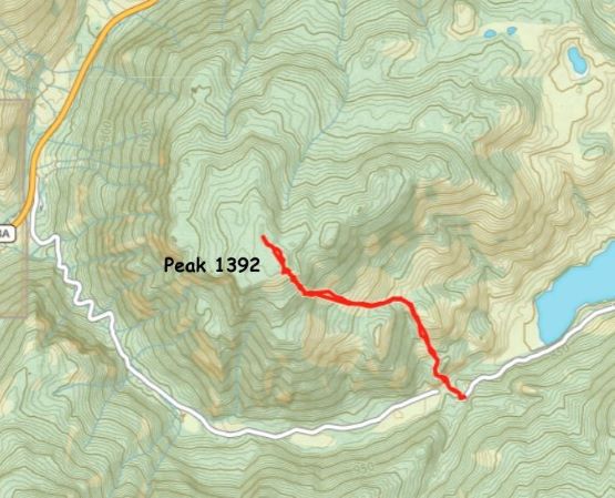
Peak 1392 “Cringe Peak”
April 28, 2024
1392m
Penticton, BC
There are a bunch of prominent peaks to the SW of Penticton that are unnamed and this is one of those, boasting over 500 m prominence. The unofficial name “Cringe Peak” was given by R. Tivy on bivouac.com and thereafter, adopted on peakbagger.com but I could not find any other reference of the origin of this name. This is a wee bit too random for me, because when I checked the area a few years ago this peak was still unnamed. In any case Simon C. had written a short “trip report” in which he did the hike from Yellow Lake to the north, but did not publish a GPX track. A quick research did reveal some “beta” for the northern approach but I still could not download a GPX track and that trail does not sound too official to me. I worried about the trail quality so went back to the maps and proposed an exploratory route from the south. This side of the mountain would be steeper, but shorter with more open views. I did think that trespassing would be required from the south and I was correct, but hardly anyone would bother to come here so I don’t think they are serious about the enforcement, at least not for now.
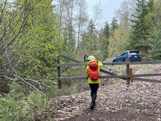
Kate and I headed westwards down White Lake Road immediately after finishing Mt. Parker in the close vicinity and I drove us to the west side of Horn Lake (Twin Lakes) towards my proposed starting point. Passing the official turnoff for Twin Lakes the area felt very local. There was one sign on the road saying “closed” but not “private” so at least it was legal to drive in, but the ravine to the immediate north was definitely on some private properties. Unfortunately we had to cross this area to access the route. The entire area was protected by barbed wire fences except for the most obvious “entrance point” so we parked our vehicle in front of the gate as who would really care.
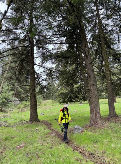
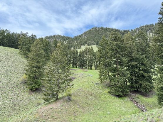
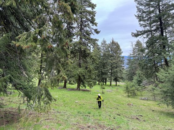
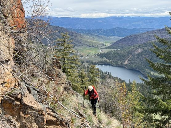
After gearing ourselves up we quickly and quietly dashed down that private road and crossed their home area. There were some cows and chickens around but we did not see any human being and the entire area seemed rather deserted. We nevertheless minimized our exposure to their direct sighting and scrambled up a very steep and loose scree cone. Above the cone there was one abandoned van that was apparently the “house” for one homeless family, and thankfully there was nobody around when we plodded by. We finally exited this little village and ascended onto some open slopes at around 900 m elevation, and from there we linked up several large patches of open slopes. I tried my best to side-hill around one bump to avoid unnecessary elevation loss and regain, and the entire area was more scenic than I thought. There were still abundant wild flowers and we even got some views down towards Twin Lakes.


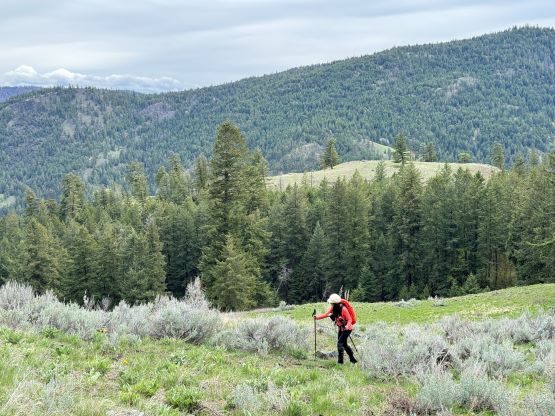
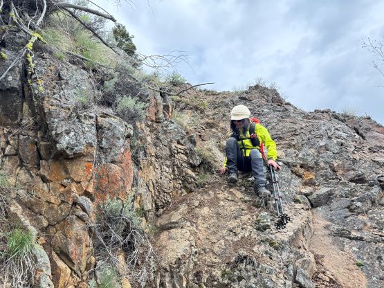
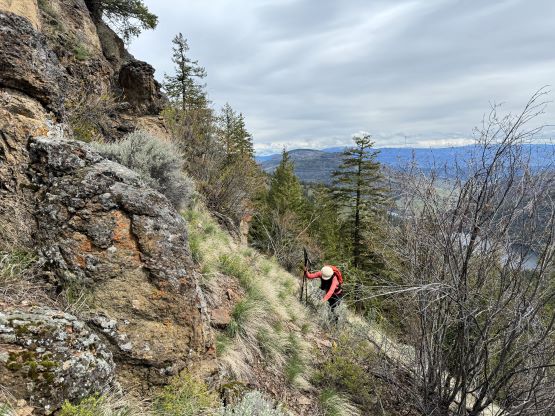
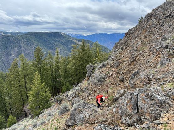
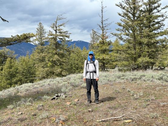
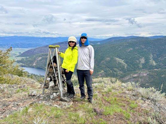
I could see an obvious cliff band higher up blocking the direct attack but I couldn’t find any obvious bypass and I was not keen on doing much bushwhacking, so I made the decision to just “take a look” and sure enough, a “class 2” route revealed its way after rounding a corner. The terrain was loose so Kate was struggling, but it wasn’t too bad especially for those with some scrambling experience in the Rockies. We had to ascend another stretch of loose and steep terrain to top out at the south summit with a surveyor’s triangular point. The forested north summit had the same 10-m contour line on the Gaia map so even though the peakbagger’s dot is on the south summit we had to traverse there to be absolutely sure. The traverse was mostly in open forest with minimal elevation change. My GPS readings showed the north summit to be a few meters lower so we went back to the south summit to take a break.


The decision was then made to descend roughly following the exact same route that we took. There was likely some easier bypass of that crux zone but I could not bother to search around. Kate needed practices on this type of terrain anyway. We again tried to be sneaky by the time we got closer to the village. There was still nobody around, and we even found a dirt path descending the side of that annoyingly loose scree cone. The “trail-head” gate was to our surprise, locked so someone had seen our parked vehicle and decided to protect their home somehow. It was a good thing that I parked outside and did not actually drive down that private road. There was no damage on our vehicle so we quickly drove ourselves away, towards Penticton where the 3rd objective was.