Kokanee Traverse: Esmeralda, Cond, Kokanee and Grays
June 30, 2025
2801m
Kokanee Glacier Provincial Park, BC
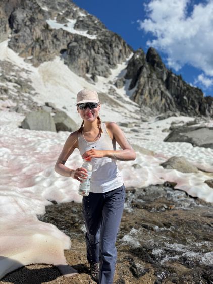
Cond Peak is the highest on Kokanee Glacier and subsequently boasts over 1500 m prominence making it one of the “ultra prominent peaks” in British Columbia. The standard route on Cond Peak itself is not difficult but I felt it would make more sense to traverse the 4 peaks on the massif making it a more fulfilled outing. Grays Peak is a standalone objective that involves some tricky scrambling and/or snow climbing, and the descent from Grays Peak requires some nasty bushwhacking. Cond Peak was the primary objective in this West Kootenays trip but as soon as I threw out the idea of making a traverse Erica was game for the challenge. We would have to carry boots and crampons but that’s fine.
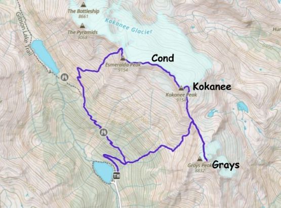
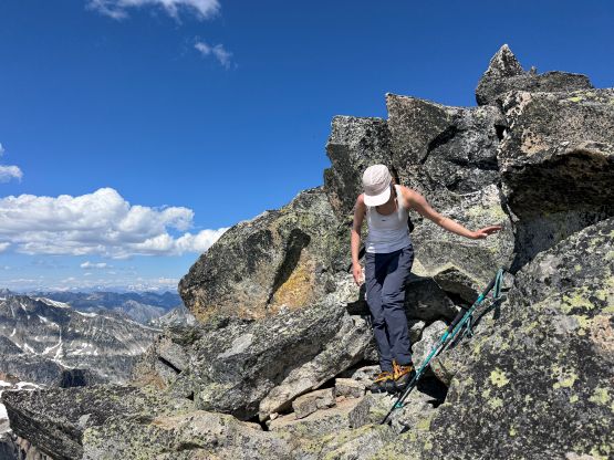
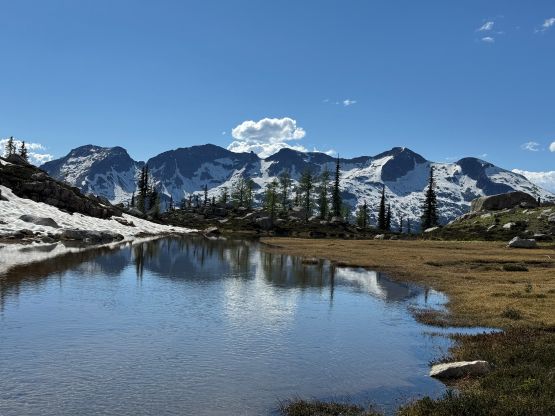
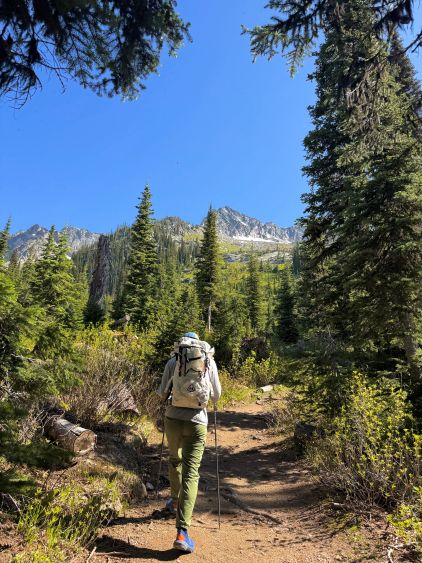
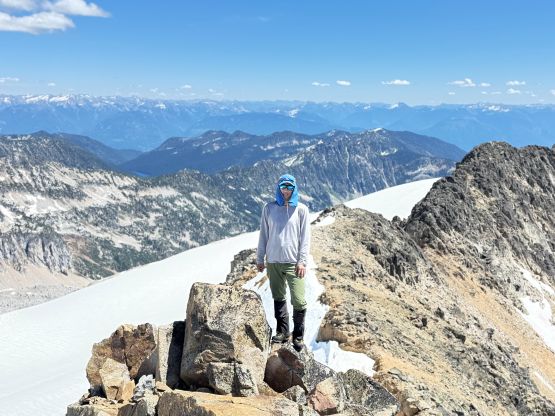
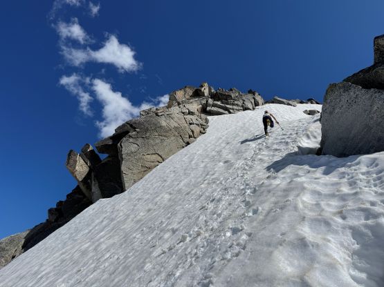
We slept in the vehicle at the trail-head and the morning routine was a bit unpleasant thank to the horrendous amount of mosquitoes. Thankfully the mosquitoes weren’t trying to follow us on the trail so the bugs situation was actually tolerable throughout the day. The turn-off towards “the keyhole” was easy to miss but I checked the GPS regularly so knew the fork was coming. Passing the turn-off the trail degraded to a “path” with lots of watercourse crossings. Keeping the feet dry was difficult but not impossible. After taking a long break at one of the higher switchbacks we marched up a continuous snow slope that brought us to a few scrambling moves through the “keyhole”. The snow slope was quite steep but was soft enough that the crampons and boots weren’t required. There were also enough footprints and steps that made our lives easier. From the keyhole we turned right and scrambled the ridgeline to Esmeralda Peak, the first objective of the traverse. There was a large group resting on the summit and apparently the leader’s living in Victoria and has done Golden Hinde. The leader said we could have done a bigger loop by including the peaks further west.
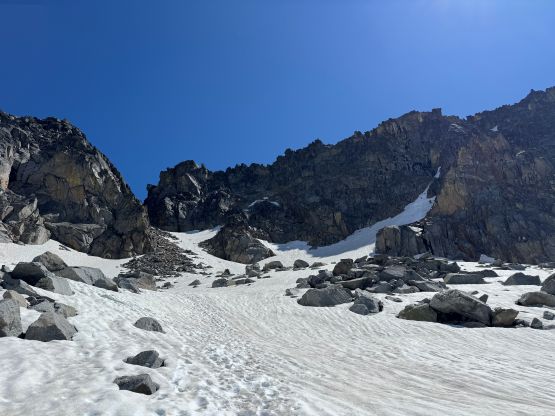
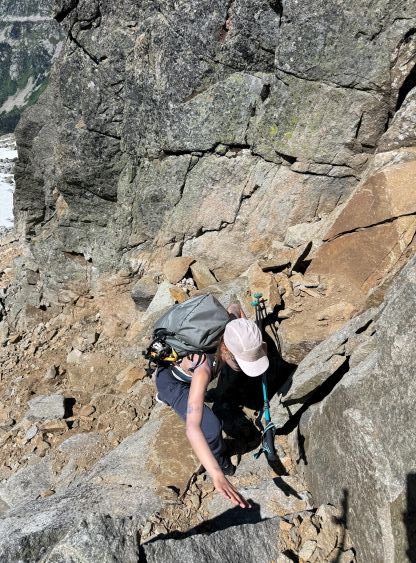

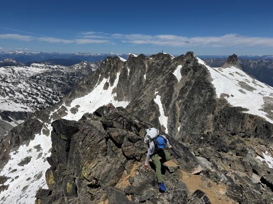
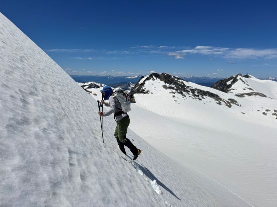
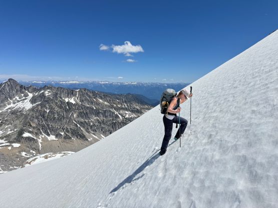
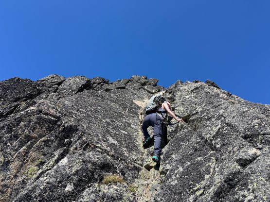
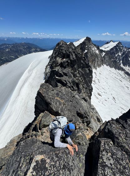
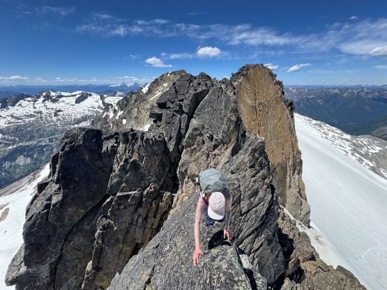
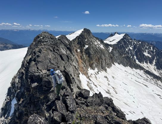
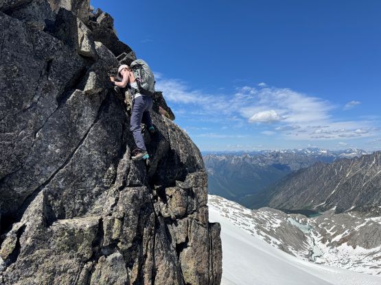
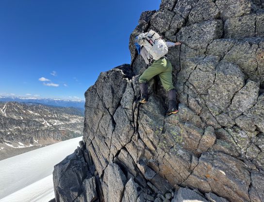
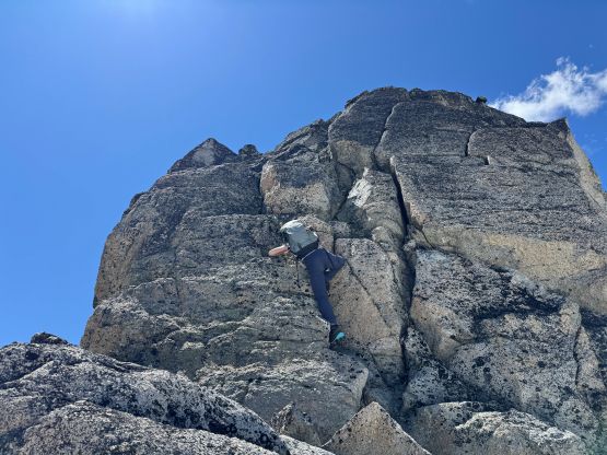
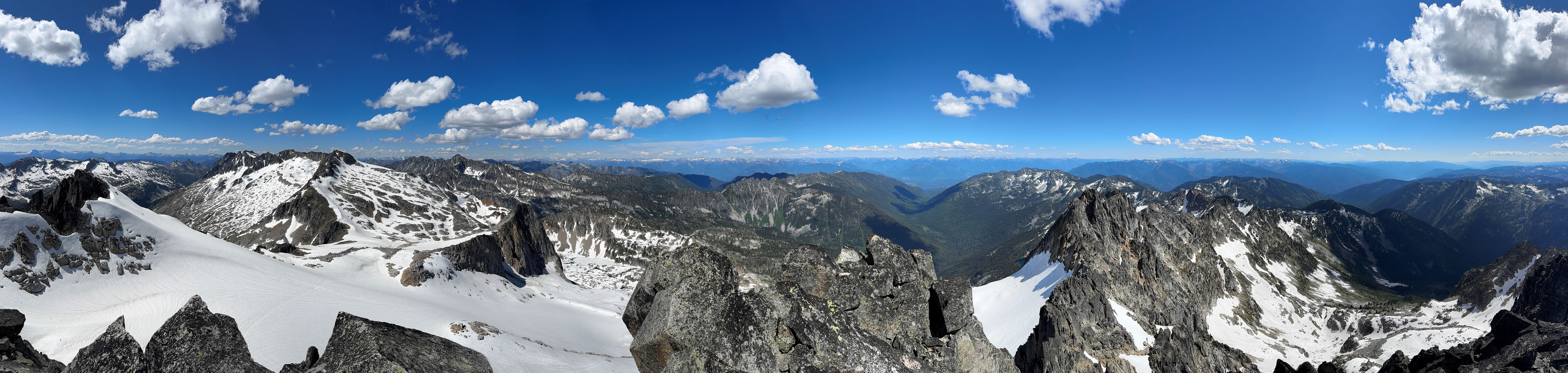
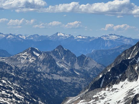
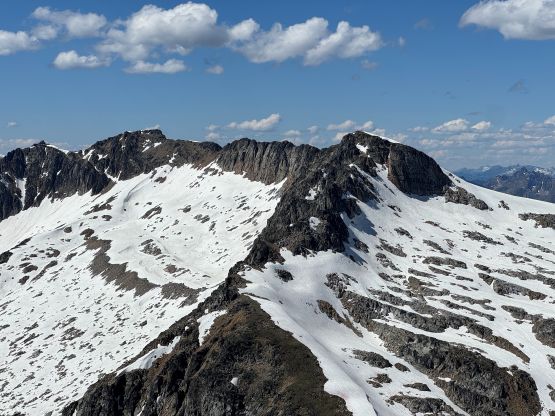
We swapped the trail-runners for the mountaineering boots on the summit of Esmeralda Peak and then scrambled down some boulders and traversed the snow slope on the edge of the glacier. We could have stuck to the rocky ridge but I felt the snow option would be quicker. In short time we arrived at the summit of Cond Peak. Had we turned around at the highest point the trip would have been much easier but we wanted the added challenges. Traversing towards Kokanee Peak we opted to stick to the ridge crest but apparently we didn’t do enough homework. The rocky ridge did go, but not without some exposed 4th class terrain with route-finding challenges. We encountered several notches and one almost turned us around, but at the very last minute I decided to scramble down and around to check out an impossible-looking ledge, which oddly was a “go”. There’s another bigger notch at the lowest point between Cond Peak and Kokanee Peak and the scrambling into that notch was also quite tricky with some consequential terrain, but after a long while we eventually hit easier terrain and were soon on the summit of Kokanee Peak, the 3rd objective of the day.
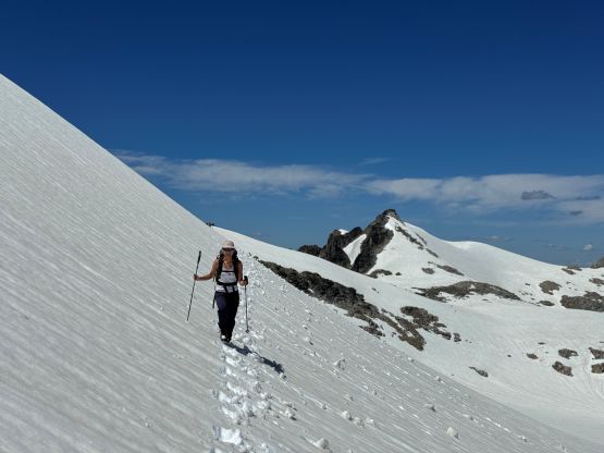
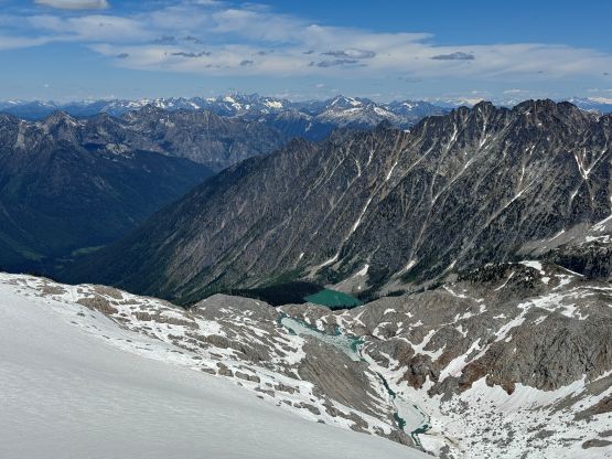
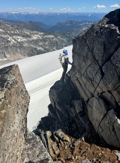


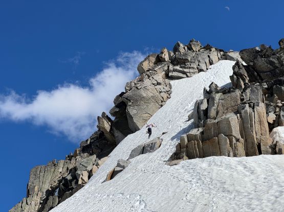
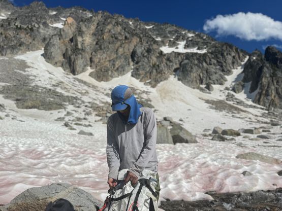
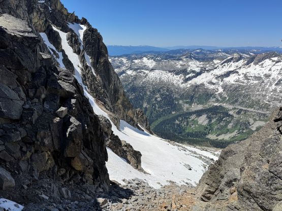
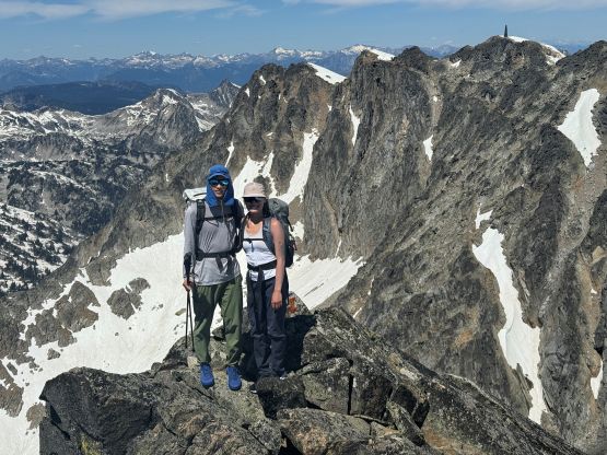
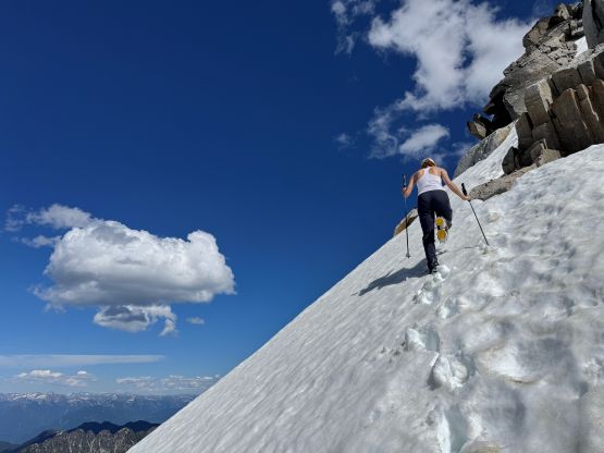
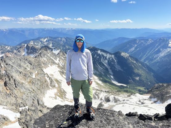
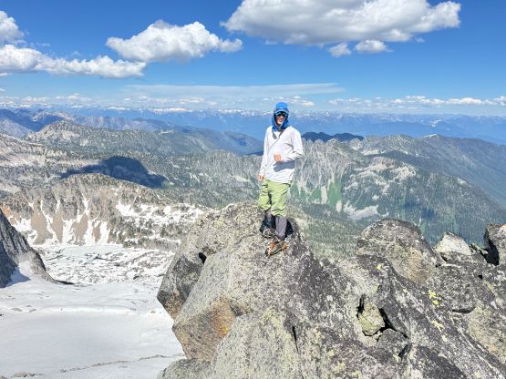
There were options to go down towards Kokanee/Grays col but after the unnecessary challenges we had just encountered we wanted to find the easiest possible way. The route descends the east ridge from the summit until we were able to down-climb a snow slope to get down into the SE basin of Kokanee Peak. I then led us linking patches of snow and generally stayed on easy terrain getting down to Kokanee/Grays saddle, and immediately pressed on. Much of the route on Grays Peak’s north slope was on snow and the previous parties had laid some tracks for us to follow. The true summit was still a “snow climb” at the moment so we donned crampons at the base of it. We had not brought the ice axes to save weight but they wouldn’t be needed (for us) anyway. Erica eventually led the step-kicking and some 3rd class moves with crampons on, and we were soon standing on the summit of Grays Peak. There were some strong cell receptions so I turned off the airplane mode and did some socials updates.

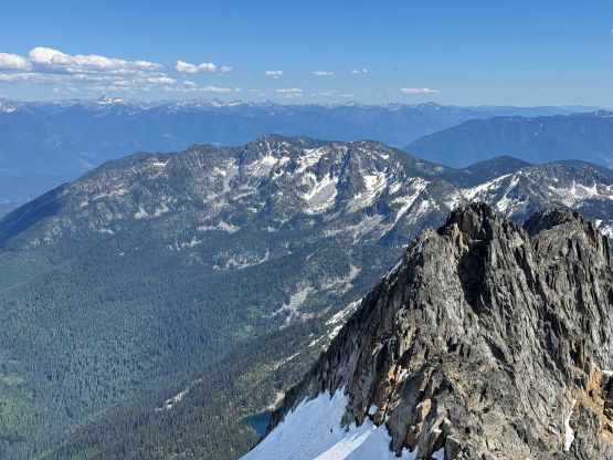
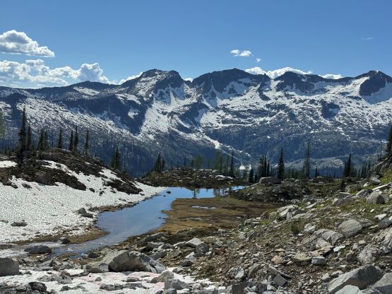
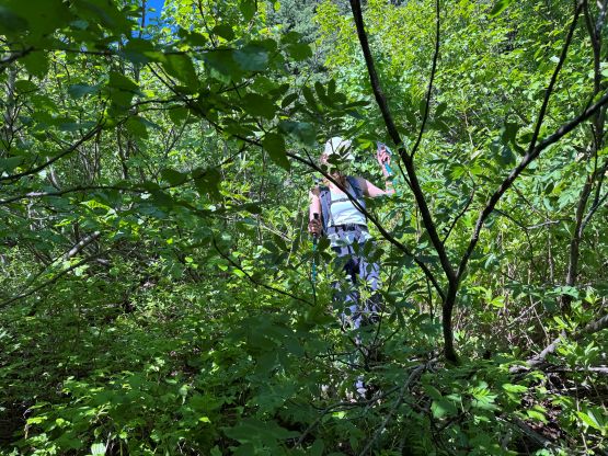
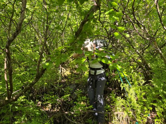
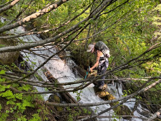
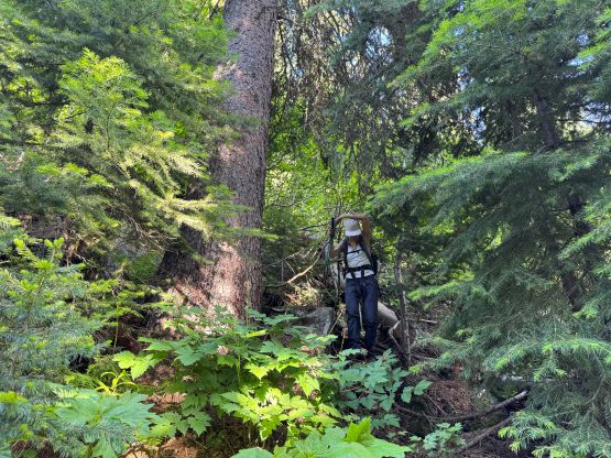
Reversing the route down Grays Peak’s summit block was fairly trivial and so was the plodding down to Grays/Kokanee saddle. The descent from the saddle was initially on choss but we quickly found some strips of snow and linked them up. We got down to the meadows/tarn at 2170 m quickly and then it was the time to face the bushwhack. Erica had downloaded a GPX track from AllTrails (presumedly) but I was only aware of the rough bearing. In the end I decided to lead us straight down dealing with whatever that was thrown on us. The bushwhacking was tolerable but did become thick after we entered some 10-feet tall alders. The section was in between two paralleling raging creeks, and we eventually had to find a way to cross the creek to the right as the two were merging. I was mentally prepared for some of the worst bushwhacking ever so didn’t find it to be that bad, but boy this was a thrash. The route brought us exactly to the 2nd switchback and then we jogged back to the vehicle. The round trip time was under 9 hours. This time we opted to have a proper dinner in the town of Nelson before driving towards the next objective, Kootenay Mountain.