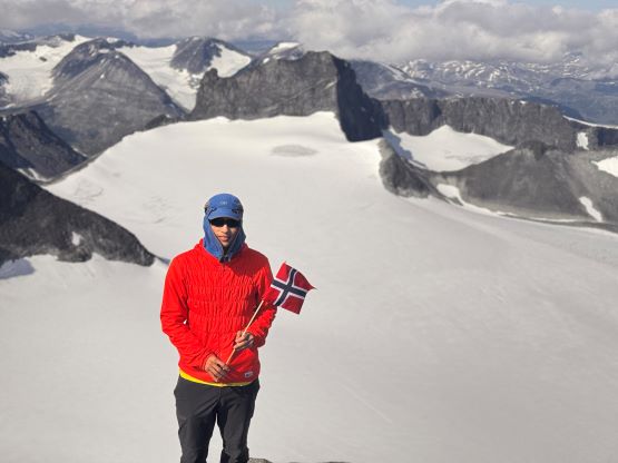
Galdhøpiggen
July 25, 2024
2469m
Juvasshytta, Norway
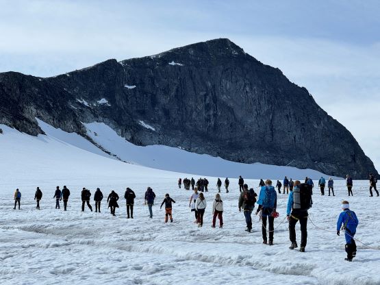
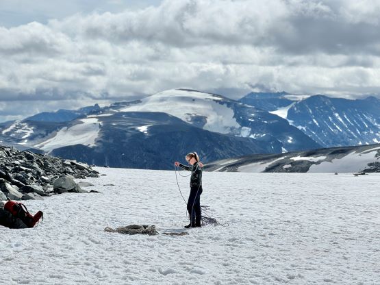
Galdhøpiggen is the highest in Norway and also the highest in the entire Scandinavia and subsequently boasts over 2000 m prominence and 1500 km isolation. It is actually one of the Top-50 most isolated peaks in the entire world. The ascent is however, nothing fancier than a “walk-up” though glacier travel is involved on the standard route. There is a longer route that avoids the glacier travel but such would double the elevation gain. The glacier crossing on the standard route is very straightforward and guides have regularly put 30+ clients onto one single batman rope, joint by two 60 m climbing ropes. The scene was kind of ridiculous and for once I thought the Chinese had leased this mountain for their military training purposes. In any case this was the primary objective between Erica and I. The original plan was to join Petter and Adam on the 29th of July and Petter had actually booked my stay in the lodge at Juvasshytta, the end of the highest paved road in Northern Europe, but I preferred to have absolutely flexibility to hit the biggest prize on the day with the best weather. Erica and I had 9 full days in the country and it made no sense to bid our luck on that particular day, so I made Petter cancel my stay (with 150 USD refund) and we would have our itinerary completely independent.
The weather turned out to be extremely fickle in this country but according to some, we just happened to be in an unlucky period of bad timing. That best 1-day window did happen and that was foreseeable even from a few days beforehand. We routed the itinerary to put Galdhøpiggen on this particular day and that involved driving a few hours out of the way. That was fine. The previous day was a big and exhausting one because the weather was also sort of on our side, that we eventually got to the steep road heading upwards towards Juvasshytta by midnight, after finishing an ascent of Store Smørskredtind. It wasn’t too sure about the camping oppourtunities at Juvasshytta and it was also forecasted to be very cold, so the plan was to find a random spot to car-camp on the lower roads. Judging by the amount of money to stay in that lodge (over 200 USD per person), I was sure that finding the legal camping spot could be the crux of the day. We eventually did find a spot to pitch a tent, on some backroads behind the “no camping” signs and right in front of a farmer’s house so probably not very legal. We got there at past midnight and thought nobody would bother to come out and fuss around with us. We did eventually get some decent hours of sleep but our gears were all soaked wet from the dew. The alarm went off at 5 am and we did our morning routine, and it was actually not that cold. I then drove us up and opted to park the vehicle at the emptied ski resort (turned out that they hadn’t opened for the day yet) instead of the village of Juvasshytta, to give 1 km of advantage per way. We also didn’t come across any paying machine at this ski resort so even though this wasn’t a free road we refused to pay anything. I knew we were definitely gambling but I had never gotten a ticket in my entire peak-bagging career, so why not bid on that for another time.


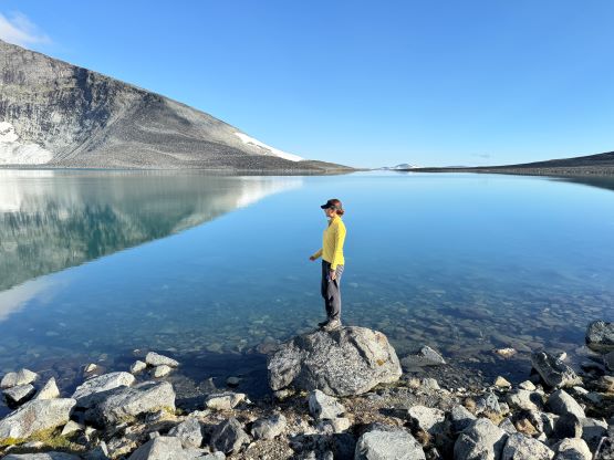

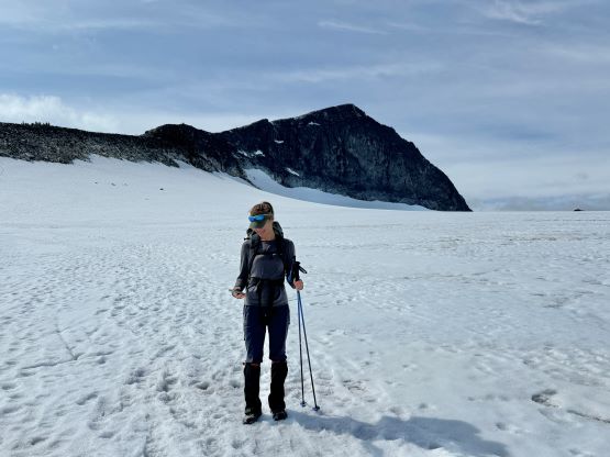
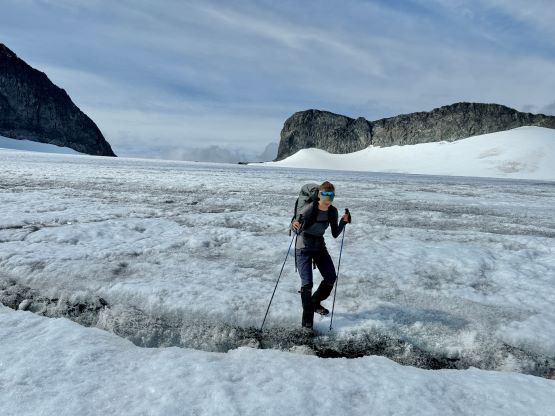
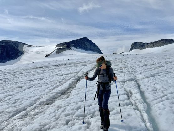
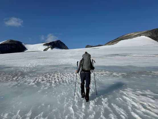
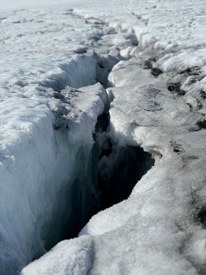
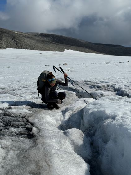
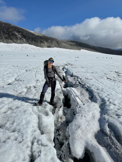
In terms of the gears we decided to not carry the rope but bring crampons and mountaineering boots. The boots were handy on the way back to help my feet stay reasonably dry on the glacial “swamps” but the crampons were entirely not necessary. In any case we did some easy boulder-hopping to get onto the main path that came from Juvesshytta and easily followed the long and gradual path to the glacier crossing. The trail was as expected, not a perfect path but with some boulder fields and snow crossings but the bearing was straightforward and the travel was generally easier than on Snøhetta. I’d heard about the crowding situations on this peak and I started to wonder if we were lucky or some, because we saw nobody ahead and none behind neither. It turned out that we just started “too early” even though I honestly didn’t think we had started that early. The glacier was drier and icier than expected, but was mostly just a plod. I started by wearing trail-runners and was expecting to change to the boots at some point but that was never needed. The route could be managed without any crevasse crossings but I directed us to a few crevasses just for Erica to experience that. That was quite fun actually and added to the variety.
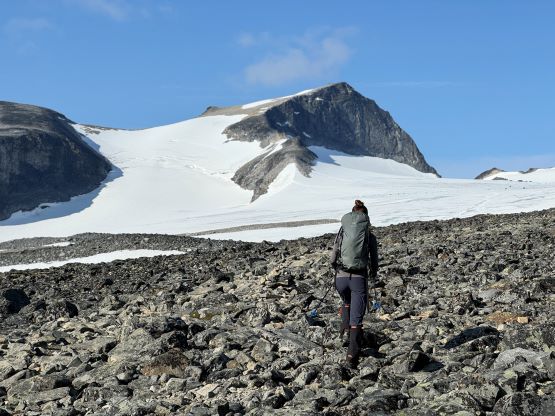
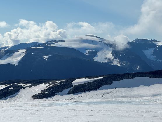
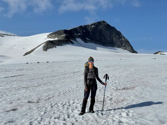
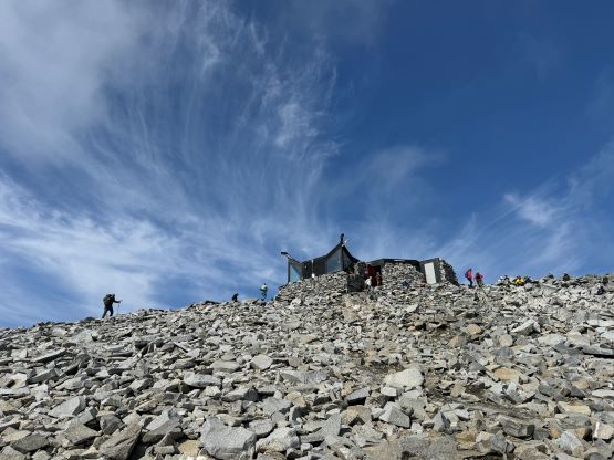
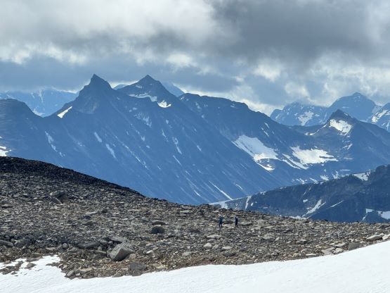
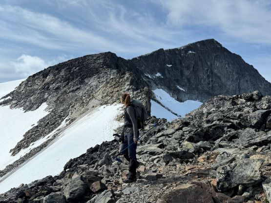
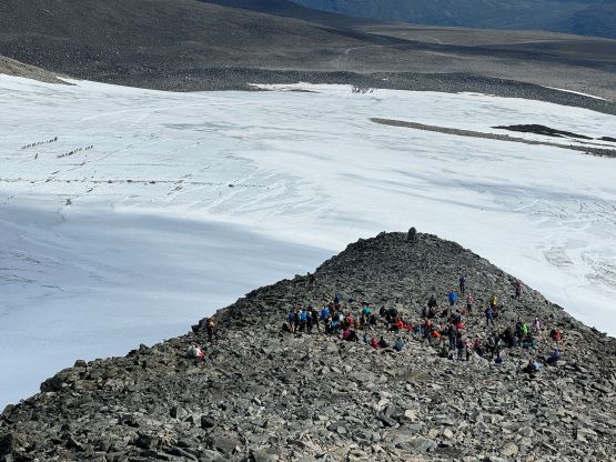
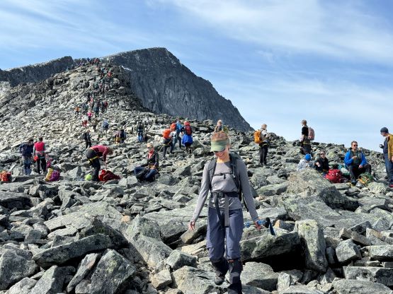
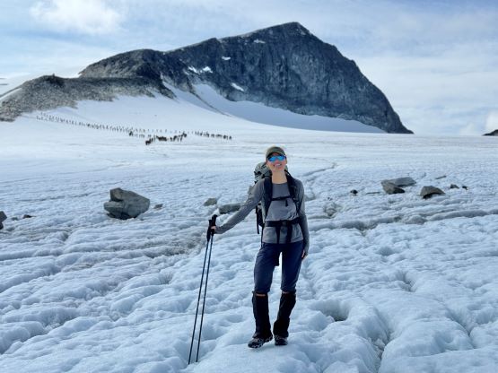
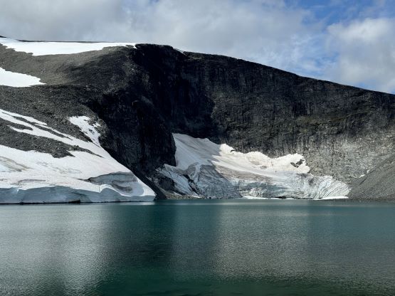
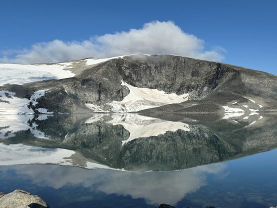
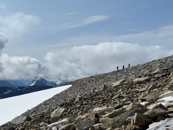
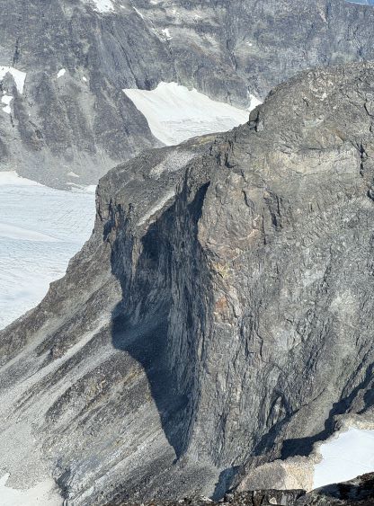
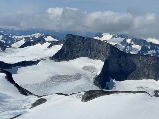
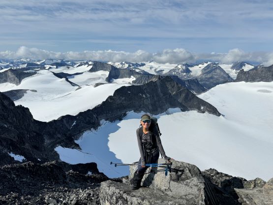
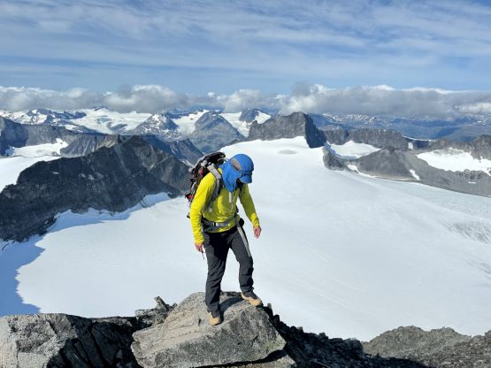
Eventually we followed the main path to get onto the NE Ridge which would offer the passage to the upper plateau. The steep and crevassed glacier on the climber’s left would offer a more enjoyable way but we weren’t properly equipped for that, so stuck with the standard route. There was actually some scrambling involved on this spur/ridge but the terrain was mostly easy boulder-hopping, and there were enough cairns and paths to lead the way. After about 300 m elevation gain we arrived at the plateau and joined the hikers that came up from the longer and more eastern route. There was a hut on the summit and the infrastructure reminded me a little bit of Fuji in Japan, but not to that extreme level. We also explored the ridge extending southwards for more photos. I was honestly quite excited about the glaciers in the immediate vicinity as the landscape wasn’t something we were used to in our home region.


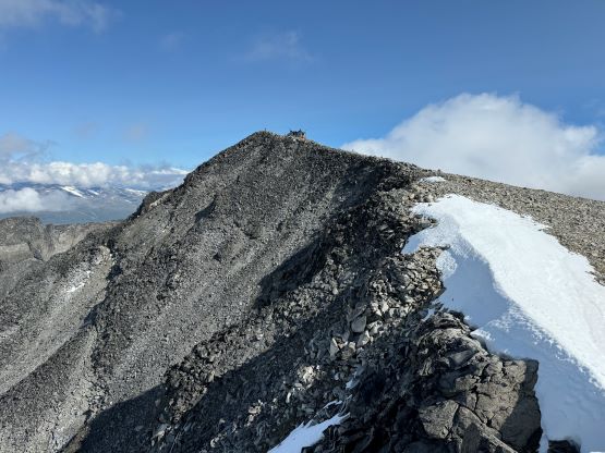
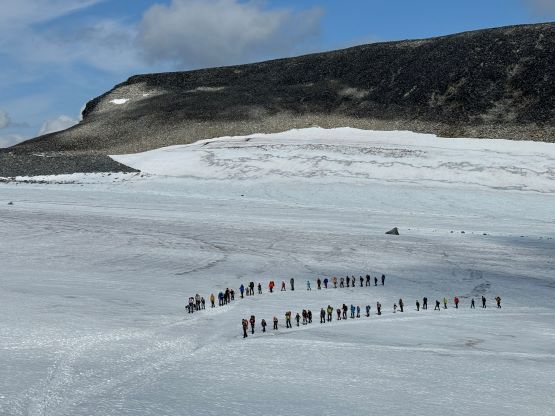
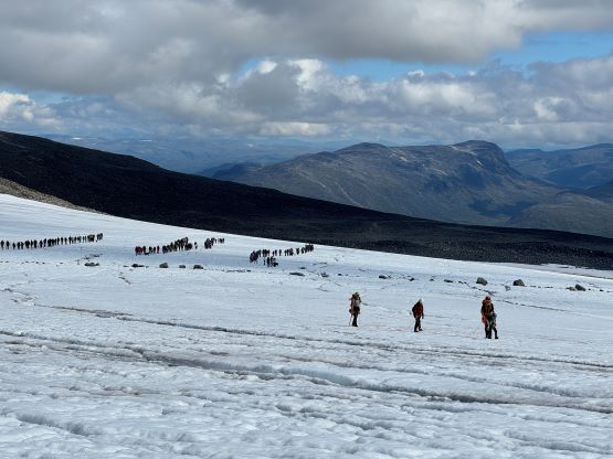
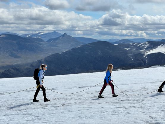
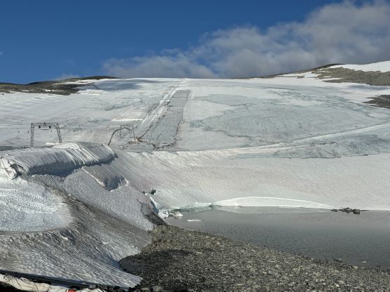
We were joined by at least 15 other hikers that came up from the longer route, but a few more groups also started to show up via the standard route. It was getting crowded up there so we quickly descended, but while descending the NE spur I noticed those gangs of people marching up the glacier, and sure enough those were the properly guided groups. They had put 30-40 people on a single rope which was quite amusing to see. I had never observed that kind of glacier travel before, but I guess the strategy would work due to the enormous mass of the team and the friction generated to reduce the acceleration if one person fell in. While plodding back across the glacier we crossed path with at least 6 teams like that, and more were gearing up at the start. The last 10 m before exiting the glacier had unfortunately already turned into a “swamp”, but the depth was below boot’s top so I was able to keep the feet dry. I had already swapped the trail-runners for the mountaineering boots as I was anticipating some sort of post-holing on the glacier, and I definitely made the right decision. The rest of the return was uneventful and we did not get a parking ticket neither. I wasn’t having a plan for the rest of the day but I had made plan to join Adam for Skåla on the next day, but while driving there we made the spontaneous decision to jack up the ambition to tackle Tron in the evening.