Großer Priel
August 29, 2025
2515m
Liezen, Austria
Großer Priel is the highest peak of Totes Gebirge, the “Dead Mountains”, one of the more unique groups in Northern Limestone Alps of Austria. This is subsequently one of the “ultra prominent peaks” in the region, and thereafter one of the main objectives in this trip. The standard route is mostly a long slog through gentle terrain but does involve a few steeper sections aided by ladders and chains. There’s a hut about 2/3 of the way up and most hikers would choose to spend a night or two there. Adam, Erica and I however, disliked that idea. The car-to-car distance is over 20 km which means this is one of the longest objective targeted in this trip. To make it worse the weather forecast was far from ideal, with at least 40% chance of precipitation throughout the day. There’s a yellow and orange thunderstorm warning for most of the Alps except for the NE region and that’s why we were thinking of this objective.
James and Arjan agreed on the itinerary and the five of us together did Grimming in the previous day. The weather was stellar but that’s the only day with decent forecasts. We again, decided to find our own respective spots to car-camp. Adam, Erica and I spent quite a few hours in a McDonald’s mostly for me to catch up the trip reports, and then we drove north through the paid tunnel. Großer Priel wasn’t terribly far away but the drive to the trail-head was contrived and long, that by the time we finally got to the last few kilometers of the narrow road it was already almost sunset. We found a spot to pull in and pitch the tents a few kilometers from the trail-head and settled for the night. The weather unfortunately collapsed and we got rained throughout the night. Adam decided to bail but the rest of the group still wanted to give it a try. I personally wouldn’t concern for anything but lightnings and thunders. In the morning we met at the trail-head and the weather was actually better than expected with patches of blue skies above.

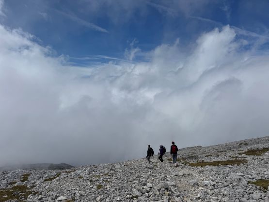
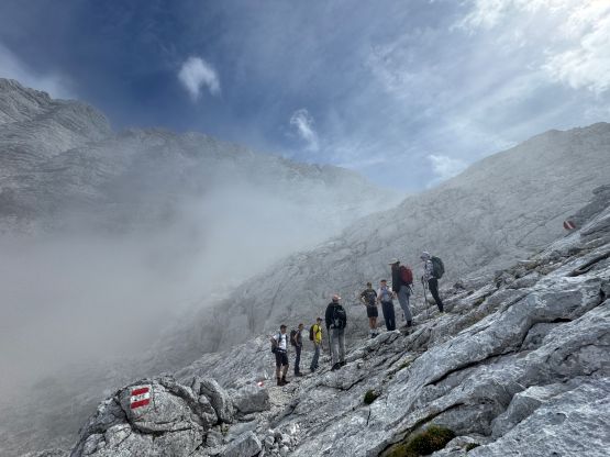
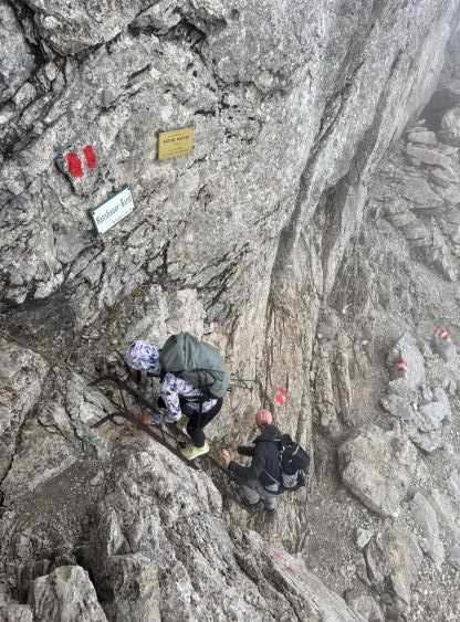
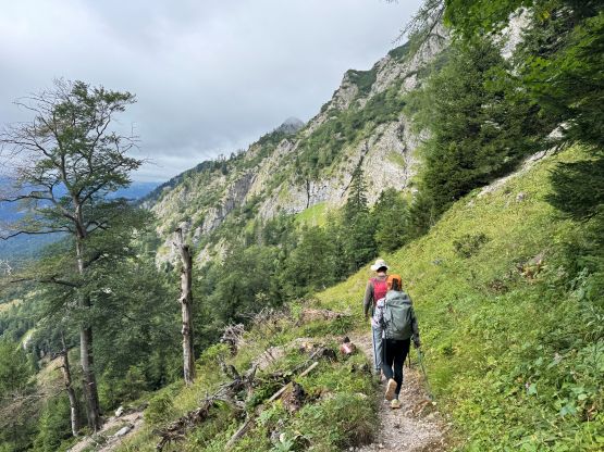
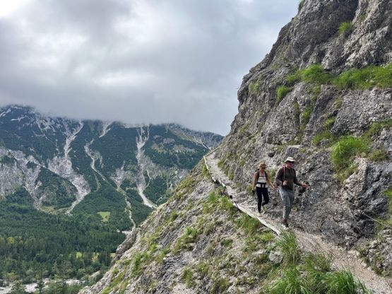
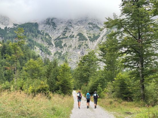
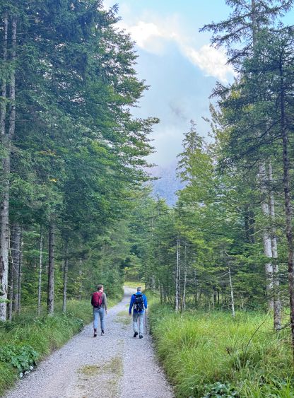
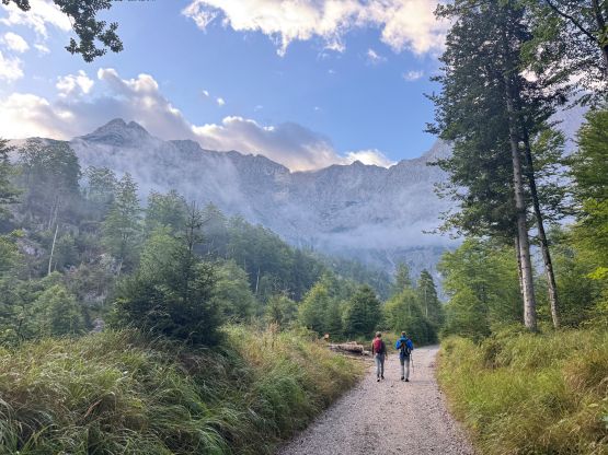
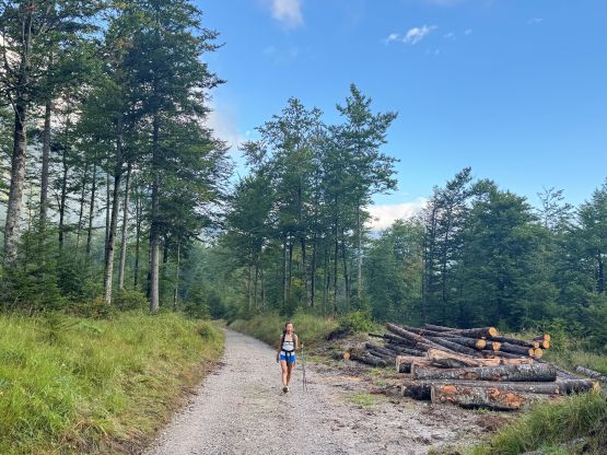
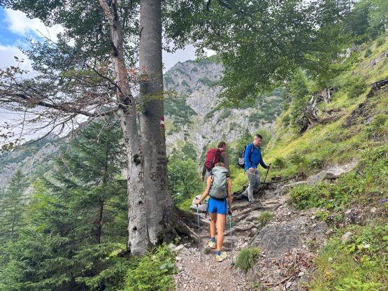
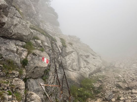
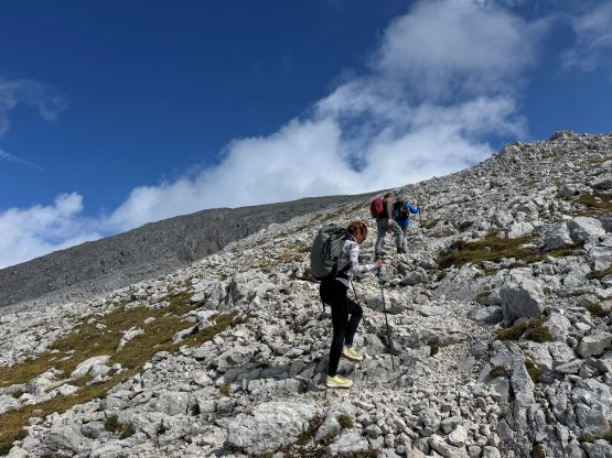
The parking lot is in front of a large restaurant/hut but the dirt roads continued for at least 3 or 4 kilometers beyond. There’s a gate but it’s not locked, and I thought we surely could have broken the rules by driving a few kilometers further without getting fined. I highly doubted the rangers would bother to patrol such a remote area, but I realized that too late. We had already been plodding up the dirt roads for 10 minutes and nobody wanted to go back to grab the vehicles. That’s okay as we didn’t mind the exercise. We decided to ignore Deividas’ GPX track and linked a different set of roads and our variation worked out nicely. Roughly a boring hour later we entered a canyon and finally started the ascent. The lower route had a few exposed traverses but then we quickly entered the fog layer. I was ascending shirtless because of the humidity but the colder temperatures meant I didn’t want to stop often. The others decided to take a break so I went ahead and the decision was made to regroup in Welser Hütte. There’s at least one ladder to climb below the hut and the ladder was wet and slippery. The rest of the team showed up 15 minutes later.
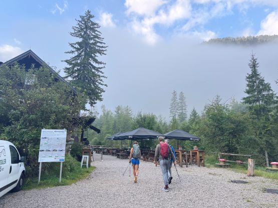
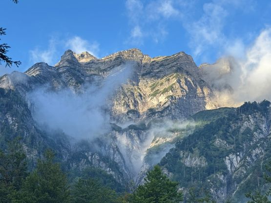
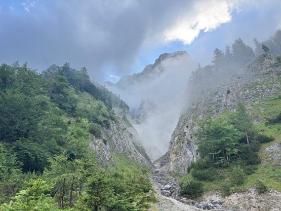
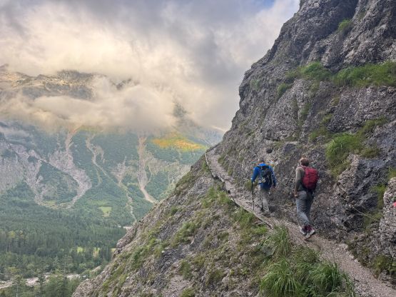
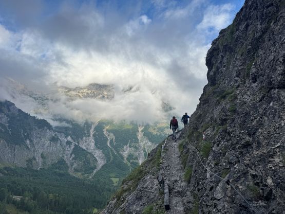
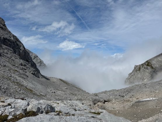
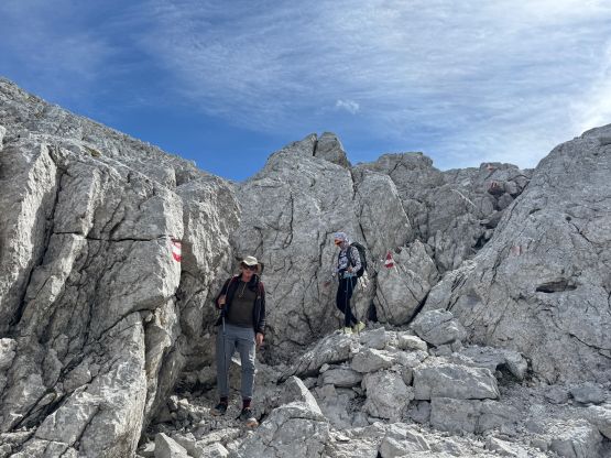
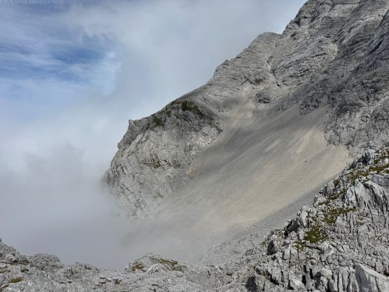
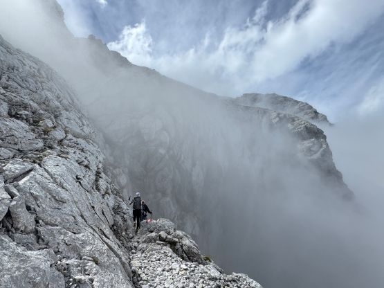
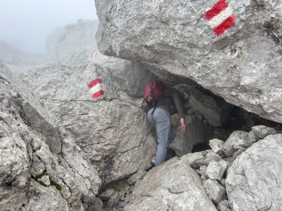
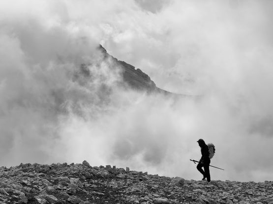
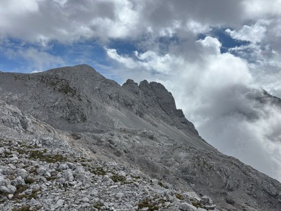
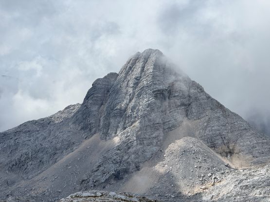
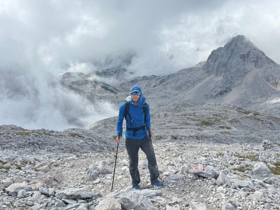
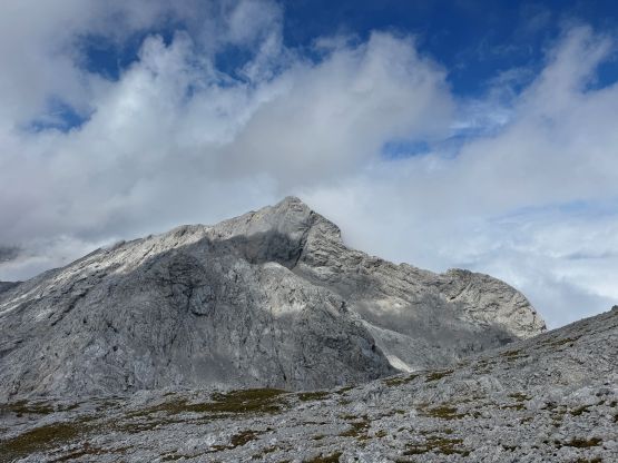
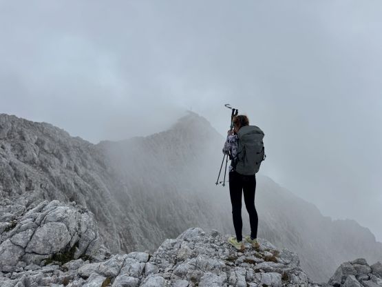
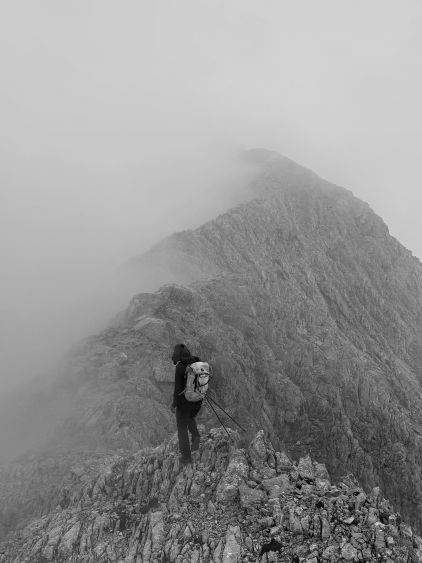
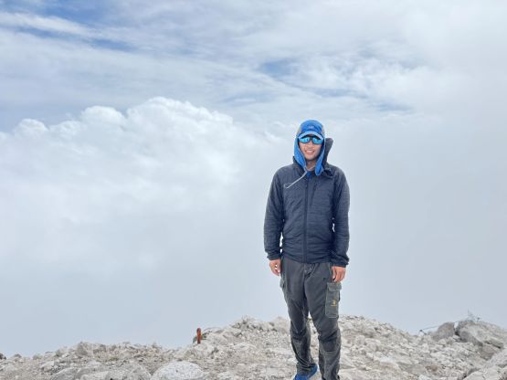
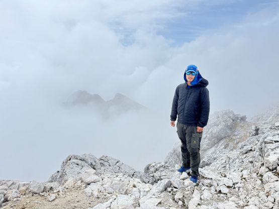
The hut was warm and comfortable but we didn’t want to linger too long in there. We would otherwise lose the motivation to continue. There’s no sign for the weather to improve so our stoke level was low, but we had to get the job done. The route-finding wasn’t too bad even in the fog as the upper route of Großer Priel was just a slog. To our surprise we started to see some patches of blue skies and then all the sudden we broke through the fog layer. We weren’t 100% above the clouds but the views did open up once we got up onto the broad SW Ridge. This SW Ridge was then eventually followed to the very summit. The summit ridge was narrow and somewhat exposed. We didn’t get a lot of views from the true summit but there were some dramatic clouds scenery while traversing across the summit ridge. Given the terrible forecasts I thought we got extremely lucky. Adam must felt disappointed.
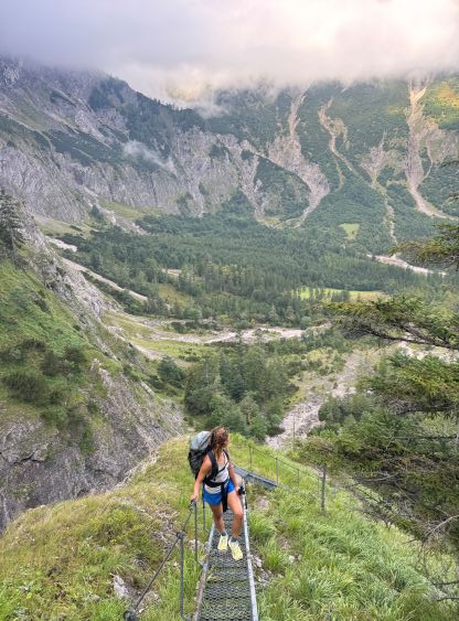
The weather was more or less the same on the descent. We got periods of good views while descending the SW Ridge but then entered the clouds layer. We took a long break in the hut for warmth and comfort, and James even bought us some food and drink. About an hour or so later we got out, and leisurely descended the lower route back into the valley. I took off for the final 4 km plodding back across the roads, and finished the round trip in just over 8 hours (sans the hut time). Adam had been patiently waiting while sitting in the car. Erica showed up shortly after and we decided to load up all of the water bottles in the hut for simplicity, and by doing so we noticed the shower was not locked. That’s an excellent news, so we grabbed the shampoo and towels and went for a free shower in this hut. This meant we would miss the 7 pm cutoff time for the local grocery stores but that’s okay. I managed to find a self-paying grocery to make do, and then drove us towards the trail-head for Hochtor.