Nicoelton Mountain
November 10, 2024
1574m
Spences Bridge, BC
Nicoelton Mountain in the vicinity of Spences Bridge does not boast any kind of mountaineering interest, but is officially named and a simple search on Google revealed absolutely no “beta” whatsoever. Peaks like this are best reserved for the so-called “shoulder season”. This peak wasn’t even in the peakbagger.com database even though it boasts over 400 m prominence. The highest point of the massif locates over a kilometer to the south of the officially-named pimple, which boasts only about 20 m prominence. As a result I don’t think this can be counted as a twofer objective, so I only entered the south (true) summit into the database. Still, I would want to visit both summits to be thorough. The weather forecast for this past Sunday wasn’t the greatest anywhere and I needed to be back to White Rock by 6 pm for work. I threw out a few possibilities and Erica eventually picked Nicoelton Mtn. mostly for exploring purposes. The main attraction for us was the fact there’s no “beta”. I went back to the maps and did some digging of the logging roads system, and found out that the most logical way required driving through some First Nation’s reserves. This would likely require some sort of trespassing (which I don’t mind), but we had no clue if the road’s gated or not. There’s only one way to figure that out, and I did have several backup objectives in case the road access failed.
We managed to leave home at 10 pm after work and drove through some miserable weather through the familiar corridor. We encountered some dense fogs in the Fraser Canyon but that had to be expected. A few hours later the rain gave way to some starry skies as we approached Spences Bridge. We turned onto Rannie Pit Road which had some steep switchbacks but was in excellent conditions, and this road eventually crossed Twaal Creek into the Indian reserve. There was one tiny “no trespassing” sign but we encountered no aggressive blockage. The drive up through this valley was very long and the only difficulty was two large puddles of mud, that necessitated 4 wheel driving. We then turned onto the spur road and quickly joined the government’s logging roads system, and eventually parked at a large meadow at 1300 m elevation. We could have driven at least a kilometer further but we wanted to at least do some exercise. Getting to 1300 m was already much better than anticipated.

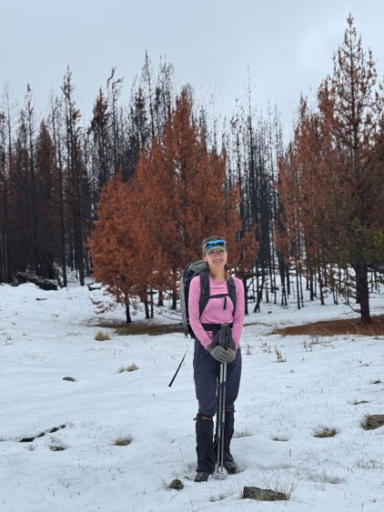
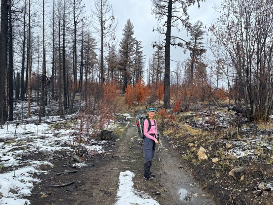
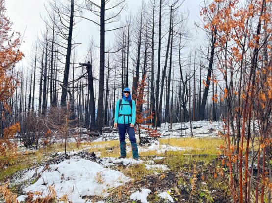
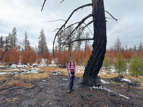
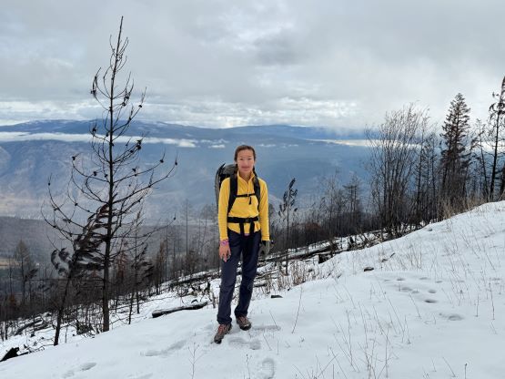
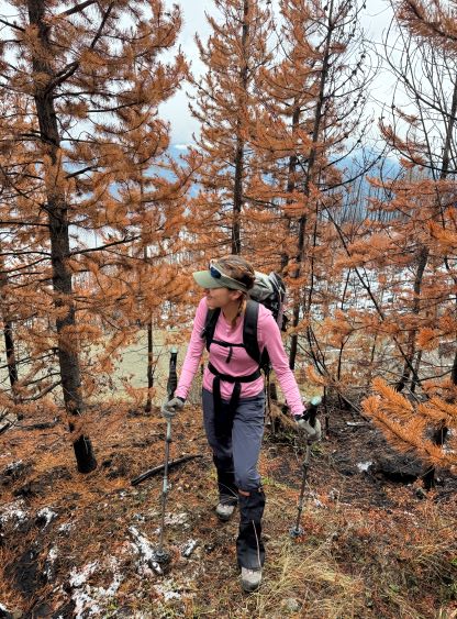
I decided for us to wake up naturally and that happened at 7:40 am. About an hour later we finally got things packed and were about to start the plod. I had brought multiple pairs of footwears and opted to wear the hiking boots while carrying the snowshoes. The snowshoes turned out to be training weight of course, but we didn’t want to take a chance. We decided to head for the higher (south) summit first and the best views were from the first two kilometers of the FSR plodding. Nearing the end of this initial stretch we did a steep short-cut through some burnt forest. The logging roads extended to within 200 horizontal meters from the summit and the final bit was some easy bushwhacking in burnt forest. We barely needed to touch the pick-up sticks but it was not possible to avoid getting black. The summit was unfortunately engulfed in the clouds so we got absolutely no view.


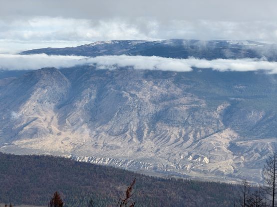

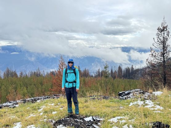


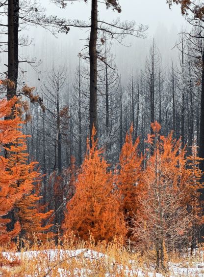
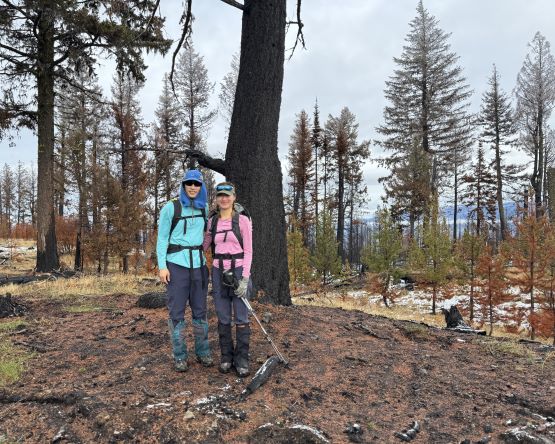
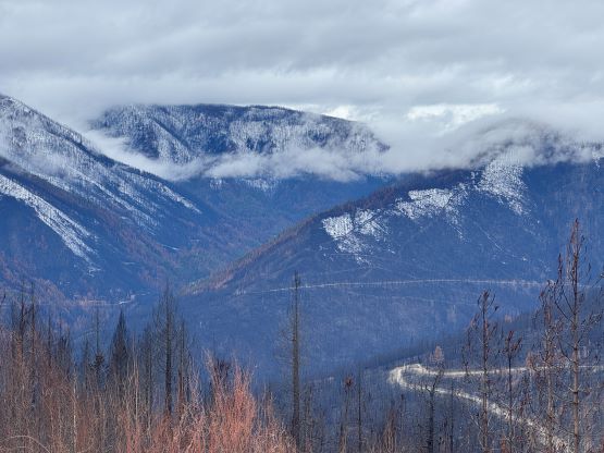
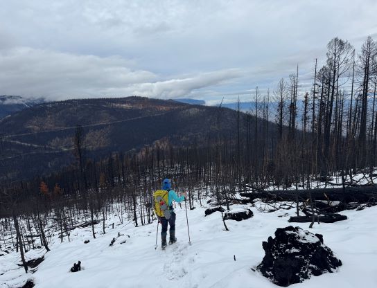
Not doing much lingering we quickly descended and headed for the officially-named but lower north summit. This turned out to be the correct decision because the clouds dissipated and we were able to get some views. Still, this was overall a “trash bagging” trip so even if the weather’s bluebird we wouldn’t be able to see much. The burnt forest was sort of cool though. I then led us descending the north slopes of the officially-named summit and quickly joined the FSR system and completed the loop in under 2 hours round trip. The day was still young so the decision was made to tag a bonus P200m objective right above Spences Bridge.