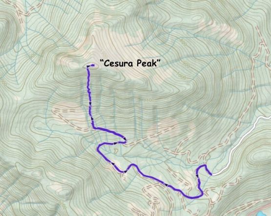
Peak 1450 “Cesura Peak”
February 28, 2026
1450m
Vancouver Island, BC
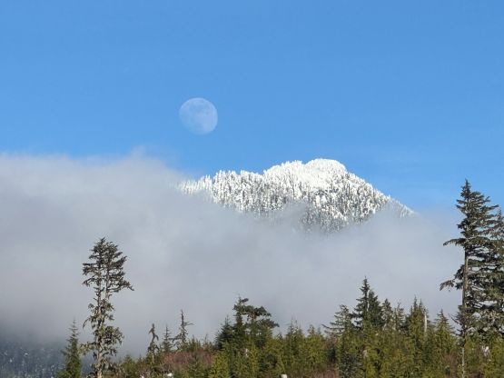
“Cesura Peak” is the unofficial name of one of the many P600m objectives in the northern ranges of Vancouver Island. This one is overshadowed by the bigger neighbours such as Mt. Ashwood and “Naka Peak” but even those bigger neighbours are obscured. There had been no information online about this peak whatsoever. Matt J. had made an attempt last weekend via the south slopes but turned around 300 vertical meters from the summit due to heinous trail breaking on increasingly steep terrain. Matt planned to come back a week later and managed to put together a team for the final 300 m of trail breaking fair. I decided to join as the weather looked promising. The condition was rather mediocre that this was basically the biggest objective we could safely attempt over this weekend anyway.
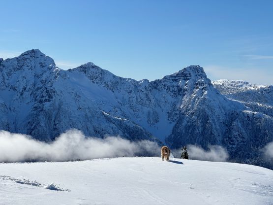
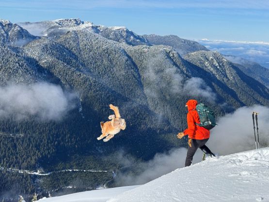
Mel, Miranda and I all gathered at Matt’s house at 5:10 am and the four of us (plug Twig) all had to pile into Matt’s Jeep. Needless to say the cargo space was very limited. I had to pack as if I would be doing some air travel so the mountaineering boots etc. all went into my backpack. I did bring two pairs of snowshoes as I really had no clue about the current conditions. If there’s significantly more amount of snow than expected then my 30′ snowshoes would be needed for the team’s success. Otherwise I would be wearing the more comfortable 25′ Lightning Ascents. The crossing to Nanaimo was uneventful and then there came the long but familiar drive northwards past Campbell River to the land-of-no-cell-signal. We made quite a few stops for gas and food such that we didn’t turn off the highway until 10:30 am. The driving on FSRs was not difficult but quite long, and the final few kilometers were rough/snowy enough that a 4×4, HC vehicle was required. We did manage to park in front of the downed tree that stopped Matt’s vehicular progress a week prior, and didn’t start hiking until 11 am. Given that we must catch the last ferry back home our time contingency for the round trip was no more than 6 hours.
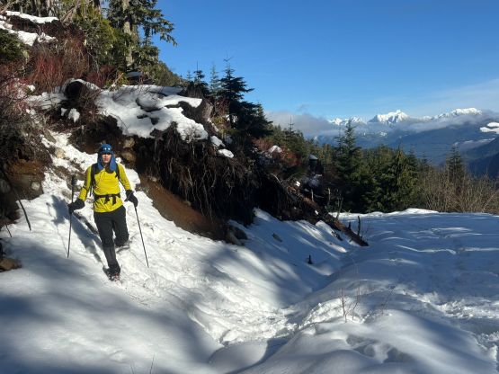
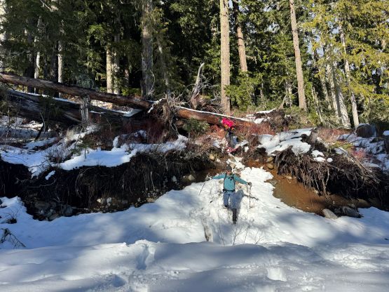
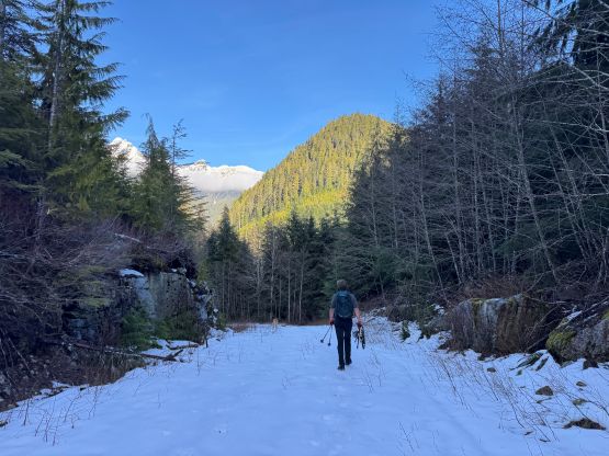
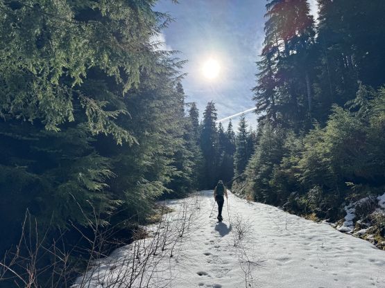
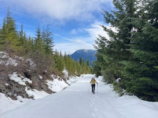
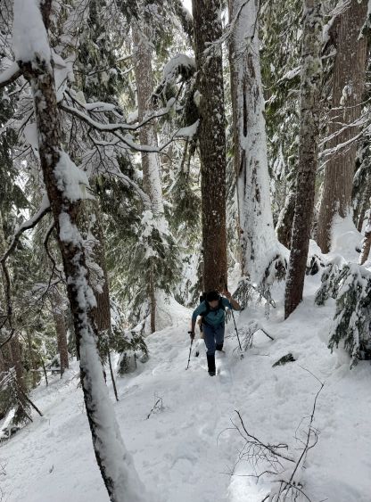
At the very last minute I decided to just wear the 25′ snowshoes which wasn’t the wrong decision in retrospect. The trail-breaking turned out to be harder than expected as the new snow was wet and mushy, but the amount of fresh snow was only 30-40 cm at the maximum. The first stretch was a boring slog to the end of the FSR. Matt insisted on us strapping the snowshoes on from the Jeep, which was not needed but did save a transition 10 minutes into the trip. The road walking was longer than I thought and due to the fog layer we didn’t get to see much in this stage. Matt’s tracks were still very visible so we mostly stayed on his tracks. Any attempt to walk beside the track would result in post-holing through breakable crust. We briefly attempted to follow Matt’s short-cut through the lower cut-block but didn’t like the mushy conditions. The alternative was the kilometer-long plodding to the road’s end which still involved fair amount of post-holing (since Matt didn’t take this way in the previous weekend). Our gang went somehow from Mel, Miranda, myself and finally Matt, and each of us was post-holing on top of the previous persons’ tracks, which I thought was hilarious. We somehow managed to perfectly line ourselves up by weight and sizes.
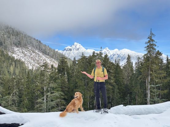
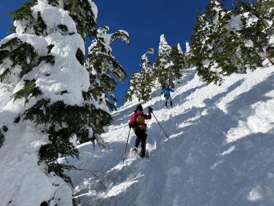
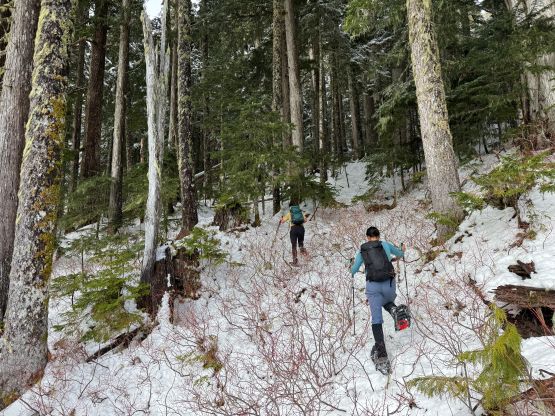
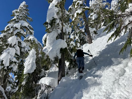
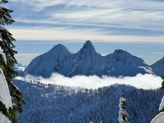
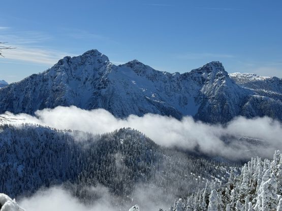
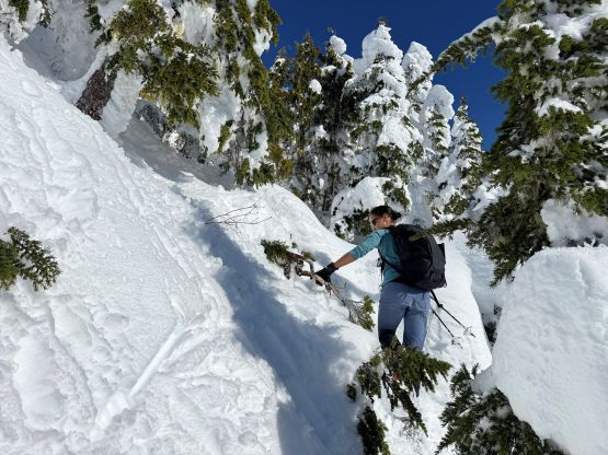
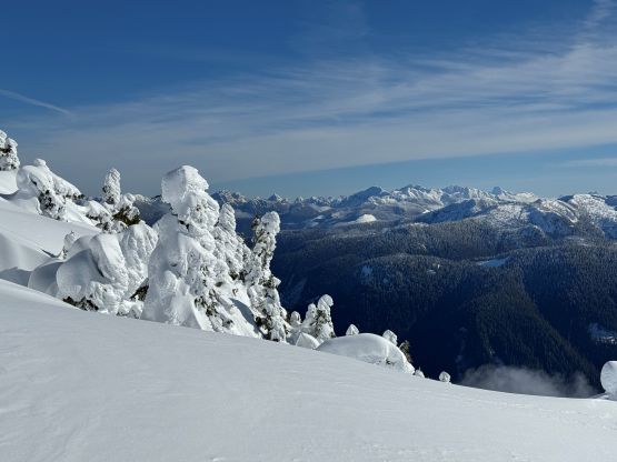
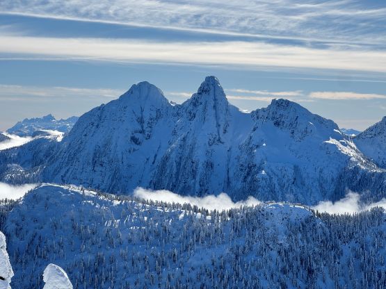
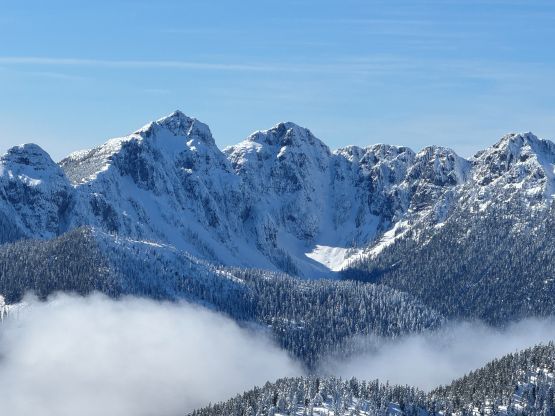
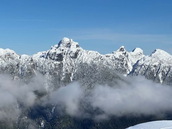
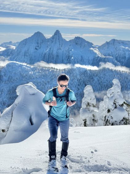
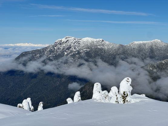
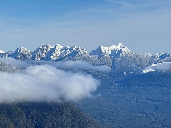
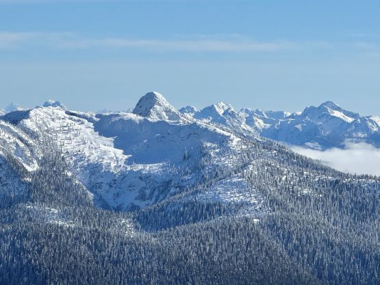
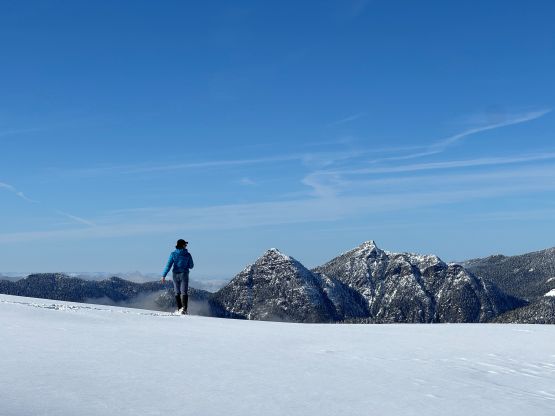
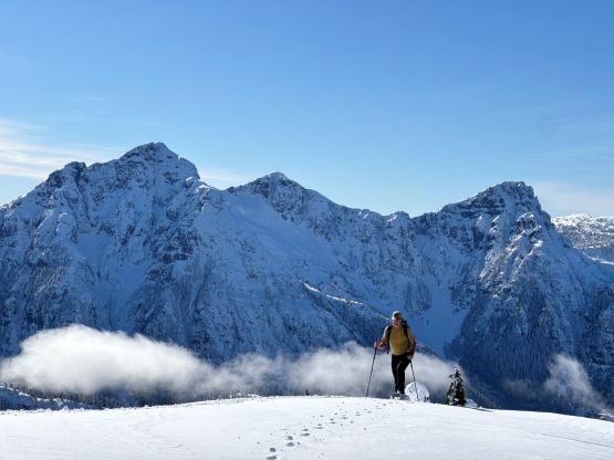
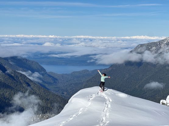
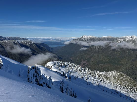
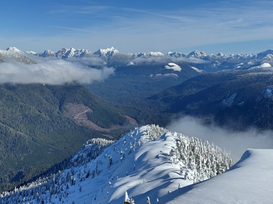
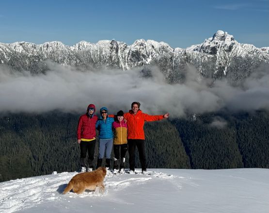
We eventually joined Matt’s previous weekend’s tracks and the route would go straight up the south slopes for 600 vertical meters to the summit. The bushwhacking was minimal despite the lack of snow at lower elevation, and the depth of the new snow did not pick up until 1200 m elevation above the end of the tracks. The final 300 m elevation gain was mostly knee deep wallowing in mushy and sticky snow but honestly the terrain and the condition was not as bad as expected. There was one notable bluff that required a leftwards traverse, and a few steeper sections where we must cut some tight switchbacks on 35+ degrees terrain. The worst was the final 50 m underneath the summit ridge where the young trees made for some heinous wallowing. I discovered at least two waist deep holes in this stretch and one of them required some efforts to pull myself out of. Eventually with some careful route-finding we reached the uppermost west ridge and the summit was quickly attained afterwards. The views exceeded my expectation with Mt. Ashwood and “Bonanza Peak” stealing the show to the south. There were so many prominent peaks visible on the horizon and I had only done at most a handful of those.
Due to the time constraint with the ferry crossing there’s no point in staying too long up there, even though we were doing quite good on time. The snow was on the heavy side so the 600 m plunge down the south face was unfortunately not very enjoyable, but it wasn’t difficult. I managed to make the full descent in a single shot and then took the mandatory break on the FSR. The plodding back down the FSR felt like a drag but again, the gravity was mostly on our side so it wasn’t that terrible. We finished the round trip in exactly 4.5 hours but the home-to-home push from Surrey was over 20 hours. The timing wasn’t exactly on our side because we ended up waiting at the Departure Bay ferry terminal for 1.5 hours even after having a dinner break in Nanaimo.