Mount Tekarra
October 6, 2012
2693m
Jasper – Skyline Trail, AB
Mount Tekarra is probably the most photographed peak on Skyline Trail area since it’s visible from both Yellowhead Highway and the Icefield Parkway. It’s also a somewhat impressively looking peak that I’d ever wish to stand on its top. There’s some limited route beta from Vern’s ascent but it was still vague if looking for the details. I came up with some experimental thoughts that one could probably traverse up and over it based on my photos and I decided to test it out. It’s probably not a good idea to do difficult scrambling with no route beta in late afternoon and by myself, but I was there already so I had to give it a shot. It’s my last objective of the ambitious solo traverse of 4 peaks in the north section of Maligne Range (Skyline area).
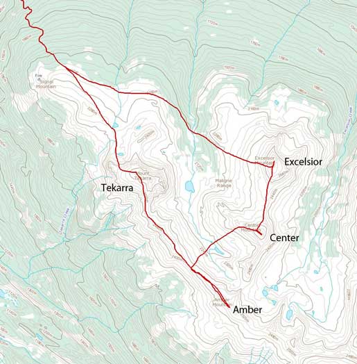
Ascent routes for Excelsior, Center, Amber and Tekarra
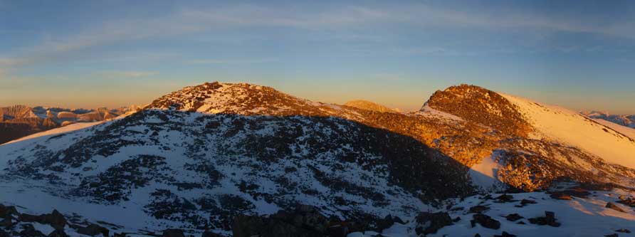
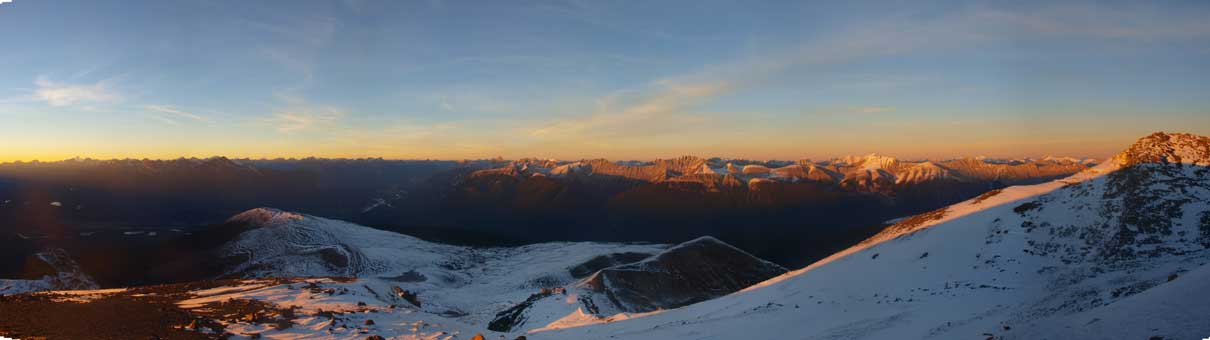
After summitting Amber Mountain, I immediately focused on the ridgeline traverse towards Mount Tekarra, and it’s a long way to go. This ridge section was very scenic. The connecting ridge initially went pretty easily, but things got trickier as I approaching Mt. Tekarra. The ridge narrows significantly. This section reminds me the traverse from Nihahi to Compression. Same direction (towards north); same difficulty (transition from hiking to difficult scramble); same tiredness (the last summit of an insane traverse); same time of the day (6pm ish); and more important, I was soloing on both… I would rate the connecting ridge as the harder side of moderate scramble in dry condition. For me, dealing the wet quartz really made me feel like doing difficult scramble.
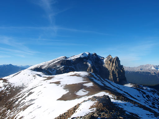
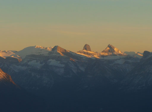
Partway down the traverse from Amber to Tekarra, looking towards Tekarra

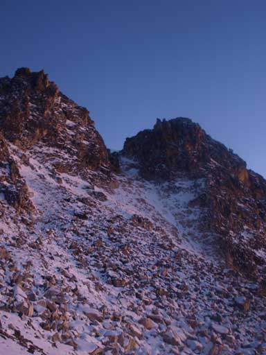
The ridge ahead would soon turn difficult and exposed

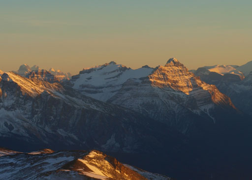
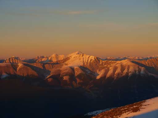
Looking back at Excelsior, Center and the long ridge of Amber Mountain

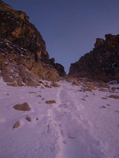
At the base of Tekarra, go left to avoid this rock band
I circumvented these cliff bands on climber’s left side, but after doing so, I found there were two summits, and I didn’t know which was the higher. I chose to ascend the left one as it has a weather station but it turned out to be the false summit… I managed to beat sunset to get up here and took an excellent panorama. The gorgeous view made me feel like doing an alpine trip. Normally you won’t get these sunset views when doing day trips. The true summit (the south summit) was about 10 min away, but I really had to hurry down as I knew the descend gully wasn’t easy. I must get down before dark. I still consider myself as finishing this peak though, especially given the fact I traversed this peak. There’s no technical difficulty, and it’s only a short walk between the two summits so I’m considering this as being “close enough”.
Panorama of Kerkeslin, Brussels, and Fryatt
Mount Edith Cavell
Mount Kerkeslin
Catacombs, Christie, Brussels, and Lowell
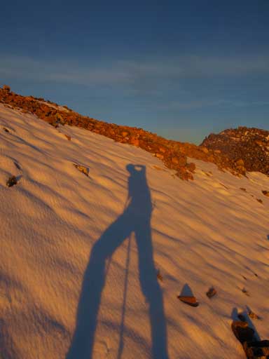
My long shadow
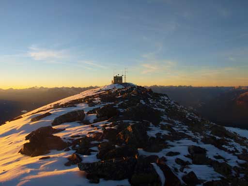
A weather station on the false summit
The true summit is on right

Sunset
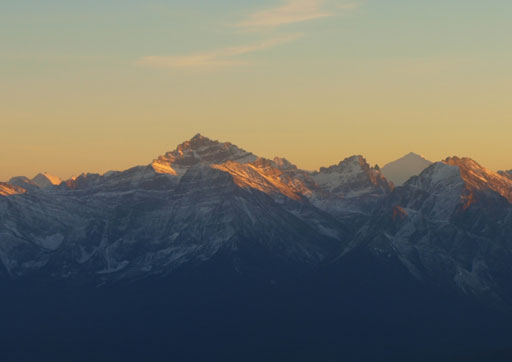
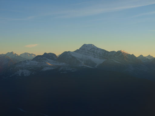
Mount Fryatt
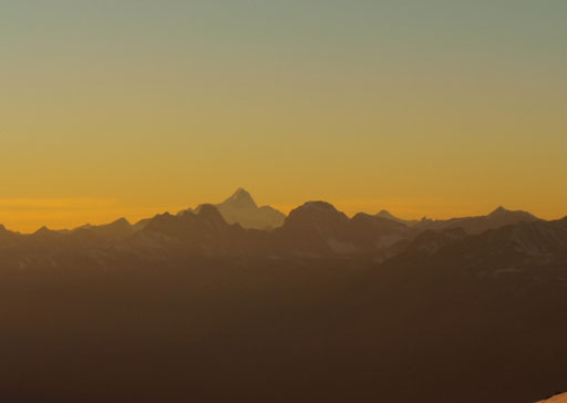
Mount Robson

More sunset colours
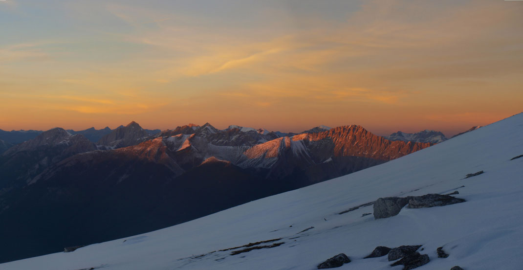
The ridge I just traversed is shown by evening sunlight
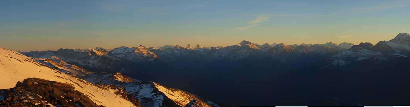
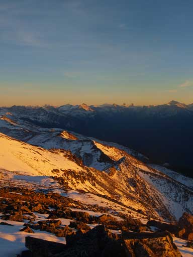
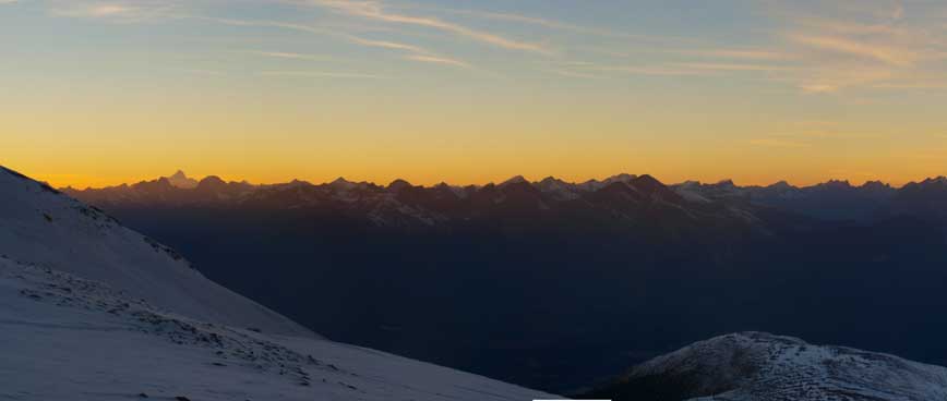
Panorama looking North
A unnamed peak on Colin Range
Mount Robson poking behind Victoria Cross Range
One last look at the evening glow on Colin Range
Based on the earlier observation, I knew the descent gully is somewhere on skier’s left side. I managed to find footprints on the snow, but they’re not humans. They’re apparently sizable bear’s track… The footprints ended at the gully. Apparently the bear felt it was too steep for him to descend… But what the heck he was doing on the summit of Tekarra… I took out my ice axe and carefully descended the upper part. I would say the crux was the initial 20m or so. Overall it was actually easier than anticipated and I quickly moved down the gully.
The descent gully
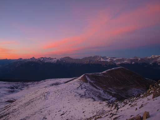
More evening colours
Looking back at my descent gully
I could see the evening view of Jasper townsite, but too bad I couldn’t get a photo of it without blurring.. I carefully descended the last boulder section of the day to safer ground. Because of the snow I didn’t have to use headlamp until about 1 hour later. I descended diagonally downhill while side-sloping around Signal Mountain. Eventually I managed to re-join my footprints and followed them back to Signal Mountain road. I took a necessary break and after that, I ran down the final 8.5km. Round Trip time: 14.5 hours.

Hey! Awesome pictures. I plan on doing the Sky Line trail in the late summer (most likely August but there’s a lot to be considered and more research to be done before setting dates). When you traversed Amber to Tekarra were you following the Sky Line trail or the mountain ridge? The way the maps mark the trail it looks like it follows the ridge from Amber for about 4KM (http://www.pc.gc.ca/eng/pn-np/ab/jasper/activ/ap-bc/sugg-sentiers_trip-ideas/~/media/pn-np/ab/jasper/activ/ap-bc/Guides/Skyline/Skyline-south_v1e.ashx – this is the link for basic map+trail). I would love to summit Tekarra as a side hike during my visit to Jasper Park.
If you could email me back, any and all information you have would be greatly appreciated!
All the best,
Bill
Hey Bill,
I was following the connecting ridge. Like the link suggests the trail only goes about halfway from Amber to Tekarra. The rest is a scramble along the ridge, on mostly quartzite boulders. Very slippery if wet. I remember there’s one jagged section with some route-finding.