Mount Willingdon
August 29-31, 2013
3373m
Eastern Banff Park – Clearwater Pass, AB
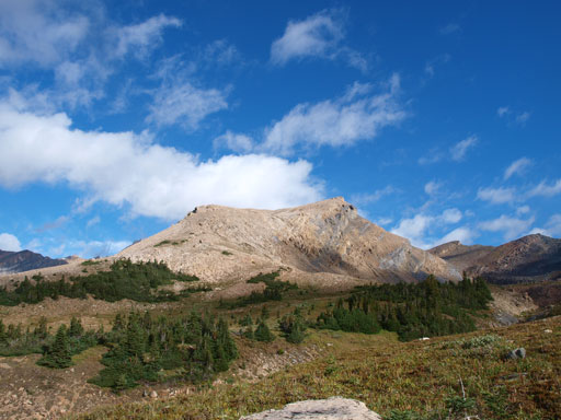
Sitting deeply in Banff National Park’s Eastern backcountry, Mount Willingdon is the highest peak between Hector and Forbes. On a clear day, its summit guarantees fantastic views. Unfortunately, (or fortunately), its standard route via west ridge is considered as “no more than a scree hike with a short rock band rating at difficult scrambling”, and therefore, it doesn’t offer the “quality climbing” like classic 11,000ers such as Assiniboine or Edith Cavell. The approach is long but not “that” long compared to its lower neighbour, Recondite Peak. Folks that do the traverse to Crown and Tower will descent the south ridge which was considered “easy” as well, but this route lacks detailed beta. Having done the three 11,000ers that I just mentioned above in less than 1 month, I was slightly less interested in this “easy” climb. However, as the date came closer, weather forecast got constantly down-graded and compared to the alternatives my preference was still Willingdon, mainly due to the fact this is a 3-day trip. In retrospect I was really glad we chose this objective. The experience, along with the views, will be something that I’ll never forget.
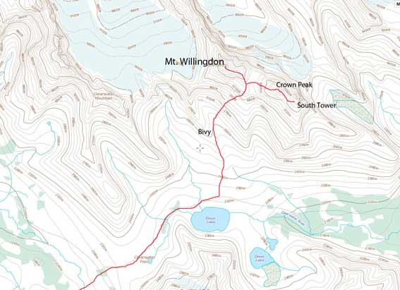
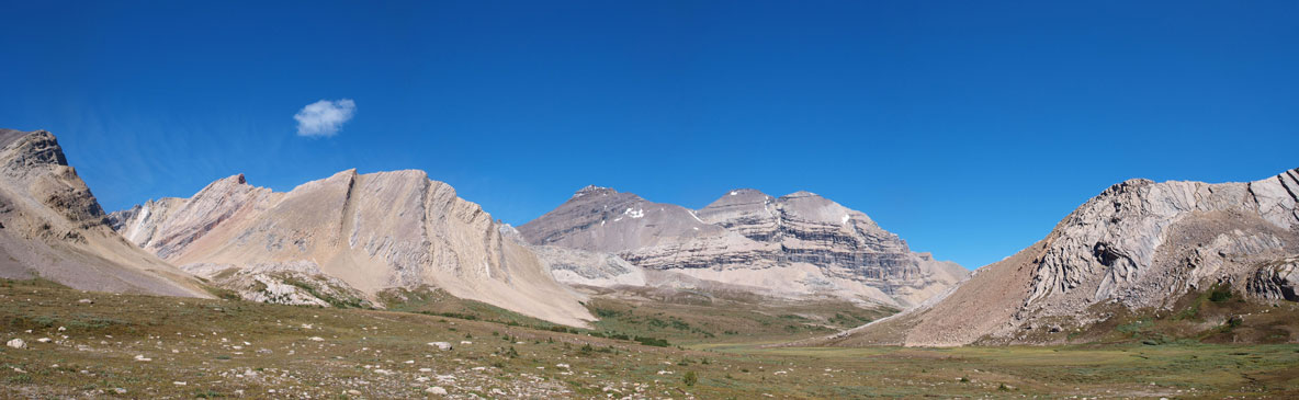
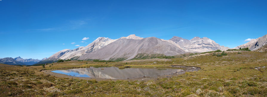
Ascent route for Mt. Willingdon, Crown Peak and South Tower
Our plan was to approach via Quartzite Col, and tag Devon Mountain on the 1st day, ascend Mt. Willingdon and traverse to Crown and Tower on the 2nd day, and then return via Quartzite Col and also bag Clearwater Mountain on the 3rd day. Of course the weather had other plans and we didn’t go exactly as planned. The main summit of Mt. Willingdon was obviously the primary objective of this trip so in this report, I’ll write both the approach and the return. Devon, Crown, and Tower are bonuses and I’ll write them in separate trip reports.
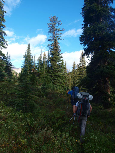
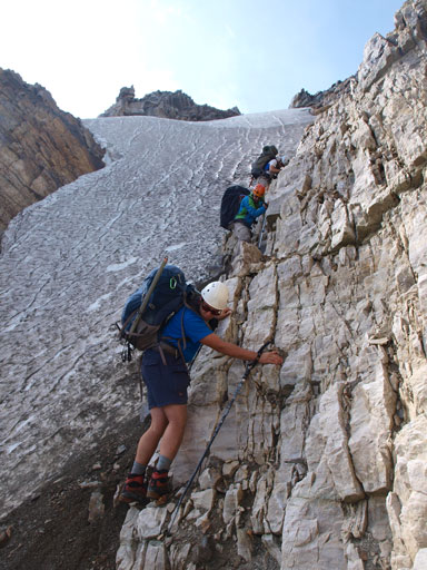
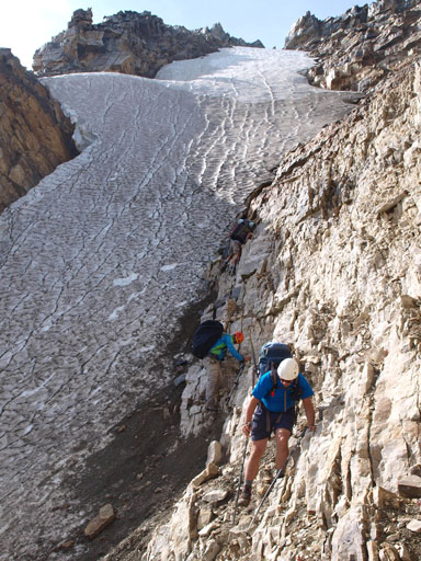
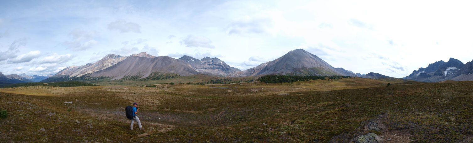
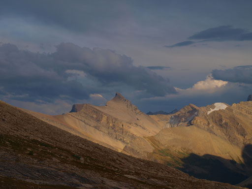
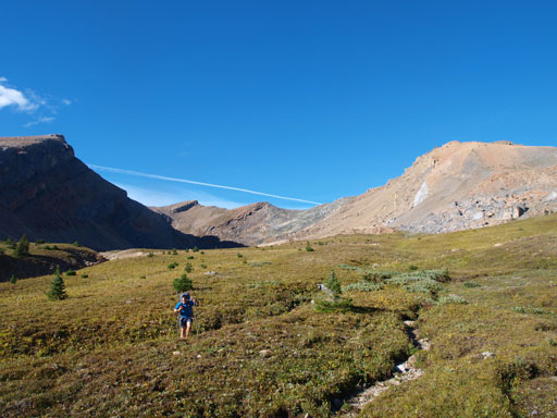
We knew the south ridge of Mt. Willingdon has a short snowy crux that “might” need crampons, and the descent from Quartzite Col is usually snowy or icy. Not liking to take a chance, we’d use mountaineering boots, and carry ice axe and (steel) crampons. We wouldn’t bring the rope though as it was very unlikely we’d use it. On Thursday morning, Vern, Eric, Ben and I gathered together at the Mosquito Creek trail-head. Weather was better than forecasted and off we went. The initial 4 km or so followed the well-defined Mosquito Creek trail. The first critical point of this approach was the 3rd log bridge. This log bridge is a major one and we’d leave the trail here before crossing this bridge. There’s a cairn to indicate this point and there’s also a path/game trail to follow. This game trail was easy to follow for most of the way but it did get faint at a couple sections. The general direction was to follow this creek up so it was hard to get lost. At one point we hopped the creek to its northeast side.
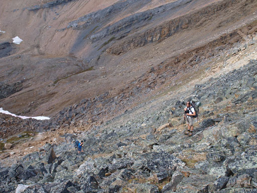
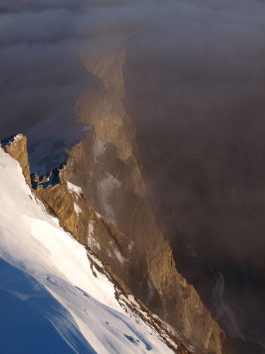
It soon became confusing since Quartzite Col wasn’t visible from valley floor. It was also nice to have a GPS track to follow, and following it we turned sharply right up the forested slope to treeline. It was still confusing as which col was Quartzite Col but again, having a GPS track to follow we wouldn’t worry too much about it. After travelling through a lovely meadows we entered the painful boulder field. The next section went painfully slow and by the time we crested over Quartzite Col we’d already gained more than 700 vertical meters. It felt like going up and over a mountain.. The other side looked ridiculously steep but again, by following a GPS track we didn’t hesitate too much before committing to this first crux of our trip. It might not be the hardest, but definitely the most dangerous part of our trip. Not knocking down a ton of rocks to each other was trickier than the down-climb itself. And the down-climb was more difficult than most of the Kane’s difficult scrambles. After the trip I did some research and apparently people had tried everything at Quartzite Col and seems like we didn’t descend the easiest line, but it worked for us.
The trail gets faint at places
Looking towards the “backside” of Watermelon Peak
Ascending into the alpine.
Lovely area
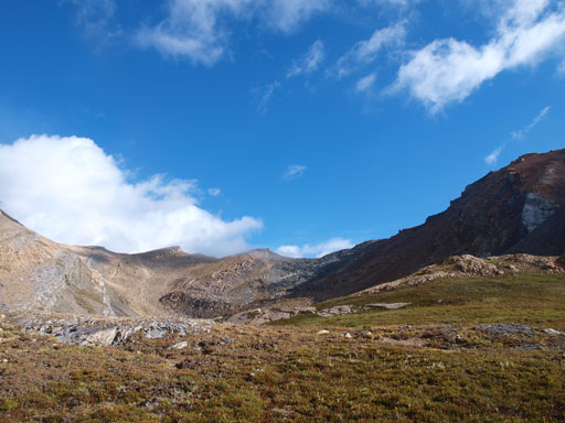
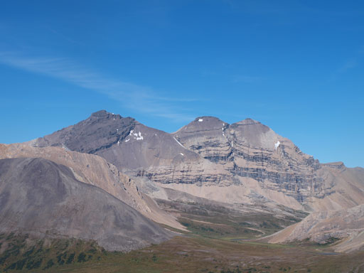
It’s a bit confusing. Quartzite Col is the one with darkish boulders.
Now I understand how it got the name…
Looking down the other side…
Simul down-climbing
Terrain was very loose around here
Trying not to slip on the snow
More boulders
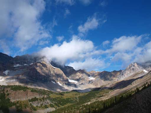
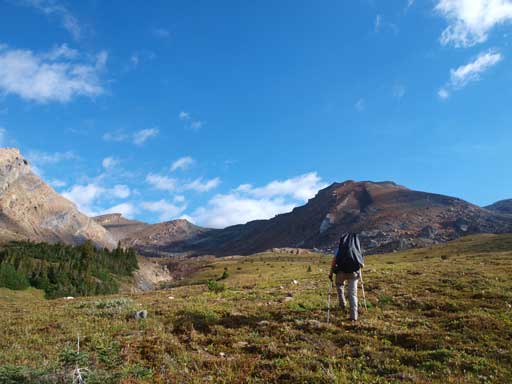
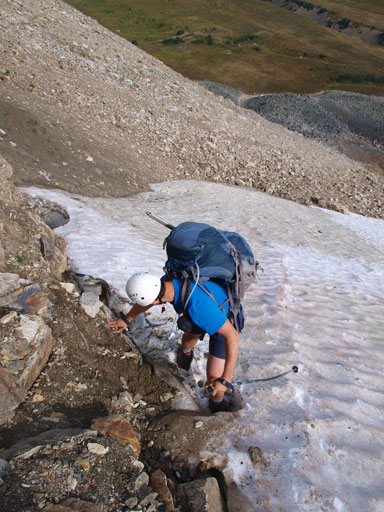
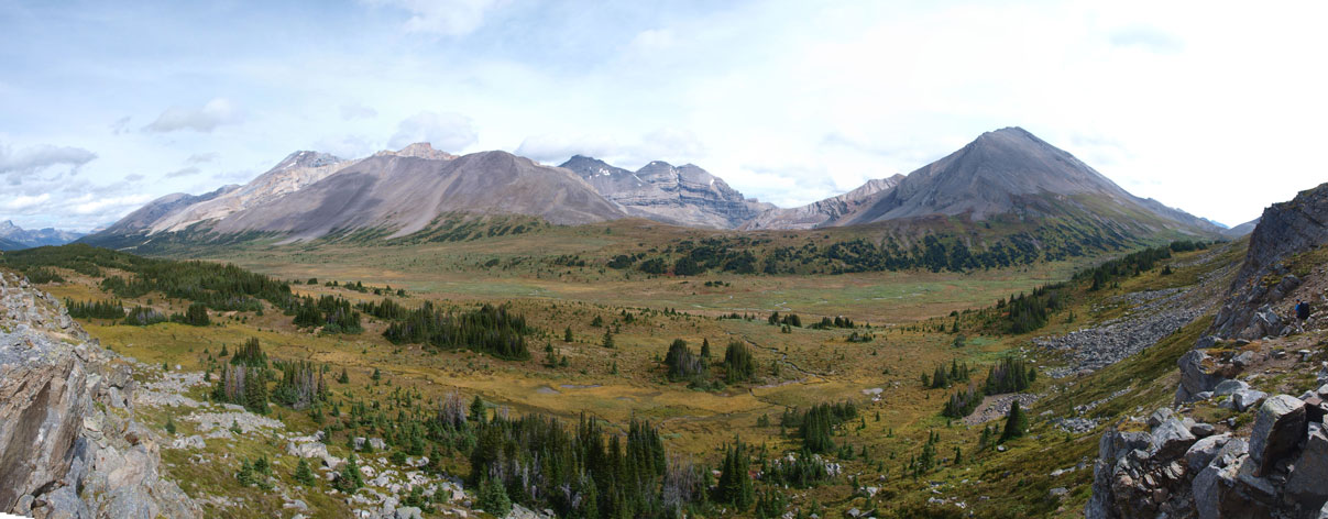
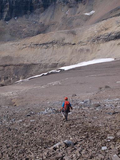
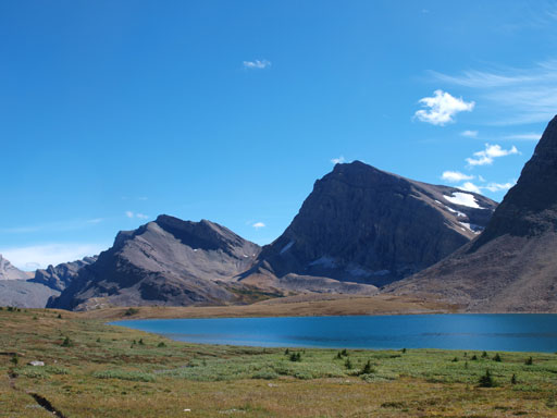
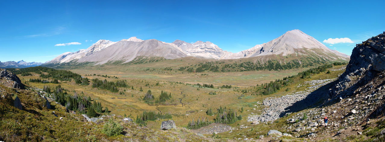
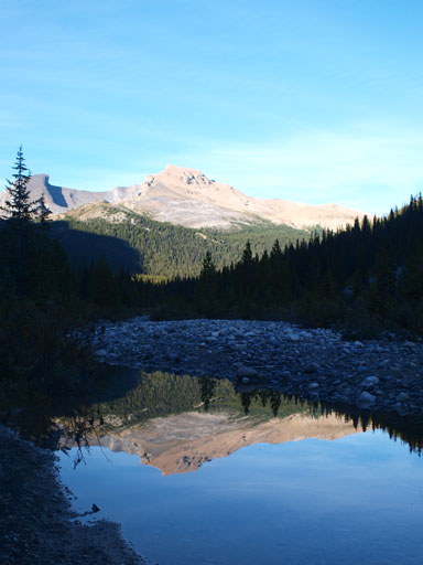
It certainly took us longer than expected here as there was still a few big boulder fields to negotiate, and by the time we made to grass field again, it was a very welcomed change. The next few kilometers’ was a pleasant hike through the upper Siffleur River Valley, with incredible vistas all around. The hike itself, was much longer than it looked. It also involves a lot of elevation gain/regain including a major dip to Siffleur River. We would soon give our attention to the pile of black scree in front of us, Devon Mountain. By the time we got back down weather was slowly moving in. It turned overcast but looked like the rain wouldn’t come in the next short while. Up and over Clearwater Pass, we soon picked the horse trail and followed it to the first, and the biggest Devon Lake. Since we still had a ton of time left we’d keep trudging up towards our objective. We found a lovely bivy spot high on the tundra field. I doubt if anyone will use this spot though since it’s for the folks ascending the (more challenging) south ridge.
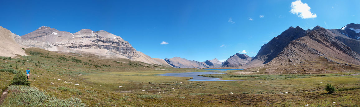
Panorama from the upper Siffleur River Valley
Now what. More elevation loss.

Another panorama of this lovely alpine meadows

Apparently there’re predators around
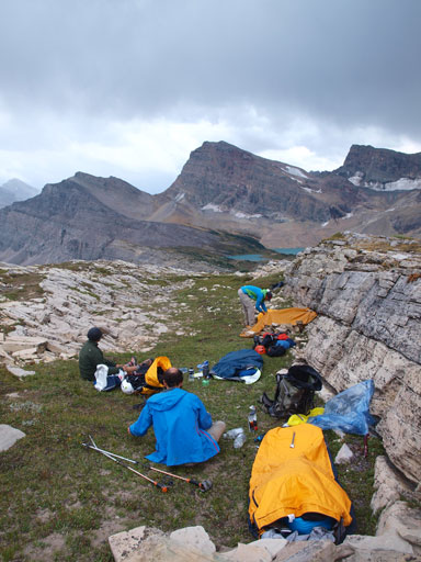
Our high bivy, about half an hour passing the Lake.
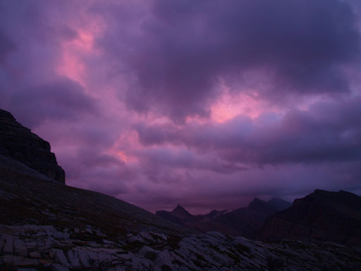
A nasty thunderstorm approached at a rapid pace from west and we barely got enough time to cook some food. This marked the start of the next 1.5 days’ or rain. Oh man.. It’s certainly the most miserable 1.5 days I’d ever spent in the mountains. Multiple thunderstorms came one after another overnight. The rain was heavy and consistent. There was one huge lighting that apparently stroke very close followed by a big BOOM. I thought someone just blasted the mountain apart… The rain eventually stopped at about 2am in the morning, but came again in the morning so we slept in. We woke up at sunrise time and it was still overcast. Time to give it a shot anyway.

One of the many thunderstorms
Panorama from our camp
Dip Slope Mountain
Morning view from our camp on the 2nd day
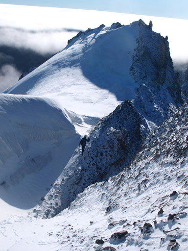
We contoured around the obvious cliff band until it became feasible to break it through. There was some moderate scrambling on loose ledges before topping above this band. We could have gone further up the valley to completely avoid the scrambling parts. By now the ceiling had lowered and the summit of Willingdon went into the clouds. We kept going up for a while but looking back it was getting worse. A band of dark clouds were approaching quickly from the west. I was more-or-less undeterred but Vern, Eric and Ben all wanted to turn around. I was not happy with this decision but it’s a vote 3 against 1, so I didn’t have a choice…

Negotiating the lower cliff band

The weather improved temporarily on our way back to camp.
Back to camp, I went straight into my sleeping bag. There’s really nothing I could do except for resting and conserving energy. We also talked about staying into the 4th day (Sunday) if we still couldn’t get Willingdon by the 3rd day (Saturday). Basically we would have 3 or 4 windows to get it. One, or the other.. I’m considering our brief attempt as scouting rather than a failure.. As long as we could get it without going back to the car, it’s not an “attempt”. The next window was Friday afternoon/evening, but unfortunately, the weather didn’t work out. Ben brought his Delorme inReach and he could communicate with outside. The newest weather forecast had promised some nice weather on the next day so at least we still had a hope. Another storm came heavily from the west. It rained/snowed consistently for the next 3 to 4 hours. It was very miserable as I couldn’t even get a chance to breath in fresh air unless I wanted to get my sleeping bag wet… The rain/snow/wet snow eventually stopped in the evening but weather was still gloomy. The mountain also got dumped by a ton of fresh snow. Again, there wasn’t much we could do so we went to bed early, hoping the sky could clear up. We agreed to wake up at 4 am on Saturday morning.
It was freakin’ cold overnight, but at least the weather did clear up and we could see millions of stars. There was a piece of cloud moving in from east though. We left our camp at about 4:20 am in a pitch dark. We had planned using a different route than the one we took in the previous day, but got ourselves onto some concrete hard dirt. It was a tad sketchy but we eventually cleared the mess and got back on track, but then bad thing appeared ahead of us as that piece of clouds turned overcast again as we slowly trudging towards Willingdon/Crown col…
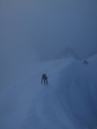
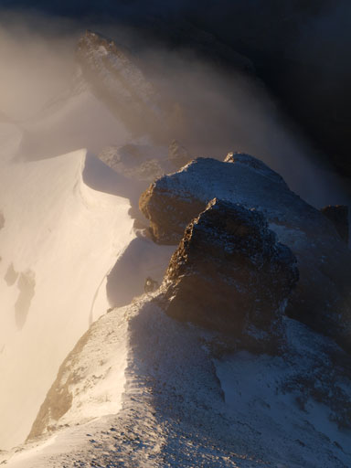
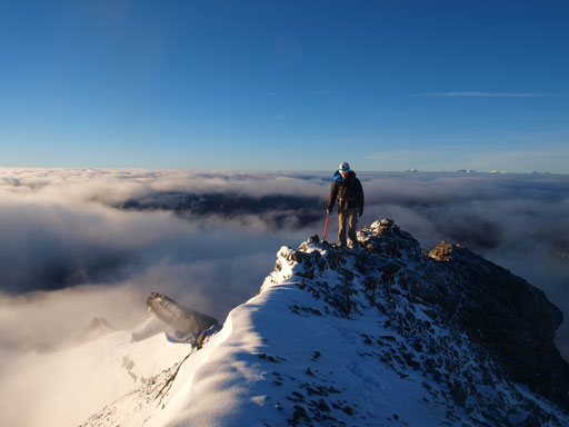
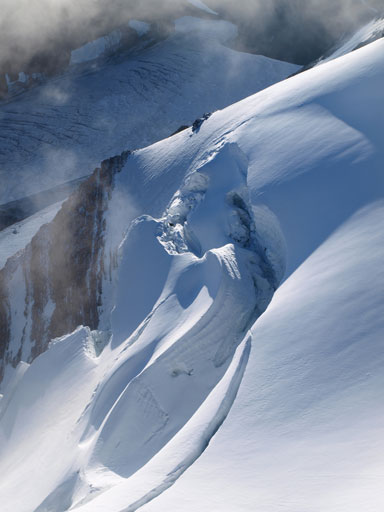
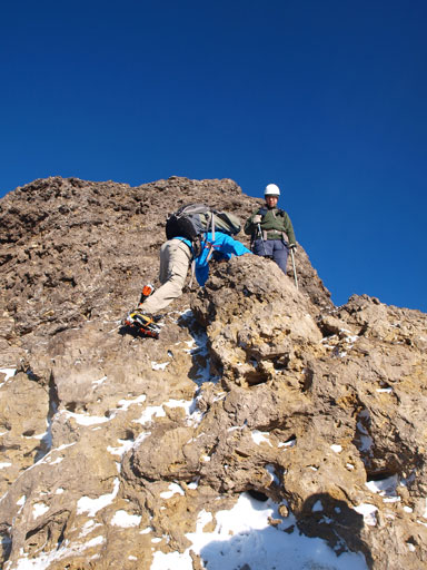
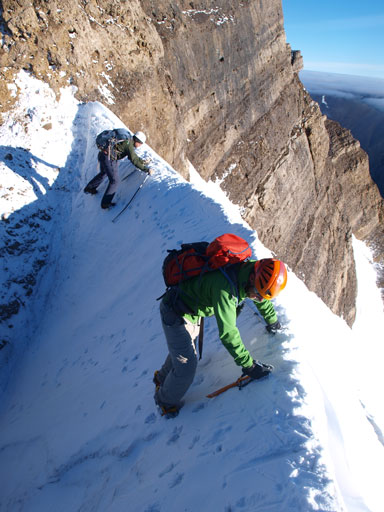
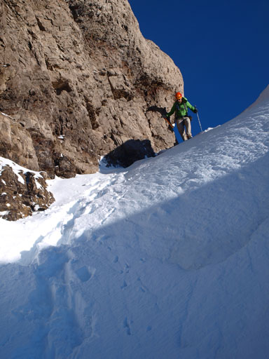
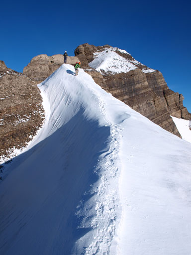
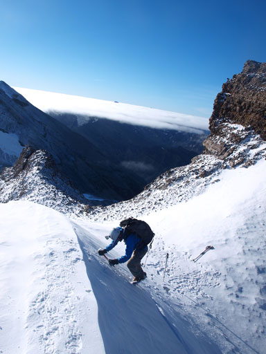
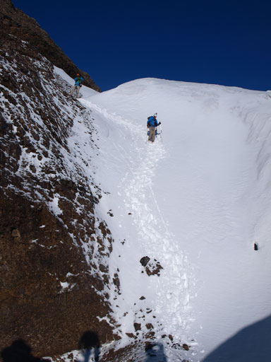
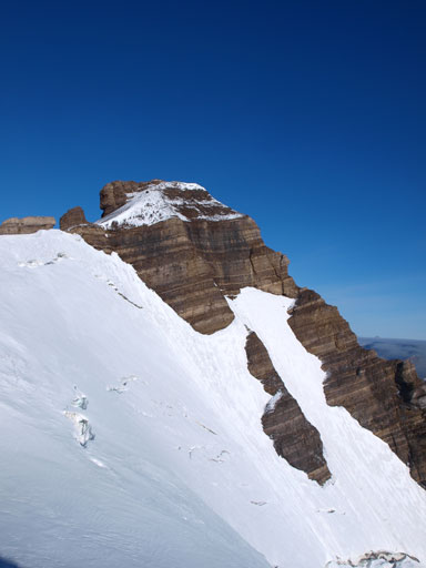
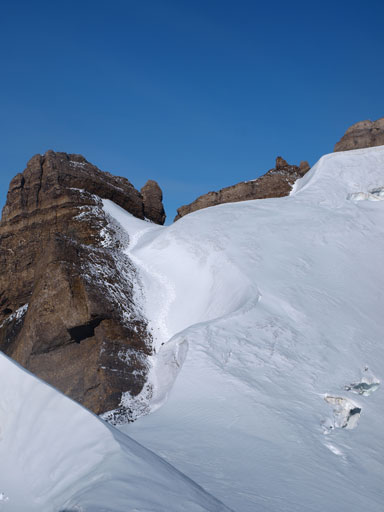
The summit of Mt. Willingdon was covered in clouds what else we could do now.. We soon entered the clouds and it’s becoming a white out, but at least this time it didn’t dump rain nor snow so there’s still a bright side. The terrain was easy until we encountered some snow. Up and over a couple smaller false summits we would soon don crampons. Up and over a snow/ice arete followed by a steep down-climb provided a good warm-up for the real crux. The snow/ice arete at the crux was too narrow and exposed that we couldn’t balance over it. We had to front-point into the ice and traverse sideways. It’s only about 10 meters though, but once I got to the other side, I encountered a difficult rock wall. It’s only about 2 meters high but it was pretty awkward. Vern, Ben, and Eric found a way to get around the snow arete but not this rock band.
Vern climbing up a snow arete

More about the south ridge. This is still before the crux
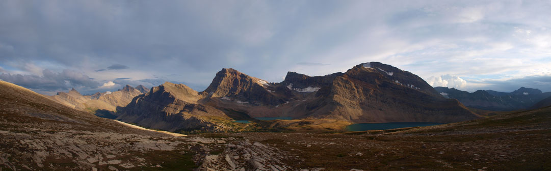
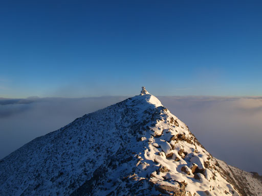
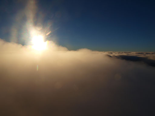
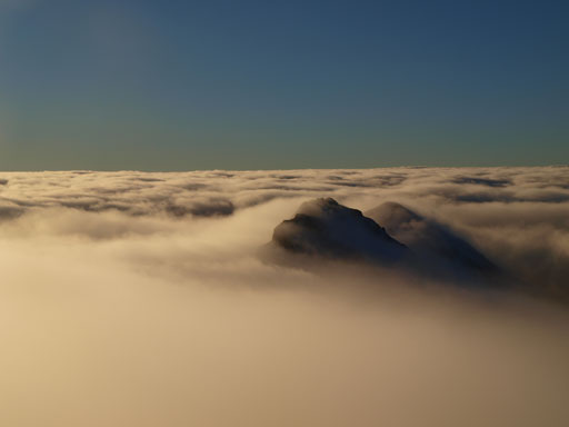
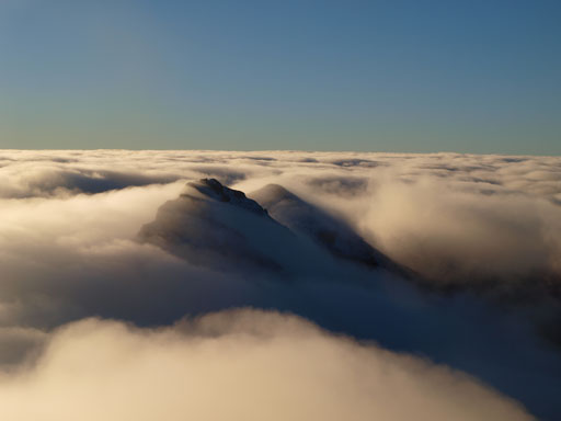
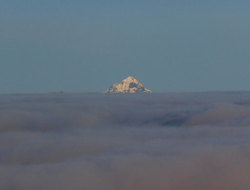
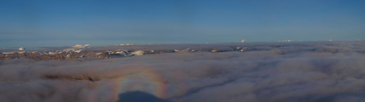
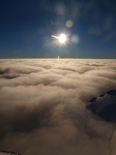
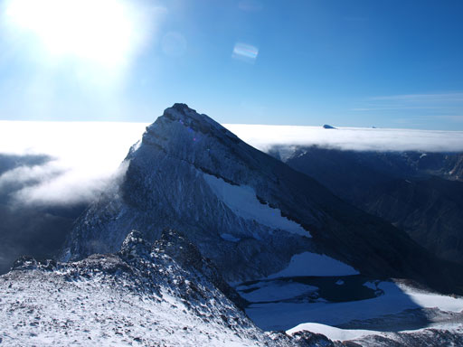
Oh man, I couldn’t believe how dramatic our trip was. Hope, no hope, and then hope, and no hope again. It kept fluctuating back and forth. By the time we entered the clouds I was totally mentally prepared for a blizzard on the summit, but oh man. At about 20 vertical meters below the top, I broke through the clouds!! What a wonderful world above the clouds! I’d got to quite a few lofty summits with inversion scenery, but this one was so special that the cloud ceiling was so high that only 11,000ers could poke through the clouds. I think the ceiling was just at 11,000 feet. The ceiling was constantly dropping and peaks started to show up one after another. Recondite looked like a tiny island in a sea of clouds. I wouldn’t describe too much as my photos would do the job!

Oh wow. Panorama from near the summit!!!
The true summit is within touching range.
On top of the clouds!
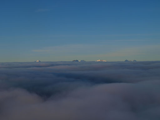
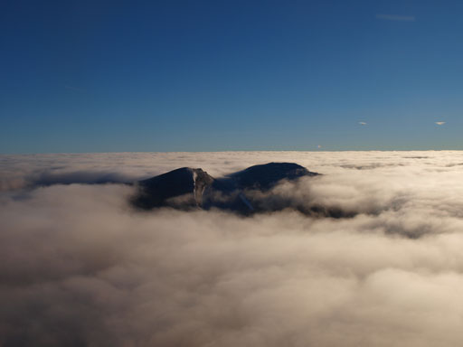
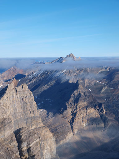
Only 11,000ers could poke through. Temple, Hector, Hungabee, Victoria, and Goodsirs
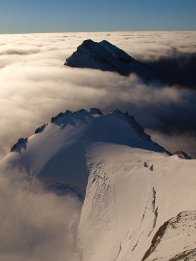
Looking down at Crown and Tower, our next objectives
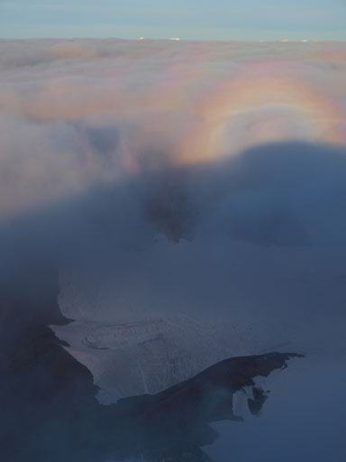
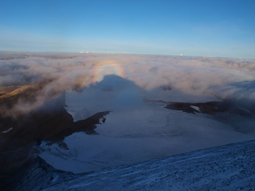
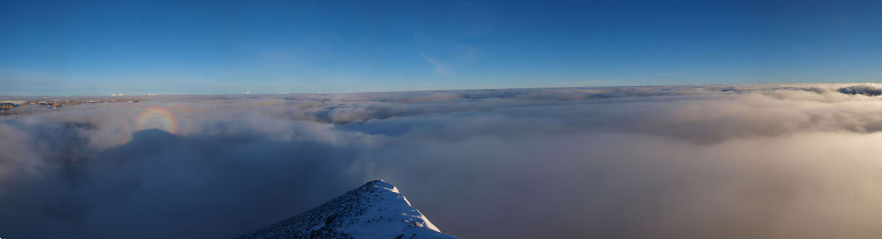
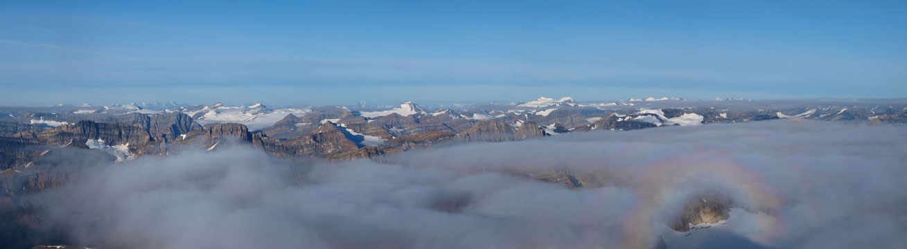
What a “rainbow” thing!

Panorama view
Another photo of Crown and Tower
Looking down the south ridge
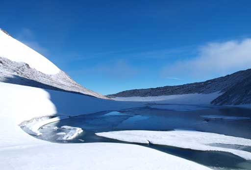
There’s an expanse icefield between Clearwater and Willingdon
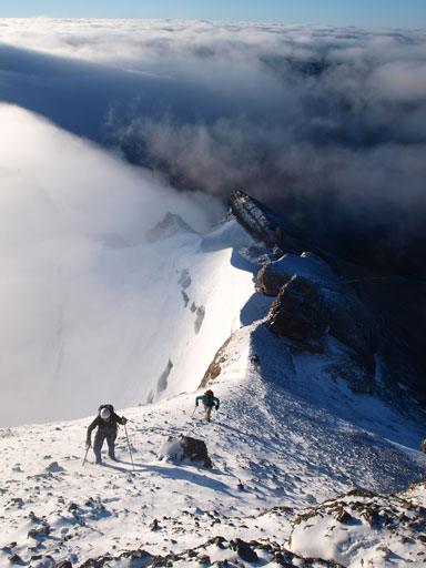
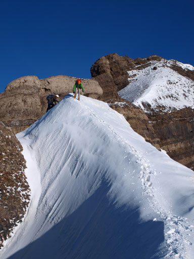
Eric, Vern, and Ben, approaching the summit of Mount Willingdon
Ben approaching the summit

Lyells
Forbes
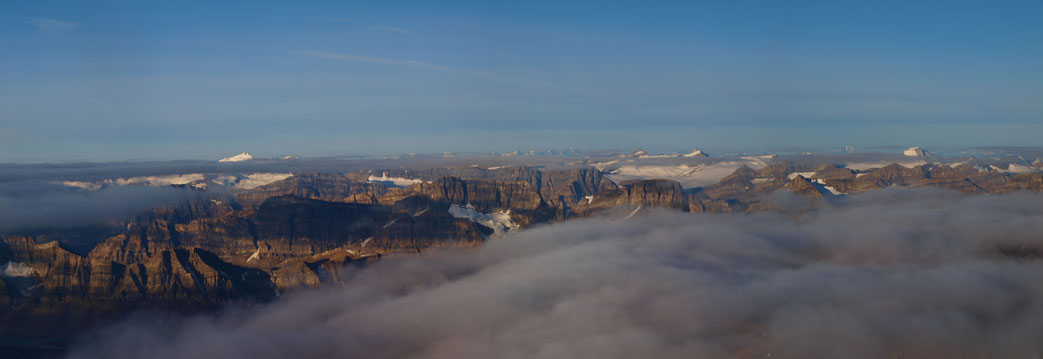
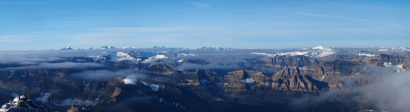
Panorama looking north. Oh man!
You can pick out some familiar mountains like Balfour
The Freshfield group on left; Forbes and Lyells on right
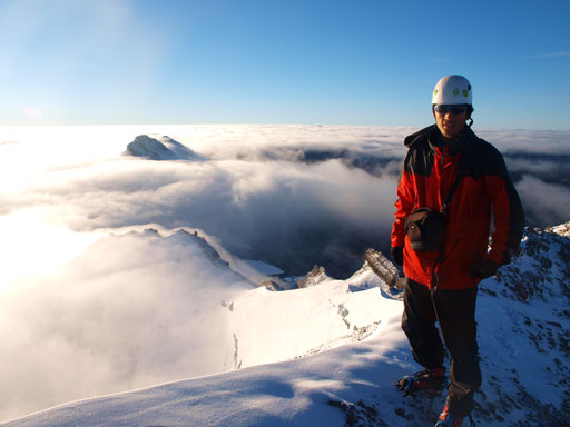
Me on the summit of Mount Willingdon

Recondite looks like a little island
So does Mount Harris
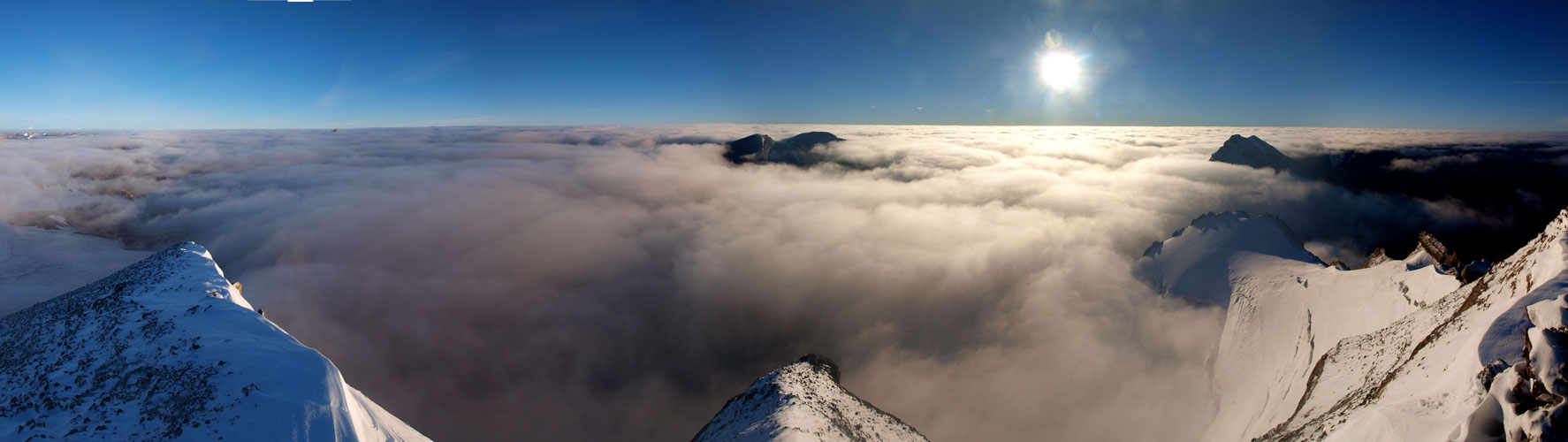
Another epic panorama
The clouds and the morning sun
Clouds started to lower, revealing more about Crown and Tower

Mount Harris
The Lake Louise Group on left; Balfour on right
The Wapta Icefield on left; Freshfield Icefield on right

Another photo of this “rainbow” thing

Recondite Peak is the bigger island. Mount Augusta is the tiny one.
Looking down the East face!

Vern soaking in the views
This crevasse can eat your house!
After shooting hundreds of sexy photos it was the time to descend as we still had two more peaks to bag. We’d retreat our ascent line but this time we’d stay much closer to each other so I got plenty of epic photos. That snow arete was sexy! I also got surprised at how much elevation we’d lose to Willingdon/Crown col. Well, that’s because I’m usually on a rush on the ascent, while I like to take my time and enjoy the scenery on the descent, so I didn’t realize how much elevation I had gained while ascending this south ridge. There’s a lovely alpine tarn sitting right at Willingdon/Crown col. This would make a superb bivy spot IF weather is good. Don’t go bivy here in a thunderstorm though.. We would soon focus on Crown and Tower, also known as Willingdon Center and Wilingdon South.
Ben down-climbing the crux rock step
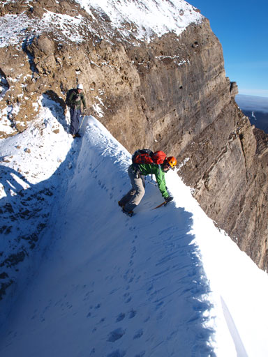
Vern crossing the snow arete
Same as above
Descending steep terrain
Any volunteer?
Descending the lower and wider snow arete
Same as above
Ben down-climbing a short section
Descending the south ridge
Descending the south ridge
Looking back towards the summit
Crown starts to look big
Clouds are lifting, revealing more of Recondite Peak
Looking back at our tracks
The tarn at Willingdon/Crown col

Panorama from Willingdon/Crown col
The traverse to Crown and Tower and back to Crown took longer than expected. Now what! A long way back to the parking lot! After trying to side-hill we decided to just bail straight down the face taking advantage of the scree. Take a note that this is a serious rock fall zone and I dislodged a big boulder towards Vern below. Eric and Ben did a great job keeping the rocks on the mountain so I switched position to hide behind them closely so I wouldn’t knock down more rocks. Down to just above the obvious rock band, we traversed skier’s right and slogged slowly back to our camp. We took a long break at the camp since we all knew how long the return would be.. Weather was very different than our approach day with blue sky above us and no smoke, so I took plenty of photos in that lovely alpine meadows at near Clearwater Pass and upper Siffleur River Valley.
Scree skiing

Looking back at our objectives
The lower Devon Lake

Panorama of this area. Dip Slope Mountain at center
Another panorama

Devon Lake
Panorama from Clearwater Pass

Bog crossing
Panorama of upper Siffleur River Valley
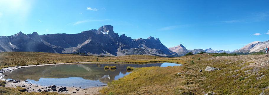
There’s a small tarn providing good photos
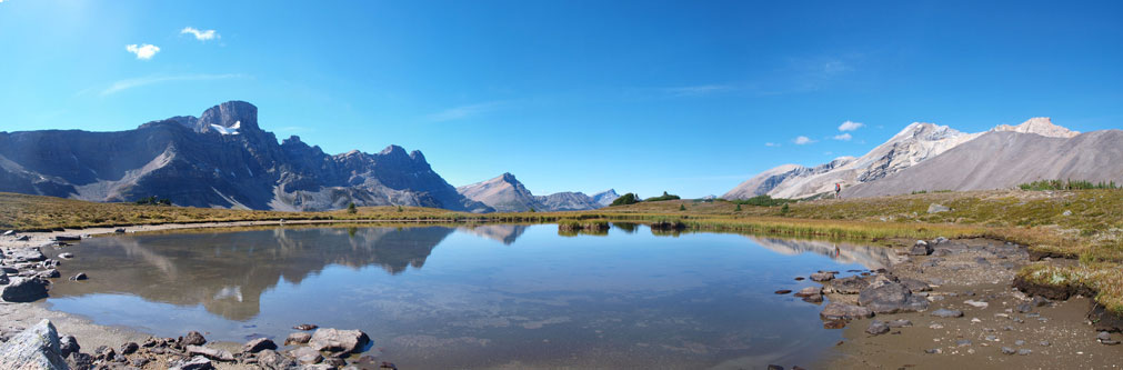
The tarn
And the tarn again, with Clearwater Mountain behind

Hopping a creek
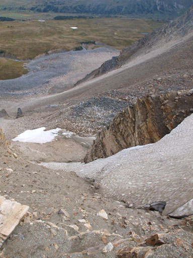
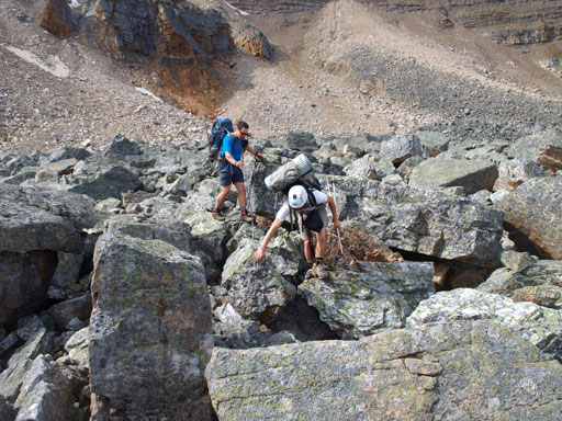
Back to the loose Quartzite Col, again, the most challenging thing was not knocking rocks down. I led up a loose boulder field at a slow pace to the left of the lower snow patch and thus bypassed it. We thought about front-pointing up the upper icy gully but decided to use the rock again. Again, we were extremely careful, not just about not falling, but also not dislodging boulders to each other. It took us a long time to eventually clear the gully. Up and over the col, we were left to another half an hour’s boulder hoping, and after that, we were back to grass again. Some brief bushwhacking brought us back to the faint trail/path alongside the creek. We followed it out but lost it, but then we just bushwhacked beside the creek and soon we picked up the trail again. Back to the main Mosquito Creek Trail, we were still left to another 4km’s walk. What a 15.5 hour day!

Carefully ascending back Quartzite Col

Panorama from Quartzite Col
Willingdon, Crown, and Tower
Clearwater

Kentigern
Noseeum
Back down the south side of Quartzite Col
Mosquito Mountain
Overall, Mount Willingdon was more challenging than expected. I think we didn’t go down the easiest line from Quartzite Col, but no matter what line we could pick, it’s loose! I couldn’t commend on the west ridge, but the south ridge is definitely not an easy scramble. It’s a snow/ice route. I haven’t done Victoria but it reminded me some photos I’ve seen from other trip reports. I’m sure I’ll be back to this area sooner than later for other big mountains such as Harris and Augusta. The alpine area around Clearwater Pass certainly deserves a visit even without the desire of peak-bagging. And like that Recondite trip two weeks ago, this is another one that gives us a true wilderness feeling.

hello, this was posted few years back so my question may not be relevant anymore, but were you required to get permits for your bivouac ? Thanks and Thanks for the great stories about the mountains.
I guess I didn’t google enough that there’s random camp zone in the Devon lakes.. 😛
Technically if you bivy in the national park you’ll need to obtain a permit and a wilderness pass. Do us mountaineers actually follow the rule? It’s a slippery question to answer in public but from the tone of my words it’s pretty easy to infer the answer 🙂
Hey guys, not sure if you will receive this as it is an old article, but what’s the best time to attempt climbing Mount Willingdon?
Hey Milo,
The best time would be late July to mid September when the route is mostly dry.
Hi Steven, another great report! You wouldn’t happen to have a GPS track you’d be willing to share for this trip would you? TIA if you do….cheers either way.
Sorry that was done in an era before I even started using a GPS track.. Vern might have recorded one so you can check with him. Alternatively, ask in 11,000ers Facebook group as I’m sure someone has recorded a track in recent years.