Whitegoat Peaks II (Dasent Peak)
October 10-11, 2014
3212m
David Thompson Country, AB
The weather forecast was questionable throughout the entire Rockies for this past Thanksgiving long weekend but superb for the day prior. So what would I do? Skip Friday then… Alright, I checked the webcam and saw some very ideal conditions – there was very little snow accumulation even on the high peaks. That was surely strange given it’s almost mid October, but if summer really decided to last long then I’d have to use it. To take full advantage of the weather and condition I’d like to push for probably the last alpine climb of this season. As usual after flip-flopping for a few days Raff and I made the last-minute call to attempt the highest summit in Whitegoat Peaks – inspired by my friend from ACC Edmonton section, Craig Hartmetz’s successful ascent one week prior to our trip.
Whitegoat Peaks is a group of high and technical summits just to the north of the more-famous Mt. Cline, buried in the backcountry of David Thompson. Strangely they’re not located in Whitegoat Wilderness, but rather to the south of it. While the first and third summits are among some of the hardest mountains in this area, the second summit, also the highest, offers a fairly straightforward route up from Whitegoat I/II col. Both Raff and I spotted this potential route from our separate visits up Resolute Mountain in the past few years, but the information online was sparse. We had no clue if the route would go as a scramble and we knew Craig’s group did one rappel, and the approach would require about 2 km or so’s glacier travel. And to make our trip more enjoyable we’d spend a night at one of the two beautiful lakes below our objective. And to take advantage of the weather window we had to make our summit bid on Friday afternoon so that meant an early start in the morning. Alright, that was the plan.
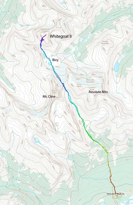
Whitegoat Peaks II ascent route. GPX DL
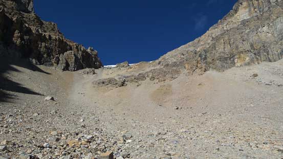
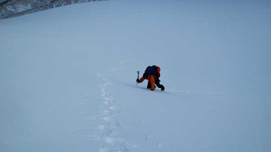
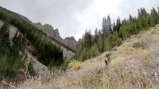
This was my third time visiting this tiny “parking lot” by Thompson Creek and the surroundings had become relatively familiar to me. The unofficial trail by Thompson Creek was in a much better shape than expected. I think over time Resolute Mountain must have gained popularity. One year ago it was heavily damaged by the flood and now people have developed a well-defined path along the new bank. At one point we’d aim steeply up climber’s right side and I remember that part being very vaguely defined. But this time we saw at least 10 cairns marking the route. There was still a bit of bushwhacking on the side-hill traversing part but other than that it was quite pleasant. The rest of the approach towards Cline/Resolute col went uneventful and with good chatting time went by fast.
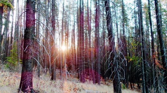
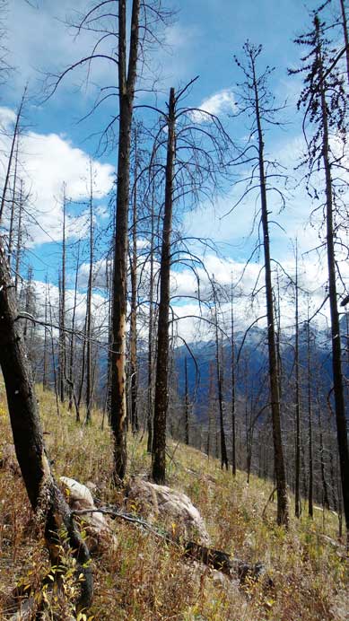
Sunbeam shone through a burnt forest
The mighty Mt. Forbes, with Mt. Outram in front which looks oddly like “Little Forbes”.

Mt. Murchison is rumored to be more than 11,000 feet high. I’ll have to check it out myself sometime.
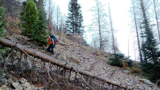
This bit of side-hilling part was the only unpleasant on this approach.
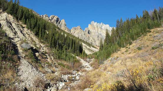
Back into the creek again. We’d soon pick up a well-defined trail.
Into the alpine. Here’s actually a very good bivy spot.
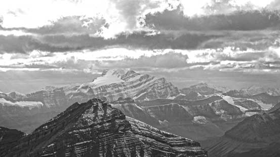
The mighty Mt. Cline – That’s the only 11,000er I summitted in a total white-out to date…

Negotiating a boulder field
The final foreshortened slog towards Cline/Lion col

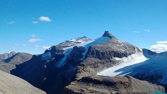
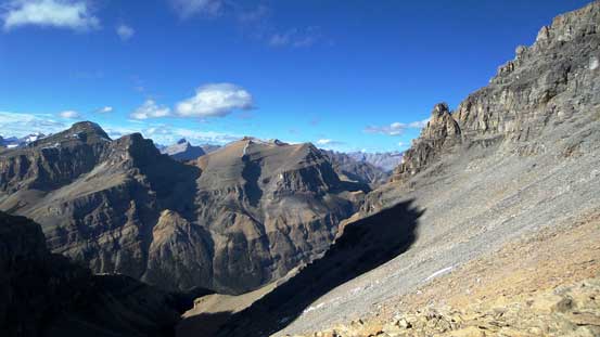
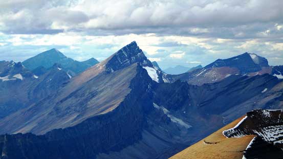
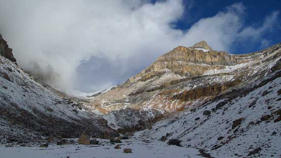
From the col, we could see the impressive Whitegoat I (Troll Peak)

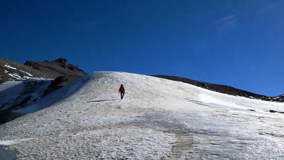
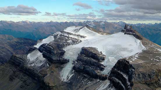
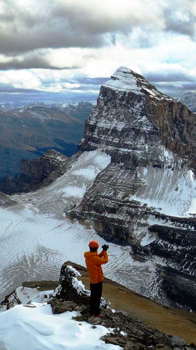
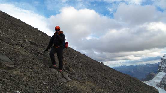
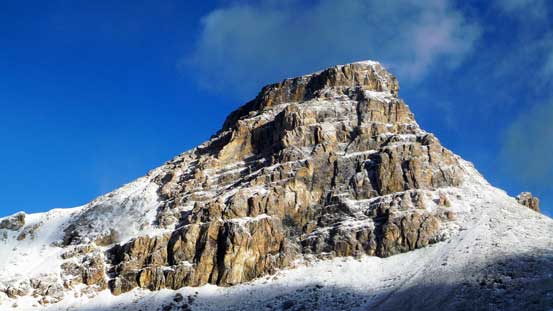
Our objective, Whitegoat II (Dasent Peak)

Crevasses on the glacier. Our path would avoid most of them except for one (at center bottom).

Raff checking out the views

Looking ahead to the next stage.
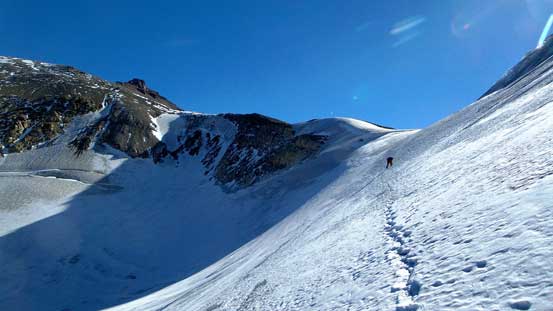
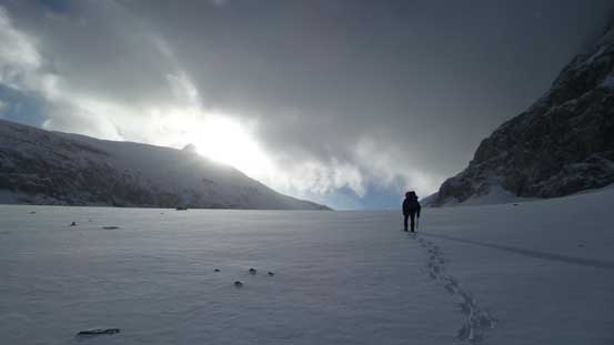
Up and until now we’d been repeating Resolute Mountain’s ascent. Obviously we wouldn’t bag it again so instead of turning right towards Lion Peak we’d continue on our path, dropping 250 vertical meters or so down to a set of beautiful alpine lakes. To get there we must travel through some glaciated terrain. There was one huge crevasse right at the start but after that it became quite benign. What actually surprised me was the steepness of this glacier. I wasn’t expecting a steep roll, and with hard glacial ice exposing to the surface we had to be extra careful. Good thing nobody brought his aluminium crampons up…
Raff starting the glacier.

Here’s that huge crevasse. I took this picture while standing on a solid snow bridge.
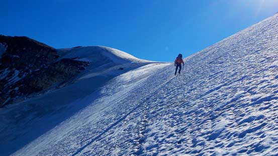
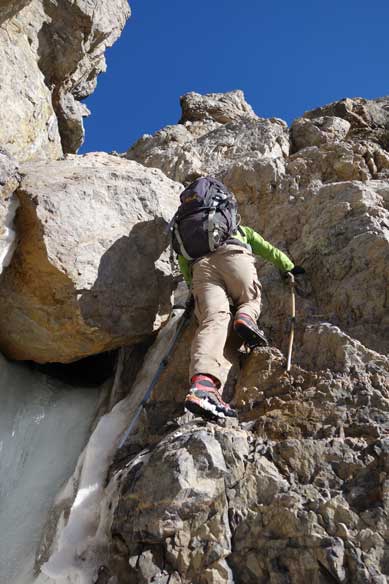
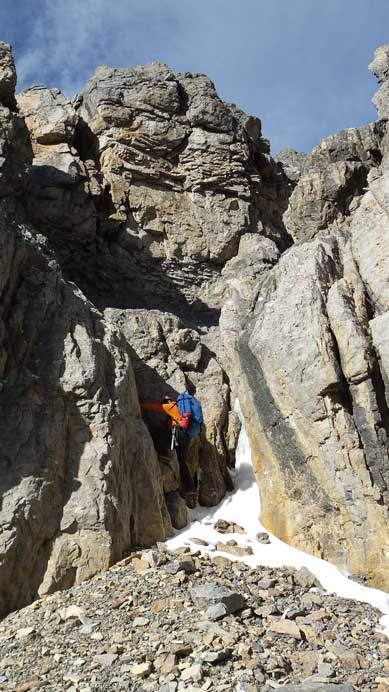
And then, we were surprised to see a steep and quite icy slope
The same slope. Raff had some crampons issue here and he had to stop and fix them.
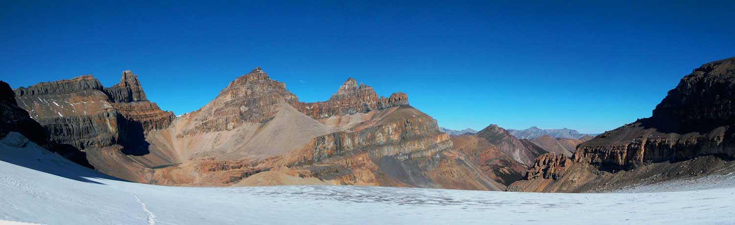
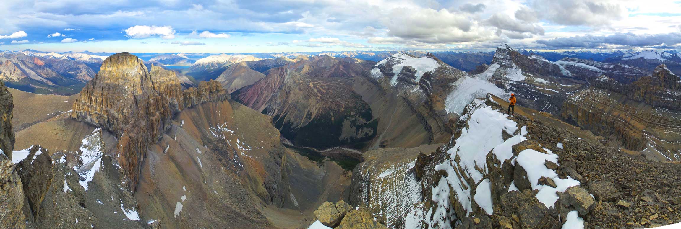
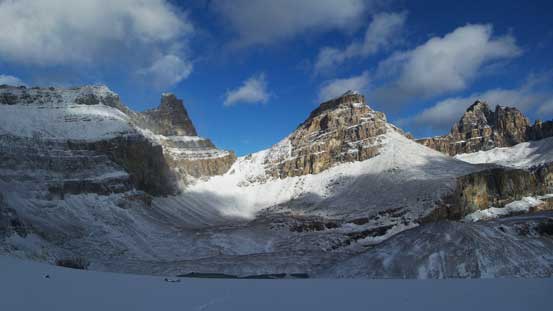
A panorama view of the three Whitegoats (Troll, Dasent, Gruff from L to R). I’m not a big fan of these separate unofficial “bivouac” names though, so I’d prefer Whitegoat II over “Dasent”.

Raff on the glacier

Onto some hard glacial ice. Scenic walk but hard on our knees

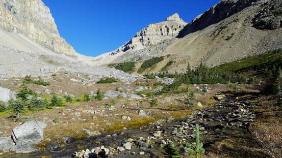
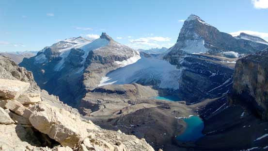
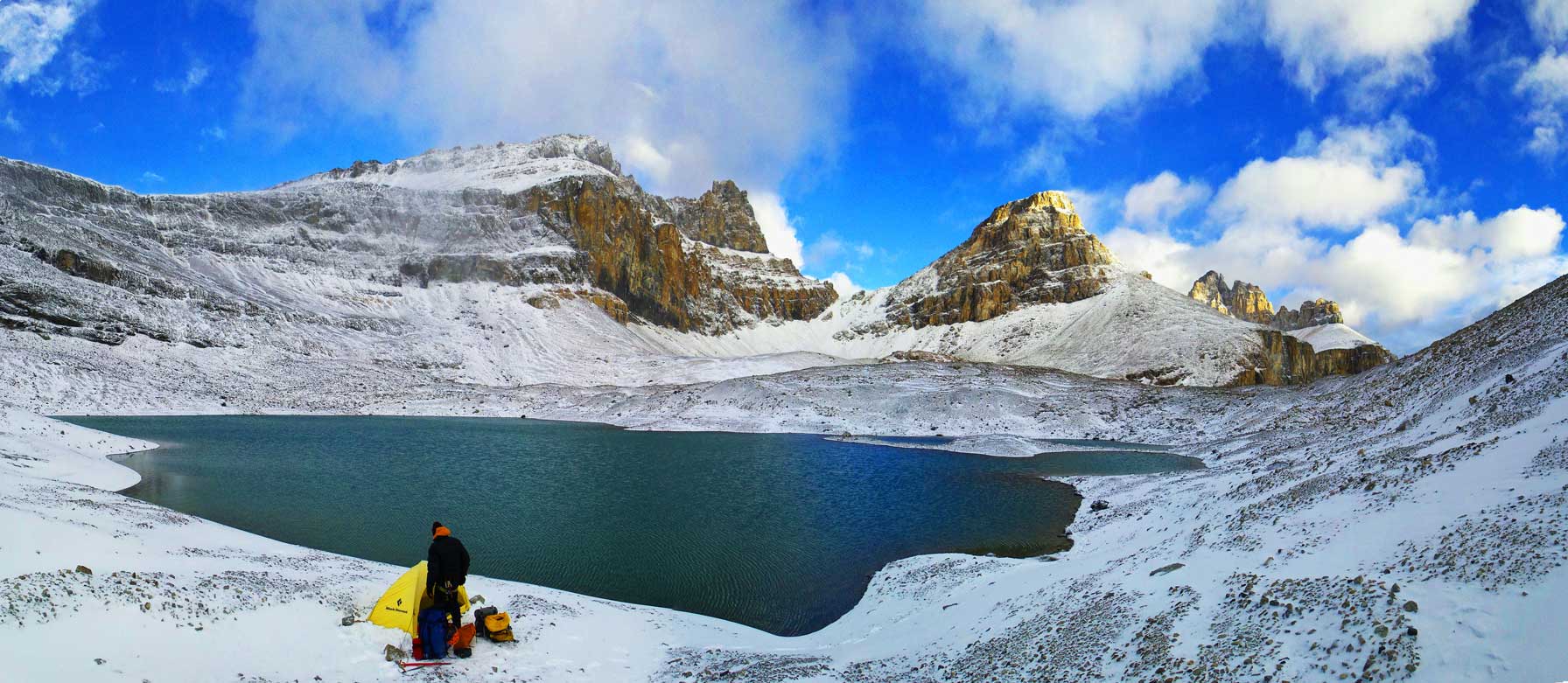
We’d set up bivy at this lovely lake.
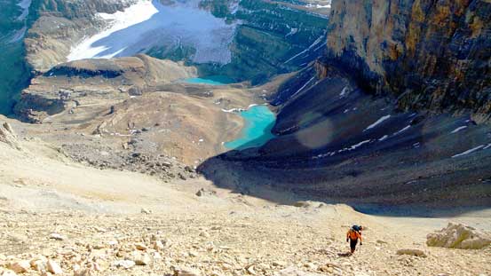
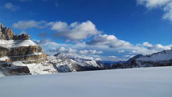
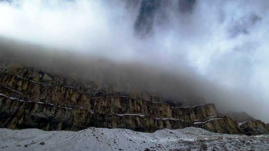
After the glacier walk we were pretty much at the lower of the two lakes. We were lazy to keep carrying heavy loads so decided to set up camp by the first lake. In retrospect there was more flat ground near the second lake, but the first one also worked for us. There was no time to waste so after ditching camping gears we continued towards our objective. After overcoming some rolling terrain between the two lakes we were staring at “a beautiful pile of scree” immediately ahead. Yes, we’d slog up that pile of scree all the way to its end – Whitegoat I/II col. That was a tedious process, but at least the view from Whitegoat I/II col was great. On the other hand we also observed some high clouds rolling in obscuring the high peaks by Columbia Icefield, as expected. The low pressure system was supposed to move in by Friday evening and it seemed a little bit faster than expected.
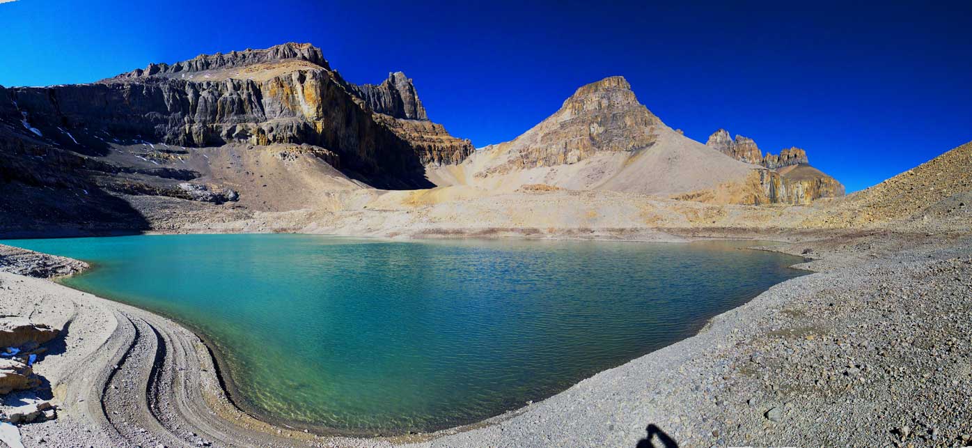
Panorama of the lower Whitegoat Lake
Panorama from where we ditched gears. Can’t ask for a better front-door view than this!
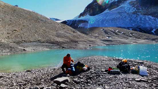
We found an excellent “peninsula” in this lake. Would be great if there’s no wind though.
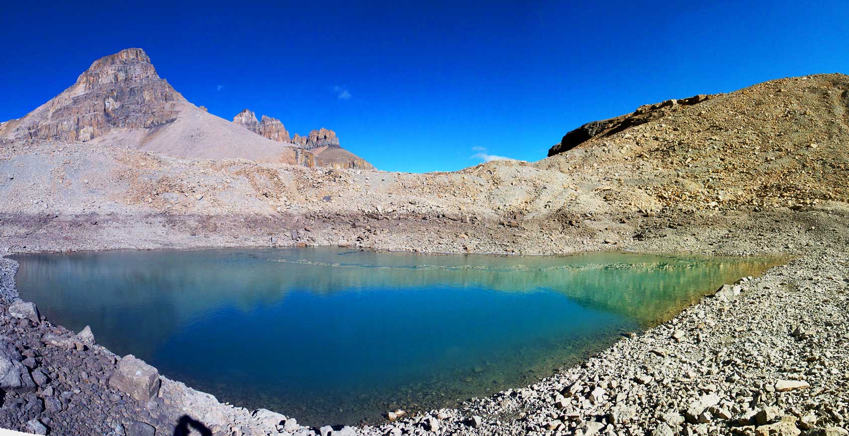
Another panorama before leaving for our objective
The “beautiful” scree slog towards Whitegoat I/II col…

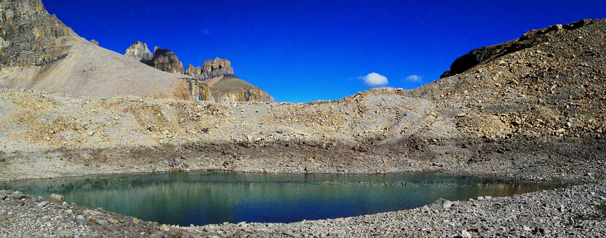
Looking back towards the upper lake. Mt. Cline in the background. Too bad we didn’t have time to investigate this lake.
Resolute Mountain has two separate peaks – Lion Peak and Lioness Peak
If you look closely you can see a helicopter hovering just to the left of Cline.
Raff slogging up the endless treadmill scree

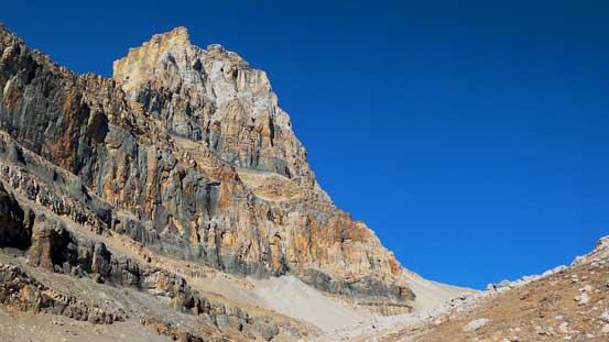
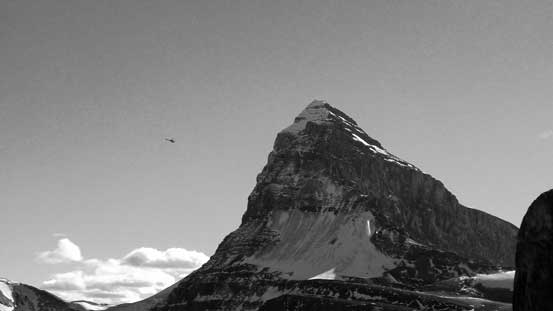
Whitegoat I looks incredibly impressive from the col
From Whitegoat I/II col, looking towards Whitegoat Wilderness. Minster Mountain on left.
Resolute, Cline and the glacier between them.

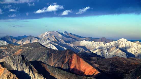
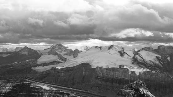
This was our best view of Mt. Columbia from this trip. As you can see weather was moving in…
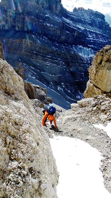
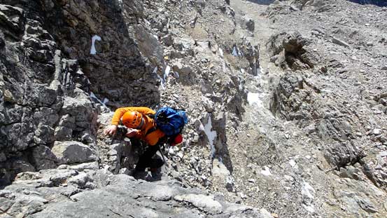
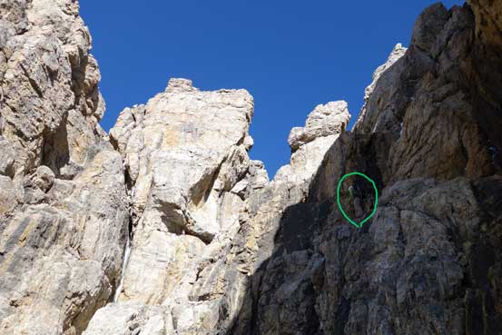
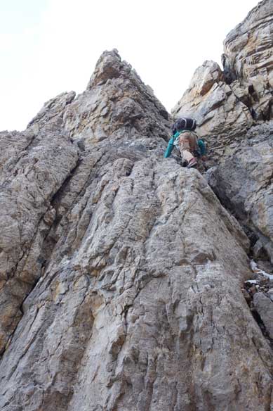
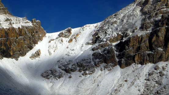
Looking up we could see a complicated system of cliff bands guarding the summit block. It appeared easier if going way to the climber’s left side but there’s no guarantee neither. Craig did not give too much information so we figured it would become obvious once we got closer, so we aimed more-or-less straight up, but slightly to the left side. This brought us to a big gully. Looking upwards it didn’t seem very bad so we made the first decision to ascending this gully. Terrain gradually became harder and after overcoming a few 5th class moves we realized there’s no way to break through the cliff band at this point without sustained exposed climbing. Bad decision.. But to be honest there’s no way we could tell from the col, especially with no detailed route description. We backtracked (awkward down-climbing) and crossed over to the next gully on climber’s left side, only to find bad news again. Well, we had to cross over to the 3rd gully then and this time it looked slightly easier than the previous two. After committing to a few bouldary type of moves I ascended a long and difficult chimney. Topping out I was delighted to see easier terrain ahead. Well I mean, “relatively easier” as we still had to overcome a few 5th class steps. Raff led the way through the final challenges and sure enough, we topped out on the scree slope.

Raff traversing around a corner.

Looking ahead. There’s no easy way up. We had to find our own way…
Starting up an obvious gully while hoping for the best.
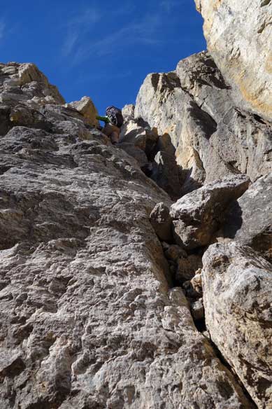
Terrain started to get semi-technical

Me challenging up the gully. Photo by Raff
Me ascending a very difficult step. Photo by Raff
Here’s where we figured this gully wouldn’t work. Had to turn around and find another route. Photo by Raff
Now here we go.. Me climbing up a steep chimney, again, hoping for the best.. Photo by Raff
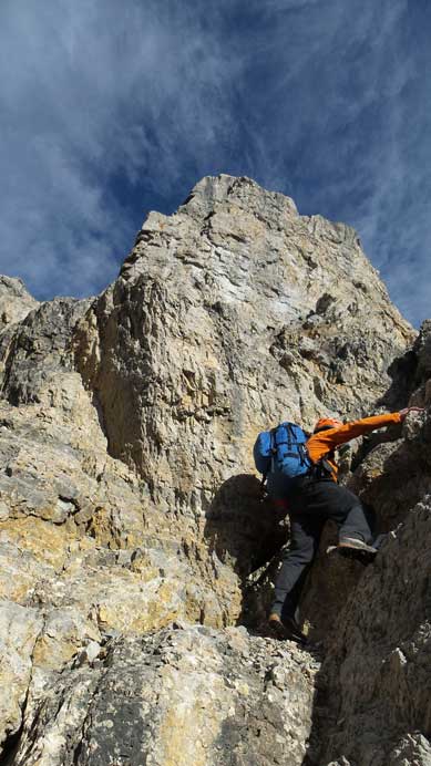
Raff took over the lead after this chimney. This is the typical terrain.
Hard stuffs hadn’t over yet.
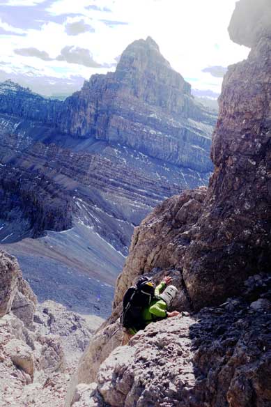
Me stemming up a challenging step. Photo by Raff
Oh yeah, scree slope. Oh yes, another pile of treadmill scree….
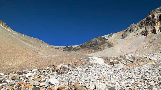
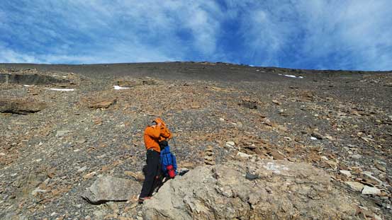
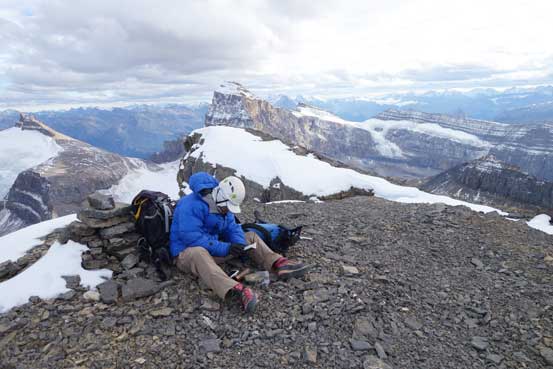
There would be no more technical challenge from here to the summit, but oh man this scree was loose… It’s the classic one-step-forward-two-steps-back type of scree and with a long day already behind we were both going slow. But that’s okay as we still had some time. Eventually we slogged to the summit, with rewarding views especially looking towards Cline and Resolute. We stayed on the summit for nearly an hour soaking in the views before committing to the descent. The sun was setting and wind was cold, so it’s the time to get down.
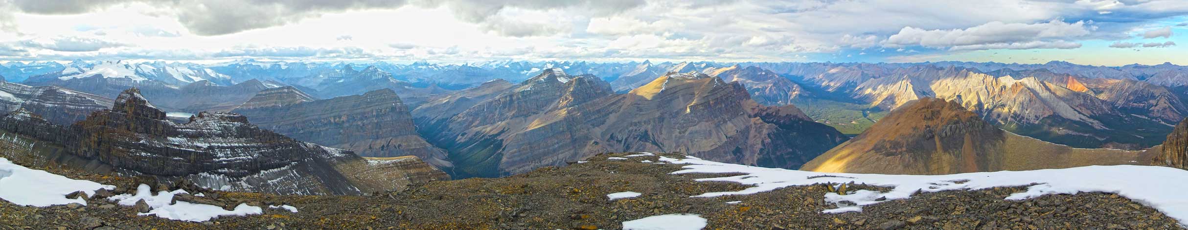
Partial summit panorama from Whitegoat 2. Click to view large size.
Partial summit panorama from Whitegoat 2. Click to view large size.
I think this beautiful front range peak is Hangman Peak
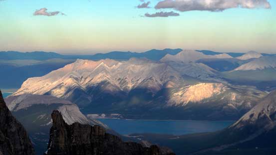
Mt. Michener and Abraham Lake. Both Raff and I did it in winter by cramponing across the frozen lake.

I really like the colours in this area.
Allstones Peak in David Thompson Country. I haven’t heard anybody succeeding on this peak and I still don’t know the route.

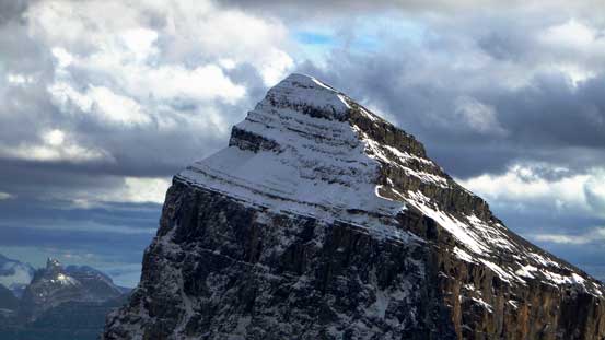
The impressive Whitegoat III.
Resolute Mountain is glaciated on its north side. Form this angle it’s definitely a sexy peak.
This is Mt. Stewart – another high peak in the front range
A zoomed-in shot of Mt. Cline

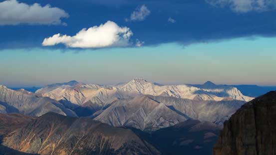
Looking way into Siffleur Wilderness. Should be able to see Recondite in this picture.
Elliot Peak on sunshine. Even this one looks small.
Raff taking pictures with Mt. Cline behind
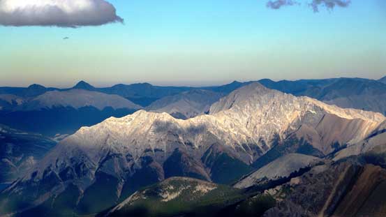
The massive Mt. Wilson. I have great memories from two years ago ascending it on snowshoes
Way in the distance we could see Mt. Barnard and Mt. Freshfield
As Raff predicted, Mt. Bryce was soaked in the clouds. For sure….

Mt. Saskatchewan
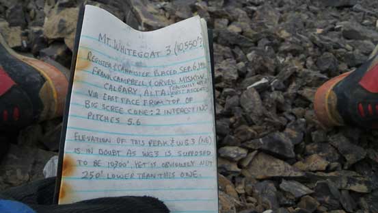
The register was placed by Miskiw and only got singed 4 or 5 times.
Me signing the register. Photo by Raff
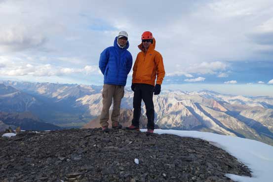
Raff and I on the summit.
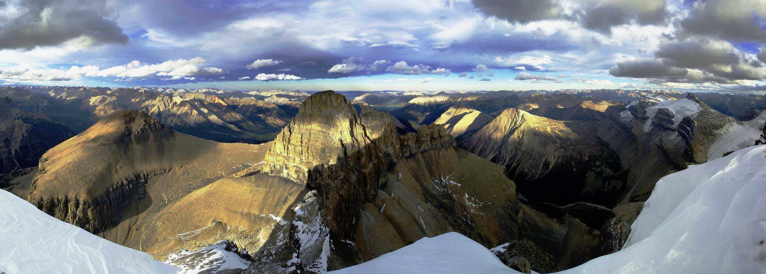
Another panorama from the summit. Click to view large size.
Following the few cairns that we built on our way up we had no problem reversing our route. We decided to down-climb as much as we could and soon enough we were back to that “long and difficult chimney”, where the toughest moves were at its bottom. We carefully down-climbed to just above the crux moves and then set up a short and simple rappel – as simple as putting the rope around a boulder. Getting into the rappel was a little bit interesting and it reminded both of us the second rappel on Bugaboo Spire – basically you just have to commit to it.. Except this time there was no exposure and we both got through quickly. My rope almost got stuck but thankfully we managed to free it. After this bit of excitement we still had a section of loose class 3 to descend before easier terrain – it didn’t impose much of a problem. Looking back it revealed some interesting fact – we couldn’t even tell where exactly we went… The wall looked ridiculously complicated and tough.
Scree skiing was fast

Great lighting on Mt. Cline
Starting the long down-climb. Photo by Raff

Raff down-climbing the next step

And, the long gully

Me down-climbing the long chimney
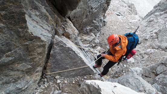
Raff rappelling the crux

Me rappelling. Photo by Raff
Raff demonstrating the technique of “cliff jump”.
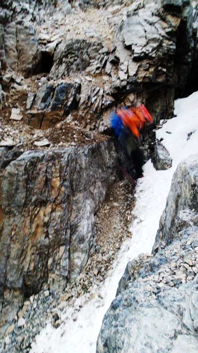
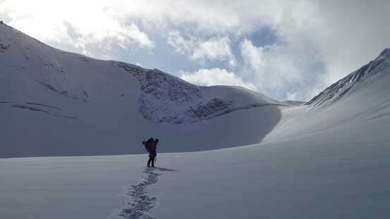
Now it was really getting late but thankfully scree skiing down from Whitegoat I/II col was fast and furious and we lost elevation in no time. We managed to win the race against darkness and got back to the first (lower) lake just before it’s too dark to see. Now we had to make a decision – where exactly we wanted to camp… Originally we planned to bivy at a “peninsula” but given the howling wind it might not be the best idea. With headlamps on we managed to find a relatively flat spot on the southern lakeshore and that’s it. It also started to rain so we didn’t want to search around for too long. Setting up Raff’s tent was interesting as well. The wind did not want to give us even one minute’s break and setting up tent in such condition by 1 person would be nearly impossible. We had two men so that was okay. To secure the tent we put our backpacks in, and then found a few big boulders.
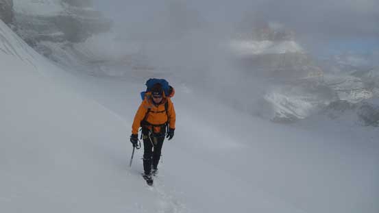
Overnight we witnessed the transition from summer to winter. We didn’t actually go out and check out but we could constantly hear the howling wind as well as rain/snow. To be honest I thought Raff’s tent would get ripped apart anytime. Good thing it didn’t. In the morning we woke up in a snow blizzard with no visibility. Great… We went back to sleep and about 1 hour later weather started to improve a bit (sort of). Considering we still have about 2 km glaciated terrain to ascend we had to take advantage of this short weather window. We didn’t even bother with breakfast, quickly broke camp and started the trudge back towards Cline/Resolute col. There was about 10-15 cm of new snow aiding our steep snow climb but made the final crevasse avoidance trickier. We had to carefully probe making sure to step on that solid snow bridge.
Panorama of the lake on Saturday morning. Well, winter is coming!

Heading into the white-out. We were hoping to have at least some visibility on that glacier.
And yes, weather cleared up. Looking back towards our objective.
The scree slog to Whitegoat I/II col is now a snow slog…
This should be Purple Mountain
Raff ascending back towards Cline/Resolute col.
Whitegoat Peaks
Gorgeous view from the glacier.
Raff and the col ahead
Snow climbing!
Almost at the col. As you can see weather was closing in again…
Looking towards the other side from Cline/Resolute col. Looks completely different than 1 day ago.
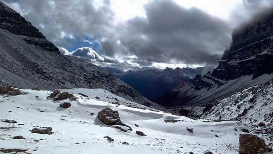
Now we were facing the last stage of our trip – a long hike from Cline/Resolute col back to the parking lot. At this point we decided to just take our time enjoying this trip as well as this beautiful area. There’s little to document about this part and again, with good chatting it didn’t seem to be as long as I remember from my Resolute Mountain trip.
Taking a break on this long depproach
Looking back towards Lion Peak
Interesting clouds formation on Mt. Cline
Hiking down

Still quite a ways to go.
Into the burnt forest
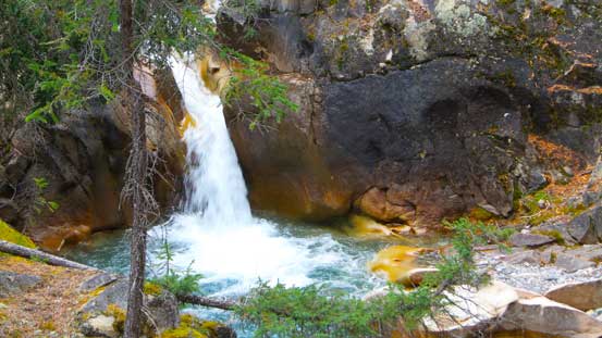
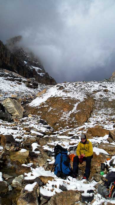
An interesting mini-waterfall.
Overall, this was a very satisfying ascent up a beautiful and remote mountain with good friend. I still can’t believe peaks like this were still in shape by almost mid-October, but like I said earlier, if summer decides to last long then I’ll have to talk full advantage of it. This trip once again proved the advantage of doing last-minute decisions. And we once again, precisely timed the condition and picked a suitable objective. Speaking Whitegoat II, this is not a mountain to be treated lightly. My suggestion is to give yourself a few extra hours so you won’t be rushed. I’m still confused as where exactly we went up but our route does involve a series of class 5 steps. I do believe there exist an easier route up but I’m not sure. You just have to take your time searching around since it’ll be nearly impossible to pick the easiest line on your first try.

I must say I absolutely love reading your reports! I can’t climb what you climb, but my list of possible backpacking trips keeps expanding as a result of your reports. (Also, as a professor I would totally agree with any student skipping class to do what you do!)
Thanks Matt. One reason why I love those remote high peaks is the travel through incredibly scenic terrain, as well as the great bivy sites. Sometimes the approach and the bivy are more memorable than the ascent itself!
Steve, you’re becoming like a legend in the Canadian Rockies.
What’s the secret for your physical stamina? I do one trip this long and get sore for the next 3 days.
I know I’m older and bigger than you, and that’s an already enough reason but even my friends are impressed by your speed and success in your trips.
Although, I’ve never scrambled with you, do you ever take extra risks by not being roped during a steep traverse or such? Do you use snow pickets or other protections?
During ascents, do you pay attention to rock fall so the party below is not being endangered?
Cheers,
Adrian
P.S. When we’ll have the pleasure of watching some panorama videos from these summits?
Hey Adrian,
I found my stamina varies but generally the key is not to totally exhaust myself out each day. This depends on individuals. For trips like this I usually only need 1 day to recover but for insane trips (say, Northover/McHarg/Worthington in 1 day) then I probably will need a few days to rest. In this year I tend to break those “16-hour day” into multi-day which helped a lot. And yes, I found multi-day trips physically easier than the long and big day-trips back-to-back.
Roping or not – it depends on my partner, the condition/time stress and the terrain. I have to say neither me nor my usual climbing partners are expert on rope work so if we do ‘textbook styled’ we could run out of time, then there’re other form or risks (condition, weather, rock fall, etc). So I’d say depends on circumstances it’s a trade-off between different kinds of risks.. But in general I pick objectives that’s within my comfort level. If it gets too hard then rope will be out. In the long run when my technical skill gets stronger than there’ll be more roped climbing.
Rock fall – yes I do pay attention. It comes with experience. It’s not difficult to manage rock-fall within a party (even in a group of 4 or 5), but tricky with multiple parties on the same route though. Chephren was an example – there was a party coming up when we were descending the chossy terrain. The only way we could minimize rock fall was to stop and wait. By picking some of the “classics” on weekdays I also try to minimize the multiple-party situation.
PS: Are you the ‘Adrian Calgary’ on Youtube? Look forward to a trip with you someday!
That is a good strategy for longer trips. I’ve noticed people, on the long run tend to have issues such as knee pain or other injuries, due to wear and tear or such.
Joining you on a trip would be awesome, I’m looking forward to this.
That’s right, that is my youtube channel, dated a few years back, and I’ve learned all by trial and error. Now I only take short clips mostly panoramas from ridges and peaks, plus I like to emphasize the route access, such as the location of the trailhead, etc.
Thanks for sharing, your work is much appreciated, the trip report you post are top notch.
Cheers,
Adrian