Mount Michener (North Peak, Phoebe’s Teat)
February 14, 2013
2545m
David Thompson Country, AB
I’ve been eyeing on this peak pretty much since March last year. It’s a major objective in David Thompson, across Abraham Lake, and looks attractive. There’s only one online trip report from Eric and Raff’s ascent a few years back in February. Michener was proposed as my possible objective for almost every weekend since the first week of January, but never realized due to several reasons. There are not many peaks in David Thompson Country, so obviously, we don’t have many alternate plans. And, I have quite a few friends wishing to try this peak, and it was very hard to schedule a day when everybody was available. It eventually came to this Thursday, the Valentine’s Day. However, Kevin and Ben had to bail and it was left to only Mike and me. The scrambling season for Michener is very short, from mid January to March. Apart from the short scrambling season (due to the lake crossing), you have to be really confident on the wind level in this area. Nordegg area was forecasted to have wind 5 kph, but we were nearly being blown off on the rib… I guess if the forecasted wind is more than 20 kph, you need to find something else to do…
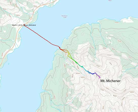
Mt. Michener winter scramble route. GPX DL
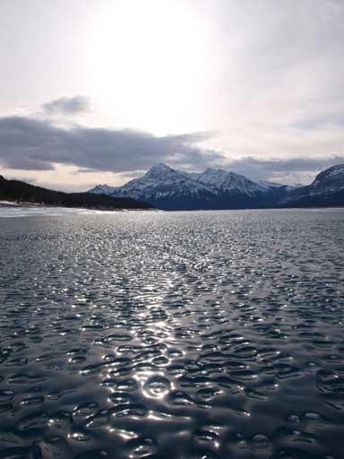
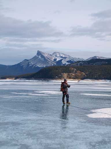
Based on Eric’s trip report, we figured that doing an early start was essential, so we started our day at 7:40. The lake is actually a reservoir, and the ice stability was variable. The ice was very thick though, but still, Mike and I roped up to cross it. Crampons were also mandatory. If you don’t have them, you will spend hours boot-skating on the lake. Wind was almost non-existence in the morning, and it felt like a simple (and scenic) ice walk.
Gorgeous morning view of Kista Peak and Abraham Lake

Morning view of Elliot Peak and Sentinel Mountain
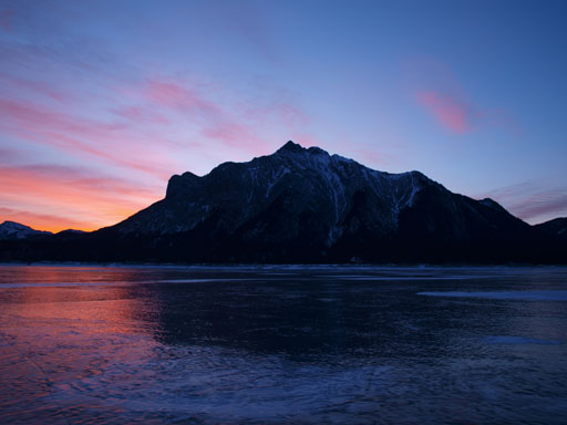
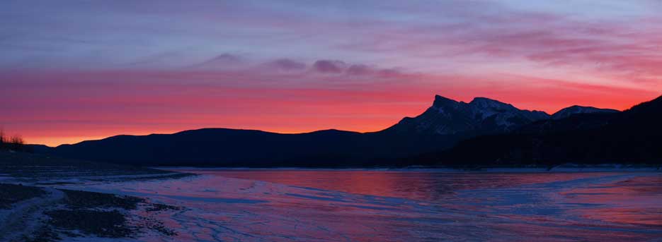
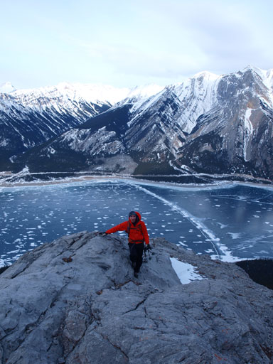
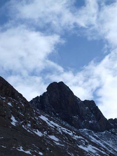
Mt. Michener across Abraham Lake

Alpenglow on Abraham Mountain

Me on the lake. Photo by Mike Mitchell
The next hour was tedious bushwhacking up forested rib. The worst part was actually the first 20 meters or so. In general the bush was very tolerable. Higher up we came across an old ascent track and followed it to treeline. It was very dry and post-holing was very minimal. I think even Heart Mountain holds more snow.. Once at treeline, the view looking back fully opened up. The Lake looked blue, instead of white. On the mean time, wind picked up. It was not too bad at this stage, but we found the wind to be constantly increasing throughout the day…
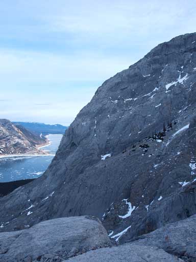
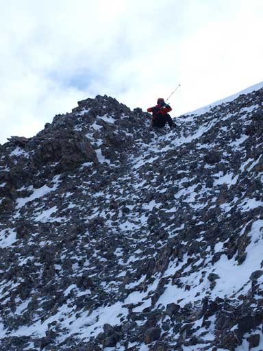
We were back at “summer scrambling” now… It felt so good to grip the slabs again rather than slogging on frozen scree or post-holing on snow. Higher up, the ascent rib joins another rib. At this point, you will re-enter trees briefly, and MAKE SURE you take a mental note by looking back at this feature. If you don’t do so, you will very likely go down the wrong rib on the way back. There’s no obvious scrambling route down that rib, and backtracking can be very frustrating. Following the ridge up, the terrain soon changes to scree slogging. We traversed on climber’s right skirting around a rocky section. This part was proved to be very miserable. We soon got tired of the side-hilling and shoot straight up towards the rock bands. Moderate scrambling was involved to overcome this band. Following the ridge up for another 20min or so, we were staring at the summit block.

Abraham Mountain across the Lake
Steep and impressive slabs on this mountain
Ascending the typical terrain on this mountain.

Here’s an optional moderate rock band.

The summit block

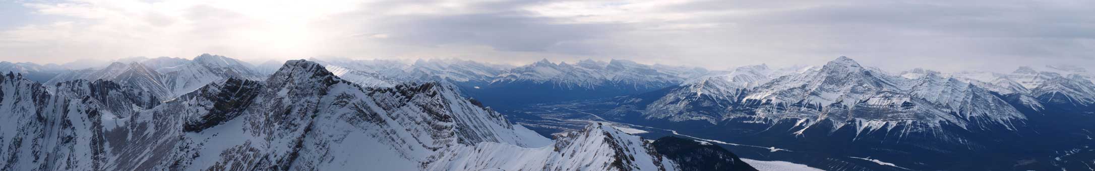
Panorama view of Abraham Lake
The route goes up the scree ramp on climber’s left side. It was mostly a hike, but near the end, the terrain steepens and the snow covered rocks were very slippery. This part was the crux for us. It wasn’t technically difficult but required some concentration. After this bit of stuffs, we had to ascent a short steep snow slope, and then we were on the summit ridge. The summit ridge was just a hike, and soon we made to the summit, less than 4 hours from car. High clouds were rolling in, and we lost the blue sky. But even so, we still got good views. So many David Thompson peaks were visible, but too bad we couldn’t figure out the distant peaks on the Parkway.

Mike ascending the slippery crux terrain below the summit block.

Merging onto snow

The only steep snow to ascent, near the summit ridge

Summit view looking East.
Summit view looking southwest. Siffleur/Loudon/Peskett at center in the distance. Elliot Peak on right.

Vision Quest Ridge (center left), Abraham Mountain (center), and Windy Point Ridge (right)
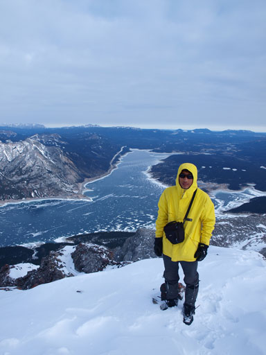
Me on the summit. Photo by Mike Mitchell
Wind was fierce and there was little hope that the weather would improve, so we hurried down without doing much summit stay. Descending the snow covered terrain was easier and faster, and in no time we made back to the crux. Some careful moves were required on this bit.
The slippery crux section.
Looking back towards the summit block

Back into the trees. Still pretty windy.
We were way ahead of schedule at this time, and we all wanted to slow down and enjoy the view. However, the wind had something else to say, and we were forced to speed up down to treeline. Once in the trees, the snow was helping us to speed up. It was just so easy to slide and plunge-step. There were a couple of snow covered slabs that we slipped on. Once we were back to the lake, wind picked up again. We did stop regularly for photos though.

Panorama view of Abraham Mountain from Abraham Lake
Elliot Peak from Abraham Lake

Mike on Abraham Lake, with our objective in the background
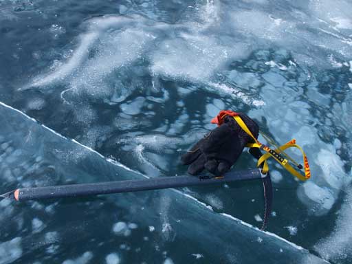
The ice, (and my ice axe)
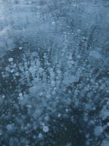
This lake is famous for its ice bubbles. A place that photographers must visit

More views from this lake
Mike with Kista Peak behind

Panorama of Abraham Lake and Mount Michener before heading back home
After a scenic ice walk re-crossing Abraham Lake we made back to the vehicle and that concluded another awesome day in the mountains. Our round Trip time was 7 hours and that was much faster than expected based on Eric and Raf’s trip, but we did have their detailed route information handy so didn’t make any major detour.

Hi i wanted to ask if is possible to camp overnight
Yes you can camp overnight in David Thompson Country with no problem.