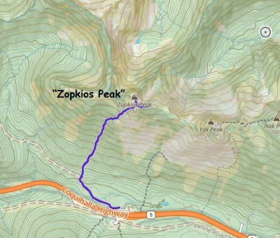
“Zopkios Peak”
February 2, 2024
1921m
Coquihalla Pass, BC
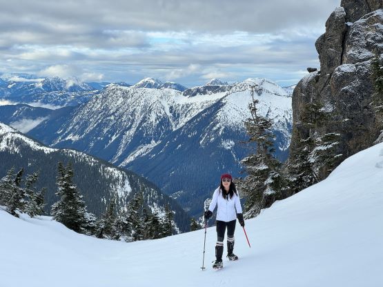
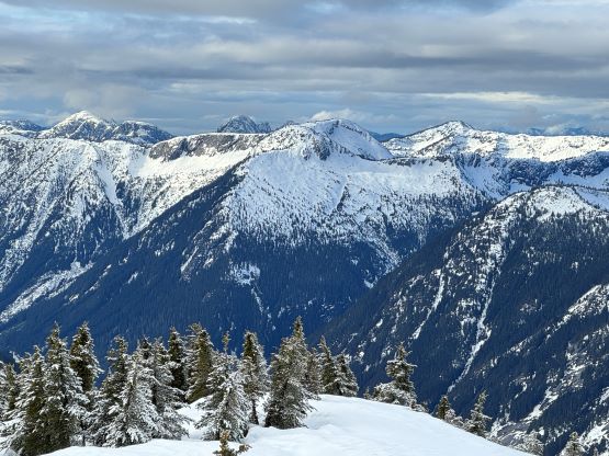
“Zopkios Peak” is the unofficial name of the highest of the bumps on Zopkios Ridge that connects Yak Peak towards Zupjok Peak. However, none of the bumps on this ridge boasts over 100 m prominence including this one. Even the status of being the highest on Zopkios Ridge is debatable as on some maps, the ridge includes Yak, Nak and Thar Peaks. To me all the facts said above made me not wanting to claim “Zopkios Peak” as an independent peak but this objective had started to become popular in the recent years. The summit does offer decent views, and the route is a steep one that requires a stable snowpack. Almost all ascents of “Zopkios Peak” were in winter when the bushes are covered by the snow and I planned to do the same. I had on-purposely reserved a weekday when the avalanche forecast dropped to “L/L/L”. I would not “waste” a full day on this objective so I would tag it as a before-work exercise.
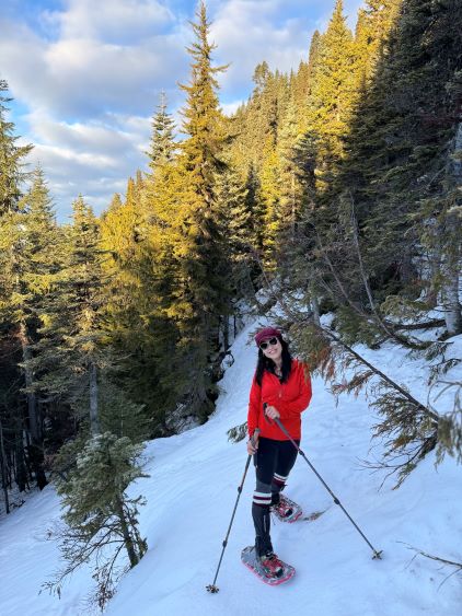
I convinced Kate to come along as she’s one who doesn’t care much about the prominence. I would need to be back home no later than 3 pm for work, and I anticipated about 3 hours of round trip, so we left White Rock at 5:30 am. In retrospect we should have left earlier as I underestimated this objective. We again used Kate’s brand new Subaru Forester and I drove us to the trail-head in just over 2 hours. There had been over a week of record-breaking warm temperatures with torrential amount of rain up to 2500 m, so I wondered how much snow would still be there. A cooling trend was happening but the car’s thermometer still read 2 degrees Celsius at the parking lot, so there wouldn’t be as much of a freeze as I was hoping for. I had brought the 30’ snowshoes as well as the 25’ and I decided at the last minute to use the 25’ ones. There was not that much of snow left, after all. In fact, Kate managed to make the entire descent (on mushy snow) without snowshoes, and that said something about the current snowpack depth.
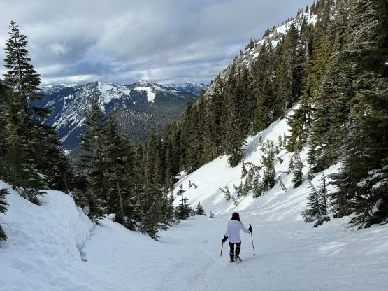
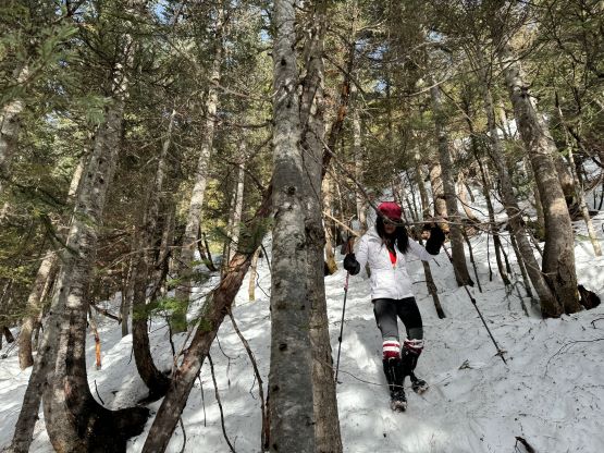
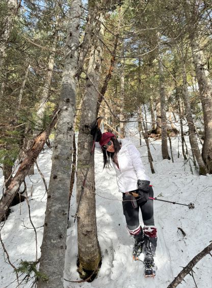
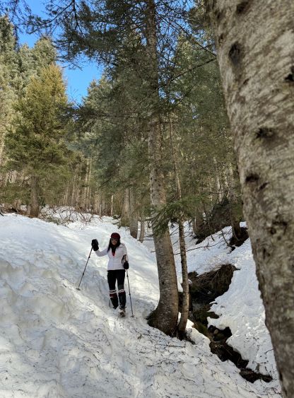
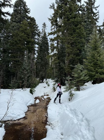
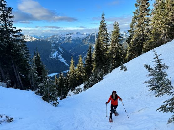
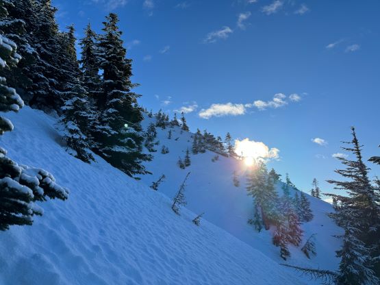
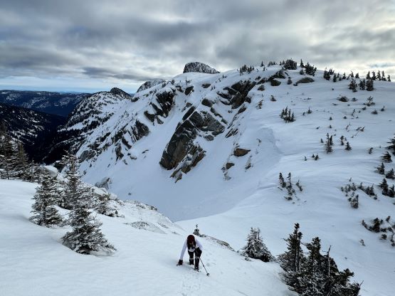
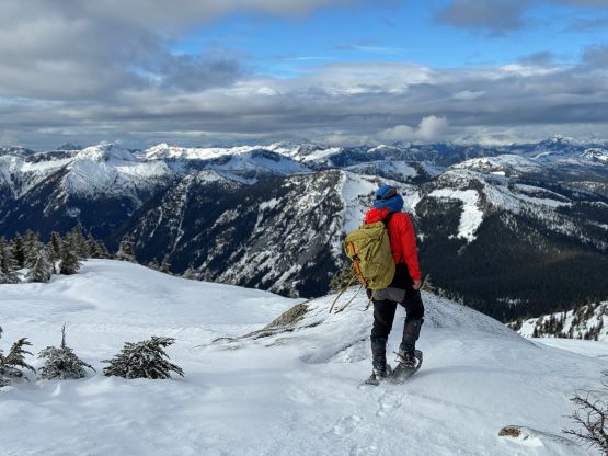
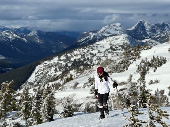
Kate forgot to bring her backpack so I would be the porter of the day, carrying two ice axes, two pairs of crampons and a bunch of extra stuffs. That’s fine as I needed to exercise anyway. Kate at least brought the important stuffs in the vehicle. We followed the well-maintained Iago Ridge’s trail for under a kilometer distance. Even parts of this trail were completely melted out and that had to be very rare for February. The snowpack was wet and not entirely supportive so we donned snowshoes. Once bailing into the forest it was then a straight-up ascent for 900 vertical meters. I mostly followed Alan Blair’s beta, staying climber’s right of a small drainage. Despite the lack of snow the forest was mostly open and the bushwhacking was minimal to non-existent. The snow was no more than 1-2 feet deep until two thirds of the way up, where we encountered some open slopes in the gradually-steepening terrain. I was not particularly looking for the “easiest” way up so we did some bushwhacking and encountered a few steep slopes.
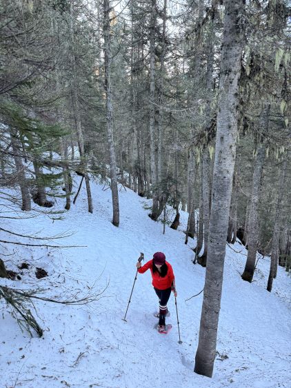


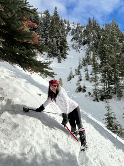
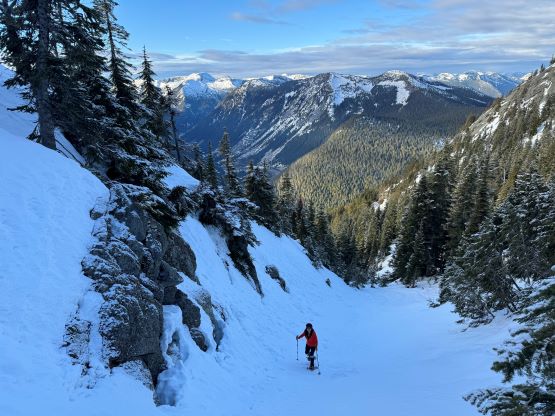
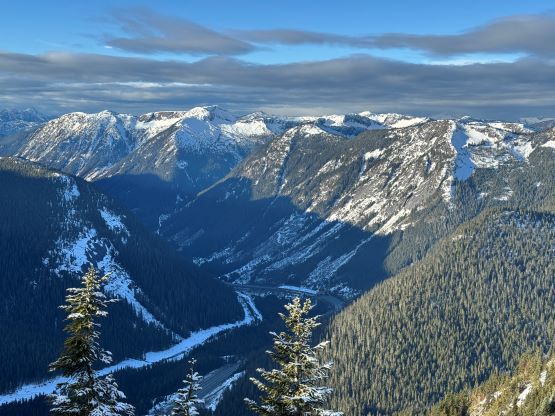
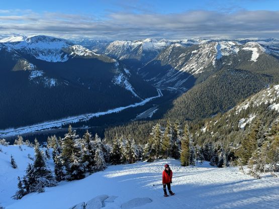
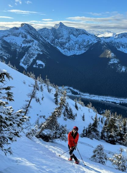
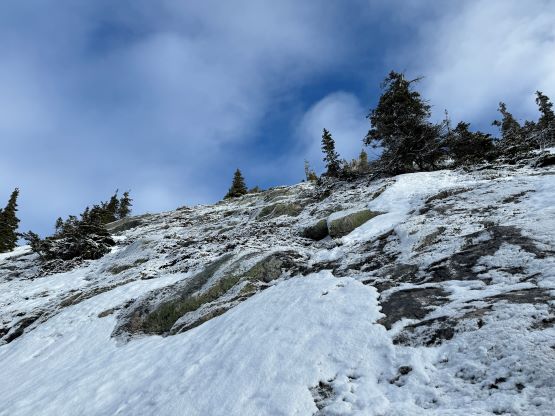
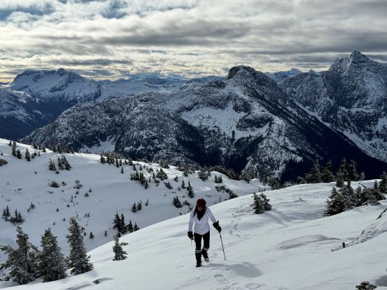
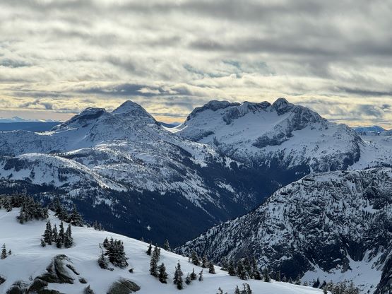
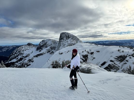
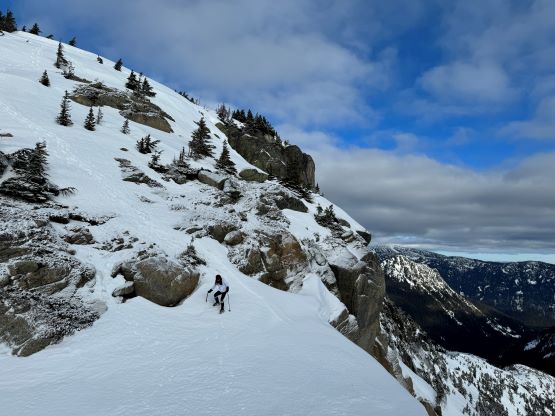
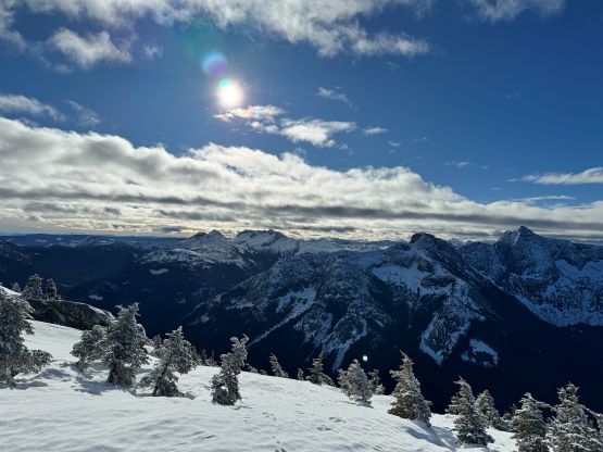
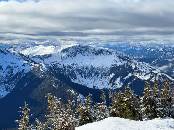
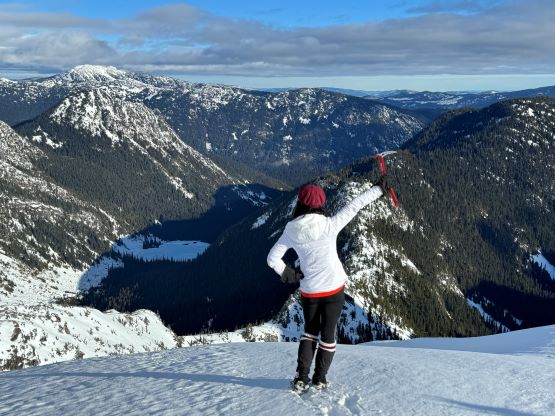
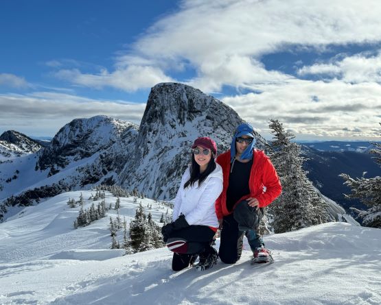
At around 1650 m elevation I started to notice a gully on the far climber’s right. I checked the satellite images on the GPS app and sure enough, this gully could lead us all the way to the saddle between the summit and the east peak with a similar elevation. Due to the stable avalanche conditions we decided to ascend this gully for fun, but we soon learnt that the snow wasn’t continuous in that gully. There’s one massive glide crack below a steep constraint that forced us to exit on climber’s left. The treeline terrain was quite steep (35-40 degrees) and the condition was a bit icy. Kate needed a bit of assistance to traverse out of a thin area as she wasn’t as experienced in this “steep snowshoeing” thing. I made her to do an awkward transition to crampons and she was then able to continue. I, on the other hand, felt comfortable in snowshoes so opted for more flotation. Kate had to deal with some annoying post-holing while following my tracks. We gradually veered climber’s right above this thin zone and merged back into the gully and had no further issue ascending to the aforementioned saddle. We checked out both summits just to be sure. To ascend the true summit required scrambling up a rocky step (class 2) that should be filled in with snow in a normal year. The east peak was definitely lower by visual inspection but actually offered some better views, so I was glad that we went there.


We were not doing particularly great on time, so we soon started the descent. The snow had softened considerably such that the icy condition was no longer existing. Kate appreciated that because she’d rather be post-holing than to gingerly descend an icy slope. I was able to make the entire descent in snowshoes, whereas Kate opted to wallow the entire way down in crampons. Using snowshoes was definitely the faster option but to descend 35-40 degrees slope comfortably on snowshoes did require extensive experience that not everyone had. I knew there’d be “better” routes somewhere near our line but decided to retrace the exact steps that we had just made, mostly for simplicity. I’d rather save my mental energy for the afternoon/evening work. We eventually finished the round trip in under 4.5 hours. I then made Kate to drive us back to White Rock as I was tired and needed to conserve energy for the work hours. I eventually worked all the way to 10 pm and concluded the exhausting day.