Volcán Atitlán
March 18, 2024
3537m
Lake Atitlán, Guatemala
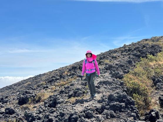
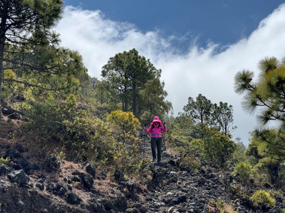
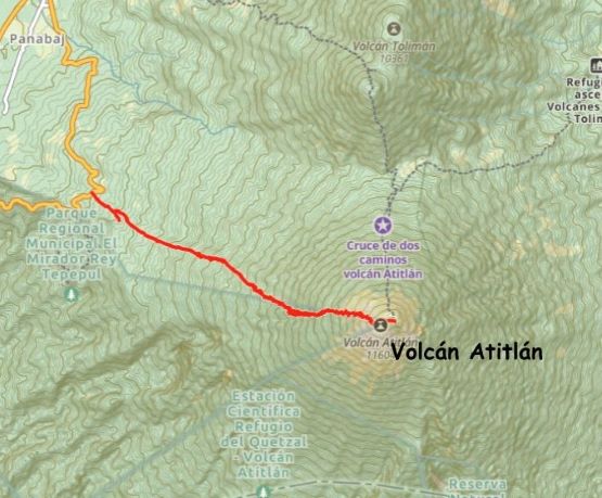
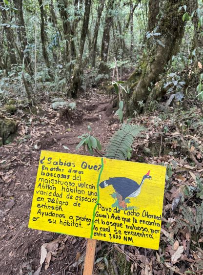
Volcán Atitlán is a harder one among the six “ultra prominent peaks” in Guatemala, that even the easiest route involves over 1700 m elevation gain. This shorter route ascends from the west side a few kilometers to the south of Santiago Atitlán. I got the “beta” from reading Craig Barlow’s trip report and I was anticipating a hefty day of work on some rough, not-so-often-used and jungle-like trails with tree roots and mud, but the reality was the exact opposite. This is actually considered the “standard route” among the locals that even on a Monday we encountered two other groups, with one from Vancouver, Canada. The trail quality was beyond my expectation with signs and well-engineered switchbacks, and the day turned out to be much easier than suggested by the stats.
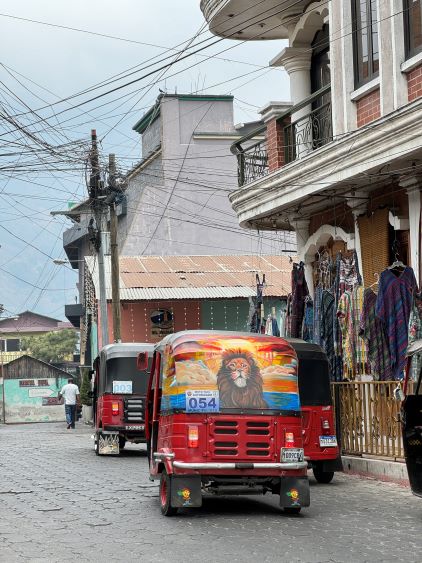
Kate and I, together with Oswald (our driver) spent much of the previous afternoon dealing with some gong shows in these lakeside villages. My original plan was to crush two nights in San Pedro la Laguna as the hotels there were cheaper, and Kate managed to book our stay in a private apartment. I’m usually not a fan of “homestay” as opposed to a proper hotel, but the advantage of staying in an apartment beside being cheaper was to have a private kitchen, and Kate would love to cook. However, this apartment was likely a scam as nobody in the neighbourhood (which felt rather unsafe) knew the name nor the location, and the owner had stopped texting us as soon as we made the payment. I did not like that neighbourhood at all, and subsequently did not like this village of San Pedro, so quickly formulated a plan to just show up at a hotel in Santiago Atitlán about 40 minutes of driving away. This would likely make our stay more expensive, but actually positioned ourselves closer to Volcán Atitlán. Fortunately the gambling was a major win, that we found a cheap-ish (600 GTQ for two nights) hotel in the center of Santiago Atitlán in situ. The name is Hotel Casa Josefa and I would recommend this one for future parties hiking Volcan Atitlán and/or Volcán San Pedro. There’s a shared kitchen – not very roomy but spacious enough for our use, and we did not have to get out of the hotel afterwards as Kate had already bought two days worth of food including fresh chicken breasts. The only downside was the owner/receptionist spoke absolutely no English, and could only accept cash payment. Fortunately I spoke some Spanish and our driver had enough cash to make do. The plan was then made to get us picked up at 5 am.

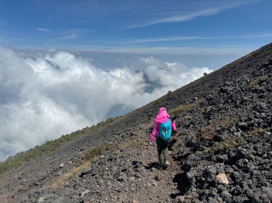
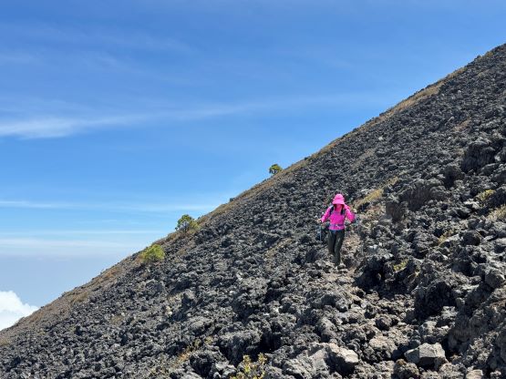
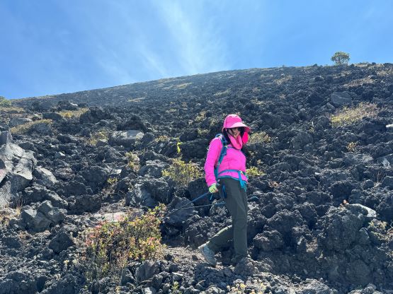
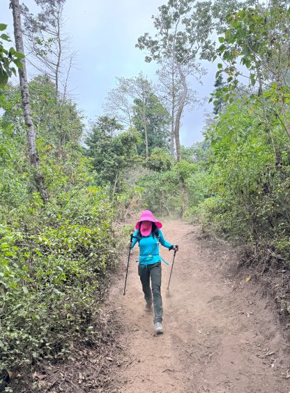
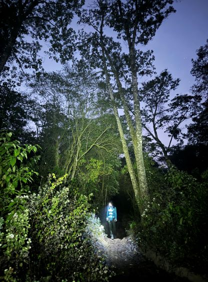
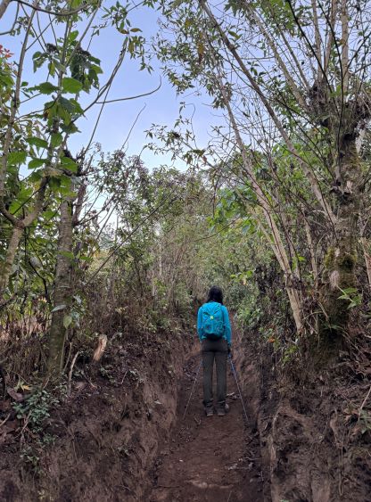
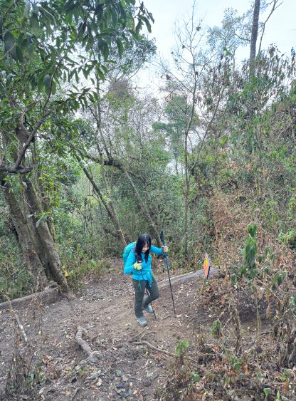
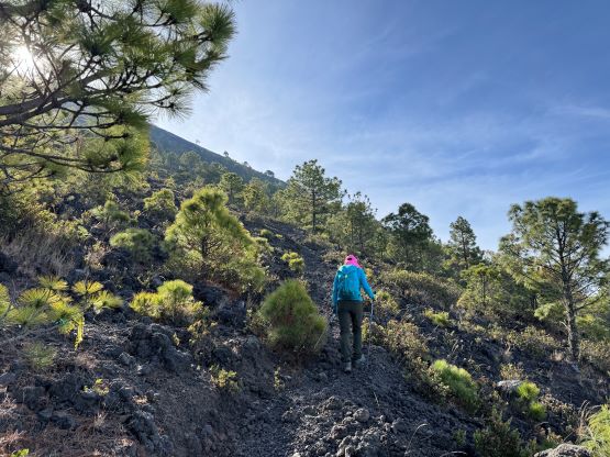
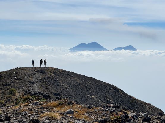
I thought the 5 am departure was essential given the 1700 m elevation gain, but in retrospect we could have started at the usual 6 am. The first half an hour had to be done with head-lamps on. The lower portion of this trail ascends through some farm lands and loggers had also been using this trail (or more precisely, the trail system) to collect woods. I was not anticipating so many junctions and as a result we made a pretty significant navigation error. Thankfully I did have the habit to check the GPS screen for every 5-10 minutes so it didn’t cost us too much. It was then a long and boring grunt at a fairly consistent mellow grade until we caught up to the group of Canadian hikers. It took us no more than a minute to realize that we both actually spoke English. This group of three hiked rather fast, but needed to take breaks frequently, such that Kate and I were still faster overall. Kate in fact, did not need a single stop for the entire 1700 m ascent to the summit. I did take one break at the treeline while waiting for Kate to catch up, but I also needed that break to don sun protections. The uppermost 400 m was on some volcanic choss, but the path had been nicely laid with endless switchbacks, such that we felt like walking on a proper trail for the entire time. After passing several fumaroles we ascended onto the crater rim and easily traversed to the true summit, as well as the eastern sub-summit that offered better views towards Acatenango/Fuego volcanoes. Kate’s ascent time was 4 hours 12 minutes so I told her that she was exactly 1 hour behind Craig Barlow’s time.


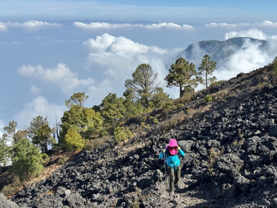


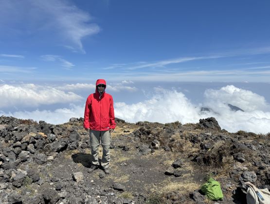
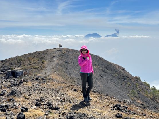

We lingered on the summit for more than an hour as it was really nice to be above the smog and the clouds. We had been breathing in Guatemala’s thick and dirty air for days and I greatly appreciated the clean air above 3000 m elevation, but it was eventually the time to move on. Not to my surprise Kate and I dashed all the way down in a single shot, jogging at times. We crossed path with another group of westerners on their way up, and finished the round trip in just over 7 hours. I then told Kate that her descent time must have been faster than Craig Barlow’s, and she seemed to be proud. There were a loads of loggers and trucks gathering at the trail-head but our driver was already there waiting, despite that we showed up half an hour earlier than the 1 pm pick-up time that had been previously agreed. This was the easiest driving day for Oswaldo as all he needed was to drive 15 minutes to drop us back at the hotel. Kate and I then went out for a short walk, but then I underestimated the dirtiness of the vehicles’ exhaust in this country. It only took me 2 minutes to conclude that without the Covid mask I could not have walked anywhere in any cities in this country, so we reluctantly went back. On a related note I’d been wearing the mask most of the time while sitting in the car.