Wish Slam – Courtney, Star, Buttermilk, Oval
May 26-27, 2024
2681m
Twisp / Lake Chelan, WA
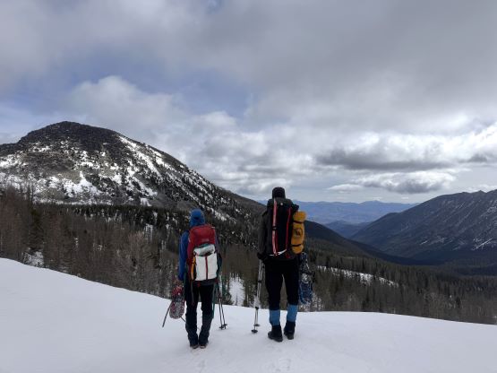
The Wish Slam contains three Bulgers in the Chelan area (Oval, Star and Courtney) and two additional peaks in the Washington’s Top 200 lists (Buttermilk, Gray). For those going after the prominence list Oval Peak is the only P600m objective in the area but those aiming at the Bulger List should spend at least 2 days to slam the three main peaks in the same trip. If the T200 list is ever going to be a goal then it’s advisable to do all five of them. For me, the goal was to simply bag as many peaks as possible. I’m never really a list-driven peak-bagger but I also hate to leave something behind and I especially do not like to repeat these arduous approaches, so the objective was to at least bag the three Bulgers over two days, and if time/energy permitted we would aim for all five of them. The approach trail that goes up the West Buttermilk Creek had been notorious with blowdowns but Matt J. had been there recently and reported evidence of recent maintenance, so I was keen to take advantage of the beta.
The decision to finally check out this area was made by the weather, as anywhere closer to home was supposed to be awful. The Chelan area was only “decent” by comparison, as there was still some chances of rain and snow but the amount of precipitation should be nil. Erica had been showing her incredible stamina over the past several months from snowshoeing with Caro Coco’s team, whereas Vlad and Holly also managed to take their time off to join. I was slightly concerned about the carrying capacity of my truck because the gears would have to be left open on the bed and it was supposed to rain heavily on the drive-in, but Holly managed to extend her vehicle’s lease at the last minute so the problem was solved. The nice thing about Washington state is the abundant of “beta” or even the existence of recent foot/snowshoe tracks even in some of the deepest locations, but the physical difficulties are not meant to be underestimated. I often find these Washington’s Bulgers are more physically demanding than the SWBC’s exploratory bushwhacks, due to the long approaches and the rough terrain. Throwing in the snowshoes and the winter camping gears to the already-hefty packs I knew we were in for another mission. We left home at 7 pm on Saturday and did not get back until 1:30 am on Tuesday morning. I was dead exhausted and ended up sleeping straight to 10 am.
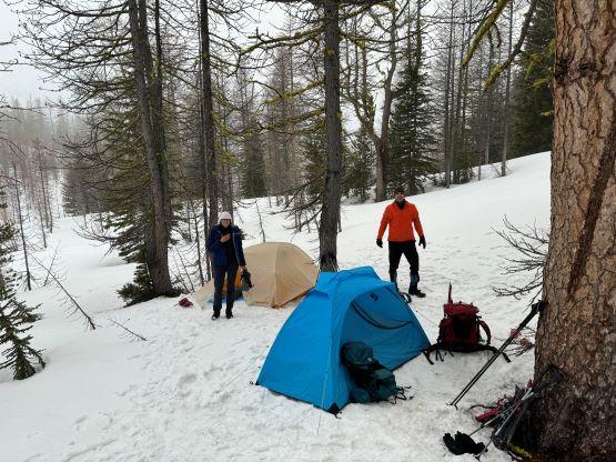
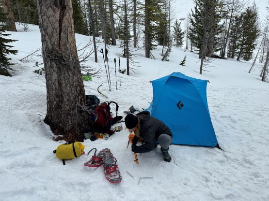
The four of us left roughly on time, and the drive took exactly 5 hours taking in consideration of the border crossing and the needs to stop for food and gas. Holly was able to offload some of my driving duties but I drove us from Bellingham all the way to the trail-head past Twisp. The second half of the North Cascades Highway was exhausting as there were quite a few deer on the road requiring full concentration. The logging roads to the trail-head was in some excellent shape, that any vehicle could make it with some careful driving. We pulled in at exactly midnight, and there was already another vehicle with someone sleeping inside. Three of us opted to pitch two tents beside the truck, whereas Holly decided to simply sleep inside the vehicle. I thought the approach would be quite chill and I honestly was not anticipating that much of work in this trip, so the alarms were set at 7 am. We ended up waking up more or less together with the other lone car-camper, who turned out to be roughly halfway through the Bulger list and even managed to recognize me out. Unfortunately our objectives and itineraries were different so we did not cross path again.
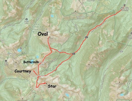
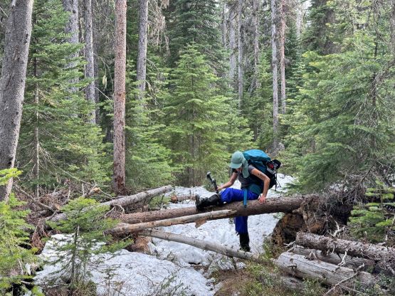
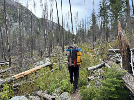
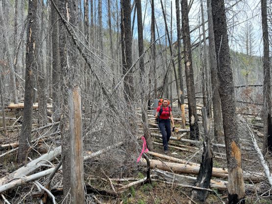
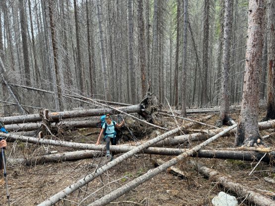
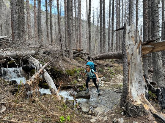
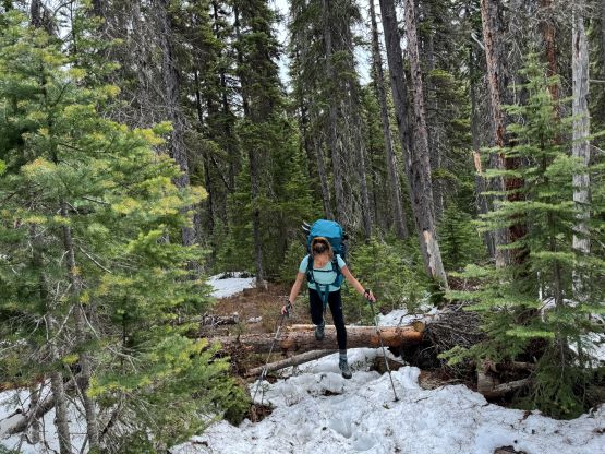
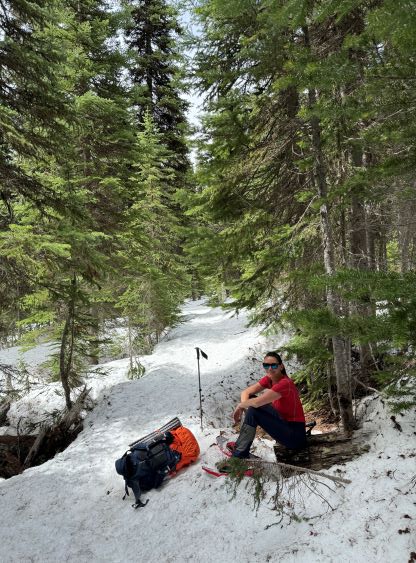
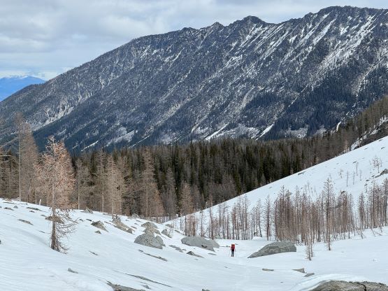
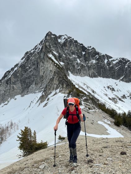
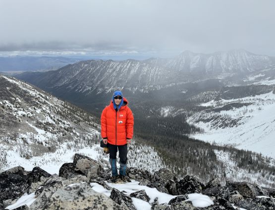
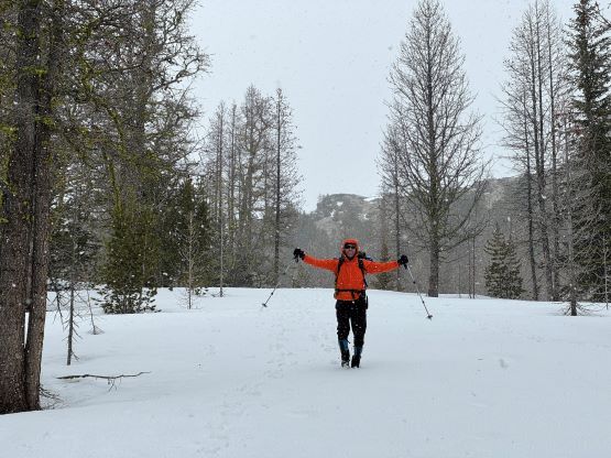
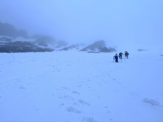
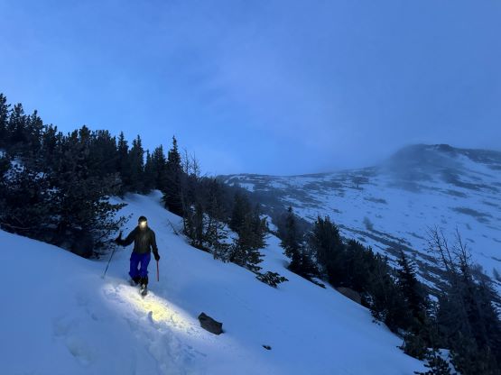
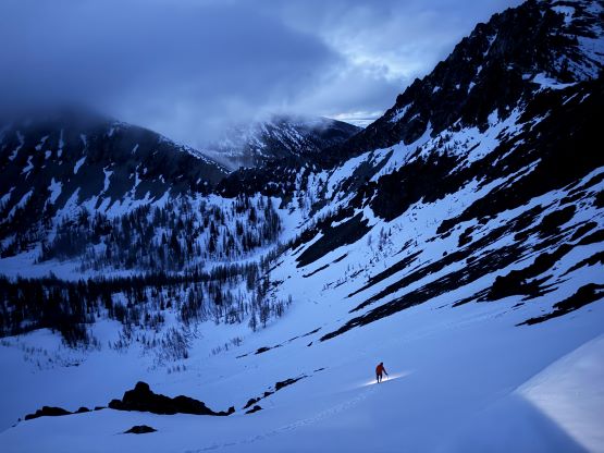
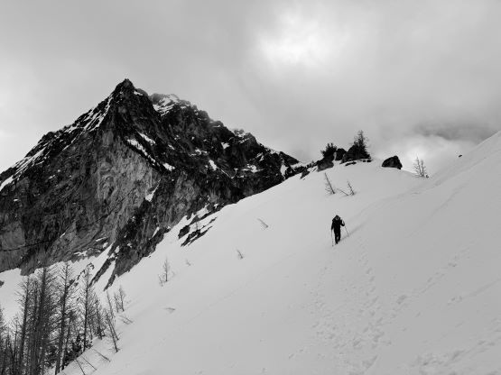
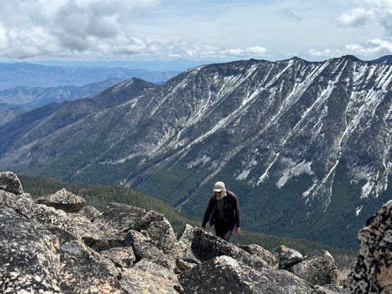
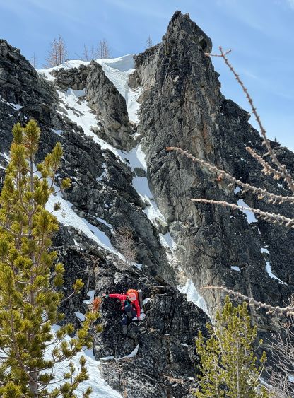
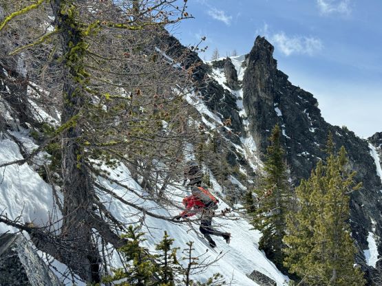
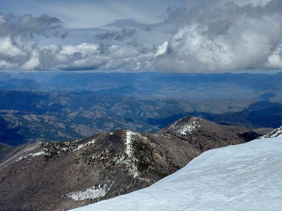
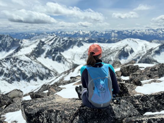
We eventually started the approach at 8:45 am under some overcast skies. The log crossing to the north side of West Buttermilk Creek was intact but the trail itself seemed rather unofficial. There was no indication that we were supposed to cross to the other side of the creek but we all did our homework and also came prepared with multiple sets of GPX tracks to follow. The next 5 km was rather uneventful but after crossing a gigantic mudslide path we encountered some annoying dead-falls. The situation was nowhere as bad as some groups made it sound like, but it was definitely annoying with the heavy packs. Shortly before reaching the Oval Peak’s bushwhacking short-cut I swapped trail-runners for mountaineering boots as we started to encounter larger patches of snow, and despite the previous tracks the snow was not very supportive. Everyone else opted to wear one pair of footwear (hiking boots) throughout the trip but I liked the comfort of the runners on the approach, and I also liked the stiffness of my mountaineering boots on the snow. I also decided to take the 105L backpack so the fitting of all those gears and boots was not a problem. We donned snowshoes at around 1800 m and we did need them for this trip. To ascend to Fish Creek Pass I decided to do our own route-finding by aiming at the large opening under Star Peak’s north face, rather than following the “trail” and the existing GPX tracks. I think this route worked out well because that open area (supposedly to be some boulder fields) was entirely covered in snow and the travel was very straightforward on snowshoes.

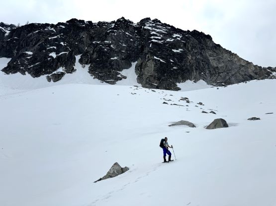


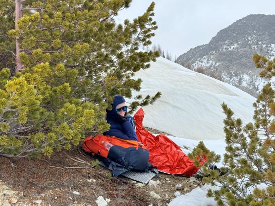
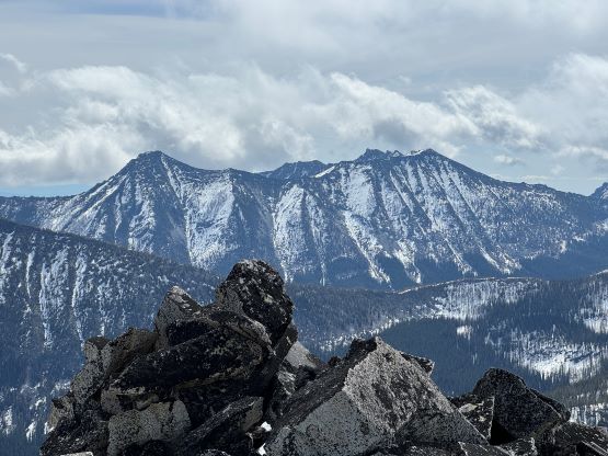
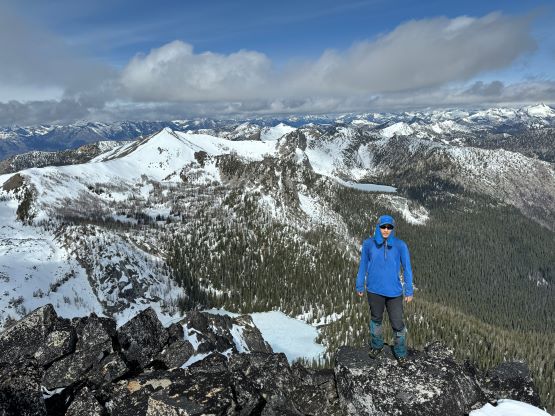
We were able to keep the snowshoes on all the way to Fish Creek Pass but ditched them in addition to the gigantic backpacks immediately upon arrival. The plan was to ascend Courtney Peak in the light-and-fast style and the few of us carried absolutely nothing. The SW Ridge of Courtney Peak was as straightforward as it appeared on the maps, and because of the snow coverage we were also able to choose either snow or rock. Holly decided to tuck in her emergency bivy while waiting for us because the weather was not very promising, and Erica, Vlad and I did ascend into a snow squall eventually. I led us staying mostly on the snow until the very top where we briefly did some scrambling on slick boulders, and the summit stay was short thank to the incoming weather. The idea of grabbing Gray Peak while we were already there also faded away and that was a good thing, because the weather was only becoming worse. After quickly making our way down the SW Ridge we shouldered the heavy packs and hand-carried the snowshoes down to the still-frozen Star Lake to set up our camp. It snowed and rained continuously for the next few hours so we spent most of the time resting in the sleeping bags. The weather forecast was not calling for “bluebird” conditions but none of the models showed that much of continuous precipitation.
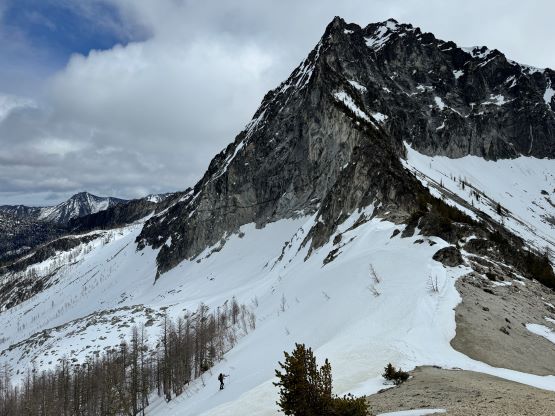
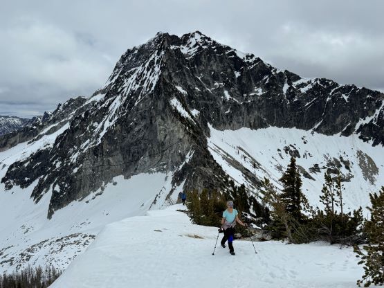

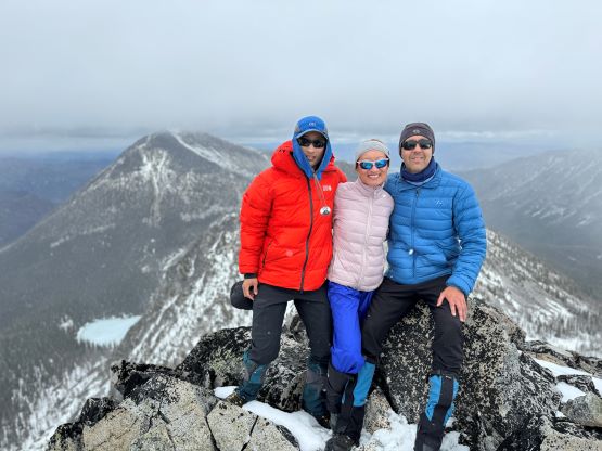
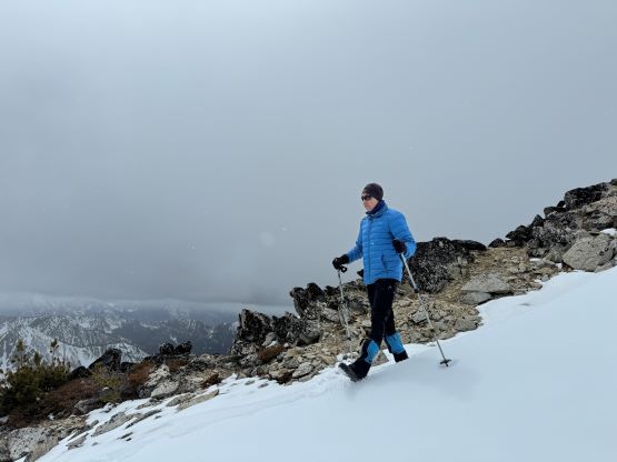
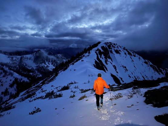
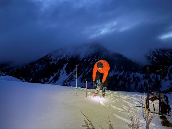
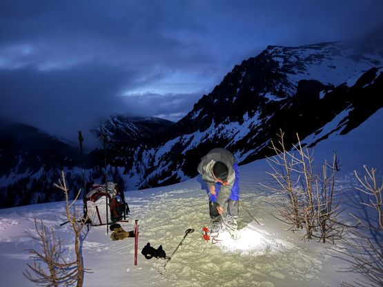
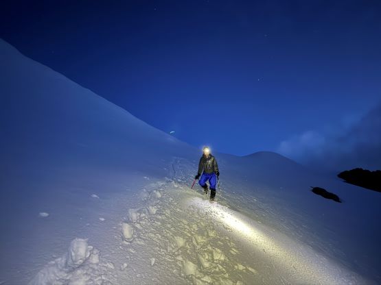
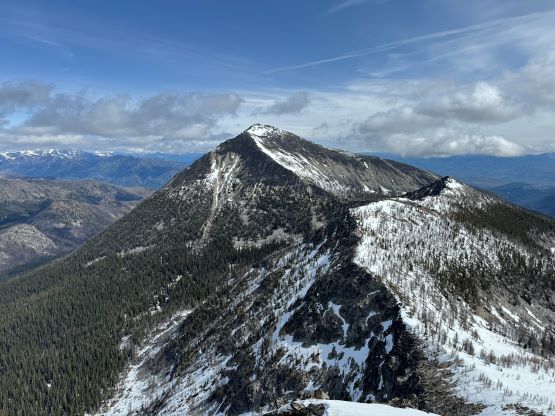
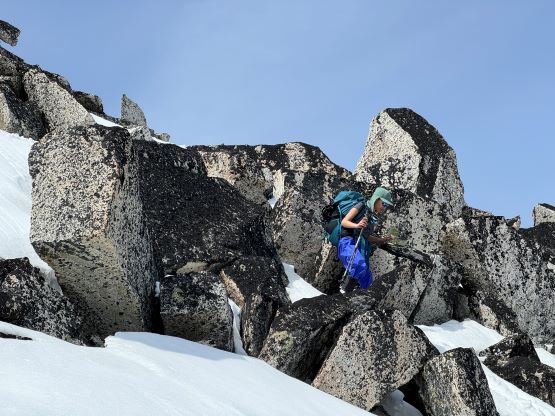
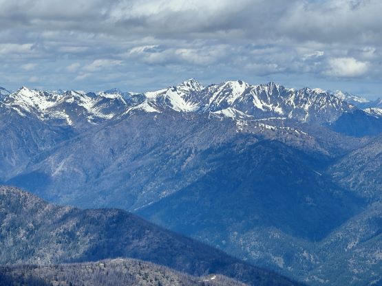
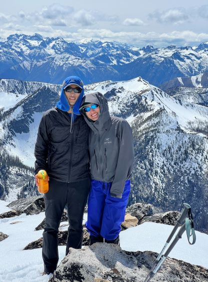
The plan was to ascend Star Peak in the evening of the first day and Erica and I would stick to the plan regardless of the weather. Vlad and Holly were on the fence but eventually decided to come along, albeit reluctantly. By 7 pm I put on the wet cloths to embrace the misery so I could prepare the hot meals for Erica and myself, and we were ready to leave about half an hour later. The sunset was at 8:45 pm so we would be coming down in the dark. The drizzling had mostly stopped but the peak itself was still soaked in the clouds. We donned snowshoes right from our camp and skirted around the frozen Star Lake on the north side. While skirting around the lake we realized a running stream at the outflow, so there was no need to continuously melt snow for the rest of the night. The snowshoes were soon ditched and the crampons were swapped on, as we slowly made our way up that steep snow face onto the SW Ridge of Star Peak. This was the only section of the entire trip that I would call “steep snow” but it was still very easy. Later in the evening I simply skied down in boots and didn’t even bother to use crampons. The ascent of the SW Ridge was very tedious with lots of micro-terrain, that eventually I decided to traverse to the face and stay as much on snow as possible. Holly turned around as it was apparent that we would be summitting with no view, and the final hundred meter was scrambling on some extremely slick boulders that made me to scramble on all-four despite the easiness of the terrain. Vlad said that it took us 1 hour 20 minutes to ascend Star Peak from our camp.
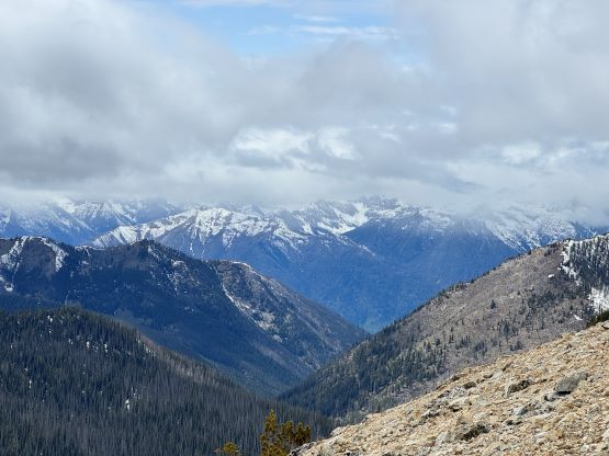
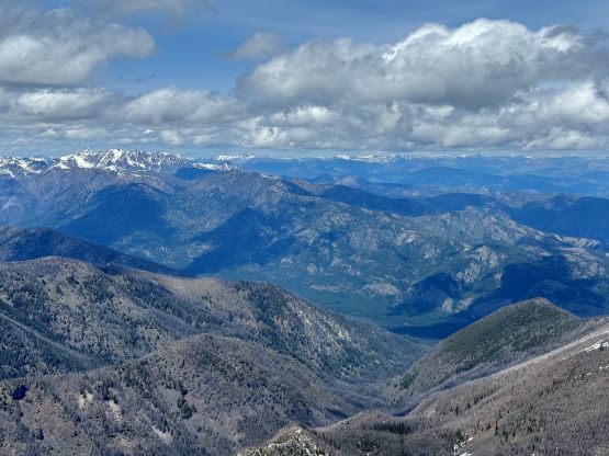
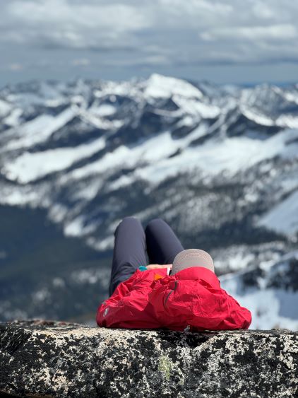
Vlad led us descending a slightly different route to avoid the worst of those slick boulders, and by the time we rejoined our tracks on the snow we had to turn on the head-lamps. Holly was only partially correct, as the weather finally improved (could be nicer if it happened an hour earlier) so the three of us spent some time on the ridge to soak in the views. Both Erica and I had the iPhone 15 Pros so the photo quality was actually excellent in the fading daylight. After taking in enough of the views we rushed back to the camp and settled for the night. I had to wear the winter park while using both the -7C and the +2C sleeping bags, and it definitely felt like a proper “winter camping” trip.


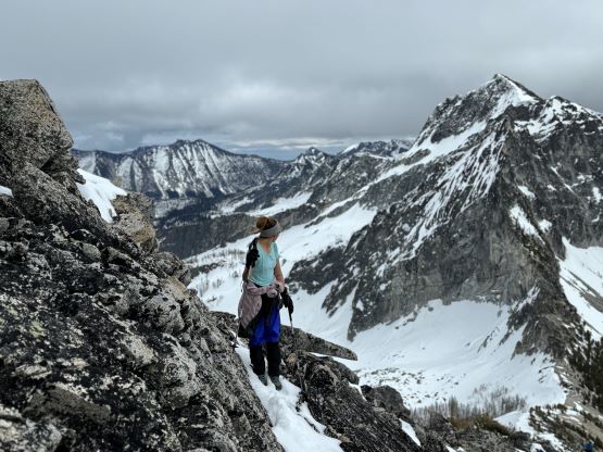
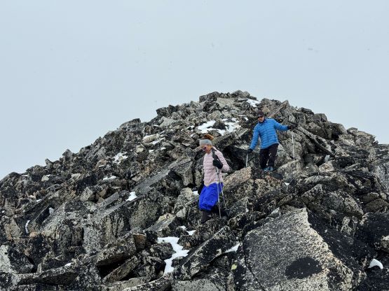
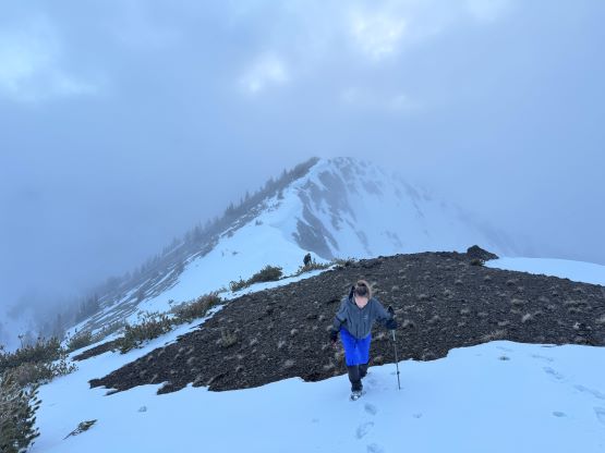
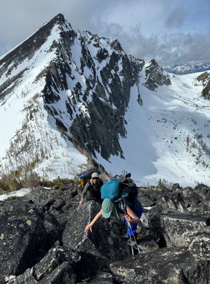
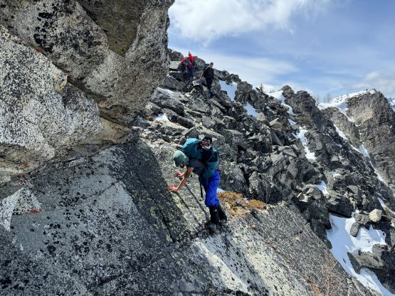
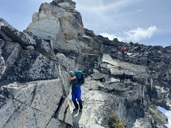
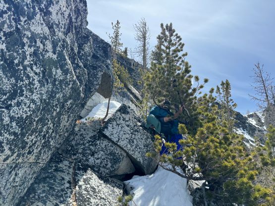
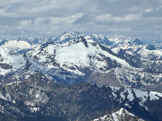
In the morning I could see clouds coming in and out and Star Peak was still mostly soaked in, so we took our time and did the morning routine rather lazily. We eventually shouldered the heavy packs and the slog back up to Fish Creek Pass felt definitely like a drag. The weather was fortunately improving, so we stuck to the original plan to traverse the ridgeline between Buttermilk Ridge and Oval Peak. There are other ways to get to Oval Peak by skipping that bonus T200 peak but none of those options was “straightforward”. We might as well pick one so that we could bag an extra peak. We donned crampons for that steep side-hill traverse from Fish Creek Pass to Courtney/Buttermilk saddle and then embraced the steep scramble up the SW Face of Buttlemilk Ridge. The terrain was mostly boulders and the boulders were quite gigantic. Sometimes we had to pull some 3rd class moves and the scrambling was quite tiring and difficult with the heavy packs. Vlad, Erica and I made the summit but I had to come back halfway down the face to carry Holly’s pack up. This section was the physical crux of the trip and turning around wasn’t an option as we were not doing that out-and-back thing. Thankfully the ridge traverse towards “Buttermilk North” was mostly on snow.


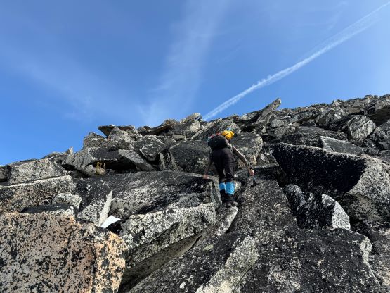

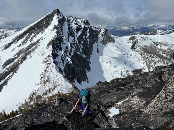
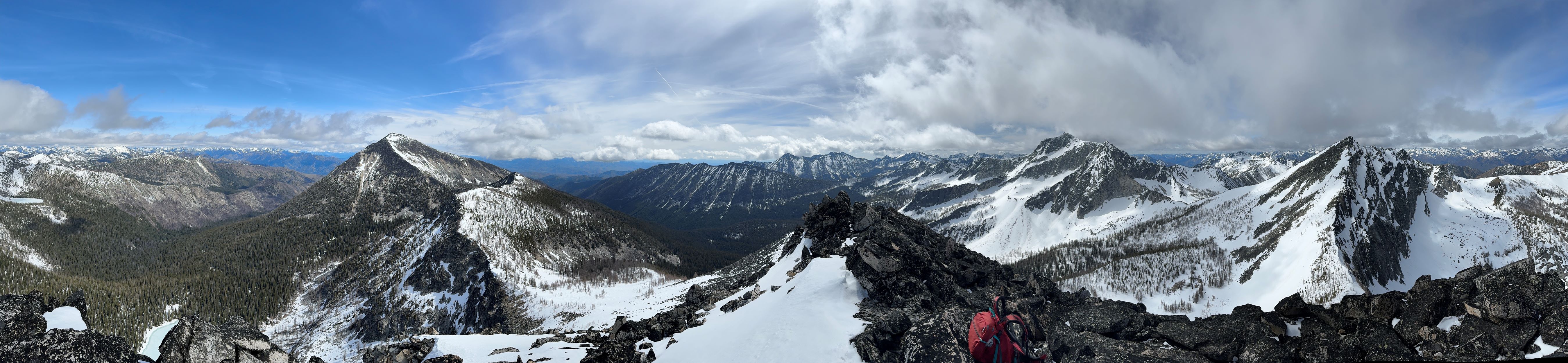
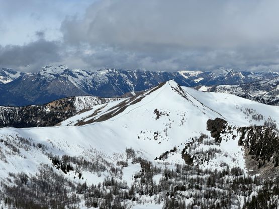
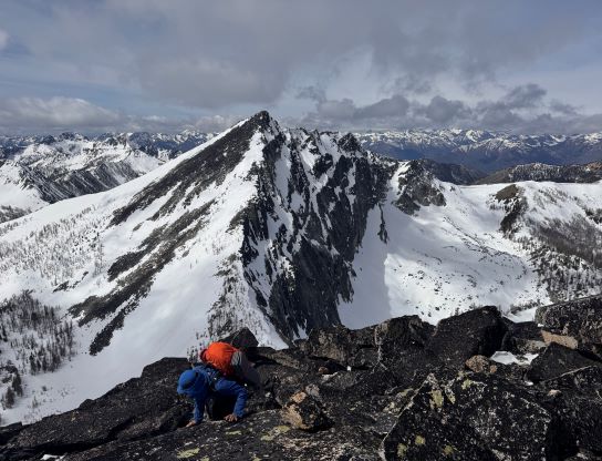
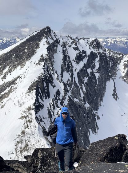

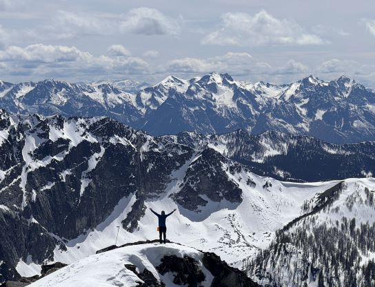
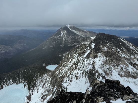
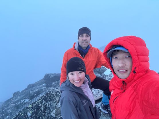
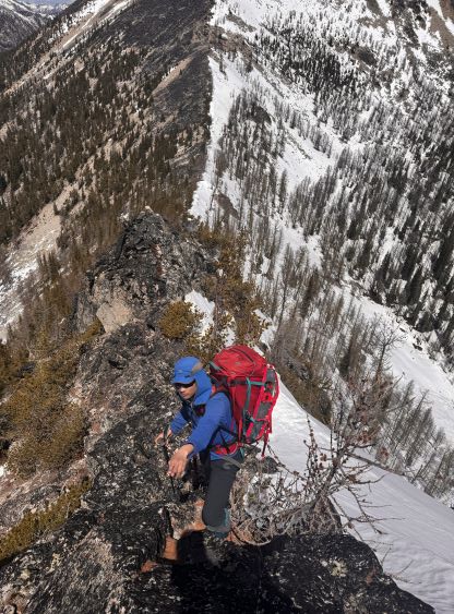
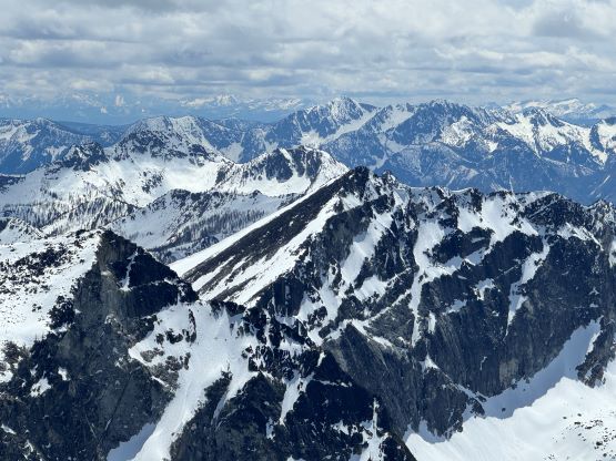
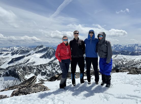
Indeed, I was able to lead us down the NE Face of Buttermilk Ridge by mostly staying on snow, and then traversed around one subsidiary bump and only did one short scrambling section to the summit of “Buttermilk Ridge North”. This peak does not have 100 m prominence nor a name so I’m not logging it in. The technical crux was followed shortly after as we descended the difficult ridge down to Buttermilk/Oval saddle. I knew there are several ways to bypass this section but all of those options involved more elevation loss and regain. I wanted to make this trip a bit more challenging than just a “plod” so down the ridge we went. The terrain turned out to be a mixture of 3rd class scramble and steep snow and it was decently exposed, and I thought it was an oppourtunity for Erica to practice scrambling, especially with a monstrous backpack. It was definitely strenuous but she handled excellently. Once everyone made down to the saddle we ditched our backpacks and slogged that 350 tiring vertical meters to Oval Peak. We saw the previous party descending from the summit and we were able to follow their tracks up and stayed mostly on snow to speed things up. Due to the improving weather we did a fairly long summit stay on the highest peak of the Wish Slam.


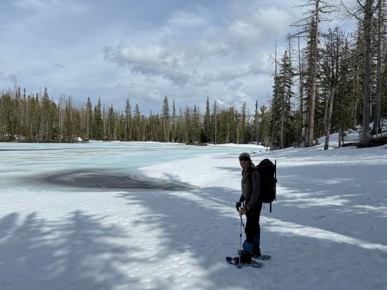
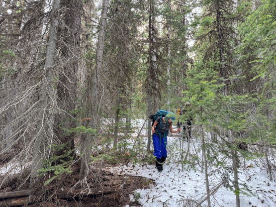
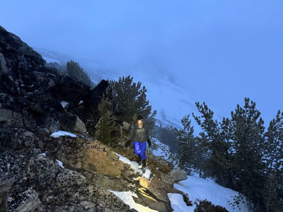
I then led us running and jumping down the soft snow back to Oval/Buttermilk saddle, took another energy break and embraced the tiring descent down towards that partially-melted 2100-m tarn. The snow had gone isothermal and the snowshoes were essential for providing flotation, and even so we all sank hip deep sometimes. Erica got her snowshoe stuck under some boulders and it took me a while to dig her foot out. We could see from the tracks that the previous group was also snowshoeing at the time, so we just followed their tracks until running out of snow. What’s left was a 300-m bushwhacking descent with lots of pick-up sticks, but it wasn’t too bad as we were descending, after all. The worst was a stretch of post-holing around a creek. It would be easier had we opted for two more transitions to don snowshoes but we decided to post-hole, somehow. After hitting the trail I kept the wet boots on for another kilometer but as soon as running out of snow I took a break to don the trail-runners. The rest of the plod back to the truck was tedious but actually quite enjoyable thank to the change of footwear. I think we got out at around 7:15 pm and did not hit the road until 9:30 pm after a slow dinner in Twisp. It was my duty to drive us from Twisp all the way back to Surrey and I was able to stay awake by listening to Chinese pops. We eventually got back at 1:30 am and everyone else had at least another half an hour’s journey back to their respective homes.