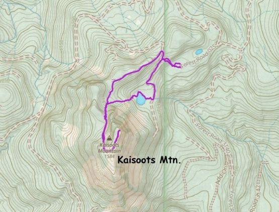
Kaisoots Mountain (Bald Mountain)
October 7, 2025
1671m
Mt. Baker Highway, WA
This is an obscured P300m objective in the “foothills” of Mt. Baker region, not far from U.S./Canada border and tucked behind Canyon Creek. There are two names – Kaisoots Mountain and Bald Mountain and both names are official. On the USGS map it is labelled as “Bald Mountain” but Washington State Board of Geographic Names designated it by the indigenous name in 1985. I also prefer the indigenous name even just for the sake reason that I have already done a handful peaks named “Bald”, so I’m more keen on calling this peak something else. I actually had my eyes on this objective since 2016 as I could see it fairly clearly from Liumchen Mtn. but at the time the access was more of a mystery. I was too lazy to figure out the logging roads situation. Some of the roads extend fairly close to the summit but most of the roads in the vicinity are private and gated, but some of them are public and not gated. I also thought about tagging it as a winter climb but I wasn’t too keen on turning a simple outing to a 30-km death march on snowshoes, as the government surely wouldn’t be maintaining those roads in winter.
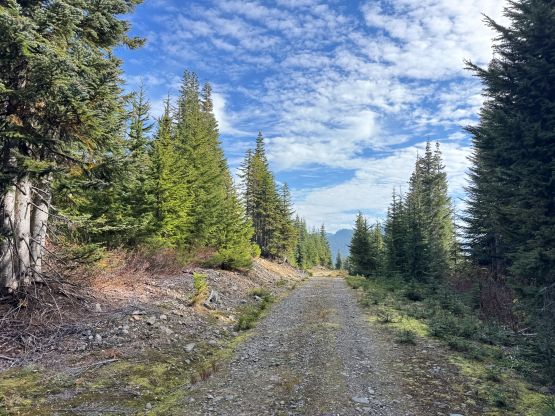
Then all of the sudden Matt Burton posted a trip report with GPX linked to peakbagger.com. The report was posted on Facebook and therefore I got “fed” by the social media. I otherwise would not have noticed it as I’m no longer paying much attention to the traditional sources these days. This sounded like an incredibly short outing so I immediately decided to take advantage of the “beta” by doing this as a before-work exercise. The driving would be about 2 hours each way and the hike should be less than 3 hours even if I went at a snail’s pace. I noticed a probable window on Tuesday morning. This was the last day of this extended weather window. I had to be in White Rock by 2 pm for work, and I couldn’t leave home until 11:30 pm in the previous day, but I still figured there’s more than enough time to make things work. I couldn’t skip sleep these days due to the insane work loads but I could make up the time by hiking fast. I left home at midnight, drove all the way to Matt’s starting point and camped at 2 am. The last kilometer was rough and bushy but imposed no problem to the stock Forester. Except for the last kilometer this contrived FSR access would otherwise be “doable” in a 2WD car. For once I was impressed by the state of maintenance in Washington.
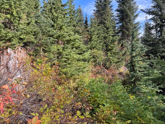
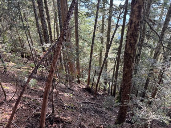
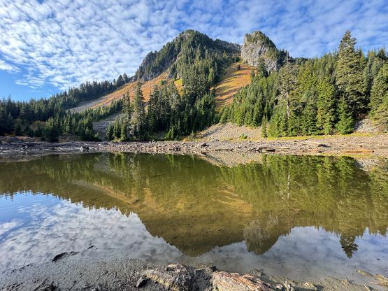
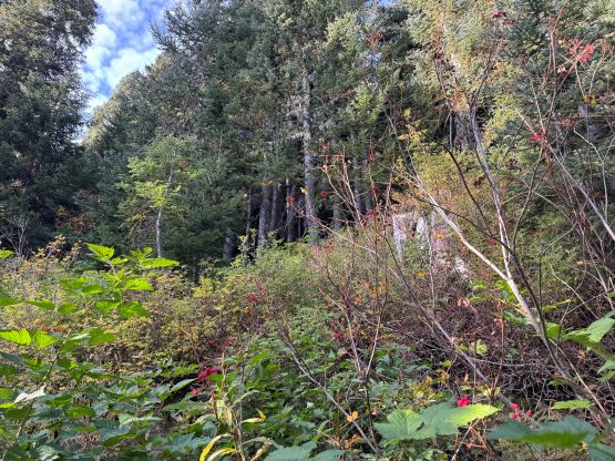
I opted to not bother setting up an alarm as I really needed to wake up naturally. This turned out to be 8:40 am which was later than I expected. I decided in situ to skip breakfast so managed to start walking in less than 15 minutes after waking up. I had read Matt’s trip report and the decision was to take Matt’s descent route to minimize bushwhacking, even though this option added some extra elevation gain and loss. The bushwhacking from the end of the road was still unavoidable and the brushes were wet, but as soon as I started up the forest the bushwhacking eased. The forest was as steep as documented in Matt’s trip report. It was a tad bit treacherous in the trail runners given the amount of pine needles and the hardpacked ground, but that’s not a problem for me. I thought about doing my own variation higher up but decided to follow Matt’s route to check out Bald Lake. This required losing all of the hard won elevation so I decided to explore my own way out on the way back. Bald Lake was disappointing as the lake was almost entirely dry at this time of a year. I did manage to take a few satisfactory photos but the scenery was rather mediocre in person.

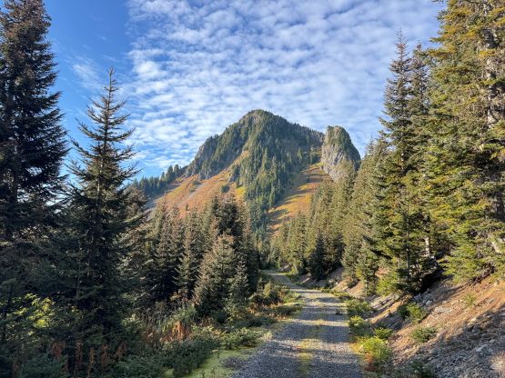
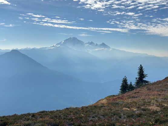
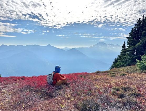
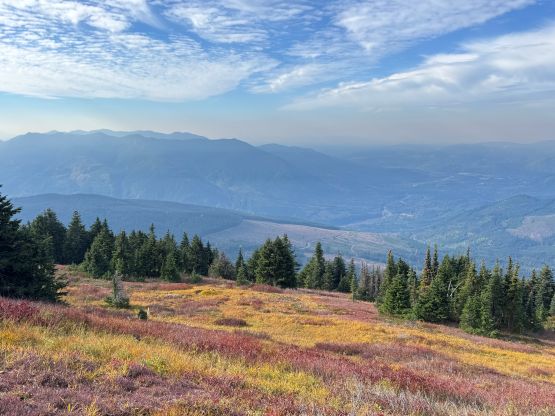
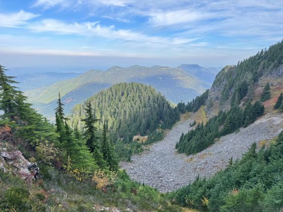
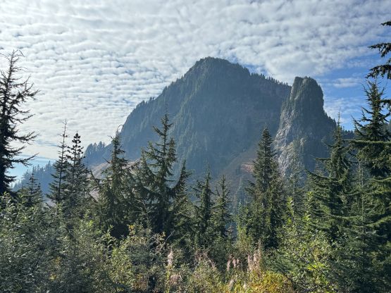
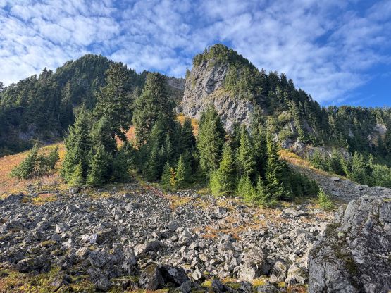
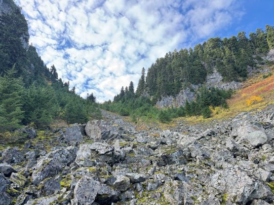
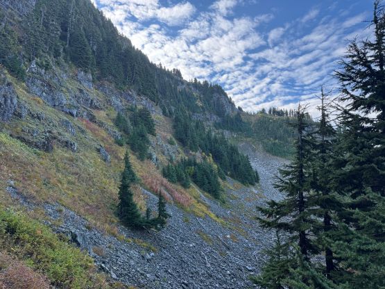
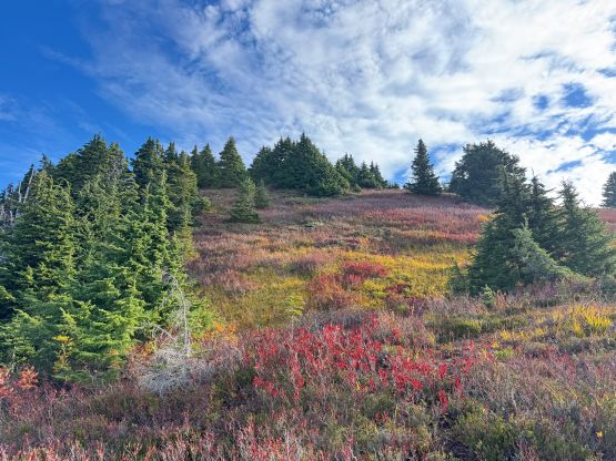
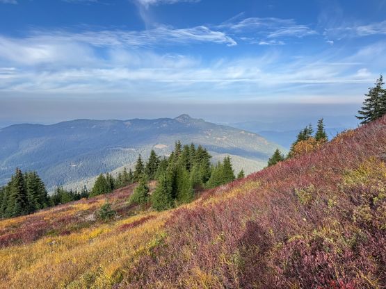
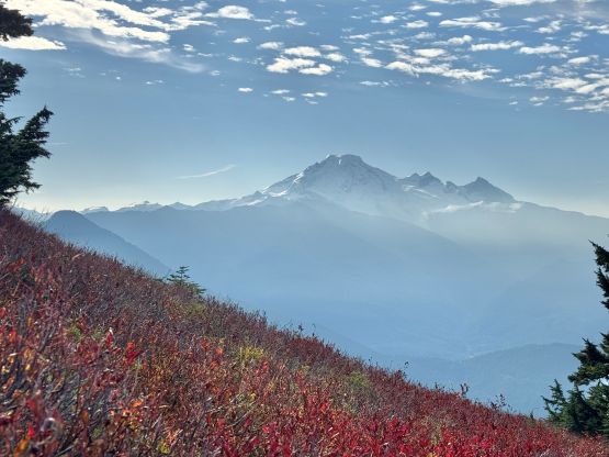
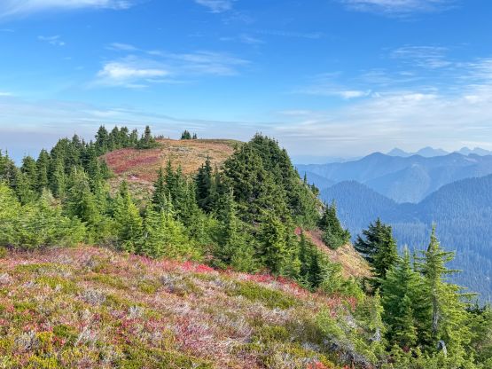
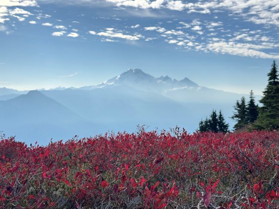
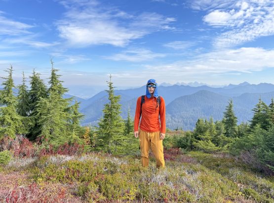
The bushwhacking above Bald Lake was worse than I thought with a band of BW4 that I had to penetrate through. I probably didn’t pick the easiest way but I was too lazy to search around. The forest was also quite steep so the going was slow and unpleasant until I emerged in the boulder fields. The boulder fields felt like a “highway” by comparison so I quickly worked my way around to the north side gully. This gully was filled with brisk sized rubbles and most, if not all of the rubbles were loose and covered in moss, and the vegetation was wet and greasy. The going was fairly treacherous but again, I was experienced and able to move efficiently in this type of terrain. Traversing across the west side bowl was also side-hilling on rubble-fuck and boulders and then there’s a gully of compact choss to ascend. This gully was quite shitty and I ended up needing a few vege-belay moves. Thankfully by wrapping around to the SW side of Kaisoots Mtn. the final attack to the true summit was scenic and straightforward. There were still huckleberries available and the fall colours were still full on, but unfortunately the weather was smoky.

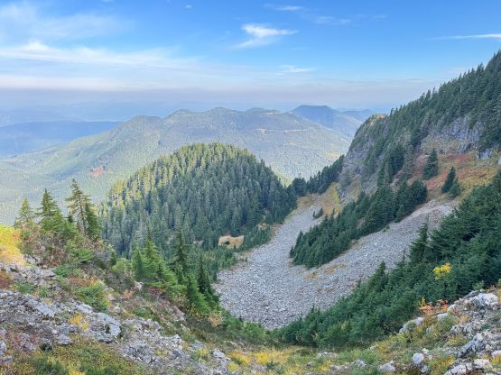

I caught some cell reception so made some updates before starting the descent. I was not particularly doing great on time so I needed to be efficient on the way out. I jogged down the blueberry bushes and then vege-belayed myself down that shitty gully. I then traversed back across the west bowl and dashed down the north facing greasy gully. I opted for the simplest way out, that was to bushwhack my way northwards to the highest point in the private part of the logging roads. The 300 horizontal meters of bushwhacking was quite thick (BW3 sustained) but I still think it’s faster than dealing with the terrain around Bald Lake. The rest of the descent was uneventful and I finished the round trip in 2 hours 15 minutes. The Google Map directed me towards Ferndale and then White Rock and I did get back in time for work. I even earned myself enough time to have a proper lunch before showing up at work. I eventually worked all the way to 11 pm. I was completely exhausted but I sometimes liked to push myself as hard as I humanly could.