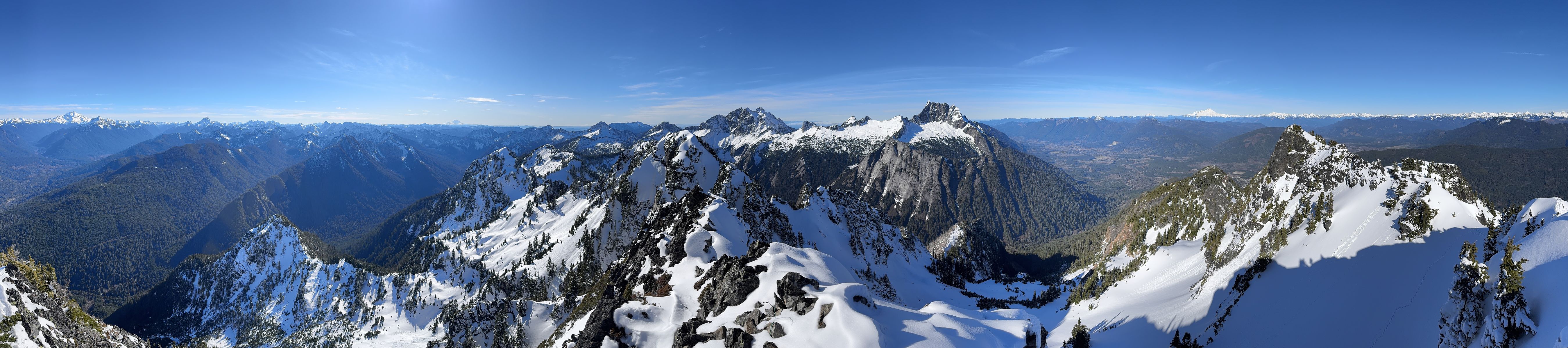
Jumbo Mountain [WA]
February 11, 2026
1775m
Darrington, WA
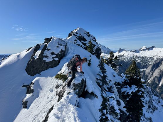
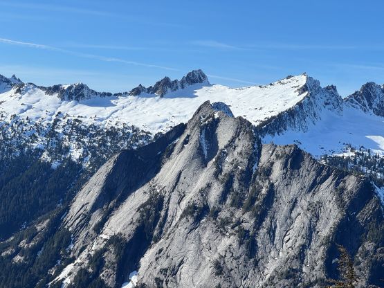
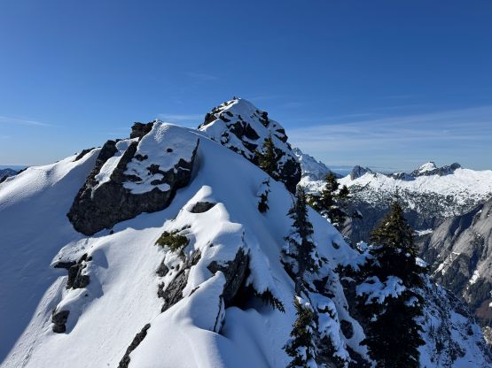
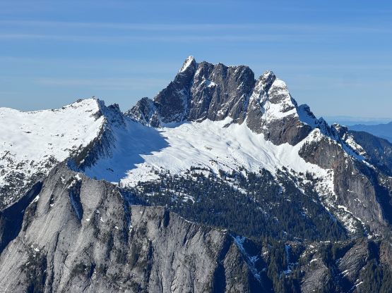
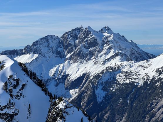
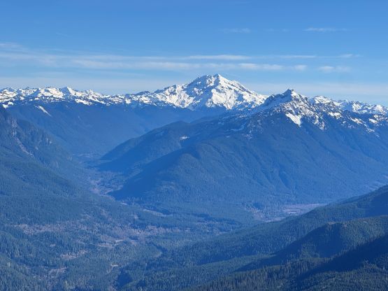
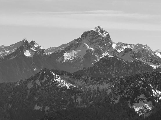
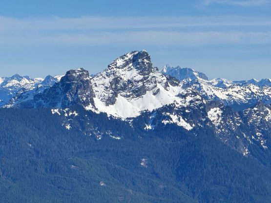
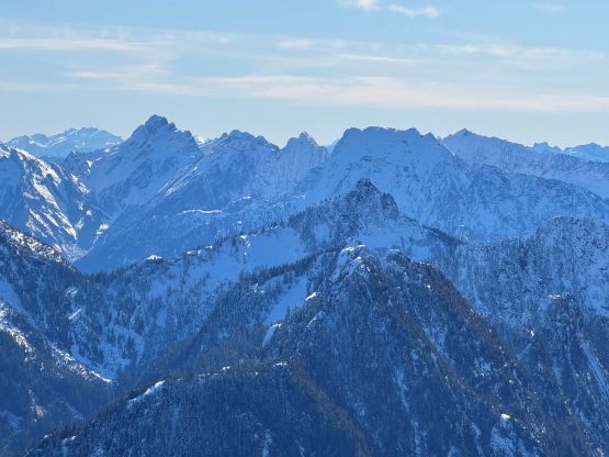
The rugged massif of Jumbo Mtn. boasts over 500 m prominence rising above the town of Darrington but is significantly overshadowed by the taller and more iconic neighbour, Whitehorse Mountain. This is unfortunate because Jumbo Mtn. itself is a fine mountaineering destination in its own. There are multiple peaks with the highest one at the center. The standard route is best done with some snow coverage to facilitate the forested travel but the route is a class 3 knife edge, that could be somewhat challenging in snowy conditions. It’s important to figure out the route beforehand because those who ended up being on the north summit would likely require a rope to traverse to the main one.
Elise made the suggestion to tag this one on Wednesday. I wasn’t going to take the day off work but given the superb weather it was hard to pass. The rare spring-like conditions made this and ideal objective, so I instantly agreed. Unfortunately I only skimmed through a few trip reports and underestimated the challenge. The Irvis Hybrid crampons were proven to be undertooled once again in the firm conditions but I nevertheless was able to make the summit. Elise and I decided to leave White Rock at 5:30 am in order for me to get back by dinner time. This wasn’t going to be a full-day adventure so I still booked a few hours of work in the end. This was definitely the correct decision.
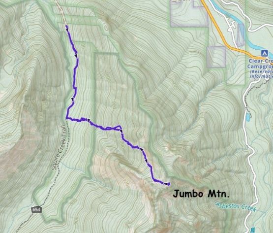
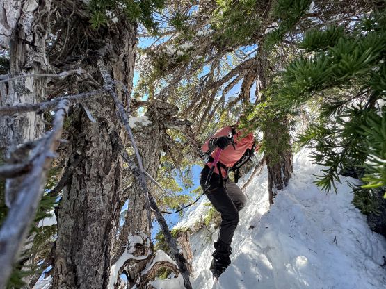
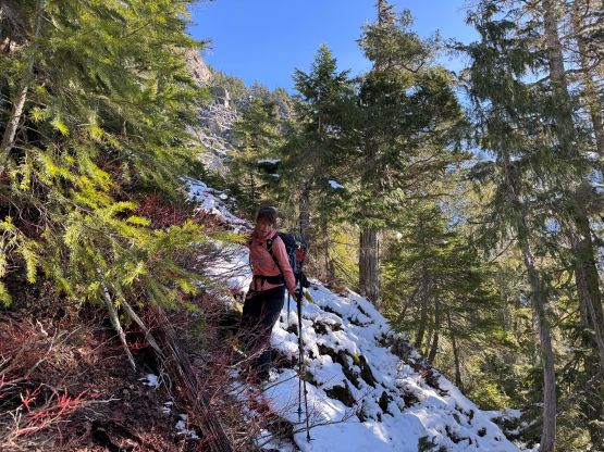
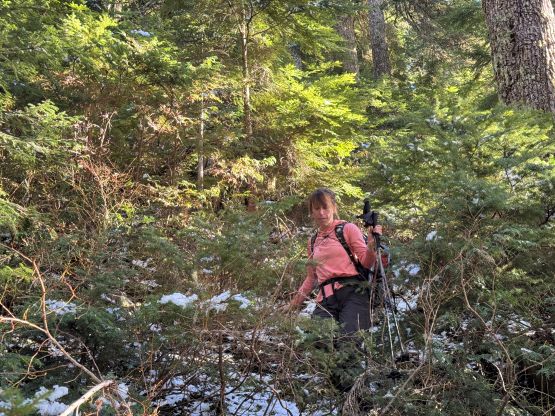
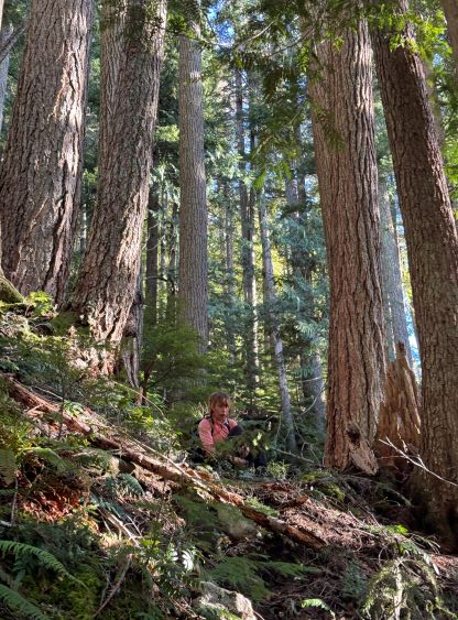
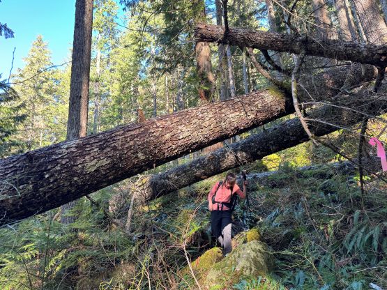
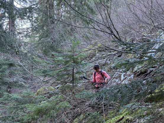
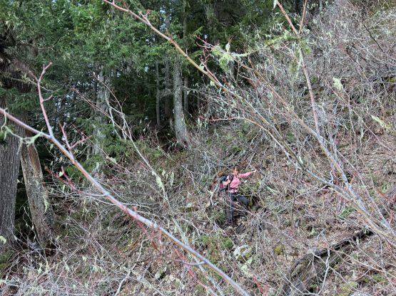
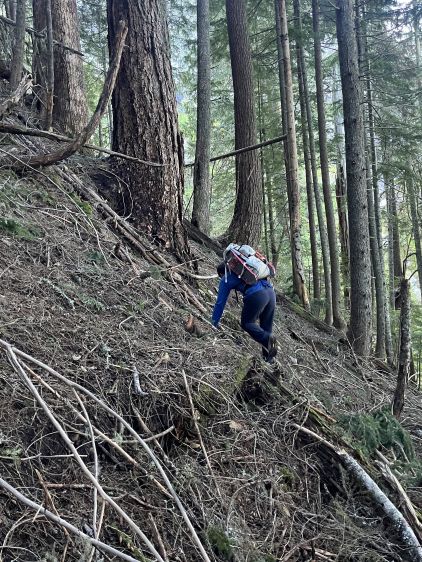
There was no recent update about the logging roads to Square Creek TH so there’s some unknowns. We indeed were not able to drive to the very end but the extra walking distance was less than a kilometer. The November flooding definitely did some damages to the area. I opted to wear the trusty Arc’teryx Alpine Vertex for as much as possible while carrying the La Sportiva G5s for the snow climbing up high. This turned out to be carrying the boots all the way to the snow traverse at 1350 m elevation. The spot to leave Square Creek Trail was indeed marked by a cairn but the best navigation tool these days was definitely the GPS app. Both of us checked the GPS screens multiple times to make sure we didn’t miss the turn. The climber’s access trail was not in an inspiring shape that even with the GPX track we lost it multiple times in the bushes. The bushwhacking wasn’t too annoying but we must be very careful about the navigation.
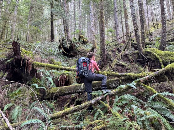
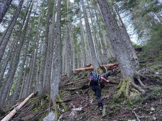
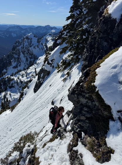
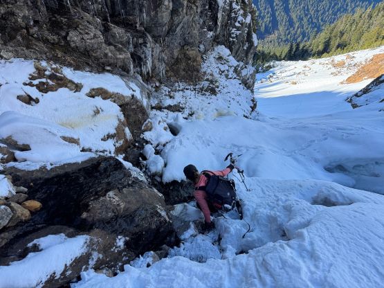
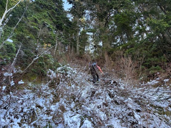
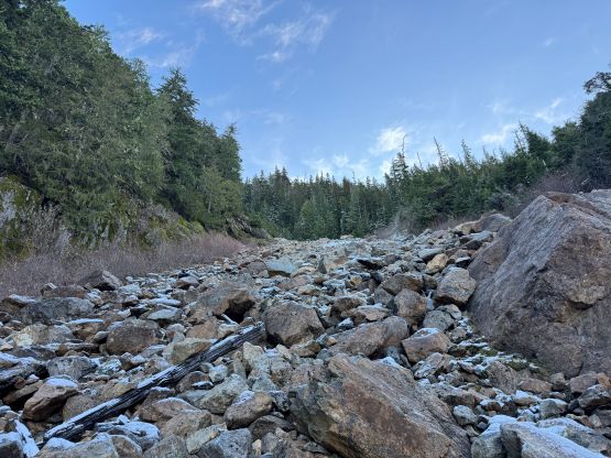
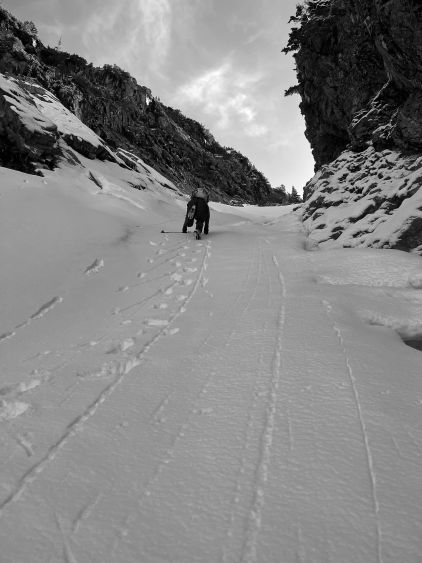
Higher up we somehow lost the route and went too far climber’s left. Thankfully Elise caught our mistake by checking the tracks. To correct the mistake we did a short but nasty traverse through alders and other types of bushes. Once on route we still had to traverse across some steep forested terrain without a trail bed, but the bushwhacking was minimal. It didn’t take us long to reach the first gully which required a bit of thrashing to get down into. Normally this part would be already filled with snow but not in this year. The first gully turned out to be boulder fields covered in an inch of fresh snow for us, which made things annoying to say the least. I thought about to switch footwear at this point but was too lazy to do so, so kept pushing in the trail runners. The worst was the short but steep and bushy slope to get out of the first gully. My hands were cold and wet from the vege-belaying. Elise was smart enough to take her time donning gloves. The terrain above this first gully was steep and complicated but the fresh snow stayed within an inch deep, that I was able to lead us all the way to the snow traverse in the trail shoes.
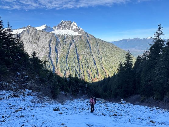
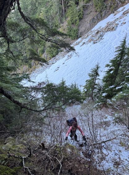
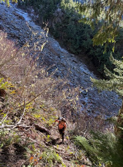
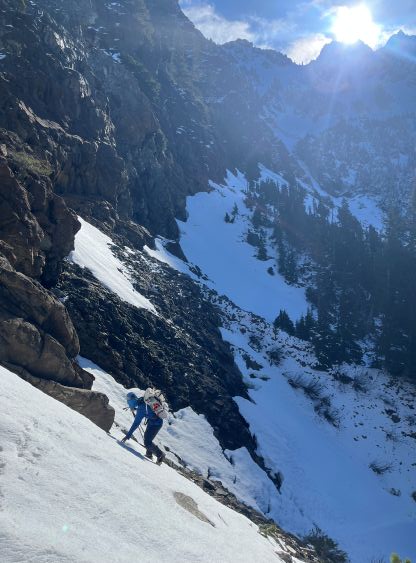
We got there just in time for the sunshine so we did the first long break of the day switching footwear. I originally was thinking to bootpack but this quickly became a dumb idea. The snow was very icy and also somewhat exposed. I then made the decision for us to don crampons and in retrospect we should have donned ice axe as well, as the exposure was quite real. The aluminum heel pieces were definitely a liability on this day so I must be 150% more careful about the biting. The terrain became more advanced as we made our way into the gully constraint so I ditched a pole and took the ice axe out. The gully wasn’t even fully filled in. There’s a melted-out gap in the middle which proved to be somewhat problematic, but a few mixed moves and some 40-degree climbing later we exited the gully into the upper draw.
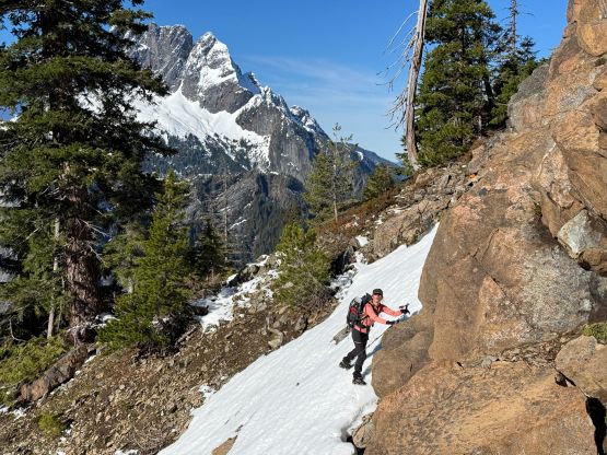
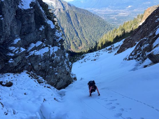
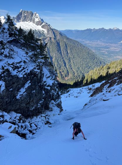
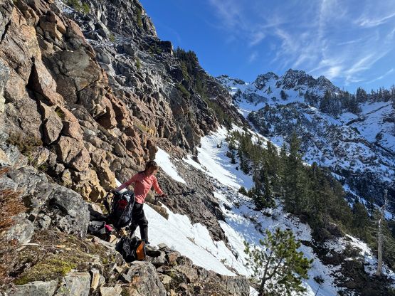
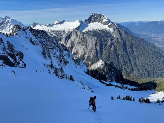
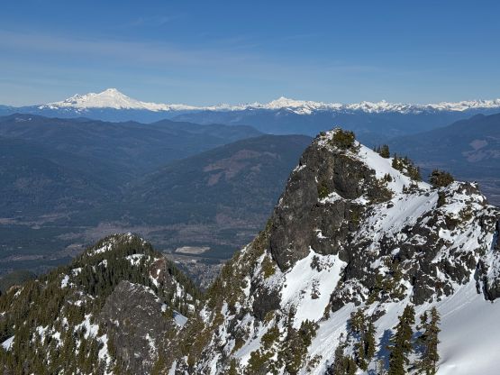
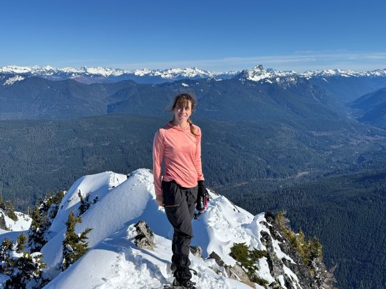
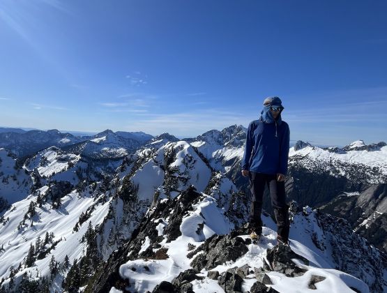
I didn’t know why we brought snowshoes but we were too lazy to ditch them. Instead, I opted to carry them all the way to the very tip of the summit for training purposes. The ascent through the “upper draw” was tedious and foreshortened and took a long while. The multiple summits came in view and we triple-checked with the map to make sure we were aiming at the correct one. The snow slope leading to the NE Ridge of the main peak appeared daunting but was actually not that bad, but the uppermost NE Ridge was definitely tricky in the fresh snow. The exposure was quite severe, the rocks were loose and the moves were not straightforward. I ended up having to clean the fresh snow off some holds to make sure we were stepping on solid ground. It took a while, but we eventually made the summit.
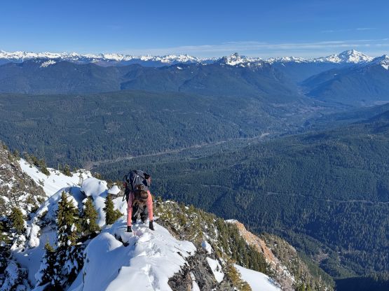
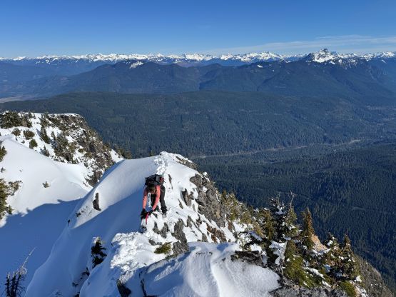
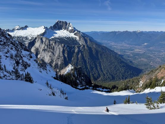
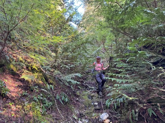
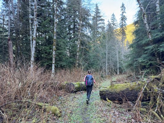
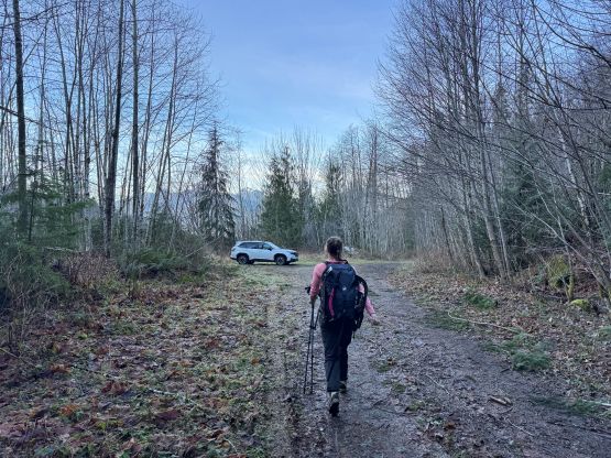
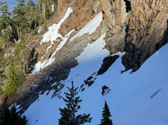
The east aspects were quickly deteriorating so the decision was made to take a break after down-climbing the ridge. We took a variation line opting for a more exposed snow traverse instead of a mixed step, which was better or worse. Plunging down into the “upper draw” was fast and furious but my aluminum heel pieces were again, not biting very well. I nevertheless was able to plunge facing outwards the entire way, but it was on the edge of my limit. Lower down we both opted for a long glissade. Descending through that lower gully constraint wasn’t too bad but the final traverse was unpleasant with the less-than-ideal crampons. I decided to keep the mountaineering boots on until we were completely done with the fresh snow, which was below that lower boulder field gully. We also stayed closer to the GPX tracks on the descent and managed to avoid the worst of the alders, but the trade-off was two nasty gullies to cross. Each of them had some Devil’s Clubs so I’m not sure if we actually found the right way. Anyway we crossed path with the climber’s trail and dashed back to the vehicle in a single shot afterwards. Our round trip time was just over 7 hours which was as expected. Elise did most of the driving homewards so that I could catch up with some sleep. I indeed got back to White Rock in time for dinner, and then worked till 10 pm.