Hozomeen Mountain North Peak (+Red, Lone Goat, Snow Camp)
September 30, 2024
2459m
Ross Lake / Manning Park, WA
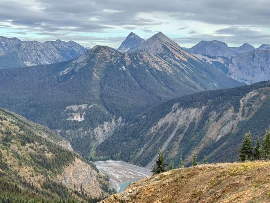
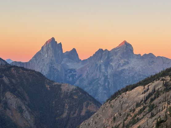
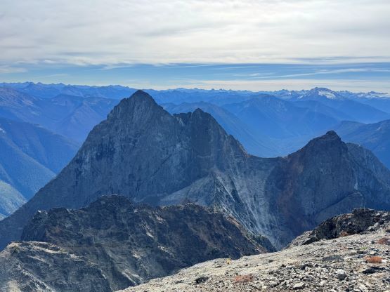
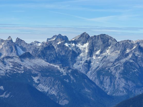
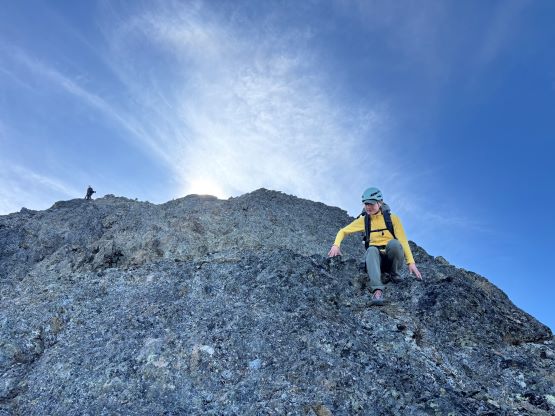
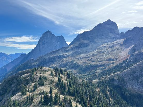
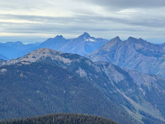
Hozomeen Mtn. is an iconic double-peak massif dominating the north end of Ross Lake while boasting over 1100 m prominence. The rarely climbed south tower is considered one of the 10 hardest peaks in Washington by the easiest possible routes. The north tower is nowhere as difficult but still has reputation of being sketchy. The standard route via the NW Ridge does not seem probable until one’s literally at the bottom of it. There is a great range of variety on the opinions of the difficulty but after doing it I generally agree with the majority that it’s mostly 3rd class with odd bits of 4th class. The terrain is somewhat loose (nowhere as bad as the Goodsirs), down-sloping, extremely exposed but not protectable so I also understand why even some of the experienced climbers found this demanding or couldn’t even make the summit. I had been eyeing this objective for at least 8 years and the general consensus back in the days was to time that narrow window in the early summer when the lower headwall’s still filled in with snow. This would surely offer the easiest climbing but then crampons etc. would also be required. For one reason or another this never ended up happening for me. The “beta” had changed over the last couple years, that apparently a late season snow-free ascent has now become the standard practice. Shayan M. was the first to report this route in the late summer while not being sketched out, and the following year Chris G. made a solo run in sub-10-hour round trip, calling it “mostly class 2”. Numerous groups had since climbed it in similar conditions and most agreed with the “class 3/4” rating, so why not ditch the snow equipment and make it a light-and-fast single day push.
The round trip distance without adding any of the bonus peaks would still be ~42 km and I had never done a single push like that. I of course had done bigger days but those were mostly because of the terrain challenge. I’m never the best at plodding flat distance but quite a few friends of mine had done it this way so I must do the same. Erica agreed to accompany me on the mission and I also convinced Alex B. and Trevor B. to join, after seeing a probable window on the long weekend Monday. That was about a week back so the forecasts had changed quite a bit. There was then a system on Sunday dumping fresh snow so I carefully watched the radar/satellite map as well as the webcams throughout the day. I had refreshed the sources at least 30 times and in the end I thought the system had mostly missed the area so we should (hopefully) be fine. I still decided to carry the microspikes but they turned out to be training weight. Francis also hopped onto the train at the last minute and the five of us together decided to car-camp at the trail-head and aim to start at 5:30 am. The Silver-Skagit Road had finally opened this year but nobody had reported the quality of the trails on that side since then. I thought it’s definitely safer to do what everyone else did in the past few years, that was the out-and-back marathon death march from Strawberry Flats in Manning Park. Four of us decided to use trail runners for the entire day whereas Erica opted to carry her approach shoes while wearing trail runners. I carried 1.5 kg of food from Save on Food and Sungiven (double what I normally eat) and ended up eating most of the package. The availability of water sources was a major uncertainty but the previous group confirmed sure sources at the bottom of the peak, so we only carried 2 liters each. I did throw in the filter at the last minute but that turned out to be training weight as well.

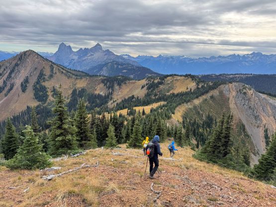
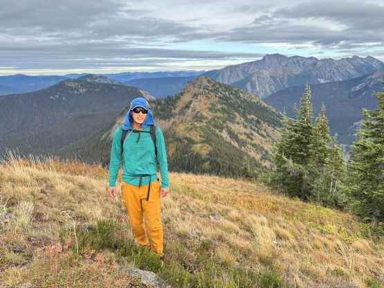
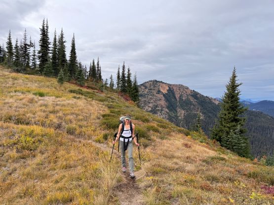
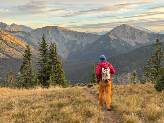
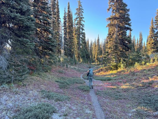
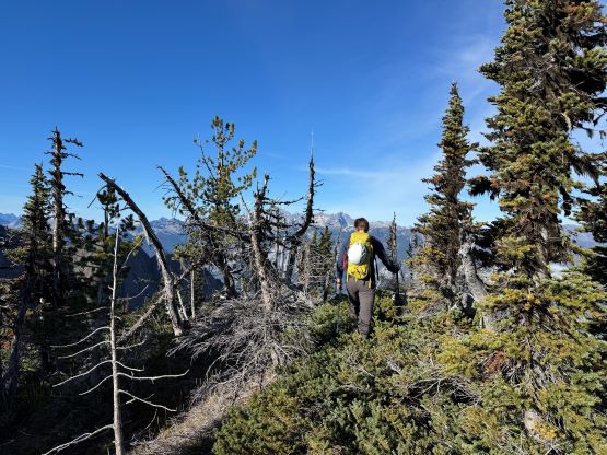
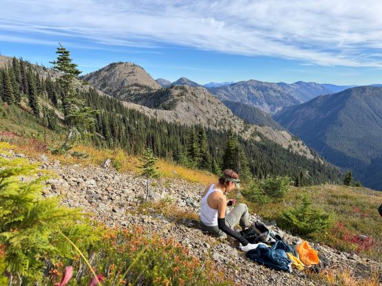
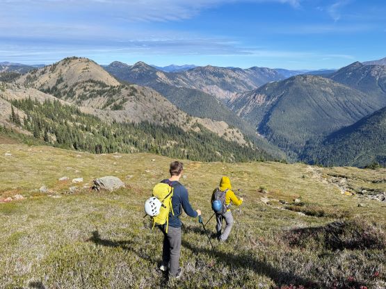
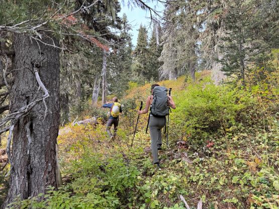
The night was cold and noisy. Erica and I arrived (in a separate vehicle) at around 11 pm but someone else pulled in at midnight and opened that gate into the ski resort. I thought we would get kicked out as pitching the tent in the middle of a provincial park’s parking lot was most likely illegal, but nobody came to fuss with us. We nevertheless did not sleep too well but that’s still better than waking up at 2 am to drive out from home. We eventually started the day at almost 6 am as the morning routine took a while. With the head-lamps on Alex led a blistering pace up the Skyline trail and I had to work 120% to keep up with the pace. There’s no time for anyone to warm up and we must hit the full gas right off the bat. Thankfully Alex needed to delayer so I took over the lead for a while and slowed everyone down to a more reasonable pace, but then I preferred to jog the downhills so we got to that first viewpoint in no time. We got there minutes before the morning alpenglow on the Hozomeens’ faces so we took a break taking in the views. That was mostly our strategy for the day. We would power-walk the uphills and run most of the downhills but we took lots of breaks along the way. A bit more of jogging later we arrived at the south side bypass of Snow Camp Mountain. We talked about these bonus peaks and the decision was to tag them on the way back, so the next bypass was on Lone Goat’s SW side and before long we descended the frosty trail down into Mowich Camp. To our surprise there’s one group camping at the pass. We thought that’s a terrible place to camp as there’s no view nor any source of water. The trickle mentioned in the previous party’s report was gone likely because of the cold weather.

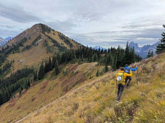
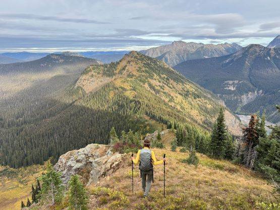
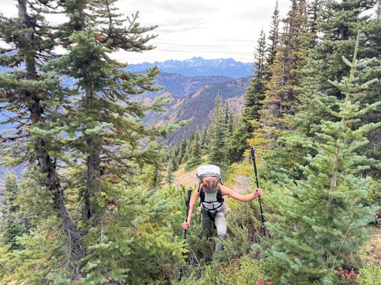
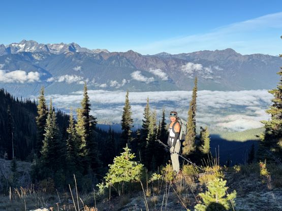
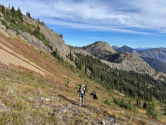
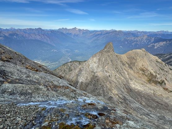
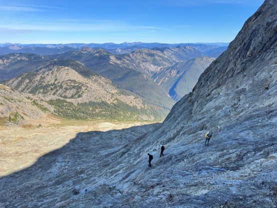
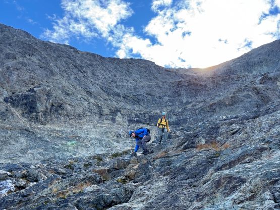
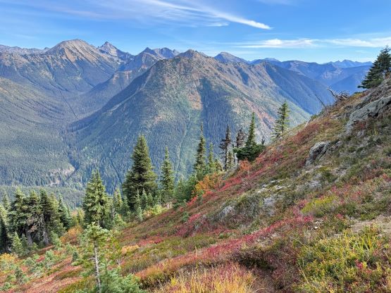
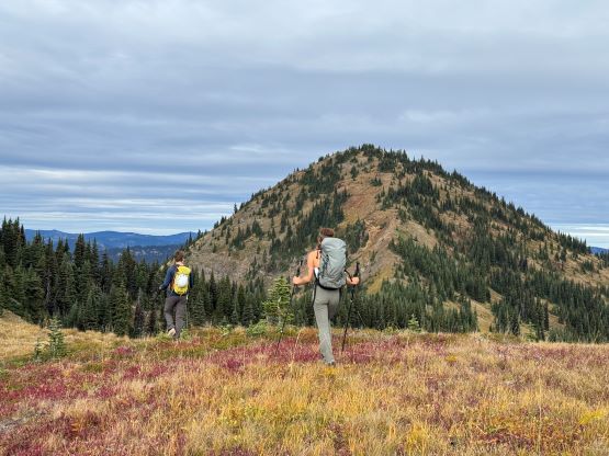
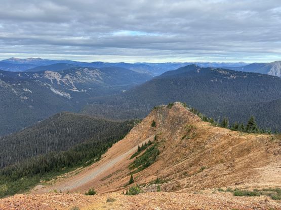
Erica, being the fastest runner in this group then took over the lead dashing up the west side of the campground onto the Hozameen Ridge (the spelling on the Canadian side is a bit different), then led the trail-run southwards across this seemingly never-ending ridge. I was very sure that we ran all of the downhills from the trail junction to the base of that unofficially named “Monument 74 Peak”. We talked about taking the bypass but decided to go up and over this P100m bump both ways, mostly because the heather was still covered in a layer of frost in the early hours. The bypass appeared steep and bushy anyway. A while later we made the boring summit of that P100m bump, took another break and then descended the somewhat tricky south face to the border crossing. I led this descent and encountered at least two 3rd class sections on questionable rocks. I could have looked more carefully but it’s good have a taste of this area’s rock quality early on. I also led us bypassing the next bump hard on the west side and ended up missing the monument, so we crossed into the U.S. without realizing. The next stretch involved some very mild bushwhacking while traversing into the basin under the peak, but there turned out to have a climber’s path for the most of it. The traverse was still very slippery on the trail runners but I could not classify this as “bushwhacking” as some of the other trip reports indicated. We then found that much needed water sources. There weren’t a lot, but enough for our use. After taking another long break we slogged up the tedious terrain, from heather slopes to the rock slabs covered in rubbles, all the way to the base of the route in one single push. The view’s foreshortened and the peak was much bigger than we thought.
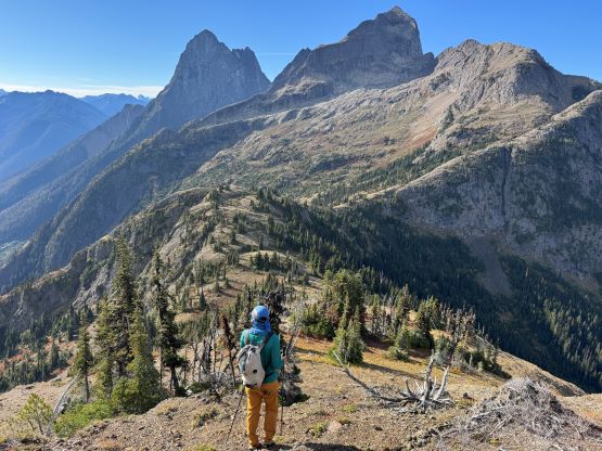


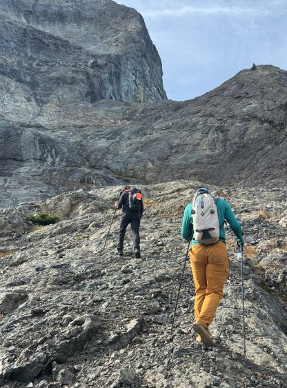
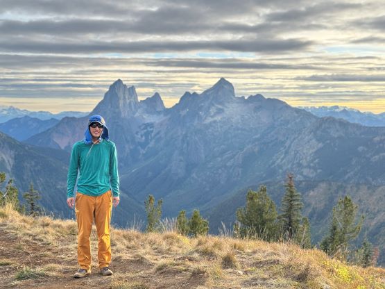
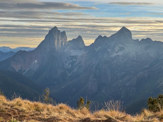
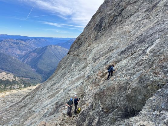
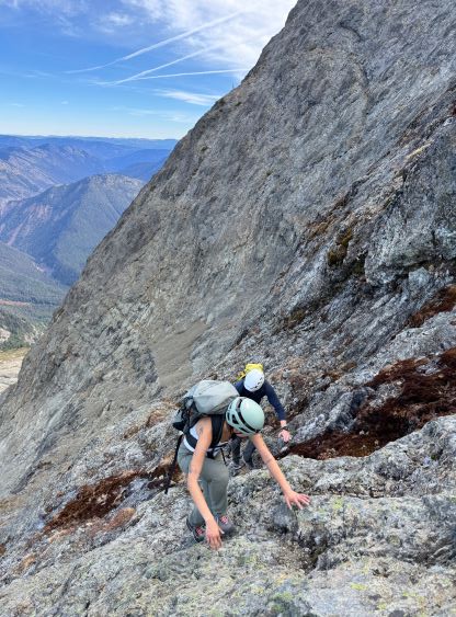
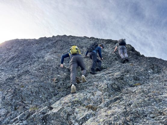
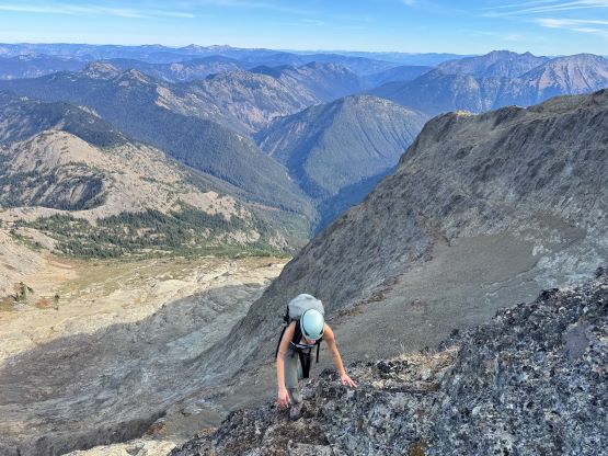
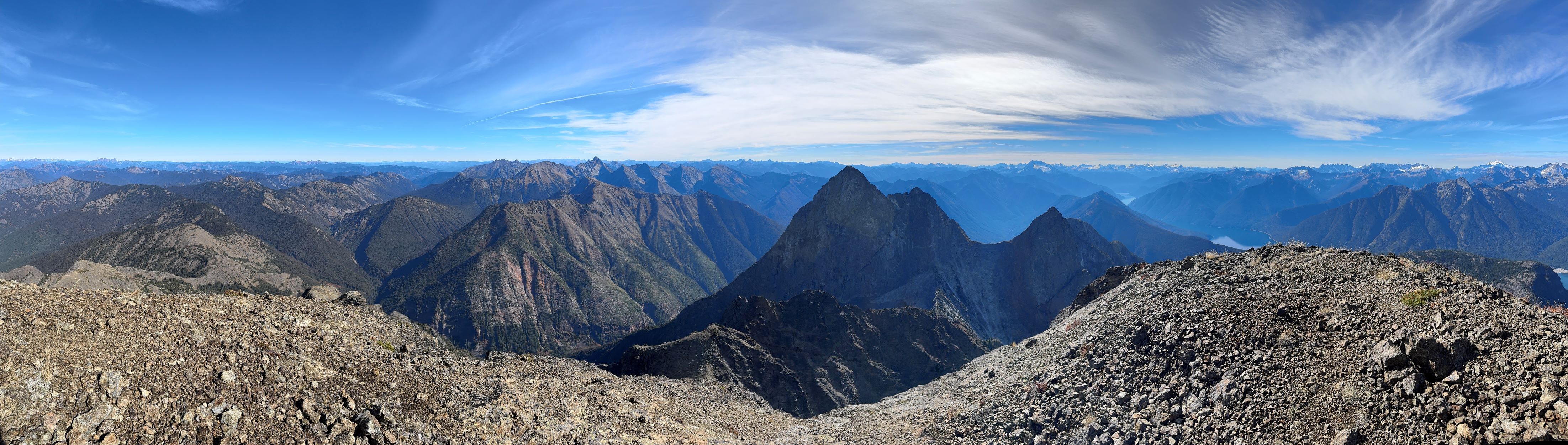
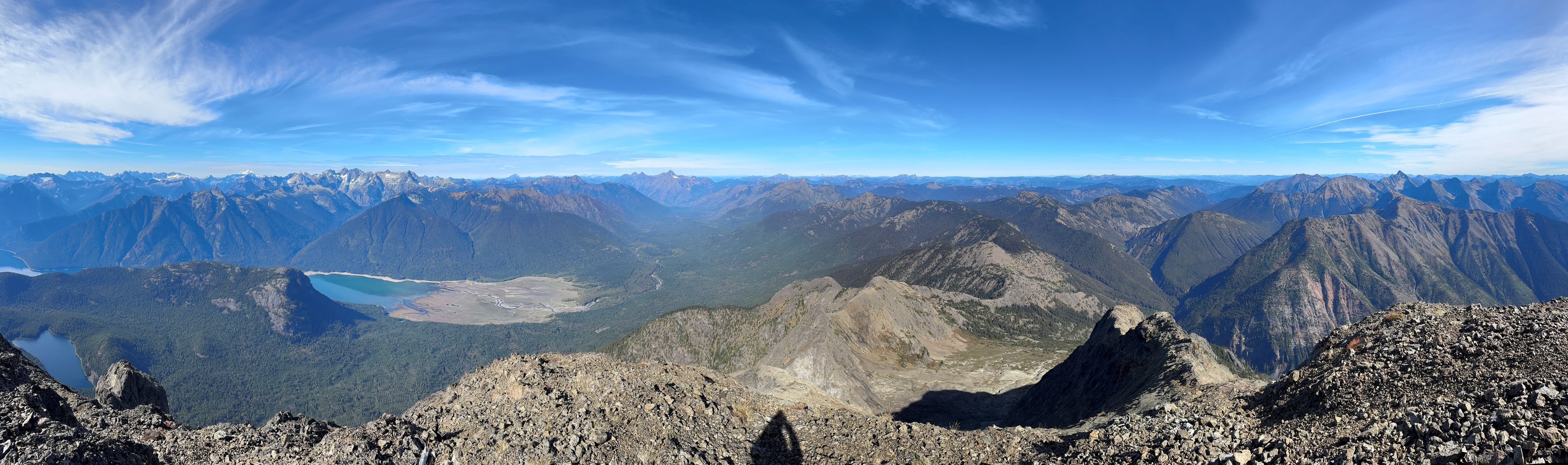
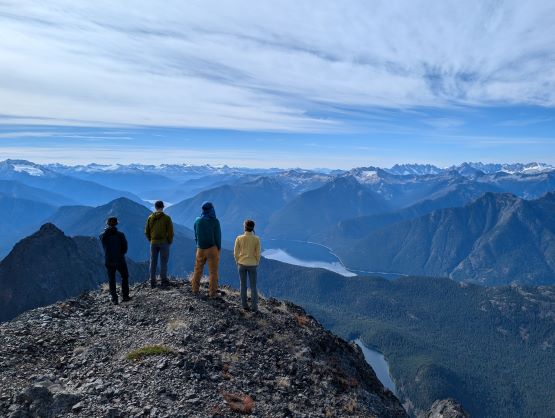
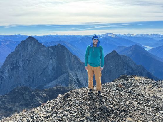
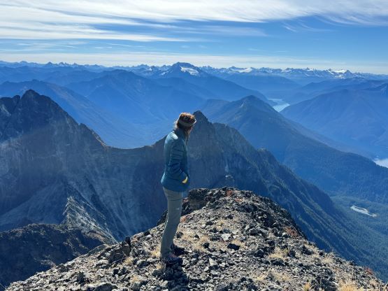
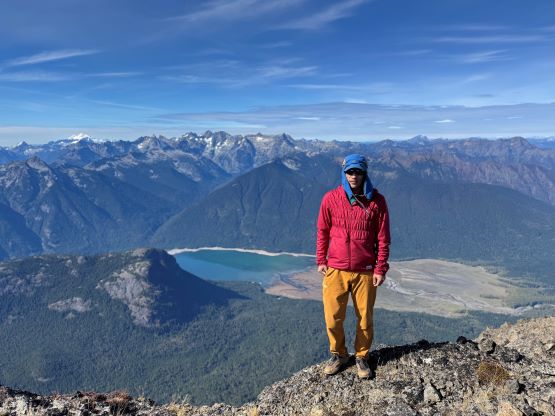
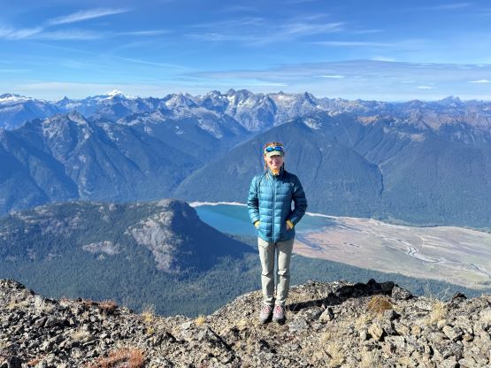
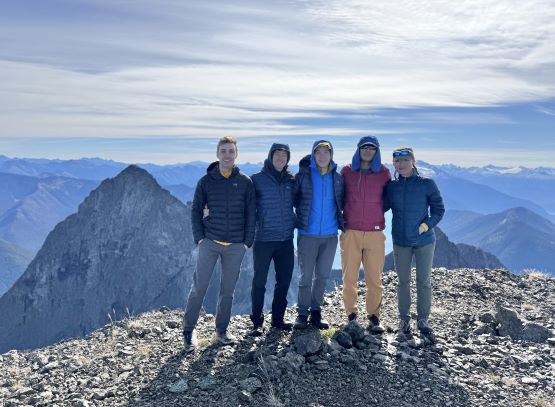
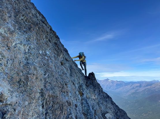
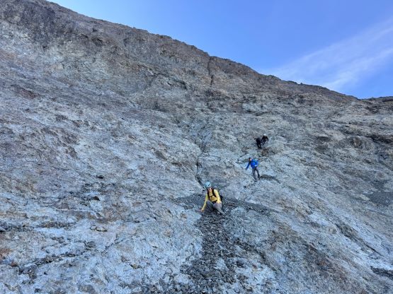
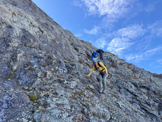
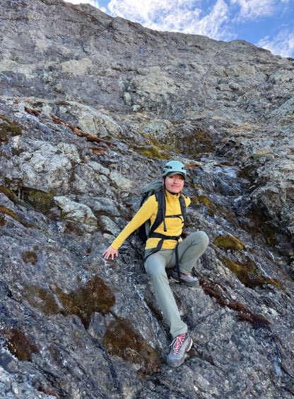
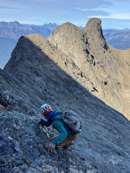
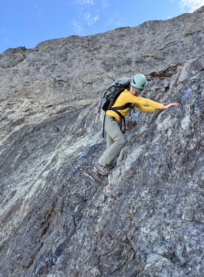
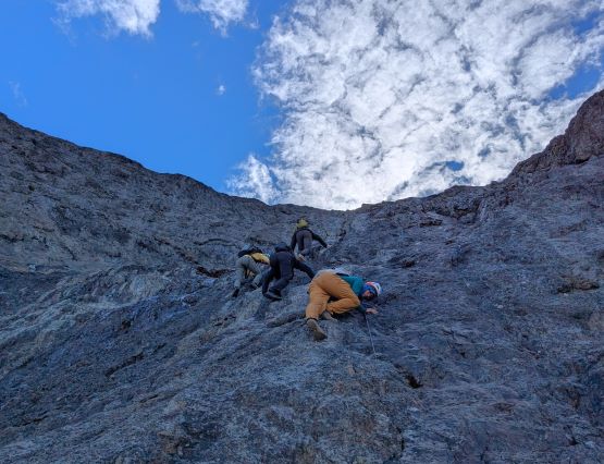
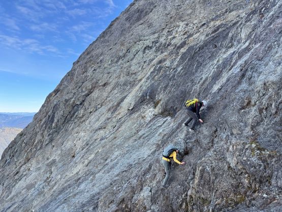
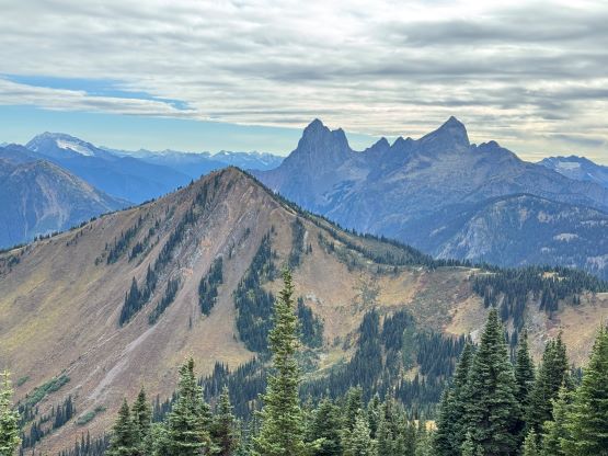
We donned helmets and ditched the poles, but I still opted to carry one pole to the summit which I definitely appreciated especially on the descent. For the lower headwall I thought the attack was on the far climber’s right side (admittedly I did almost no research beside downloading Matt’s GPX track), but upon closer inspection I thought the right hand was too difficult to be the correct way. Francis was leading the middle of the wall and I finally checked the track and sure enough, Matt had detoured to the far climber’s left. Erica and I eventually traversed into Francis’ route and we climbed a section of 4th class and then exited towards right on a ramp system. This was the crux for our route as there were plenty of verglass in the area making the route-finding tricky. The terrain was also down-sloping, so those without climbing experience might find this terrifying. The middle draw was almost always covered in snow according to the old trip reports even in the late summer, but the permanent snow had long gone these days. For us it was a tedious slog on treadmill scree and unstable rubbles to the obvious ramp that brought us climber’s right onto the NW Ridge proper. Some people had climbed a crack/chimney system on the climber’s left of the ridge but we thought taking the ridge was the best idea. There’s one really exposed 3rd class stretch on questionable rocks but the rest of the route was easy class 2 cruise sailing. It had taken us 5 hours 40 minutes to reach the summit, beating Matt/Miranda/Mel’s time by exactly 1 hour so we took our time taking a break up there. The views were excellent but there were signs of fresh snow towards almost all directions, so we were definitely lucky on this success.


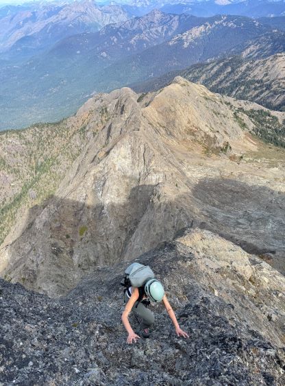

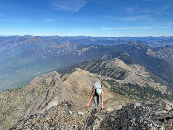


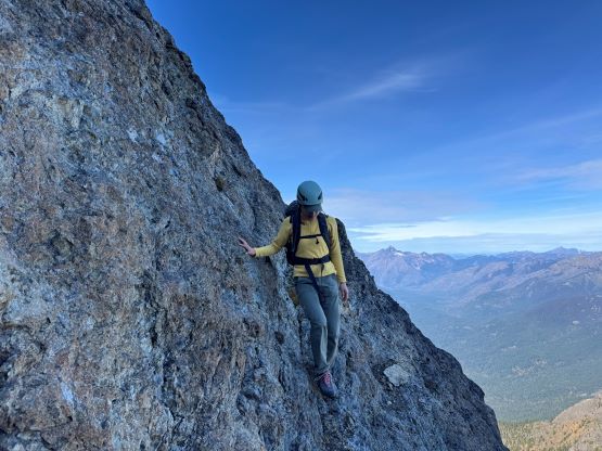
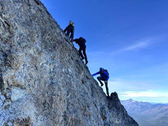
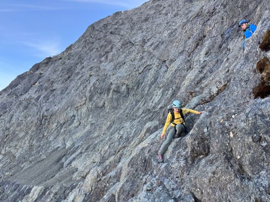
After taking in enough of the scenery I decided to head down first with Erica. I expected Erica to be quite a bit slower on the descent than the rest of the climbers in this team given her limited experience but I was wrong. Erica was mostly able to keep up with me and I was not on purposely slowing down. In the end she did not slow anyone down and I was thoroughly impressed, because it was the descent that made me appreciate the seriousness of this mountain. The nature of the terrain made this one of those mountains that the descent was much harder than the ascent. For the lower headwall I decided to take a variation which turned out to be just as difficult, if not worse. I spotted a likely 3rd class route but it turned out to be covered in a lot of verglass. I was forced to do a few climbing moves to traverse out of the questionable zone. Erica, Francis and Trevor followed me whereas Alex found a faster way on the side. While the route was not horribly loose by our standards, managing rock fall in a group of five was not straightforward. We then again, took a long break at that one-and-only source of water before committing to the 20 km death march out.


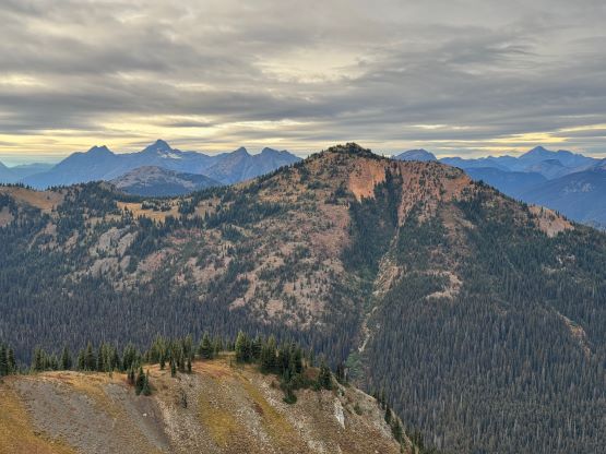
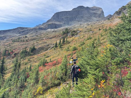
It was then my turn to lead us back across that undulating Hozameen Ridge. I again thought about taking the bypass but decided against it at the very end, so up and over that P100m bump we went. A bit of technical-ish running later we started grunting upwards again, and I thought we surely had gained 100 m in the next stage so I went to the maps and looked for the contour lines. I was hoping that the next bump could be another P100m objective. I was not correct after consulting with the Peakbagger app, but I was not far off. This one boasts 96 m prominence so for the Americans (using P300 feet as the cut-off) it would still count, so I must log it. My legs were already giving me troubles but I ignored the pain and led us running all the way down to Movich Camp where we took the next break. It was about 1 pm so I ate an entire sandwich but was still hungry afterwards. I thought I had brought too much food but I was not correct. We had already decided to bag all of the peaks in one batch of grab so the next section would be the grueling 400 m gain to the summit of Red Mountain. This is the highest in the area boasting over 300 m prominence, and required fair amount of detouring off-trail. Trevor led the bushwhacking upwards onto the SW Ridge but then we had to make some annoying side-hilling to traverse around a few bumps. The final grunt up the SW Ridge took forever that I was thoroughly beat by the time I slogged to the summit. I was the last to reach this summit and that was not very normal for me.


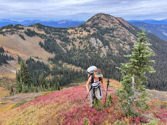
At this point I was committed to finish the project so I would push onward to tag Lone Goat and Snow Camp with or without the pain. I was thankfully still able to run most of the downhills and Alex found a better way traversing down to Red/Lone Goat saddle. The traverse involved more steep side-hilling on grass but had minimal elevation regain. The NW Ridge of Lone Goat might be the hardest route on this peak and was a 150 m straight up ascent on 40-degree grass. I thought this route would not be doable in the early morning hours due to the frost so we were definitely lucky to be here at the warmest time of a day. After taking another much-needed break on the top we jogged down the east ridge to finally rejoin the Skyline trail. Francis, Alex and Trevor had already climbed Snow Camp Mtn. years ago so they decided to skip it. I told Francis to go ahead to get home earlier whereas Erica and I must carry on to tag the last peak. We mostly used Matt’s route up the steep south side and took another long break on the summit. It was getting to that “golden hour” so the scenery was actually improving. I also needed to really stretch my legs as the muscles and tentons were able to give up. Erica needed to switch her shoes back to the runners after we got down into the forest so I took that as another oppourtunity to take another long break stretching the legs. We did not push too hard on the final 8 km plod back to the parking lot but we still jogged a good portion of the downhills, finishing the round trip in under 14 hours, covering 44 km and 2800 m gain according to the Gaia app, which is known to underestimate the stats. The others had already gone by the time we got back to the trail-head and I was too tired and hungry to go anywhere. Thankfully Erica and I had come prepared with rice and curries so we made our own food and then drove home afterwards. The “short drive” was a nice change for us and I even got back home well before midnight.