Hibox Mountain
October 18, 2024
1996m
Snoqualmie Pass, WA
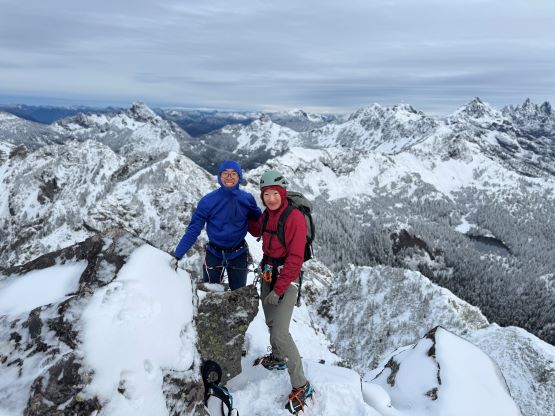
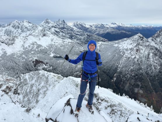
Hibox Mountain is the highest peak on the rugged Box Ridge and itself is a fairly popular 3rd class scramble not far from Snoqualmie Pass. I had been seeing this objective fair regularly on the social media over the past several years but it never sounded too exciting. I almost pulled the trigger a couple weeks ago but changed my mind to some obscured peaks near Washington Pass at the last minute. On the other hand, the scramble could be more exciting in the “shoulder season” conditions. The weather for this past Friday was terrible everywhere except for the far south-east and only in the early morning hours, so I finally decided to go for Hibox Mountain. The recent dump of snow meant we would be hauling mixed climbing gears. I honestly was not expecting to use them but the amount of accumulated snow was more than I thought, that we ended up using most, if not all of the gears. As usual Erica would accompany me on the Friday’s outings but Kostya also decided to come along at the last minute. Kostya had to drive out separately as he had some other commitments in Seattle area later in the day.
Erica and I would be car camping as usual and we left White Rock at 9 pm. Unlike the previous Friday I did remember to bring my NEXUS card this time so we no longer had to make that hour-long detour to grab them from my parent’s house in north Surrey. The drive southwards was uneventful and we arrived at the trail-head before 1 am. The last stretch of the access road was unpaved but the Washingtonians knew how to maintain their backroads. I was able to easily cruise at 40 km/h in the Corolla and that is not something one could expect in Canada. Unfortunately as a Canadian we must accept the fact that our government is either poor, or does not want to spend money on the infrastructure. Kostya arrived somewhere around 3 am and the planned starting time was 5:30 am. I did not get much sleep if any. I was tempted to turn off the alarms but I also knew the only chance of getting some views was in the early morning, so we must execute this trip as planned. No sleep, no problem.

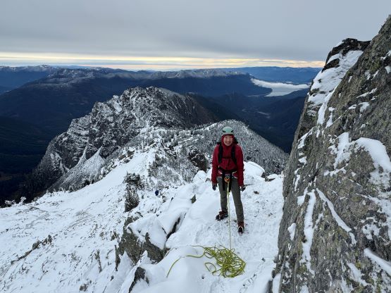
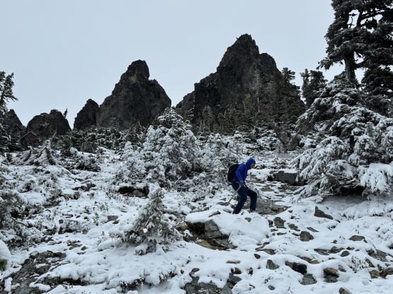
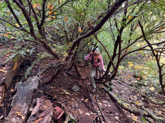
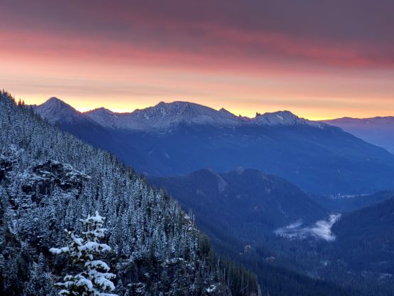
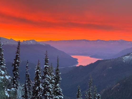
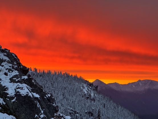
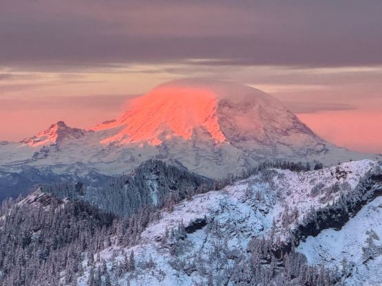
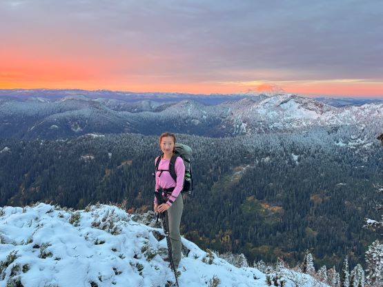
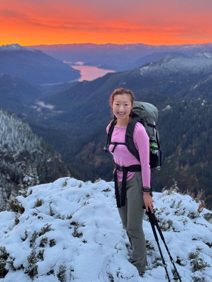
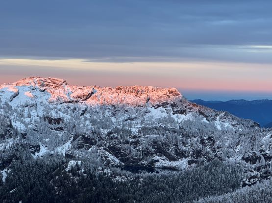
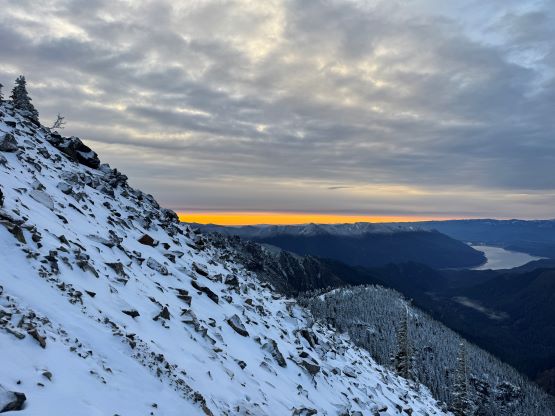
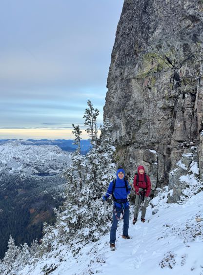
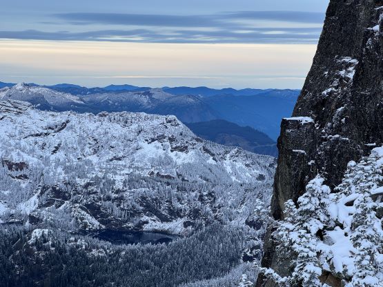
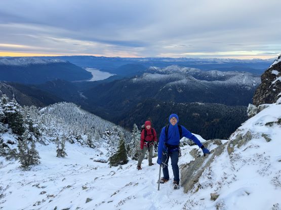
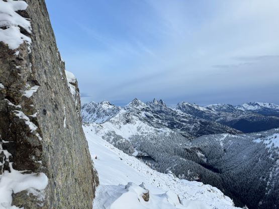
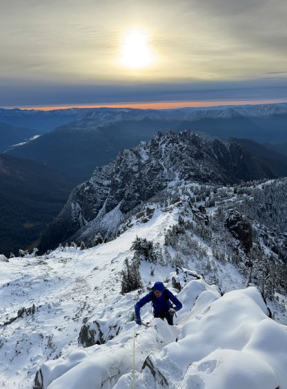
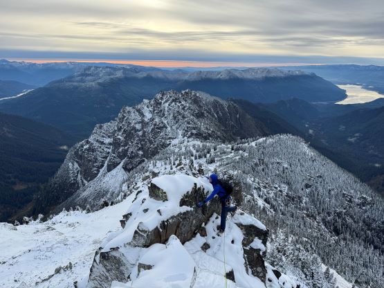
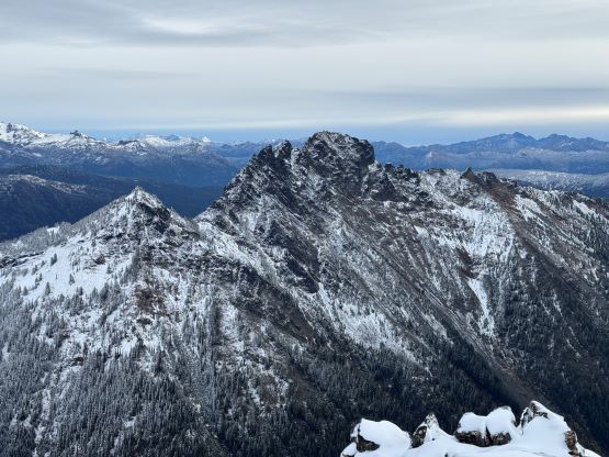
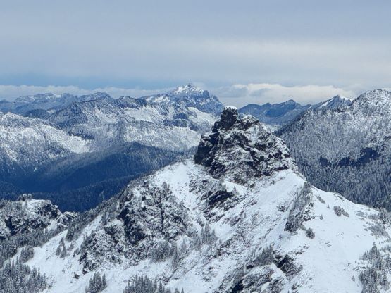
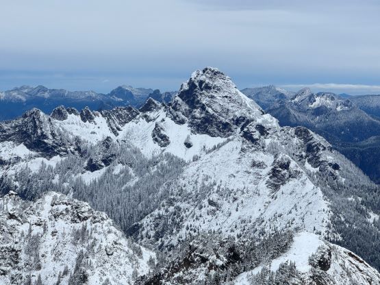
I made Erica to carry the rack and Kostya to carry the 30 m rope and then we dashed up the Rachel Lake trail. I led the way and I was able to maintain the ~5 km/h pace up this boring valley. The trail was wet and muddy and there were several annoying downed trees, so we couldn’t cruise at the maximum pace. I also had to pay extremely close attention to the climber’s trail turn-off as it’s not marked nor obvious. It was still pitch dark when we turned onto this climber’s trail and this trail was in a poor shape. Without very carefully tracing the existing GPX tracks it was nearly impossible to stay on route. We thankfully only made one mistake but quickly corrected it by some frustrating backtracking. The correct route started to traverse towards climber’s right but there were many misleading branches that quickly turned into bushwhacking. At around 1400 m the terrain finally opened up so we got some glimpses of views towards the east. There were numerous scrambling sections. It was also here that we started to encounter icy patches and accumulated snow, but the snow depth did not increase until basically underneath the summit block. We were able to wear the trail-runners all the way to under the south face of the summit but in retrospect we should have swapped the footwear earlier. We did get that amazing sunrise horizon thank to my insist on starting early.

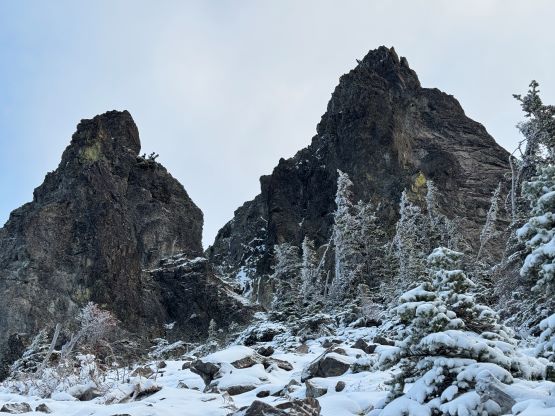
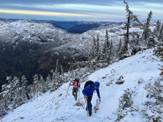
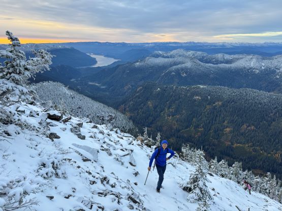
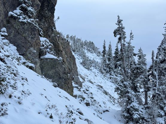
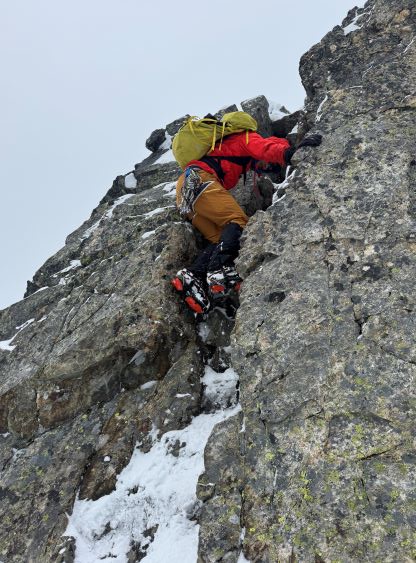
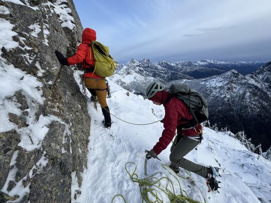
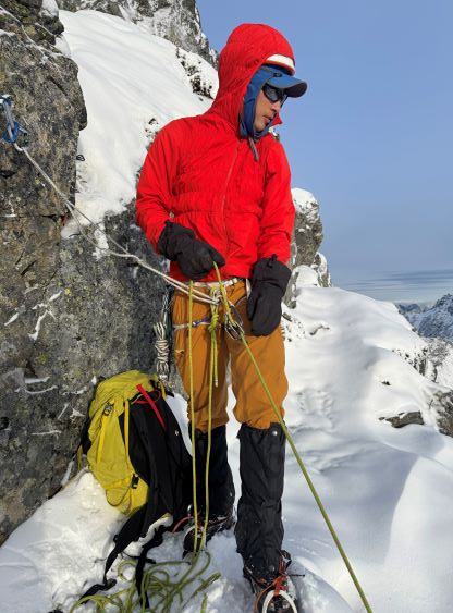
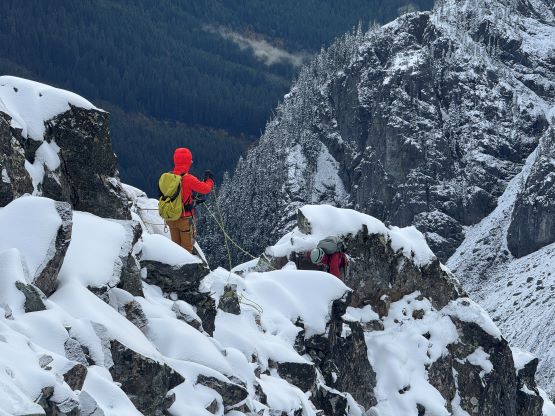
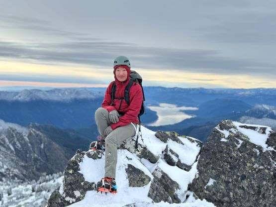
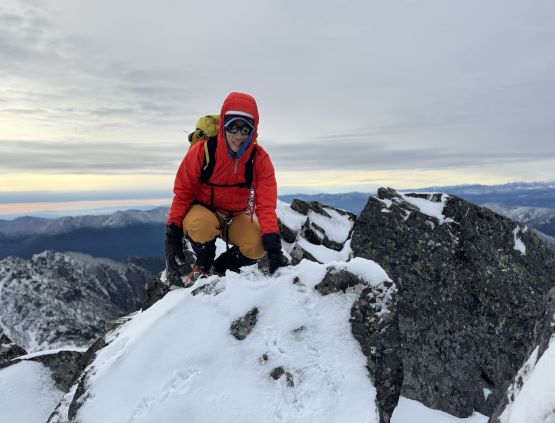
I eventually called for the swap of footwear and the stop was a cold one as we were all sweating like pigs. Our pace had been mostly furious on this steep ascent but again, the views made the cruel grunt worthwhile. While changing footwear I also decided for us to might as well don harness and crampons. I was still not anticipating to use them, but at least it would look better on the photos. Erica was the one who did the research and warned me against the couple tempting gullies on the south face. I followed her advice and led us traversing all the way onto the east ridge. There was about 15 cm of snow accumulation on the ridge (more than I thought) so after seeing the out-of-shaped crux chimney I made the decision to pitch it out. I had brought five cams and a couple slings and that was sufficient to do the climb in two 30 m pitches. Kostya was more comfortable and did not need a belay, but Erica happily accepted my belays as this was her first time wearing crampons on a rock scramble. Given the conditions the route felt like legitimate “4th class” to me. The true summit was then tagged but the stay was short thank to our lack of preparation for the winter weather.


On the descent Kostya went ahead and simply scrambled down without using the rope but Erica took my belays. I was not keen on leaving anything on the mountain so I made Erica to pull the rope from below and I down-climbed the route afterwards. We then removed the crampons and Erica and I kept our mountaineering boots all the way until running out of snow. Kostya only had one pair of footwear but he felt confident on this kind of conditions in just the trail shoes. The rest of the descent off this steep climber’s trail was not very fun even after switching to the runners, as the terrain was slippery and the route was confusing. We got off route again and did some terrible bushwhacking to correct the mistake. The vegetation was extremely wet thank to the recent saturated weather. After getting back to Rachel Lake trail we started jogging but I’m not nearly a trail-runner compared to the rest of us. I eventually gave up on running and I knew Kostya wanted to race with Erica as I had told both of them that they were the two fastest runners I’ve hike with. I made them to go ahead on the final kilometer but Erica was more keen on staying with me than racing, so the “result” would have to wait. Our round trip time was 6 hours but not a lot of that was the actual “moving time”. The rain came minutes after we got back to the trail-head so the timing could not be better. We then drove into the city of Seattle for lunch and a couple hours of shopping before embracing the horrendous Friday afternoon traffics.