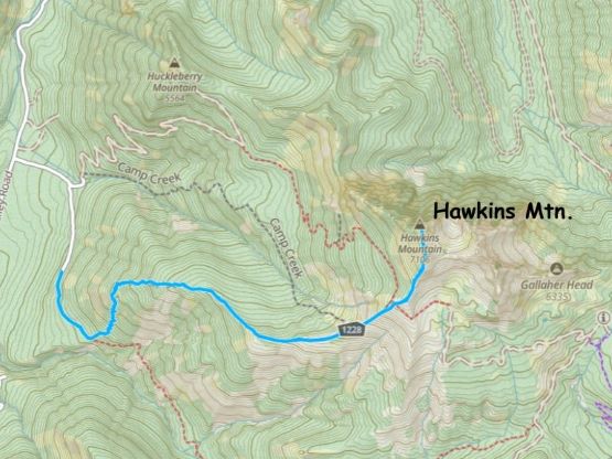
Hawkins Mountain
November 12, 2023
2182m
Cle Elum, WA
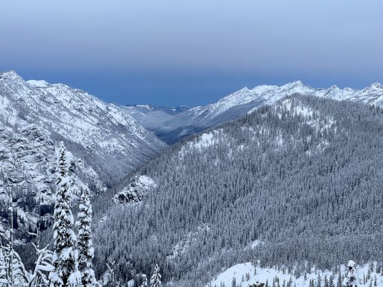
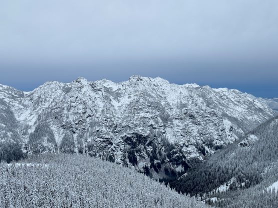
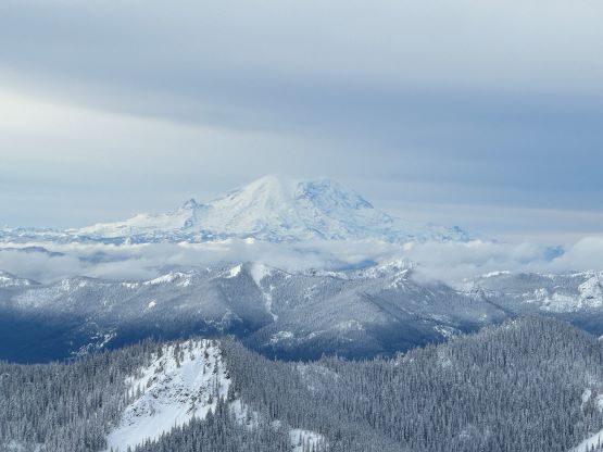
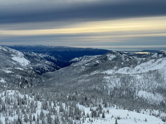
Hawkins Mtn. is a fairly major summit in the “SE Cascades”, boasting over 400 m prominence between Cle Elum River and the familiar peaks in the Teanaway area. A trail goes up from Cle Elum River side and the only required scrambling is between the false and the true summits. The access is not maintained in winter so there’s few ascent done in winter, if any, but I figured the peak should be easy enough to do on snowshoes. November is an ideal time as the road’s still free of snow. There was up to 60 cm of new snow reported in the treeline and alpine of various areas. I decided at the very last minute to do Hawkins Mtn. mostly to take advantage of the snow-free access road. In a few more weeks this area would no longer be accessible without a snowmobile. This objective was harder than expected thank to the unconsolidated snow and the extreme ridgetop wind. It turned out to be a full on winter mountaineering trip.
Kate and I left White Rock at around 7:45 pm on Saturday and cruised down the familiar I-5 corridor and then eastwards up I-90 to near Cle Elum. The weather was mostly cloudy as forecasted, but it was raining quite heavily near Snoqualmie Pass. Once entering the village of Roslyn the rain stopped but I immediately got my second ever speed ticket. Oddly for both times I was caught in a small town as I was not paying attention to the supposed slow-down. I had never been caught speeding on freeways as I simply do not speed while driving already fast. The roads in Cle Elum River valley are paved all the way to Salmon la Sac Campground and beyond the end of pavement I turned onto the narrower forestry roads. I had driven this road all the way to Mt. Daniel’s trail-head in 2017 and this time I only needed to drive 1/3 of the total distance. I turned right at the unsigned Camp Creek Road turn-off and drove us all the way to the trail-head. The 2WD vehicles would have to park 1 km earlier at the first fork. These spur roads were high enough (~1000 m elevation) that there’s already a coat of fresh snow on the ground, but did not impose any problem to the Tacoma with 4WD and all terrain tires. The trail-head was not spacious enough to accommodate multiple parties but we had the whole place to ourselves so we easily found flat ground to pitch the tent for a few hours of sleep.

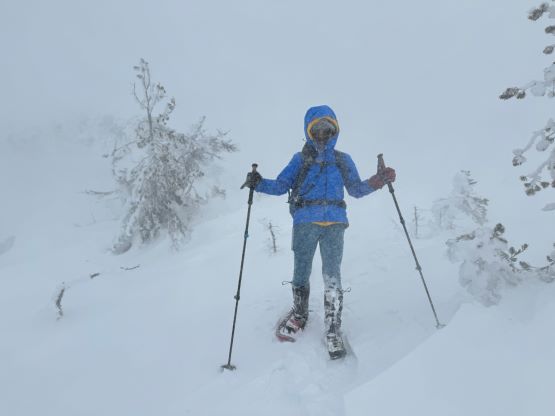
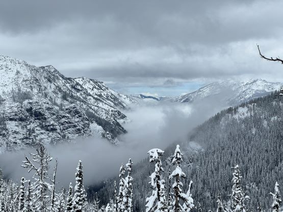
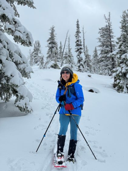
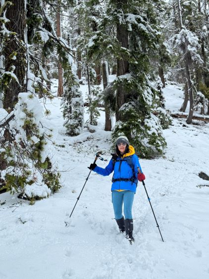
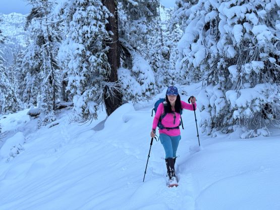
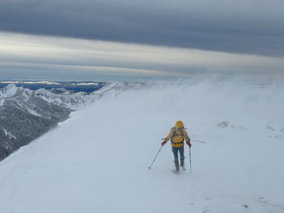
I insisted for us to wake up at 4:20 am in hope for better views in the morning. My trusted forecast models all predicted a clearing trend in the morning. While this trend was correct, the morning weather was still not as good as I was hoping for. It turned out to be completely overcast for the entire day but the clouds were higher and thinner in the morning. The first hour was hiked using head-lamps and the post-holing started immediately after leaving the main trail. I did not bother to figure out the names of these trails as I was just following the trails on the Gaia map. That turn-off was unsigned and not obvious, but I had a habit to check the GPS screen frequently so didn’t miss it. The trail then ascended steeply onto the broad ridge on the divide between Camp and Big Boulder Creeks. There was no existing track and the snow was deep enough (about a foot) that it was no longer possible nor practical to stay on the trail, so we donned snowshoes and started plodding straight up this forested ridge. We did not encounter any notable bushwhacking but the post-holing was brutal. The snowshoes could not provide enough flotation that we basically sank to the ground no matter how deep the snow was. This was because the entire snowpack was laid by one single dump and this was the first day after the precipitation so there’s not enough time for consolidation. We nevertheless plodded to the treeline and were surprised to be welcomed by some fierce ridge-top winds, which was again not in the forecasts. Instead of a pleasant, partly sunny morning all we got was clouds and cold winds. The winds were madly transporting the fresh snow and this was shaping to be a miserable day ahead in the alpine.

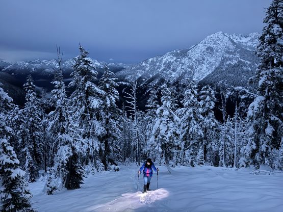


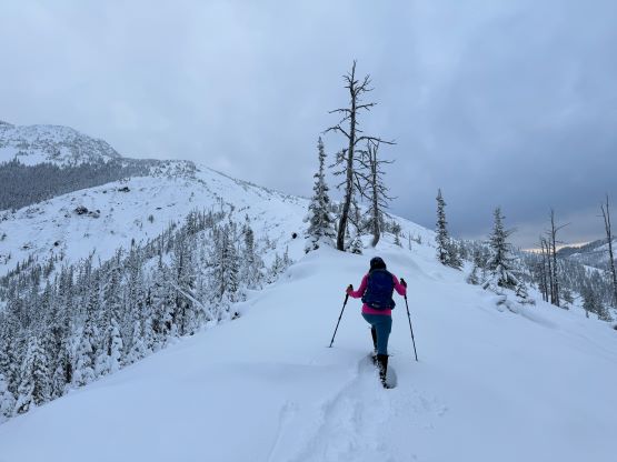
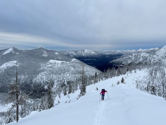

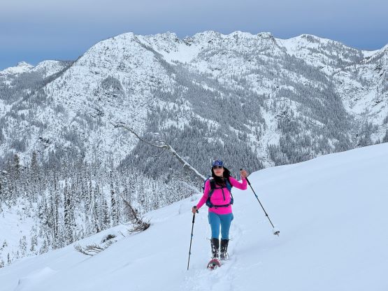

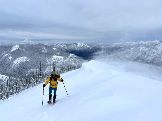
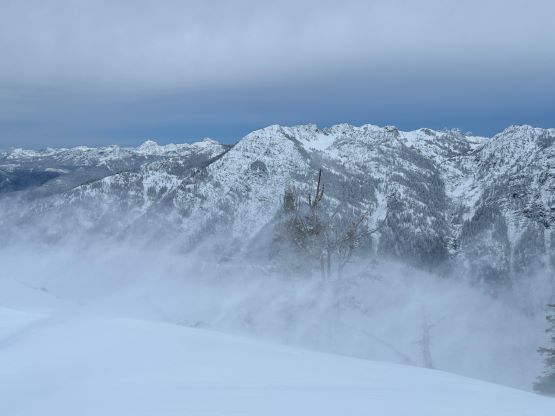
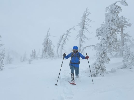
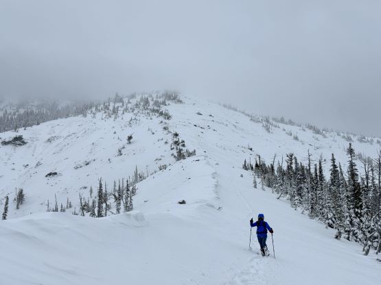
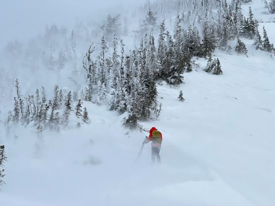
Neither Kate nor I were dressed properly for the 60 km/h winds carrying fresh snow. I did bring enough layers but I did not bring a balaclava nor ski goggles. We plodded into the misery nevertheless and in short time we stopped to don all layers. I started to lead at a snail’s pace because of the lack of visibility and the post-holing, and it’s also important to not sweat too much. Somewhere around 1950 m we found a sheltered spot and I immediately called for a break despite that none of us was feeling hungry. This would be our only spot to eat or drink anything due to the miserable weather ahead, so we must take this oppourtunity. At the same time Kate noticed that she had lost a snowshoe somehow. We descended for about 50 meters but our tracks were already eliminated, and without a shovel I determined that it’s not possible to find that snowshoe, even if we knew where it could roughly be. At this rate this was shaping to be an expensive trip. Despite that, we had to make the summit so we went upwards again. The worst winds were encountered after gaining the south ridge of Hawkins Mtn., that we were starting to lose balance. There were also enough snow that it was no longer practical to use only 1 snowshoe as even with 2 snowshoes I was sinking to knee deep at times. We decided that the best thing was for Kate to find a sheltered spot in a cluster of trees to wait for me tagging the summit.


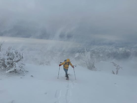
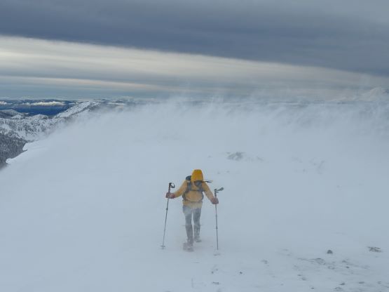

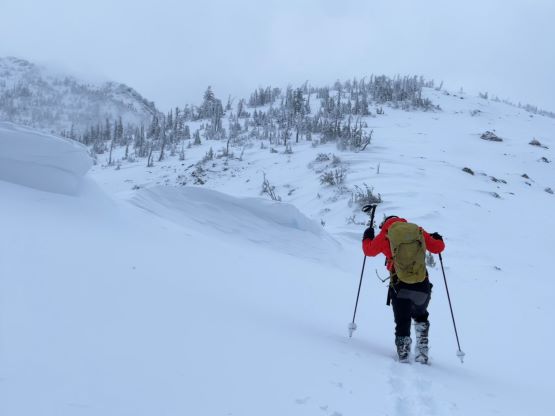
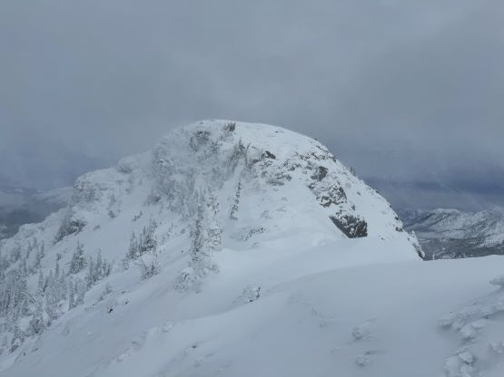
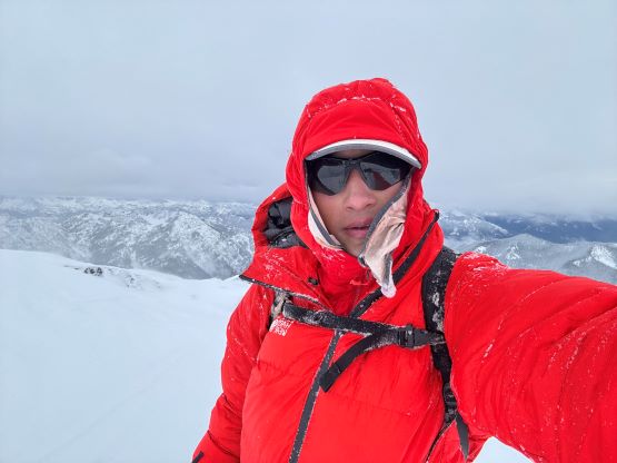
Little did I know that the final summit push would require another hour due to the worsening weather and conditions. The visibility was mostly zero and I had to clean the snow off my sunglasses for every 20 seconds as otherwise I could not even see the immediate ground ahead. The navigation was mostly by the small trees and the exposed rocks on the ridge. It had been a while since I got caught in weather like this. I bypassed the false summit on the west side and I continued side-hilling on some very steep terrain (mostly to avoid the worst of the winds) to near the false/true saddle. The true summit appeared daunting and much farther away than I was hoping for, but I was committed at this point. Thankfully the view was deceiving that the traverse actually didn’t take me too long. What appeared to be steep was actually quite mellow and the biggest challenge was still the blowing snow and the lack of visibility. I took some photos and a selfie and immediately started the descent, following the faint tracks that I made. The tracks were already gone at places but I knew where to roughly aim towards. I also needed to check the GPS a few times to confirm the bearing, and I still needed to wipe the sunglasses a couple times per minute, so the process could not be fast.
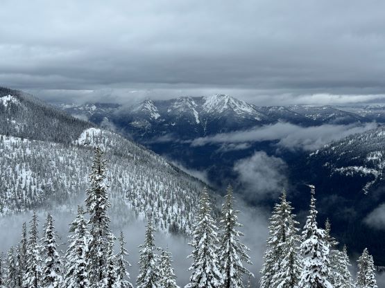
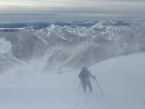
I eventually got back to Kate after being away for 1 hour and 20 minutes and we then immediately descended together. There was no sign of our own tracks but with me leading the navigation wouldn’t be a problem. In about half an hour we exited the misery and the treeline zone was still very calm. This was strange as the only winds we encountered were on the ridge top, and below a certain elevation threshold it was absolutely calm. The descent was complicated by the lost of one of Kate’s snowshoes, but the snow depth was overall not that deep yet, that it was possible to make our own way out by post-holing. There was some struggling, but it wasn’t too bad. We simply followed our own tracks all the way down, and took off the snowshoes at the exact same spot where we donned them in the morning. The round trip time was over 7 hours which was actually not that bad considering the weather and the conditions. While driving us back I decided spontaneously to hike Little Si as the weather was actually fine west of the pass and we still had some daylight time. Most importantly, Kate needed a summit so let’s find something easy.