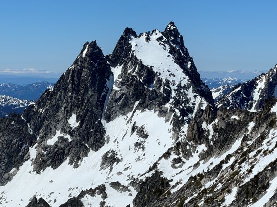
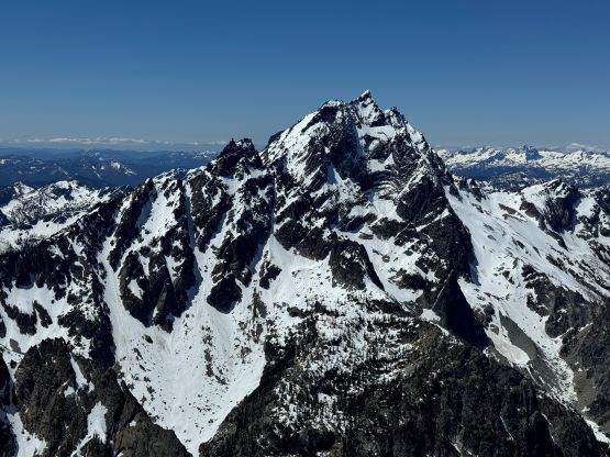
Dragontail Peak and Colchuck Peak
June 5, 2024
2693m
Leavenworth, WA
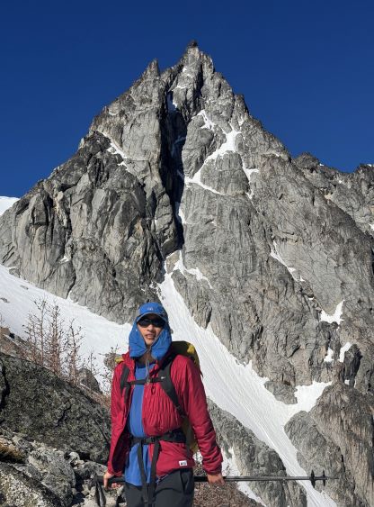
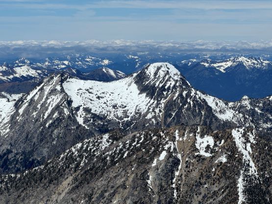
Dragontail Peak and Colchuck Peak are two of the most popular objectives in the core zone of the Enchantments but for some reasons I managed to leave them behind. I had paid two visits into the core zone from Colchuck Lake side and did Enchantment Peak and Prusik Peak respectively. The approach was definitely a slog, but the views made it worthwhile. The connection between Dragontail Peak and Colchuck Peak involves some steep snow at and around the “Pandora’s Box”, and this stretch is considerably harder than the standard routes of each of these peaks. I was looking at a full value day with Erica on Wednesday and eventually decided on these objectives. There was some significant but yet unknown amount of precipitation in the form of snow thank to a cold snap with two atmospheric river events, but the SE Cascades had escaped most of it. The colder temperatures in the morning meant the snow conditions would be prime for climbing, but the day was supposed to warm up quickly. After formulating a plan Erica paid a visit to Vancouver’s MEC and bought me a pair of brand new Petzl Vasak crampons which is quite a bit lighter than the Lynx. This seemed like the perfect trip to test them out. Erica also needed to break into her new mountaineering boots and I suggested her to carry them in while wearing trail-runners on the approach and this was what I would do as well.
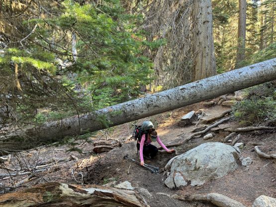
Due to the various commitments in the city including the need to grab some food in Subway we did not leave home until almost 9 pm which was a tad bit later than anticipated. I was able to keep driving but we did not get to the trail-head until 1 am, and the planned wake-up time was 3:30 am. I hastily set up the tent for us and I honestly didn’t think I managed to get much sleep at all. I decided instantly that we should sleep in for another hour by the time the alarm went off, so after all of the “morning routine” we did not start the approach until it was already bright enough to not require the use of head-lamps. We opted to carry the snowshoes which turned out to become training weight, and if the condition was not favourable we also had Little Annapurna there as a “Plan B” to salvage the day. I did throw in a spare ice axe at the last minute (so 3 ice axes between us), which turned out to be actually useful.
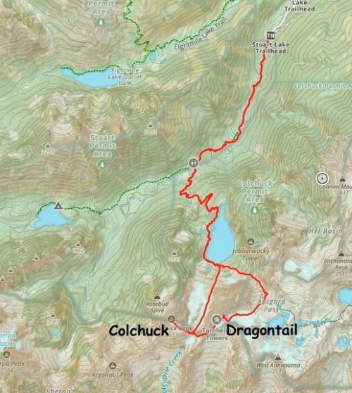
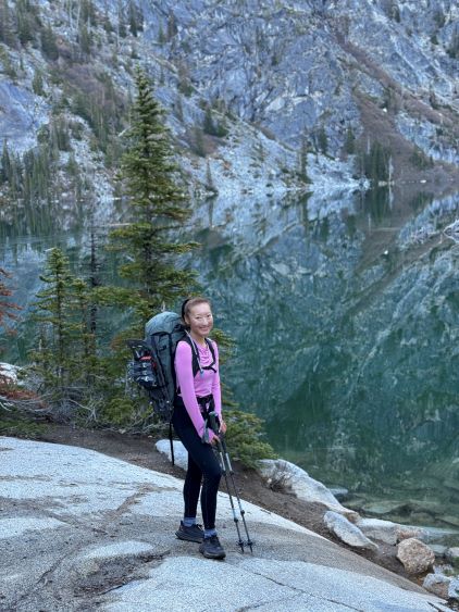
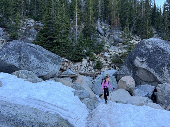
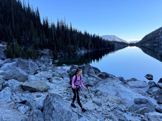
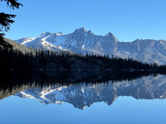
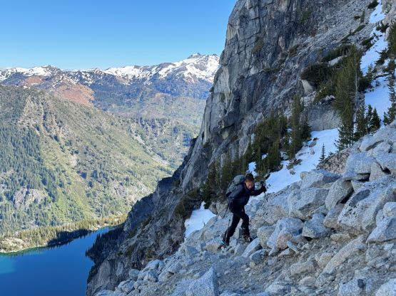
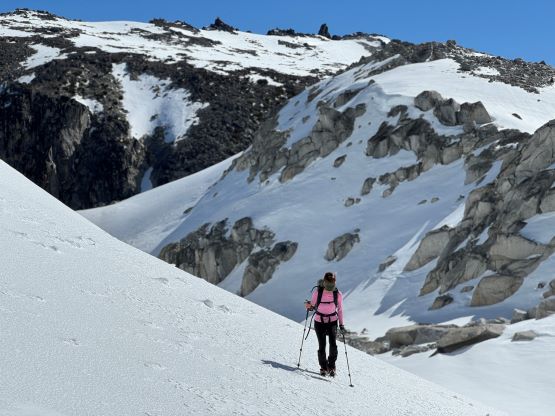
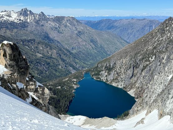
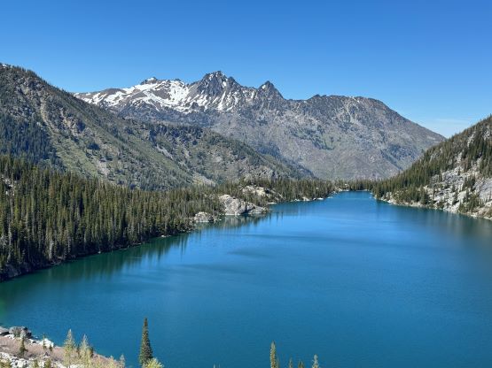
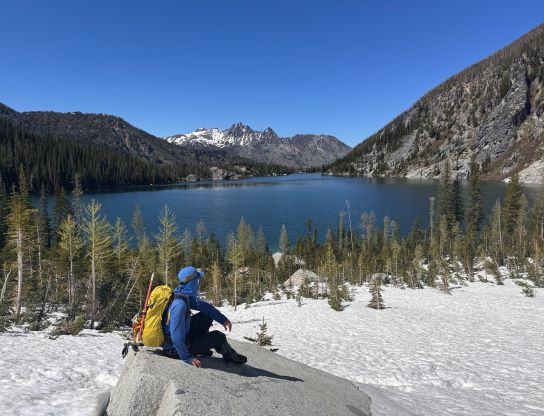
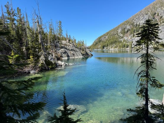
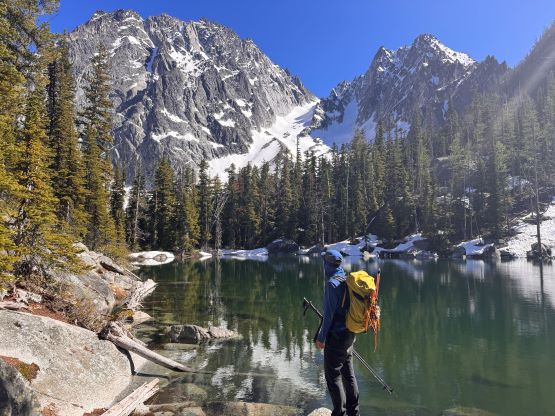
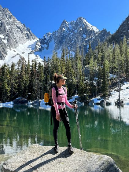
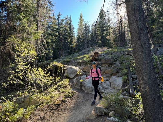
It seemed to me that no matter how fast I pushed on the approach hike Erica was always right on my heels so we dashed up that boring trail rather quickly, arriving at Colchuck Lake in about an hour and half. I probably could have done it slower so we didn’t have to sweat that much. After seeing the peaks in our own eyes we decided to ditch the snowshoes but if the tourists saw my 400-dollar brand new Lighting Ascents they would take them, so we did a bit of bushwhacking so hide them behind a creek and a rather large boulder. The approach around the lake had a lot of undulating terrain but I knew that based on the previous experience, and the boulder field on the south side of the lake was only partially covered in snow. The snow was icy in the morning, so the going was straightforward but eventually we stopped for the second batch of gears dump – ditching the trail-runners and donning mountaineering boots. I wasn’t too sure about the availability of water sources up high so we loaded up our water carrying capacity at the bottom of the foreshortened slog up towards Aasgard Pass, and sure enough 15 minutes later half of Erica’s water leaked. It did not seem feasible to patch her bladder so we would only have a liter and half of water between the two of us, which was questionable but probably doable. While slogging up towards the pass we both donned our brand new Vasak crampons and I was generally satisfied about the performance. The crampons were worn all the way up to the pass, and to my relief we found a running source of water and took another long break there in the sun.
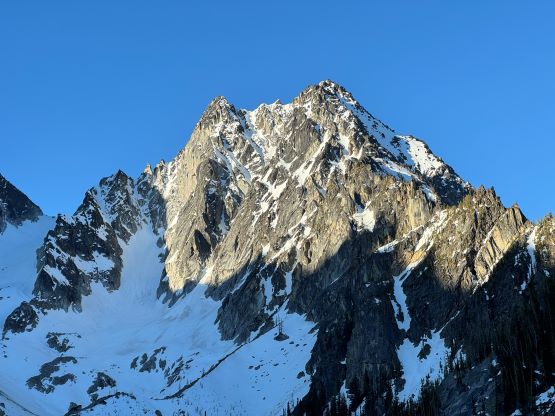
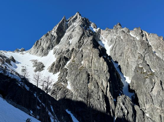
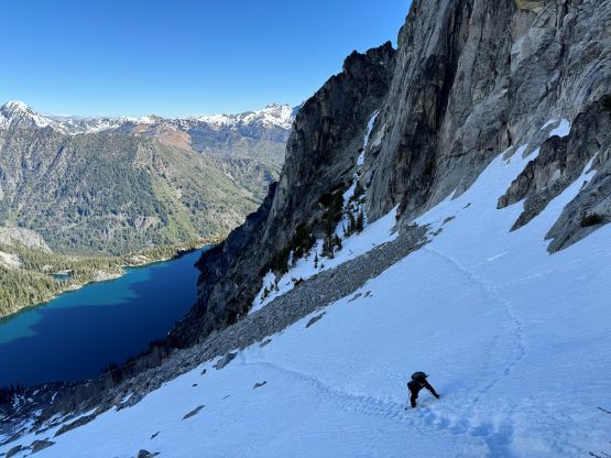
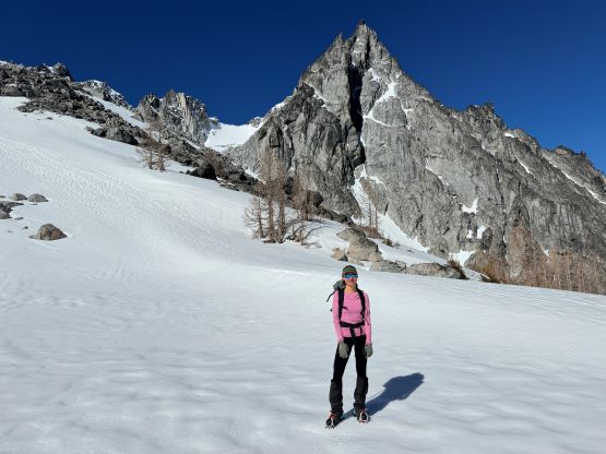
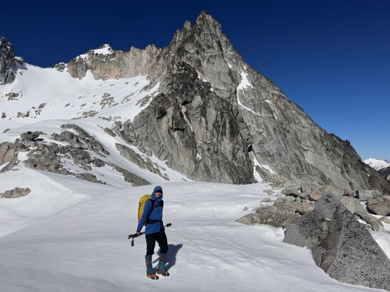
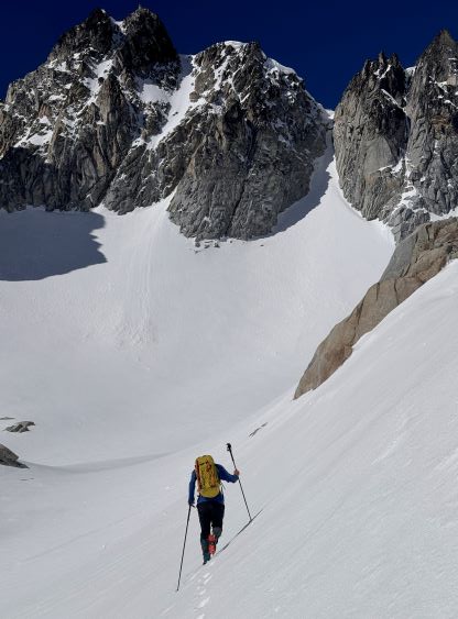
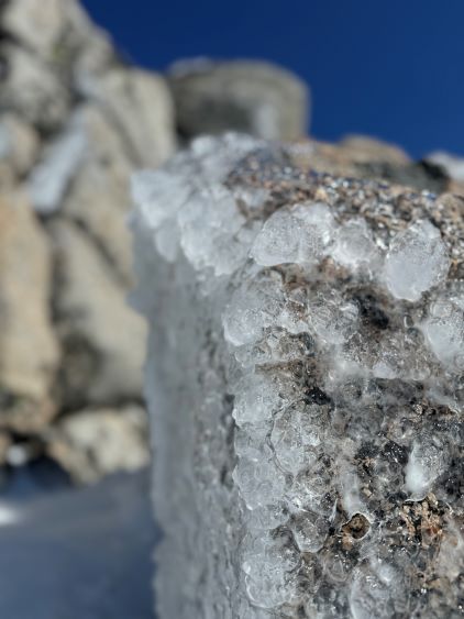
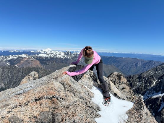
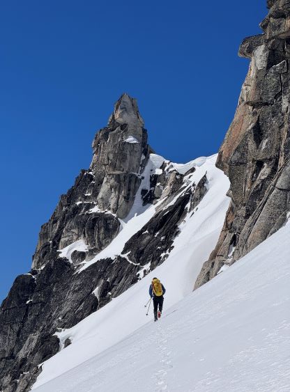
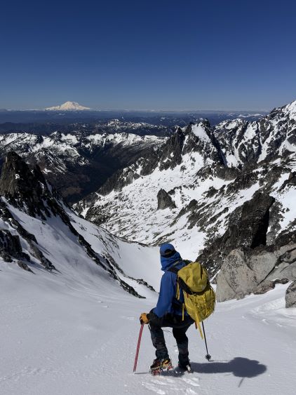
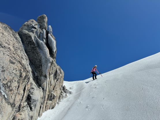
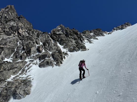
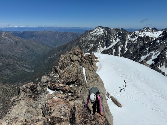
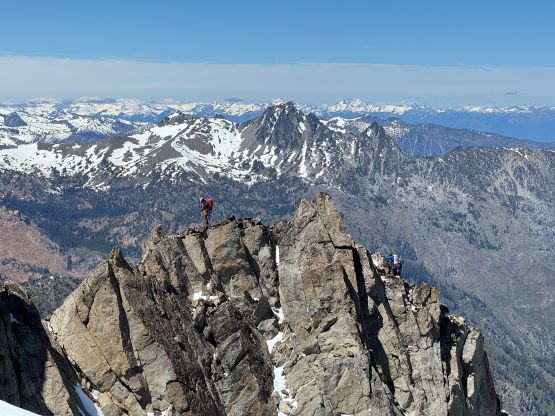
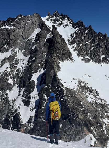
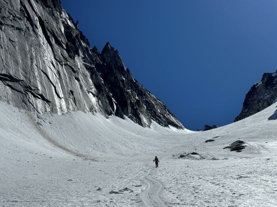
There was another steep rise to actually top out at Aasgard Pass and then it’s time to tackle our first objective. There was not obvious foot prints heading up the standard route of Dragontail Peak which was to our surprise, so we mostly picked our own way. I thought the route-finding must be straightforward and did not even bother to download a GPX track. Instead of following the dotted lines on the Gaia map which is the summer route I led us traversing to that pocket east side glacier. The condition softened up quickly but not to the point to raise any safety concern. Erica then took over the lead breaking trail all the way to that steep pitch under Dragontail Peak’s SE Ridge. I was struggling to keep up from behind as I made additional post-holing on top of Erica’s track from time to time. That steep pitch was indeed very steep and involved a “snow mantle” on 55+ degrees terrain but only for a meter or two. Both of us did not even bother to take the ice axe out and just used our fingers for added traction. The rest of the ascent via the standard route was straightforward with lots of cool verglass scenery thank to the recent precipitation. I was glad that we didn’t have to do much scrambling on rock as that would otherwise not be very feasible.
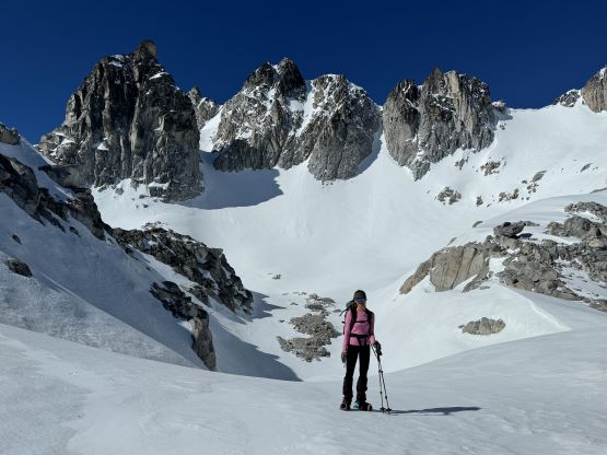
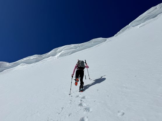
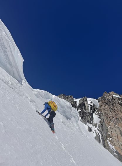
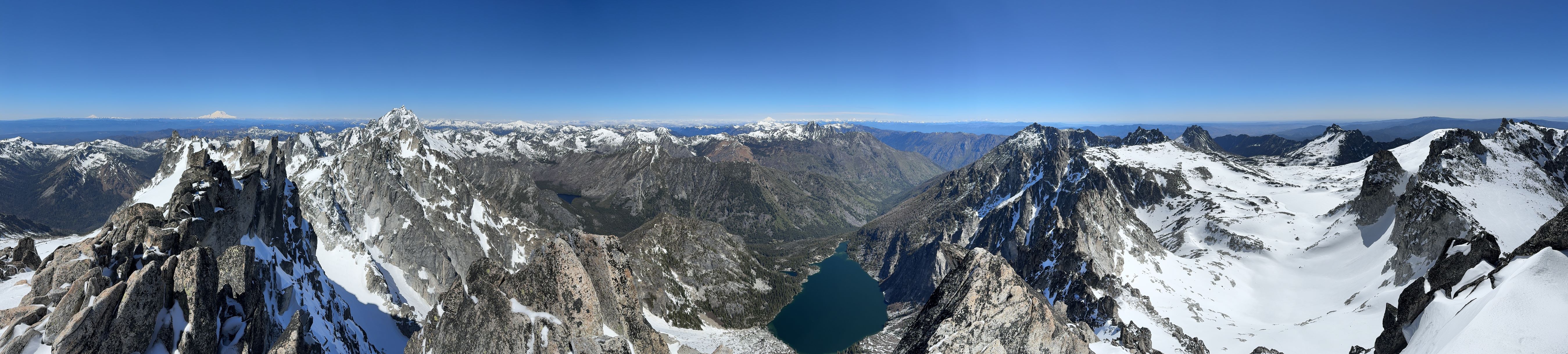
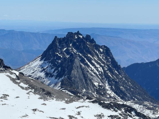
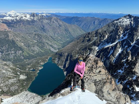
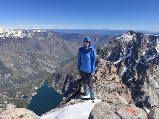
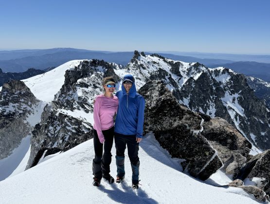
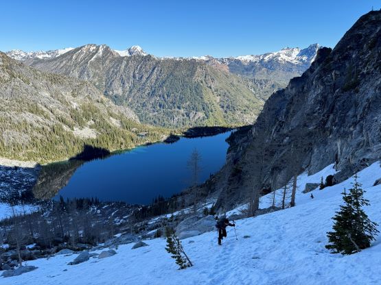
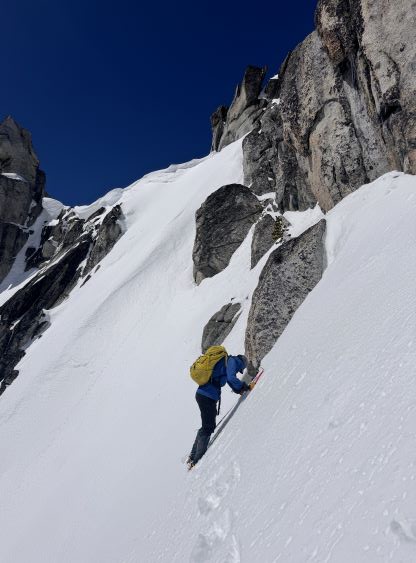
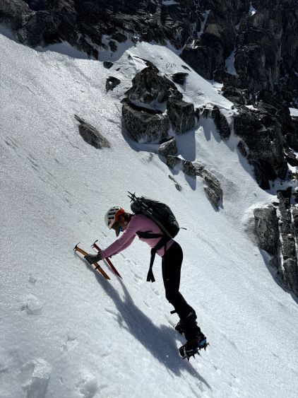
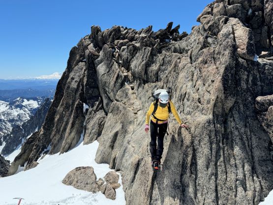
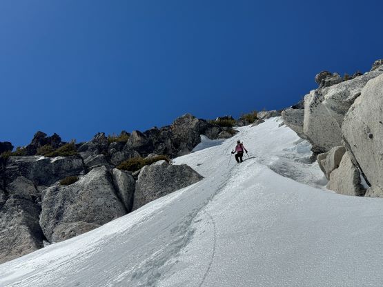
The traverse to the base of Pandora’s Box appeared steep and committing so we didn’t linger too long on the summit of Dragontail Peak. The slope had been baked by the hot sunrays by at least a couple hours and I was keen to get over with it as quickly as possible. While traversing there we made numerous thigh-deep post-holes and that made me wanting to further speed things up. Thankfully the steep climb was very short and there was only a few moves on rotten snow that made me pause a bit for safety concern. The bottom half of the pitch was actually still very firm. I gave both my helmet and the second ice axe to Erica and then easily led the way up. I did not bring a rope in this trip so it was a good practice for Erica on steep snow climbing and I thought she did it very well. I thought we had done the crux of the trip but the descent off the SW side of Pandora’s Box was not trivial. Contrary to the east facing slopes the west side was still very icy. It would not be possible to arrest a fall in this kind of conditions so we had to be extremely careful as the runout was quite long. After gingerly making some slow but steady progress we found a neat ledge to sit on while taking an almost-an-hour break for the sun to soften the snowpack. The condition only improved marginally so we took another break at another “rock island” but eventually made down to Banshee Pass (Colchuck/Dragontail col).
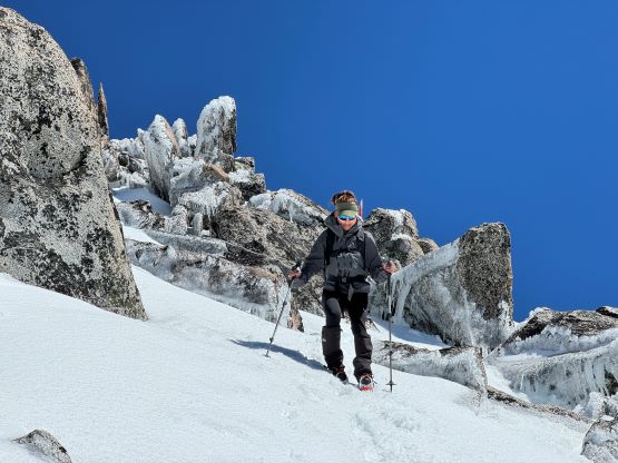
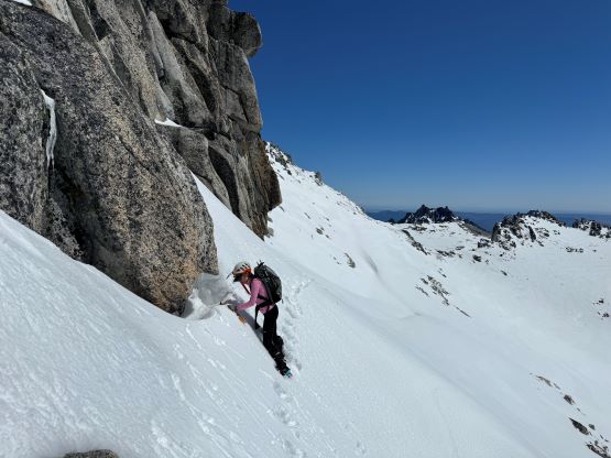
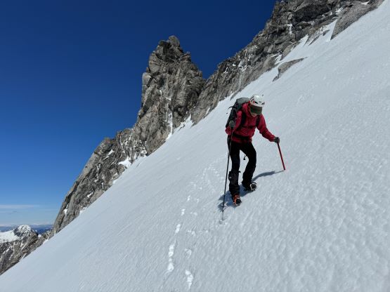
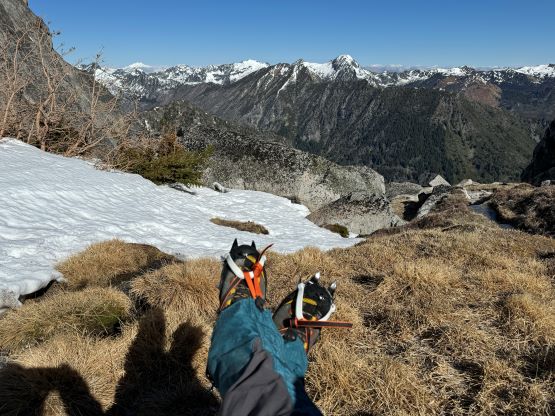
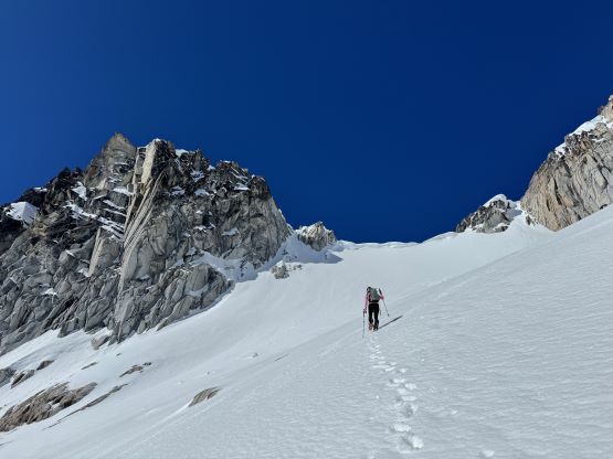
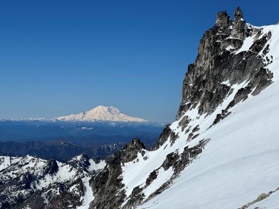
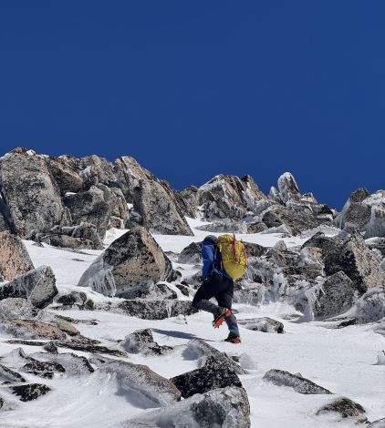
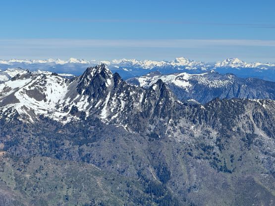
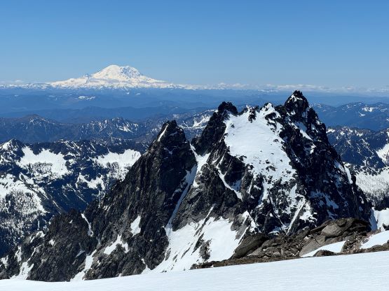
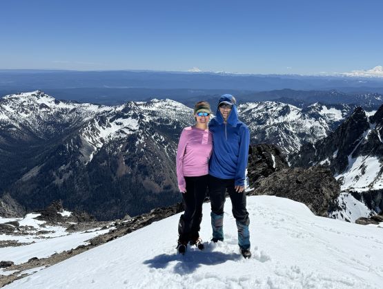
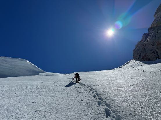
There was again, no visible track on Colchuck Peak so we made our own postholes up the lower SE Face. This section was steeper than I thought but the snow was already very soft making some easy climbing conditions. I did use an ice axe on the ascent but stored both the axe and crampons later on the way down. There were at least two steep 40-degree constraints to take note of but maybe that’s because we didn’t spend enough time to find the “easiest possible way”. The upper route was fairly flat with views of Argonaut Peak stealing the show to the south, and to reach the highest point we had to make a few scrambling moves with crampons on.
After another lengthy summit stay we finally decided to go down, and then we observed three climbers on their way up one of the north side routes. They were about 2 pitches from topping out so they would have even softer snow conditions on the descent. In any case I didn’t even need to use crampons and just slipped and postholed back to Colchuck/Dragontail col. The descent off Colchuck Glacier involved a mix of glissading, boot-skiing and plunging and was extremely fun thank to the soft snow. I was looking forward to this part of the trip and that’s also one reason why we decided to do the loop in the clockwise direction. We made a single dash down to near the shore of Colchuck Lake, took another break and then picked up the ditched trail runners. Traversing back around the south shore was now very tedious thank to the unexpected (or expected) postholes in the boulder fields, so we took our time there. The waterlogged boots were then swapped for the dry runners but I had forgotten to bring a pair of spare socks. Thankfully Erica offered a pair of hers so I was able to do the rest of the hike-out in dry feet. The plodding back to the trail-head was long and tiring but was actually not that bad.
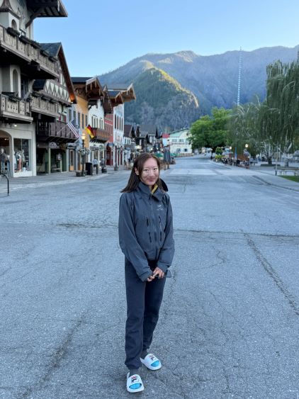
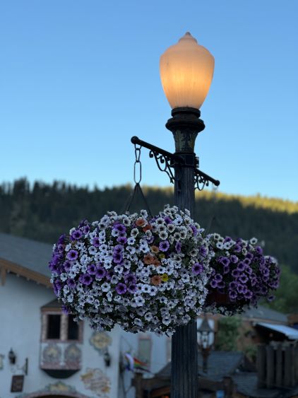
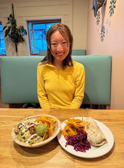
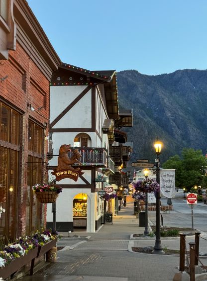
Our round trip time was 13.5 hours but of which 6 hours were the “stopped time” according to my Gaia GPS app. We were only about half an hour away from Leavenworth so I immediately turned on the engine and drove us down there. Erica had some fond memories about this little village and I was not in any hurry to go home so we spent the next couple hours exploring the pedestrian street in the town. I had visited the area multiple times in the past but never made a single stop in the town, and I was very glad to have seen something different this time. Erica did have to get home eventually because of her trip to the island on the following day, so I eventually drove us back at 3:30 am in the morning. I did have to stop 3 times for napping and I was still dead exhausted afterwards.