Dirtyface Peak
June 16, 2024
1902m
Lake Wenatchee, WA
Dirtyface Peak is the highest point of the large massif that looms above the north side of Lake Wenatchee and boasts over 1000 m prominence as the ridge system is detached from the rest of the range. The “lookout site” on the SE end of the ridge is a popular hiking destination, but that’s nowhere close to the true summit. Only the die-hard peak-baggers would dare to make the lengthy and contrived traverse to the true summit and back, and fair amount of unpleasant terrain needs to be covered. The east peak (second-to-last “false summit”) has a benchmark on the summit and is only a few meters lower, but still boasts over 100 m prominence so my plan was to grab both summits in one go. Erica and I were in the area recently doing Mt. David with Matt J. so we were aware of the current conditions, that the snowshoes were definitely not needed anymore. We made the plan to go back to the area at the last minute only because of the weather. Elsewhere in BC and WA were supposed to be rainy and miserable and the only spot with some chances of seeing sun rays was the rainshadow zone of the “SE Cascades”.
I was able to get off work fairly early on Saturday at around 6:30 pm so I invited Erica to have hotpot dinner with me before starting the 4-hour drive southwards. This decision was made at the very last minute so I had to make a hasty visit to T&T Supermarket in the early morning, and after a busy day Erica showed up at 7:30 pm and the meal was ready shortly after. This was Erica’s first hotpot in years and I was glad that she enjoyed it. We eventually left home at 9 pm and the drive to the trail-head was a different story. It was pouring cats and dogs from the moment we left I-5 that I had to turn on the fastest level of the wipers for some lengthy periods. The rain gradually turned into wet snow as we gained elevation towards Stevens Pass. A lot of vehicles were pulled over for the night but I had experience in dealing with this kind of situation since I was 19 so I crawled us over the pass in the Corolla with hardly any visibility. The precipitation stopped revealing stars as we descended towards Lake Wenatchee, and we arrived at the trail-head at 1 am. This was one hell of driving experience for both of us, but especially Erica. There was no vehicle around and I hastily pitched the tent for us. The alarms was set at 5:30 am and we both desperately needed some sleep.


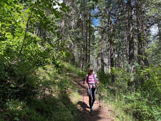
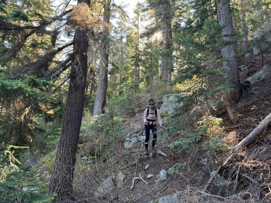
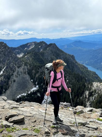
The first stage of this hike was the 1000 m grunt to the NE shoulder on “Dirtyface Lookout” and the trail was well maintained and easy to follow. This was still a slog though thank to the amount of elevation gain. We were in the sun after about half an hour but thankfully the day was decently cold for June’s standard. I do not think Dirtyface Peak would be a great idea in the height of the summer even just because of the aspect of the trail and the heat. We took our first break at the shoulder. My original plan was to ditch the trail-runners for mountaineering boots from this shoulder but the terrain was drier than I thought, and this could be a great oppourtunity to test the off-trail performance of these new Arc’teryx trail shoes so I kept the mountaineering boots in the backpack. The boots ended up staying at the bottom of the pack for the entire day. There were two bowls to traverse across and both required some substantial amount of elevation loss and regain. The first bowl involved some bushwhacking whereas the second bowl had lots of boulder-hopping. When snow covered this route would be cruise sailing on snowshoes but we had to deal with different kinds of unpleasant terrain. We nevertheless made good time to the south ridge of “Dirtyface Benchmark” which is that unnamed east summit mentioned earlier. The plan was to take the bypass on the way in and tag it on the way back.


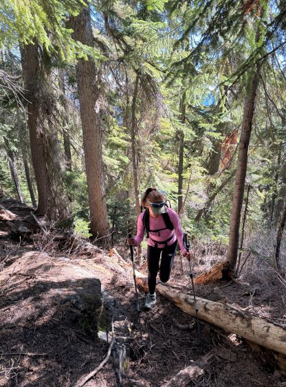
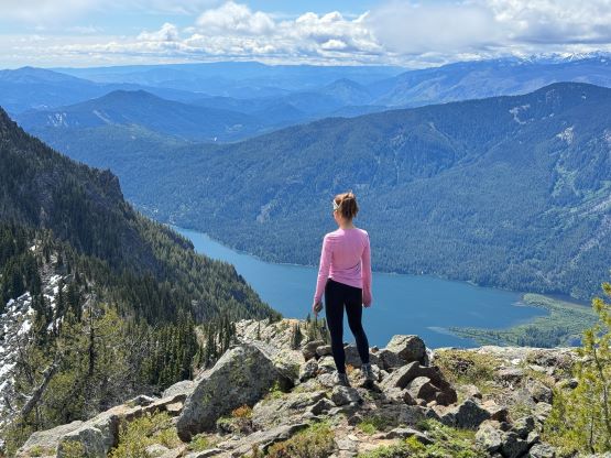
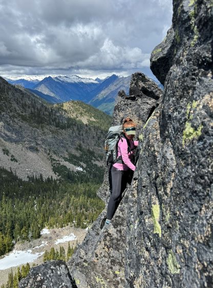
The trail shoes ended up doing reasonably well on both snow and boulders and I do think they are better overall than the Salomon’s that I used to wear. They gave me blisters on Mt. David but not this time, but I also taped my heels this time and that could be the reason. The south face bypass of “Dirtyface Benchmark” was not trivial as the first half had some steep side-hilling on slippery grass and the second half was on some unstable boulders. The final kilometer of the traverse to the true summit was also harder than I thought with more micro-terrain. The ridge crest was generally rugged so we were forced to traverse mostly on the east/north side, and the scrambling was not as straightforward as seen from the topo map. At one point I led us bypassing a bump and ended up having to pull up a 4th class chimney, and after that we moved back to the ridge. The final summit push also involved some 3rd class scrambling but at least the route was reasonably well travelled. The coolest thing was seeing the summit register full of who-is-who in Washington’s peak-bagging community. The other cool thing we did on the summit was to melt snow and cook lunch. I had brought a pack of Korean kimchi noodles and that felt especially good on a chilly day like this.


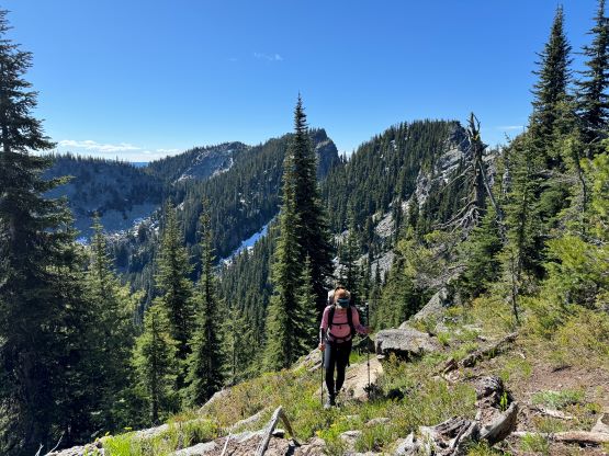
We stayed for well over an hour on the summit to fully soak in the experience, but eventually it was the time to head down. I led us descending as closely to the ridge crest as possible until we were next to the imposing W. Ridge of “Dirtyface Benchmark”. I had done absolutely no research about this bonus objective but I did download a GPX track and the track traversed up and over the bump. We did the same, but the scrambling was quite involved with lots of route-finding and 3rd class terrain with decent exposure. At least one spot that we did qualify being “4th class” and the looseness suggested that this route hadn’t been done often. I had to clean off some holds and the choss just kept cascading down. In any case we were racing with some incoming weather from the north, so did the scramble fairly quickly and then jogged down the easy, grassy SE slopes. We took the next lengthy break at the bottom of the deeper of the two bowls to refill our water bottles.


I was fully prepared to get soaked by a thunderstorm but the weather never reached us. By the time we got back to the “Dirtyface Lookout” east shoulder we could see storms around but it was always sunny above us. Erica then led us running down the trail and I tried hard to keep up but eventually had to slow down and go at my usual pace. Erica’s trail descending pace is one of the two fastest I’ve ever seen (together with Kostya), faster than Matt’s pace so I had absolutely no chance in fully keeping up. About halfway down Erica stopped to treat for some blisters and we descended leisurely and together back to the car afterwards. Our round trip time was 9 hours 20 minutes but one third of which was “stopped time”. Erica then volunteered to drive us back to Everett and I was able to catch some sleep. After a well deserved Thai dinner I drove us back home, arriving in Surrey at 9:30 pm.