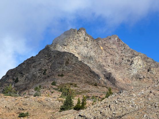
Crater Mountain [WA]
October 3, 2025
2479m
North Cascades Highway, WA
Not to be confused with Crater Mountain south of Keremeos, B.C. that I did back in 2017, this one is in the “heart” of the North Cascades in Washington. This one had been on my radar for at least half a decade but the class 3/4 terrain combined with the road access means it requires a snow-free window, but there were simply way too many other peaks to consider in the summer months. Crater Mountain has also been recently bumped into the “World’s P600m” list thank to the LiDAR surveys. The prominence is however still shy of the 2000 ft mark so the survey only helped the international peak-baggers who prefer the metric system. In any case I finally pulled the trigger on this past Friday taking advantage of the longer-than-usual summer weather and conditions. I was originally planning this trip with Matt J. but my partner got switched to Mark L. and Nico P. at the very last minute.
I had to be back by 7:30 pm for work and Mark also had an evening commitment at 7 pm so we had to be fast and efficient. Mark and Nico picked me up at 5 am as planned and we dashed down south across the border in Mark’s Jeep, together with their dogs Kaslo and Walter. The border guard asked us quite a lot of questions probably because of the weirdness of three random dudes crossing the border in an Albertan vehicle. The Americans are really not welcoming visitors these days. Mark then drove us down to the trail-head uneventfully and I tried quite hard to catch up with some sleep. I think I did fall sleep for at least half an hour, which was great. I didn’t bother to do much research besides downloading a GPX track from peakbagger.com. Despite the fact that 95% of the route would be “on trail” this is a huge ass slog with over 25 km distance and 1800 m elevation gain. The one trip report that I referenced indicated 11 hours round trip so I was anticipating something like 9 hours for us. It turned out that we were even faster than my estimation. There was no fresh snow to be seen so we left the microspikes in the vehicle and opted to travel light.
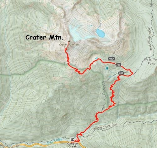
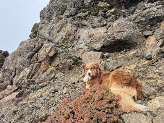
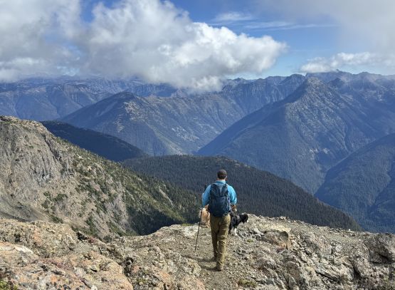
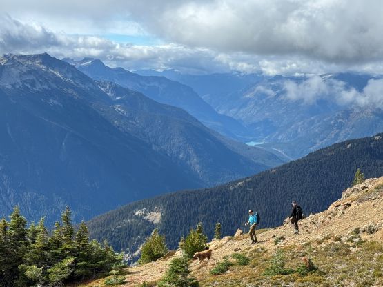
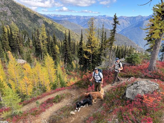
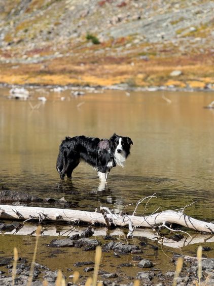
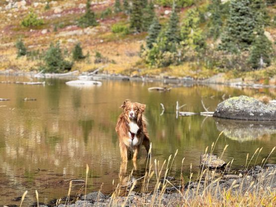
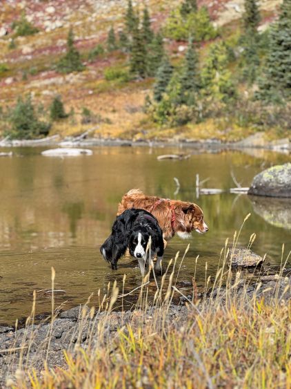
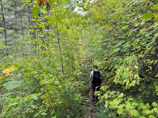
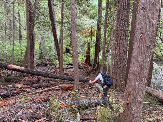
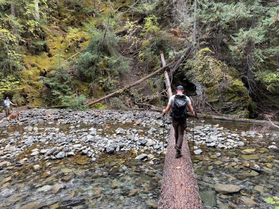
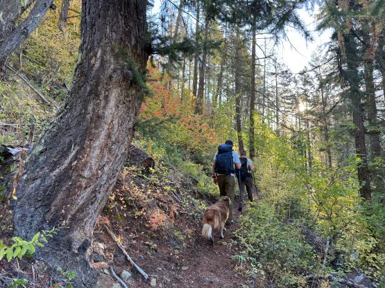
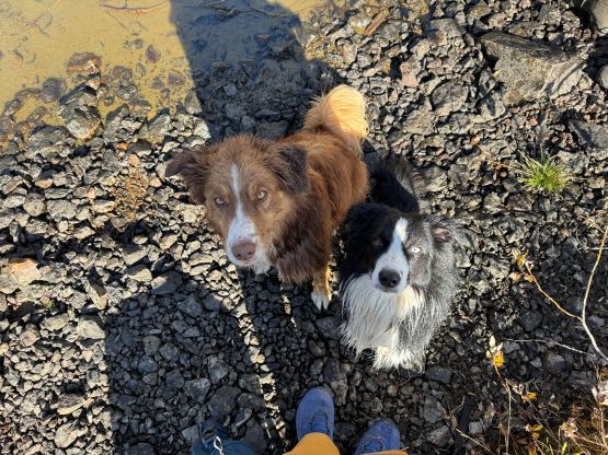
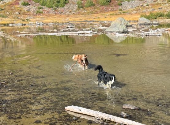
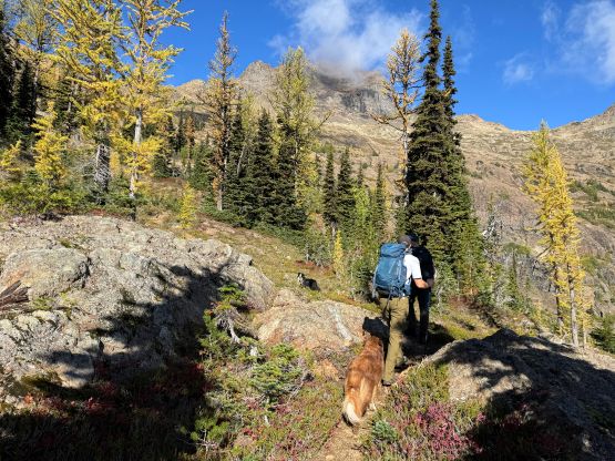
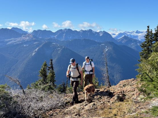
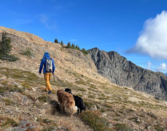
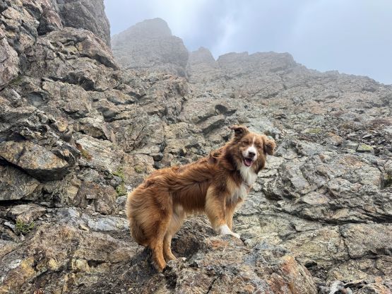
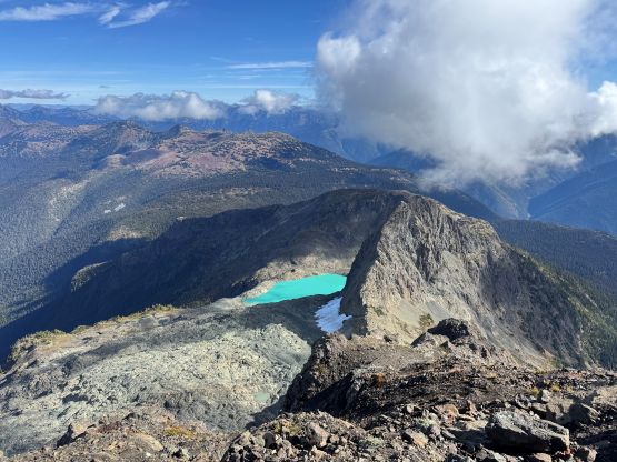
Mark had apparently done his homework and was aware of the downed bridge across Canyon Creek. This is apparently a “ford” mentioned in some older trip reports, but these days there’s a log for hikers to cross, about 50 m upstream from the old crossing point. Accessing this log proved to be rather tricky as there’s no direct way of getting their without wetting our feet. Instead, we opted for an up-and-over scrambling option by detouring on climber’s right. We did some hands-on scrambling on choss to get back down to the river bed. I’m not entirely sure if we had picked the easiest way but it worked for us, so I wouldn’t bother to dig. The reference GPX track did not detour as much as we did so maybe there’s a better solution, or maybe that person opted for fording. The trail on the other side of Canyon Creek was a bit overgrown but it wasn’t bushy enough to bother us. Nico and Mark took turn setting the blistering pace and I had to work quite hard to keep up with the pace. I called for a break to don some sun protection as my neck was feeling the burn in the south-facing forest, but otherwise we did the push to the tarn unofficially known as “Crater Lake” in a single push. Mark and Nico’s dogs needed to stay hydrated so we took a long break at the lake.

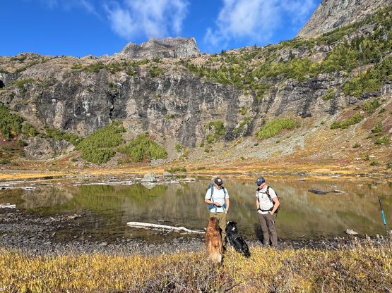
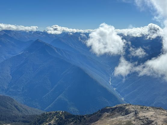
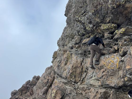
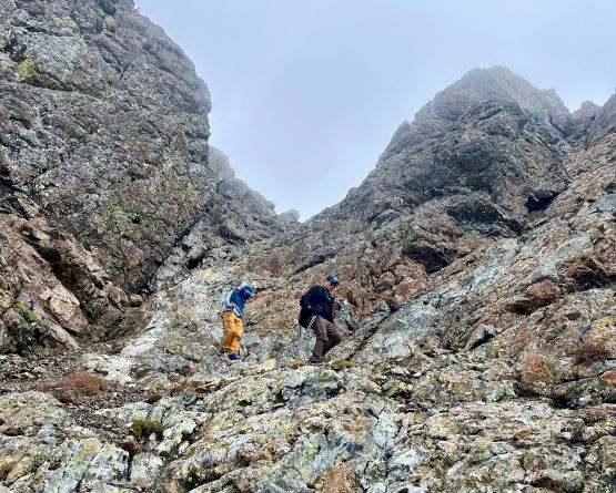
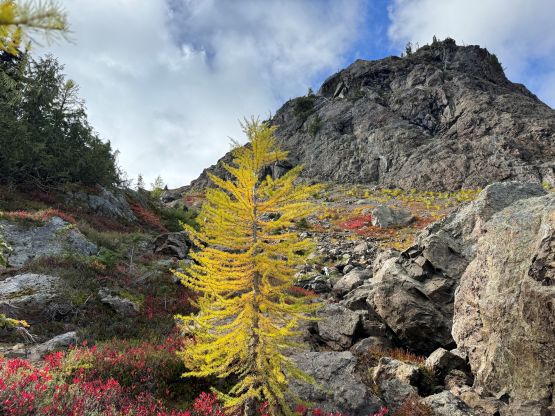
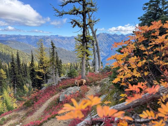
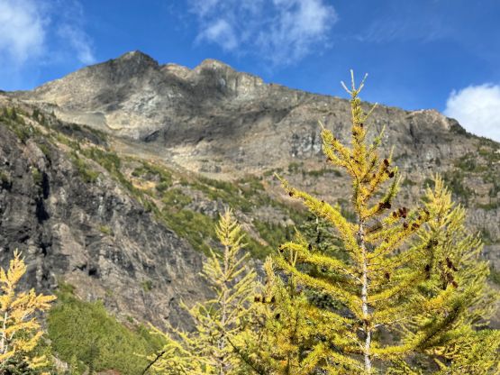
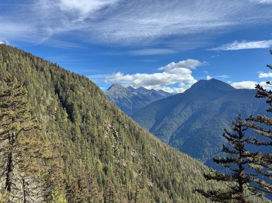
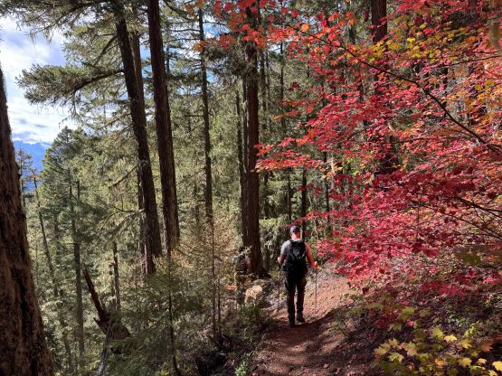
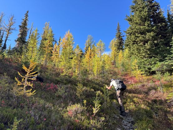
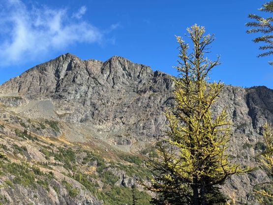
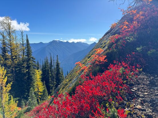
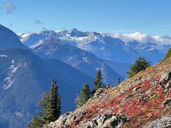
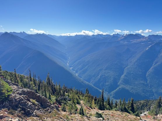
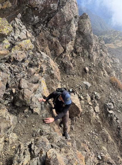
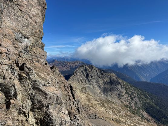
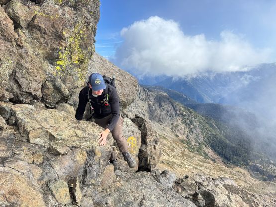
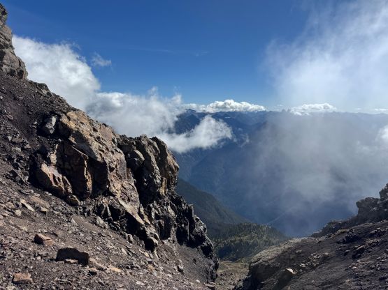
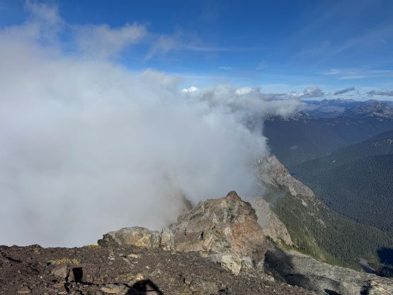
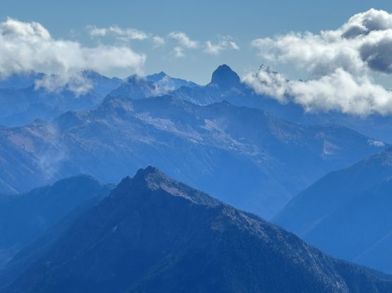
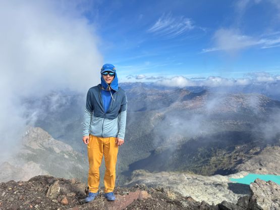
The section above the lake had some unexpected larches and the larches were about to hit the peak colours. I wasn’t anticipating a “larch madness hike” on Crater Mountain so this was a pleasant surprise. We however did not take our time photographing the larches as we were rather pressed with time. The ascent was foreshortened and took a while. The climber’s trail was quite easy to follow even though it was fairly overgrown. It brought us onto the “SW shoulder” with some open views down into the valley. We then followed the path onto the south ridge and then into the alpine. We were greeted by some bitterly cold winds and fog so the scramble was mostly done with minimal visibility. I also did not bring my gloves but it wasn’t that cold yet. The worst was the 3rd class gully section as the terrain was too loose for three men plus two dogs. The dogs were struggling to ascend the initial 4th class step out of the gully even though the exposure was minimal, so Nico volunteered to stay behind watching the dogs. Mark and I continued up the ridge. I thought the scrambling was mostly only 3rd class with maybe a few or two steps that could possibly be rated “4th class”. We also broke through the fog layer and got some nice views from the summit.
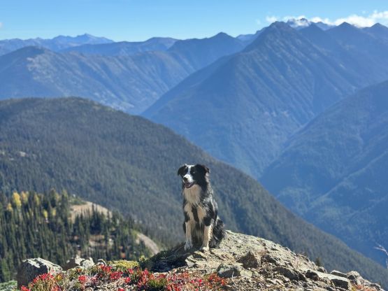
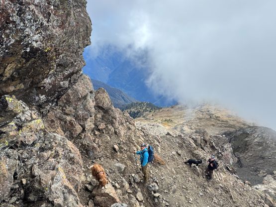
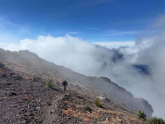

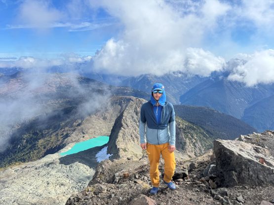
Upon retreating we figured we should have enough time to get back for work so Mark and I took a long break watching the dogs, while waiting for Nico tagging the summit. Nico got back in less than 20 minutes and then we together gingerly descended the loose gully. We did trigger several rocks towards each other but that was unavoidable. After finishing the scrambling sections we followed Nico’s lead power-walking and jogging for most, if not the entire descent. We again took a long break at the lake for the dogs but then made a single dash down to the vehicle afterwards. I took a chossy class 4 short-cut to bypass some of the detours that we did for that creek crossing. I also somehow missed the trail heading back to the parking lot and ended up walking half a kilometer along the highway. Our round trip time was just over 7 hours taking in account of all the breaks, so this was not that big of a day. Mark managed to stay awake for a couple more hours driving and I did get back to White Rock in time. I also caught up with some sleep while sitting in the vehicle. I eventually opted to work for 2 hours to conclude this exhausting but satisfying day.