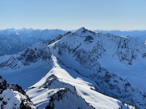
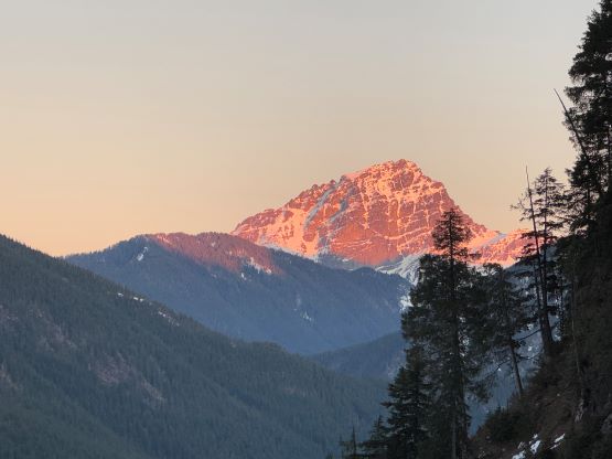
Big Four Mountain
January 29, 2025
1881m
Mountain Loop Highway, WA
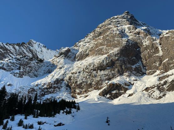
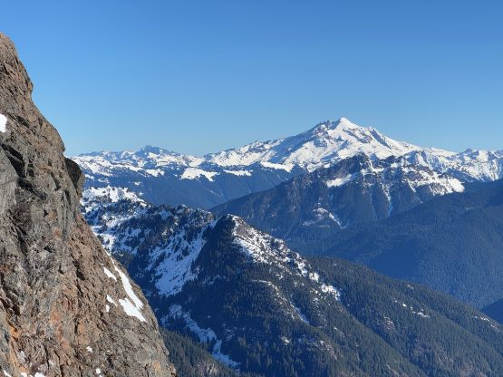
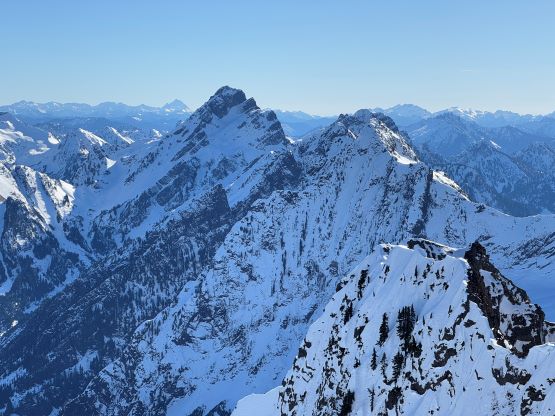
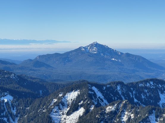
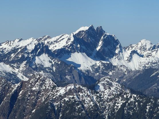
Big Four Mountain boasts one of the most impressive north faces in the state of Washington and is yet one of the more elusive objectives that had seen more failures than successes. This is a seriously dangerous mountain no matter how one dares to attempt. Up until now the best “beta” were still from parties in the early 2000s including but not limited to Jason Hummel’s ski descent, Franklin Bradshaw RIP’s post on NWHikers.net and Paul Klenke’s trip on Summit Post and the timing windows ranged from a cold snap in December to a hot day in June. I thought the most assured way was to take the standard Dry Creek route in a “green brick” condition window but a higher-than-average snowpack would surely be beneficial for the access. For the latter reason I wasn’t particularly thinking about Big Four Mtn. in the past three weeks of exceptional drought period. But on the other hand, the elevation of the forested traverse is around 500-600 m elevation and given the global warming trend it might not ever get covered by a healthy snowpack in the foreseeable future, so after chatting with Fletcher about the objective the trigger was pulled.
The decision was made while Erica and I were still bagging peaks in the Qathet (Powell River) area, two ferries away from home on the exact opposite direction of travelling. Fletcher was keen on Tuesday but such would not give us any time to rest in between so I pushed it back to Wednesday, the last day of this condition window. A problem arose as there was apparently a temperature inversion going on from Monday to Wednesday and the avalanche condition was no longer “green brick” anymore. I nevertheless thought this was still in January after all and the daytime heating wouldn’t nearly be as problematic as in the spring. The main issues would still be the overhead hazards of fallen ice and cornices but such was just part of the game of taking this route. There’s no safe way up Big Four Mountain and by attempting this peak we would be taking chances no matter what. Fletcher bailed at the very last minute but Dave Golias hopped into the team so we still had a group of three, but the pressure was suddenly all on myself as I now had to be responsible of leading the entire way up and down. This would be exhausting but wouldn’t be a problem, as I was forced to do such last year as well on harder objectives like In-SHUCK-ch Mountain and Pyroclastic Peak.
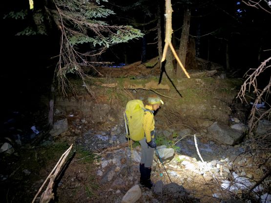
In terms of the gears we decided to bring one 60 m 7.5 mm rope, three pickets, two screws and two ice tools each. Despite the lack of trip reports in the recent era there was oddly one condition update on NWAC over the weekend. I happened to have checked their “observation” and noticed right away a report of “Big Four, Dry Creek”. This was AFTER we made the commitment so it wasn’t us PLANNING to poach their tracks but rather by pure coincidence. The report could hardly be used as a route “beta” but did contain some crucial piece of information. It never mentioned whether the summit was attained but the “6000 feet south facing slope didn’t soften by much” likely indicated they had made at least that far and hence the summit. They did not bring nor need to use snowshoes, and the snow condition was variable (as expected). I still made us to bring snowshoes just to be 120% sure but we ended up ditching them after the first few kilometers of road walking. Dave somehow missed the part of the conversation and didn’t bring his (which we found out after starting the approach), so Erica and I might as well ditch ours as well. Fletcher and I had originally made the plan to start walking by 2:30 am but I changed that to 4 am at the last minute. We all opted to sleep in our respective vehicles at the “trail-head” – the Deer Creek winter closure gate. Erica and I pulled in at 12:30 am whereas Dave arrived at least 3 hours earlier. I didn’t get much sleep at all but that’s routine for me thank to my strange work schedule.
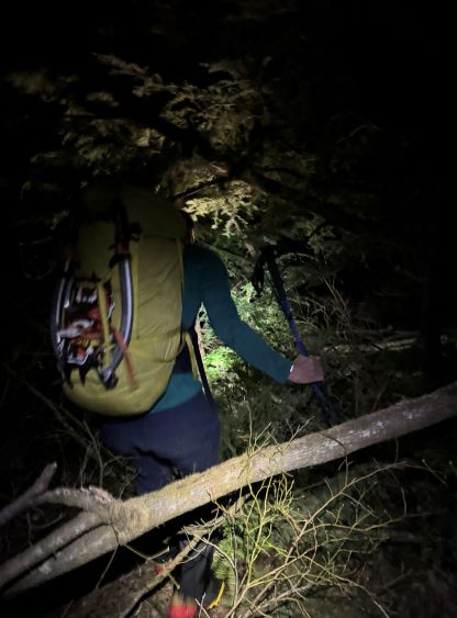
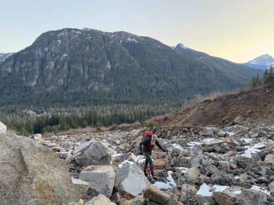
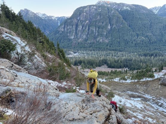
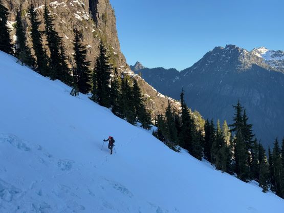
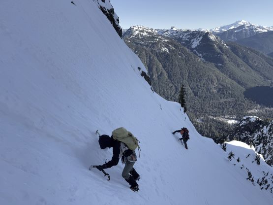
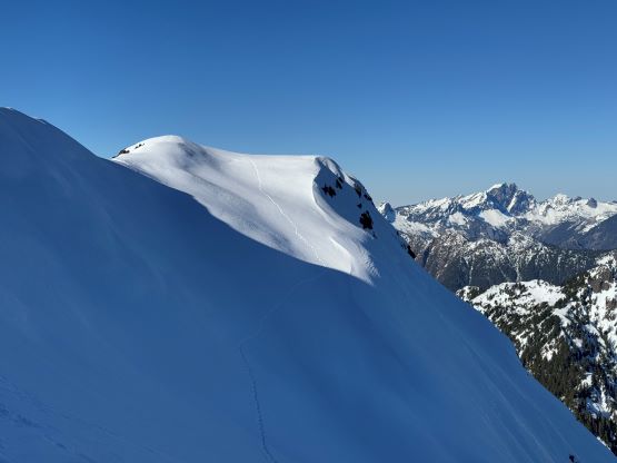
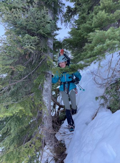
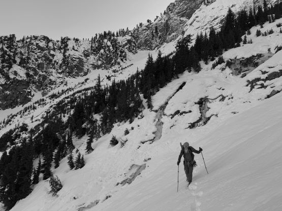
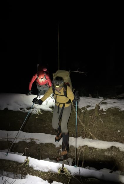
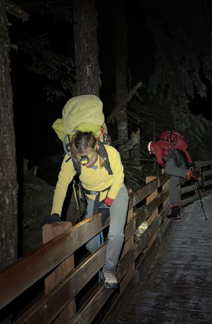
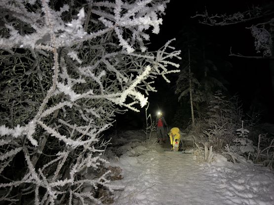
This is a seriously complicated route and even getting into the Dry Creek required tremendous amount of effort. We did not have a healthy snowpack to facilitate the approach and in fact, it was almost bone dry until halfway up the lower “hidden gully” and the entire approach was bushwhacking. There are essentially three approach options. Back in the 2000s the hiker’s foot bridge on Big Four Ice Cave trail was either not installed or plainly ignored and climbers would leave the road higher up to find a sketchy log crossing of Stillaguamish River. These days I thought it would make more sense to use the bridge but the bushwhacking would be significantly longer. Nevertheless with a healthy snowpack down to 500 m elevation this wouldn’t be a problem (such as in Jason Hummel’s trip report), but the going was very exhausting and confusing for us. After a few kilometers of plodding on the dry, paved Mountain Loop Highway we took the signed Ice Caves trail to the hiker’s foot bridge. It was very cold thank to the inversion and as mentioned earlier, Erica and I ditched our snowshoes somewhere in this stage as Dave did not bring his. Instead of following the trail to the very end we opted to leave the path immediately after crossing the river and this required hopping over the handrails. We then took another break swapping trail runners for mountaineering boots. My choice for footwear was La Sportiva G5 whereas Erica had to use her cumbersome Phantom 6000s as that pair of high altitude boots was the only full shank mountaineering boots she had. My plan was then to take a rising traversing bearing in the forest aiming straight at the open lower Dry Creek as seen on the satellite images (for ~2 km long), but the going was very rough. There were countless amount of gullies and ridges that without checking the GPS screen every few minutes we would be constantly doing circles. The bushwhacking was also more exhausting than I thought with lots of devil’s clubs and dead-falls.
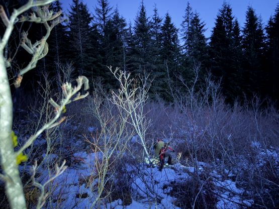
After a while we merged into the “darker green” zone as seen on the satellite images and the going became momentarily easier, but that did not last long. I thought maybe it would be better to go higher to aim at that traversing bench that Jason used in his trip. Dave had also armed with a GPS track (from someone else’s attempt two years ago) and that track also traversed much higher, after taking the Ice Caves trail to the very end. Unfortunately but not to my surprise this bench was full body thrashing in the alders. There was some snow to bend the alders but not enough to really provide any help, so after losing almost an hour in the mess I decided to cut the loss by descending 50 m straight down back into the forest. This saved the day, as the second half of the forested traverse was rather smooth sailing. We still stayed a bit too high on the traverse and had to deal with another stretch of alders bashing before merging into the Dry Creek drainage, and by this point, 3 hours into the trip the horizon was already bright enough to not need the head-lamps. I was glad that we finally exited the shit zone but the day’s shaping to become a long one.
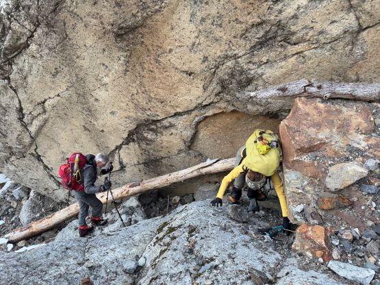
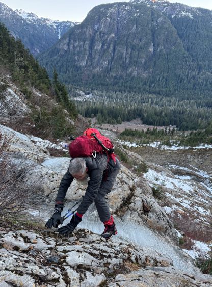
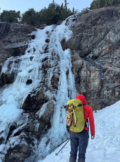
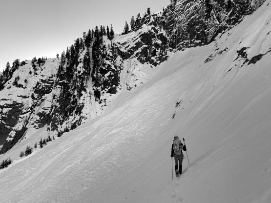
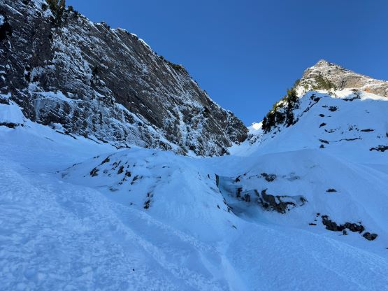
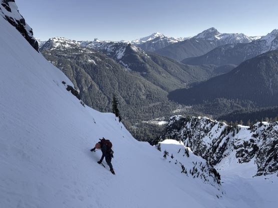
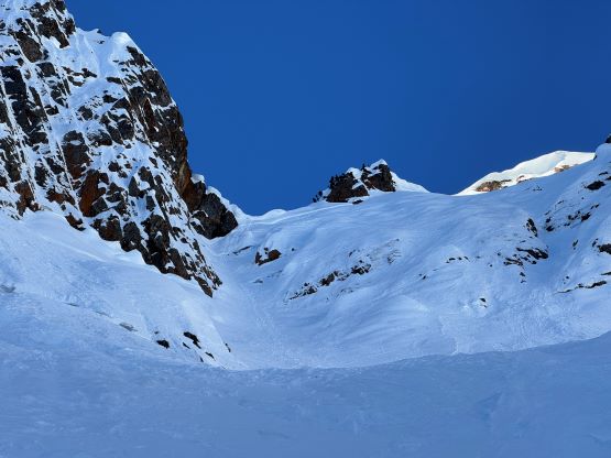
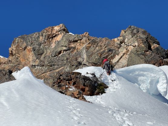
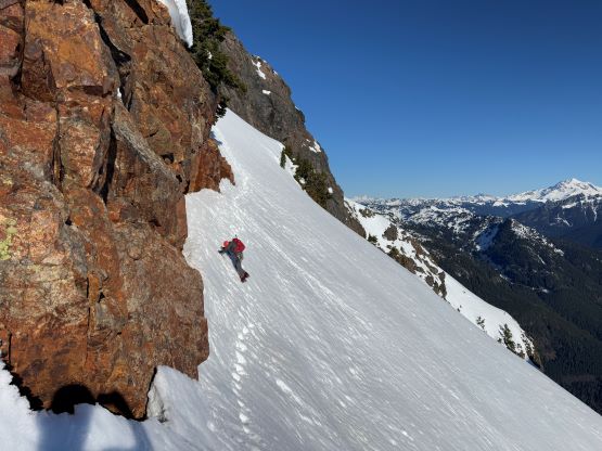
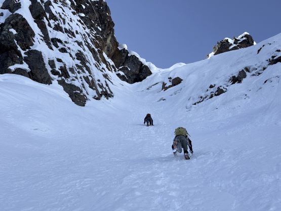
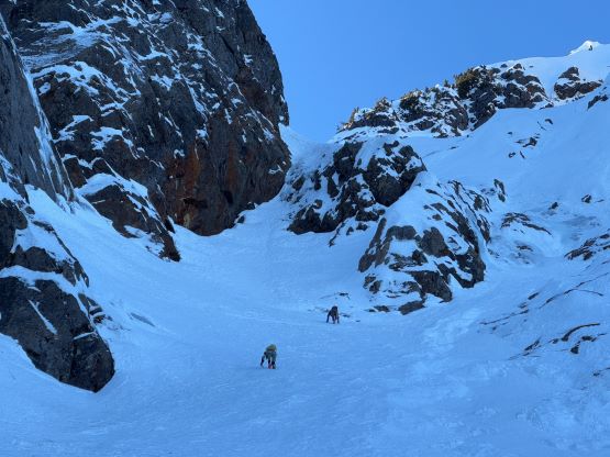
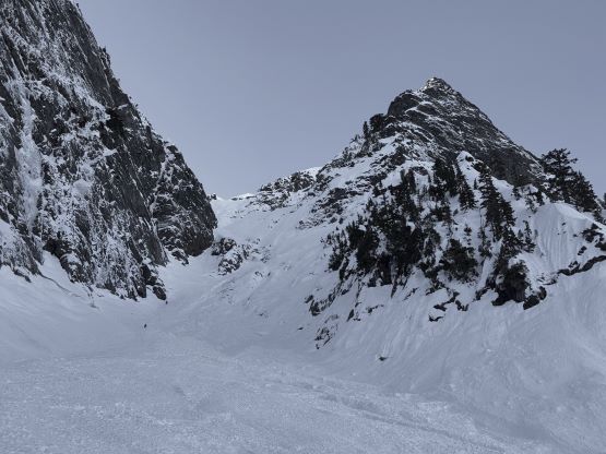
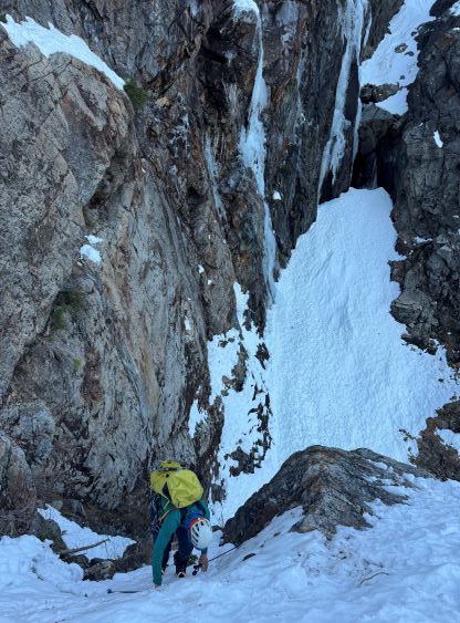
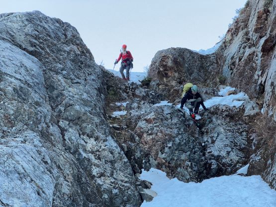
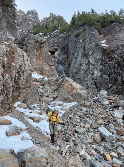
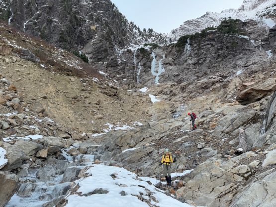
Looking ahead the lower Dry Creek route was very much “not in”, as there was no snow to be seen anywhere in the vicinity and the entire creek bed was boulder hopping. The boulders were extremely loose even by Rockies standard probably because the creek was running underground. If not because of the party that made the NWAC post I probably would have quitted here. Even getting into the lower basin required some route-finding and 3rd class scrambling and to get into the “hidden gully” was also not a piece of cake. More 3rd class terrain with verglass needed to be negotiated. There was enough ice to make the scrambling and route-finding difficult, but not enough to warrant donning crampons. A rightwards traverse on a snowy bench followed by a step-down then brought us to the bony “hidden gully”. We scrambled up through the first constraint with lots of loose rocks and donned crampons afterwards. The foot prints that we had been following had turned into some crampons tracks so we should do the same. The tracks on the other hand, were bizarre as they only went one way (uphill). I thought maybe they descended a different way and that usually indicated some complications on their ascent route (the one we were in). The upper constraint/chockstone of the hidden gully was completely free of snow so we had to take the ramp on the climber’s left variation exit. This ramp was also very bony but the mixed climbing was not actually that bad. It was 3rd class at the maximum in dry conditions. The previous party’s tracks had become much more obvious above this exiting ramp and in fact, they were doing fair amount of post-holing in the next stage. We surely appreciated their work, and slowly but steadily made our way across the forested bench taking a rising traverse aiming at the entrance of the meat of the Dry Creek (upper) gully.
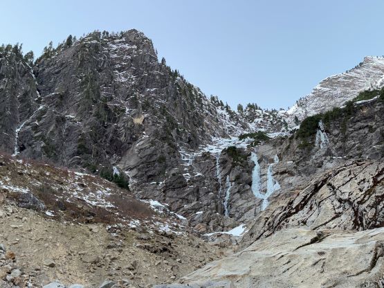
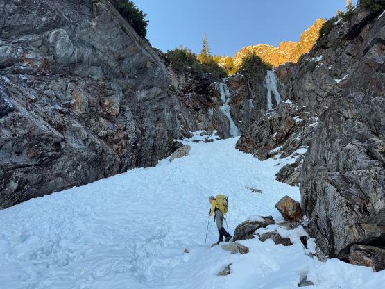
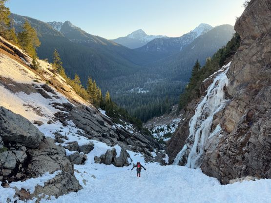
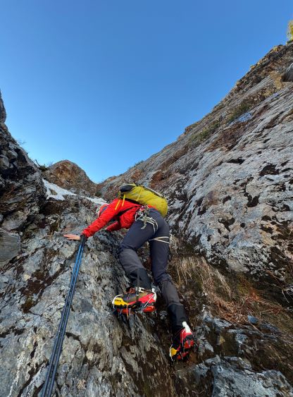
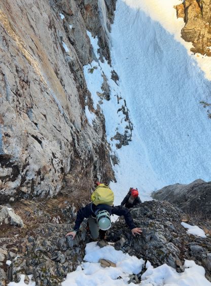
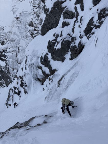
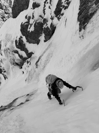
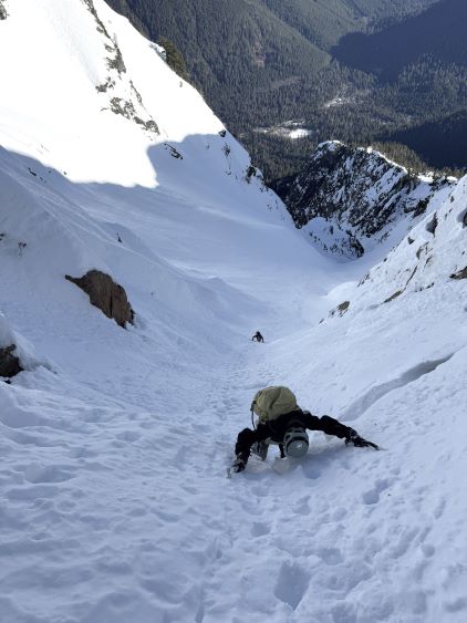
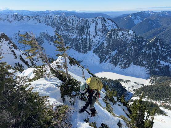
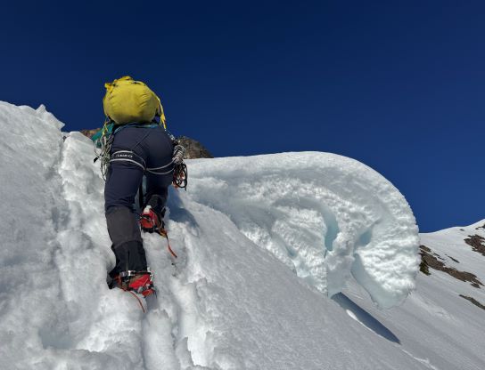
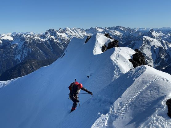
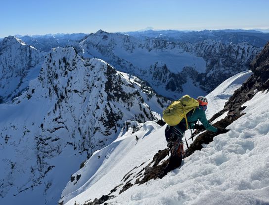
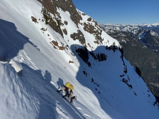
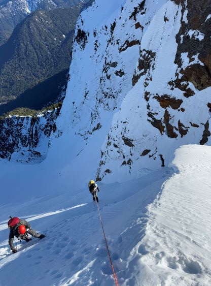
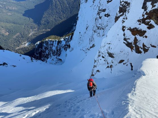
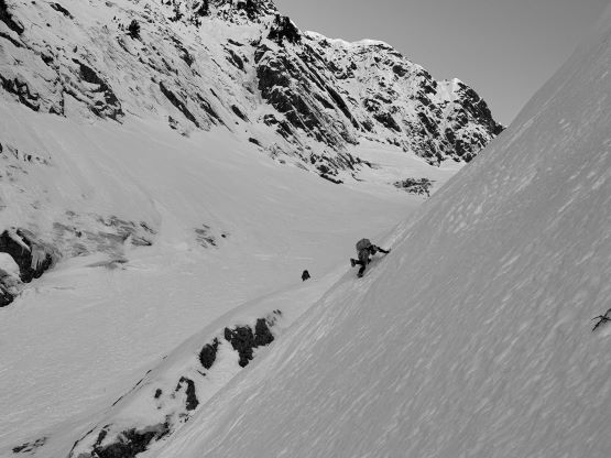
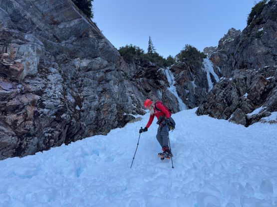
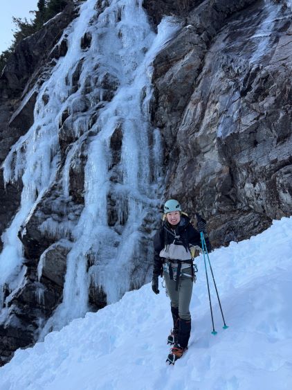
I have to mention that the line we took connecting the exit of the hidden gully to Dry Creek’s upper gully was much lower than the few June attempts I had seen in the 2000s trip reports. I assumed the previous party picked this line to mitigate the overhead hazards. The higher route that traverses directly underneath the east faces would be mostly on open slopes so likely would involve less amount of post-holing. The start of the upper gully was at most 35 degrees but there’s one steeper zone in the middle that turned out to be even steeper than appeared. We all ditched one pole and took one tool out, but about halfway up the icy middle crux we had to take the second ice tool. I led a line staying mostly in the middle or climber’s left of the fall line before crossing to the right at the constraint, and this route involved a few climbing moves on snice. I still wouldn’t classify our route as “ice climbing” but it was much firmer than the typical front pointing on steep snow. Meanwhile the morning sun rays had dislodged a microwave sized ice chuck down the fall line and narrowly missed Dave. This was a scary moment but we all expected something like that to happen as this was simply part of the game of climbing Big Four Mountain. Thankfully the mother nature did not give us a second close call afterwards. To exit the middle constraint we then traversed back climber’s left on firm-but-not-icy snow and this entire stretch averaged 45-50 degrees. We were contemplating to rappel this afterwards but would make the decision later.
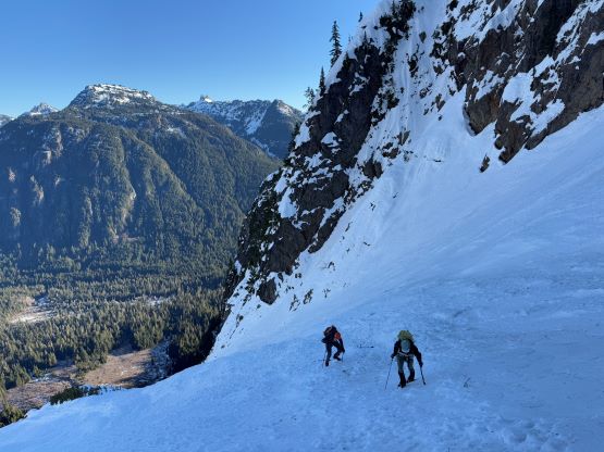

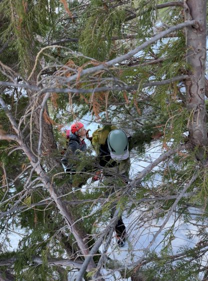
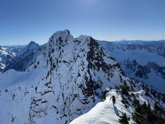
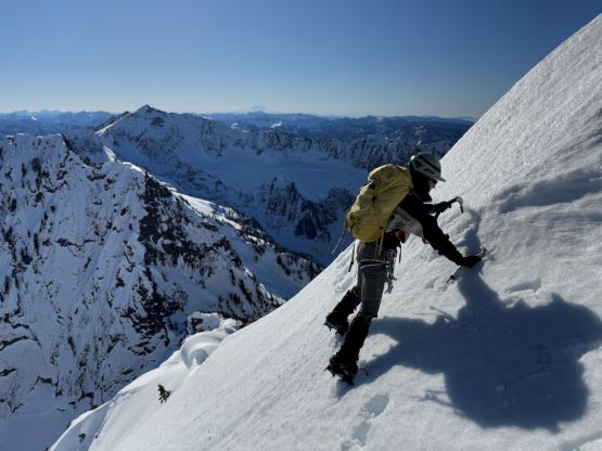
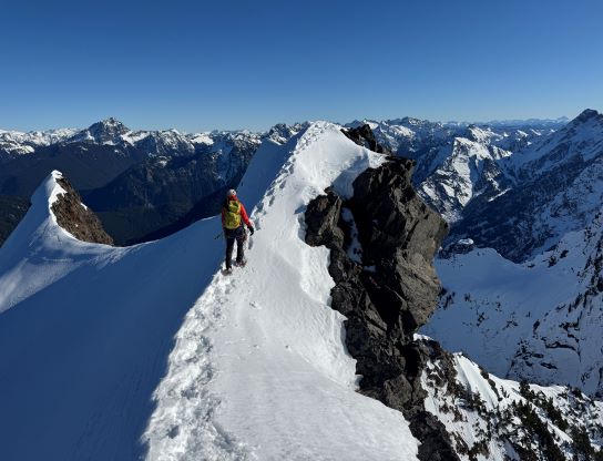
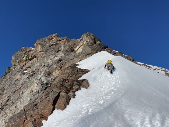
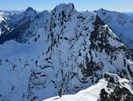
There was another flatter-ish stretch below the final headwall underneath the main/south peaks saddle that offered us a bit of a break. The previous party had put up a set of boot-packing tracks straight up the upper couloir to directly underneath the saddle, whereas my original plan was to go climber’s right aiming straight towards the upper SE Face of the main summit. I was seriously contemplating about doing my own route but opted to follow their tracks instead. To exit the couloir we had to deal with a few moves of 60+ degrees shenanigans but the condition was powdery and soft so it never felt too exposed. The tracks then went up into the notch and I assumed they either had turned around, or thrashed the “BW5 evergreen” mentioned in Klenke’s trip report. I couldn’t understand the reason, so did my own variation by putting up a 45-degree traverse underneath some cornices and that brought us to the upper saddle. I was happy to see their tracks continued up the ridge as that’s an indication the entire route would go. After regrouping we followed the tracks up and over the next stretch of ridge feature dealing with some bushwhacking and exposure, but I had already made the decision to take the skiers’ variation on the way down. I liked to stay on open slopes as much as possible instead of taking these time consuming variations.

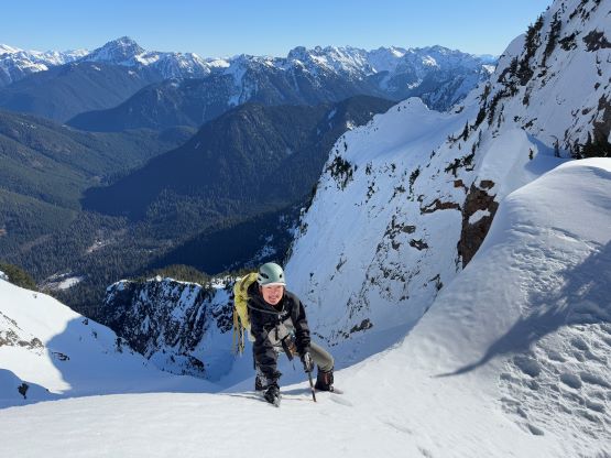
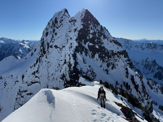
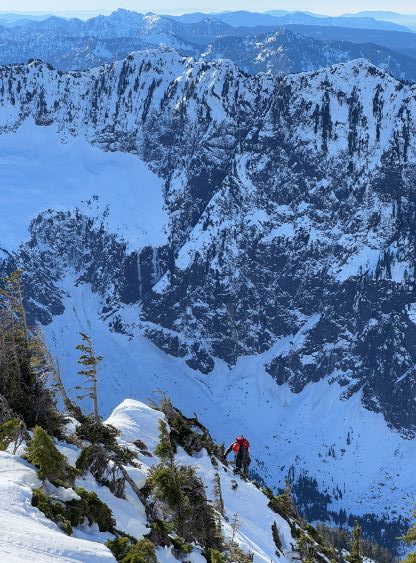
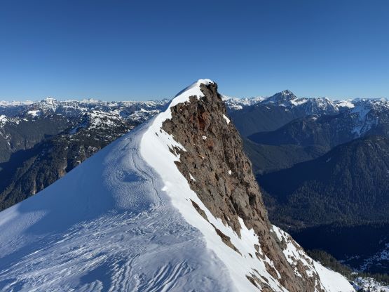
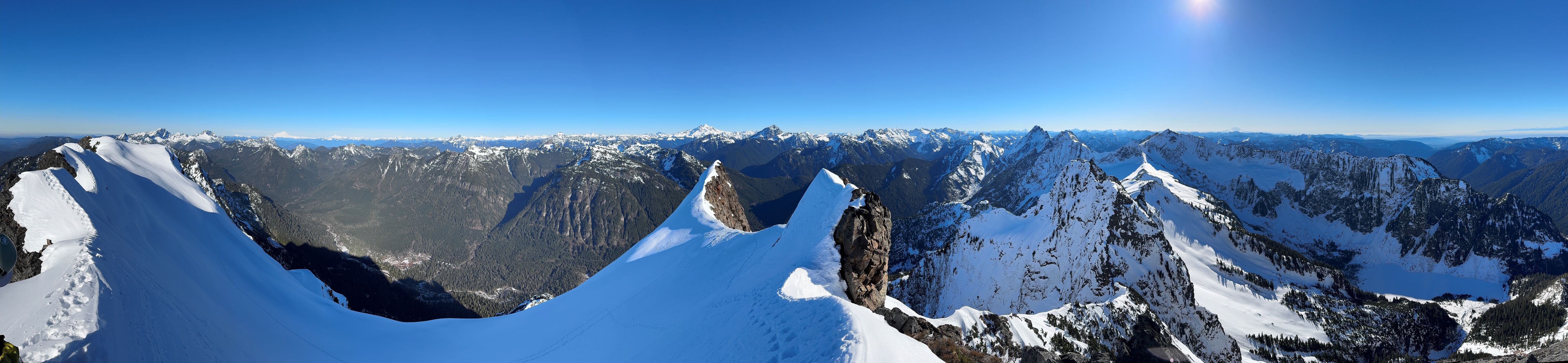
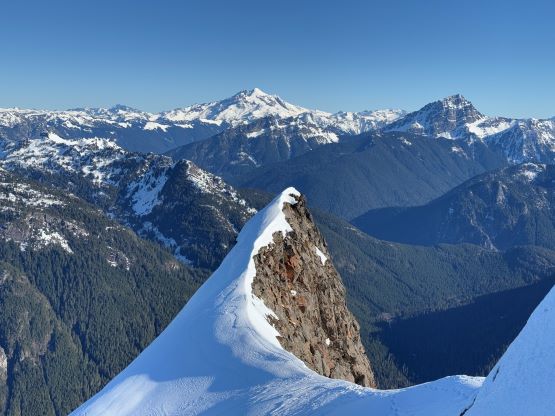
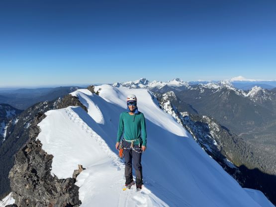
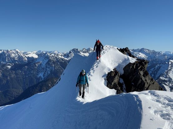
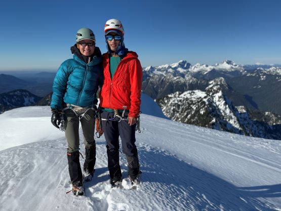
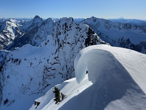
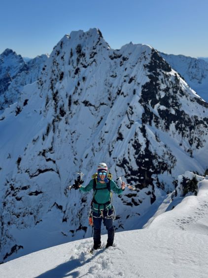
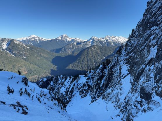
A few 50+ degrees steps on the upper south ridge later we arrived at the infamous rightwards traverse underneath the summit ridge. This was the mental crux mentioned in Klenke’s trip report and in Frankin Bradshaw’s report I had seen them taking the rope out. From below this stretch looked to be nowhere “in” as half of it was exposed rocks. I was glad that the previous party had put up a set of tracks past it but again I opted to traverse the meat of a snow slope underneath their tracks to cut into the line. The other party had opted to stay as much on rocks as possible. The rock scrambling was thankfully again, 3rd class at most but the exposure was indeed very severe. I wouldn’t call this the “mental crux” though as we all felt comfortable down-scrambling without a rope on the return. There are a few bumps on the summit ridge. The true summit should be the 2nd or the 3rd but we explored all of them simply because we had the time. I actually wanted to descend after the sun’s moved to the west side so we on purposely lingered longer on the summit (area) than absolutely needed. The other group had also wondered around presumedly for views. I was also able to catch some satellite receptions to texted Fletcher about our progress, as we were running late.
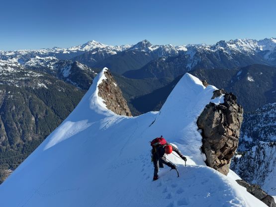
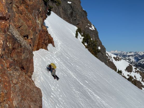
The plan was to down-climb as much as possible but Dave wanted to rappel that stretch of 60-degrees shenanigans underneath the notch. But first of all we needed to get off the upper south ridge which involved one exposed traverse with some 3rd class rocks, at least two 50+ degrees step of down-climbing and two more exposed 45-degrees traverses underneath some cornices. The alternative for the two under-the-cornice traverses was to take the exposed ridgeline dealing with BW3+ thrashing in the evergreens, which we were not keen. The down-climbing mostly went well, and then I went ahead to set up the single strand 60-m rappel for Erica and Dave. I had decided to down-climb that pitch so it made sense for them to take full advantage of the rope length. I simply buried a dead man picket to make an anchor and in no time Dave and Erica were down. The down-climbing surely felt like 60 degrees but was not problematic. The rope got stuck unfortunately but thankfully I was above the stuck point and was able to traverse over to free the rope. We did not need to use the rope afterwards. For that icy 50+ degrees middle constraint we simply took our time and gingerly made our way down step by step. I led a slightly different line down and avoided the iciest part of the route. There were still a few moves on snice but they were nowhere as exposed.

The lower part of the upper gully was trickier to descend than I thought, that we still needed to make some front-pointing while facing into the slope. I was able to walk in French technique facing outwards for as much as possible, but Erica and Dave did most of the descent facing in, and that took a while. The soft snow on that bench traverse back into the hidden gully was a welcoming change in conditions as we were even able to swap the two ice tools for the two trekking poles. The ice tools then stayed strapped to the backpacks without being needed afterwards. The tools could make things easier on down-climbing the 3rd class mixed steps in that lower hidden gully’s exit ramp, but we made do with just bare hands. There were a lot of scrambling afterwards but at least we knew the route so we worked our way down fairly fluently. The daylight was fading as we hopped our way down the bottom of the Dry Creek and the head-lamps were turned on immediately after entering the forest. I opted to lead a traversing line staying lower than the route we took on the way in, and the theory mostly worked out well. The bushwhacking, though annoying was never too sustained but the micro-terrain was still extremely confusing. We crossed at least 10 ribs and gullies and staying oriented would be impossible without the current era’s GPS technology. About an hour and half later I led us exactly back to the tree underneath which we ditched the trail runners, swapped the footwear, grabbed the snowshoes and power-walked back to the vehicles. Our round trip time was 16 hours and we eventually got home at midnight after taking turn driving.
It turned out that the previous party did end up putting up a TR on NWHikers (albeit after we finished our trip), and their account was very similar to what we had experienced.
