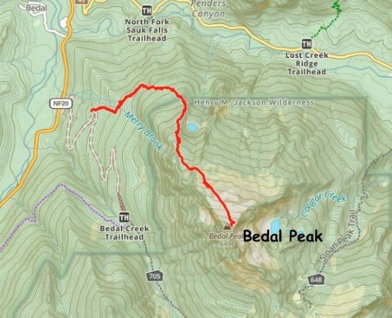
Bedal Peak
May 25, 2025
1999m
Mountain Loop Highway, WA
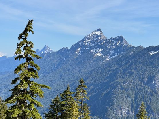
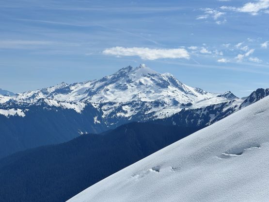
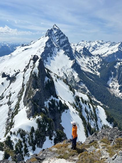
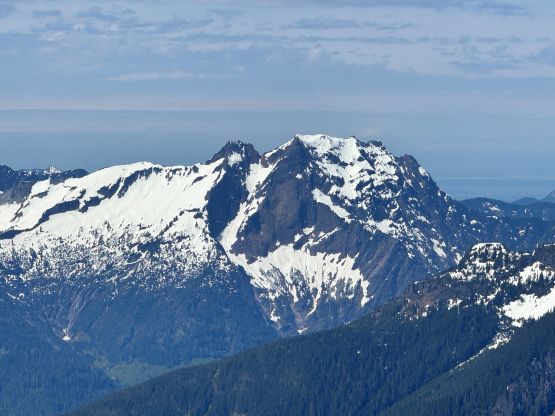
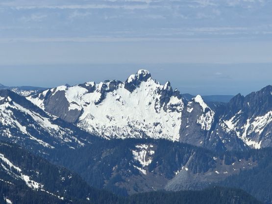
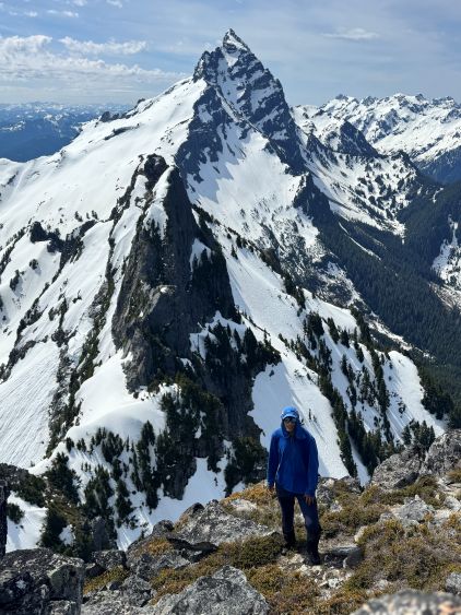
Bedal Peak is known to have the finest view of Sloan Peak, the “Matterhorn of the Cascades” which I climbed back in 2017. Bedal Peak was still obscured at the time. Since then the approach trail had seen some improvements and nowadays this objective could see several ascents in a single weekend. The best timing would be “spring” as this is just another objective in the PNW that is better done with a healthy snowpack to cover the boulders and bushes. A few detailed trip reports had been published on “The Mountaineers” and peakbagger.com. I only skimmed through some “beta” but made my partners to do the digging. This objective definitely seemed rather straightforward compared to when I first heard of it in 2017.
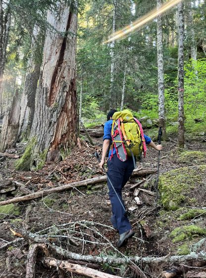
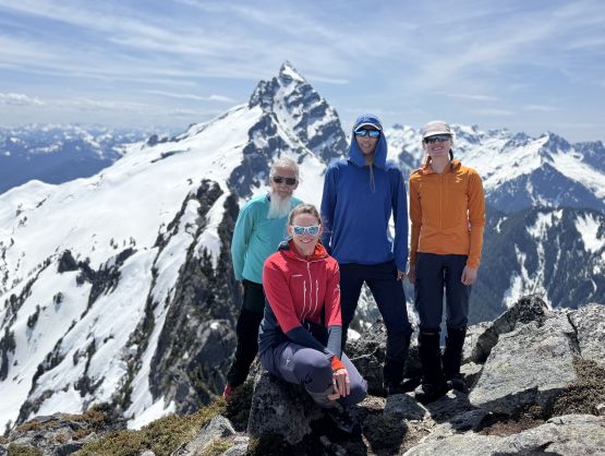
The plan was formed at the very last minute as I sensed a weather window on Sunday but was struggling to find the suitable objective. I messaged a few friends and eventually Erica, Holly and Dave all agreed on Bedal Peak. I was originally thinking of another objective in Skagit Valley in B.C. but nobody was too keen on that one. The three of us from Canada drove out in the previous evening and slept at the trail-head. This was my first time crossing the U.S./Canada border since the beginning of the shenanigans and they had definitely made things more difficult by asking a loads of repeated questions. I wasn’t even sure if the NEXUS card could still get me across so I brought my passport just in case. They didn’t make me show the passport, thankfully. The entirety of Mountain Loop Highway had been recently reopened but there wasn’t any update of the spur road heading to the trail-head. The road was rough as expected, but imposed no problem to my Subaru. We had concerns whether Dave could make all the way to the trail-head in his 2WD van but he impressed us by showing up at 6 am as expected.
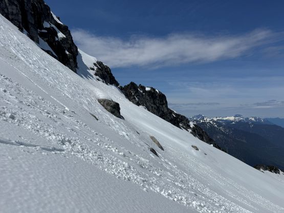
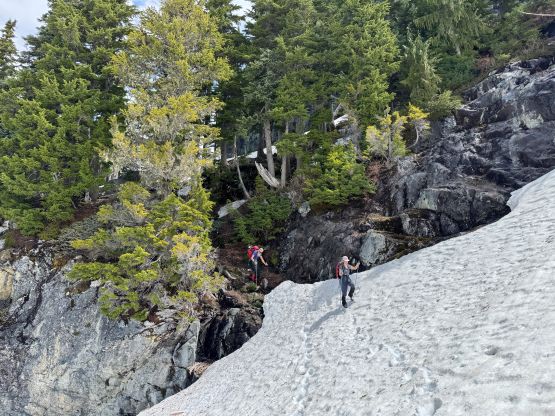
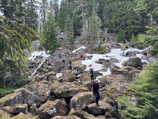
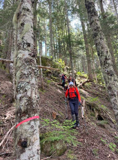
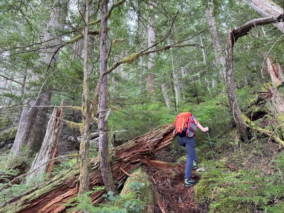
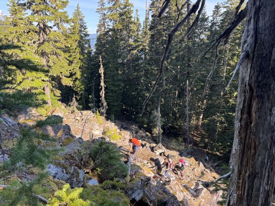
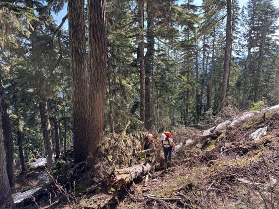
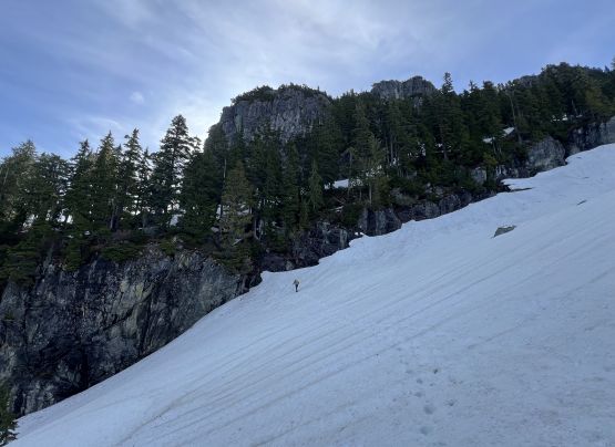
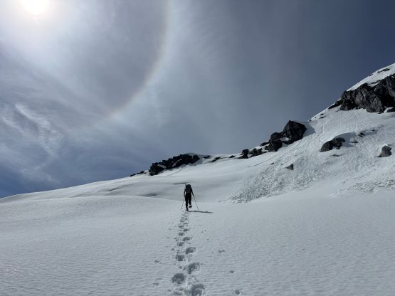
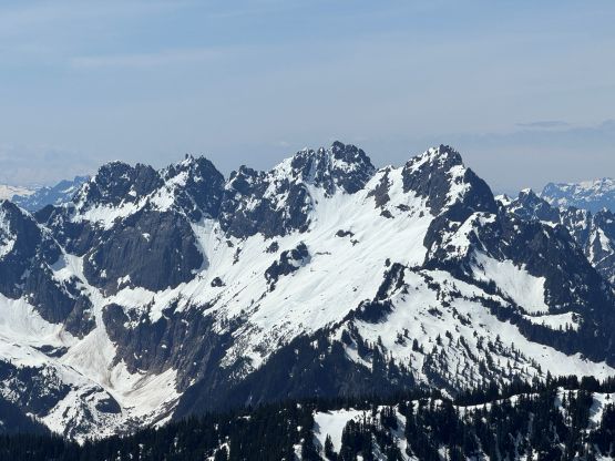
The only reliable water source was at the crossing of Marry Brook so bringing 2 L of water for the entire day was a bit of a risky decision. Shortly after the crossing we came to a confusing section and accidently did a circle without realizing. The trail below 850 m elevation was bushy at places and involved fair amount of traversing with some micro-terrain, but the quality improved higher up. We also encountered two major patches of boulder fields with the upper one partially covered in snow, but generally speaking the approach was quite straightforward. We merged onto continuous snow at 1400 m elevation and quickly entered the first basin aiming for the key “ramp” at 1550 m. The hardest part was to get off the snow as we had to be careful about the moat, but the ramp itself was quite straightforward.


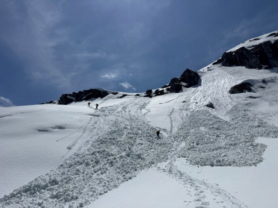
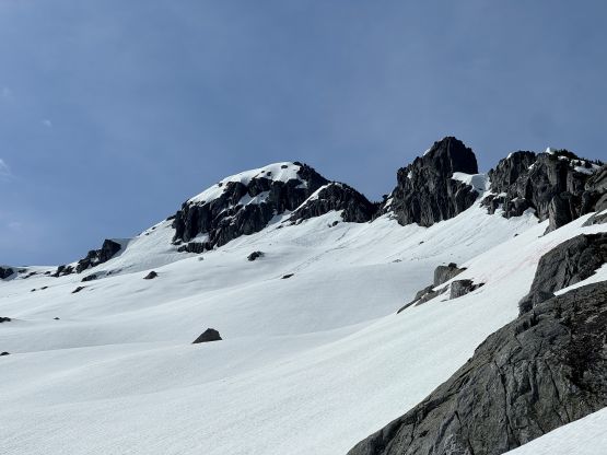
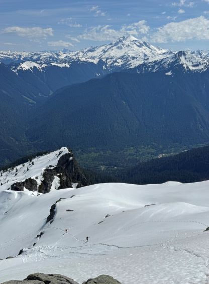
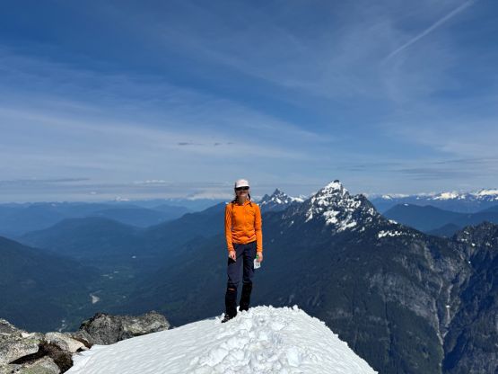
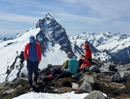
We then got onto the upper route and once the post-holing took over we did the transition donning snowshoes. Erica led us scrambling up a 4th class step just for fun, but it was easily avoidable on climber’s right side. I quickly realized by this point that the snow condition was rather horrible on this day, that we could easily set off some wet slides. I wasn’t quite sure about what exactly to expect on the summit block but there’s only one way to find out. After a long while of slogging we ascended a steep short-cut onto the east ridge. Erica was in charge of the trail-breaking and a few slides were indeed sent down the slopes. I quickly traversed farther climber’s left (almost onto the rocky ridge). I still ended up snowshoeing all the way to the summit but stayed within touching distance from the rock ridge. Dave and Holly showed up on the summit about 10 minutes later and we stayed up there for at least an hour long. While lingering on the summit I on purposely triggered as many slides as I could to make our descent safer. The slides went entirely down the NE Face but only the top layer of the snowpack went.
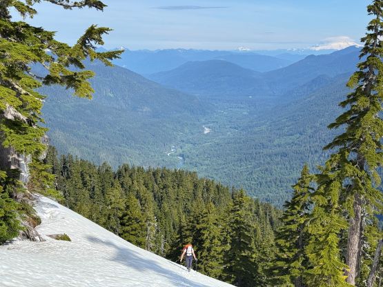


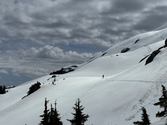
On the descent I went first and triggered a few more slides. We also went further around to bypass that steep short-cut. The slides that we had triggered earlier in the day (including on the summit) had now partially covered our ascent tracks so this was definitely not the right day to push into consequential terrain. Lower down we followed Holly’s route to bypass that unnecessary rock step, and the rest of the descent was rather uneventful, but tiring. Our round trip time was over 8 hours but we really took our time and did a few very long breaks. This was a short trip, after all. On the way back home I was too tired to drive so Erica took over for about an hour’s job.