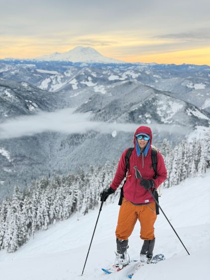
Bandera Mountain
December 28, 2025
1600m
Snoqualmie Pass, WA
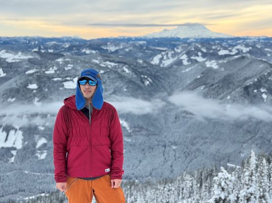
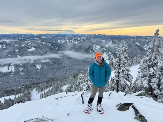
Bandera Mtn. in the vicinity of Snoqualmie Pass has a trail to the top so it’s one of the more popular objectives in the area. Most of the “ascents” are done in summer as the route, though doable, is not as straightforward as one might expect in winter conditions. My plan was to save these easier objectives for winter ascents but I didn’t do much digging besides checking the maps. This outing turned out to be tougher than expected. Erica and I decided to do something together last weekend and it took us a while to figure out the objective. The recent conditions had been heinous with 30+cm deep powder almost everywhere, and the weather was also less than ideal. The only areas with guaranteed sunshine was far to the south, so we settled on Bandera Mountain east of Seattle. It had been a while since I did a “proper” outing so I wasn’t sure about my current fitness level. It was simply smarter to settle on something not too outrageous. Another benefit was for Erica to pick up her gears that were shipped to Dave Golias’ house.
Due to the cat I wouldn’t be as free to do overnight trips these days, so we left Vancouver in the early morning. We crossed the border at 7 am. The drive down south was uneventful. I was curious about the lack of traffic in the Seattle vicinity but then I realized that this was actually a Sunday. The standard starting point for Bandera Mtn. is Ira Spring Trail-head but I wasn’t expecting to be able to drive there given the low snowline. Erica even found a recent report, that the road had been “blocked” 2.5 miles from the trail-head. Alternatively, we parked at the lower lot just across the freeway from McClellan Butte’s trail-head. This added 200 m elevation gain but we didn’t mind the extra exercise.
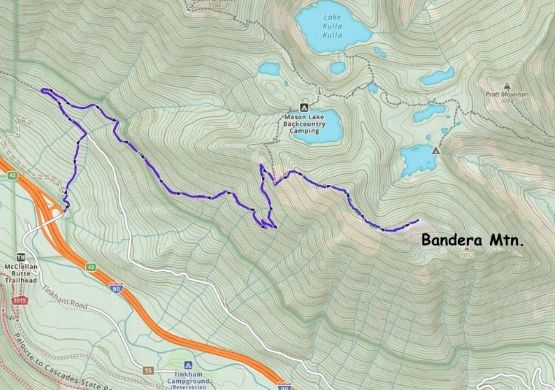
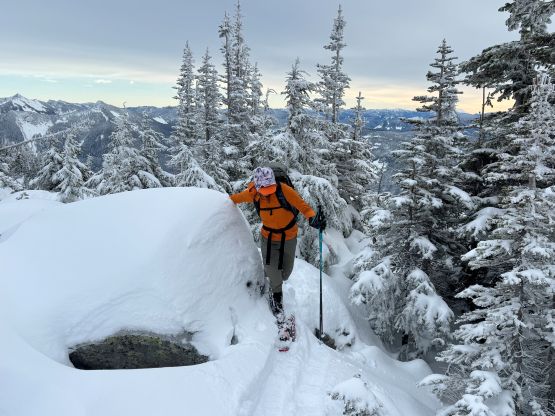
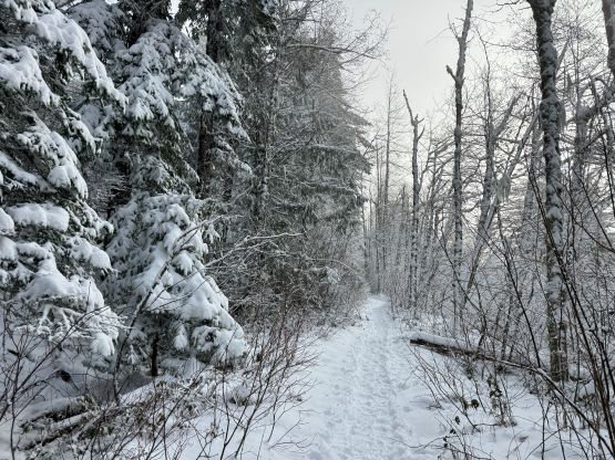
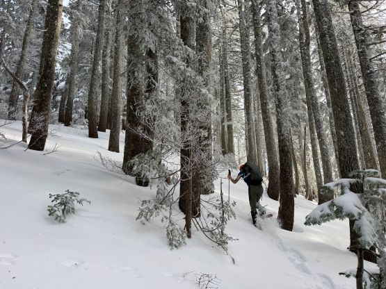
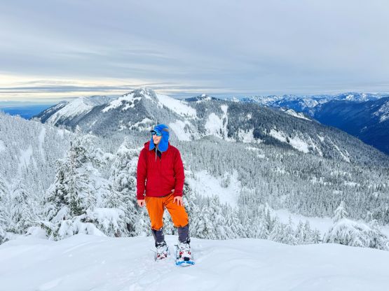
There were snow right from the start so I decided to wear the Trango Tech mountaineering boots for the entire day. I also decided to carry the 30 inches snowshoes given the unknown amount of trail-breaking higher up. They did become beneficial for the traverse over the west peak to the true summit so this wasn’t entirely an overkill. The connector trail was actually in a decent shape but then we quickly realized that the “blockage” had been cleared, that at least two vehicles had made the proper trail-head. One of them was even a 2WD car despite the icy conditions. Ira Spring Trail had seen fair amount of traffic since the last precipitation event such that we followed the path all the way 1250 m elevation without needing to don snowshoes. The snowshoes however, were definitely required afterwards.
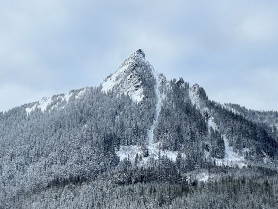
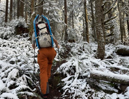
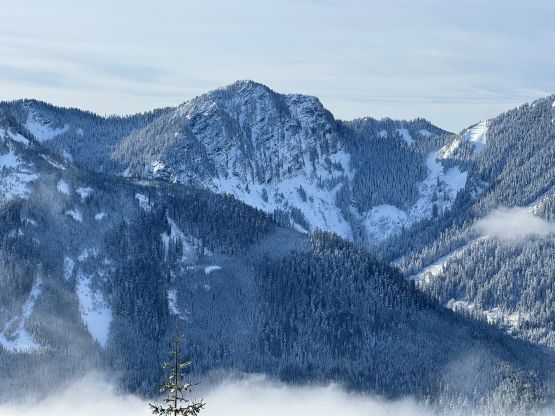
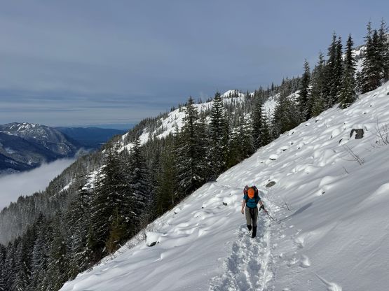

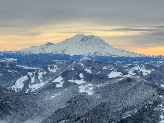
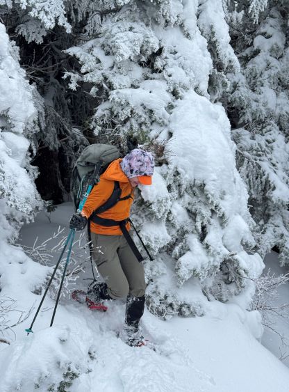
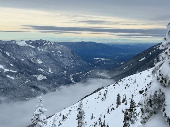
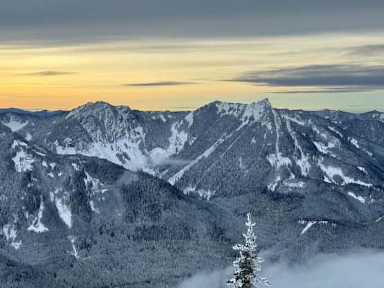
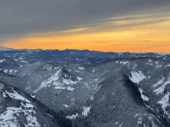
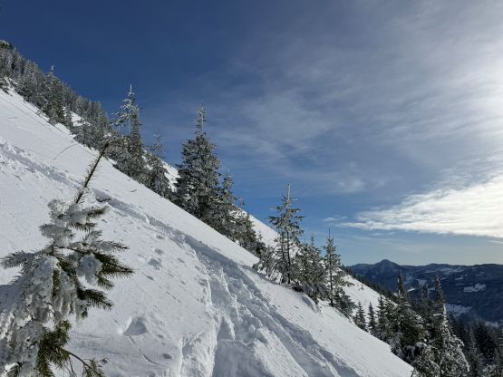
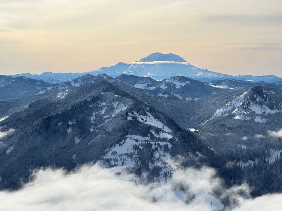
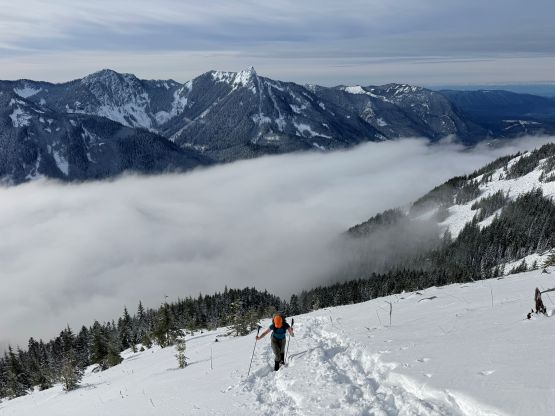
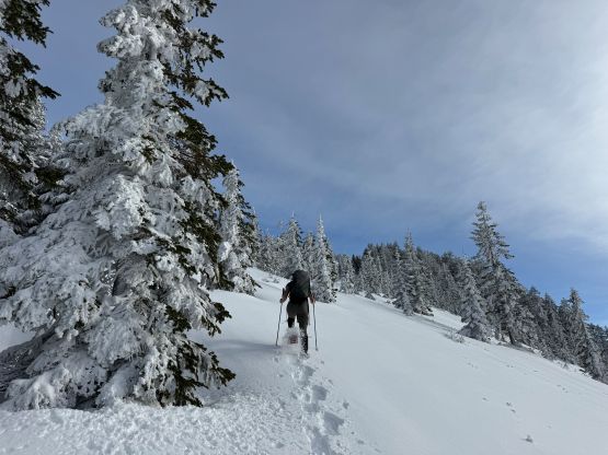
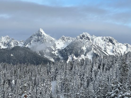
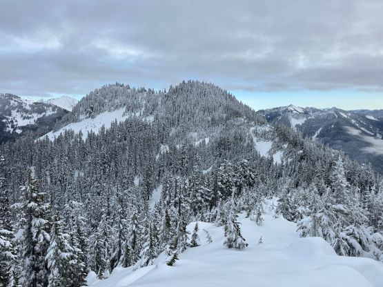
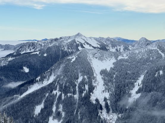
There was a large open area at around 1350 m elevation that would cause some avalanche concerns but not on this particular day. There was simply not enough snow yet. At this point we were already on snowshoes and were following a set of snowshoe tracks aiming straight up towards the west ridge of the west peak. One lone hiker was descending on foot saying that he didn’t make all the way to the top. In fact, his turn-around point was still a ways from the west summit. From 1400 m elevation we were on our own breaking trail in the deep snow, but the going was reasonable all the way to the west (false) summit. The traverse to the true summit was the real deal in winter conditions due to the endless micro-terrain. It was difficult to stay exactly on the ridge due to rocky terrain and the tight bushes and I got sucked into the deep and steep terrain on the north side of the ridge. The trail-breaking was heinous even with the 30′ Lightning Ascents but I eventually corrected the bearing and we were back on the ridge. Higher up we stayed more or less on the south side of the ridge and traversed across a few more open slopes. There were also a few boulder fields insufficiently covered by snow, that we had to be uber careful.

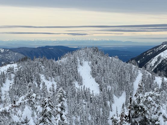
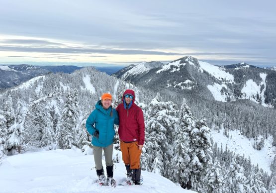
Due to the late start we didn’t linger long on the summit. Traversing back to the false summit was infinitely easier as we already had a set of tracks to follow, and no longer needed to do the brain work of route-finding. We skipped the idea of tagging Mt. Defiance and went straight down back to the trail. Once taking the snowshoes off the going was much more enjoyable so we jogged and power-walked back to the vehicle. Our round trip time was under 6 hours which was honestly not too bad given the less-than-ideal conditions. On the way home we stopped in Dave’s house to pick up the two pair of boots as well as the climbing rope that Erica had bought, and then stopped in a Thai food restaurant for dinner. We eventually got back home at around 10 pm.