Pinnacle Peak [AZ]
March 6, 2026
966m
Phoenix, AZ
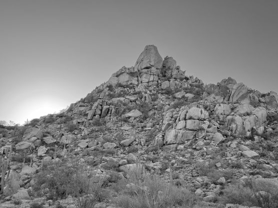
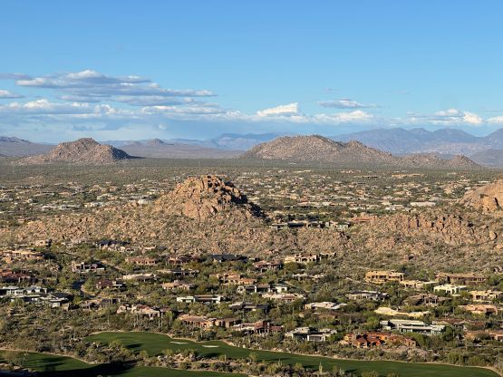
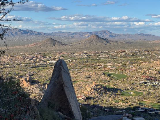
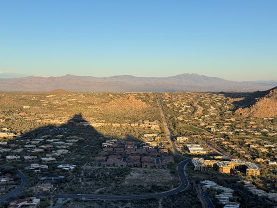
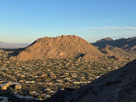
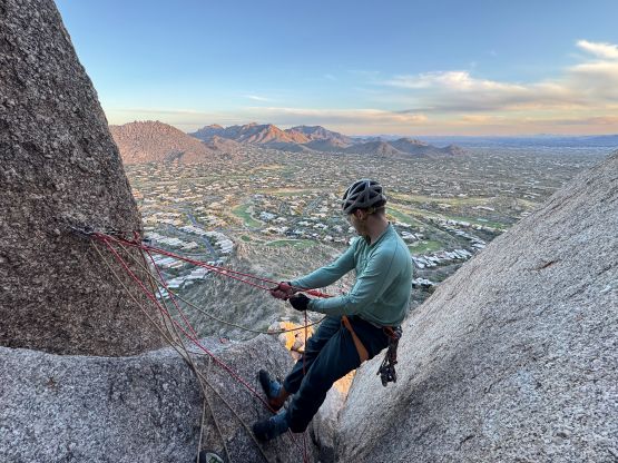
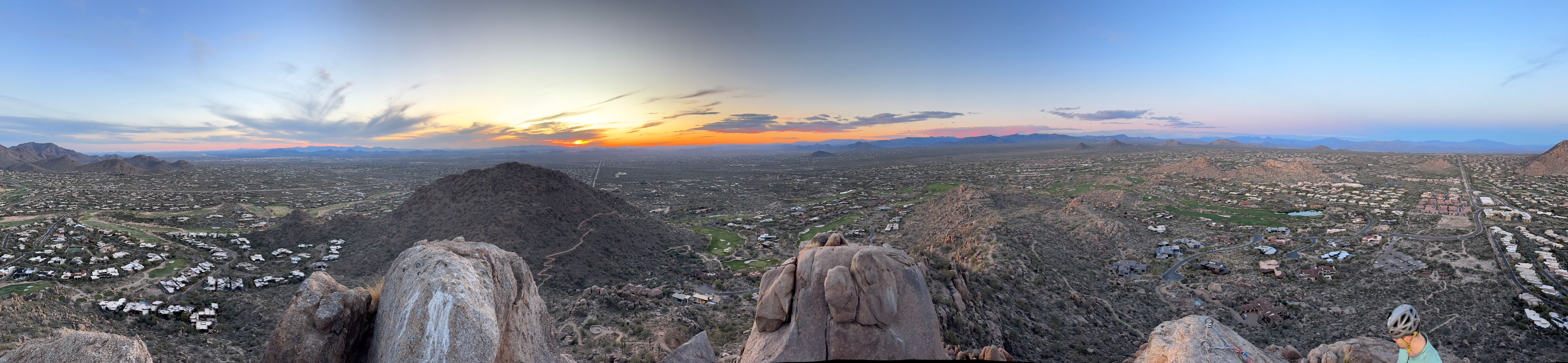
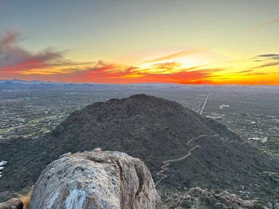
Pinnacle Peak is a monolith of granite in the foothills of the McDowells on the edge of the urban area of Phoenix, but despite the proximity to civilization the peak itself had not been modified for tourists, which is very fortunate for the climbers but not so fortunate for the hikers. If this peak is in any other country outside the U.S. and Canada I’m sure there’ll have at least some sort of via ferrata to the top. There’s no walk-up route as the easiest route requires 3 pitches of climbing rated (originally) at 5.3. The rating is very sandbagged as by the modern standard there are many moves up to 5.7 and this is in my opinion, not suitable for the beginner climbers.
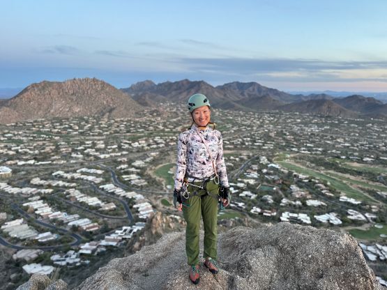
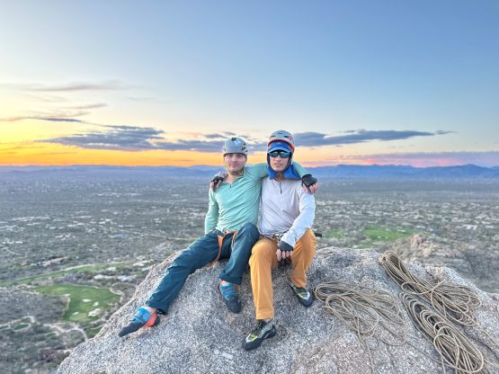
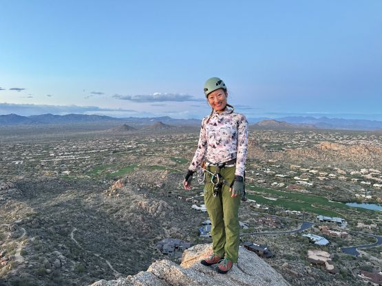
Caspar, Erica and I decided spontaneously to add this objective in after completing Courthouse Butte and Bell Rock earlier in the day in Sedona area. The drive would take 1.5 hours and the final destination would be Tucson another 2 hours away. Needless to say the itinerary was crazy but we liked to challenge ourselves. It was actually me who insisted on adding this peak in, because we had already decided to skip another classic 5.7 peak in the Sedona area due to Caspar’s family commitments. Frankly speaking all of us didn’t give it enough respect as we had read somewhere that people had been using Pinnacle Peak as their first ever trad lead, so how hard could it be. Well, the climbing turned out to be much harder than we thought. There’s also some complication with the park’s gate (which was to be locked at 6:30 pm sharp), but we got out nevertheless without having to pay a single penny of fine after some creative but illegal practices which I’m not going to write about on the internet.
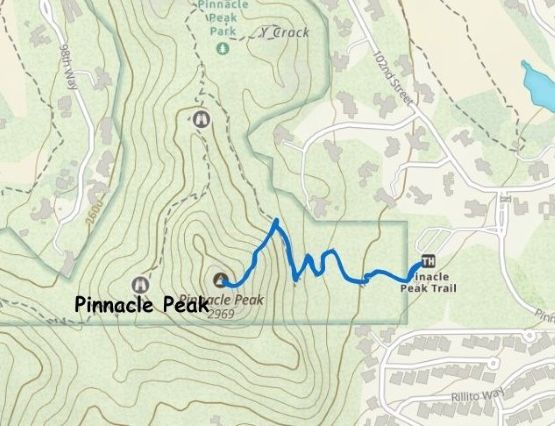
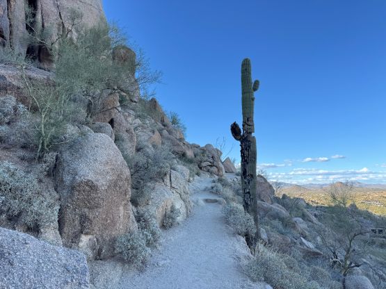
In any case we got to the trail-head at 5 pm and right away we noticed that 6:30 pm gate closure time that none of us was aware beforehand. I also couldn’t find my headlamps even after spending 10 minutes to search all of the bags, so we were literally racing against both the park’s hour and the darkness, which was far from ideal. I also don’t think people would only budget 1.5 hours for the round trip climb of Pinnacle Peak, but off we went anyway. This is also one of the objectives that we couldn’t obtain a GPX track from peakbagger.com, and I figured out the reason after completing the climb. My own track got completely messed up by the vertical cliffs such that I simply deleted it afterwards. I’m sure it happened to the other parties as well. The route is not hard to figure out though. Perhaps the most critical point is to locate that climber’s access trail, which was marked by a cairn with some signages of “not for hikers”. We made at least one route-finding error by losing this faint trail but after some class 3/4 scrambling we regained the path and found the start of the climb after a little bit of struggling.
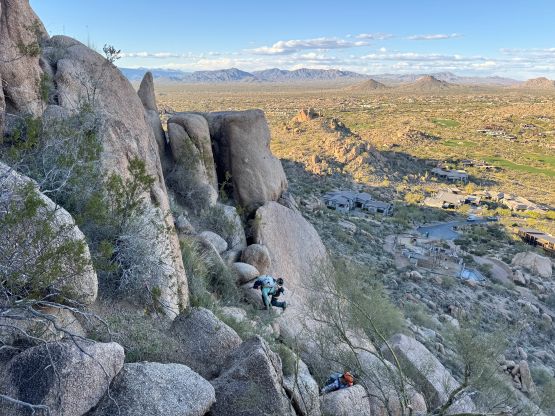
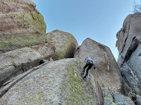
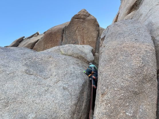
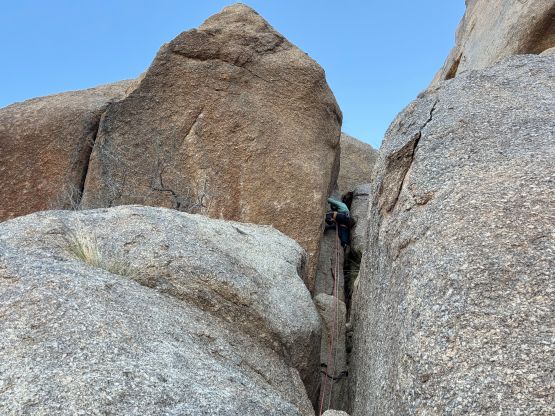
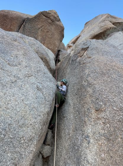
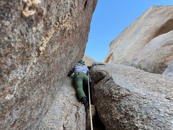
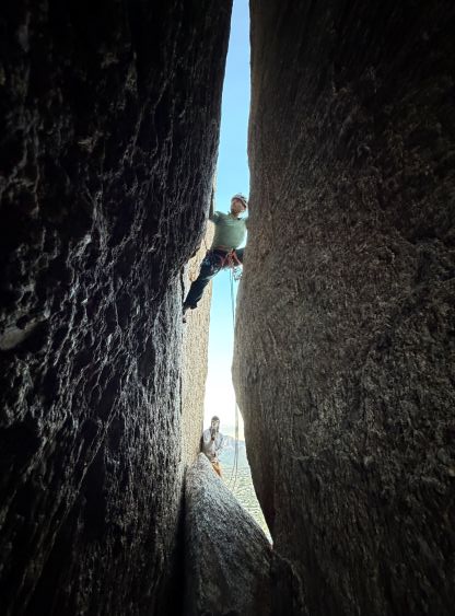
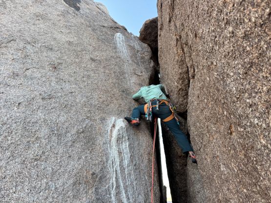
The first pitch is also known as the “approach pitch”, that some parties opted to solo. I would not agree with that statement so we took our time gearing up. Caspar volunteered to solo this pitch to speed things up but it took him quite a while to figure out the initial chimney and the off-width higher up. Caspar placed one directing nut but otherwise managed to solo to the two-bolt anchor below the “south crack”, and belayed Erica and myself up. To speed things up Erica and I climbed simultaneously but we both struggled even with a top rope belay. I somehow felt this climb easier than the sandstone pitches we did earlier in the day, probably because I’m slightly more used to cracks and off-widths. The second pitch had the most exposure but was also the most fun, climbing straight up the “south crack” for 30 m to another two-bolt anchor. The belay stands were awkward.
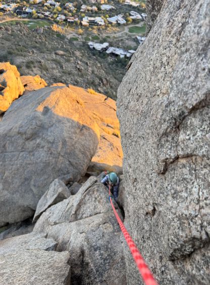
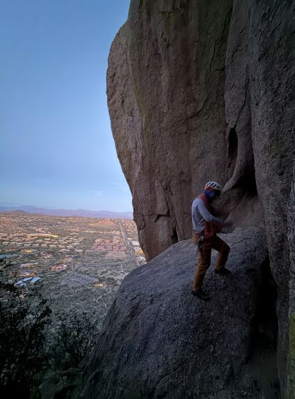
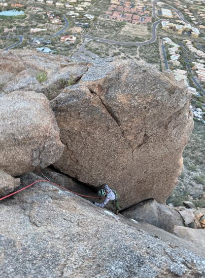
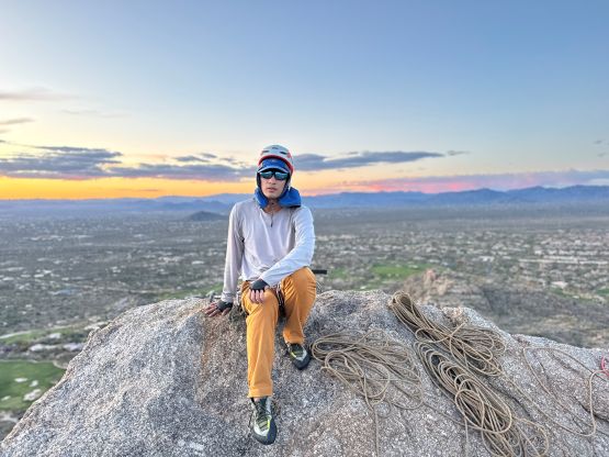
At this point we knew we wouldn’t be making the 6:30 pm deadline but we were only 1 pitch from the summit so there’s no way for us to bail at this point. We had also brought two 60m ropes as the plan was to do a single (long) rappel off the backside of the summit. A lot of parties got their ropes stuck while bailing off the climbing route. The 3rd pitch felt the easiest but had a few awkward moves. Caspar placed the #4 cam which was kind of fun. We made the summit with only a few minutes of spare before sunset, and we were actually not far off from making the deadline. The new decision was then made for Caspar to rappel off and run ahead to hopefully drive the car out of the gate, whereas Erica and I would simply take our time. Caspar would also leave his head-lamp for me as if he ran for the parking lot he would be able to beat the darkness.
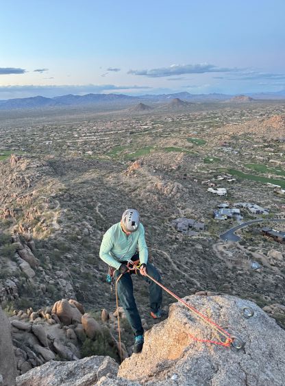
The rappel was a committing one with a massively long overhung at the bottom. My ATC turned into a hot piece of metal that I simply couldn’t touch it for almost a minute after finishing the rappel. We successfully freed the ropes and then carefully down-climbed to our gear stash. There was more scrambling than I thought to get back to the gear stash. Erica and I then took our time leisurely walking back to the car and we finished the round trip in just over 2 hours. Caspar, as well as a few other hikers indeed got locked in but Caspar found a way of getting out without having to call the officials, and this likely saved us a few hundred dollars as well as 2+ hours of waiting time. We then took turn driving south to Tucson and it wasn’t even that late by the time we got to Caspar’s dad’s house. Overall I would not agree with the 5.3 nor the 5.5 rating for this route. If it’s in Squamish, B.C., it would be at least 5.6+ or 5.7. It felt quite a bit harder than some of the 5.6 climbs I’ve done in PNW such as Liberty Bell Mtn. or the crux pitch on Forbidden Peak.