Twin Lakes – “Crystal Peak” and “Elliott Peak”
July 6, 2025
2468m
D’Arcy / Haylmore Creek FSR, BC
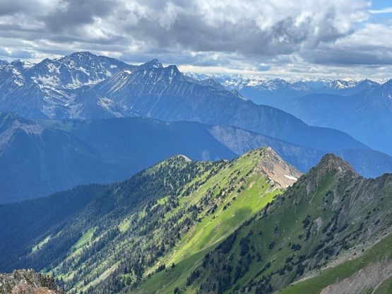
The two peaks above Twin Lakes in the Barkley Valley are well written in Matt Gunn’s Scrambles in SW British Columbia and at the time the book was published, the peaks were unnamed. Somewhere around the mid-2010s Robin Tivy from bivouac.com unofficially authorized himself to name a bunch, if not all of the peaks in the area and the names “Crystal Peak” and “Elliott Peak” has since stuck, at least in the online world. I’m not a fan of the “bivouac names” at all but if everyone else uses the same unofficial names then I guess I have no other choice. I was never too keen on the peaks in the scramble book as these well-written peaks lack the sense of adventure or accomplishment but for once in a while I do want an easy outing when time/energy/motivation is lacking.
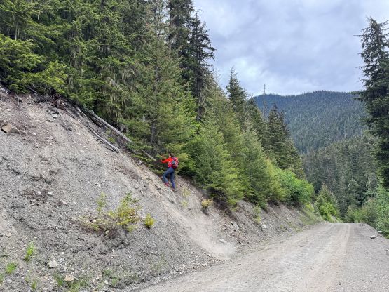
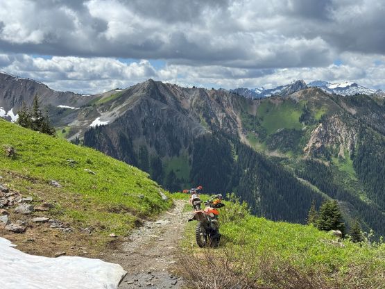
There had been some recent updates on the Haylmore Creek FSR access, that apparently it’s possible to drive “any SUV” to the starting point. I figured that I might as well take advantage of that, so talked Holly into this trip. Holly was not available for car-camping but offered to drive her Ford Explorer, and we decided to leave North Vancouver at 6 am in the morning. The weather would be party cloudy throughout the day without risks of thunderstorms so there’s no point in killing the sleeping hours. Holly drove us to Pemberton and I took over the drive afterwards as I was more experienced in driving the FSRs. The Ford Explorer could not match the Subaru Forester when it comes to the off-roading capabilities and the vehicle was only equipped with the stock tires. The road had no “obstacle” aside a very shallow creek crossing, but was rocky and rough so I had to drive at a snail’s pace. Upon parking at the trail-head I consulted with the maps again, and decided spontaneously to drive us 1.5 km farther down the road. The first 1.5 km of the trail parallels the road and the bushwhacking short-cut looked quite inviting at least on the map.

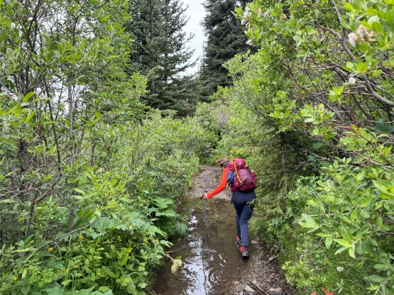
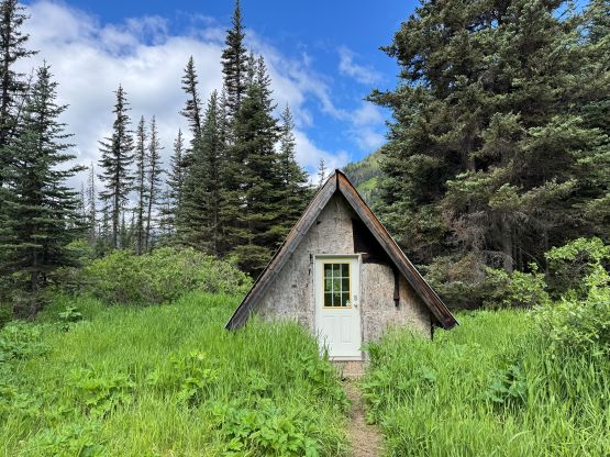
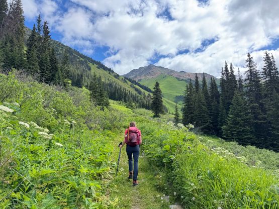
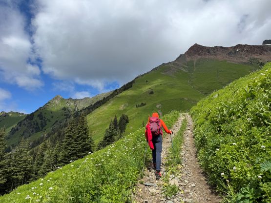
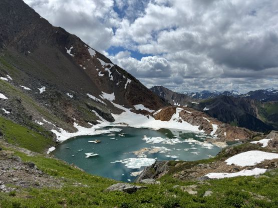
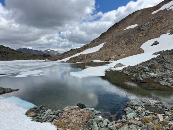
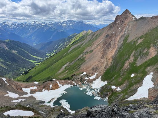
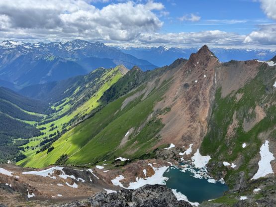
After parking the vehicle at a small pull-out we dived right into the bushes. Getting into the forest involved some scrambling on choss but the forest was surprisingly open. Holly timed that we only spent 7 minutes to get to the ATV road/trail so our in situ decision definitely saved a LOT of time and energy. I then made Holly lead the pace and our next stop was the cabin in Barkley Valley. The mosquitoes were terrible but the cabin was open so we could take a break inside to get away from the bugs, momentarily. I told Holly that if the bugs situation wasn’t improving then I would take zero break until the lakes and Holly reluctantly agreed. Thankfully this was a chilly and cloudy day, that the density of the mosquitoes had decreased drastically above the switchbacks. After taking another needed break at the “road’s end” we pressed on to the lower lake, which was kinda messy. The upper lake was a much nicer spot to take in the views.


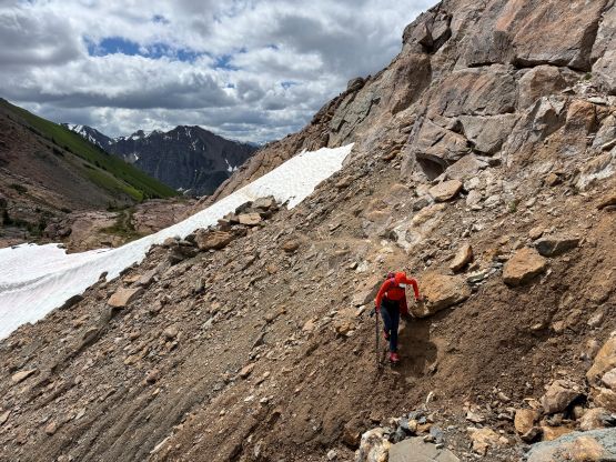


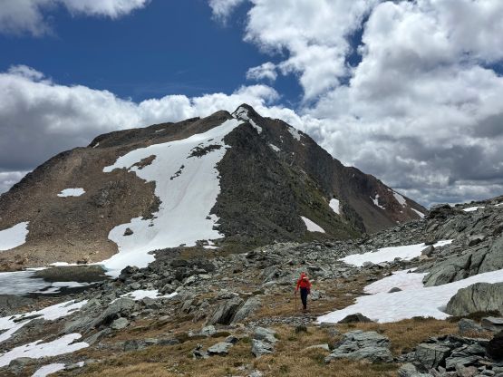
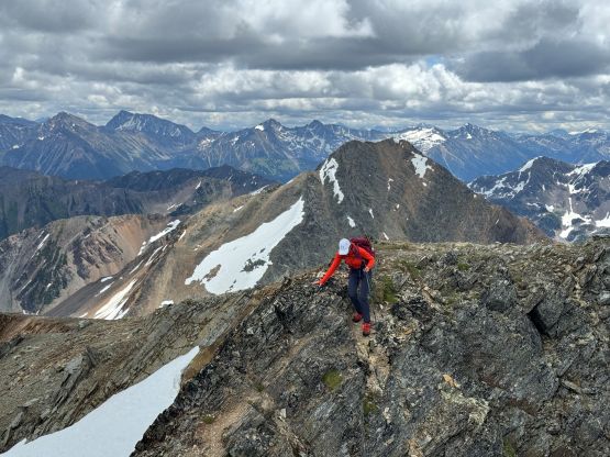
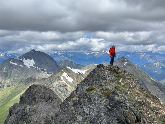
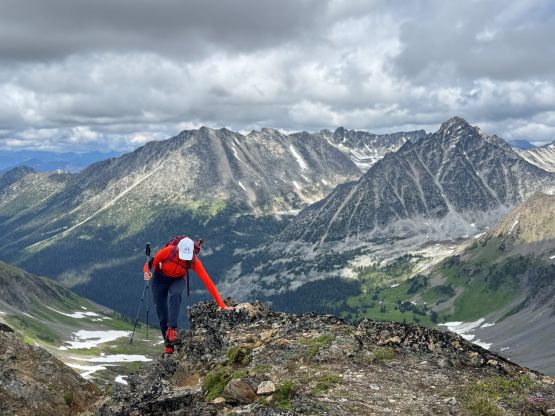
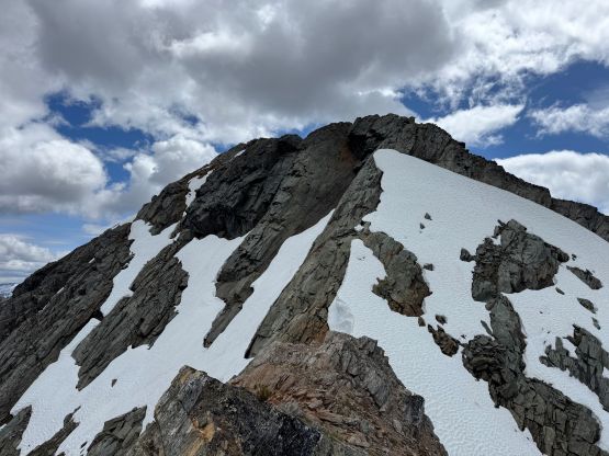
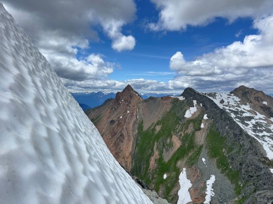
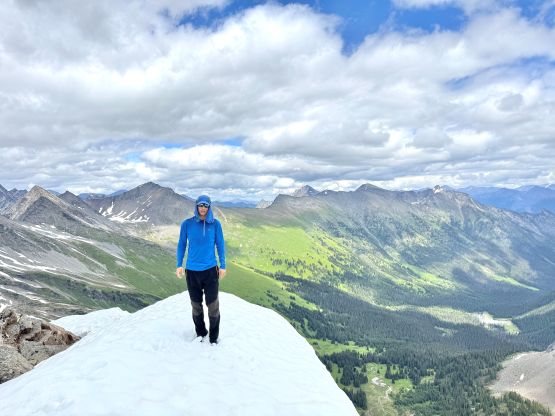
I decided for us to do “Crystal Peak” first as it’s the taller of the two. It’s unfortunately the more boring option but I had done no research beforehand. I simply followed the set of GPX tracks downloaded from peakbagger.com traversing towards climber’s right and it seemed to me there are many ways. We found some running streams to refill the water bottles, and this east-facing valley was still currently covered in snow in most places. I had not brought an ice axe nor crampons but the snow condition was soft that the trail-runners were more than sufficient. There’s one steeper (30-degrees) snow slope to ascend near the top of this valley but it could be bypassed had we looked for an alternative. We were then on the south ridge of “Crystal Peak”, and the true summit involved a surprisingly airy gap to traverse across. The scrambling was class 2 at the maximum but the exposure was real.


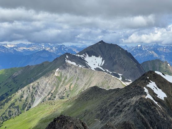


Holly decided to skip “Elliott Peak” so I didn’t stay too long on the summit of “Crystal Peak”. I quickly made my way down to the upper lake following our own footprints. The step-kicking had become post-holing on the descent, such that my shoes were thoroughly soaked but I couldn’t care much. Upwards on “Elliott Peak” I stayed initially on snow but the snow was quite firm and steep. I merged onto the rocky ridge on climber’s right side and followed it easily until I came face to face to the crux section. I was surprised that “Elliott Peak” wasn’t a walk-up as this zone appeared rather tricky given the early-season conditions. I had to do some step-kicking on 40-degrees snow (in trail-runners and sans crampons and ice axes), and deal with some 3rd class scrambling with exposure on climber’s left side of the snow. It was quite amazing that I could scramble around the steepest part of the snow as otherwise I would have to come back to the upper lake and grab Holly’s ice axe and microspikes to give it a second shot. I did some research afterwards and this section was indeed “on route”, but at least one person bypassed it somehow. The rest of the ascent following the north ridge was trivial but took a while as the true summit was on the far side of the ridge.


Not doing much lingering I quickly made my way down, and reversed what exactly I did on that crux zone. I then plunged onto the snow slope and made some quick work down to the upper lake. To my surprise I got down to the upper lake quicker than Holly. Holly debated for a while but eventually opted for a swim in the brutally cold water. She only dipped in for 5 seconds but that still counted. We then made a leisure descent and concluded the round trip in 7.5 hours taking in account of everything. The drive home afterwards was tiring and long.