Tverrfjellet
July 26, 2024
776m
Ålesund, Norway
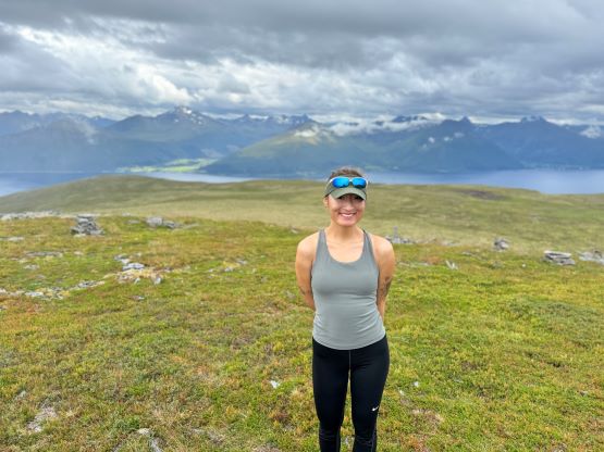
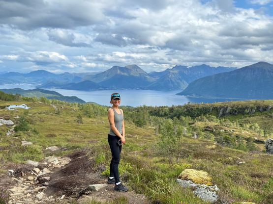
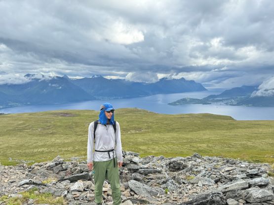
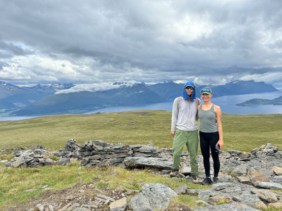
“Fjellet” means “mountain” in English and Tverrfjellet is the highest peak on the island of Sula, south of the city of Ålesund. This peak boasts over 600 m prominence and so are many high points of islands on the west coast of Norway. Unlike some of the P600m objectives in this country this one does require one to gain most of the prominence. There are lots of possible starting points, but most aren’t far above the sea level so this is a somewhat “proper” hike that takes at least a few hours for most parties. Erica and I decided spontaneously to give it a try after having a bit of a clearing window in the otherwise, dreary day. The forecasts were still calling for torrential amount of rain but the sunny skies above made the decision for us. Erica had missed out Skåla earlier in the morning so I was very keen to get her a summit on this day. There were a few smaller P100m objectives that would take no more than an hour but I wanted something a bit more special. The P600m island’s high point made the most sense.
My only “beta” was from the Gaia topographic map and there are lots of trails and roads to choose from. I picked the eastern approach as the drive would be shorter and it seemed like we could have a higher starting point at around 350 m elevation, shaving off almost half of the elevation gain. Of course that stayed as in theory, as the spur road turned out to be “not allowed for driving”. We discovered that in situ but there was no gate or anything to physically block our entrance, nor was there a camera (at least I couldn’t find one by simply looking around). In North America I always ignore signs like that but I tried to be more careful in Europe, but then looking at the maps our only chance was to drive at least a few kilometers up this road. I had already done 1000 m elevation gain in the morning and we had a big objective planned for the following day, so we shouldn’t tire ourselves out. The decision was made to risk it and we did get the rental car a few kilometers up before the road became too rough to drive. We passed several locals on their way down and one gave us a lessen how this was not supposed to be driven.


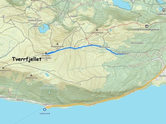
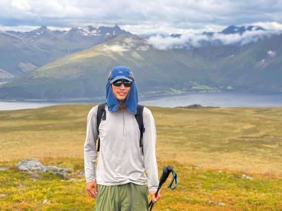
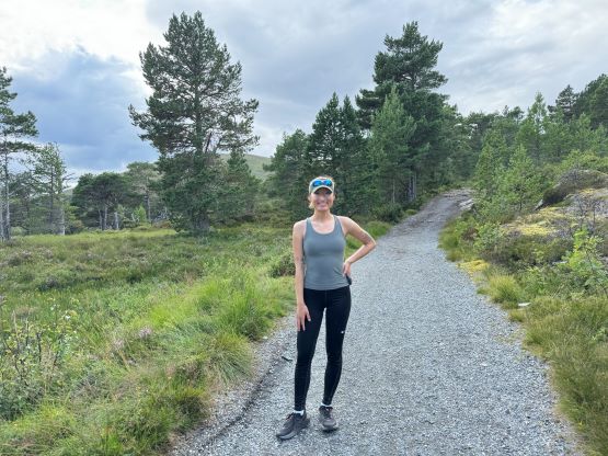
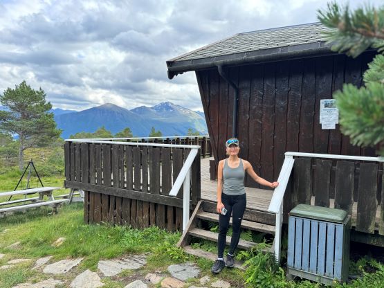
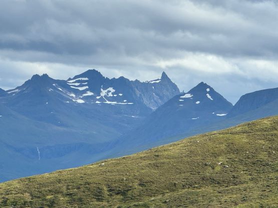
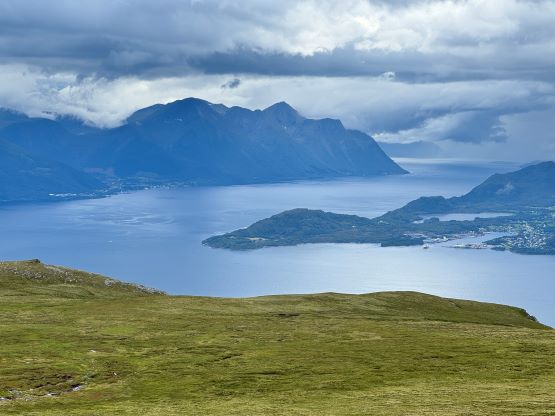
This would still require over 6 km round trip distance even though we illegally drove to 300 m elevation so it was still not the “no brainer” that I was looking for, but whatever. The weather was still showing signs of improvement so we actually had some high stoke level. The road’s end was the village of Rollonhytta which was currently “closed” for visitors, but hikers still came there to take a look. The village was more or less just a single building but it was quite cool. We then picked up the obvious trail that ascended again, some Scottish landscape for a few more kilometers to the summit. There was not much worth noting about the hike itself, but the views were quite memorable towards all directions. We could even see the pointy spire of Kolåstinden which would be our next objective.


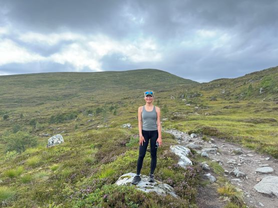


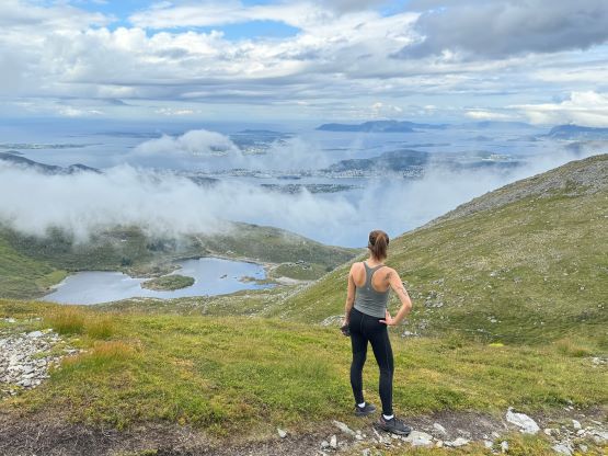
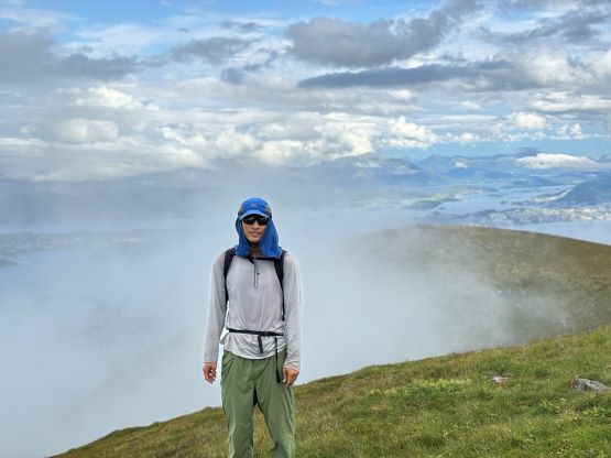
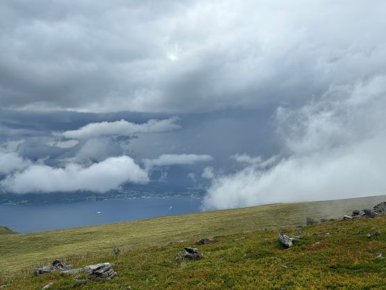
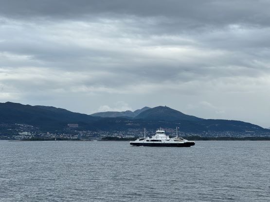
The weather was still stable by the time we got to the top but I could see some really bad weather to the west, and in fact a wall of low clouds were approaching rapidly. I told Erica that we might get drenched in no time and she was quite upset because we didn’t actually bring rain gear. I ended up giving the car key to Erica and she made an instant dash down, disappearing in no time. I could have no chance in keeping up with Erica on the downhills and she did end up getting back 20 minutes earlier. The rain never came until the last two minutes of my descent but when it came, it came heavily. A few more minutes later it had become a torrential downpour. I had to focus on driving extremely carefully to get us out of there without causing any problem, and once out I drove us straight towards the next ferry crossing. It was pouring cats and dogs while we waited for the ride, but cleared up nicely when we drove towards Volda on the other side. Erica and I had booked a homestay for the night, anticipating some rain and unpleasant camping experience otherwise, but with the decent weather we decided to walk around the town to explore a little bit before checking in.