Tsast Uul / Tsambagarav High Point
September 5, 2024
4193m
Ölgii, Mongolia
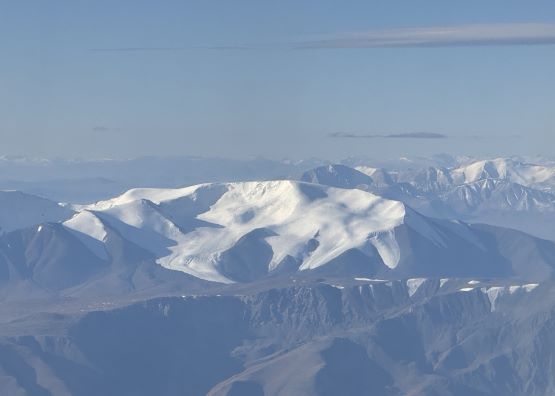
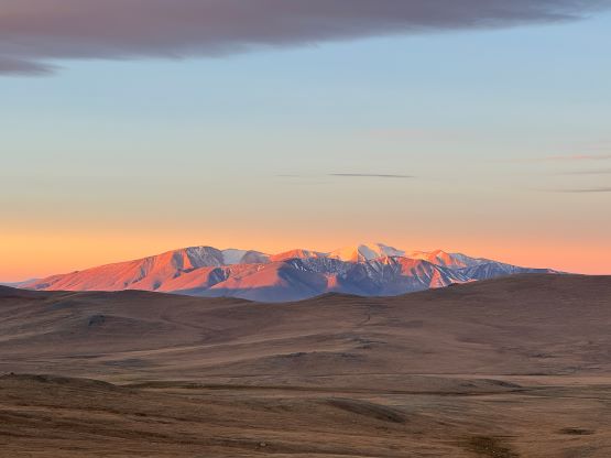
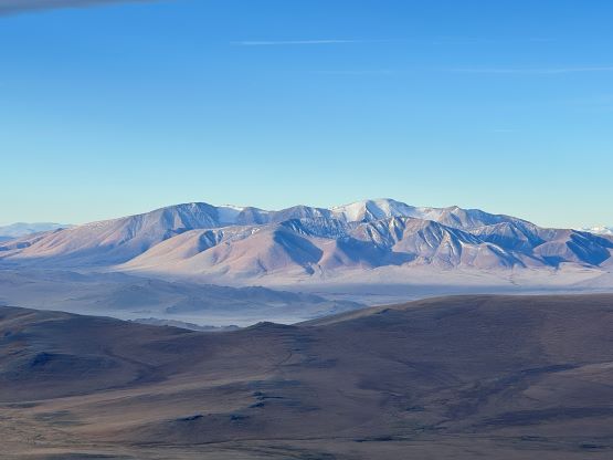
Tsast Uul is the highest peak on the massif of Tsambagarav Uul, which is supposed to be Mongolia’s 3rd highest peak according to the official maps. There are however three peaks (Sutai Uul, Munkh Khairkhan’s Sukhbaatar and Tsambagarav’s Tsast) that are currently competing to be the country’s 2nd highest peak as their elevation data, at least according to our GPS measurements are very similar at the moment. Two of the three summits are covered under glacier so their heights could drop if the global warming continues. This is one of the two “ultras” that Petter had climbed during his previous visit in 2019 so it was excluded in the 34-day trip with Gangaamaa Expedition, but I added 6 days at the end for Khüiten Uul since it’s the country’s highest peak. As the second half of this trip became closer it was apparent that if Tsast Uul could be squeezed in then I would have a chance to make the full sweep of the Mongolian “ultras” with the only exception of the northernmost one on Russian border that must be done in a different season. Judging by Rob/Deividas/Mclellans’ paralleling trip I knew it was logistically possible but the weather must cooperate. Adam was supposed to be with me on the entire 40-day itinerary but bailed due to health issues. Gangaa had issued him full refund (something like 2300 USD) for the second part of the trip so we are now on low budget. Tsast Uul was added to Khüiten’s package only because of my negotiation but it could not be free due to the additional driving and logistics etc. The cost would be 300 USD and I didn’t bother to argue much. I knew the other group got this one for free but they had 4 people paying the similar expenses per capita and I had already got Tsetsee Gun as well as Otgon Tenger essentially for free earlier in the “big trip”. This price for a 2-day, 1:1 guided climb sounded reasonable anyway.
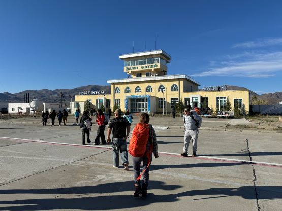
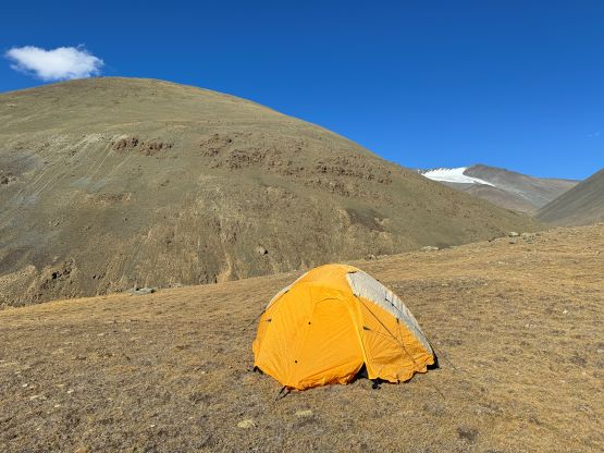
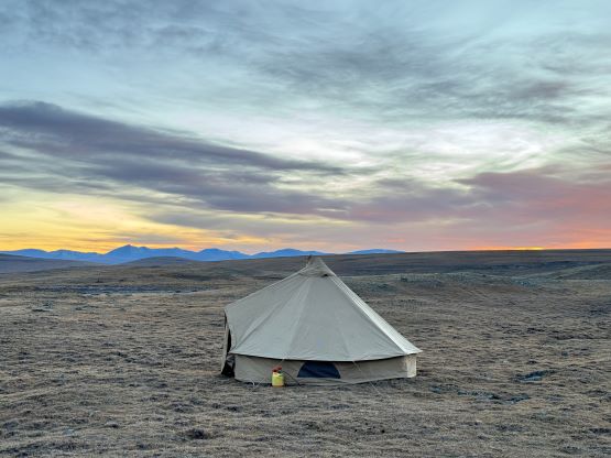
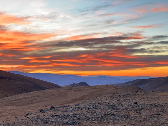
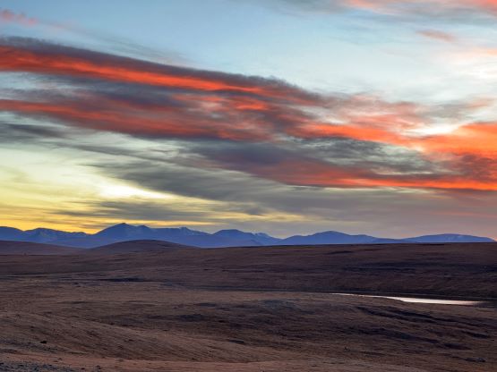
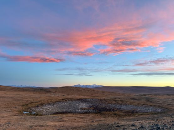
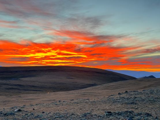
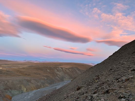
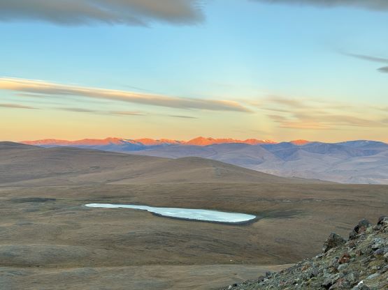
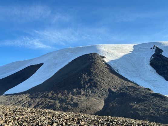
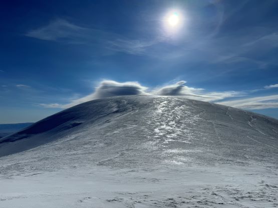
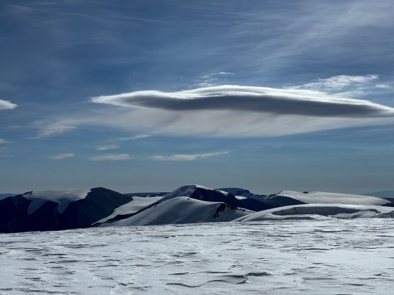
The weather for the 6-day period turned out to be not very ideal, with a system coming in the middle of the span. This might not be a terrible news because I could use the middle two days to travel, and Tsast Uul had reasonable forecast on the second day after arrival. The downside was the associated coldness as I was not preparing for the winter-like conditions when planning this trip, but that’s more about Khüiten a few days later. Gangaa and I took the domestic flight from Ulaanbaatar to Ölgii on the morning of the 4th, made some shopping in the city together with the driver and quickly made our way to Tsast’s basecamp. There seem to have several routes. Petter had climbed it from the north whereas Rob’s group did it from the west. This time Gangaa took me to the south side route and I should say that the three routes have very similar distance and elevation gain. The driving was definitely rough but only for the last few kilometers. We were hoping to drive all the way to the base of that ridge but the vehicle could not make that steep descent to the creek crossing at the very end, so we set up the basecamp above the creek and settled for the day. The winds were not as bad as forecasted and the weather was mostly clear.
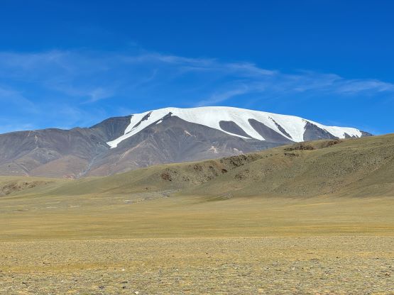
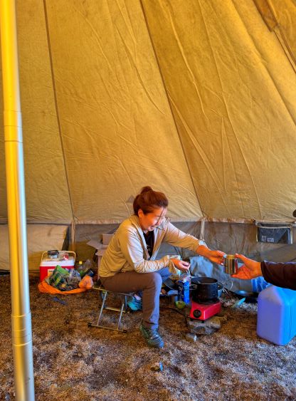
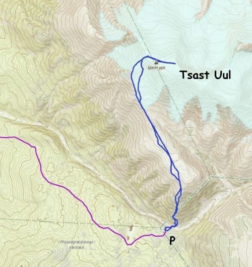
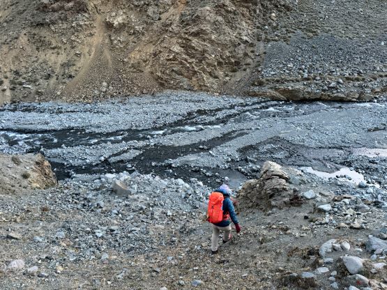
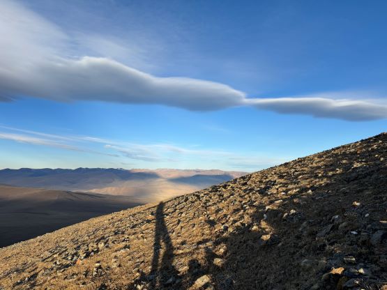
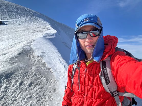
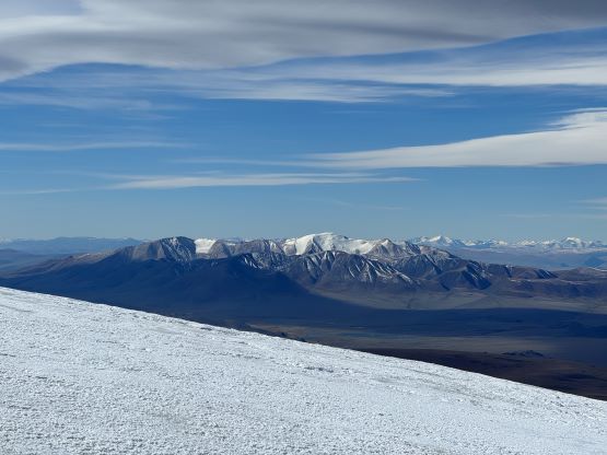
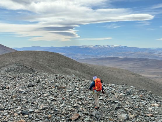
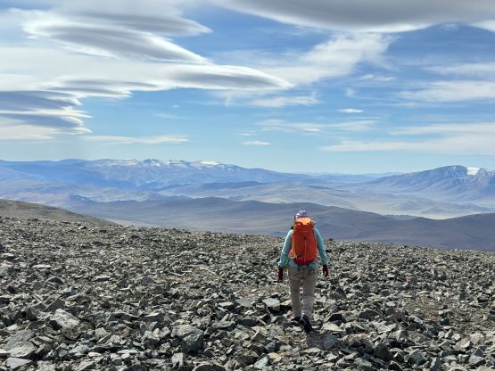
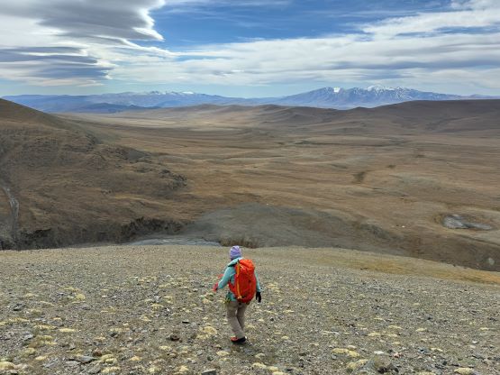
The night was cold but not enough to freeze the water bottles. We got out at around 5:20 am, had breakfast and started at around 6 am. Thank to the limited budget I no longer had a guide on this climb, but Gangaa offered to “guide” me instead. Gangaa had climbed K2 and Everest and is known as the most famous mountaineer in Mongolia and she’s able to “open the door” for things that others could not, such as the visa extension and the Dünkheger’s negotiation, but Gangaa had not climbed actively in the past year thank to some health concerns. I appreciated her offer but after a few hundred meters of elevation gain it was apparent that we had very different uphill speeds, so Gangaa made me to go ahead. Gangaa would still climb at her own pace and would turn around wherever we ended up meeting again, on my descent from the summit. The initial creek crossing was actually quite tricky as the rocks were covered in a layer of verglass. I did my usual tactic to carry the boots while wearing shoes and I deliberately made some careful footwork to keep the shoes dry. Gangaa had opted for mountaineering boots for the whole way, on the other hand. There was about 500 m steep grunt to get out of the valley but thankfully the terrain was not super unpleasant. There was virtually no “boulder hopping” on this entire route. There were a few kilometers of plodding at around 3500 m due NW along a ridge and I tried hard to make the bearing straight while resisting unnecessary elevation loss and regain.
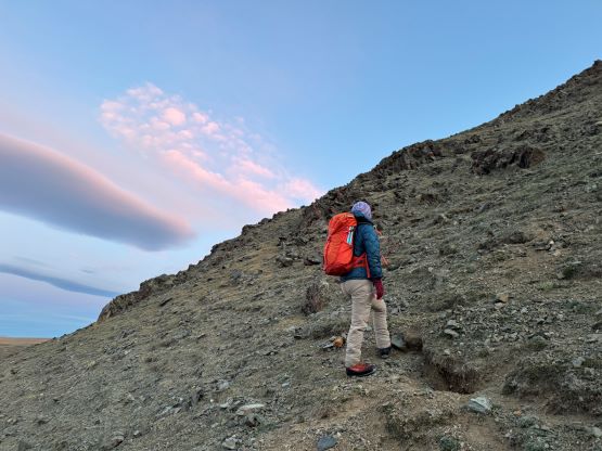
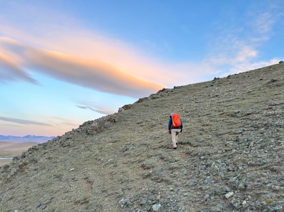
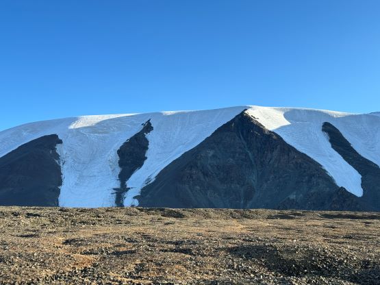
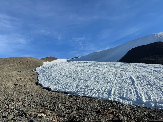
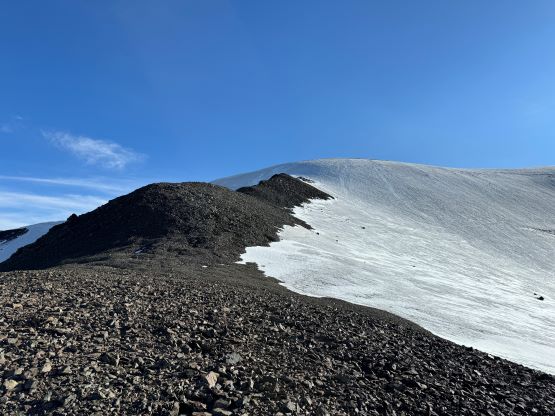
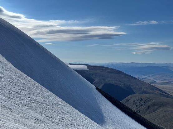
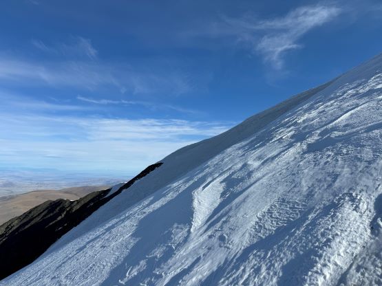
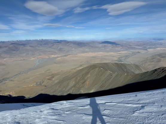
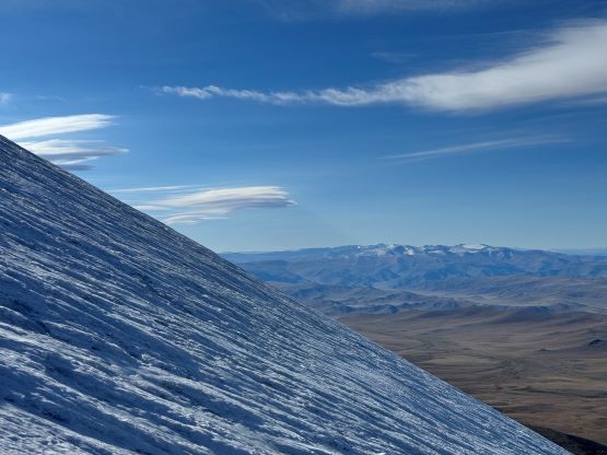
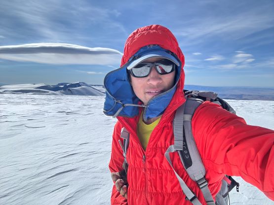
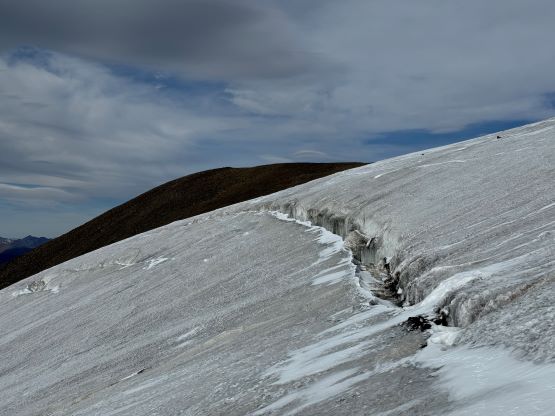
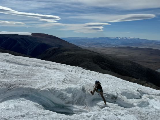
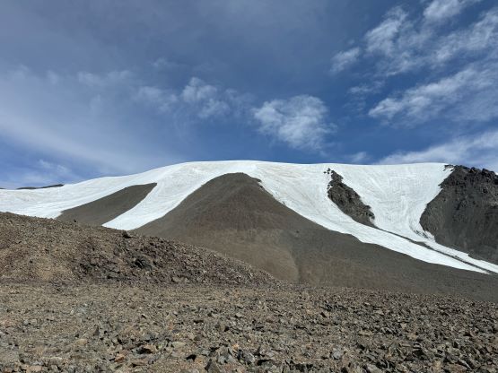
There was about 20 m drop that could not be avoided, and then I faced a decision making situation. The supposed route goes up the entire course of that SW-facing glacier but the rocky ridge to the left of it looked more appealing. I opted to stay on rocks for as long as possible because for me that would be the faster way. This ridge lasted for a long while and I eventually hit the glacier at almost 4000 m elevation. I made a hasty change of footwear as my fingers were cold in the winds. I also made the decision to leave the ice axe and harness behind as the route ahead appeared rather straightforward. There was no more old snow on the glacier all the way to the summit so the entire plod would be on ice. There was some new snow but not enough to obscure the crevasses (if there’s any). The initial 50 m grunt onto the NW Ridge was quite steep and I could see that some clients might prefer to be short-roped. I, on the other hand, had no issue going up with just crampons and two trekking poles. I did discover on ankle-biter minutes after topping out on the NW Ridge but otherwise, saw no visible crevasse. The winds were brutally cold on the other hand. To my surprise I got some cell receptions on the summit and there were quite a few things to get done. First of all the organizer of Petter’s China trip sent me some two-minute worth of voice messages so instead of texting I called her back. Fortunately she picked up the call so I got a better idea of what’s going on. I then texted Petter back on What’s App (he’s using VPN currently). I also had to reply quite a few work related messages as the school season had already started. All together I managed to stay on the summit, bare hand in the cold for about 20 minutes but that was my limit.
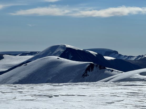
I put the gloves back on and still felt very cold while plodding back down the NW Ridge. I did not fully warm myself up until finishing that steep part of the glacier, and then all the sudden I saw Gangaa ascending the lower glacier route. I made the decision to keep the crampons on to join her, but I did not like this route. I much rather preferred the choss on the ridge but the glacier did offer some different scenery. For the rest of the descent I opted to follow Gangaa’s lead and as you can see from my GPX track the descending track was much more meandering. This proved once again that having a GPX app could easily be more efficient/accurate than relying on the memories from having been up there 3 times in the past. The round trip time was 6 hours 45 minutes including everything. Because we finished the trip by lunch time we made the in situ decision to drive back to Ölgii. The hotel stay was not in the original package so I paid for 32 USD. This was still much better than wasting the rest of the day at the basecamp (without cell reception).
