The Still
June 12, 2023
2297m
Chilliwack, BC
For a few years The Still was the only peak in Cheam Range that hadn’t done, not because of the technical difficulty but rather the obscured status. The access is the same as the peaks in Baby Munday area and I had done that approach twice. I was not looking forward to do it the 3rd time just for the sake reason to finish off the business but I heard recently that the Airplane Creek FSR as well as the trail had deteriorated considerably. I feared the access would be “gone” soon. Elise casually mentioned during our drive home from Mt. Pershing in the Olympics, that Chris Gulka just summitted The Still a few hours ago. Apparently the road was only drivable to 800 m elevation nowadays and the trail had become significantly overgrown. I made the final, last minute decision at home (at around 11 pm) to tailgate Chris’ trip on the following day despite the tiredness and the lack of motivation. The weather was supposed to collapse on Tuesday so I had exactly one more day to take advantage of the dry conditions.
I did not bother to try finding a partner with such a short notice and I decided to sleep in till 7 am, mostly because I was tired from Mt. Pershing’s long drive. Based on Chris’ trip I knew there’s at least one mandatory crossing of a snow slope but the slope angle was rather tame. I also on purposely start late to let the snow soften so I could to do the whole trip in trail runners, but carrying an ice axe and crampons just in case. The snow gears of course turned out to be training weight as they were not needed. I made a stop in Abbotsford’s A&W for breakfast and made to Chilliwack Lake Road at 9 am. The pot-holes on Foley Creek FSR were not any smaller than I remembered and despite the recent drought there were still several large puddles to push across. There’s one wash-out with a bypass on left side through a creek that I couldn’t remember from the previous visits. The condition on Airplane Creek FSR was similar to what I remembered. This is a “road” solely for Tacoma, 4Runner or a Jeep and beefy tires are highly recommended. It’s more like an ATV trail to be honest. I used 4Low to crawl most of the way up, and did not scrape the bottom of the truck crossing that one particularly deep water bar this time. One truck had already parked at the small turn-around spot under the impassible wash-out at 790 m elevation so it was a difficult task for me to find a spot to put my truck in without blocking the other party’s exit. I managed to start hiking at exactly 10 am.
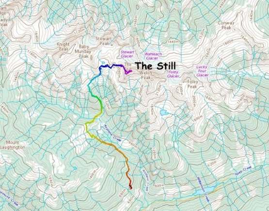
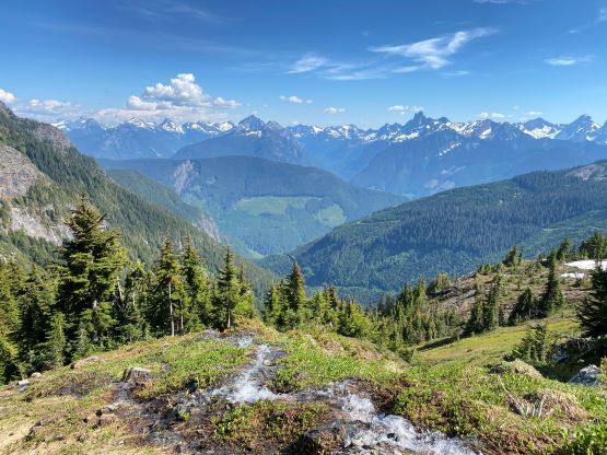
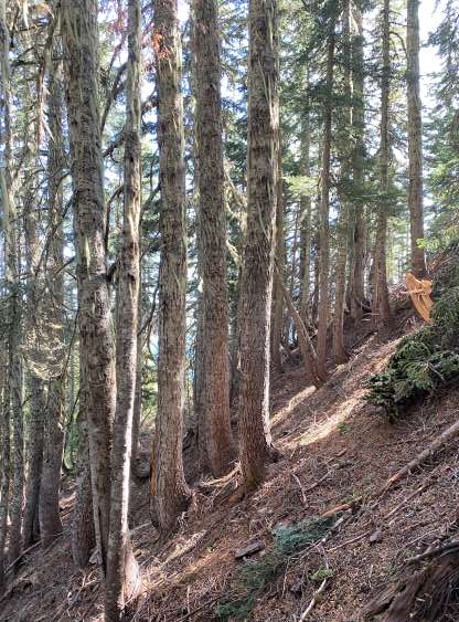
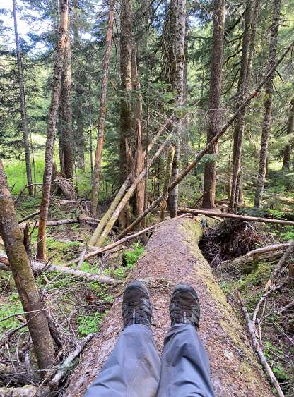
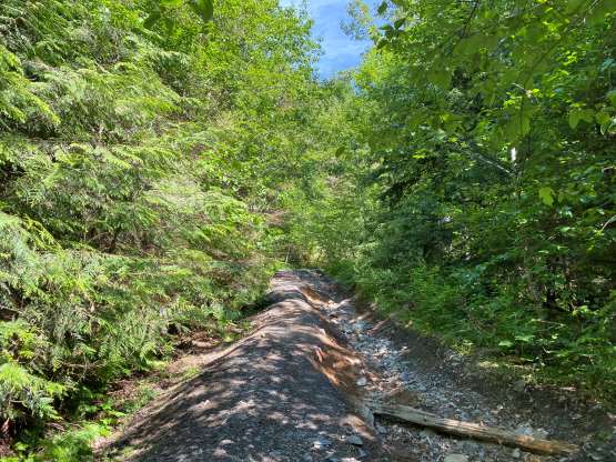
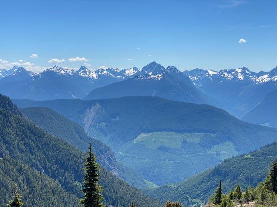
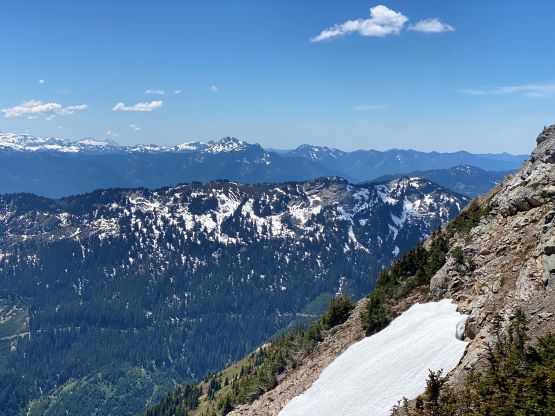
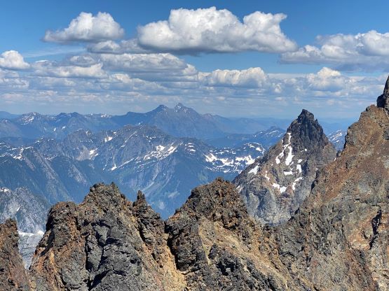
It took me 20 minutes to plod to the actual trail-head. The first few kilometers of the trail was seriously overgrown. I did not remember the alders to be that bad on my visits in 2021. The entire stretch paralleling Airplane Creek felt like a bushwhack. Several small creek crossings were also not easy with bushes and the eroded banks so this trail is seriously overdue for maintenance. Nonetheless I got to the point where I should drop ~100 m elevation down to the main Airplane Creek crossing in under an hour. I took my shirt off after entering the forest as the day had been hot and humid. There’s a fallen log to help crossing the main creek. I walked on top but some might have to au-cheval. Over the next hour I grunted up the steep climber’s trail to treeline at 1500 m elevation. This part of the trail was more or less similar to what I remembered from before. I took my next break at the treeline applying sun protection. I then carried on, taking the climber’s right trail branch traversing underneath the south slopes of Baby Munday Peak with several mandatory snow gullies to walk across. The trail became faint but I was able to mostly follow it to the basin south of Stewart Peak. I did lose the trail near the top of this stretch and did some unnecessary bushwhacking.


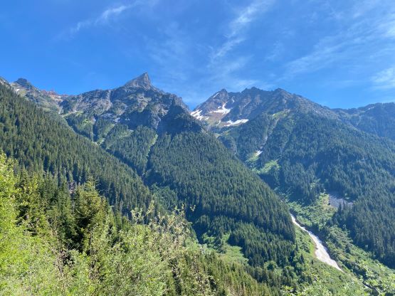


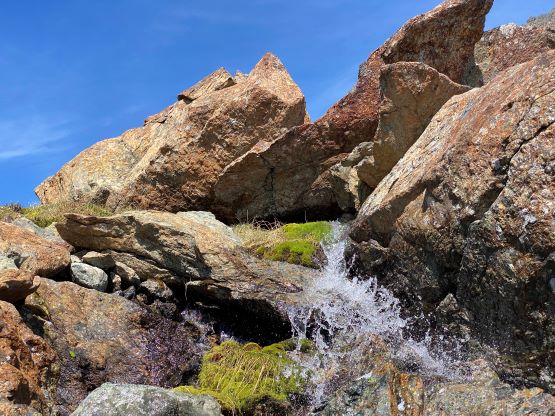
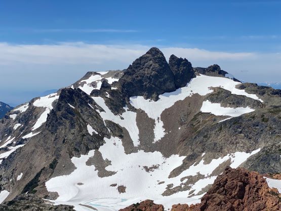
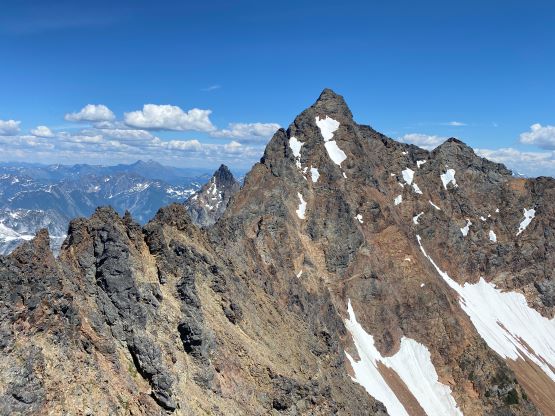
I kept traversing climber’s right over some undulating terrain until I found a rather impassible cliff blocking the direct route to the west slopes of The Still. I had Francis Bailey’s GPX track and apparently he had scrambled through this cliff, but his trip was done in late summer. The spot where Francis’ GPX ascended was literally a waterfall. I could have descended and traversed around but I was feeling tired and I wanted the shortest possible way, so I attempted that waterfall step. It took me two tries to figure out the sequence of moves so that I wouldn’t be completely soaked after finishing. I would rate this step 4th class in the conditions I had, and I did manage to not get fully soaked. My shoes were already wet from the snow crossings so I couldn’t care too much. Onto the west slopes of The Still I mostly ascended a straight-up line in the middle of the face, dealing with some class 2+ scrambling on choss until I reached the bottom of the snow face that Chris talked about in his trip report.

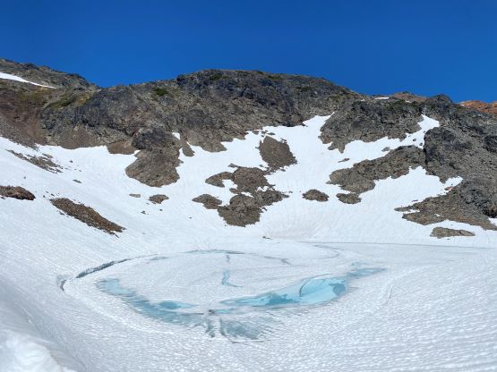


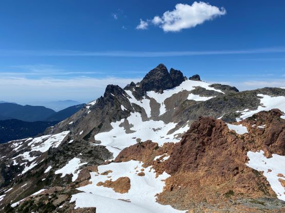
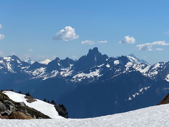
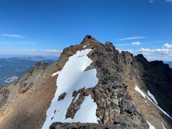
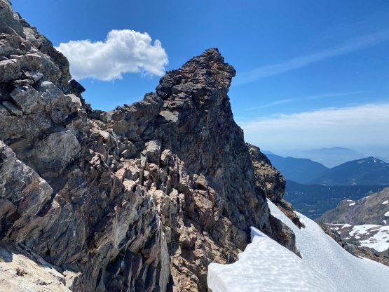
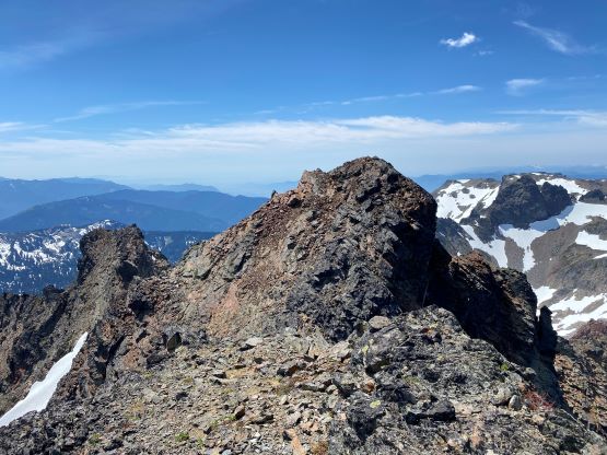
I ascended the climber’s left side of this snow slope to basically the top of the snow and then hopped onto the slope. The crampons and ice axe were unnecessary given the soft conditions and the traverse was indeed mostly flat. I knew most parties ascended the upper mountain via a direct choss bash and everyone complained about it. I opted to explore the SW Ridge variation by traversing farther to the climber’s right ridge. This was almost a mistake but I somehow made it work. I ascended up and over the subsidiary bump on the ridge (class 3) and encountered an impassible section of pinnacles. I climbed to the top of a pinnacle (class 4+) but there wasn’t a scramble route down the opposite side, so I gingerly down-climbed, then scrambled between the north side of it and the moat (class 3+) and found a way to bypass. I had no further trouble ascending this ridge to the summit, but I already made the decision to descend the standard route later. I also visited the lower east summit since there’s a cairn and a better platform to sit on and relax. Prior to this trip I wasn’t sure which summit is taller but it’s very obvious that the first (west) summit is the true one.


While descending the standard route I opted to utilize snow for as much as possible. I descended skier’s left on a band of choss and hopped onto the snow slope. The angle was quite steep but the run-out was not exposed. After a few careful steps I started running down this slope. I then reversed the exact route that I took on the ascent and was off the west slopes of The Still in short time. This was overall not a “fun” ascent but wasn’t as bad as people described. I debated about finding another way around that waterfall step but decided to just commit to the challenge. Again it took me two attempts to figure out the down-climbing moves and I did get myself quite wet this time. My shoes were already water logged so it didn’t matter that much. I took a lengthy break (about an hour) near a stream to dry the shoes off. I also appreciated this break to soak in the experience since this was my last trip in the Cheam Range. The rest of the descent was uneventful. I walked decently fast, but I took a few more breaks and eventually finished the trip in 8.5 hours round trip. I somehow got back to the truck at the exact same time as the other party (who did Knight Peak), and their dog bit me on my calf. Thankfully I was wearing thick socks so there wasn’t much of a wound. I eventually got back home at 9:30 pm. All the clinics were closed, but on the following day I did not feel the need to check in anymore.