Sutai Uul
August 22, 2024
4205m
Tonkhil, Mongolia
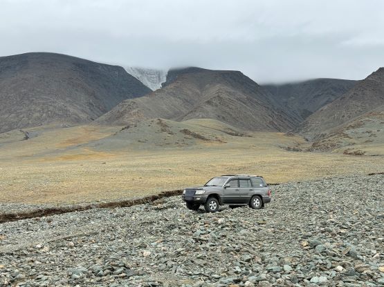
Sutai Uul, also pronounced as Sutay Uul is one of the three peaks in western Mongolia together with Munkh Khairkhan and Tsast Uul (Tsambagarav), that compete to be the 2nd highest in this country. All three peaks are currently at around 4200 m elevation but Tsast and Sutai have glaciers on the summit that are melting fast. I think in the future Munkh Khairkhan will still be the 2nd highest due to the global warming, but anyway. The standard route of Sutai Uul is fairly straightforward from the south side with only slightly more than 1000 m vertical gain. The glacier is very tame with no crevasse whatsoever, and the drive isn’t that crazy neither.
Petter and I, together with our guiding company Gangaamaa Expedition somehow lined up this objective on the same day with Rob, Deividas and the Mclellans and each team consists of 6 members and 2 HC 4×4 vehicles. This was not planned at all, but just happened completely in situ. Thankfully there were some decent cell services in the area so we were able to communicate. Rob’s team had just completed Munkh Khairkhan whereas Petter and I just did Dünkheger. We both had budged one full driving day between our respective previous objectives and Sutai Uul. I thought they would arrive at the basecamp earlier but we ended up beating them by about an hour. Again our drivers knew their country really well and we were able to take a major short-cut avoiding detouring all the way to Tonkhil. The drive was mostly straightforward except for the last few kilometers which required cross-country travel with one difficult crossing of a dry creek. We were able to catch some receptions at the basecamp and I managed to send Rob our driving GPX file so they could show up at the exact same location. It took them a while to find a way to cross that dry creek but they did eventually show up. The six of us here rank currently at 1st, 2nd, 3rd, 5th, 6th and 10th on this global Ultras peak-bagging leaderboard. This was quite cool, but it was already my 3rd time involved in this kind of meetups within the past year. Other than Bob Packard and “Rockinstraw” I had already done trips with everyone else in the Top 10.
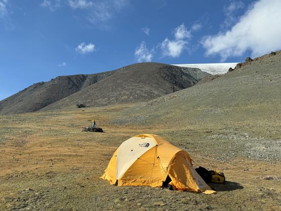


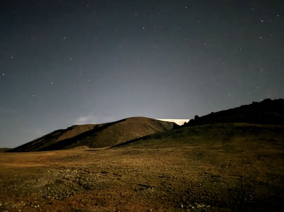

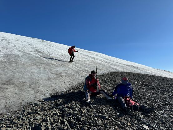
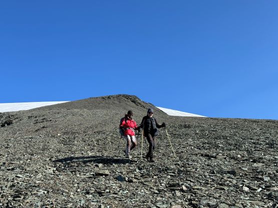
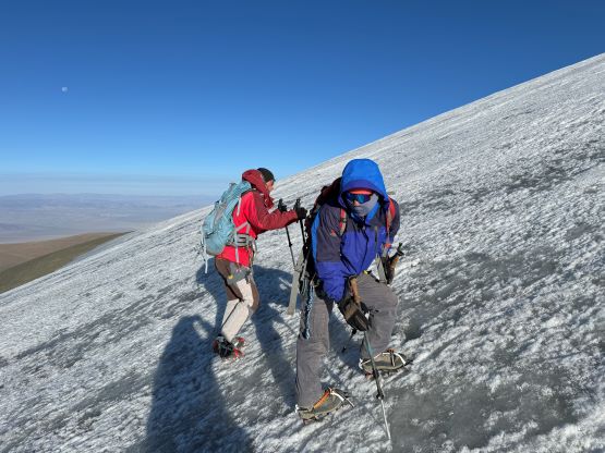
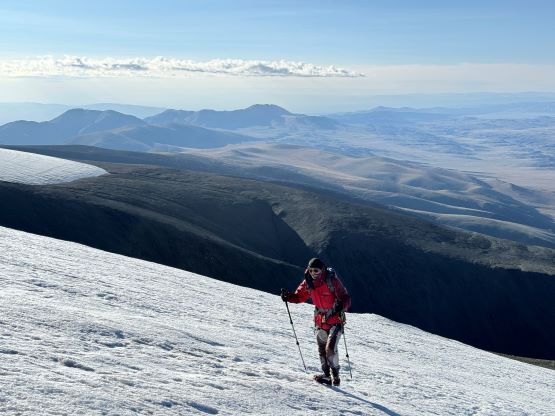
The night was cold and our cell phones got switched back to the western time zone but I was already prepared for that given that it was not the first time in this trip. Instead of setting up an alarm at 5:20 am I used the 6-hour-something timer which should work regardless the absolute time. Petter missed the alarm so I had to wake him up. I was not surprised at all. Later Deividas told me that it’s much simpler to just turn off the “set automatically” in the “date and time”. I thought my solution by using the elapsed time was smart but I had to admit that Deividas found the even better way. In any case the decision was made for us to start hiking by 6 am but we did not manage to start until 6:45 am but that’s okay. The other team started about 15 minutes later. Manlai went ahead and set a blistering pace that I had to work hard to keep up. I often need at least half an hour at the beginning of the day to warm myself up but there’s no time for that on this particular outing. I eventually did manage to fully warm myself up but we were welcomed by a cold headwind that was certainly the coldest we had encountered in this entire trip. I eventually had to stop and take the gloves out but was able to tough it out without donning a jacket all the way to the edge of the glacier.


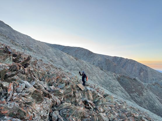

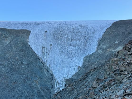


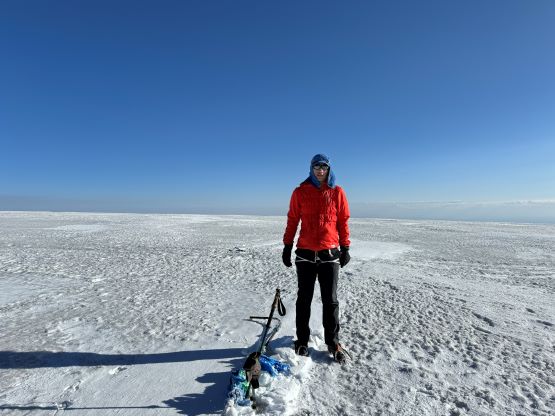
I had brought an ice axe but instantly decided to ditch it. In fact it was almost flat enough to be done without crampons but that initial slope getting onto the icecap was fairly steep and icy. I had brought a pair of steel crampons so might as well use them. We all donned harness but those were definitely overkill, as there was zero risk of crevasse fall especially in late season conditions like this. I was too lazy to use my brain so simply followed Manlai to the very top of the icecap but apparently the highest point was about 100 m beyond the official high point. I wondered around the summit dome for quite a bit to make sure I found the highest point. My Gaia GPS reading was somewhere around 4205 m which suggested that this peak could be slightly higher than Munkh Khairkhan at the moment.


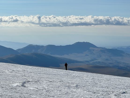


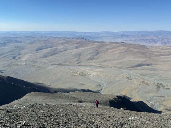
Petter needed more time to take his GPS readings but we eventually decided to descend. We crossed path with Rob’s team near the edge of the glacier. We should have walked slowly so we could be on the summit at the same time but that was not possible with Manlai leading the way. After getting off the glacier I again, simply turned off my brain and walked behind Manlai and there’s not much worth documenting about the descent. Our round trip time was under 4.5 hours and we quickly packed out the drove away. The others managed to get back to the basecamp before we finished packing. Both of our following objectives were Ikh Ovoo, but we had different driving plans.