Süphan Dağı
July 13, 2024
4058m
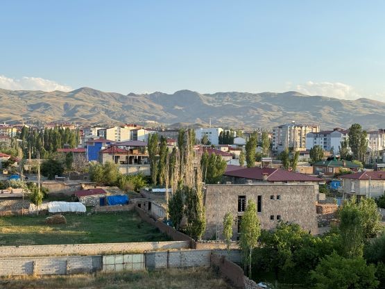
Van, Turkey
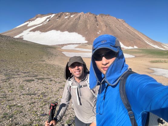
Süphan Dağı is a massive volcano dominating the north side of Lake Van in eastern Turkey, and thereafter boasts over 2000 m prominence. This peak is considerably more often ascended than the ones we just did in Hakkâri province, likely due to the close proximity to Mt. Ararat and the fact the area is more politically stable. Rob had already done this peak over a decade ago so he flew somewhere else for a couple days. The rest of the crew would spend a day driving to and past Van and we will see Rob again in a few days after finishing our primary objectives. We had a fairly lazy itinerary for this travel day, that we didn’t leave the hotel in Yüksekova until 9 am in the morning. The drive took 7-8 hours and was straightforward, but we encountered about a dozen military checkpoints and had to show our passports at least two times. This is definitely not the most stable area due to the close proximity to Iran and Armenia borders.
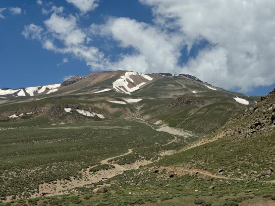
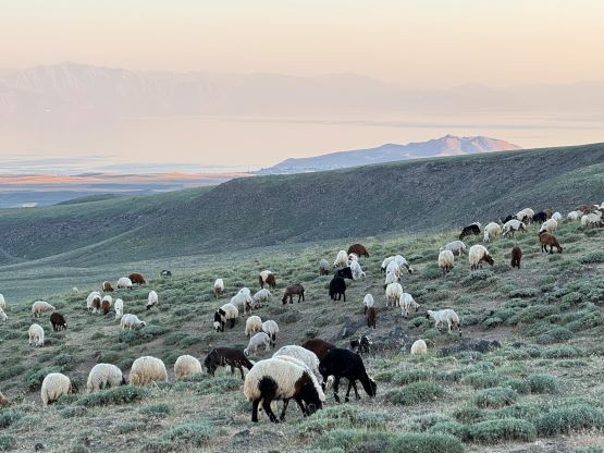
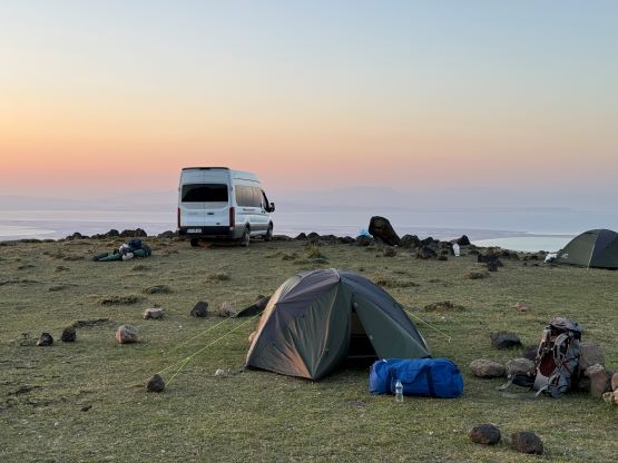
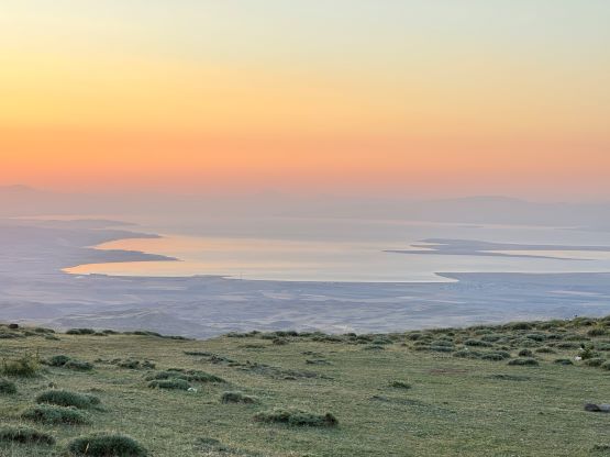
We had lunch and did some grocery stops in the small city of Erciş and then drove straight to the trail-head. The last few kilometers were quite steep and rough but the driver and the van handled it well. The performance of our vehicle seemed to have improved drastically since the issues we had on the first objective. The air conditioning was also functioning properly. The only downside was that our guide forgot to buy some eggs for our breakfast but we had enough food to make do. The camping area at the trail-head was amazing with some million dollar views, but the reception was sporadic. I tried quite hard to send out some pictures and text messages before going to bed. I did also wake up at midnight thank to the jet lag, but I used that opportunity to do some nighttime photography. There was at least one tortoise in the area, at least 1000 sheep and some shepherd dogs. The dogs came by at night and barked for quite a while.
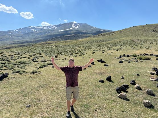


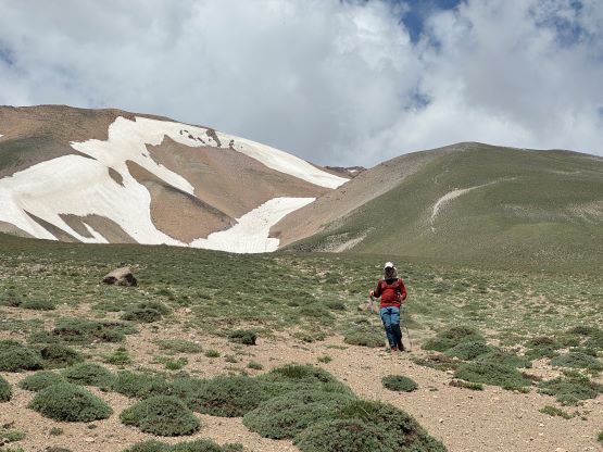
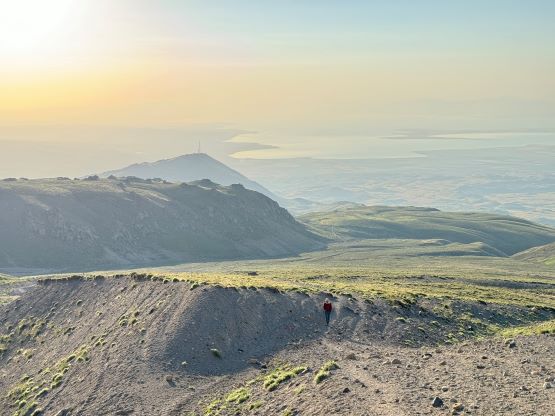
The plan was to start hiking at 5 am in the morning and I got up at 4:20 am for that. I packed my sleeping bags etc. and expected the driver to take down the tents during the day (he did not), and then salvaged the breakfast with some cheese and honey on bread. The rest of the team started at exactly 5 am and I was a few minutes behind. Meanwhile we watched an amazing sunrise behind some random P100m bump that is covered in military base. I caught up to Dave, Deividas and our guide Recep and plodded behind the line for the first few kilometers. Adam went ahead as usual, but somehow disappeared and then showed up behind us. Adam then decided to take a different route on climber’s right side of an obvious drainage as most of the Wikiloc tracks were on that side. The rest of us decided to follow Recep’s lead mostly because we were tired of thinking. Somewhere in this stage Recep and I went ahead and did the rest of the climb on our own pace. All I did was to keep up with Recep and we somehow got ahead of everybody, Adam included.


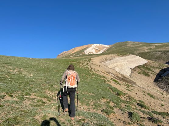
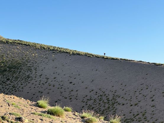
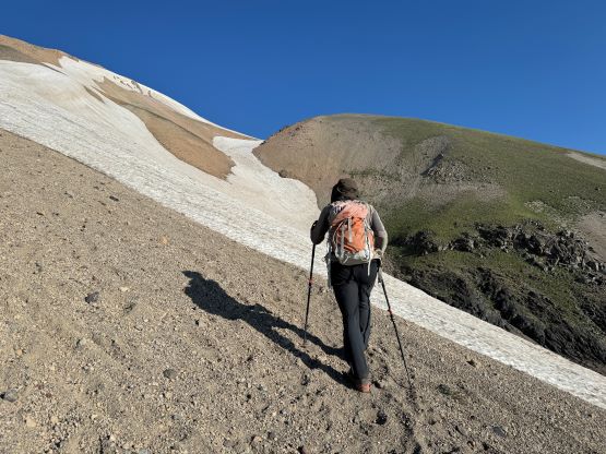

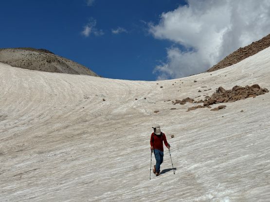
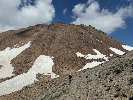
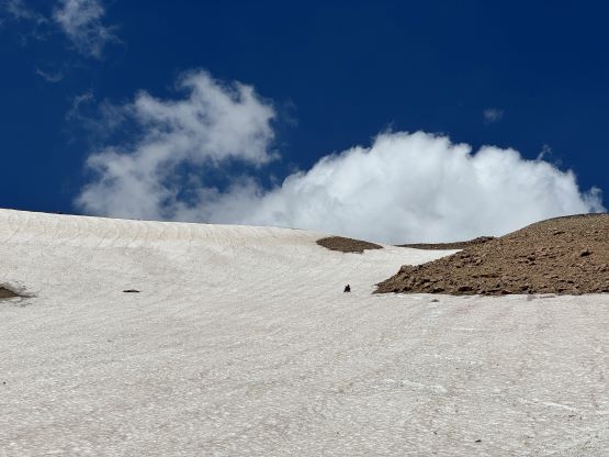
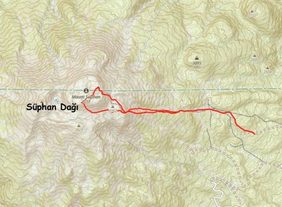
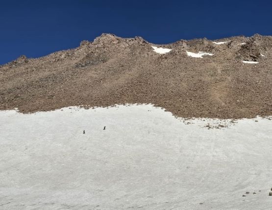
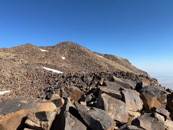
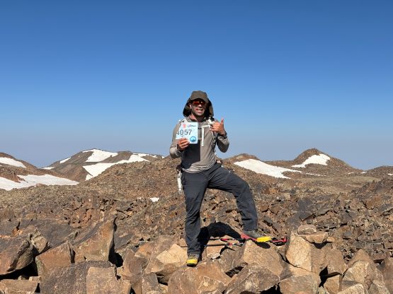
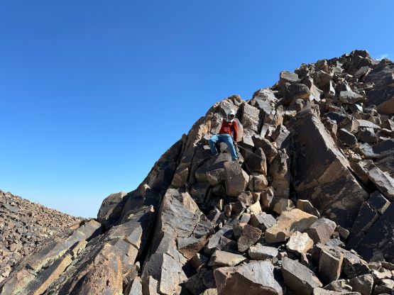
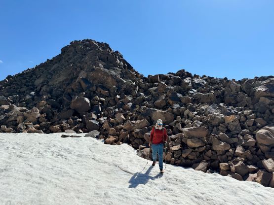
After what seemed like eternity we made to a plateau at 3750 m elevation. The final rise to te summit(s) was ahead and Recep decided to take the snow line to minimize the time spent on unstable boulders. I also had Ken Jones’ GPX track and Ken’s group had gone up a completely different way on the south side of the summit, which we ended up taking on the descent. We took a more direct route on the way up, that involved some step-kicking on trail-runners, lots of unstable boulders and a frustrating traverse across the crater rim in counter clockwise direction. The traverse was shitty as there’s fair amount of up-and-downs and the boulders were loose even by Rockies’ standards. Recep and I got to the NE summit 3 hours 15 minute after starting the hike, and Adam showed up about 20 minutes afterwards. The SW summit is unfortunately just as high or slightly higher so we must traverse across the rim to tag it. Adam and I went ahead but Recep had to stay behind to wait for Dave and Deividas. The traverse wasn’t actually that bad, as we were able to utilize snow for quite some distances. My GPS readings showed the SW summit being 1 meter higher, which basically is inconclusive. Tagging both would be a “must” until someone like Eric Gilbertson shows up here with his professional level surveying equipment to settle the debate.

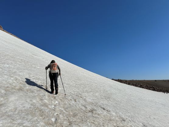


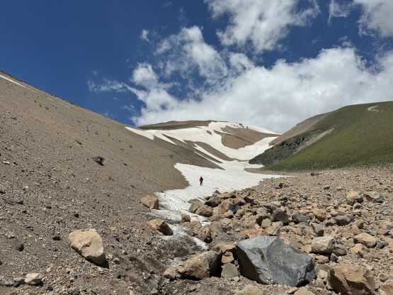
Adam and I made the in-situ decision to descend Ken Jones’ route because the valley to the south was still holding lots of snow, so potentially could speed up our descent. I managed to catch some weak signals and informed the rest of the group. This alternative way down was indeed much more pleasant and the boulders were generally more stable. The snow in the valley was mostly as expected, and there was only roughly 20 m of regain to get back on track. While descending the tedious standard route down from the plateau I spotted some snow slopes and instantly decided to go for that. The next few hundred meters of descent was then done mostly by boot-skiing. The trail-runners were slightly undertooled for the job but with the amount of experience I have on snow, it wasn’t problematic and we certainly had saved lots of time. We eventually merged back to the trail and I dashed down as hard as I could, finishing the round trip in exactly 6 hours. Adam was again, 20 minutes behind and we were now waiting for the others to show up. I used this time to type out the trip report as the reception was actually working, and I did successfully finish the written part of the trip report before the rest of the crew showed up (in 2 hours). We then drove down, had a late lunch/tea stop in Erciş while waiting for the driver to fix the break pads. We would then drive to Dogubayazit to settle for the night.