Stony Hill and Carmichael Peak
December 8, 2024
229m
Keats Island, BC
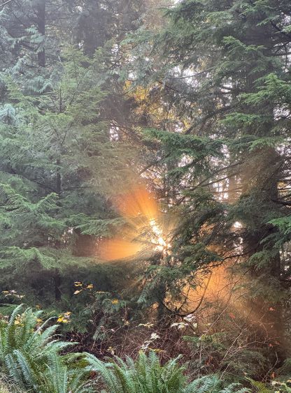
Stony Hill and Carmichael Peak are the two officially-named pimples on Keats Island. The latter is the island’s high point which subsequently boasts over 200 m prominence despite the lowly elevation, whereas the former is just a sub-P100m bump. These are “trash bagging” at the finest as both bumps are forested with no view whatsoever but to get there from the mainland one has to take 4 ferries (round trip), and deal with some degree of bushwhacking and trespassing. Most parts of the Keats Island are on private properties including the surroundings of Carmichael Peak, and at least two groups had been turned around by the property owners. To make sure the summit could be attained 100% I had to draw some creative lines but the plan was to roughly follow Sean Caufield’s route on peakbagger.com. There’s a named high point called the “Highest Peak” on the Gaia map but that’s just a sub-summit of Stony Hill, which is nowhere near the island’s highest point. There’s an official (hence legal) trail to that sub-summit and it even offers some views but I, along with majority of the peakbaggers could not be satisfied with just that.
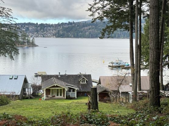
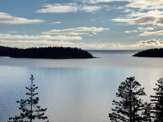
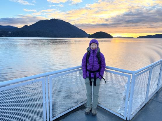
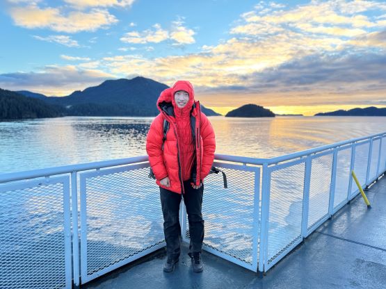
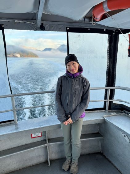
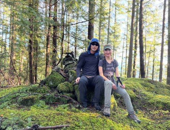
For once I had a commitment in North Vancouver at 6 pm on Sunday so I still didn’t have a full day available. This isn’t a lot of “half day” objectives for me up in the Sea to Sky Corridor anymore but the time frame (barely) allowed me to squeeze the Keats Island itinerary in, assuming all of the ferries were on time. This would also be my final officially-named summits in the Howe Sound as I had already cleaned off the other islands. Erica was on board and we left home at 6:30 am in the morning. The travel to Keats Island would be done on foot so we parked the car at a nearby free parking lot and then walked to the ferry’s terminal in about 10 minutes. The outbound ferries were on time and we got to the island in an hour and half. The ride from Langdale to Keats Landing was quite scenic.


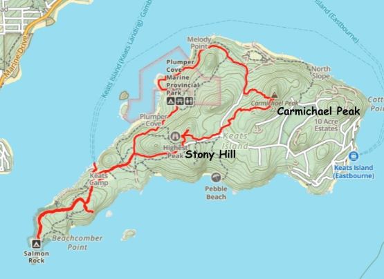
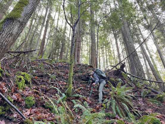
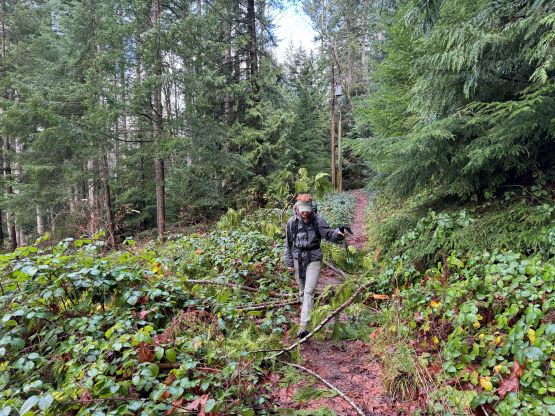
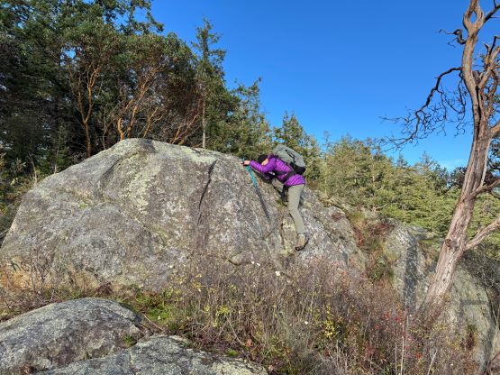
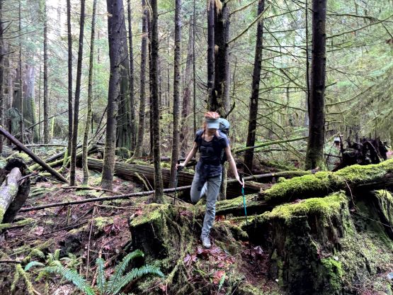
Talking to a local who shared the ride with us we knew the walking on Keats Island’s main road was definitely legal so we opted for the simplest way to reach that “highest peak”, which was plodding up the road. We correctly located the turn-off and followed the short trail to the lookout, which was mediocre but better than nothing. We then backtracked and thrashed to the true summit of Stony Hill. There was surprisingly a path heading up to the summit but bushwhacking was still required. There wasn’t any point in lingering up on the forested summit so we quickly descended and took the connector trail towards Carmichael Peak.


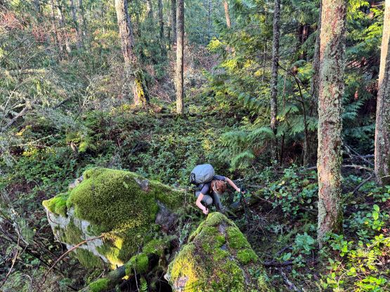

From Sean’s trip report we knew the walking on that “Corkum Road” northwards was technically illegal and the attack of Carmichael Peak from the other (east) side would be even worse with lots of private houses (Caro etc. got turned around), so the only guaranteed way was to thrash up the SW Ridge. We encountered a few old FSRs in that piece of woods as well as some abandoned wells and hunter’s cabins. A good road brought us northwards to join Sean’s GPX track and from there we headed upwards more or less staying on the track. The bushwhacking was tolerable but upon hitting the ridge we encountered a sizeable house perched right on the crest. To bypass that house we detoured on the east side and then picked up a fairly well-maintained trail. Just when I thought the summit would be in the bag we noticed another expensive house higher up on the ridge, so that trail was definitely private. That house didn’t seem to be occupied yet but I didn’t want to take a chance and led us thrashing back into the forest and this time to the west side of the crest. We had no further trouble getting to the summit but nobody had mentioned these houses in their respective trip reports, so I assumed these were new. The access situation could only become worse so it’s definitely a good thing that we got this objective bagged while we could.


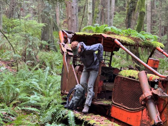
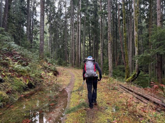
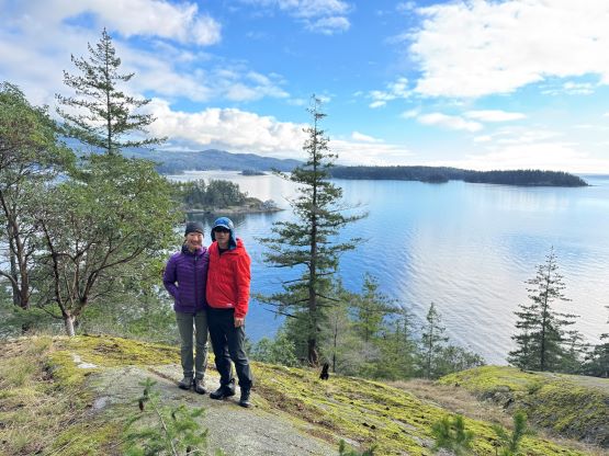
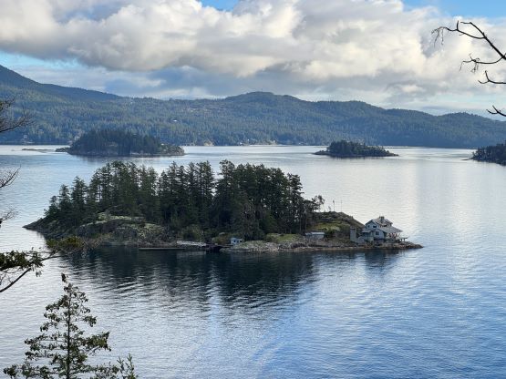
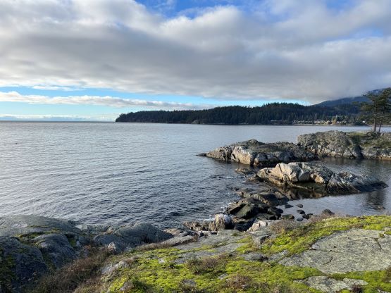
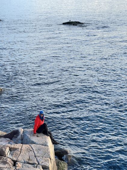
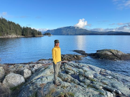
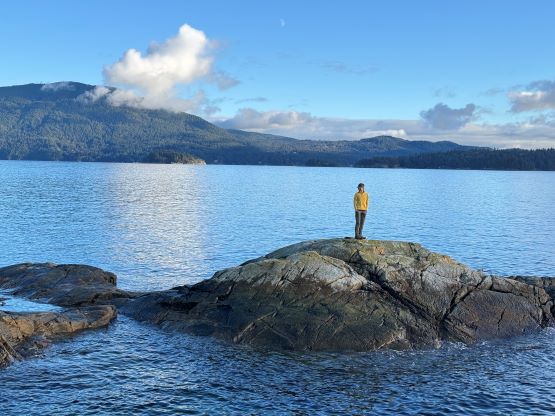
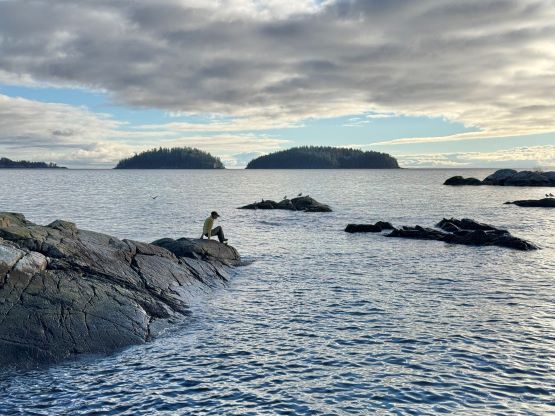
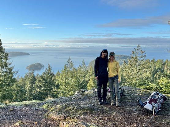
On the descent I could care less about the issues associated with trespassing so we took a more direct way down the west face, which was quite steep but not very bushy. This got us down to an abandoned mine site which was not in operation on this day. I would say our descent route would be the better one to use but this summit could not be “guaranteed” no matter how you do it, as some degree of trespassing would be required no matter what, and such had to be done in the middle of the day thank to the constraints with the ferries. We then walked north along that Corkum Road (did not see any prohibitive sign, contrary to what Sean mentioned) and took a connector trail towards Plumper Cove. We had more than 5 hours to kill on Keats Island so there’s no point in rushing. We wouldn’t come back to Keats Island so we might as well get the most of it in one trip. Plumper Cove was supposed to be touristy but we encountered nobody there. The traverse back to Keats Camp involved about 100 m of elevation regain to bypass the private houses along the beaches, but the trail was well signed. We had 2 more hours to kill so the decision was then made to check out Admiral’s Bluff and Salmon Rock on the far SW corner of the island, which was definitely a good call. The views were the best from these spots and we lingered for quite while before plodding back to catch that 2:50 pm ferry. Thankfully the ride was on time so we were able to catch the 3:30 pm ride back to the mainland. We even earned ourselves some extra time at a local cafe in Horseshoe Bay before my party commitment at 6 pm.