Stimson Hill and Mount Washington
December 5, 2024
878m
Arlington, WA
Stimson Hill boasts over 500 m prominence and Mt. Washington is its lower neighbour, and both peaks locate on the “logger’s island” not far from Arlington. The area is known for the access complications due to the gated FSRs and the various private property issues and these peaks aren’t exceptions. The traditional access from the south had long been gated with multiple signs of “no trespassing” but the tracks on peakbagger.com suggested this route’s still being used. Someone had discovered a legal route from the NW but that route is much longer and therefore not suitable for a “before-work exercise”. My plan was still taking the south access and I had actually made an attempt with Kate earlier in the year. The gate was open upon arrival so we boldly drove through, but encountered active logging and there’s no way to work that around. We almost got locked in as someone was actually closing the gate when we exited. After being lectured how we were absolutely not supposed to be there we went to check out the nearby “McMurray Benchmark” to salvage the day, and I swore to never attempt to drive through that gate again.
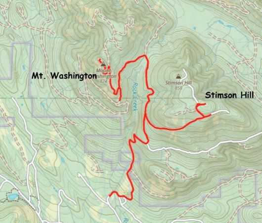
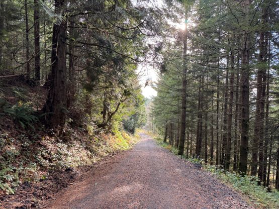
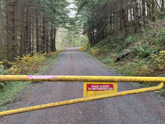
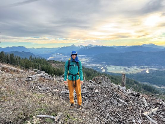
This time I made the attempt solo as I was unable to find last minute partner(s) and especially for a dumpster objective that required a somewhat serious trespass. I finished work at 8:30 pm and drove an hour and half down south and parked within 500 m from the start of the private road. The gate was locked at midnight and I was able to find a tiny pull-out to park the car. Instead of pitching the tent and letting everyone know the presence of a foreign hiker I opted to sleep inside the vehicle to reduce visibility. The next morning I woke up at 7 am and quickly made my ramen breakfast. I planned to start an hour an half earlier but I was too tired to get up, but 7:30 am was proven to be sufficient. The gate was open but given my previous experience I wouldn’t make another drive-up attempt. The troublesome zone was a private house about 1.5 km up the road and upon getting there I noticed a vehicle turning around. I started jogging (quite difficult given the uphill grade) and minutes later a semi truck came from behind, presumedly there to deliver something. I wasn’t sure if I were noticed but had I started two minutes later I sure would be caught. The section of the FSR immediately after the private zone was insanely steep which made the uphill running not possible, but I made sure to plod as quickly as I could and exited the upper gate. At this point I was back on the state’s land so I should have no problem bagging the peaks, so I finally slowed down. Between the two objectives I decided to tag Stimson Hill first as that’s the taller of the two. The true summit was trashy and required some degree of bushwhacking and post-holing, but the viewpoint to the south of the summit was quite pleasant to check out.


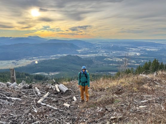
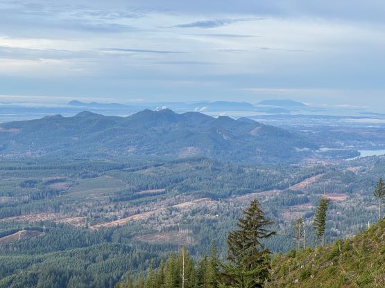
I quickly ran back down and took the connector FSR towards Stimson/Washington saddle, losing more than 300 m elevation along the way. I thought about skipping the second objective but being lazy would not be acceptable. I then picked up the meandering roads heading up the south ridge of Mt. Washington and the views were actually quite expansive. I stopped a few times for photos. The summit of Mt. Washington had a few contenders and I opted to check out the two nearby ones. The official name was labelled on the forested bump but I thought the next bump to the north was the higher of the two. These two bumps are reasonably close so it wouldn’t make any sense to not tag both. The north summit had better views anyway. There’s another contender about 1 km further to the NE that shares the same contour and I hoped the Lidar survey wouldn’t eventually prove that one to be higher. The spot height on the government’s topographic map does indicate that one to be a few feet shorter, so hopefully it stays like that.


I did my only break on the summit of Mt. Washington to have some food, and then started jogging down the mountain. I made a horrible error for missing a key turn and the backtracking required about 50 m of elevation regain. I treated that as plainly doing more exercise. The rest of the descent was rather uneventful. Upon entering the private zone I sped up and jogged down at averagely over 10 km/h and encountered no traffic. The vehicle was also intact upon return and I quickly drove away. I eventually got back to White Rock with an hour of half’s spare before work, and then I worked to 9 pm in the evening. I was glad to be finally done with Stimson Hill and the associated problems.