Ruth Mountain and Icy Peak
June 1, 2025
2167m
Mt. Baker Highway, WA
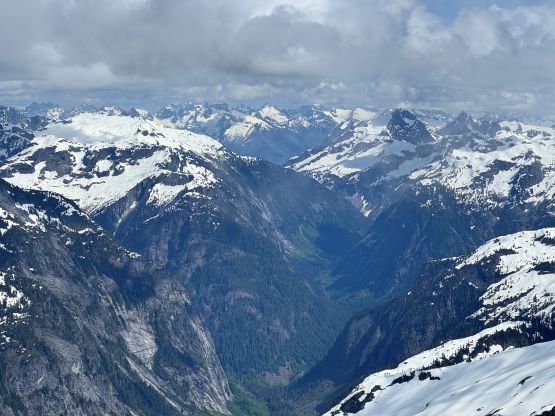
Ruth Mountain has become a classic objective in the recent years due to the outstanding views of the Nooksack Cirque and at the same time, the standard route is nothing fancier than a “walk-up” on a low-angled glacier. The season lasts from spring to mid summer. I had this objective in mind for at least 8 years but I wanted to save it for a longer trip when I could include Icy Peak in the package. The latter has to be done by traversing up and over Ruth Mountain and the exit has to be done by re-climbing Ruth Mountain, so it made zero sense to pay a separate trip for Ruth Mountain itself. The standard route on Icy Peak involves mandatory 4th class climbing and the entire trip requires over 2000 m elevation gain so this has to be treated much more seriously than doing Ruth Mountain itself. The oppourtunity presented itself when Elise sent me an invite at literally the last minute. I immediately scraped off the original plan (Big Gee) and made the agreement. I had to do some last minute digging but I had the full day available so why not.
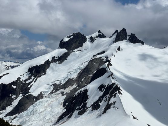
I vaguely remembered reading about Icy Peak having two competing summits and I was definitely correct. The USGS map as well as the older trip reports put the true summit on the harder SE one but peakbagger.com had updated their database, reflecting the newest LiDAR survey. It is currently believed that the NW summit is actually higher by about 4 feet. Both summits require exposed 4th class climbing and they aren’t terribly far apart, so I was hoping to do both. Part of me wanted to be 100% sure but I just wanted to have more fun. For the gears we opted to bring two 30 m ropes, two ice axes/tools each, crampons, snowshoes and approach shoes. The approach shoes would be used on Hannegan Pass trail as well as the rock scramble on Icy Peak, and the extra axes would be used for that 45-degree couloir descent off Ruth Mountain’s south slopes. There are other ways to descend Ruth Mountain but we preferred the no-brainer option that involved the least amount of thinking, that was to down-climb the entire stretch of that couloir. We ended up using all of the gears brought, so this wasn’t an “easy” trip by any measure. The next morning I drove to Nugents Corner, left my car there and Francois drove us all the way to the trail-head. We got there at 6 am and a group of 5 skiers got there minutes before us. We ended up sharing various parts of this trip with those skiers.

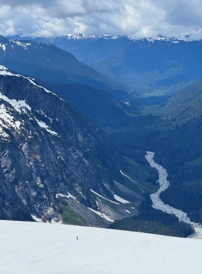
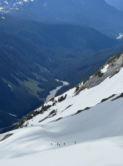
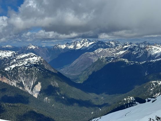
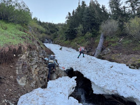
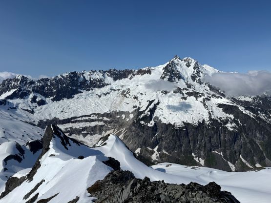
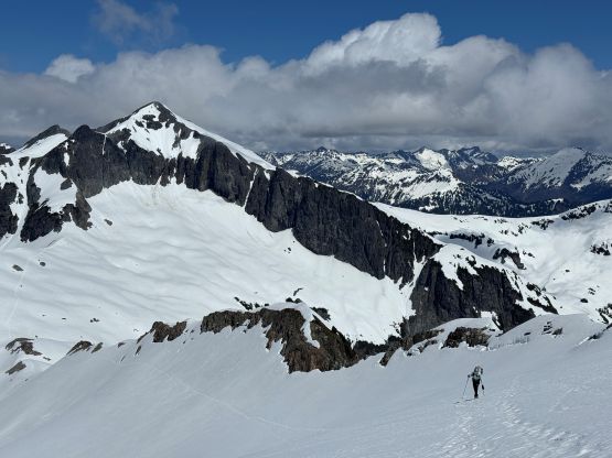
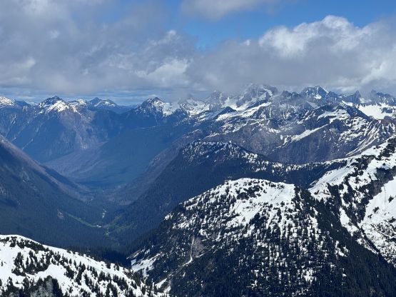
Elise and Francois opted to leave their trail runners in the vehicle but I definitely preferred to wear mine. The 6 km approach to the snowline underneath Hannegan Camp was simply too long for plodding in mountaineering boots. Elise dashed up the trail at a blistering pace that I had to jog occasionally to keep up. We ended up doing this approach in averagely 6 km/h pace… There were also half a dozen troublesome creek crossings that made me slightly regretting wearing the approach shoes. One of the crossings even involved trusting some sketchy snow bridges. Eventually we came to the switchbacks underneath the camp and did the first long break refilling the water bottles and swapping footwear (for me). I opted to carry the approach shoes for the entire day as some had mentioned using them for the slabby terrain on Icy Peak’s scramble. In the early season conditions there’s no point in visiting the actual Hannegan Pass and instead, we took the short-cut heading directly to the unnamed pass underneath “Peak 5946”. The snow had become continuous from the meadows above Hannegan Camp and we mostly followed the skier’s tracks. The snow condition was very icy for us. Elise and Francois opted to use their crampons whereas I was more comfortable using the snowshoes for traction. The next stage involved a steep grunt followed by a traverse to the east shoulder of that unnamed 5946-ft peak and then the views opened up. Traversing towards Ruth/5946 saddle had some of the finest views of the day, but we lost ~50 m of the hard won elevation. It’s also worth mentioning that this unnamed bump now has more than 100 m clean prominence thank to the LiDAR survey. I was completely not aware until the time of writing this trip report, as otherwise I would have pushed to bag it on the return journey.


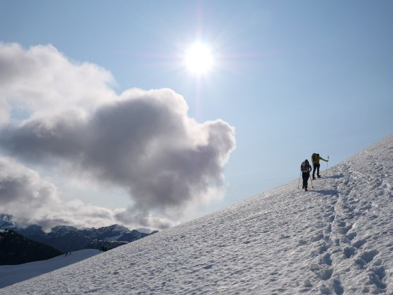
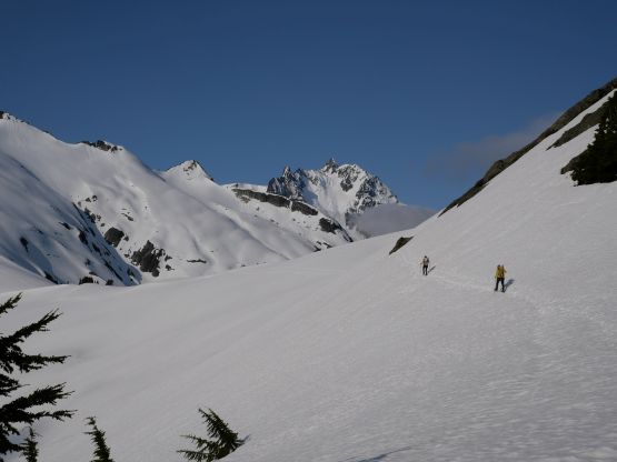
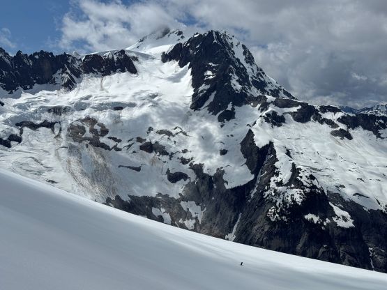
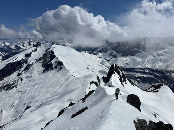
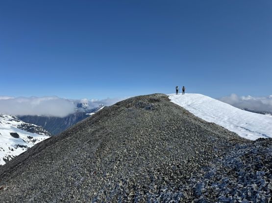
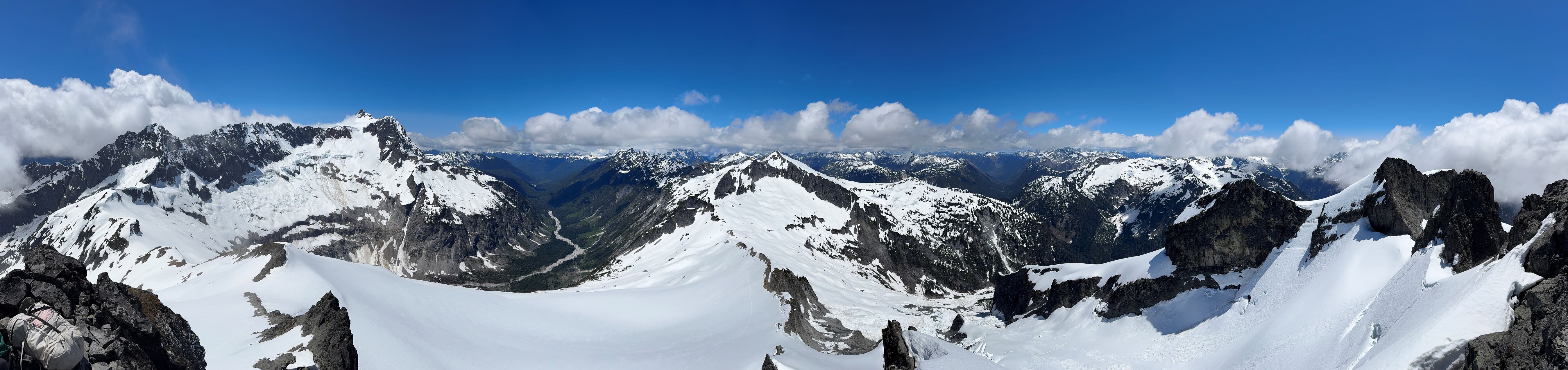
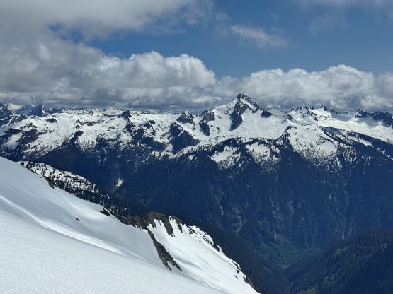
The route ahead was the grueling 400-m slog up the north slopes of Ruth Mountain to the summit. The previous parties had laid some nice tracks but the route was on some slight side-hilling terrain. It wasn’t the most comfortable on snowshoes given the firm conditions but I also didn’t want to deal with the occasional post-holing that Elise and Francois had encountered. The result was that I made better time to the summit of Ruth Mountain so the snowshoes were still beneficial, providing one’s experienced in side-hilling on snowshoes on firm snow. I didn’t linger on the actual summit of Ruth Mountain as the viewpoint to the south apparently offered better views towards the Nooksack Cirque and Icy Peak. We all took another long break on that viewpoint, contemplating the complicated descent ahead.


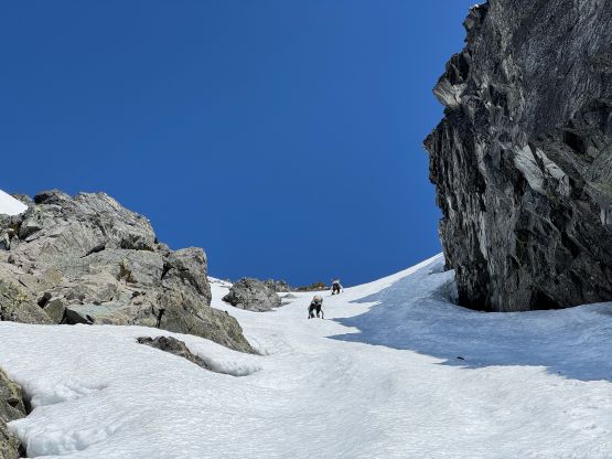
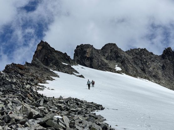
There are two stages in Ruth Mountain’s descent towards Ruth/Icy saddle. The first stage was to get to that entrance of the south couloir. I had done zero research about this part, but the route-finding was straightforward in situ. The skier’s had descended the SW Face but I thought it made more sense to balance across the knife edges on the south ridge proper. This required some careful footwork on crampons but was much more direct. Elise and Francois reluctantly followed. The sun rays had fortunately warmed up the south couloir but we still took out both ice axes, anticipating some ginger down-climbing. I ended up descending at least half of the couloir while facing outwards but the middle stretch required me to face in. The steepest part was about 45 degrees and the length of the couloir was less than 200 vertical meters. We then hopped back onto the east side of the connecting ridge and post-holed our way down to Ruth/Icy saddle. I thought about to put the snowshoes back on but didn’t bother.
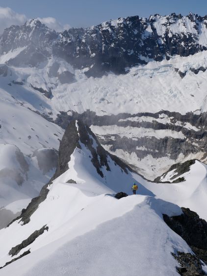
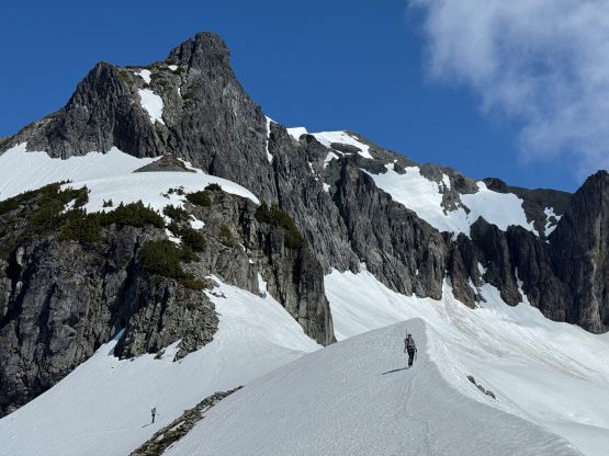
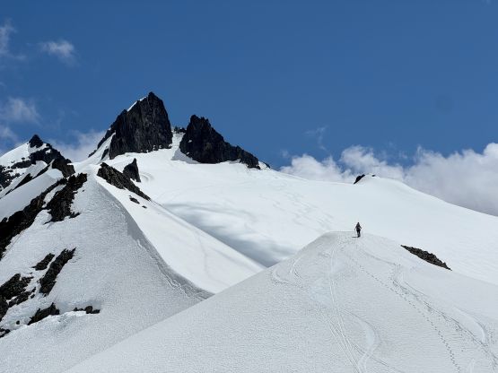
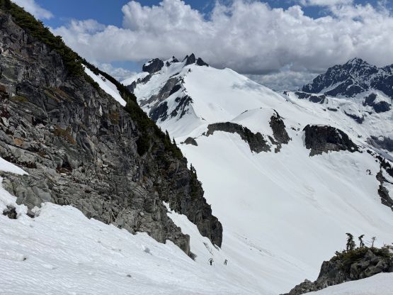
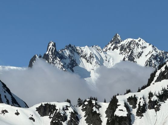
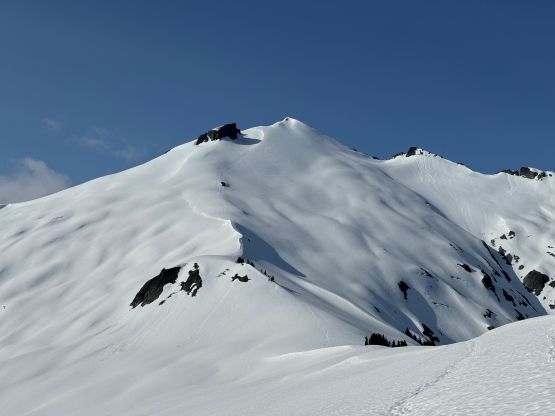
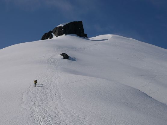
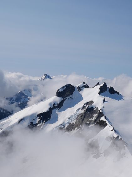
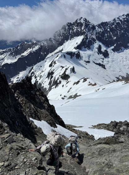
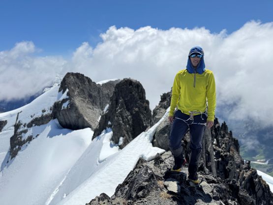
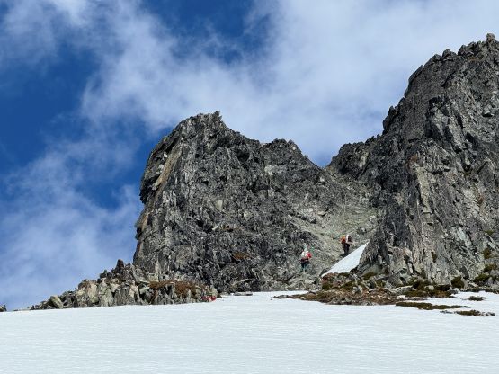
The ascent of Icy Peak’s north glacier was again, done on the west side of the ridge proper so the condition transitioned to being firm and icy. The previous party’s tracks also stayed much closer to the ridge and the terrain involved a great deal of side-hilling. Wearing crampons was definitely the right decision and we kept them on all the way to the upper glacier. Eventually the breakable crust forced us to make another transition swapping crampons for the snowshoes, and the snowshoes were kept all the way to the base of the scramble. We had opted to trust the LiDAR survey results that the NW summit’s the highest one, so that’s the one we were aiming at. The south couloir didn’t appear too complicated so I didn’t bother to put the approach shoes on. I did leave my backpack at the bottom to conserve energy. The scramble turned out to be harder than I thought as the terrain was slabby and the rocks were particularly inspiring. The previous day’s precipitation had also made the lichen covered rocks wet and that required some extra careful footwork. We even encountered patches of fresh snow underneath the rappelling station. Upon reaching the summit we all agreed to take the two 30 m ropes that we had hauled all the way up here to make a rappel.


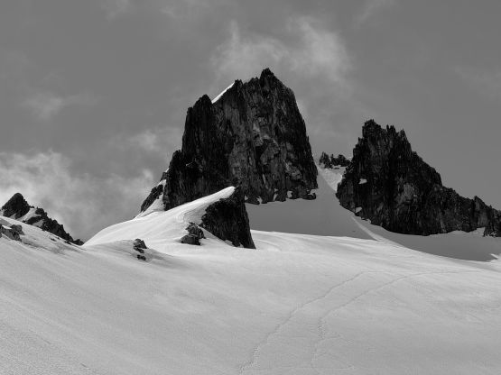


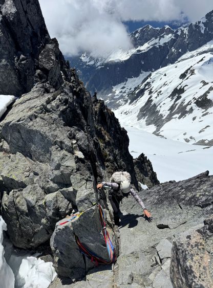

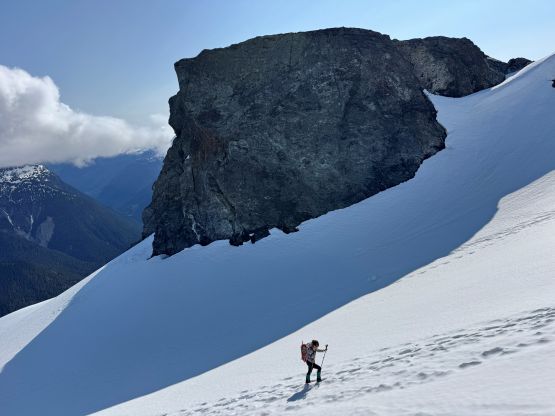
My plan was to bag both the NW and the SE peaks but Elise and Francois weren’t super keen, so I took off on my own, set up the rappel and quickly made my way back to the ditched gears. I grabbed the snowshoes and post-holed down the south face until I was able to make a high line traverse towards the saddle between the two peaks. This traverse appeared at least 40 degrees so I had no choice but making another annoying transition to don crampons. The snow condition was very soft and the run out was a bit sketchy, so I made sure to cross this slope as fast as I could. At the col between the two peaks I ditched everything and swapped footwear to the approach shoes that I had lugged all the way here. I would have no rope with me and the scramble was supposed to be even harder than the NW peak, so it’s smarter to take advantage of anything that I had brought. The lower ridge wasn’t too bad as I stayed entirely on the south side but the terrain eventually formed me to traverse onto the SW Face following ledges. To get back onto the ridge proper I scrambled through that slabby section mentioned in Wyatt’s peakbagger trip report and then there came the crux moves on the NW Ridge. The exposure was lethal and the rocks were covered in wet lichen. The fresh snow had melted but the sun hadn’t fully dried off the rocks yet on the NW-facing aspects. The quality of those rocks was much worse than on the NW peak so after debating for about 10 minutes I turned around. I made quick work down to the transition zone and then plodded back to the SW Ridge of Icy Peak’s NW summit on crampons. Elise and Francois were rappelling and joined me about 10 minutes later. Meanwhile I was sitting next to that group of 5 skiers. Bagging the summit was not their intension so the SW Ridge of Icy Peak’s NW summit was their high point of the day.


Given the softening conditions it made sense to strap the snowshoes back on, but Francois opted to keep descending on foot. The snowshoeing wasn’t easy given the side-hilling terrain but the condition was just soft enough to make this work. I nevertheless had to be 100% concentrated. Without doing much lingering at Ruth/Icy saddle we quickly picked up the tracks heading up the south ridge of Ruth Mountain. The skiers had got ahead of us but we caught up to them again underneath the south couloir of Ruth Mountain. They had decided to take the long way around to the west side of Ruth Mountain but for us, the simplest way was to re-climb the south couloir. This was more of a physical grunt than a technical challenge in the soft conditions. At the top of the couloir I picked up the ditched food, water and gears and we made the final decision to go all the way to the very top of Ruth Mountain, mostly for simplicity. These days I could hardly do one hike per week so it made sense to push as hard as I could for simple reasons of staying fit. We joined the hordes on the summit of Ruth Mountain and then began the tiring descent in worsening conditions. After post-holing and glissading down the north glacier for about 200 vertical meters I made another transition to don snowshoes. For me it’s definitely easier to be on snowshoes wherever I could. Elise and Francois had other opinions but we all managed to get down to the meadows above Hannegan Camp at the exact same time as the group of 5 skiers. This said something about our pace as those skiers were pros. After one last transition to swap footwear and refilling water bottles we jogged down the final 6 km and concluded the round trip in just under 12 hours. This was a grueling but worthy day.