Peak 2046 “Fat Dog Mountain”
January 21, 2024
2046m
Manning Provincial Park, BC
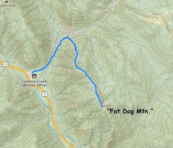
This unnamed peak is actually fairly significant by Manning Park’s standard, boasting over 300 m prominence and higher than a lot of the nearby objectives such as “Memaloose”, “Nordheim” or Porcupine Peak. The obscurity of this peak is largely due to the lack of a name and the lack of trails. Back in the old days of ClubTread era Grant Myers named it “Fat Dog Mountain” on peakbagger.com due to the proximity to Fat Dog Trail, and then a few years later in 2015 Simon Chesterton inquired Robin Tivy to synchronize the name on bivouac.com after making an ascent himself. Grant and Simon had taken different routes but no matter what, this would be an off-trail ascent on steep, bushy and bluffy terrain. I thought the northern approach made the most sense in the deep winter as the parking lot (Cambie Creek) is designated and maintained for the uses of Fat Dog and a whole bunch of other trails, whereas Simon’s route would require a random parking on the side of the highway. It might not be possible as I doubt the maintenance crew would plow that section of the highway shoulder. I had read somewhere that Grant M. had also approached from the north side but I was unaware of the details. I nevertheless came up with the idea of taking the NW Ridge over a subsidiary summit as this seemed to be the least steep option.
I had been away for 3 weeks and there’s a massive dump immediately after I came back. I anticipated the snowpack had gone back to “normal” but I was wrong. Asides this one precipitation event (up to 1 meter of snow in the mountains) there wasn’t much going on in the past few weeks. The base was still shallow or non-existing up to 1700 m elevation in Manning Park and the snowpack was far from “deep enough” to bury the bushes and the dead-falls. To make things worse the majority of this 1-meter dump was unconsolidated facets. The past few days saw some warming trends with rain but there’s not enough refreezing to make the snowpack supportive. I came up with this objective mostly because of the weather being better further towards the east, but also because I needed a shorter day. I was still recovering from a cold that was likely caught travelling and I had also booked some work in the evening. I was anticipating to be back home no later than “early afternoon”, but this trip turned out to be a major sufferfest with hours and hours of intense trail-breaking. Kate signed up for this adventure and I’m not sure if she had regretted or not. At least the rewards (views) of making the summit were rather excellent.
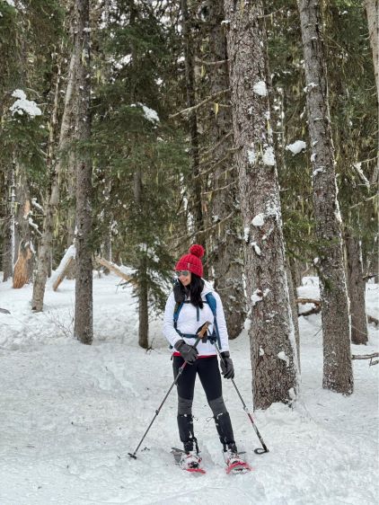
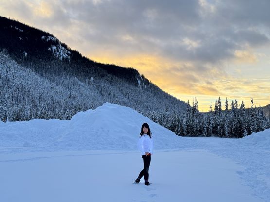
Kate and I left White Rock at 5:30 am and we stopped in Whatcom exit’s A&W for breakfast. I opted to drive Kate’s Subaru for this trip as there’s no off-roading required. The weather was mostly as expected, rainy in the Fraser Valley turning into cloudy in Manning Park. The highway had been well-maintained and so was the Cambie Creek’s winter parking lot. There were already kids playing in the snow and we parked the vehicle right around sunrise.

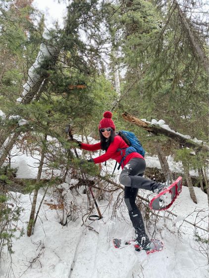
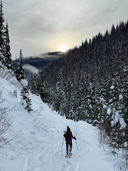
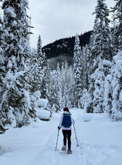
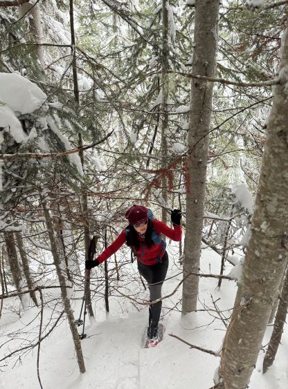
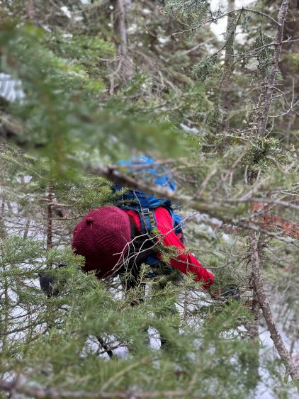
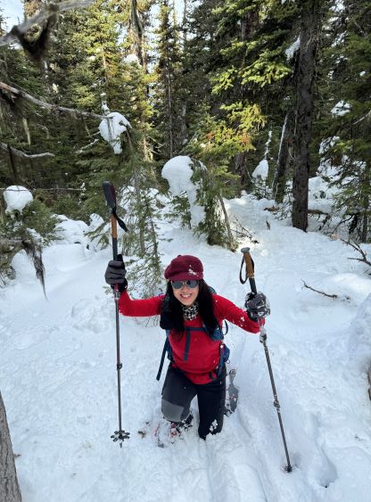
The first ~2 km was by plodding up Fat Dog Trail and Kate actually thought the objective of this trip was snowshoeing this trail. Kate was not mentally prepared for bushwhacking nor any form of off-trail travel, so that’s one reason why I don’t like the name “Fat Dog Mountain” as the peak had nothing to do with the namesake trail apart from the starting point. In fact, the ascent is very much the exact opposite as one would expect from an “easy stroll on Fat Dog Trail”. The exact location of the spot where one should bail the trail to dive into the bushes was arbitrary and I just randomly picked one. Right off the bat I knew we were in for an adventure. I took me literally a minute to wallow up a few meters into the forest and we had to gain 700 m in total. I had opted to wear the 30 inches snowshoes and I still sank to the ground. The entire snowpack had no strength as it was literally deposited from one single precipitation event. To make it more “fun” we had to push through a long section of overgrown secondary growth forest with some thick bushwhacking. I had failed to study the satellite images as I wasn’t expecting much from this outing at all, and this route turned out to be mostly in a logged forest with a very “green” appearance on the satellite views. Oh well. We had already committed so there’s no turning back. I kept watching the GPS screen and it had taken us over an hour to cover a few hundred horizontal meters and we would be finishing in the dark if the condition wouldn’t improve. Our stoke level was not very high. I made sure that we both had brought a head-lamp before resuming.


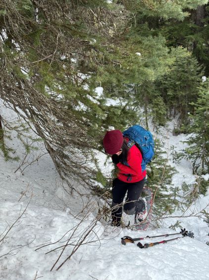


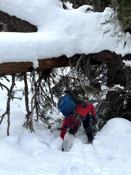
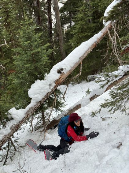
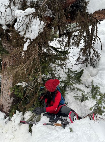
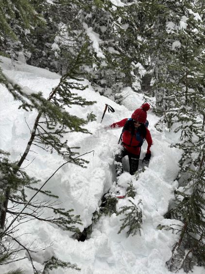
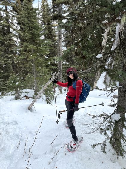
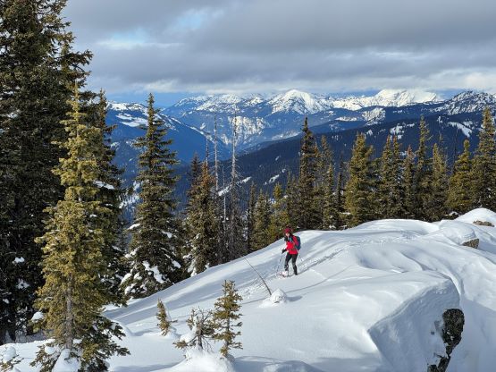
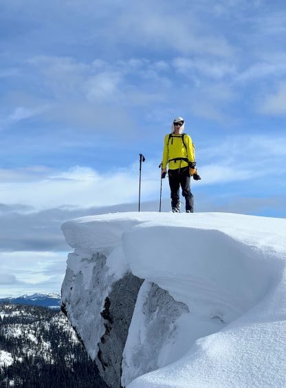
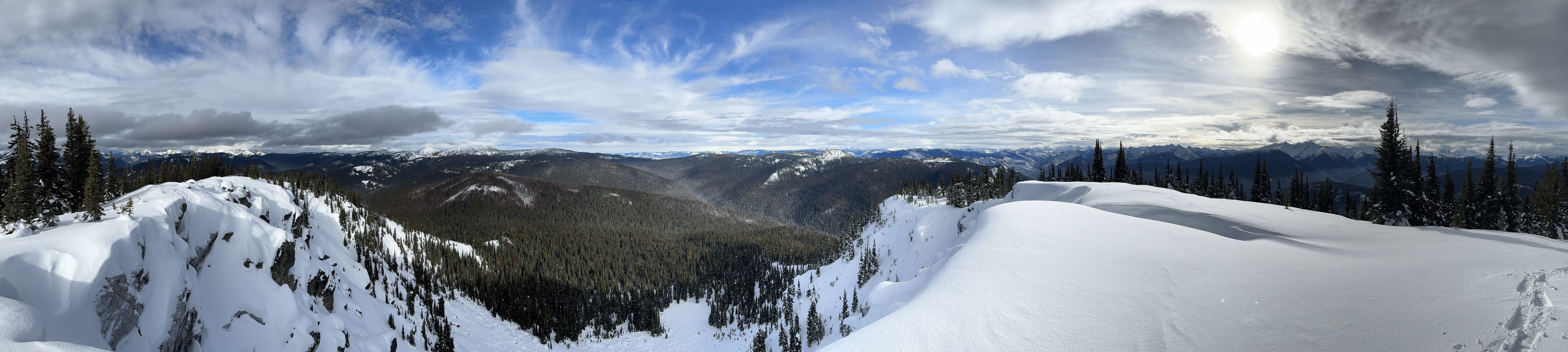
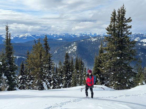
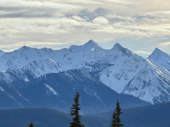
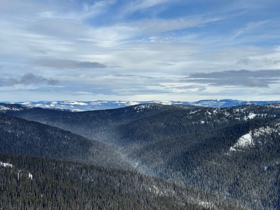
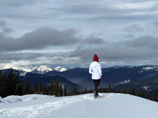
After what seemed like eternity we finally exited the secondary growth forest onto the N. Ridge of the subsidiary bump. I thought we would be cruise-sailing but I was wrong again. The ridge was riddled with pick-up-sticks and the snowpack was far from deep enough to cover up those sticks. The going was still extremely slow as we both kept falling and getting our snowshoes stuck underneath the logs. Thankfully the condition finally improved as we slowly but steadily approaching that subsidiary bump. The trail-breaking was still brutally heavy on any slope that’s steep but at least there wasn’t that much bushwhacking anymore. The top of this bump was viewless and there’s more elevation loss than I thought to descend into the col. The plod to the true summit was thankfully mostly on supportive snow as the snowpack had become fairly strong at this elevation (1900-2000 m). As we slowly approaching the summit the forest thinned and the views eventually opened up, so the hard work paid off nicely. It had taken us over 4 hours to get here so it wasn’t actually that bad. I thought we could definitely finish the round trip before dark so we took our time on the summit soaking in the views.


I briefly considered descending Simon’s route but that’s a steeper route with lots of bluffs, and it’s always better to stick to the knowns. The descent was actually quite a no-brainer as we no longer needed to do any route-finding. In short time we were back to that NW subsidiary bump. The next hour or two of bushwhacking was not very pleasant but at least we knew exactly what to expect. By the time we got back to the trail Kate was completely soaked to the bone without a single piece of dry cloth, whereas I was mostly able to keep myself dry except for the feet. The boots were unfortunately no longer water proof but I’d worn them for at most 15 times and most of the trips were done on snow. This was a bit disappointing for the Trango Techs. Our round trip time was just over 7 hours and I drove us straight back home afterwards. I was eventually on time for the 8:30 pm work.