Myangan Yamaat
August 30, 2024
3620m
Baruunbayan-Ulaan, Mongolia
Myangan Yamaat is one of the three “ultra prominent peaks” down south in the Gobi area of Mongolia and there seem to have at least two alternative names, “Bara Bogd” and “Bogdin Tergun Uul” according to various sources. Among these three Gobi objectives Myangan Yamaat has the most complicated access problems due to some lengthy driving (over 20 km) required on a river bed inside a canyon. Rob and Deividas had figured out the solution through two attempts in the previous year and Petter and I would take full advantage of their work. In fact, among the few peaks that we did end up using their “beta” this is the one that we had to give them the most amount of credit. The “road” in that canyon was hardly visible on the satellite images and it would take a lot of determination to commit to this route without having much “beta”, let alone to actually figure it out. Our local drivers and guides had absolutely no idea about this peak so we essentially “guided” them to the start of Rob/Deividas’ route.
As always our drivers, particularly Manlai preferred to take the shortest possible way and he insisted on driving north towards the small village of Baruunbayan-Ulaan. I did not think this was the greatest idea but by this point we had already earned several buffer days so we could afford fussing around. Eventually it was clear that Manlai’s route was not going to work, or at least not without significant amount of detouring thank to some impenetrable sand dunes between that village and the mountain, so we backtracked and took Rob and Deividas’ access route. Rob’s GPX file was quite off at some spots but we had downloaded some satellite images that the navigation wasn’t a problem. It seemed to me that Rob’s driving GPX was not a recorded track, but rather drawn roughly by hand. In any case we optimized the driving route and in about 20 km we got into that said canyon. The road in this canyon was not difficult to follow, but was as rough as the “worst case scenario” that I had thought about. Perhaps a quarter of the route could be considered a “road” and the other three quarters were essentially crawling on rocks. There were also numerous ditch crossings that had put the Landcruisers’ clearance in test and we scrapped the bumpers many times. There wasn’t any particularly cruxy spot but the entire way was rough and slow going. Our drivers were on the other hand, quite determined to get us as high as possible, that we eventually drove past Rob’s starting point and parked at the absolute driveable end, higher than 2800 m elevation. My driving track had elapsed exactly 3 hours over 47 km distance and that was only one way.


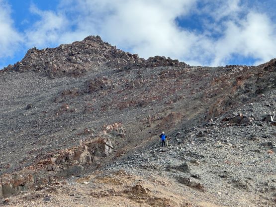
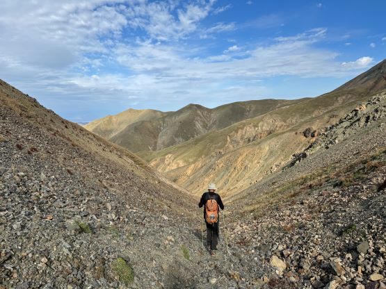
It was apparent that we no longer had enough daylight time to make the summit on this driving day so we waited until the next morning. The alarms were set at 5:50 am and the breakfast was served at 6 am. We eventually started walking without the need to use head-lamps, and Manlai this time opted to stay behind. We’d have another long day of driving ahead and it’s much better that he decided to sleep in for a few extra hours. It was only Petter and I that started this up and we essentially followed the exact same route that Rob and Deividas took. I’m someone who never takes other people’s route for granted and always look hard for other ideas using satellite images etc., but I failed to find a better route on this objective. The walking in the canyon bed was mostly pleasant and the running creek extended quite high up. I wondered where the running water came from as I don’t think this area sees a lot of precipitation.


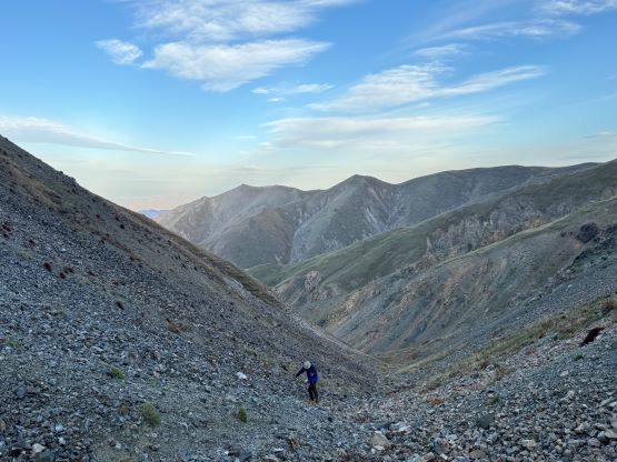
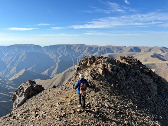
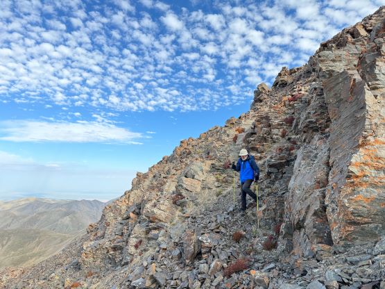
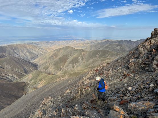
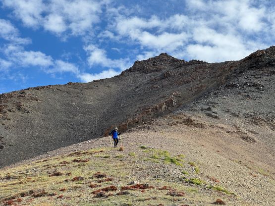
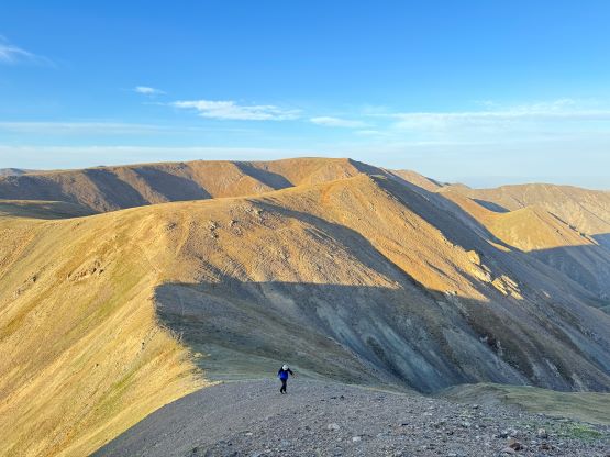
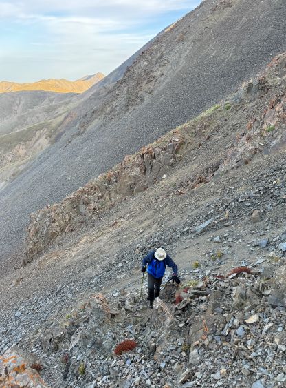
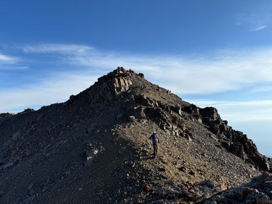
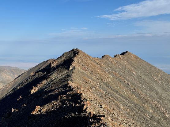
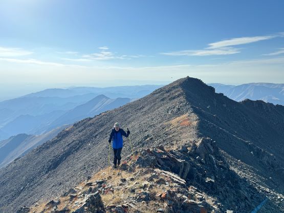
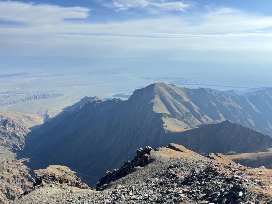
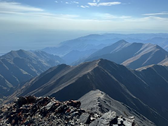
The canyon eventually terminated at the saddle south of the peak and the second half of this ascent would be a somewhat chossy scramble up the south ridge. The peak appeared chossy from afar and it sure was loose. Thankfully there wasn’t any particularly difficult section even though we did have to use our hands quite often. The “crux” section mentioned on Rob’s GPX track was some class 2 compact dirt but wasn’t difficult. There were a few harder moves that we did higher up by sticking on the ridge crest. Those could be bypassed on either side but such would require more traversing on compact choss. The summit ridge composes of three distinct high points. Rob and Deividas visited the first two but we tagged all three of them. The farthest one was definitely lower by at least 5 meters but the first two are roughly equal in elevation. Without a more thorough measurement the future parties would need to visit both summits to safely claim this objective. The ridge traverse was a pleasant walk with excellent views.


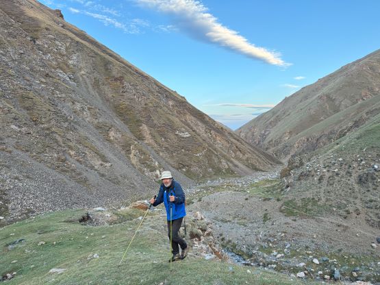
We took our time on the descent. I did dash ahead down the south ridge but for the canyon bed I opted to let Petter lead ahead to set the pace. Our round trip time was 3 hours 45 minutes and we got back to camp about 15 minutes later than the promised time. Gangaa was already up in the canyon looking for us but we were at least not too far behind. After a hasty packing process we were on the road again, and made much better time driving out of this long canyon. We then took Manlai’s route towards NE and bypassed the sand dunes on the far eastern side. The rest of the day was then spent navigating hundreds and hundreds of kilometers of rough roads towards SE, firstly to Bogd and eventually to the camping area next to Servey. The plan was to camp but we got there late (past sunset) and the mosquitoes were horrendous. After being eaten alive Gangaa decided for us to spend some $$$ at a privately owned campground with guesthouses. That was a pleasant surprise. I even managed to take a much needed but cold shower.