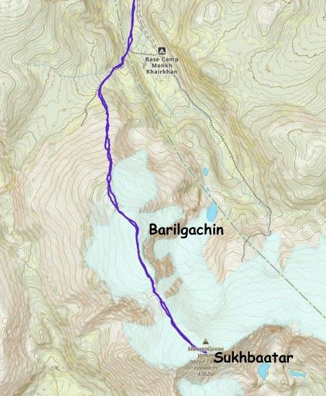
Munkh Khairkhan (Barilgachin & Sukhbaatar)
August 17, 2024
4203m
Khovd, Mongolia
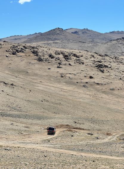
Munkh Khairkhan is a large glaciated massif with multiple summits, and the highest of those is the second highest peak in Mongolia, subsequently boasting over 1500 m prominence making it one of the 18 “ultra prominent peaks” in this country. This is a fairly popular objective and the standard route is nothing fancier than a “walk-up” with some simple glacier crossings, but do not underestimate the physical difficulties. A fit party can do this in a reasonably long day from the base camp but proper acclimatization is essential. The crux could well be the driving. The area is deep and requires 5-6 hours of careful navigation on backroads with multiple river crossings. The last 5-10 km was pushing the limit for our Landcruisers and it’s often recommended to hire a specialized Russian 4×4 vehicle for this objective.
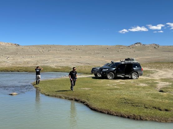
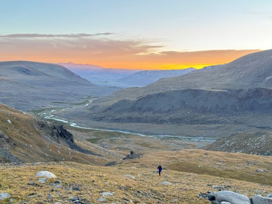
Nevertheless Petter and I got to within 1.5 km from the supposed base camp with the Landcruisers provided by Gangaamaa Expedition. We basically spent one full day driving from Baatar to Munkh. It might seem “close” on the maps but there were several hundred kilometers of dirt roads between them. Our Mongolian drivers once gain opted to minimize distance by taking a direct, but more obscured cross-country path that was nowhere to be seen on my Gaia map. Those guys did seem to know this objective really well so I eventually decided to turn off the brain to put the money in use. A few hours later we stopped in a small village for lunch and there was surprisingly reliable cell reception. Unfortunately the lunch stop was rather short so I couldn’t really make much use of the service. The company surely did not let us down, that a few more hours later we turned southwards into the access valley after a major river crossing. As mentioned earlier we did not make all the way to the supposed “base camp” but stopped right in front of another major river crossing but this could actually be their “plan”. I consulted with the maps and thought if we were to park here it might make more sense to take the route up and over that northern sub-peak. Despite the 150 m elevation loss (and regain) we could avoid crossing that river on foot by sticking to the west side of the valley. Petter actually asked the guides and confirmed that we indeed planned to take this route, and in fact this is the “standard route” nowadays. Overnight at least one Russian 4×4 van drove past our camp, crossed the river and supposedly parked at the base camp labelled on my Gaia map. We actually bumped into those guys on the mountain and it seemed to me that they had 1 km less walking (each way) but an additional river crossing on foot (also each way).


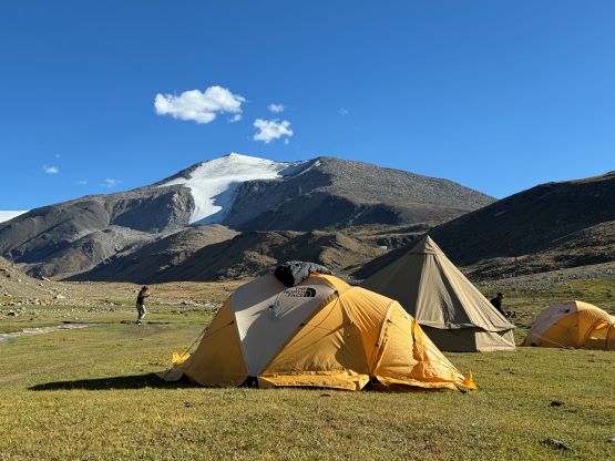


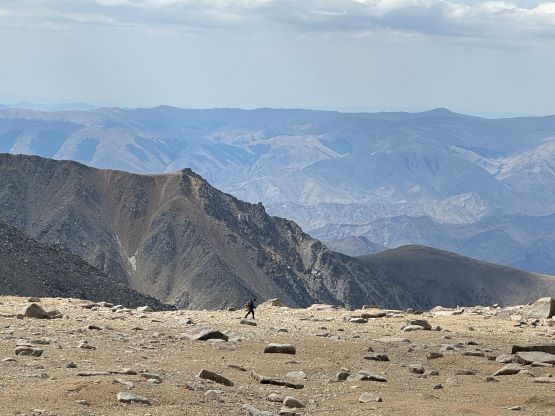
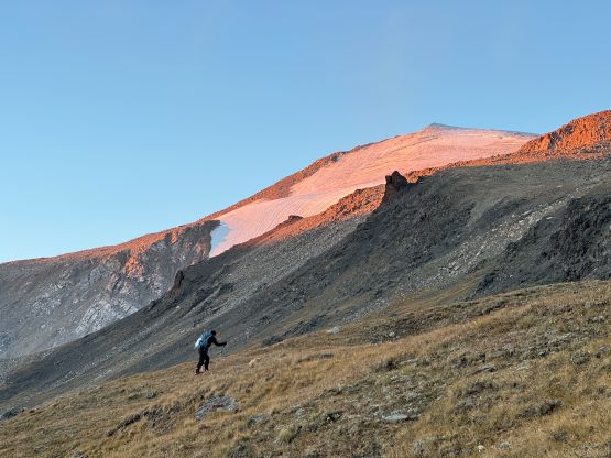
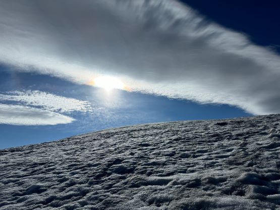
The next morning we woke up at 4:20 am and managed to start hiking by 5 am as planned. The initial 20 minutes had to be done with head-lamps on, and I opted to stick behind Manlai as he had done this peak many times. Manlai picked an efficient route despite the lack of visibility and we basically aimed directly towards the entrance of a side valley. This valley was then ascended and meanwhile we got some excellent views looking back. The concerning clouds were breaking up. What’s coming up next was the most tedious section of this ascent, a monotonous 700 m grunt up never-ending boulders to the edge of the glacier on the north peak. To make things worse we had to battle a consistent cold head wind so I eventually got impatient and went ahead and did the rest of this climb alone.


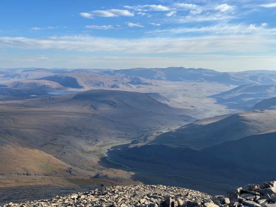
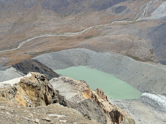
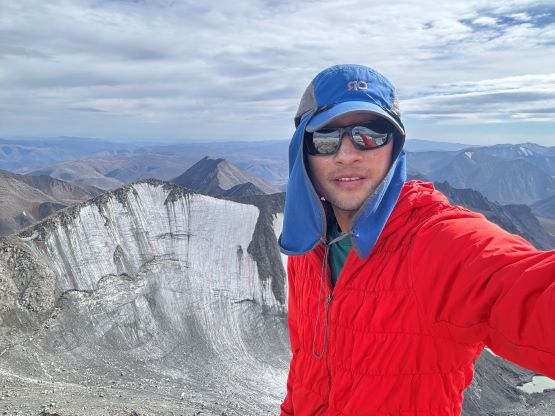
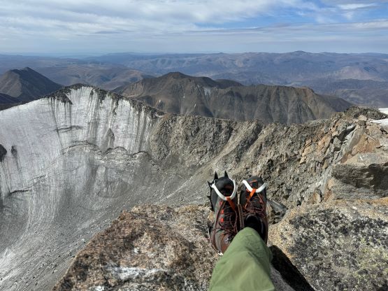
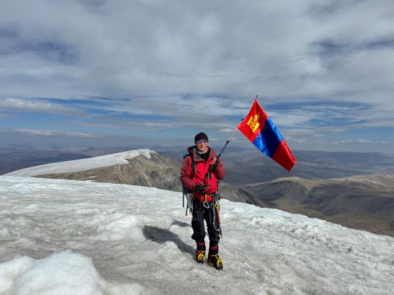
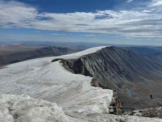
I was slightly more careful about route-finding in those boulder fields on the ascent than on the descent so the scrambling difficulty never exceeded “class 2”. I did opt to wear my approach shoes while carrying the mountaineering boots and that definitely helped on this boulder hopping game. I took one break at the edge of the glacier to swap footwear and also to don crampons. The glaciers were as expected, completely dry with no snow whatsoever so it was 100% safe to cross them solo. I underestimated the distance between these two peaks (Barilgachin and Sukhbaatar). Apparently there were several kilometers each way of plodding between them, all at and above 3900 m elevation. There were two more gear transitions as I needed to remove the crampons for the dry section at the saddle, and I ditched the entire backpack for the final 200 m grunt onto the true summit (Sukhbaatar). Just when I thought I would go down alone I managed to catch some cell services from the summit so I spent the next hour or so reconnecting with the real world. I even made an Instagram post about the previous few peaks because I never got enough reception on the roads. The others eventually showed up so we celebrated the success together.


I debated about staying together on the descent but eventually opted to go down alone, as I was more keen to have lunch at a proper time. I did not bother to don crampons for the traverse back up and over that north peak (Barilgachin). The final 50 m descent to the gear cache was a tad bit too steep for bootpacking but was manageable with care. That 700 m descent on boulders was as bad as expected, but at least I was wearing the approach shoes and not the painful mountaineering boots. I did not pay too much attention in route-finding because I was able to scramble down any class 3 or 4 easily in those footwear, and as a result I did fair amount of hands-on scrambling with friction footwork. The final few kilometers of plodding on grass was also tedious and tiring and my round trip time was just over 9 hours. The round trip distance was 20 km and the elevation gain was over 1500 m, so this was definitely one of the bigger days in this trip. Gangaa had prepared some delicious Chinese dumplings so I staffed in a huge meal, wrote the trip report (offline of course) while waiting for the rest of the team, and then dived into my tent for a much-needed nap despite the unbearably hot temperatures. For some reasons I felt very tired but I don’t think that’s because of the overall distance or the altitude of this ascent. The next day we drove out following our exact way back to that paved highway at the base of Baatar Khairkhan which took 5.5 hours, and then continued driving south to the city of Bulgan to settle for the night.