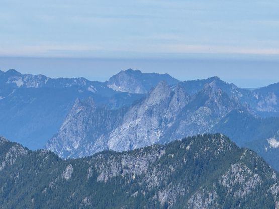
Mount Thomson (via W. Ridge) and Kendall Peak
July 8, 2025
1997m
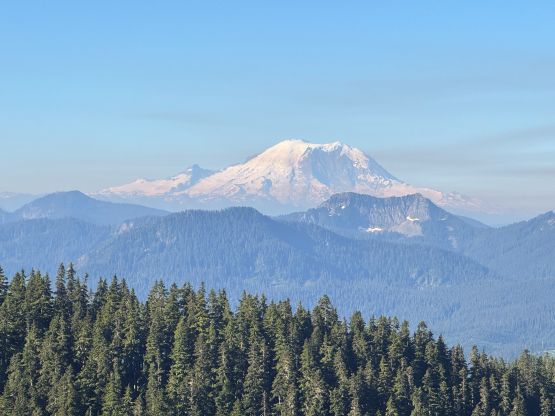
Snoqualmie Pass, WA
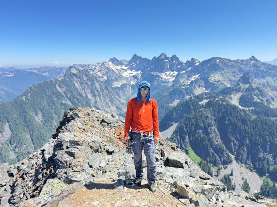
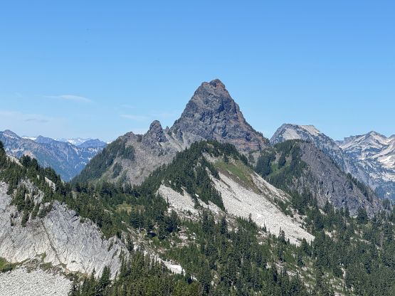
Mt. Thomson is a pointy peak not far from Snoqualmie Pass that had caught my attention over the past several years. The easiest route is the east ridge and goes at “class 4” but scramblers usually bring a rope “just in case”, whereas the west ridge offers a much more aesthetic multi-pitch low 5th class rock climb. The official grade of the west ridge is 5.6 but I knew a few friends who had climbed it and it didn’t sound as tough as some of the other 5.6 routes I’ve done. Erica and I were looking at something that requires a rope and I eventually decided on Mt. Thomson via the west ridge route. The weather was better towards the south and the objective had to be in the realm of “day trip”, albeit we had the flexibility to car-camp the night before. I was still far from being 100% physically so the deal was for Erica to carry the 60m rope throughout the trip. I would carry a single rack of cams up to size 2 and some nuts.
We left Surrey at around 8:30 pm in the previous day and the border traffic was very tolerable. We made the familiar drive down south and then east and got to Snoqualmie Pass at around 11 pm. This was one of the trips that I could bring the Corolla so we pitched the tent in the parking lot even though it’s definitely illegal. We would be pitching the tent from midnight to around 5:30 am so I was certain that no park official would come to fuss with us. The alarm was set at 5 am but I was too tired to wake up. We slept in for an extra half an hour and eventually started the day at around 6:30 am. I opted to wear the trail runners for the entire approach and scramble but carried the rock shoes for the technical pitches. We together carried one pair of crampons and one ice axe but they turned out to be training weight. There was no up-to-date beta about the conditions so we wanted to be 120% sure of the success.
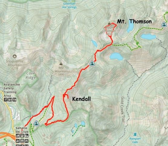
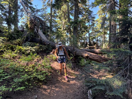
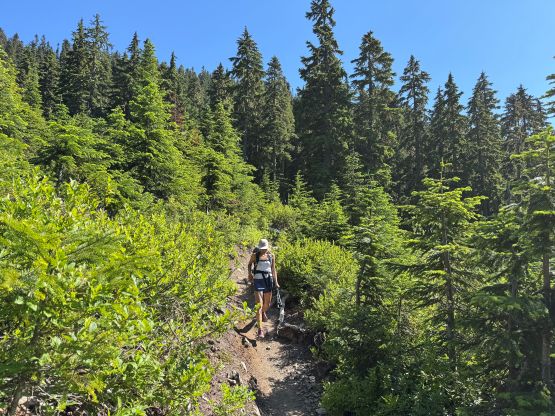
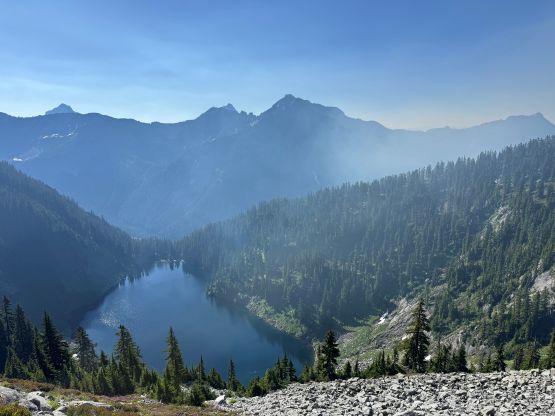
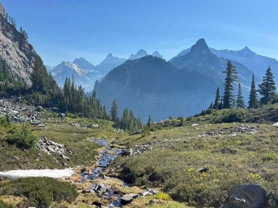
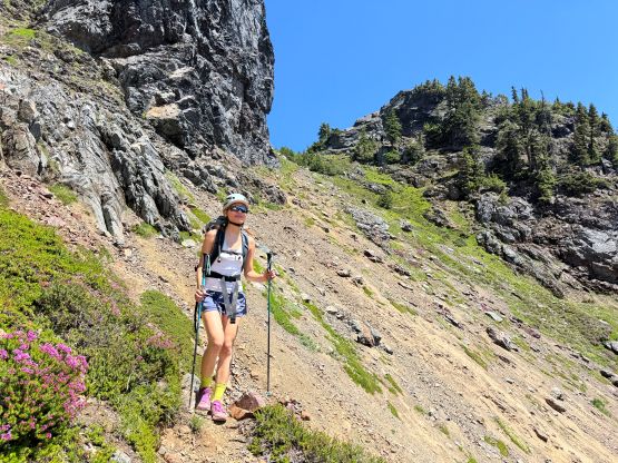
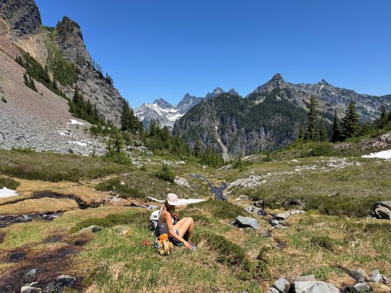
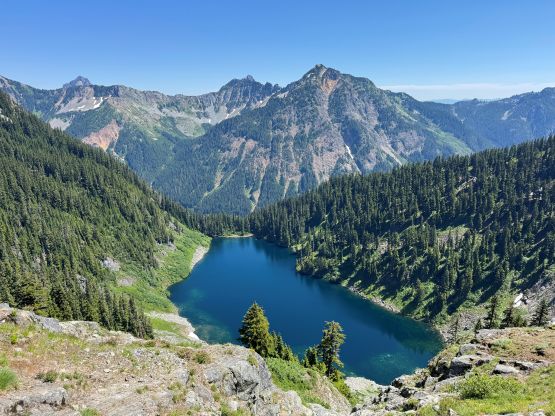
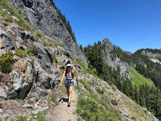
There are two ways to start the trip and we opted to take the old trail which shaves several kilometers off the round trip distance. The quality of that old trail was not comparable to the new PCT but I always prefer the option with the shorter distance. I’m never a fan of plodding flat distance. There were a shit ton amount of spider webs on that old trail so the going was quite unpleasant for me leading in front. The situation improved drastically after joining the PCT and our next stop was somewhere along the “Kendall Catwalk” section. I’m not very sure where exactly is the catwalk nor do I care about it, but we never encountered anything that could be classified as a “catwalk” in my book. We got to the saddle between Kendall Peak and Red Mountain in under 2 hours from the car and took a break donning sun protection. The next break was at Ridge Lake filling up the water bottles. I read several trip reports indicating abundant water sources in the bowl south of Mt. Thomson but without up-to-date beta I didn’t want to rely 100% on the old information. We loaded up 2 L of water but I didn’t bother to tab them. Instead, we made the trek up and over Bumblebee Pass and dumped the unfiltered water in the basin. There was indeed plenty of water sources so there’s no need to drink the dirty lake water. We had some discussions about how we couldn’t bluntly take consideration of other people’s time. I had brought enough food to sustain a 16-hour day but this was shaping to become much shorter than estimated. Some parties had even budgeted 3 days for the approach and climb, which we couldn’t figure out why…
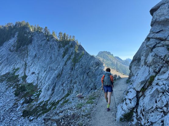
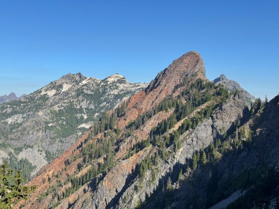
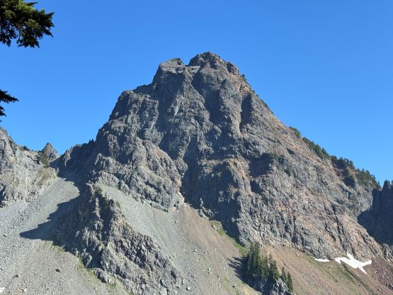
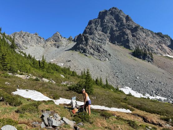
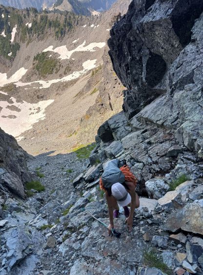
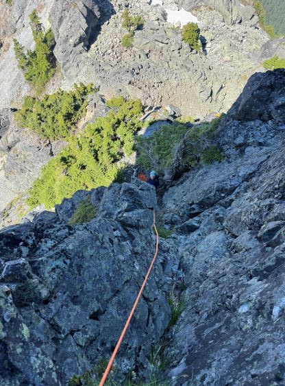
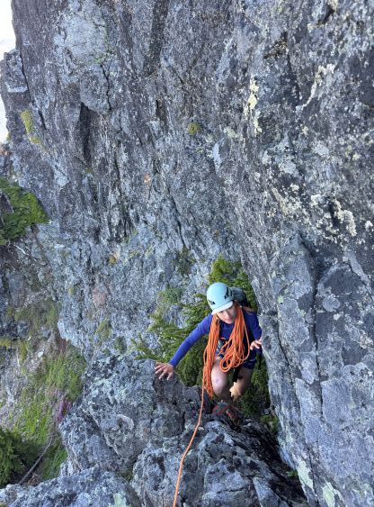
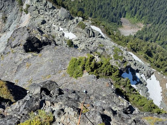
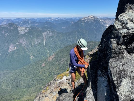
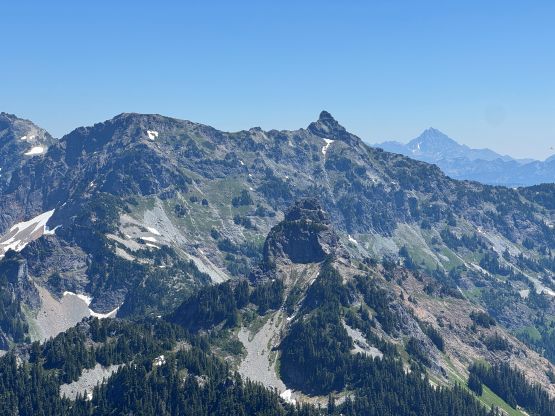
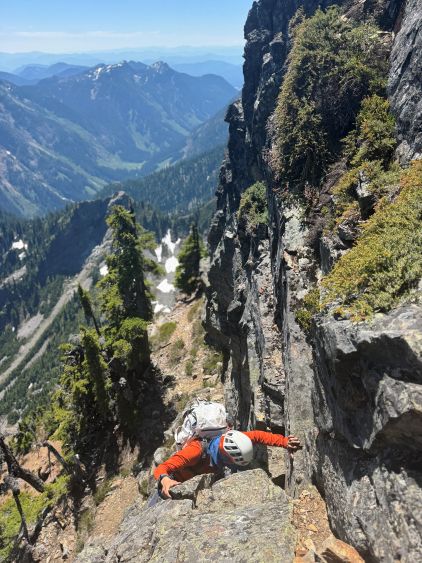
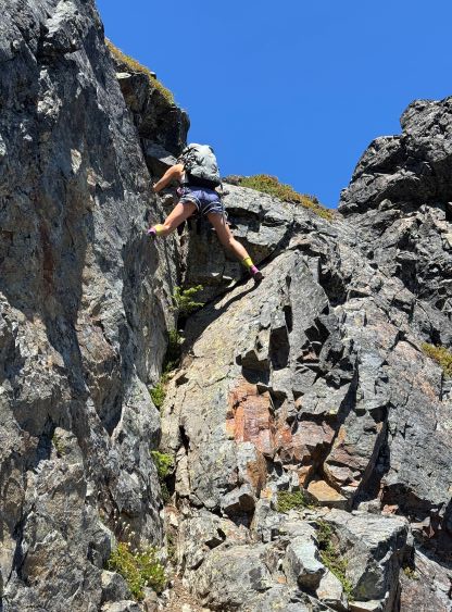
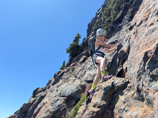
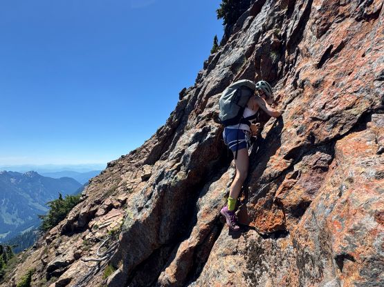
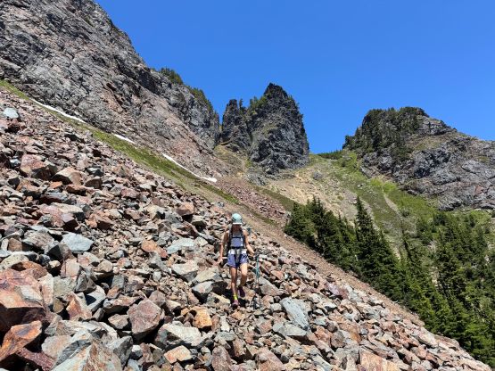
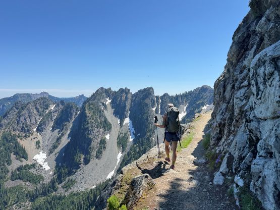
We ditched some unnecessary gears and food in the middle of this bowl next to the stream of water and then made the trudge up the rubble-fuck to the notch on the west ridge. This section was unpleasant given the size and the unstableness of the rocks. These are some brisk-sized choss that is miserable no matter what type of footwear we opted to wear. The gully leading to the notch was rather trivial but we had to scramble over some pinnacles with one tricky down-climb (4th class, long reach) to the start of the pitched climbing. The route didn’t appear overly difficult but the route-finding was definitely the challenge. I led out wearing rock shoes and I agreed that the first step-left move was quite mental given the lack of any reliable hand hold. I made the move and then went rather straight up the chimney-ish feature. There were lots of low 5th class moves involved but the climbing was not sustained. Higher up the grade eased and I scrambled over some bushes and belayed Erica up using a boulder. There were some old slings presumedly for bailing but I didn’t use them.

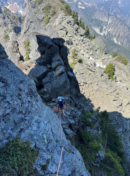
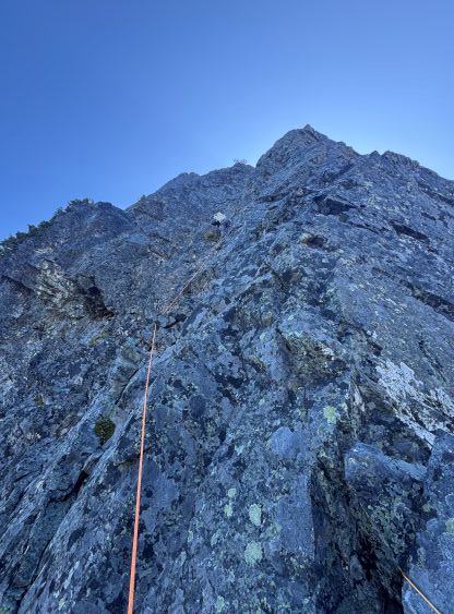
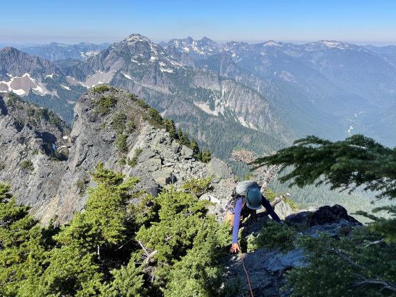
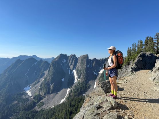
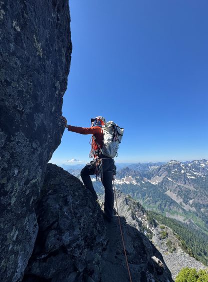
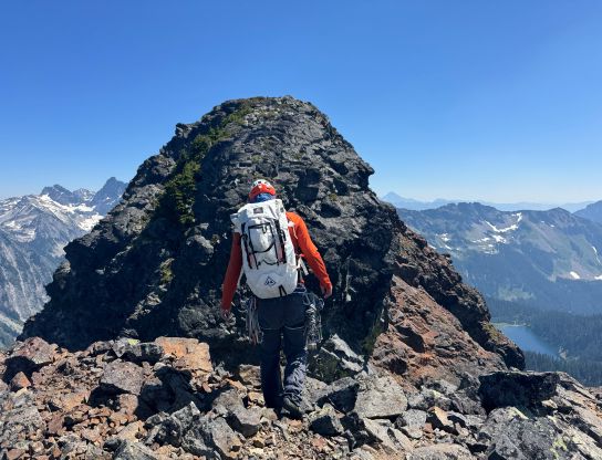
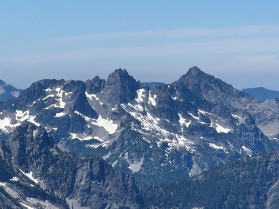
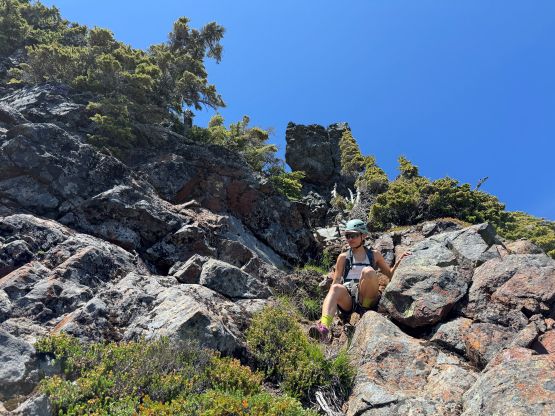
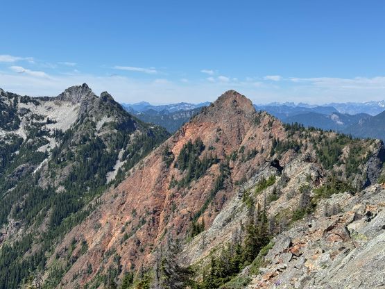
The second pitch was definitely the crux as I led the way zig-zagging up the ridge. The first difficult stretch was almost vertical but thankfully the holds were plenty. I then moved climber’s right onto the crest of the west ridge and did some 4th to low 5th class climbing until I was below a “roof feature”. I wasn’t sure if this was the roof mentioned in the other trip reports but I didn’t like the direct attack. Instead, I made a traversing descent to the left (north) and then scrambled up some 4th class terrain. Unfortunately this detour created some significant rope dragging that made the climb quite annoying and difficult. I pulled up another vertical, mid 5th class step before finding another boulder to belay Erica up. This pitch had taken over 50 m and was fairly sustained. Since I was unable to make a single pitch to the “3rd class slabs” due to rope dragging we had to do another short (10 m ish) pitch to finish off this section, so essentially we climbed the 2nd pitch in two separate pitches. Upon seeing the slabs I decided for us to scramble across and the terrain was indeed very straightforward especially in rock shoes. We also scrambled the start of the 4th pitch until one exposed 5th class step made us donning the rope again. I placed one size 1 cam but that’s it. I scrambled the rest of this pitch (4th class mostly) and belayed Erica up from just below the false summit. The scramble across the gap to the true summit involved a few tricky moves but nothing too difficult to warrant the use of rope again.
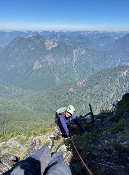
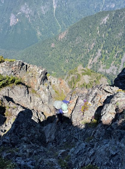

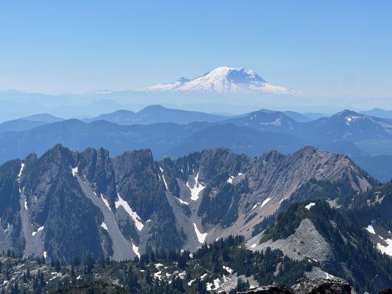
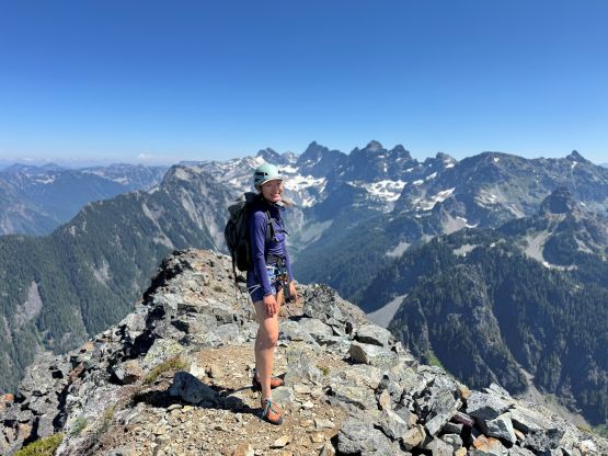
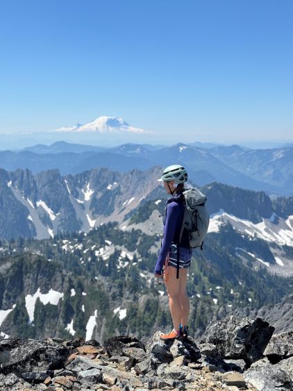
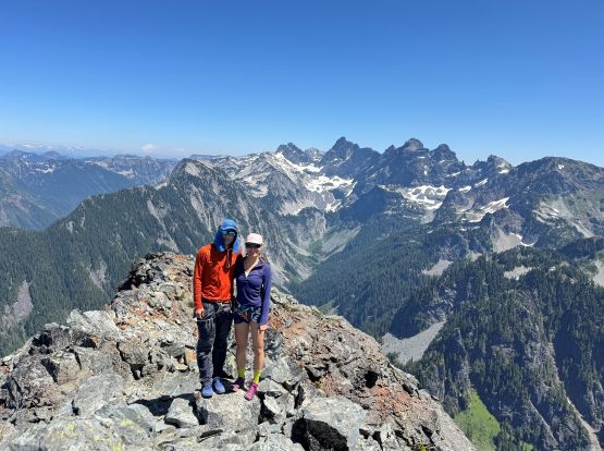
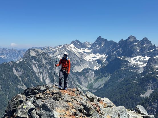
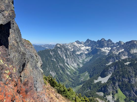
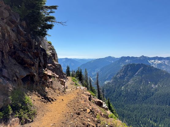
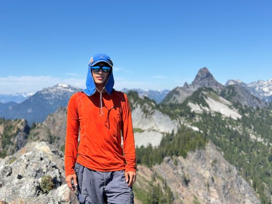
It had taken us about 5 hours 45 minutes from the parking lot to the summit of Mt. Thomson so we took our time resting on the summit. Unfortunately the mosquitoes were terrible. They had been chasing us up the route and were now swirling around on the summit. I had to wear my puffer jacket as bug protection and that was not right. We quickly got chased off the summit by the bugs. Going down the east ridge the plan was to “practice” scrambling as we were both competent in rappelling. I wasn’t sure if we had found the easiest route as I had done virtually no research about the east ridge. The first steep down-climb was quite difficult and felt low 5th class, but was doable. We then located a rappel station and down-climbed right underneath it and towards skier’s right, and encountered lots of exposed 4th class moves on down-sloping terrain. In retrospect the skier’s left was probably easier, but we couldn’t care. The more scrambling, the better. We encountered no more difficulty afterwards but the terrain below the east ridge’s notch on the south side was quite shitty and loose. There’s even some compact moraine type of choss. Eventually we gingerly made our way down to the gear cache and took another long break. I was contemplating about adding Huckleberry Mtn. into the already-long day but sanity won in the end.
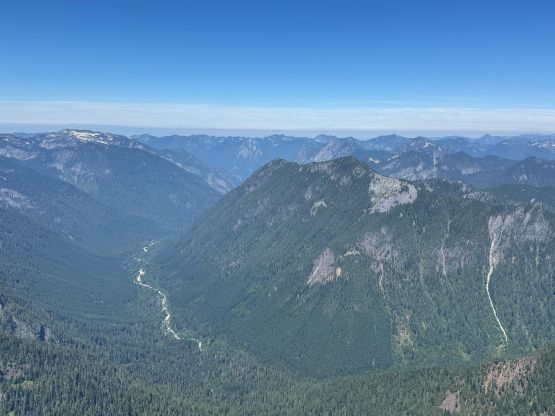
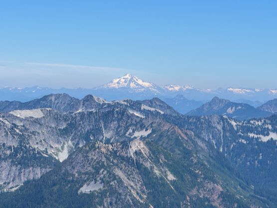
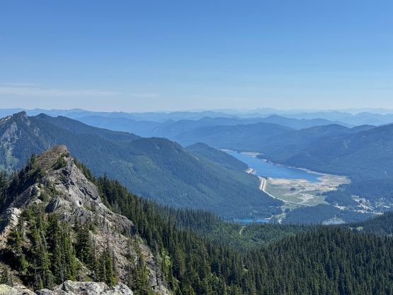
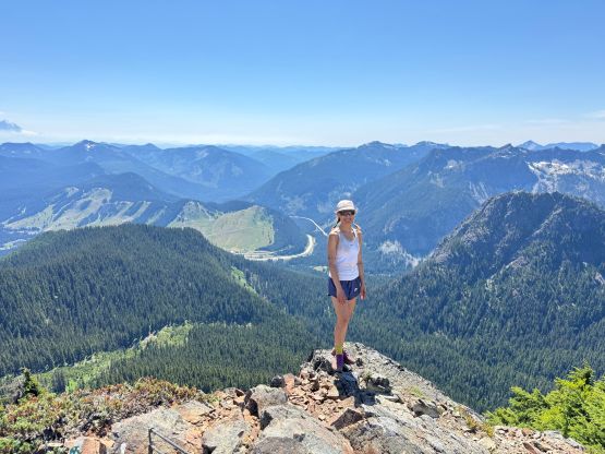
We plodded back up and over Bumblebee Pass and then slogged back along the PCT passing underneath “Collar Mountain”. This shitty-looking summit does boast over 100 m prominence but lacks any mountaineering value and is unofficially named. We decided to skip it to save the energy for Kendall Peak, which is a much more worth destination. We quickly plodded back across the busy trail, ditched the backpacks at the start of the climber’s trail and gained the 150-ish meters to the summit of Kendall Peak. The views were quite nice.

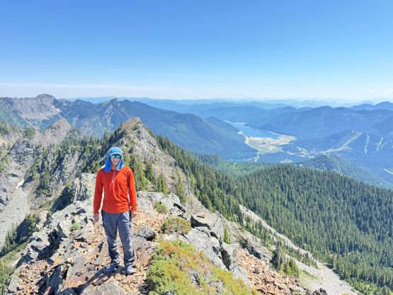
There were again, loads of mosquitoes on the summit but they weren’t as terrible as on Mt. Thomson. We were eventually chased off by the bugs and then dashed back to the ditched backpacks. I then led the way trail-running most of the way back across the new PCT to the junction. The section of the old PCT wasn’t as great for trail running but we nevertheless made quick work down, concluding the round trip time in less than 10.5 hours. Not doing much lingering I turned on the engine, and we took turn driving home and eventually got back at around 10:30 pm.