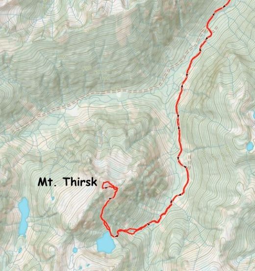
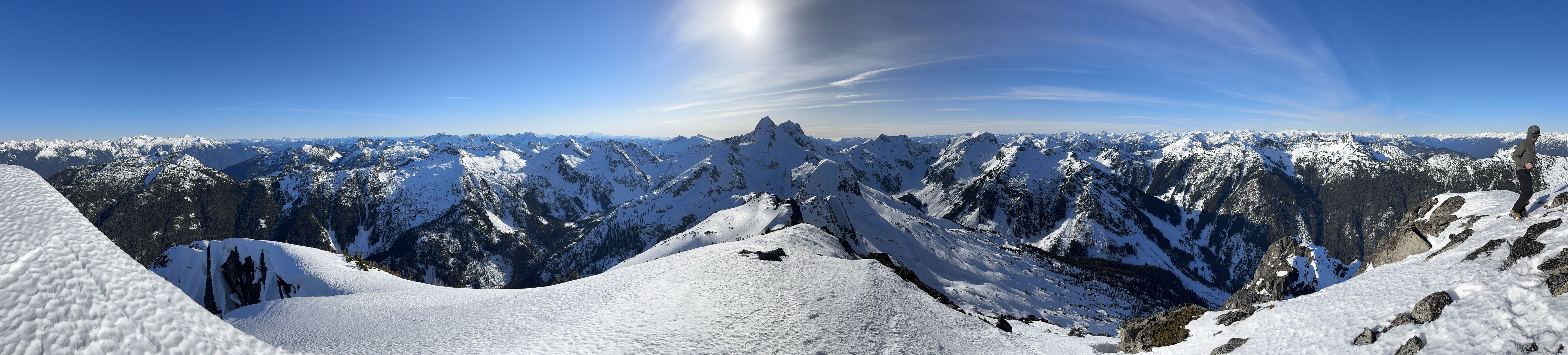
Mount Thirsk
January 24, 2025
2059m
Tipella / Chehalis Area, BC
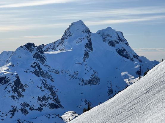
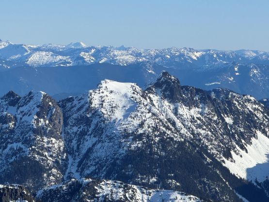
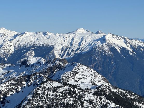
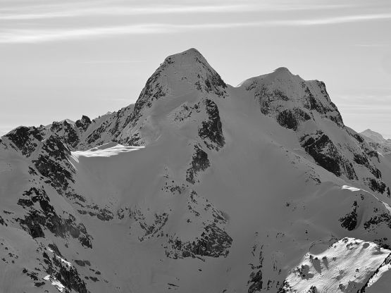
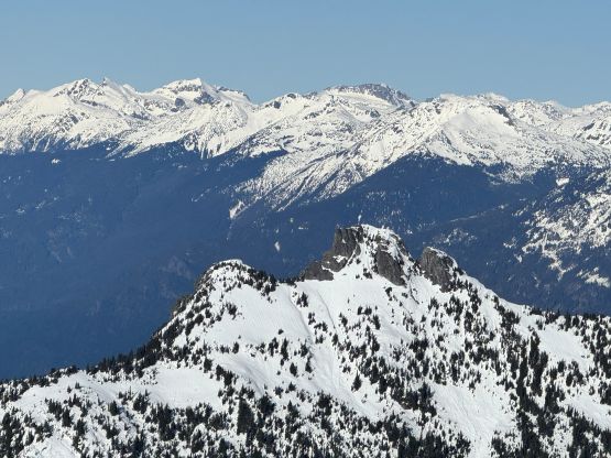
Mt. Thirsk boasts over 300 m prominence above the saddle with Robertson Peak and is rugged and bluffy on all sides. This one sees far less visitor than the bigger neighbour. Even Robertson Peak was once an obscured objective, but the situation had taken a sharp turn since I climbed it back in 2021. There were only 4 known ascents prior to that trip but as for 2026 there are already over 20 people logging it in even just on peakbagger.com. Mt. Thirsk has no “beta” whatsoever but bivouac.com casually mentioned it could have seen an ascent by the surveyors’ party decades ago. There was no account of the said ascent, so this could still potentially be a virgin peak. This triggered my curiosity for years but I couldn’t figure out an obvious route. I had proposed three different options and all three of them had some major uncertainties that I wasn’t too keen to tackle without being pushed by someone else more keen on venturing into the unknowns than myself. This person turned out to be Francis Bailey.
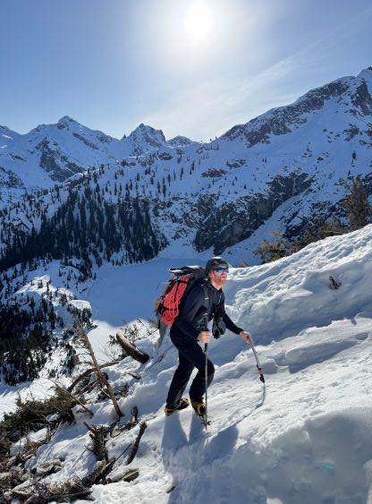
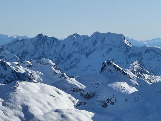
A rare 10+ days stretch of sunny weather had made the snowpack as “green” as it could ever be, so I was eager to get out even though I had lots of responsibilities these days in the city. I reached out to a few potential partners for Garfield Mountain via the north route in Washington but Francis countered back with Mt. Thirsk in B.C. Sure, this might finally be the time to resolve the mystery. The bonus point was taking advantage of the “highway” of snowshoe tracks laid by 5+ parties doing Robertson Peak in the past week. After a few hours of discussion we agreed on tackling the SE Face route. The approach to the lake would be the same as Robertson Peak’s 2nd ascent (via the North Glacier) but with the difference of doing it in winter. I wasn’t 100% sure about the headwall underneath the lake but there’s only one way to find out. The SE Face seemed to be complicated based on the limited photos we could dig out, so we decided to bring two ice axes each, one 60 m rope, several pickets and slings. Of course all of those turned out to be training weight. This is still a serious route that hits all kinds of avalanche terrain. It just ended up being non-technical.
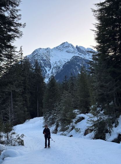
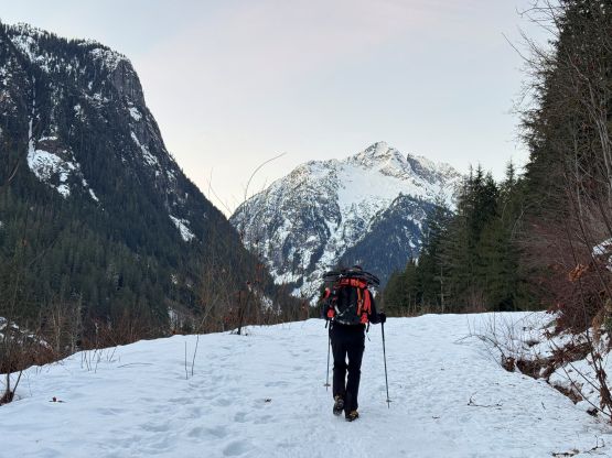
With the cold temperatures we had no concern of the snowpack stability whatsoever so agreed on a not-so-early start, but given the 5-hour (each way) of driving we still met at the Church at 3:15 am. In less than two hours we were in Pemberton eating the McDonald’s and another 2 hours later we were parked at the “trail-head”, which was basically the snowline on Tipella Creek FSR at just above 400 m elevation. There were already 3 vehicles parked at the same spot, suggesting more-parties-than-expected on Robertson Peak. This was already my 6th trip in the vicinity of Tipella which is halfway between Pemberton and Harrison Hot Springs. All of these trips were done by driving in and out via either Lillooet West or In-SHUCK-ch FSR. The shorter but much router south side access via Harrison West is now rumoured to be “faster” time wise, but we preferred extra gas cost over expensive truck maintenance.
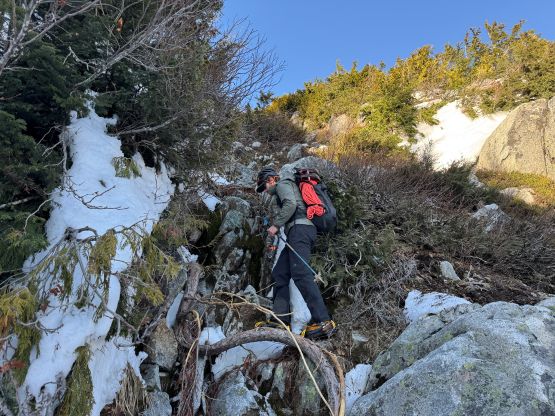
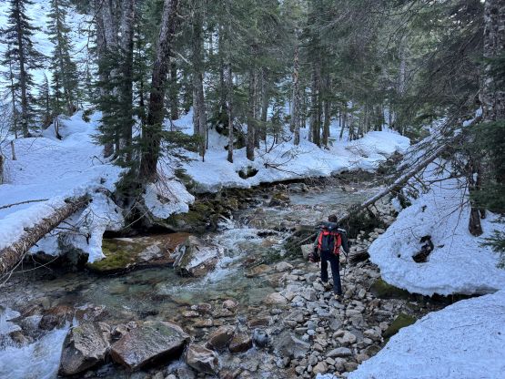
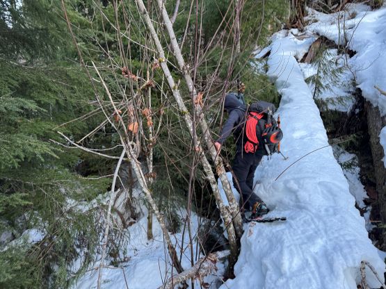
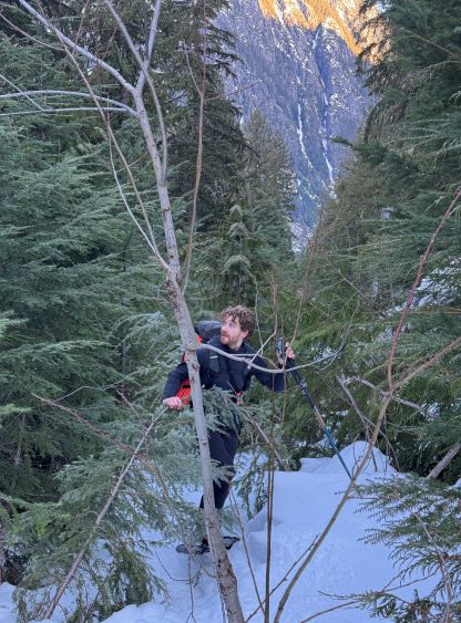
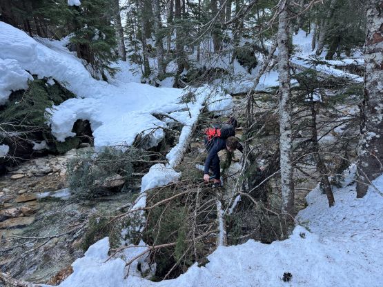
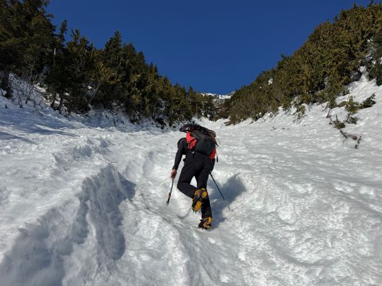
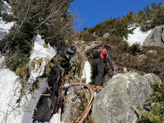
We started the trip by boot-packing but in less than a kilometer we had to strap the snowshoes on. The snowshoes were only necessary for the 7km of road plodding even with the help of the previous parties’ tracks. The snowshoes could have been ditched for the entire ascent after leaving the “trail” but this was only in retrospect. We ended up carrying the snowshoes all the way to within 250 m from the summit and then down. The bushwhacking on the overgrown spur road after crossing Tipella Creek on a nice bridge was as bad or good as what I remembered from 5 years ago. The terms “bad” and “good” are relative, meaning it really depends on your expectation. I was anticipating at least level-4 bushwhacking on the first time, so the situation was quite “good”. This time given the abundant tracks I was hoping for a “highway of freedom”, so the reality was rather disappointing. The snowpack was nowhere as thick so there was actually more bushwhacking this time, but the existing tracks helped eliminated the necessity of route-finding. There’s no snow bridge across the main creek so the previous parties couldn’t merge onto my GPX track and did more side-hilling and traversing in order to stay on the east side of the creek. The lack of snow bridges also meant Francis and I would have to find a different way to cross the creek to the west side. I thought we might have to ford it, but we found several logs. None of them was ideal but we made do with some strenuous man yoga moves on snowshoes. I crossed the same log on crampons on the way back, which was slightly easier but not by much.
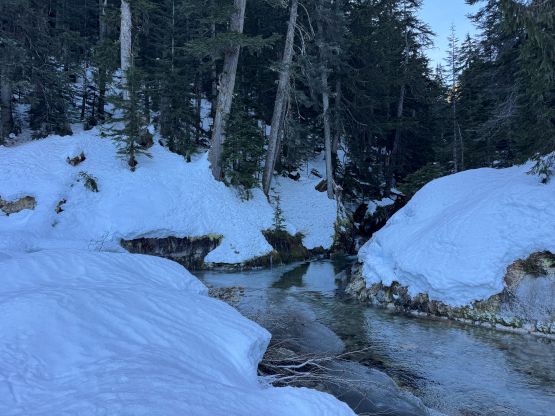
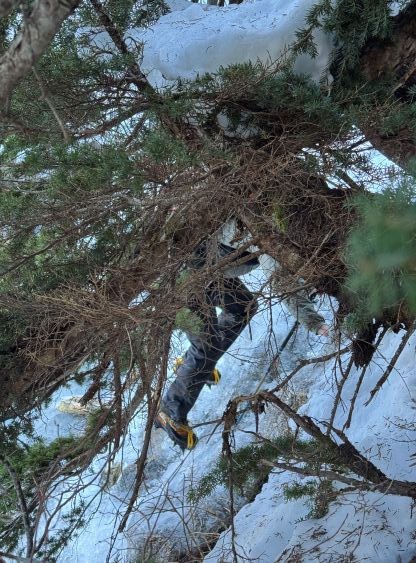
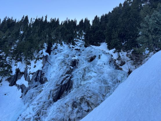
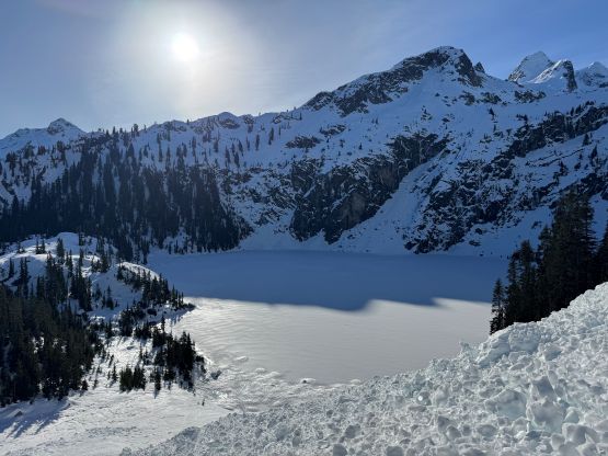
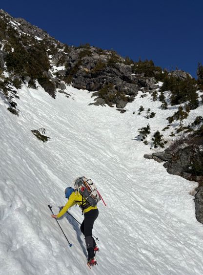
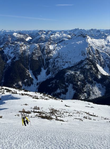
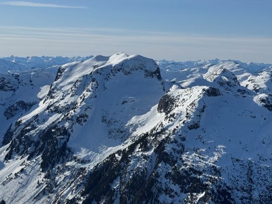
We then made a diagonal traverse staying on the north side of the tributary creek draining from the aforementioned lake between Robertson Peak and Mt. Thirsk. Even this creek was not entirely frozen. On the way in we opted to stay more on open slopes in order to have better observations. This meant we had to cross the creek several times on either questionable snow bridges or ice. I led us staying entirely on the north side of the creek on the return which was much faster. The exact attack of the headwall was determined in situ at the very last minute using a combination of the field observation and the LiDAR map that Francis managed to obtain. There were definitely 2 or more options on the extremely far climber’s left or right but we preferred to stay relatively in the middle to avoid unnecessary detouring. None of the options including the one we took was “no brainer” so pick your poison. We veered climber’s right while ascending the snow-covered boulder field, and then did a diagonal traverse back left to cross the main creek in the middle of a frozen waterfall. I was anticipating a flat platform but it was still sloped. About halfway across after a few interesting moves we had to make an awkward transition from snowshoes to crampons. The crampons were then stayed strapped to our boots for the entire climb and descent. The ice was low-angled enough that we only needed one ice tool. Above this creek crossing we had another hundred meters of steep forest to ascend, but there was nothing overly serious.
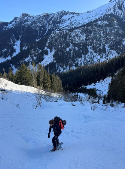
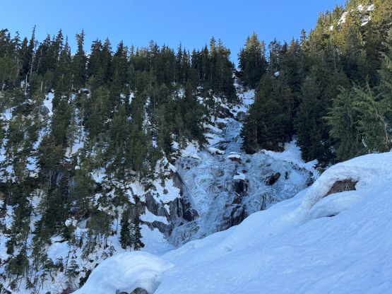
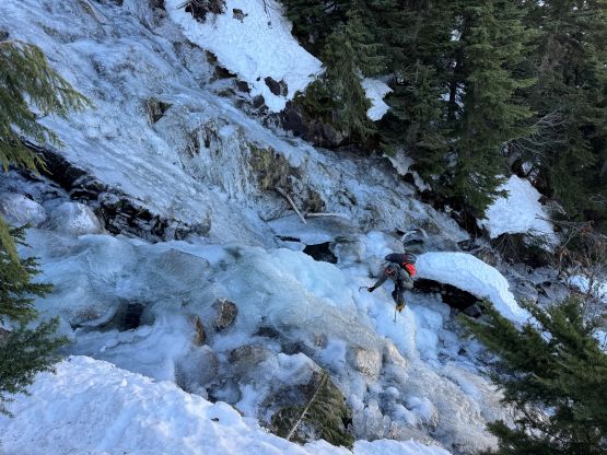
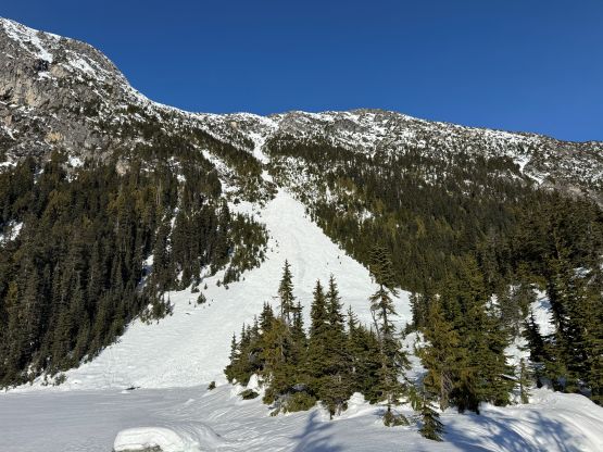
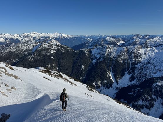
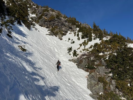
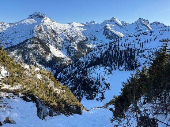
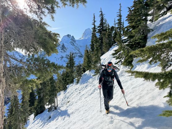
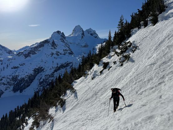
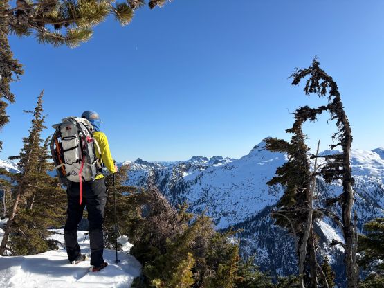
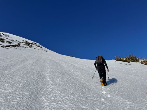
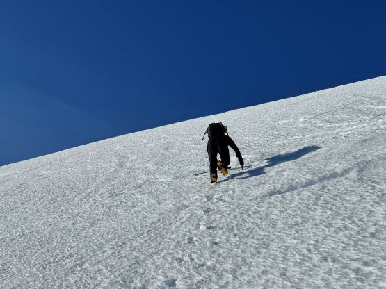
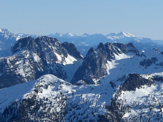
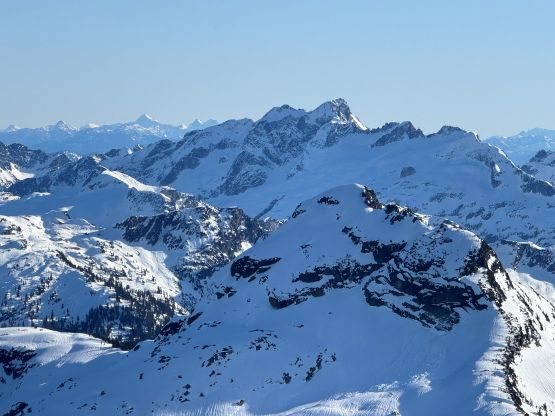
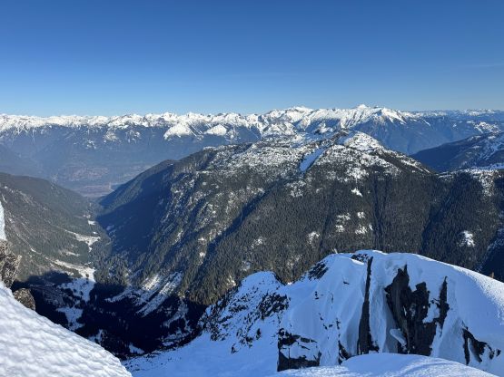
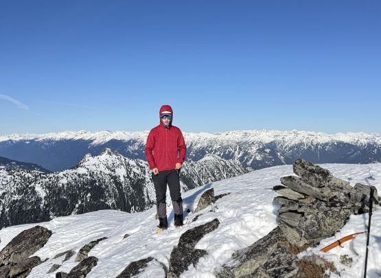
We didn’t have to venture onto the frozen lake and instead, we traversed around the NE corner dealing with some mild post-holing over breakable crust. The SE Face of Mt. Thirsk appeared more or less as expected. Ideally we would want to have more snow, but the coverage was enough to “make do”. There are three gullies that we would ascend and traverse diagonally across all of them. The first gully was the longest. We climbed the far climber’s right side staying on mostly avalanche debris until the two melted-out constraints. The constraints ended up being class 3 scrambling so we resumed the original plan. I had formulated a different plan in case the upper (harder) constraint required mixed climbing. Francis then led the first diagonal traverse out to the right in thinning forest. Transitioning into the second gully required a few steps of down-climbing that I didn’t even bother to take the ice axe out, but traversing towards the 3rd gully started to become more and more exposed. I finally took the ice axe out. Crossing the 3rd gully had the most exposed snow climbing in this trip, but still it didn’t warrant the use of the 2nd ice tool. After the 3rd gully we descended slightly in order to stay on lower angled terrain, and eventually took a break 250 m underneath the summit ditching all of the unnecessary gears. The upper SE Face would be nothing fancier than “plodding” based on the satellite images, but was still quite steep at places. Having one ice axe helped the sense of security. I was feeling the drag at this point so Francis led the final push to the summit. Francis wasn’t very stoked to see a cairn on the summit. We couldn’t find a register note, but we were definitely not the first ascent party. We most likely had made the first winter ascent of this peak, but in our opinion having the winter snowpack actually helped eliminating the difficulty (which was mostly the bushwhacking).
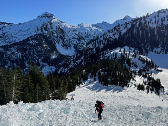
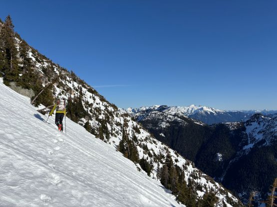
The descent was mostly about the techniques than fitness so we made very quick work down to the frozen lake. The only painful section was the avalanche debris at the very bottom but Francis spotted a better line on the skier’s right, which definitely saved our ankles and knees. Lower down we followed the exact same route that we took including the traverse across the frozen waterfall. This time we did the down-climb on crampons instead of snowshoes, which definitely made things more enjoyable. I thought we might have to strap the snowshoes back on at some point, but we ended up plunging all the way down to the valley bottom in crampons without much post-holing. Francis wasn’t stoked about the man-yoga moves so went for a different log, but I proved that the original log crossing was still the faster one. By the time we got back to the tracks we noticed that nobody on Robertson Peak had made the return yet. Eventually there came the final 7 km of zombie mode plodding, which was not enjoyable but not terrible neither. Our round trip time was 9 hours 45 minutes and we finished minutes before needing to use head-lamps. The drive home was exhausting but I still managed to get home before midnight.