Mount Tatlow (Ts’il?os)
June 20-21, 2024
3063m
Nemaia Valley / Chilcotins, BC
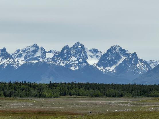
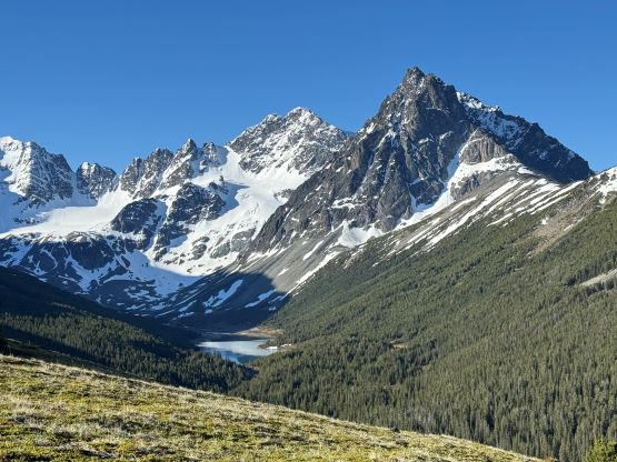
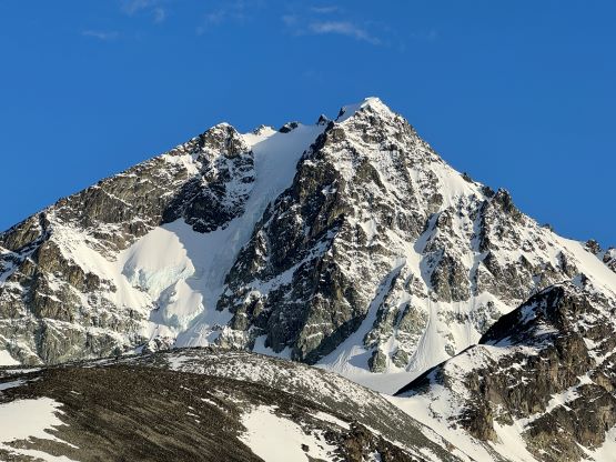
Mt. Tatlow, also traditionally known as Ts’il?os, is the highest peak in Nemaia Valley and one of the few “ultra prominent peaks” in the Chilcotins of British Columbia’s Coast Mountains. Trekking, mountaineering or even pointing at this sacred peak is considered prohibited by the locals so do consult with your own ethical values if deciding to use my “beta” for the climb. There are however, plenty of horse trails, a summit cairn and at least a few detailed trip reports out there on the internet even dating back to several decades ago. One party came back 3 days later after summitting, only to discover their vehicle being trashed and that might have something to do with climbing Mt. Tatlow, but we don’t know. In any case there are basically only two routes on the mountains – the standard NE Ridge and the N. Face glacier/icefall. To climb the glacier would be the coolest way to experience this mountain but the global warming had made it a 70-degree ice climb nowadays. The standard route is not to be taken lightly neither, and still requires some serious mountaineering on steep and exposed snow. Matt Juhasz had made a successful ascent in the spring of 2024 amazingly in just one day, and via an exploratory approach that he had scouted on the satellite images over the past years. Matt did not make this sound “easy” by any mean, but I was determined to follow his footsteps as soon as I saw a window forming. I wanted the window to be big enough to do Mt. Tatlow over 2 days (for the camping experience), as well as including Klokon Peak and Mt. Nemaia via Gulkas’ route, so I patiently waited for a few weeks.
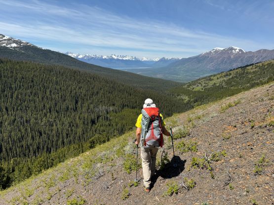
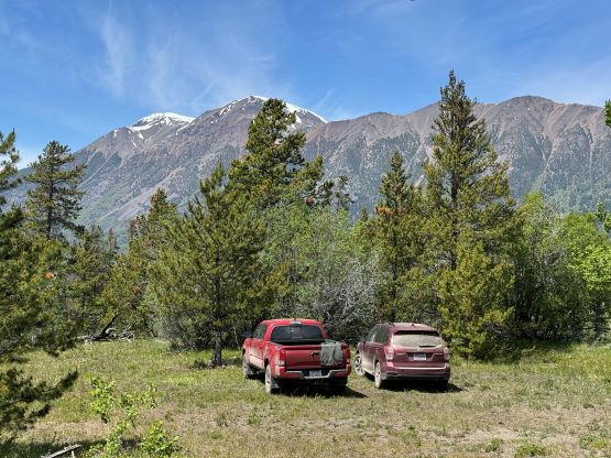
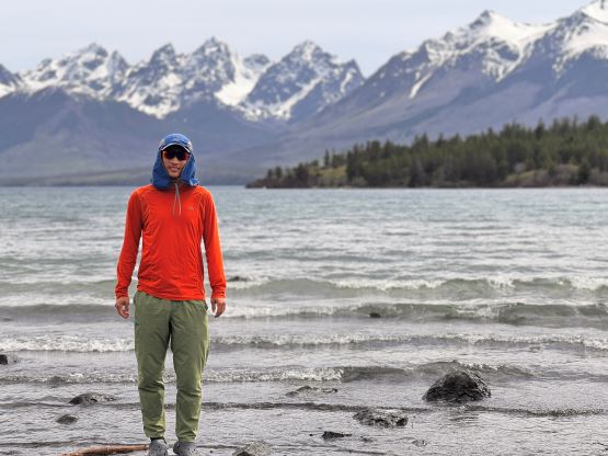
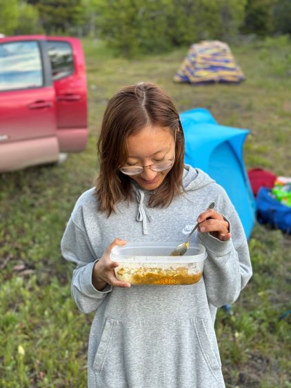
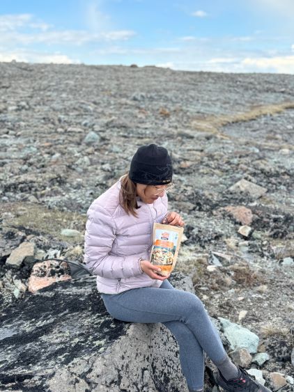
Erica and I had been hanging out together for a while and I was keen to take her on a “project trip” as what we had been doing recently was cool, but not long/difficult enough. I was confident that she could handle Mt. Tatlow if I brought a rope along and do all of the leading, so I planned this project mostly with Erica. Meanwhile Adam W. and Dave G. happened to be peak-bagging in B.C. so I shot them a last-minute message and sure enough, they were instantly in. No one else was aware of the plan as 4 was already large enough for this objective. The plan was to budget an entire day for driving (each way), and spend 3 days in Nemaia Valley for Mt. Tatlow and then Klokon/Nemaia. On Wednesday morning Erica and I left Surrey at 6 am and met Adam and Dave in Abbotsford. We together drove 3 separate vehicles to Williams Lake where Dave left his van behind. I considered this trip important for myself because this was my first foray to the north in the Coast Mountains and I had been dreaming about that for years. Sharing this experience with Erica along with two other good friends made it even more special. We made the 2-hour detour to drive up Mt. Alex Graham as planned, and then dashed SW onto Taseko Lake Road. There would be over 100 km of FSR driving each way, and the summit of Mt. Alex Graham was the last spot with some cell reception. The road was in some excellent conditions and the drive was very scenic. Past Davidson Bridge rec. site we turned onto Nemaia Valley road. After a scenic rest break at Konni Lake we drove past the small village where we could get some gas if we needed. Erica then directed us to the spur road that Matt spotted on the satellite images. The road was definitely narrow and muddy, but both of our vehicles got to the “trail-head”. There were still about 2 hours of daylight time so we leisurely set up the car-camp and cooked meals.


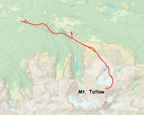
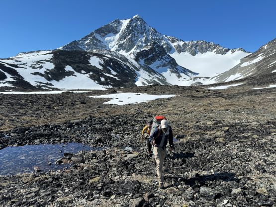
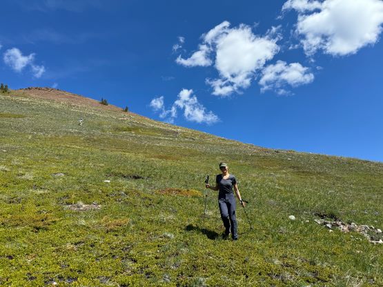
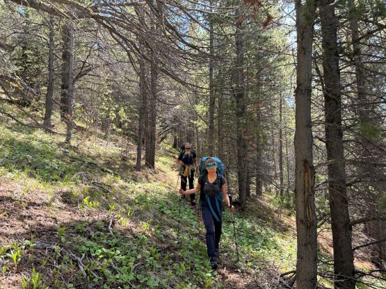
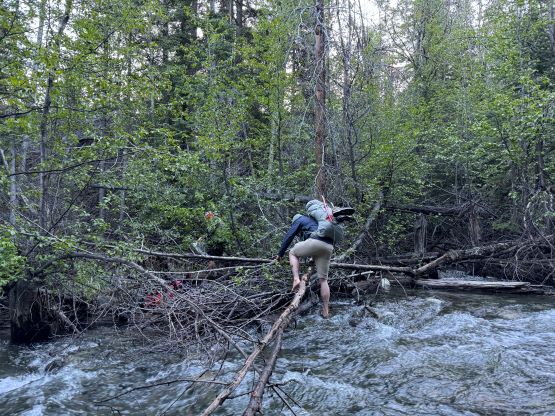
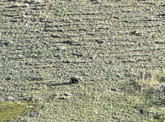
On the next morning we woke up at 4 am and was ready to go by 5 am. The plan was to push to the “lake camp” and make the summit on the same day, and there was some thunderstorms in the forecast in the afternoon so we needed to be quick. One crux presented near the start and that was the creek crossing. I believe the horse trail on the other side of the trail does not originate from our driving route, so we had to thrash through the bushes both ways to find a suitable crossing spot. On the way in we strictly followed Matt’s GPX but had to take the boots off and wade across. The current was quite strong and the bare feet crossing would be very painful and difficult so I made two trips and carried Erica’s pack as well as my own across as Erica had never done a river crossing before. My feet were frozen after the first ferry and I needed several minutes to warm them up before making the second crossing. On the return we crossed downstream and used a sketchy log, which was better but not necessarily safer. Adam then set a blistering pace up the horse trail probably because he wanted to be out of the sight for as quickly as possible, but frankly speaking I don’t think the locals use this trail by much, if at all. There are several overgrown stretches but with Matt’s GPX track the navigation was very straightforward. We took the first needed break under the P200m bonus bump where we saw a monstrous grizzly minutes after. Thankfully the plan was to hit that bonus peak on the exiting day.


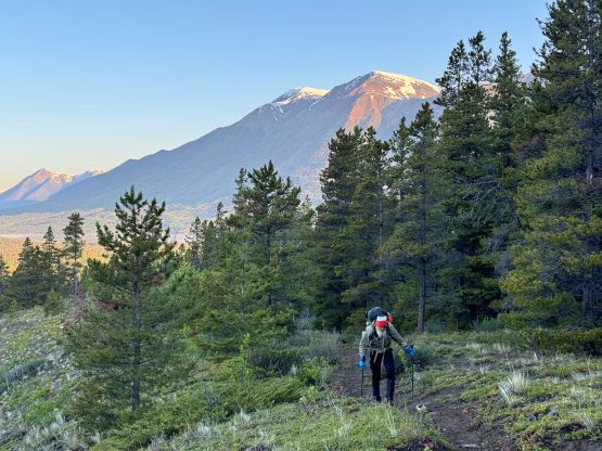

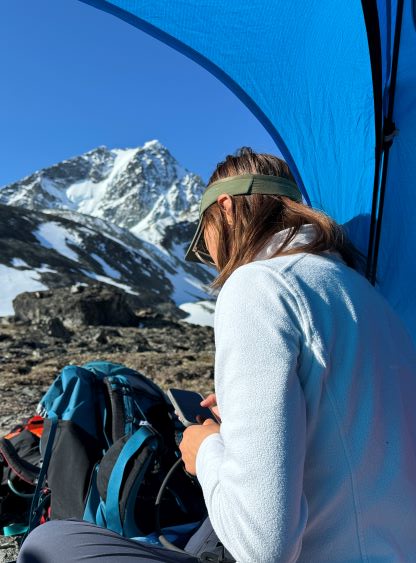
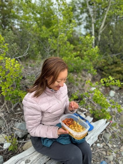
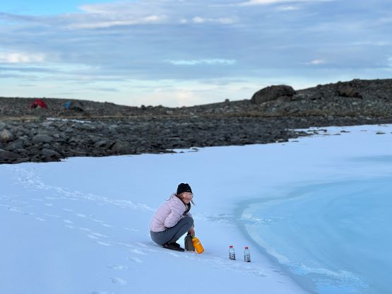
The trail basically ended somewhere there but we were mostly in the alpine anyway. The next section involved linking up several patches of open grassy slopes. The bushes were dense in between the patches of open but Matt had picked an excellent route and all we needed was to stick to his GPX as if it’s the god’s sake. Once entering the alpine I made some adaptations and took a more direct bearing in between Matt’s ascent and descent tracks. The area where Matt mentioned “swamps” sucked no matter what and I do not think there’s actually a better way. It wasn’t too swampy for us, but the bushwhacking through those dense unknown type of low growth was unavoidable. Thankfully it didn’t last too long, and we were soon facing that foreshortened diagonal grunt to the “lake camp”. Erica and I took over the lead for the rest of the approach and having Erica right on my heel made me going quite hard. Adam and Dave had to hit the maximum gas and we together made to the camp in just over 3 hours from the truck. There was thankfully enough melting along the lake’s rim for us to collect liquid water, but elsewise I only gave us 20 minutes to take a much needed break while setting up the tents. None of us carried a bear spray but Dave had brought an Ursack which we all appreciated, especially after the grizzly sighting that was not that far away.

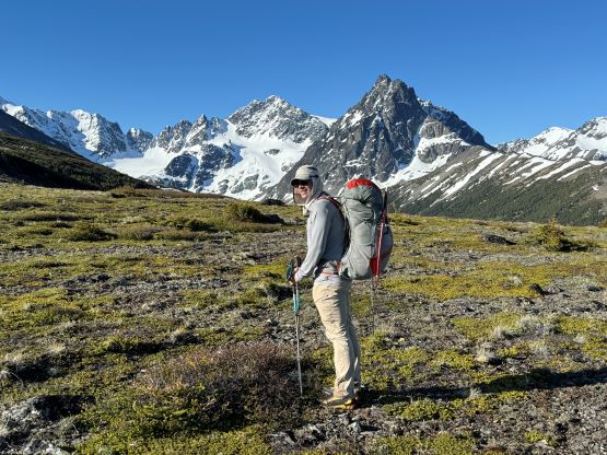


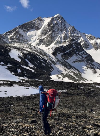


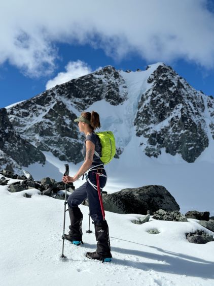
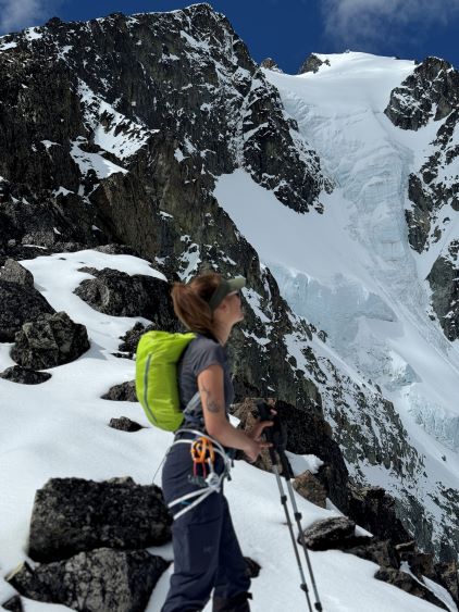
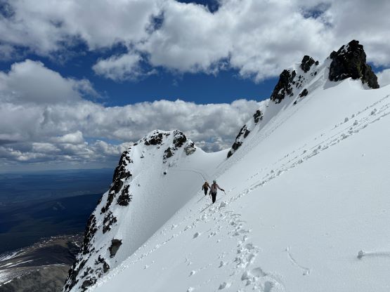
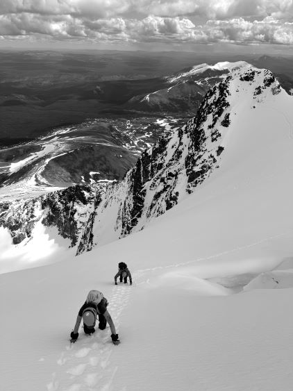
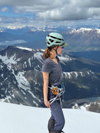
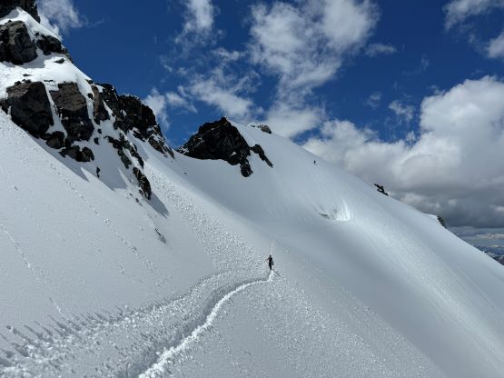
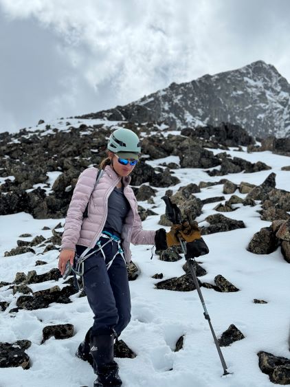
Erica and I each brought a small summit pack but ours weren’t large enough to fit in those gears. Mine was the only one with ice axe loop so I carried two tools on the pack and leashed one of Erica’s to the harness. We both had to wear harness from the camp and carry some stuffs on the harness. The route-finding was confusing above the camp as we had to cross several ribs with loose boulders, but I was able to pick a route sticking to snow for as much as possible. The post-holing was manageable and the snow was also not too icy so the crampons stayed in the packs until all the way to the false summit. There was about a foot of fresh snow over the past week but the temperature stayed reasonably cold throughout the day, which made for some perfect climbing conditions. We hit the NE Ridge at 2550 m and the false summit was at 2950 m and it was here that Erica finally showed her true capability. Erica and I took turn breaking trail in the shin-to-knee deep snow and Dave and Adam fell instantly hundreds of meters behind. I had to work 100% hard to keep up with the pace and Adam later claimed Erica to be the fastest female that he had ever hiked with. I’m not sure if Adam was exaggerating but there definitely weren’t that many folks out there, men or women who were able to push me to my physical limit on snow ascents. I figured that we didn’t have to beat ourselves that hard so I led most of the upper ridge to the false summit and that gave Adam and Dave some time to catch up. Adam unfortunately decided to turn around after seeing the technical traverse towards the true summit.


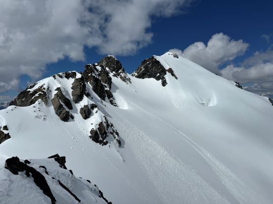

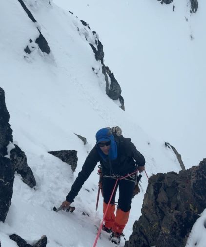
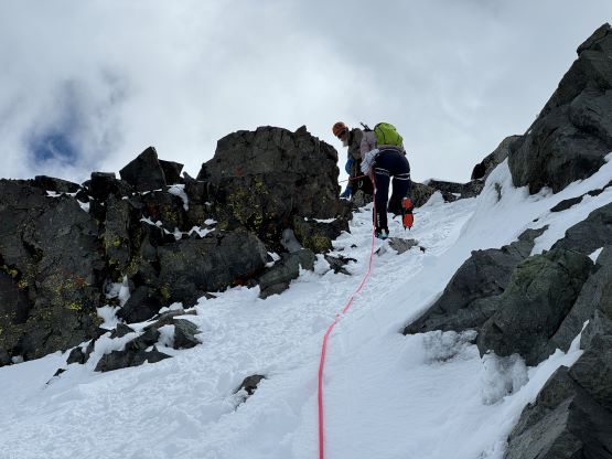
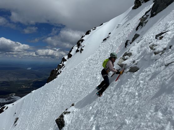
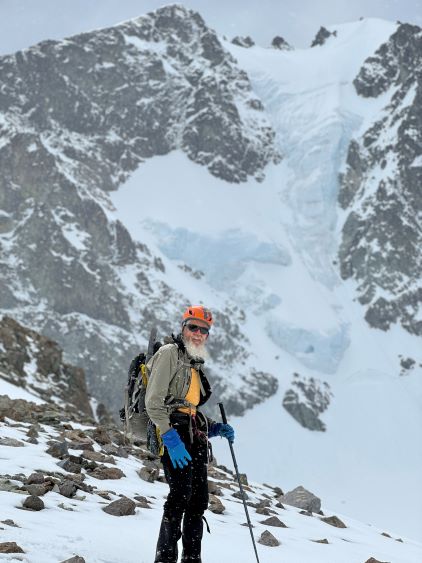
We had together brought two ropes, two ice axes each and one snow picket. I firstly inspected Matt’s “au-cheval” which was unfortunately melted out. It was doable, but I liked the snow chute option. To make things more fun I decided for us to make one single strand rappel and leave the rope fixed on the false summit for the return, and that would be my 20 m “scrambling rope”. The anchor was easily made using Dave’s picket, and Dave would carry the other rope down in case we needed that for the glacier crossing. Erica had never done a rappel before but both Dave and I were able to teach. I ended up going down first to scout things out, and Dave took the rear end. The traverse afterwards was worse than I thought, with 500 m exposure straight down the north face icefalls so I made some gigantic bucket steps for Erica to follow. I could have crossed much faster but group safety first. I also gave Erica my Petzl Quark and swapped for her aluminum ice axe, so my combo was Camp Corsa Nanotech plus Petzl Gully. We did brought the steel crampons and proper mountaineering boots and we definitely appreciated that. Frankly speaking, the snow traverse was literally nothing compared to the difficult peaks that I did earlier in the year such as Pyroclastic Peak, but this was definitely one of, if not the most exposed snow climb that Erica had ever done. I led us taking the lower option traversing to the climber’s right side of the open crevasse. The final 50 m was on some not-too-terribly steep snow so after a short while I made Erica to lead us to the top, and of course once she took over the lead I was unable to catch up until the very summit.


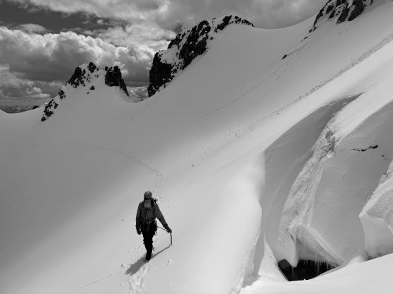


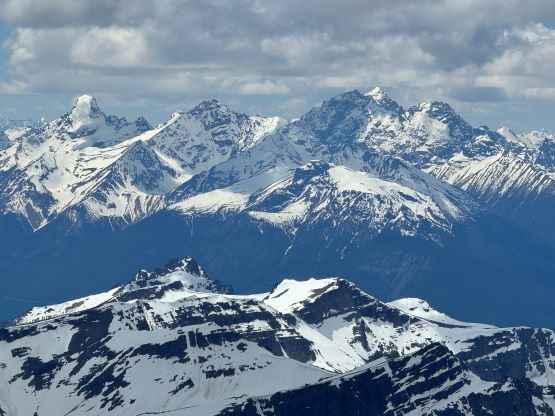
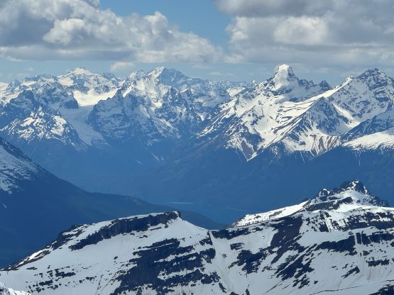


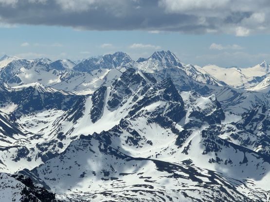
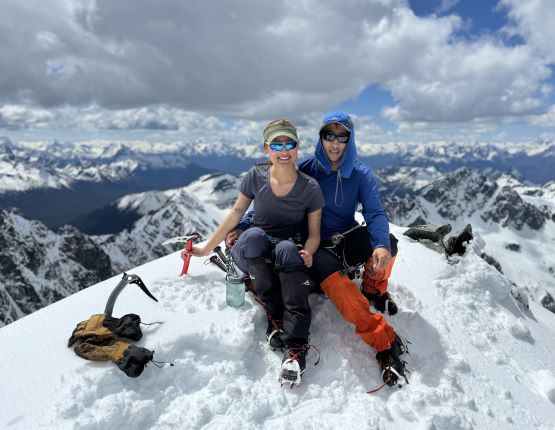


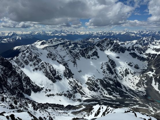

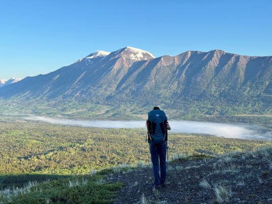
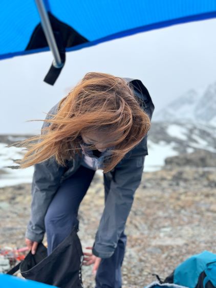
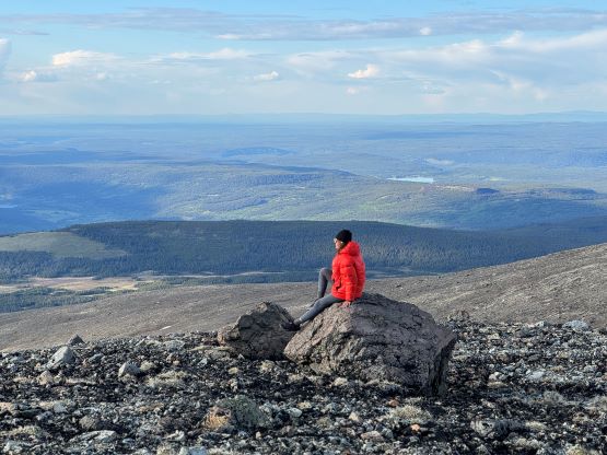
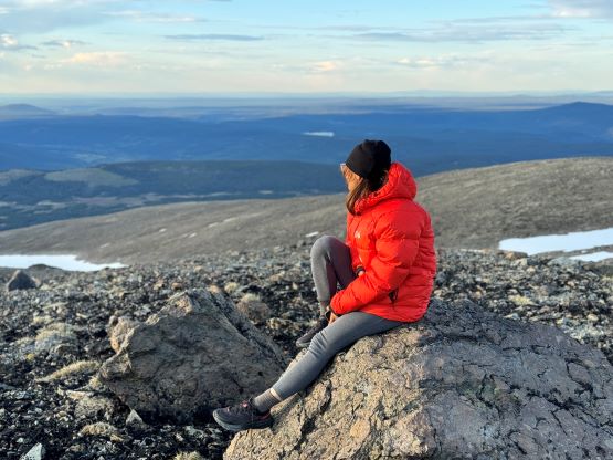
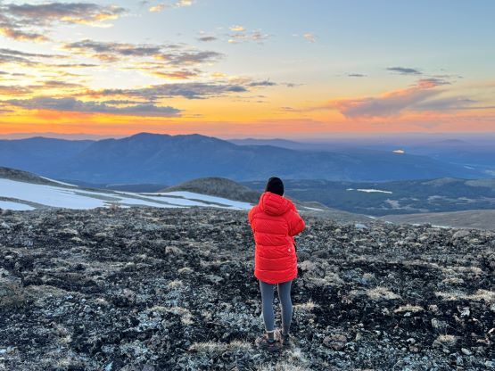
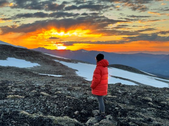
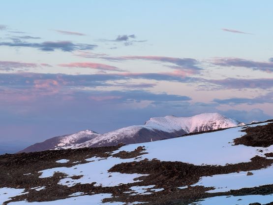
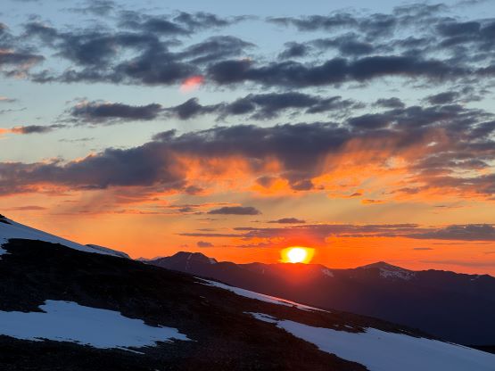
Our truck-to-summit time (excluding setting up camp) was only slightly longer than Matt’s time and I was impressed considering the heavy ass packs that we had hauled two thirds of the way up the mountain, so we deserved a long break on the summit. The peaks to the west made show for us except for Mt. Waddington, but I was able to pick out Good Hope Mtn. and Mt. Queen Bess along with the closer giants like Taseko Mountain. I had never seen these mountains before so it was definitely a mind-blowing experience to be standing on the summit of Mt. Tatlow with clear views. This was also my first 3000er in the Coast Mountains. In any case we plunged down the snow face and then easily traversed back to the fixed rope. I set up the NanoTraxion for Erica and then both Dave and I ascended using a prussik as self-belay. I thought the climbing was quite chill on the return. While descending the never-ending NE Ridge we got hit briefly by a couple snow squalls but those only made the atmosphere more dramatic. There was more rain events in the afternoon but we got back to camp in time to take a shelter. Once the rain stopped Erica and I did a few laps around the camp to soak in the views. The sunset was at 10 pm these days so it was a bit difficult to drag our tired selves out of the comfortable sleeping bags, but I made us to go outside and it was worthwhile.


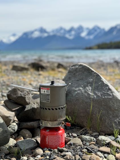
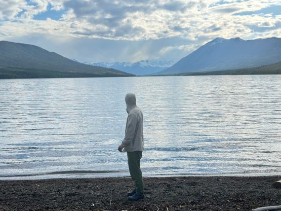
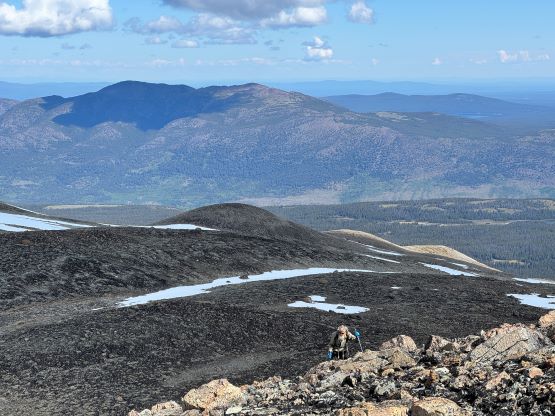
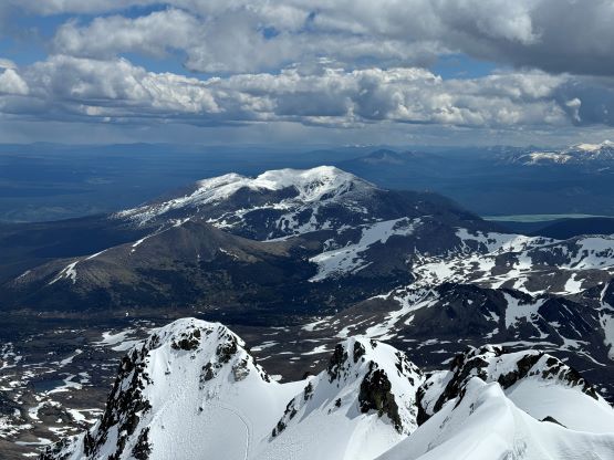
Fortunately the grizzly did not come to grab his burgers and burritos. The next morning we woke up naturally at around sunrise but slept in until almost 8 am. Another hour later the camp was broken and another hour later we were down at the saddle of that P200m bonus objective. I did the entire navigation mostly holding the phone on my hand because I did not want to do extra work. I explored a higher line around that bushwhacking zone but did not find a definite better way. The grizzly was nowhere to be seen, so we ditched the backpacks and ran up that bonus peak. There was fair amount of choss to content with. The view looking back at Mt. Tatlow was great but otherwise this was a pure peak-bagging add-on. I then made Adam to lead us back to the truck but he was also cruising at a fairly fast pace, and as mentioned earlier we tried a different way to cross that creek, but failed to find a definite better solution. The log made for a dry crossing but it was far from straightforward. Dave lost a pole and Adam had to build some additional “bridges”. I again, made two trips back and forth to carry Erica’s pack over. This option also involved more bushwhacking than our wet-feet crossing on the way in, so pick your poison. Our vehicles were still intact so after the trail-head routine we quickly drove away. Erica directed us to Nu Chugh Beniz campground on the shore of Chilco Lake using my phone, and we spent the rest of the day chilling and enjoying our time in such a remote part of our home province.