Mount Pershing
June 11, 2023
1876m
Olympic National Park, WA
Mt. Pershing is a somewhat obscured objective immediately to the north of the more popular Mt. Washington. I don’t know why Mt. Pershing isn’t often done as it’s a rare one in the Olympics that does not require a long approach. One does have to drive on logging roads and ascend a rough climber’s trail to access the alpine, but those are pretty “standard” in the area. The regular route involves some steep snow to 45 degrees and moderately exposed scrambling to “class 3+” so it’s considerably more challenging than Mt. Washington and Mt. Ellinor.
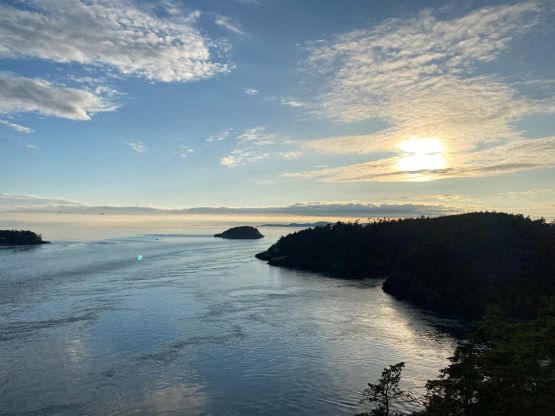
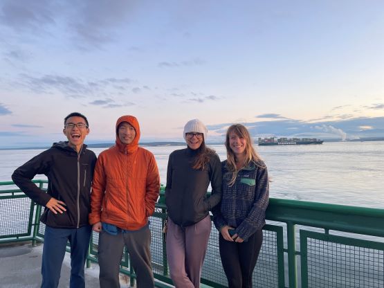
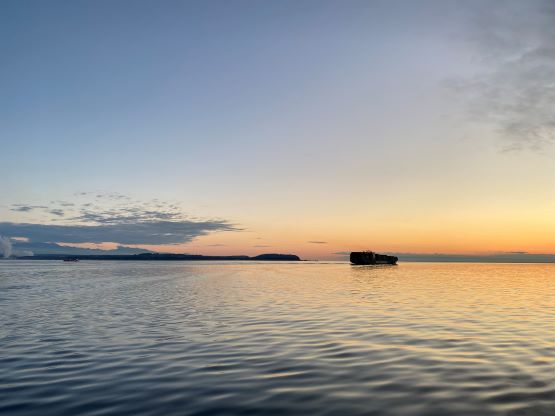
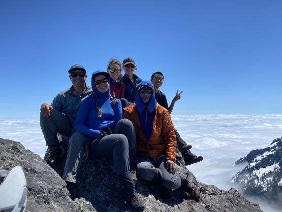
Admittedly I was not considering this objective even though I had seen it for years since I did Mt. Ellinor in 2017 and Mt. Washington in 2018, but the recent trip by Adam W. and Paul K. had put it back onto my immediate radar. With the up-to-date conditions update I made the spontaneously decision to pull the trigger for Sunday, and I somehow managed to recruit a group of 6 – myself, Elise, Kostya and Holly coming from B.C. and Selena coming from Washington with Max. All 6 of us would car-camp at the trail-head to shorten the drive on our summit day. The 4 of us from B.C. left White Rock at 6 pm and caught the 9:10 pm Coupeville-Port Townsend ferry to the Olympic Peninsula. The drive on the other side was winding and slow, and the forestry roads, though in good shape, were quite long. En route to the trail-head we passed Selena’s Subaru. We assumed that they didn’t want to tackle the deep water bar ahead. With the Tacoma we had no issue driving over that obstacle and found a perfect place slightly beyond the trail-head to park and pitch 3 independent tents. We got there at 11:30 pm and the alarms were set at 7 am. Selena and Max drove over in the morning and the planned starting time was 8 am. Based on Adam’s words and trip report I made us to bring one 30 m rope, one 30 m tagline and harnesses and of course those all turned into weight for training. This route was not even close to require a rope for us. At least I was the one carrying that rope both ways so I didn’t feel too bad.


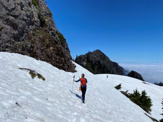
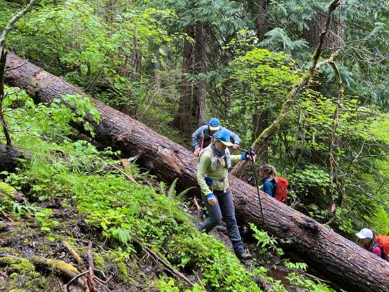
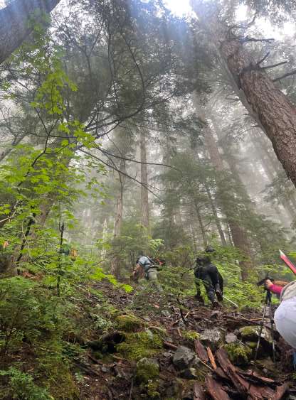
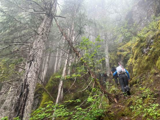
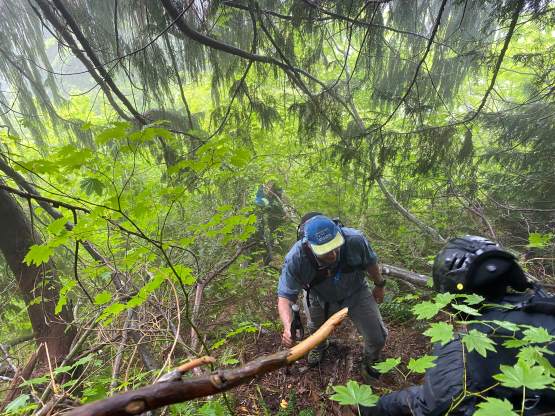
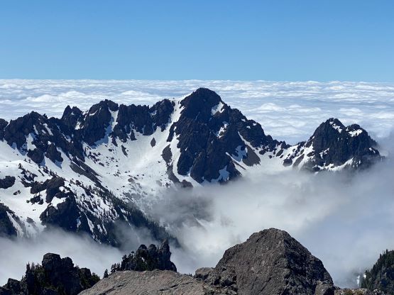
The climber’s access trail had been improved in recent years with more flagging but it’s still a “climber’s trail”. The initial stretch might seem innocent on the map, but involves lots of up-and-downs and micro-terrain that quickly became annoying. Several large dead-falls had to be climbed over or ducked under. We also needed to pay close attention to the flags as the trail bed was not very clear. Once the going turned into a straight-up grunt the route-finding was actually more obvious, but boy this trail is steep. At times we felt like scrambling instead of hiking. The weather had been overcast but we broke through the cloud layer. The steep trail yielded to a snow-covered bowl at 1350 m elevation and we knew it’s going to be a great day ahead.


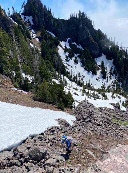
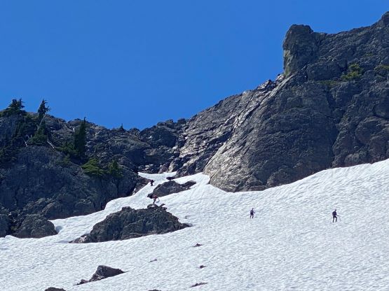
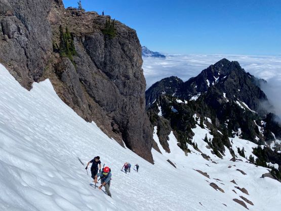
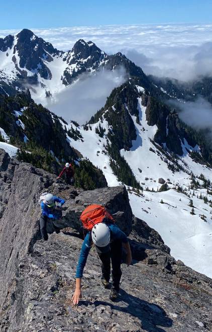
Max and I altered the lead in the next while grunting out of this lower bowl. We did one small detour into the trees on climber’s left to find running water as most of us didn’t bring enough water for the whole day. I anticipated running water since we’d be ascending some snowy bowls, so I made us to carry less-than-needed amount of water. It turned out that we only found one source of water and it wasn’t at an obvious place. To get out of this lower bowl required more scrambling on boulders followed by a zone of 35+ degrees snow. The snow was soft enough that nobody bothered to take the ice axe out. After emerging into the upper bowl we took another lengthy break while staring and studying the route ahead. I spotted the “highest snow finger” that Adam mentioned and it appeared dauntingly steep, so we all donned crampons and harness. The harnesses turned out to be unnecessary.


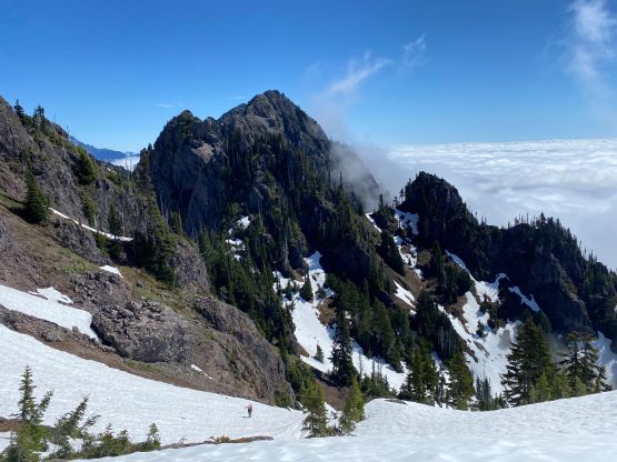
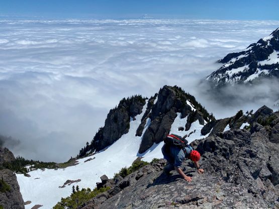
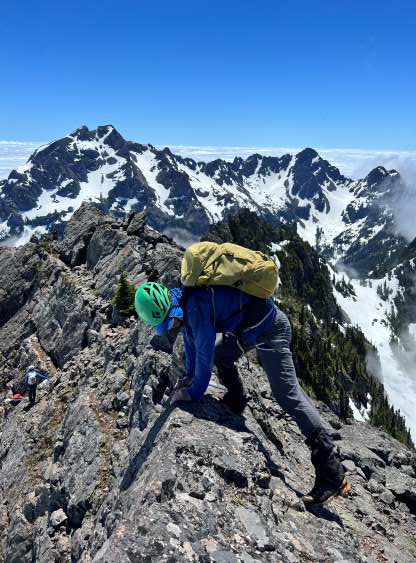
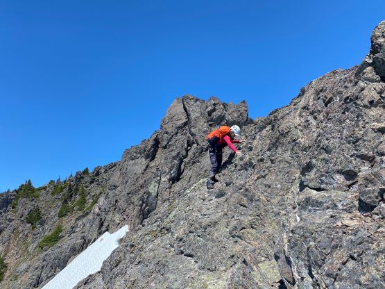
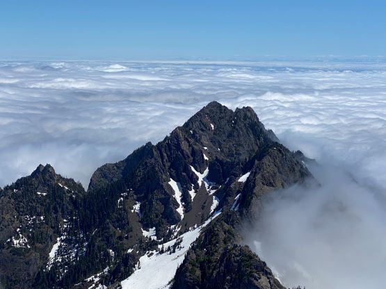
The slope angle was actually quite mellow until the very top where the angle became at least 45 degrees. Ice axe and crampons were mandatory but we didn’t find the transition onto rock to be “sketchy” as described in the other reports. I simply led us climbing to the very top of the finger and then traversed sideways, facing into the slope onto a rocky ledge with zero moat issue. After ditching crampons and ice axes on this ledge we all took our own lines scrambling to the summit ridge. Kostya and I went ahead. I knew traversing climber’s left would be easier, but decided to scramble straight up for added fun. Our line was probably in the range of “class 3+” and was not scary.


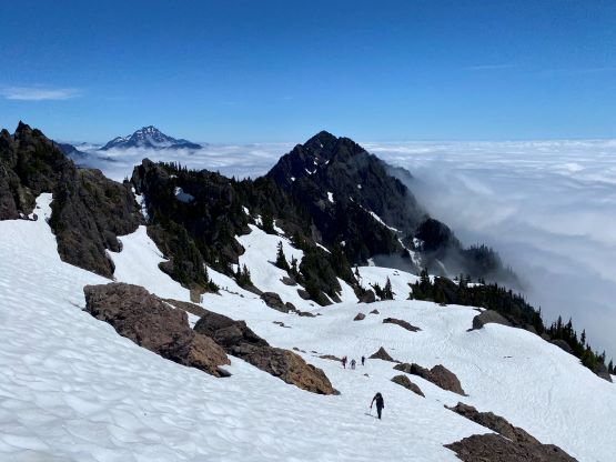


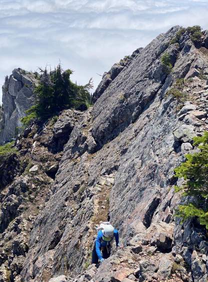
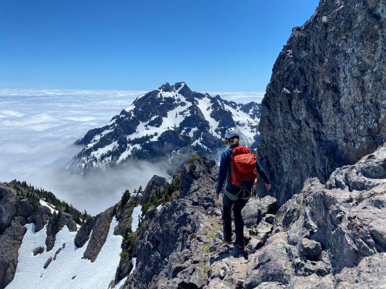
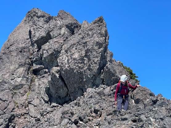
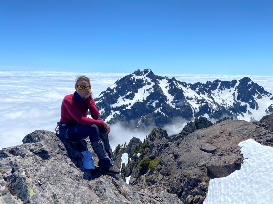
Onto the summit ridge, now with Kostya leading ahead. I stayed behind to take pictures. The first challenge was a slabby section that didn’t offer much in terms of “hand holds”. We had to rely on friction on our feet and the exposure was real. After that bit of excitement we encountered some narrow ridges followed by another exposed ledge traverse on climber’s right side. Max and Elise went ahead to scramble the ridge crest (class 4). I came to the end of that ledge and decided to explore a “low route” traversing immediately underneath a patch of snow. I did not come here with any “beta” but my route worked out greatly with nothing harder than class 3. Selena and Holly followed me and we soon all made the summit. We lingered on the summit for about 1.5 hours to socialize and fully soak in the views.


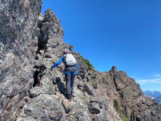


I opted to follow Elise and Max descending the ridge direct for variety and the hardest spot was definitely 4th class with exposure. The others descended the low route and we all joined at that exposed ledge traverse. I then stayed behind with Holly for the lower slabby section in case she needed a belay. It turned out that we all down-climbed that section without needing a belay, but I wouldn’t say it’s “simple” or “trivial”. The down-climb to the snow finger was easy by comparison. We were all confident on snow so I jumped ahead, running down the slope so that I could take a food/hydration break while watching the rest of the group gingerly making their way down. We did not take another break during the descent since descending is usually rather effortless. A few of us briefly tempted to find that water source but we overshot it. None of us wanted to backtrack, but within the group we did have enough water if anyone needed, so that’s fine. The rest of the forested descent was easy but slow-going. The trail bed was slippery and most of us took some spills. Our round trip time was 6 hours 40 minutes on a leisure pace with lots of breaks. It had taken some parties 7 hours just to ascend to the summit and apparently this group wasn’t that kind of party. The homewards journey was a bit of an adventure too. I forgot this was a Sunday that not making a reservation for the return ferry almost turned out to be a mistake. With luck we were the second-to-last group to board the 6:45 pm ride back to Coupeville. If we didn’t make this boat we would be waiting for two more hours for a very late return. I eventually got back home at 9:30 pm and the rest of the group had another hour of driving ahead.