Mount Odin [BC]
July 11, 2025
2971m
Revelstoke / Shelter Bay, BC
Not to be confused with the highest peak on Baffin Island, this Mt. Odin is the highest peak in the southern Monashees in the interior of British Columbia. This peak subsequently boasts over 2400 m prominence making it one of the more topographically significant summits in the province. An ascent of Mt. Odin was used to be an multi-day ordeal from the south. The “beta” dated back to Tivy/Stolk’s trip in 2006 and since then Rob Woodall had made an epic solo ascent in 2017 using the same route. Rob’s trip took 3 days including a 21-hour summit push. For a number of years I was planning Mt. Odin using the same route over 4 days but I started to focus more and more on international trips in the summer these days such that timing the right window for a 4-day expedition had become more and more impractical. Then all the sudden Chris Hood published his successful solo 1-day ascent via Frigg Creek from the east. I consulted with Chris about the GPX file that worth a thousand words and immediately made the plan with Erica taking advantage of the excellent weather on Friday. In the online world Chris had just made a significant exploratory ascent of a P2000 “Ultra” that had completely changed the game of this peak, but locally Chris’ route is nowhere “secret”. We ended up meeting two groups of climbers and it sounded to me that this “secret trail” is well known among the locals.
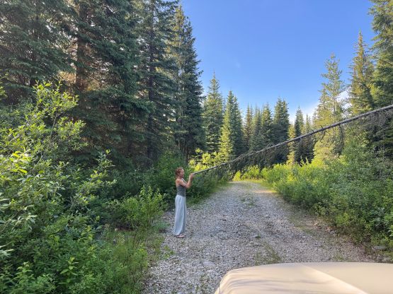
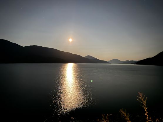
It had been pouring cats and dogs in Revelstoke over Wednesday and Thursday so I remembered to throw the chainsaw in the Subaru. It turned out there were indeed some fresh dead-falls but the logs were cut prior to our arrival. Erica and I left Surrey at around 4 pm on Thursday and the plan was to car-camp at the trail-head. The traffic out of the Lower Mainland was horrendous but I was expecting that so didn’t complain. We got to Merritt at 7 pm for dinner. Past Kamloops up the Highway 1 corridor we encountered numerous construction zones that caused significant delays even at night. The traffic situation improved drastically after turning south down Highway 23 towards Shelter Bay. I wasn’t 100% sure about the logging roads but I had downloaded the Gaia, satellite and Backroad Mapbook layers and thought I could figure out the “beta” using the modern technology, one way or another. It turned out that even the sole Google Map app was more than enough. There were about 25 km of driving on the maze of FSRs and the driving was slow as my Subaru was only equipped with stock tires. The recent downpour had surely made some damages but those were already fixed. We eventually got to the pull-out at Chris’ starting point past midnight so the entire driving game took over 8 hours. To my surprise there was a red Albertan Tacoma parked at the trail-head. I told Erica that I wouldn’t be surprised if that’s Peak Pirate sleeping in his vehicle but it wasn’t him, and nobody was in the vehicle neither.
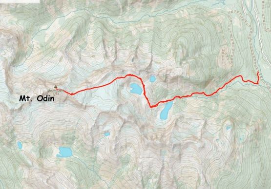
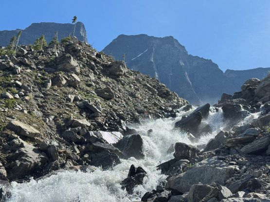
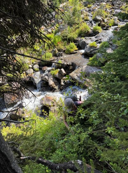
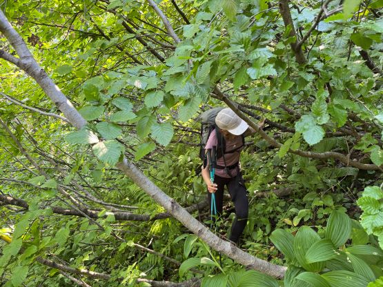
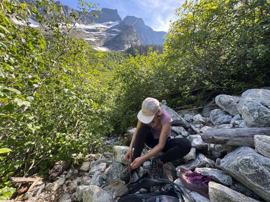
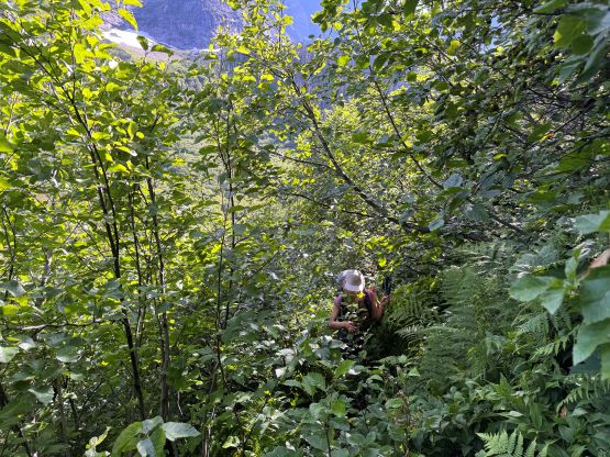
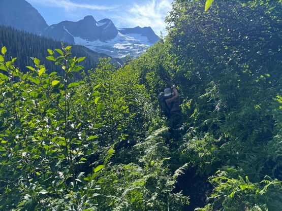
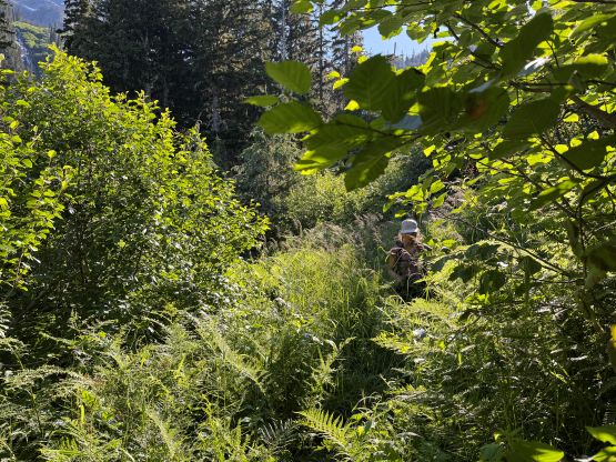
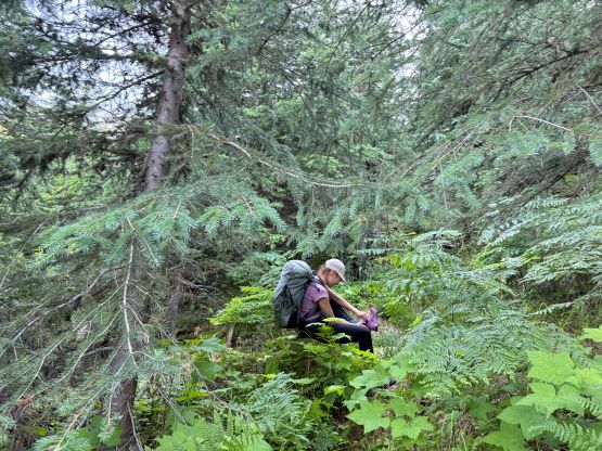
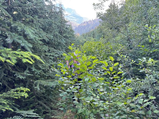
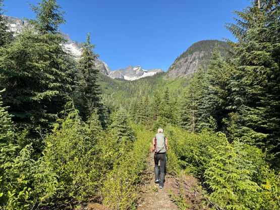
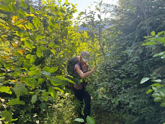
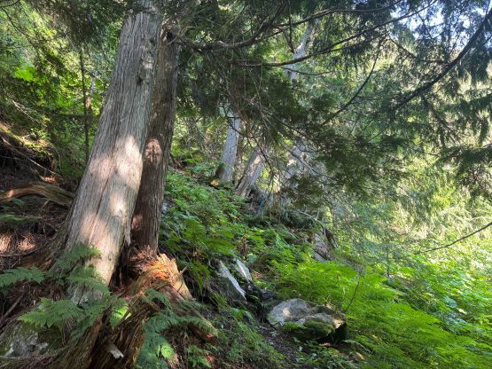
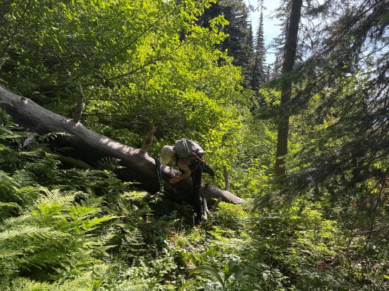
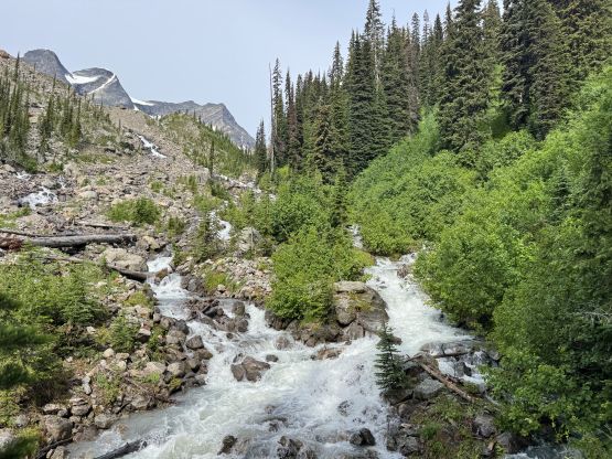
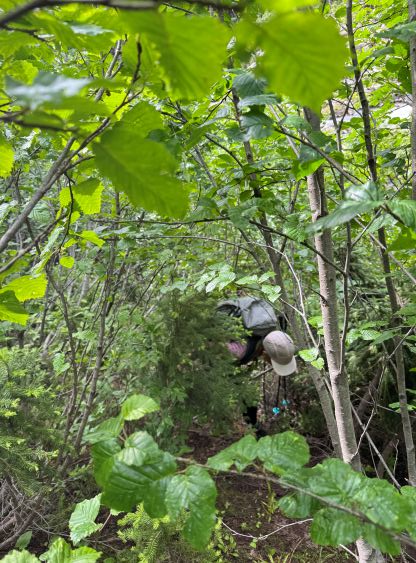
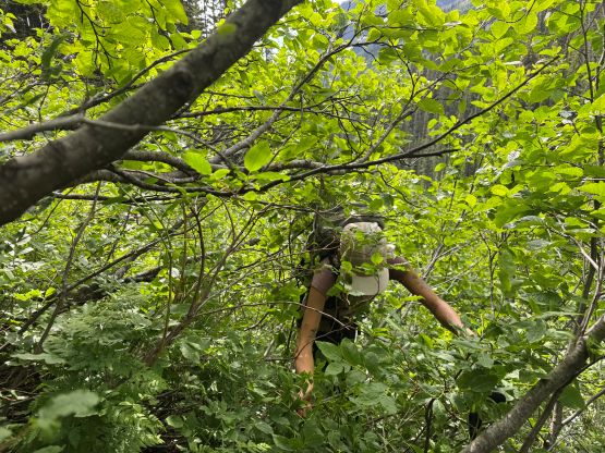
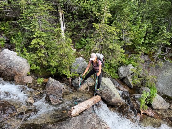
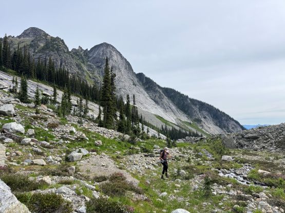
It had taken Chris Hood over 8 hours for just the ascent so we anticipated a fairly sizeable day, but it turned out that we had brought too much food for the 10.5-hour mission. The bushes were wet and the ground was saturated from the rain. The first decision to make was the type of footwear. I opted to wear my trail-runners for as much as possible while carrying a second pair of socks, the mountaineering boots and crampons for the glacier travel on the upper route. Erica opted to wear her boots (for the waterproofness) but carried her approach shoes for the hike-out in the drier condition in the afternoon. My shoes were already soaked after thrashing up the first few kilometers of the overgrown road. Into the forest the “trail” was much better than we thought, with plenty of flagging and a clear-ish bed to follow. We did briefly lose the trail a few times but only needed to consult with the GPS map several times. Without the cut path the bushwhacking would be some sustained level BW4/5 which is well known for the Monashees, so it was actually quite difficult to get lost. In between the two long stretches of avalanche paths there’s a section of old growth forest, and this part was actually quite enjoyable. The crux was actually the creek crossings mentioned in Chris’ trip report. Probably due to the recent precipitation this creek had turned into a raging torrent that I didn’t feel comfortable about the fording, even with a sketchy log that spanned more than halfway across. Instead, I consulted with the map and came up with a “plan B”, that was to bushwhack around this stretch. The going quickly became BW4 but I thought it was quite fun to introduce Erica into some real Monashee thrashing. The bushwhacking was thankfully short as I quickly spotted a way to get back into the open and this moderation bypassed the two troublesome creek crossings.
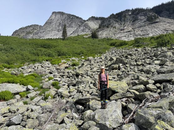
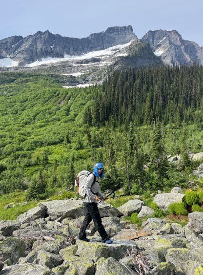
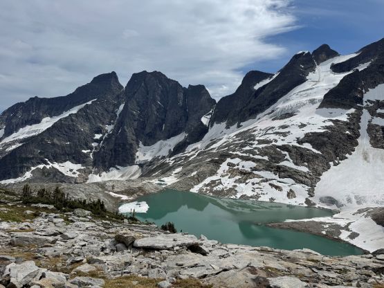
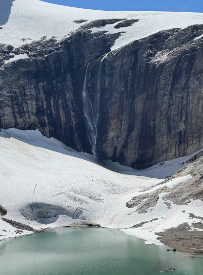
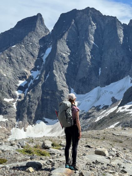
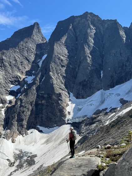
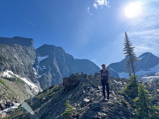
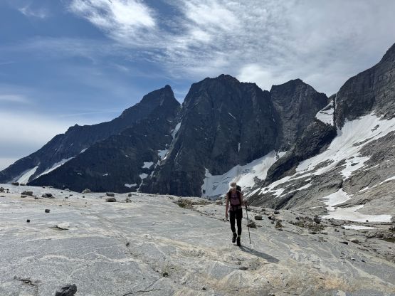
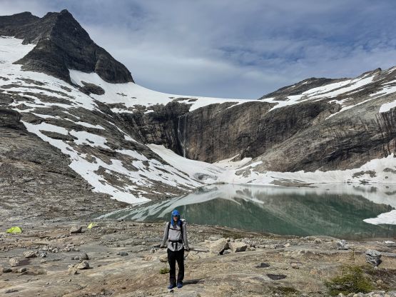
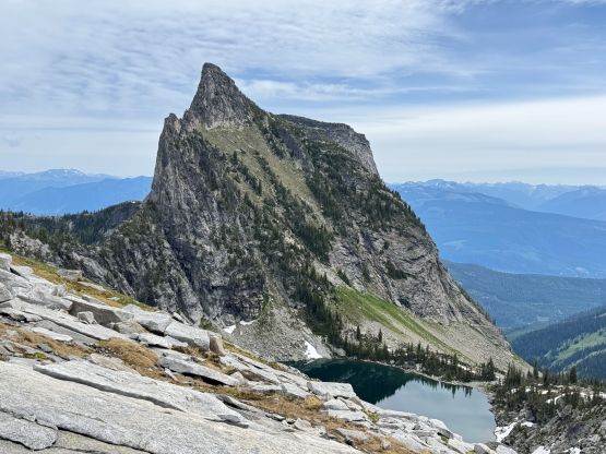
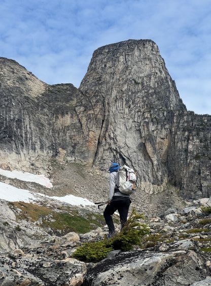
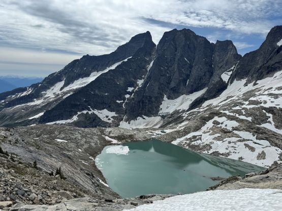
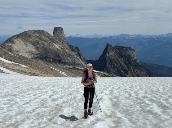
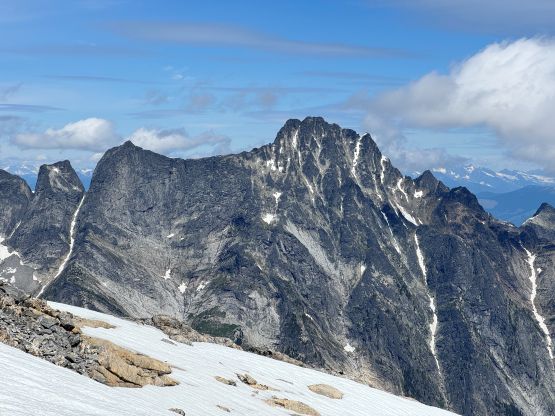
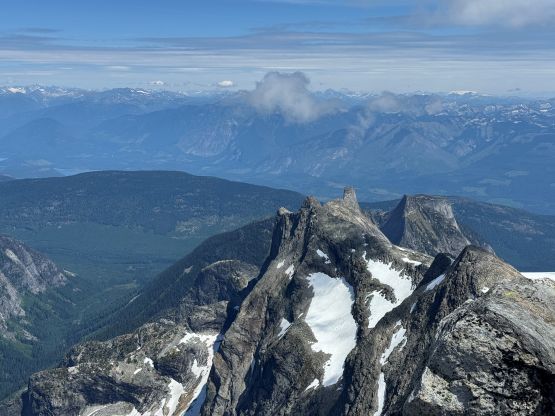
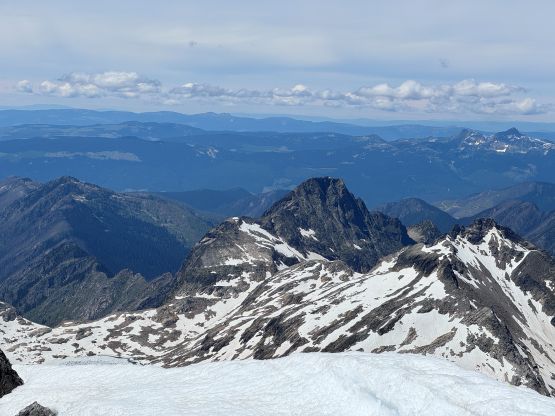
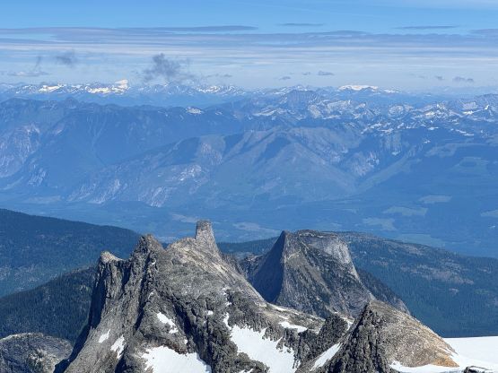
I agreed with Chris that if one makes to this spot, the going would be much easier afterwards and the summit would almost certainly be in the bag. We ascended the crest of a not-so-great moraine to near the outflow of the lower lake, but didn’t linger due to the swarm of mosquitoes. The next stretch involved traversing across some unstable moraine but without aggressive elevation changes. We marched up this valley farther than Chris’ GPX track and ascended a series of ramps and steps towards the upper lake. The mosquitoes had been chasing us throughout this stage but upon seeing a running creek we had to stop for some water. We had opted to carry minimal water so desperately needed to take a break here. As a result I had to don my puffer for sole reason of bug protection. The mosquitoes situation had improved drastically as we dragged our asses into the upper basin, and we also spotted two tents perched at the lakeshore. Looking ahead I was able to spot two climbers on the east ridge so it seemed like we might cross path with each other somewhere on Mt. Odin. Not doing much lingering besides taking in the scenery we plodded upwards towards the south side of Frigg Tower, and then turned left across a series of slabs, ramps and snow slopes. Our intended route was the “glacier direct” so there’s no point in ascending too high up towards the east ridge.
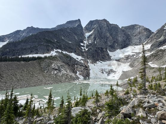
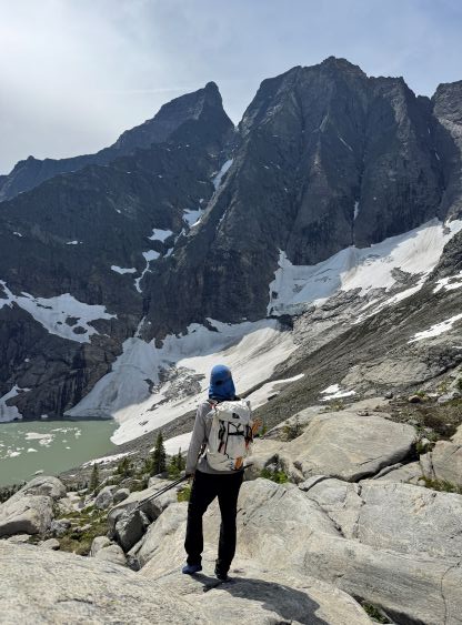

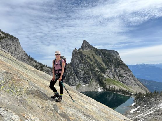
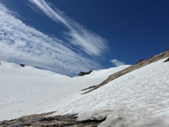
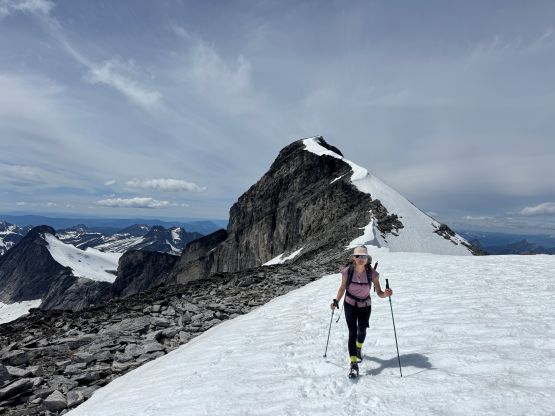
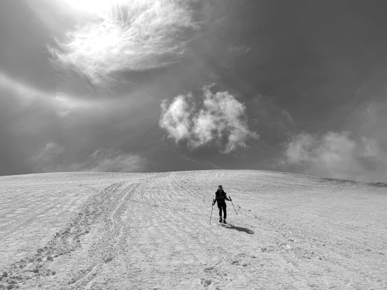
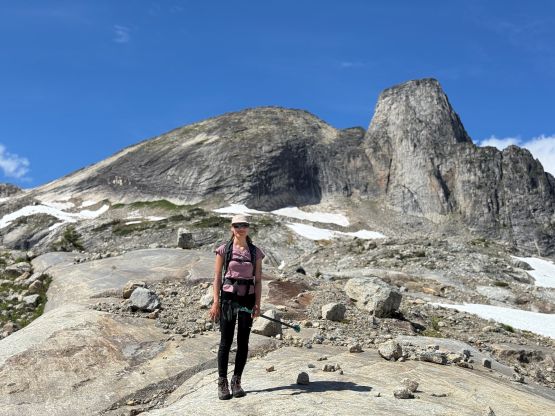
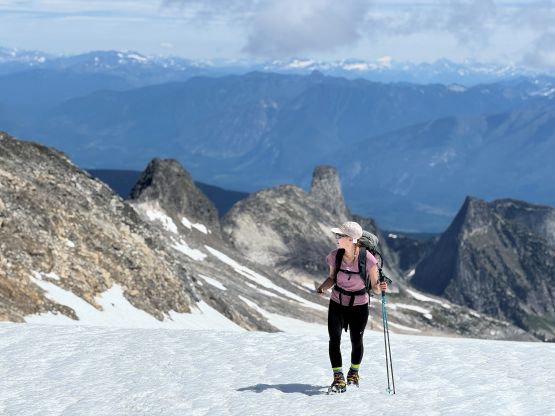
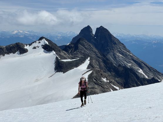
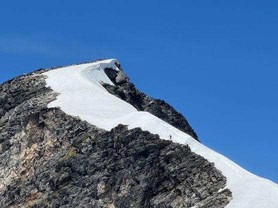
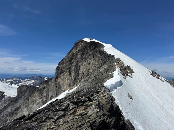
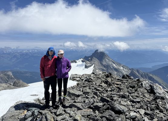
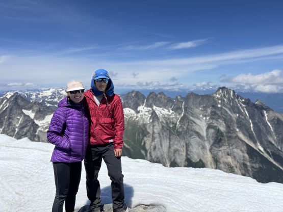
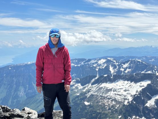
I managed to wear my wet trail-runners all the way to the edge of the glacier. The weather was sunny and hot so I anticipated them to be dry upon returning, and changed to my second pair of socks and the Trango Tech mountaineering boots. I also made us don crampons even though they weren’t strictly needed on this day. The crampons would make the upward plodding much easier, in my opinion. This glacier was as tame as I thought, with no open crevasse nor any visible sagging. The snow condition was also perfect with no post-holing whatsoever. The view was however, extremely foreshortened as we still had almost 500 m elevation gain left, and it was hard to accept that. After what seemed like eternity we joined the footprints left by the other party near the “false summit”. Onto the rocky ridge we removed the crampons and stayed on dry rock for the rest of the ascent. The summit block appeared intimidating from afar, but was only class 3 at the hardest. It was a bit tricky at one spot trying to avoid snow, but we had carried the ice axe and crampons so even if we needed to get on snow, it wouldn’t be a problem. We quickly joined the other group on the summit and they turned out to be climbers doing technical routes in the vicinity. One of them was from Canmore and the other was from Calgary, so again this “Frigg Glacier route” is not a secret. Chris Hood was surely the man to open this route for me but this route had been used regularly by the locals as well as climbers from the Rockies side. There had also been at least two “mountaineering camps” in the vicinity for the fly-in climbers, and the summit register was full of entries including a note from 1950 sealed in an aluminum time capsule.

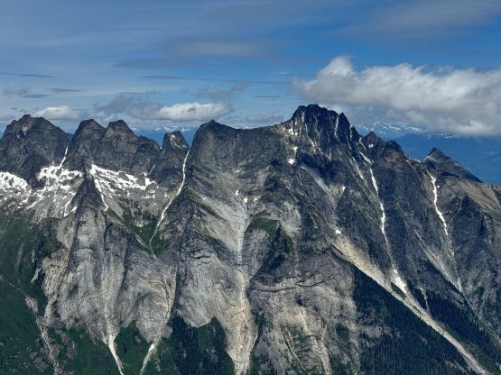
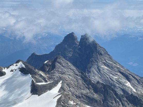
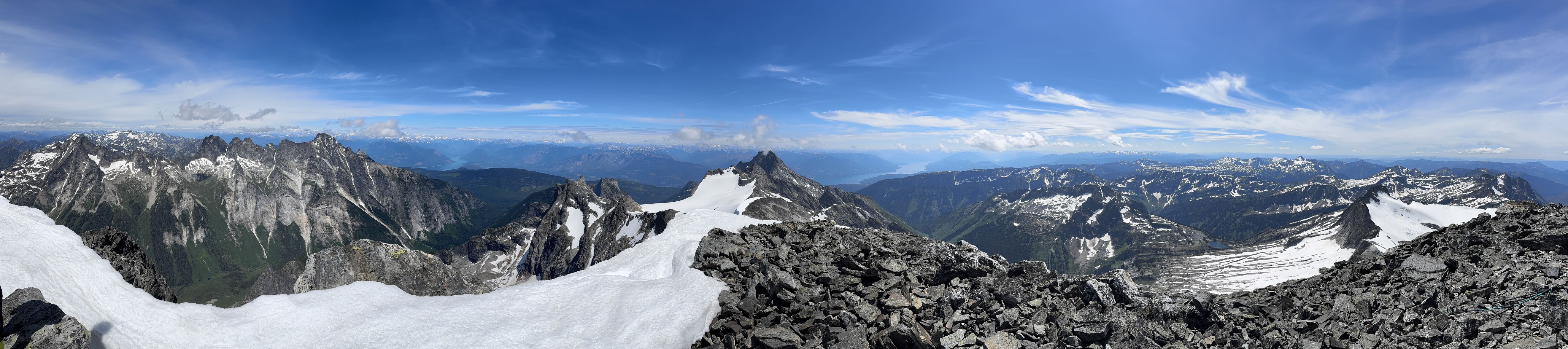
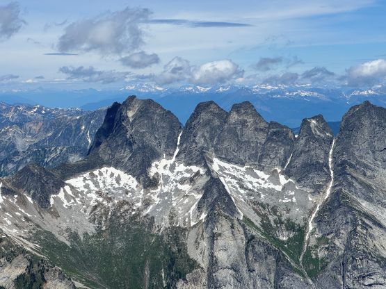

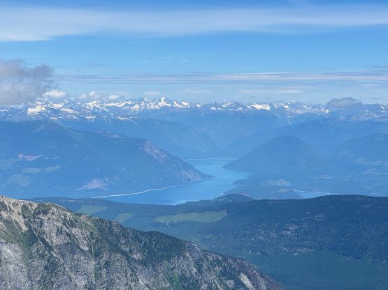
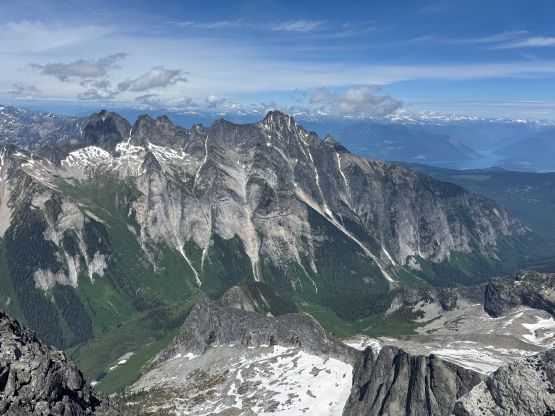

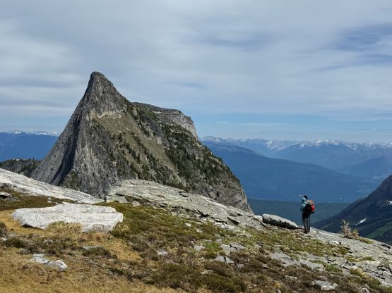
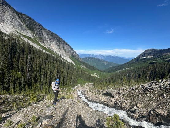
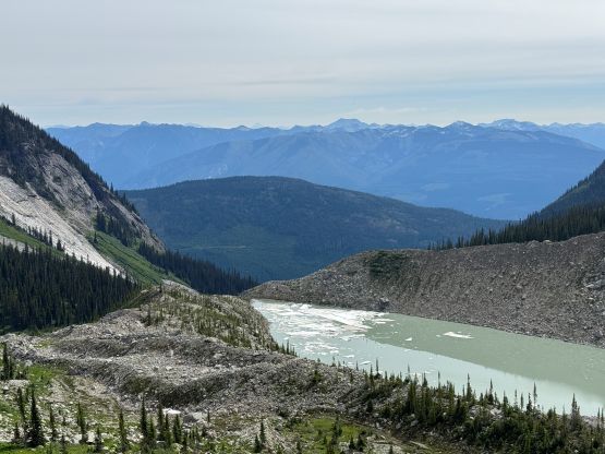
After taking a long ass break on the summit we eventually decided to descend. Plunging down the glacier was as fast as I thought but the snow surfaces had started to be sun-cupped, so it wasn’t that perfect boot-ski that I had been hoping for. Back to the ditched gears we took another long break transitioning as there were some running creeks. None of us was ready for the bugs and the bushes so we wanted to stay in the alpine for as long as possible. Eventually it was the time to face the bugs, but at least the views of the north faces of Mt. Grady and Mt. Burnham was excellent. It was not possible to have vertical faces of this scale in the South Coast so this trip was quite an eye-opening experience for Erica. The mosquitoes were bad but not as terrible as a few hours earlier, probably because we were moving faster on the descent so they had less time to bite. I more or less directed us staying in close vicinity of our own GPX track even though the terrain between the two lakes has lots of options. Lower down we found a slightly better way around the creek crossings, only dealing with a few minutes of level-4 bushwhacking. The rest of the descent following the trail was a “cruise” by comparison, but did drag on for a long while. We came across another group-of-two from Revelstoke on the logging road section, and our round trip time was under 10.5 hours taking in account of everything. The moving time according to my GPS was only 7 hours 50 minutes so Mt. Odin is definitely a day-hike. It might be even possible as a home-to-home push for a few individuals from Vancouver… On the way out I decided to explore a short-cut connection towards Mt. Hall road system but this spur was quite bad. It might not save any time so I would suggest to take the same way back to Shelter Bay. The plan for the next day was originally Joss Mountain but the weather had changed. To salvage the morning the new decision was Larch Hills, so we had a bit more driving to do in the evening.