Mount Nicola
October 29, 2024
1415m
Merritt, BC
Mt. Nicola is one of the officially-named bumps in the immediate vicinity of Merritt and this peak does not stand out by any measure except for perhaps the obscurity. One would expect such a hill with mostly open terrain to be fairly straightforward but upon closer examination of the maps I anticipated most of the lands could possibly be inside some private properties. The obvious access road from the SW seemed to be gated based on the satellite images but nevertheless, my plan was to simply trespass whatever the fences/gates they had installed by parking on the highway and sending in the dark. This peak however, was never high on my radar even though I had been contemplating for years. The weather for this Tuesday suggested some clearing trends towards the NE and Mt. Nicola could theoretically be done as a before-work trip. Then I went onto peakbagger.com and saw that Simon had already published a trip report earlier in the year. Simon took a completely different route than what I had been thinking about and even his sneaky way from the backside required hopping over two barbed wire fences. I instantly gave up on my own idea and decided to simply follow Simon’s footsteps.
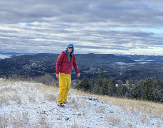
Kate would be my ideal partner for this kind of trash bagging. The driving time would quadruple the hiking time, the weather was mediocre and the peak was just a stupid hill, and to further complicate things we must car-camp in order for me to get back to White Rock in time for work at 3 pm. There was thankfully some decent views from the summit but such could not be guaranteed as Simon hadn’t published his pictures so there’s essentially no “beta” about the views whatsoever. I could not think about any other person that would be stoked about this kind of itinerary. Kate and I left White Rock at 9:30 pm after I finished work on Monday evening and I drove us all the way there through some pissing rain and mixed precipitation. It was still drizzling in Merritt and the FSR (Lundbom) was already covered in a layer of fresh snow. The driving to Simon’s starting point was a bit more difficult than I thought but imposed no problem to the Subaru Forester. We got there at around 1 am and quickly settled for the night.
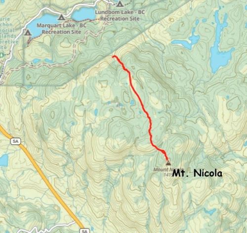
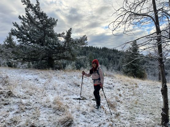
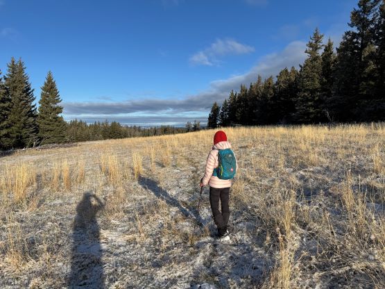
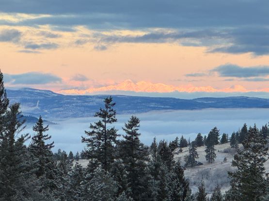
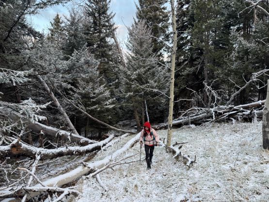
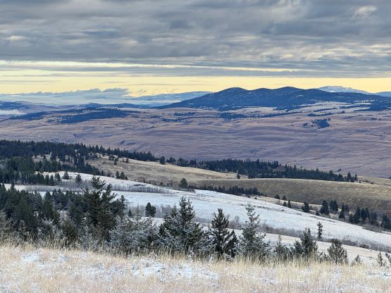
My plan was to watch sunrise from the summit but I wasn’t too keen on navigating 3 km of cross country travel in the pitch dark, so when the alarm went off at 5:30 am I instantly turned it off. We ended up sleeping in till 7 am when it was already bright enough to not need the head-lamps, but that’s fine. Kate as usual, did the cooking job and we eventually started the day at 8 am. I tried to optimize Simon’s route but I had to say that Simon had basically picked the most efficient path. After a bit of travel in open forest we crossed a large open meadows, which was then followed by more cross country travel in open forest. There was some descending before the final push towards the true summit, and the summit itself was thankfully open with fair amount of views. We made the summit in a single push in under an hour, which was a little bit quicker than I thought, given the conditions.


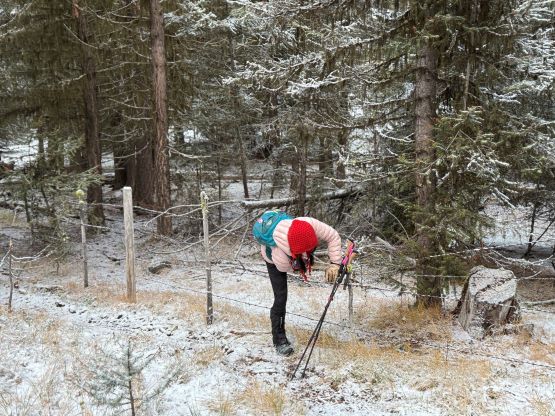


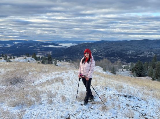
Given our time constraint there was no point in lingering on the summit other than updating the Instagram and Peakbagger apps. There’s some strong cell reception so I did the job from the summit as always. We then descended following the footprints that we had just made. Somewhere between the true and that false summit bump we came across one truck driving up putting in some fresh tire tracks on some narrow backroads. They had noticed us and decided to back down. The window’s rolled down revealing two First Nations with one being particularly grumpy. I was very sure that they were not appreciating our presence given that we had hopped over several barbed wire fences to get to this spot, but they didn’t bother to fuss with us. By the way I had studied the various map layers for Mt. Nicola extensively over the years and noticed several roads extending very much to near the summit, but I highly doubt the feasibility of driving up these roads due to the private properties. The rest of the descent was rather uneventful as the fresh snow gave us the possibility to follow the exact route that we had taken, by tracing the footprints. Our round trip time was 1 hour 45 minutes. I drove us all the way back to Chilliwack and Kate drove the rest of the way back to White Rock. The weather as horrendous near Coquihalla Pass with lots of fresh snow. I earned myself about an hour of napping time and then worked from 3 pm all the way to 8 pm. I then got home half an hour later and another hour later the trip report’s out, not a single minute of time’s wasted.