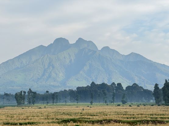
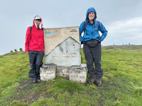
Mount Muhabura
January 13, 2024
4127m
Volcanoes National Park, Rwanda/Uganda
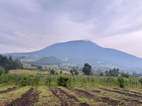
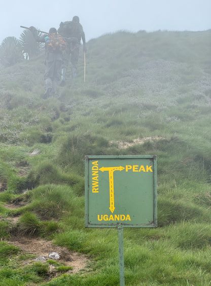
Mt. Muhabura is the easternmost volcano in Volcanoes National Park and is also the second highest peak in Rwanda, bordering Uganda. This is the other “ultra prominent peak” besides Mt. Karisimbi, which is also Rwanda’s highest peak. A total of six of us did it as a day-trip after completing Mt. Karisimbi’s ascent and the logistic agency we used was Amahoro Tour. The fact that Mt. Muhabura locates inside this national park makes it complicated as guides and armed soldiers are required by law. This is because of the presence of buffalos and gorillas, but is also due to the political instability in the border regions. In any case we agreed to leave the hotel in Ruhengeri at around 7 am. I would honestly prefer a much earlier start due to the frequent thunderstorms in the afternoon but our driver refused to do so. The hotel forgot to provide us lunch boxes so we needed an additional stop to buy some snacks. The options for food were very limited in Africa so I had to deal with it. We also needed to make a detour to the park’s headquarter to collect our guide and do a briefing, and the drive from there to the trail-head would take another hour, so we wouldn’t be starting until 9 am at the earliest. These peaks are ridiculously expensive (1500 USD per person for a group of 6, for the three peaks planned) and the company was not able to customize to our own needs, but this is just how it works in Rwanda, so make your gamble or say goodbye to these peaks.
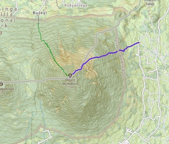
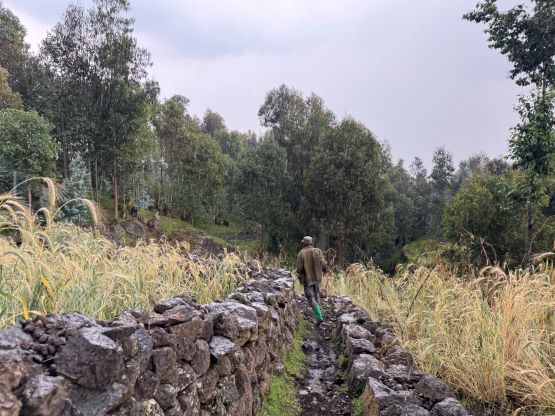
Our local guide was actually quite knowledgeable and was able to resolve some of our questions regarding the third peak planned. There was some major issues, but more on that later in the next trip report. The guide was also helpful by pushing the driver to drive us at least 1 km farther and 200 m higher than Rockinstraw’s starting point (GPX track downloaded from peakbagger.com), and this compensated the late starting time a little bit. We parked in the middle of a village and the driver would be there waiting for our return.


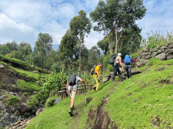
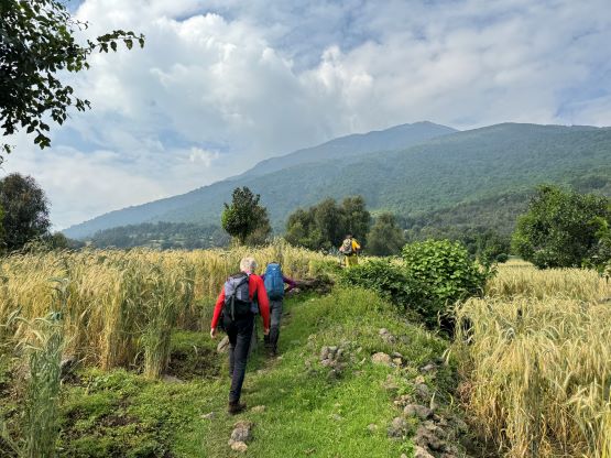
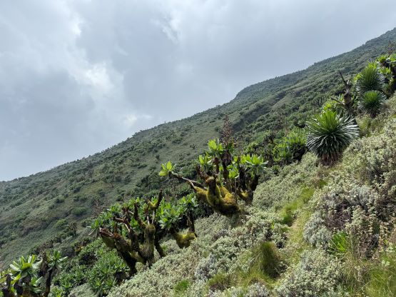
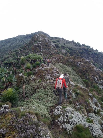
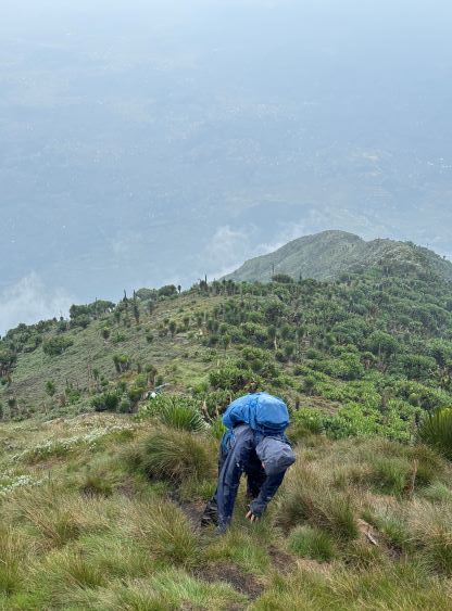
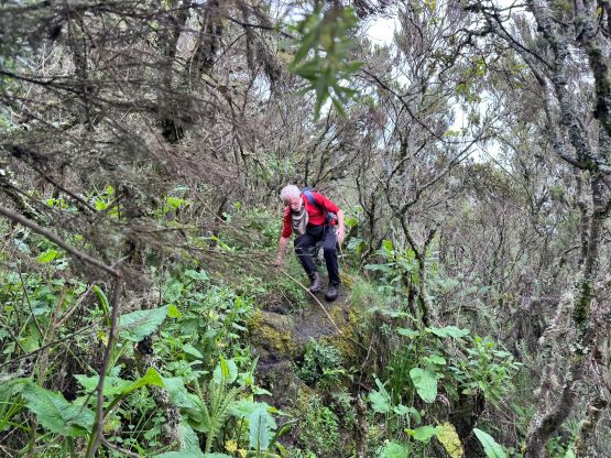
The initial 30 minutes was hiking through the farmlands just like on Mt. Karisimbi, and then we met the group of 7 soldiers on the edge of the forest. There was none carrying a machine gun so I assumed the danger from bad people is lower here. This peak borders Uganda instead of Democratic Republic of Congo. The hike was quite different than on Mt. Karisimbi, in the way that the trail was much more rocky but less muddy. This made the ascent easier, but the descent would be slightly harder on the knees. The forest was also quite open and the canopy could not provide a complete protection against the sun, so I had to wear the hat and the shirt. It was extremely hot, humid and miserable. The lead guide gave us the option to split the group into two, and Rob and I signed up for the faster team. In retrospect we made the right decision as this essentially saved us from getting drenched in the thunderstorm, but I was not in my element on this day, that keeping up with the guide (and Rob) felt particularly difficult. Nevertheless I pushed as hard as I could. I was planning to take a break at the “halfway point” but had to call for a stop about 15 minutes earlier. We did not stop at the “halfway point” afterwards.


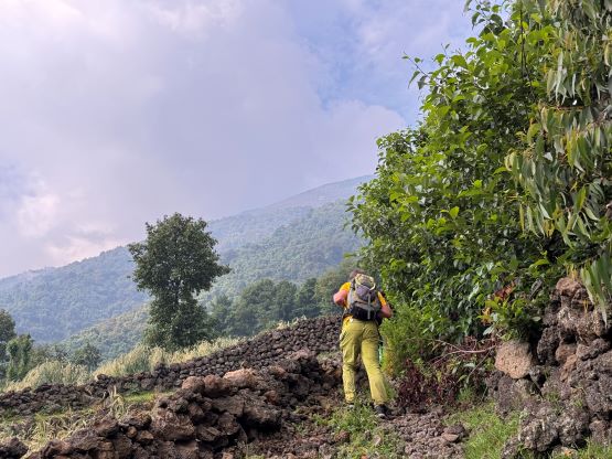


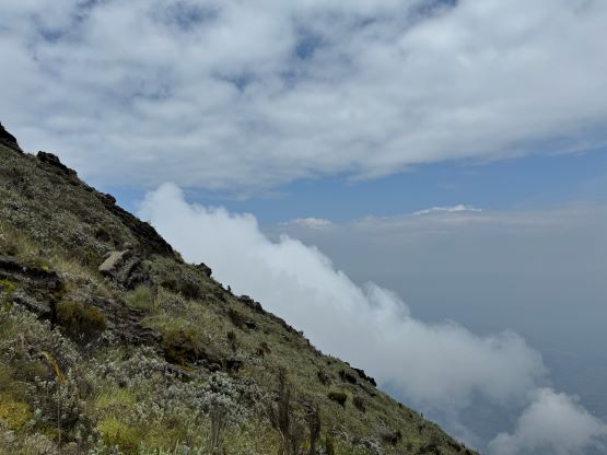
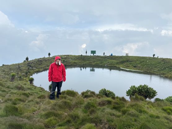
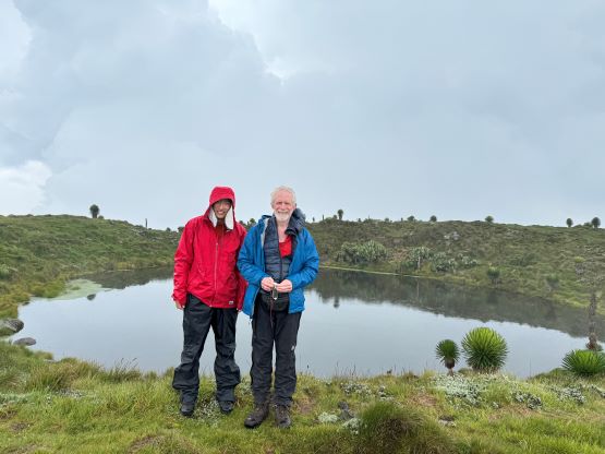
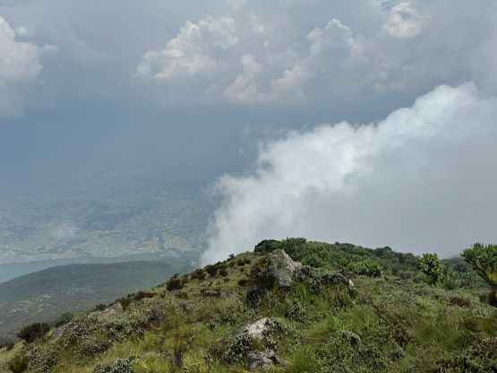
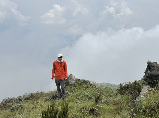
The upper half of the route was mostly open, and was relentlessly steep. The entire route gains 1800 m elevation and offers virtually no “break” whatsoever. The weather was a mix of sun and clouds so not as bad as I thought, but about 20 minutes before reaching the summit we were hit by a hail/rain storm. The storm wasn’t heavy so we pushed all the way to the crater rim to make a stop to don the rain gears, but then I heard at least one or two thunders not far from us to the west. This was the only hike in this entire trip that I opted to bring the rain pants, and I surely made use of them. Rob used his hand level to determine the far side of the crater rim to be higher so we had no choice but to make a circumnavigation of the rim. Thankfully the crater is a rather tiny one, at least for a volcano of this size. Due to the weather we did not wait for the rest of the group even though they weren’t actually that far away.


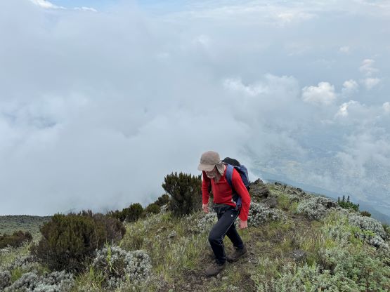

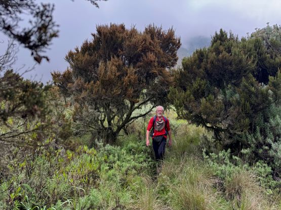
We crossed path with the rest of the group about 50 vertical meters under the rim, and continued descending on our own. Two soldiers were following us closely from behind, and we knew each of us would have at least one soldier at all time. The rain stopped and the sun actually came out, so I called for a break to take off the rain pants. I was not anticipating the rest of the day being “sunny” because I could hear thunders lower down on the mountains and more storm clouds not too far from us. In any case I started to speed up as I was not particularly stoked about being on an exposed slope with thunders around, and Rob and the soldiers were able to keep up no matter how fast I pushed. I did have to slow down after entering the forest as the bushes were obscuring the visibility a little bit. The trail was also wet and slippery. For a while I thought about to do a break to give the knees a break, but kept pushing all the way down to the edge of the forest, losing about 1600 m elevation in a single go. I needed a break there to thank the soldiers but also to take off the sun hat and the sunglasses. One ranger was then guiding us back to the trail-head and we got hammered by a thunderstorm in the last 10 minutes. The rain was intense but we weren’t completely drenched in that short time period. We were also running as fast as we could in order to keep up with that ranger guy, and finished the round trip in 5.5 hours. Our driver was shocked about our time. Rob and I earned 1-2 hours in the truck to dry out ourselves, and Deividas, Alastair, Denise and Richard showed up afterwards one by one. They ended up descending separately as well and all of them were completely drenched as it was absolutely pouring out there.

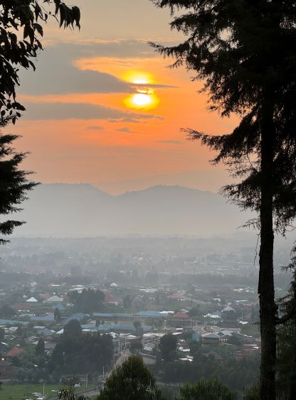
We then drove back to the hotel for a much-needed rest, but en route Deividas made a spontaneous decision to hike that P80m bump in the middle of Musanze. A few of us had already done it in the previous day but Deividas and I missed it out for different reasons. I was not keen at all because I mostly draw my dumpster-diving line at 100 m prominence, but I had nothing else to do. I surely did not regret because we got some cool sunset views. There’s an army base on the summit and we got to talk to the soldiers for a while, as warned by the others, but they did not give us a hard time. The highest point is outside their fenced area anyway. Walking on the streets in Musanze was also not too bad. While everyone was staring at us and some were begging for money we did not feel unsafe to be there without a guide.