Mount Moroto
January 7, 2024
3083m
Uganda
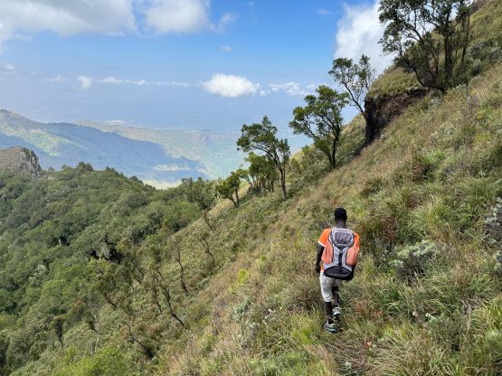
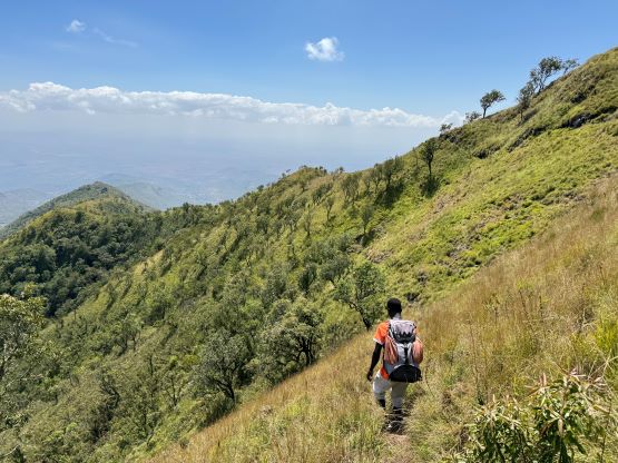
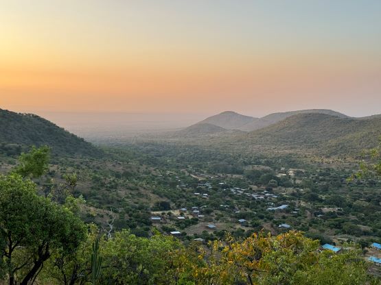
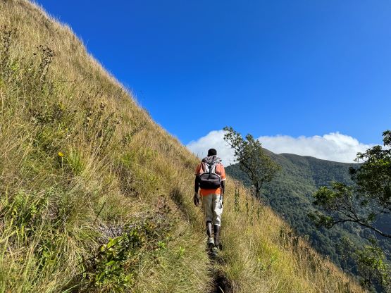
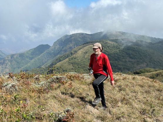
Mt. Moroto in eastern Uganda is another “ultra prominent peak” that Rob, Alastair and I bagged with African Ascents. This was towards the tailing end of the Kenya-Uganda section of the trip and we were based in Karamoja Safari Camp in the town of Moroto for 3 nights. Our itinerary was ambitious that we would be tackling big days back to back, with absolutely no rest between Kadam, Moroto and Napak, but that’s the norm for us. The idea was to bag as many peaks as possible so we must push ourselves really hard. The standard route of Mt. Moroto is long and monotonous. It ascends an undulating ridge for over 10 km each way, and much of the terrain is open country with no shade. It’d be another long and hot slog and I was not particularly looking forward to this outing. Thankfully the scenery was supposed to be excellent throughout the hike.
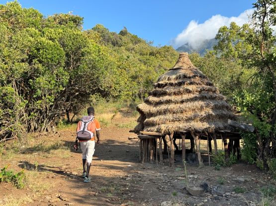
The route does not start from the town of Moroto and in fact, we had another hour of driving to reach the trail-head that locates in the small village of Tapak on the south side of the massif. We had two local guides, David and Andrew with Andrew in particular living in the village of Tapak. Julian would again stay behind to make sure our vehicle was safe, but Elijah would accompany us to the summit. The food and accommodation in this Karamoja Safari Camp was actually quite acceptable despite the severe poverty in this part of the world. There was (cold) showers, private rooms, electric outlets and most importantly, wifi connection. My cell phone’s data roaming does not work in this part of Uganda so it was very crucial to have wifi. The only downside was the dinner’s serving speed. We had ordered the dinner to be ready at 7:30 pm but it was not served until almost an hour later. I have absolutely no patience whatsoever on people’s lack of time management so I went back to the room to work on the trip reports, but once the dinner was served it was good. I usually eat twice as much as most people do on this kind of trips and I was satisfied with the food here.
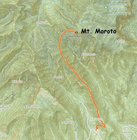
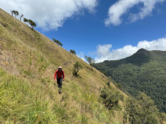
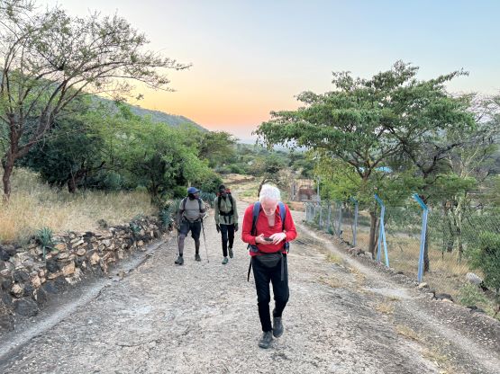
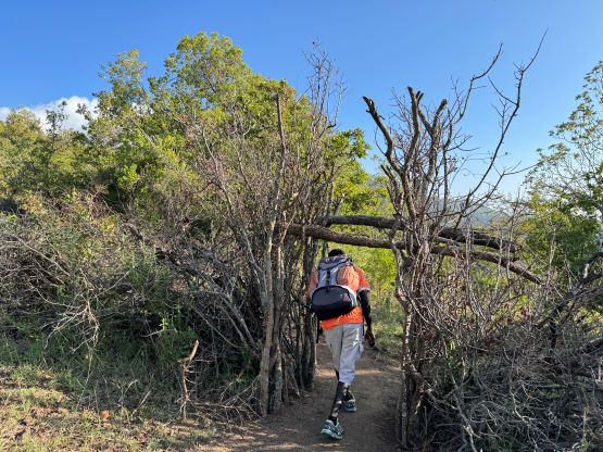
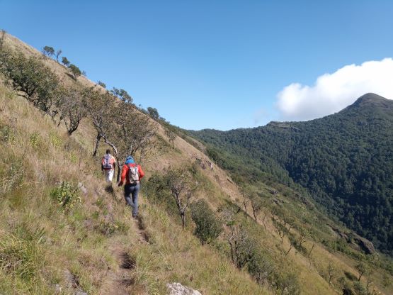
We ordered the breakfast to be served at 5:00 am and it was ready by 5:20 am, which was actually to my surprise. We all showed up on time but I was honestly not expecting to be eating until 6 am. As a result we were able to start hiking at sunrise. On the previous outing two years ago Julian had driven the other group to the end of the steep pavement, but this time we parked at the bottom and walked from there. It only added 5 minutes of walking anyway. The first section of the hike was to gain the long and undulating south ridge and once there we would stay on the ridge for the rest of the ascent. In the first hour and half we all managed to stay together but eventually Rob and I took off together with Andrew. Andrew was leading at a blistering pace and I always beat myself as hard as I could when there’s someone faster going in front. Rob was also pushing really hard to keep up with us. Rob and I disliked taking breaks so we gained at least 300 m elevation within half an hour, to the point that there’s no way for the rest of the crew to catch up unless we sat and waited for a long time. We rationalized that we should just go ahead on our own pace as Alastair had two guides (David and Elijah) with him.

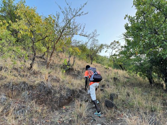


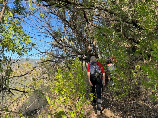

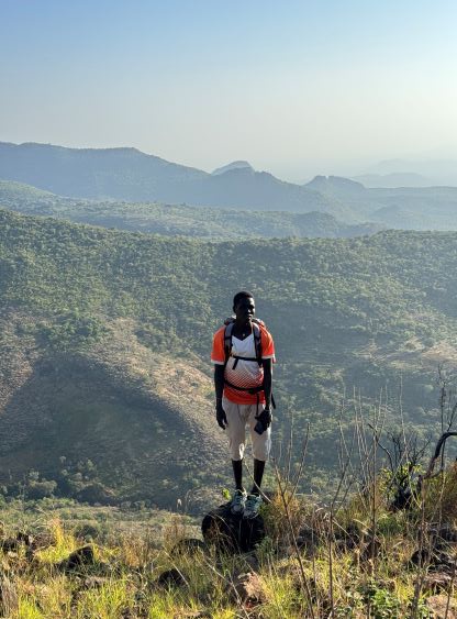
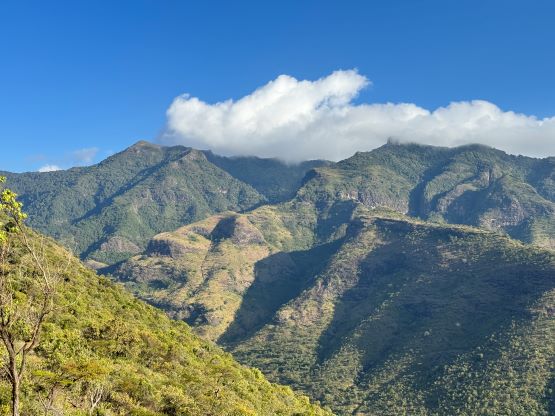
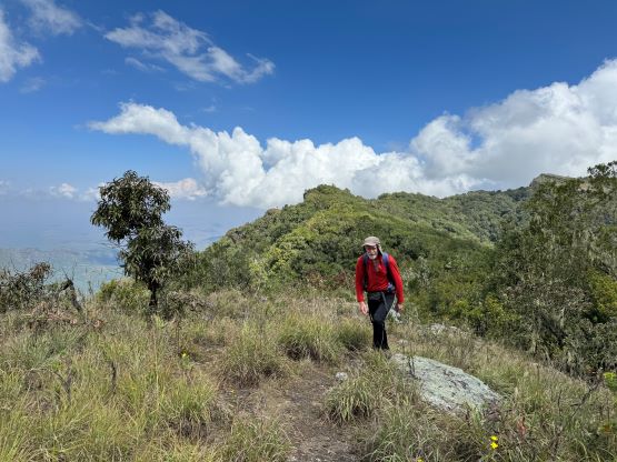
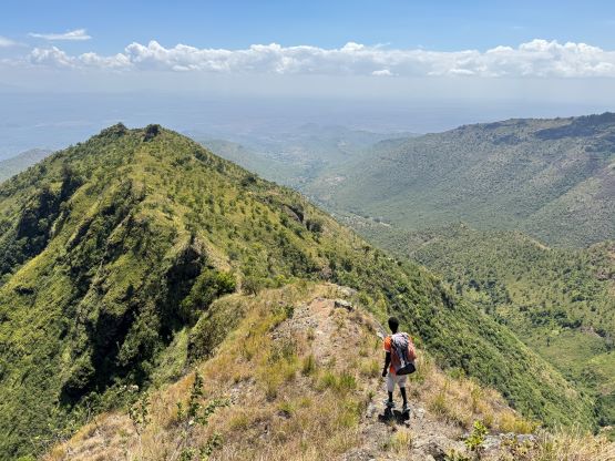
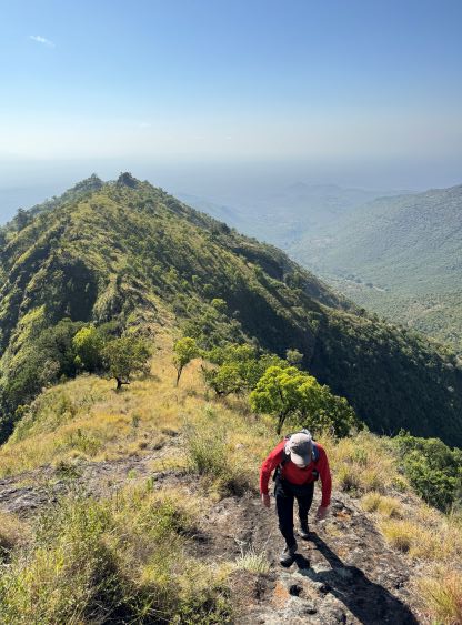
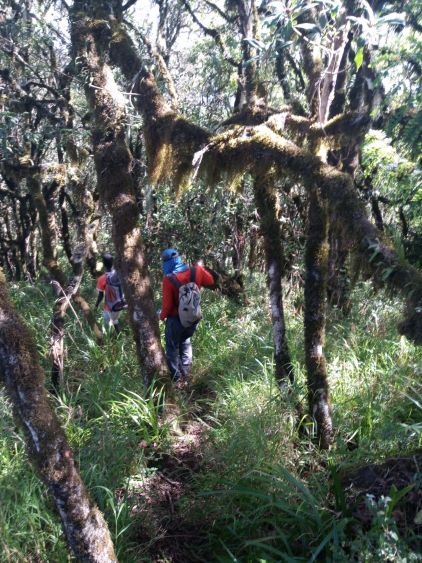
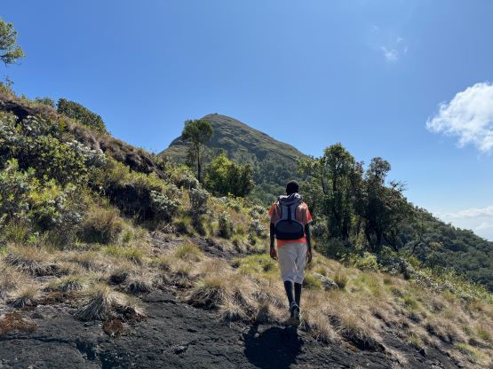
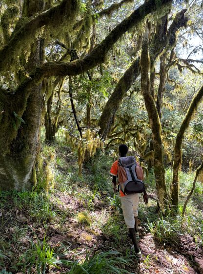
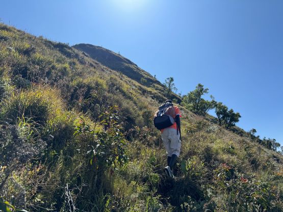
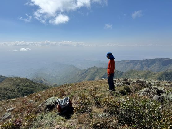
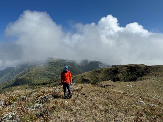
This was at around 2400 m elevation and we were not even halfway up the ridge yet. It’s indeed a very long and undulating ridge. I felt the hiking to be quite boring as I disliked plodding on this kind of monotonous terrain. Thankfully there’s some varieties after all. Not much farther up the ridge we encountered a short and steep scrambling section. The scrambling was at most class 2, but there’s some exposure to spice things up a little bit. The views were also improving. The open terrain eventually terminated at around 2850 m elevation. From the top of that bump we had to lose about 30 m elevation and the next few kilometers were in a cool forest. We finally had some shades. The trail in this forest was unfortunately not as easy/smooth as lower down, that we had to constantly fight against the brush. There wasn’t much net elevation gain until the summit block, which was attacked in a weird way. We firstly made a very steep side-hilling traverse due south, and then ascended the steep and open south slopes to the very top. Our ascent time was just over 4 hours. For a while Rob and I were trying to be faster than Deividas’ descending time (3 h 50 min) but we did not achieve that. Had we taken less breaks in the first hour we probably could have matched that time.


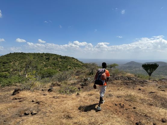
We stayed on the summit for 40 minutes but there was still no sign of the rest of the crew, so we might as well start descending. We somehow passed each other in the forest section without seeing each other, and that caused a lot of confusion later. There was still no sign of Alastair, Elijah and David by the time we got back to that 2850-m bump so we assumed that they must have turned around. In fact, they did not turn around and they were probably on the summit at the moment. A couple hours later Rob, Andrew and I were back to the few houses on the lower part of the ridge and there was still no sign of the other people. Andrew started talking to the locals in their local language and they did not remember seeing them descending. Rob thankfully was able to catch some Kenyan cell reception and got a text message from Elijah, saying they were on the summit and were descending. This was very confusing as I thought there’s only one route on this mountain and it follows the ridgeline. The guide however, eventually confessed there were actually two trails in that forest so they must have taken a different one. The rest of the descent was painful in the heat. The trail was rocky, slippery and generally unpleasant with plenty of thorny plants pocking around. I started to get tired and took a few spills. I also started to develop hot spots on the heels so I slowed down eventually. Our round trip time was 7 hours 50 minutes and we then waited for two hours at the trail-head. Julian showed up with his truck minutes before we got back to the trail-head. We had attracted a bunch of the locals. Some of the kids were playing football and part of me wanted to join. However, I felt like I should stay in the vehicle to make sure nobody would come in and steal our shits. Most of the kids were also begging for our food. Part of me wanted to feed them but then I would have to give food to everybody, which would not make sense, so I did not hand out any food nor even get out of the vehicle.