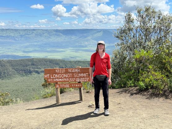
Mount Longonot
December 24, 2023
2776m
Naivasha, Kenya
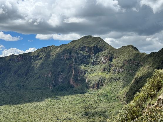
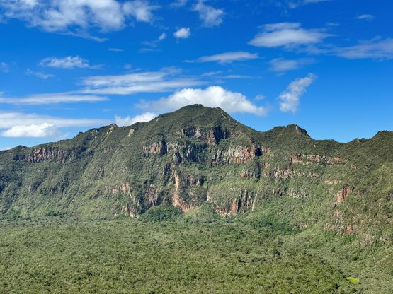
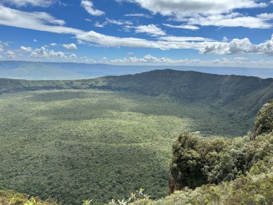
The large and unique caldera of Mt. Longonot is a major tourism attraction not far from Nairobi, the capital of Kenya. It’s a very popular hiking objective and boasts over 600 m prominence. This was the first objective that Rob and I planned in this extensive, guided peak-bagging expedition in Kenya, Uganda and Rwanda. I however arrived a day earlier than Rob and subsequently hiked Ngong Hills by myself. Our guide Elijah showed up at 7 am to pick us up from the hotel and for once, the pick-up was on time. The hotel however, wanted to charge us an extra 35 USD per person for the pick-up from the airport. This was ridiculous as the pick-up was supposed to be included in the package and even if not, they should have told us beforehand. I could have easily hired a taxi from airport in 15 bucks without waiting for a single minute. The hotel’s pick-up was a no show and I ended up waiting for almost 2 hours in the previous morning. I certainly wouldn’t wait for 2 hours to pay an EXTRA fee. I told the receptionist that I was going to call the guiding company, but as soon as I started typing the receptionist said it’s indeed included and I was good to go.
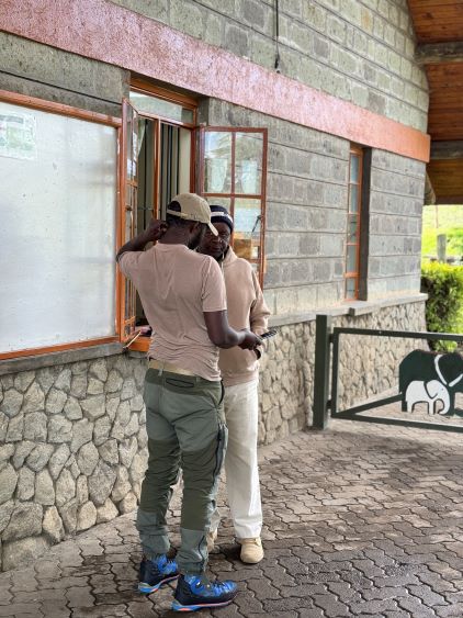
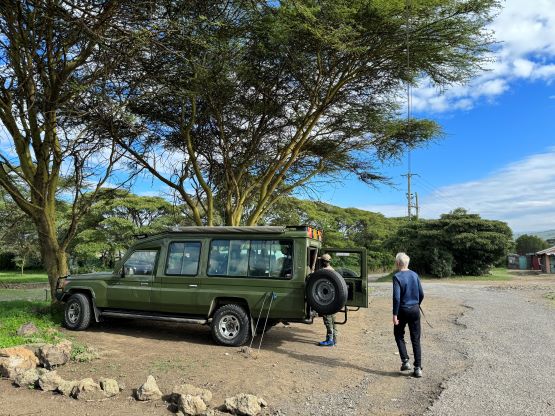
Elijah then directed us to a fancy Landcruiser which would be our vehicle for the following days. We also had a private driver and they together would do all of the navigation. For once, I did not have to think about the directions. In about 2.5 hours we arrived at the entrance of Mt. Longonot National Park. The registration process had been switched to online in the recent era but as always, the system failed upon our arrival. It was eventually fixed half an hour later, but then the park rangers wanted to check our bags to make sure we didn’t bring plastic bottles into the park. Elijah had actually warned me against using these plastic water bottles (bought from convenient stores) but I did not listen. I thought I could win the argument but the rangers stated clearly that I either use Nalgene bottles or buy from their shop. Thankfully I had brought two 1L Nalgene bottles. I prefer the regular plastic bottles these days as they are lighter, but I had to abide the rules this time. Another 10 minutes were wasted as I needed to dig out the second Nalgene from the bottom of the luggage. I was not in a good mood, but at least we were finally able to start hiking.


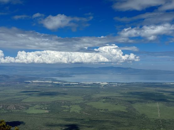
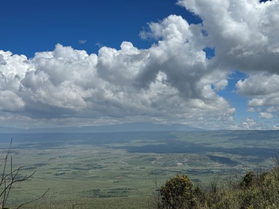
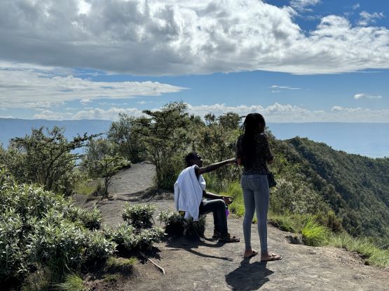
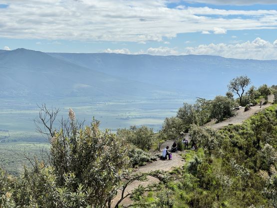
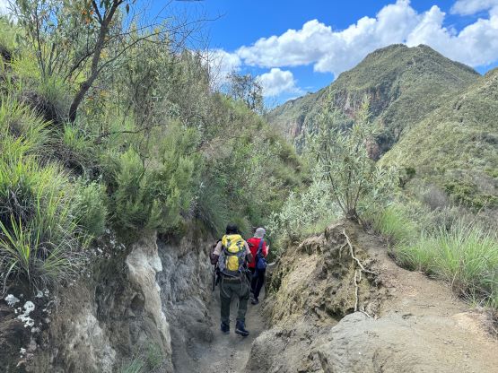
This was shaping up to become a very hot day and the hike would be entirely exposed to the sun without any shade. This area actually has a more desert-like climate despite the proximity to the equator. The initial few kilometers were rather flat and boring, but the grade gradually picked up as we gained elevation steadily towards the crater rim. There are a few steeper stretches with concrete staircases and we also passed a “rest stop” along the way. In Indonesia they would call that “Pos 1” and the guide would force us to stop to take a break. Fortunately our Kenyan guide was strong and able to maintain a steady pace, that our first break was on the crater rim. The hikers that we passed along the way were also much stronger than I thought. A few ladies were wearing sandals and jeans but more or less moved at the same pace as us. I had to keep reminding myself that some, if not most of the world’s best long distance runners are from Kenya. The view from the crater rim was impressive that I could totally understand why thousands of tourists come here each year to see the caldera. Unfortunately (or fortunately), most of them do not go further towards the summit.


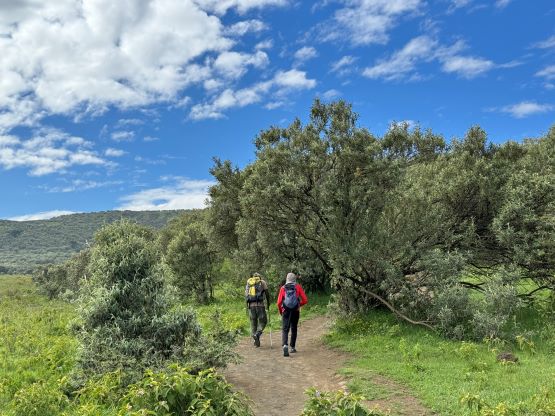


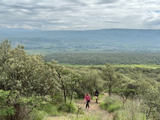


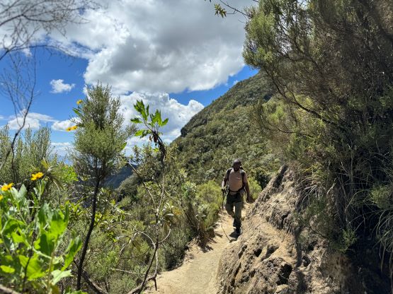
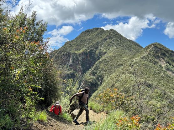
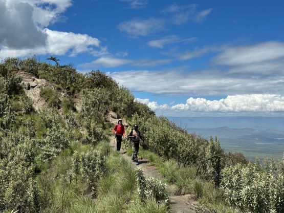
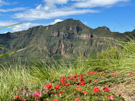
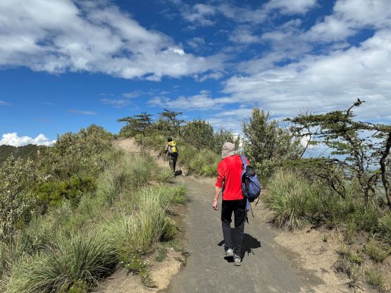
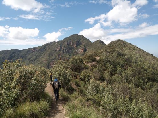
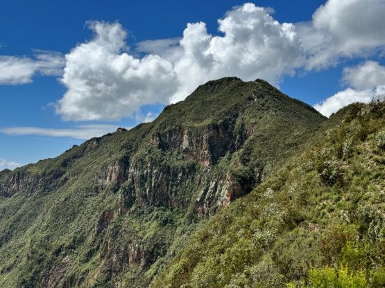
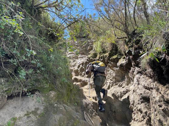
The plod across the crater rim towards the true summit was longer than I thought, and involved another few kilometers of undulating terrain. There was still no shade. Fortunately the view was incredible for the entire way. A notable false summit was bypassed on climber’s left (east) side, and a few “mud tunnels” reminded me some peaks that I did in Indonesia in this past summer. The route on this peak is much shorter, however. Our ascent time was under 2 hours and we were not rushing at all. Looking back we could see a band of precipitation ushering in from the east but it lost its power before reaching us. The weather stayed nice and sunny for us throughout the day.


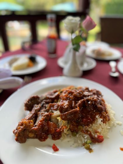
Rob and I thought about to make a loop traverse across the crater rim which was exactly how Deividas did, but Elijah reminded us that we still had a long drive ahead. Rob and I eventually decided to take the same way back so we would be less rushed after the hike. All three of us jogged most of the downhills and power-walked the flats, and finished the round trip in 3 hours 15 minutes. The rangers did not bother checking our bags on the way out as they probably assumed that we wouldn’t be leaving the Nalgene bottles up on the summit. We then drove north into the city of Naivasha to get Rob a much-needed SIM card (which took a long while), then drove westwards to the far side of Lake Naivasha. This would not position us well for the next objective, but there’s a nice resort and the guiding company had paid our stay. I was initially questioning the decision to stay here but the quality of the service in this Naivasha Kongoni Resort was beyond my expectation. They gave us a private suite with wifi and hot shower and the combo also came with a buffet lunch and dinner. For once, I did not complain about the internet speed and that’s quite impressive.