Mount Law
April 29, 2024
1127m
Kelowna, BC
Mt. Law is one of those forested hills along the Highway 97C corridor close to Kelowna. There’s nothing special about this one and I picked it simply by random. I had been thinking about this group of not-so-interesting peaks for a number of years but never bothered to pull the trigger. Kate and I happened to drive back through Kelowna and I decided to finally do one of those. Mt. Law is not the worst out there because the summit does offer some views. Earlier in the trip we had bagged 5 peaks in the vicinity of Penticton and Summerland and we were too tired to drive home afterwards. I had to be back home no later than 3:30 pm for work on the following day, but if we spent another night car-camping we might as well bag another peak in the morning. There are a maze of logging/powerline roads on the eastern flanks of Mt. Law and our route roughly followed the vague description given by Simon C. on peakbagger.com. We simply parked in front of the locked gate along Glenrosa Road and slept in the vehicle.

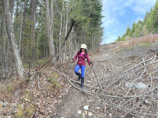
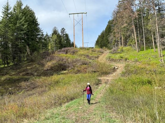
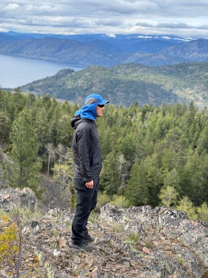
On the following morning we woke up at 7 am and started the hike about an hour later after cooking some ramen breakfast. There were too many options to choose from but I decided to minimize distance by staying directly under the powerline on some rough and steep ATV tracks. There’s one barbed wire fence to hop across, and two notable drops that involved about 30 m elevation loss each, but the route was mostly free of obstacle overall. We followed these powerline roads all the way to the broad saddle on the north ridge. The true summit is on the south side and to get there we had to traverse over a few bumps of similar elevation. There are several bluffs within close proximity from the true summit that offered some nice views, but the highest ground itself was forested with no view.


On the return we tagged another bump on the ridge to be 100% sure, and then took a different way down that might or might not have saved any time. This road joined the powerline road in less than 1 km and we descended the same way back afterwards, concluding the round trip in just over 2 hours. Kate was able to offload about an hour of driving duty and I drove the other 3 hours, and we eventually got back to White Rock at around 2 pm. I did not earn enough time to take a much-needed nap but I somehow was able to pull through the work all the way to 10 pm without feeling too exhausted. That’s the end of this productive peak-bagging trip to the Okanagan Valley.