Mount Kinangop
December 25, 2023
3906m
Aberdares National Park, Kenya
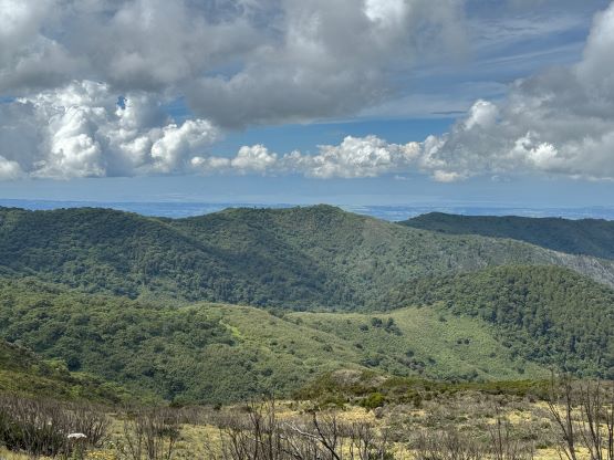
Mt. Kinangop is the second highest and the second most prominent peak in Aberdares Range but the ascent is significantly longer and more challenging than the highest. When planning this East African peak-bagging trip Rob and I happened to have a couple spare days at the beginning. There are three P600m objectives in the vicinity and we could pick two of those. The first one that we picked was Mt. Longonot as it’s a classic in the area. For the second objective we decided on Mt. Kinangop. The stats were somewhat intimidating. The round trip distance would be 28 km and the summit elevation is above 3900 m. The trail-head elevation is 2600 m so the majority of the hike would be done in the “higher altitude” zone. We were not acclimatized at all so this was quite an ambitious plan.
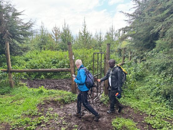
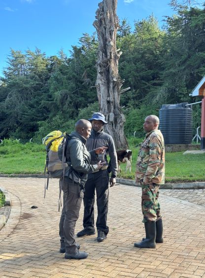
The day started from Kongoni Lodge on the west side of Lake Naivasha. The earliest time they could open the gate for us was 5:45 am. We would prefer an even earlier departure time but they rejected our request. They fortunately were able to provide box breakfast and lunch for all of us. The drive to the trail-head took about 2 hours and en route we picked up our local guide for the day, Peter. Our lead guide Elijah hadn’t done Mt. Kinangop (this is not a popular objective by any measure) so we needed to find another guide who’s familiar with the route. The last ~10 km of the road was so rough that the driving was not much faster than walking, and as always, the trail-head registration was a major failure. The online payment system had collapsed, so Elijah would stay behind to sort out the problem. Elijah originally planned to join us on the outing, but now it was only Peter guiding us. At least the officials permitted the rest of us to carry on so I wouldn’t complain. The weather pattern in Kenya is usually sunny in the morning but cloudy and rainy in the afternoon. Due to the various limitations our starting time was not nearly as early as I was hoping for.


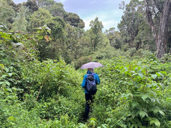
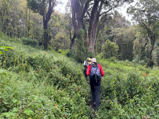
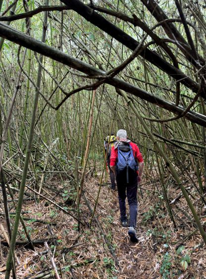
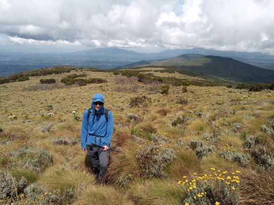
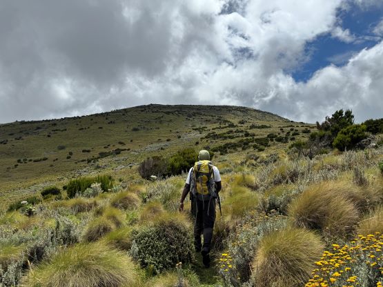
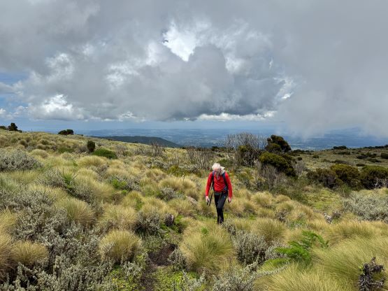
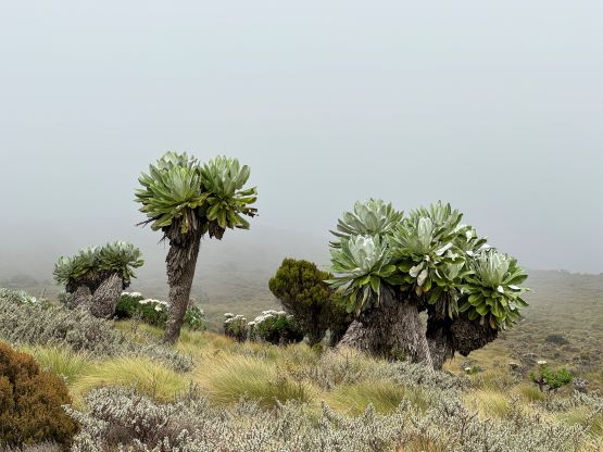
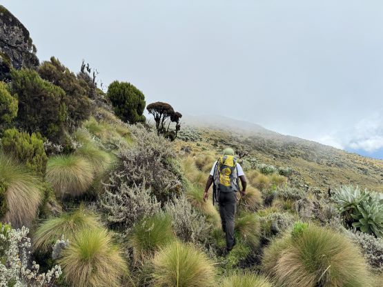
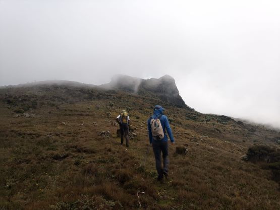
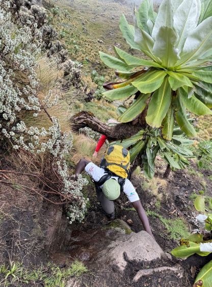
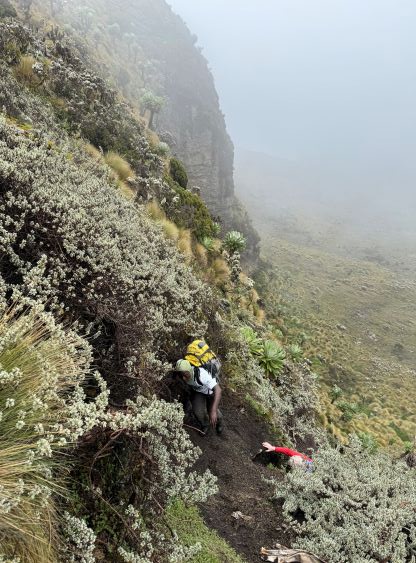
Right off the bat Peter was setting a blistering pace. I was able to keep up on the flats but in about an hour I had to call him to slow down. The initial few kilometers were on an deactivated road, and then there came a gate. The path quickly narrowed down to a singletrack and the grade slowly picked up. The trail had become significantly overgrown at places such that we were literally “bushwhacking” while following the trail. The bushes wasn’t that thick but some were thorny. Wearing long pants did not help and I got stabbed a few times. At around 2950 m elevation the trail enters some thick bamboos. This section was actually quite spectacular but the trail had gradually become muddier and muddier the higher we went. There were also some up-and-downs in the forest that surely would become annoying a few hours later on the return. The next section was the worst. The trail was still overgrown and we had to cross a few creeks and some swampy sections. It was almost impossible to keep the feet dry. Nevertheless with perseverance we eventually exited the forest at 3400 m elevation but we still had about 6-7 km of plodding.


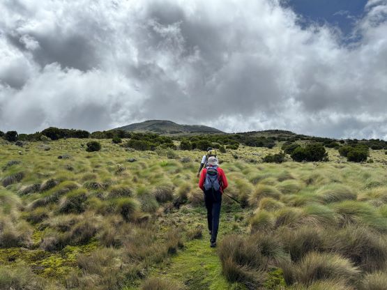
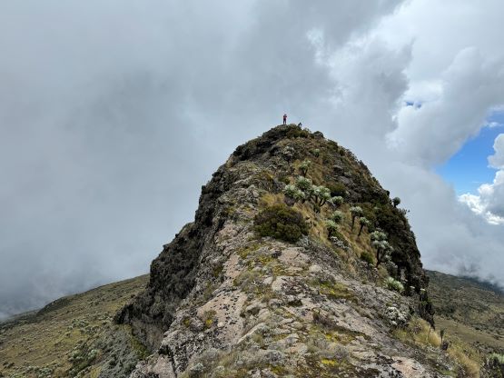
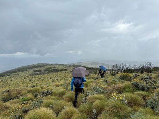
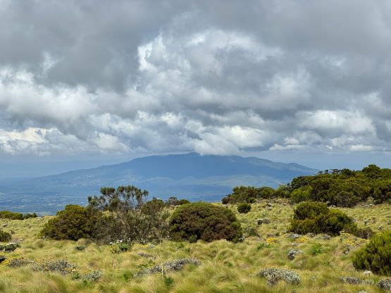
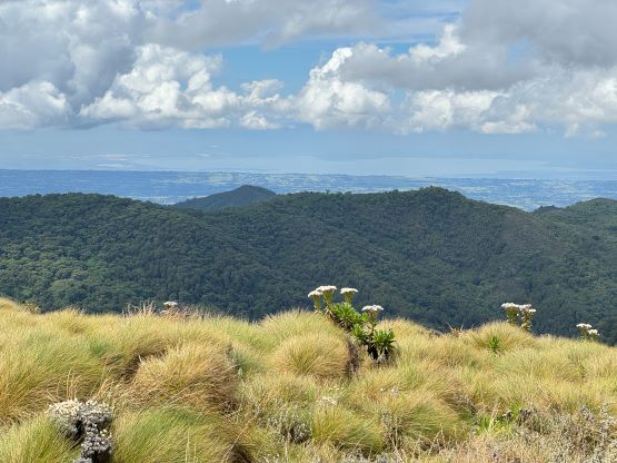
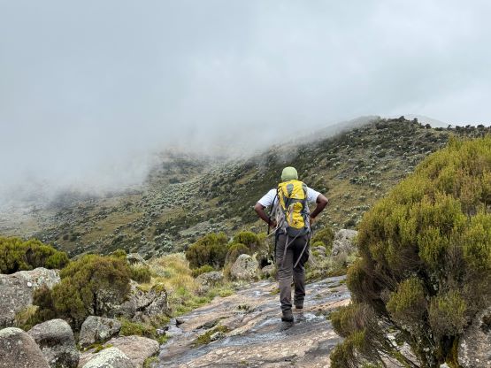
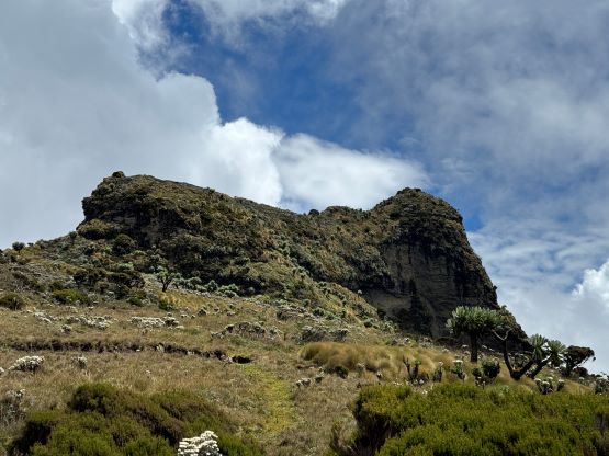
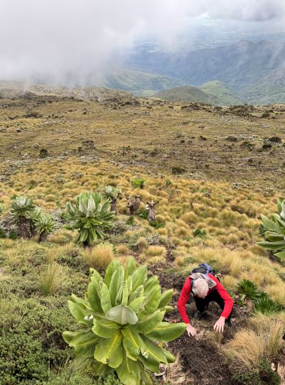
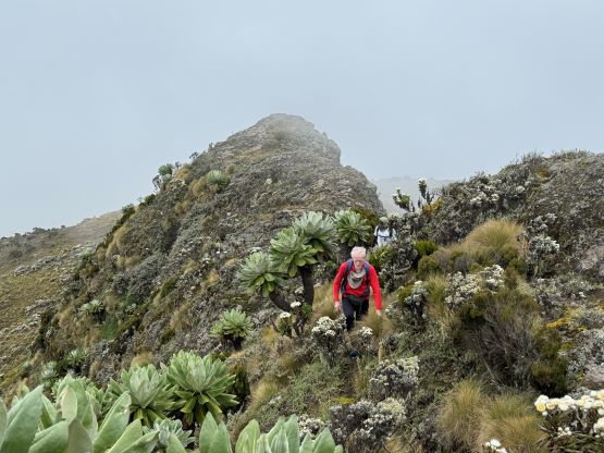
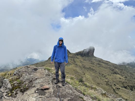
I thought we’d be trouble free but I was wrong. The alpine section was at higher altitude so making progress was generally difficult. The terrain was also not as friendly as I thought, with more swamps and up-and-downs. The swamps were actually worse in the alpine than in the forest. The only bright side was the trail being obvious to follow. I had to call for another break and also called Peter to slow down numerous times. I’m not quite used to being the slowest person in the group. There were multiple reasons to rush including the weather and our ambitious itinerary but we also had to be realistic. After what seemed like eternity we could finally see the infamous summit block. We were still about 2 km away but our stoke level was high. The final scramble on the west face involved some 3rd class mud with moderate exposure. One particular rock step felt particularly difficult, probably 4th class. The west face scramble brought us to the north ridge, and the traverse to the true summit along the north ridge was easy, but somewhat exposed. This ascent definitely felt satisfying, but the time was getting on and we could not linger too long up there. It was already raining below us to the west and it’s just a matter of time before we all got drenched.


On the descent I quickly made my way down that steep and muddy west face. This was probably the only section that I did not have to try hard to keep up with the rest of the group. We then followed Peter’s lead dashing down the alpine zone and the rain came within half an hour. It never poured really hard, but there’s enough rain to make the bushes wet, that we all got soaked in no time. My shoes were already waterlogged at this point. The rest of the descent in the forest involved more mud, bushes and slippery sections. We all took a few spills and I got stabbed a few more times. I could have dodged the thorns but trying to keep up with Peter’s pace made that difficult, if not impossible. We eventually finished the round trip in under 8 hours and immediately started the long drive to Lesatima’s basecamp.