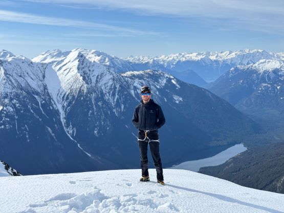
Mount John Decker
April 14, 2024
2209m
Pemberton / Birkenhead Lake, BC
Mt. John Decker had caught my attention for a number of years ever since I discovered the ClubTread trip report of the BCMC trip led by Alastair F. that also included Simon C. The summit block is extremely aesthetic when covered in snow and the climbing sounds challenging but manageable. At least two groups of friends scrambled it in summer over the past several years and reported the summit block to be “nothing harder than 3rd class”, but I still preferred the winter option even just for the sake reason of reducing the amount of bushwhacking. There’s no trail whatsoever on Mt. John Decker so the thicker the snowpack the easier the approach would be. Eventually it was Francis who signed up for the adventure. The timing would be “early spring” and the condition was as bomber as it could be in the recent days. In fact, I think this weekend was the right time to push into some bigger terrain but I was recovering from a hand injury and opted to play conservatively. Kate and Finn were keen to come along but we unfortunately couldn’t make the offer as Francis had to be back home by 5 pm for a family dinner. I made the suggestion that they could drive out separately and climb it independently (but having our tracks to follow), and they were fine with that.
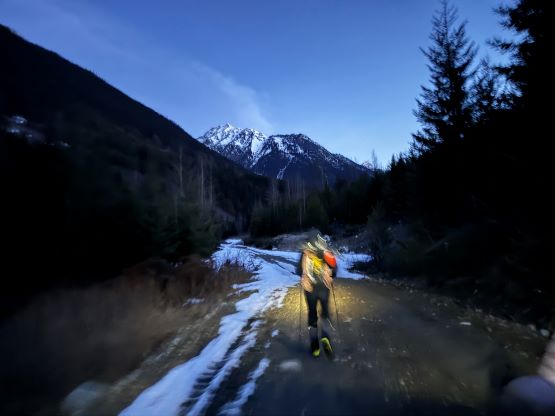
Due to the time constraint and the concern of afternoon heating we all decided to car-camp at the trail-head. Francis and I had some discussion about our approach options and the conclusion was to take the longer but easier way explored by Alan, Sean and Elise a year ago, mostly to avoid the heinous bushwhacking that had been reported in the “standard/BCMC route”, but Alan’s route was not without uncertainty. The information wasn’t clear whether or not there would have a barrier/blockage at the start of Phelix Creek FSR because of the April 1-June 15 annual wildlife closure. We knew the other group did it during the closure time but they really had to squeeze their truck through the blockage and their truck was a small one. Not wanting to take any chance Francis and I decided to bring our bikes, and the 4 of us would meet up at the start of Phelix Creek FSR and spend the night there. Francis and I got there at around 11 pm and found no blockage whatsoever. We even drove up the road for about 15 minutes to scout things out and we were positive to drive to the snowline in the following morning. This pleasant discovery pushed our starting time about half an hour later and the new plan was to get ready by 5 am. The next morning I was able to drive everyone about 3 km up the road to the snowline at 1070 m elevation and parked next to another vehicle. This road provides access to Brian Waddington Hut so there were quite a few vehicles parked on various stages of this road. A high clearance vehicle is needed to negotiate the water bars, and with tire chains one could drive at least 1 km further. I did have chains in the truck, but could not bother to don them. We were already in a better position than the “worst case scenario”. Before starting the hike I had to lock our two bikes to the truck as these two combined probably worth 10,000 dollars.
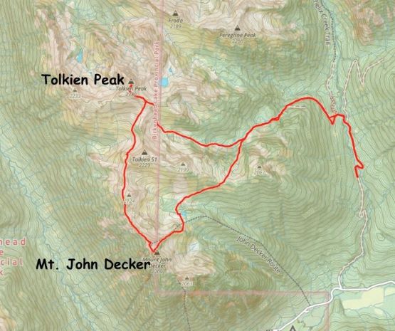
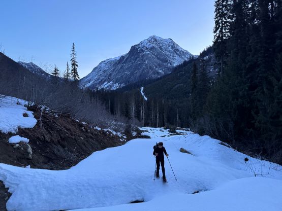
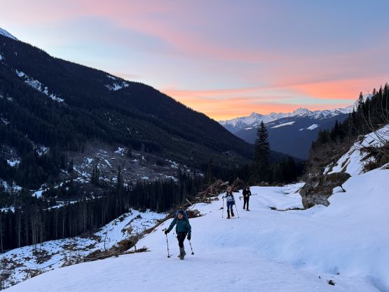
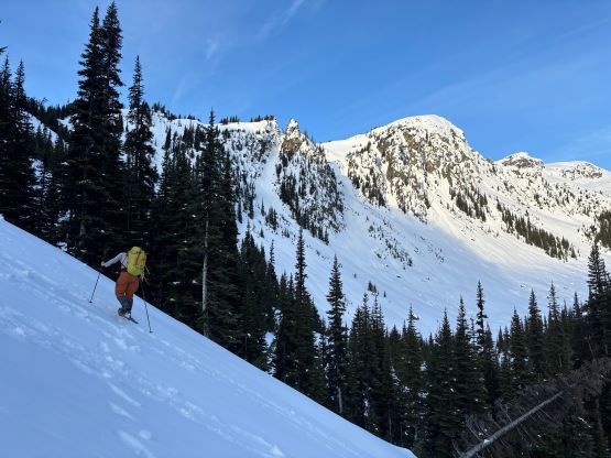
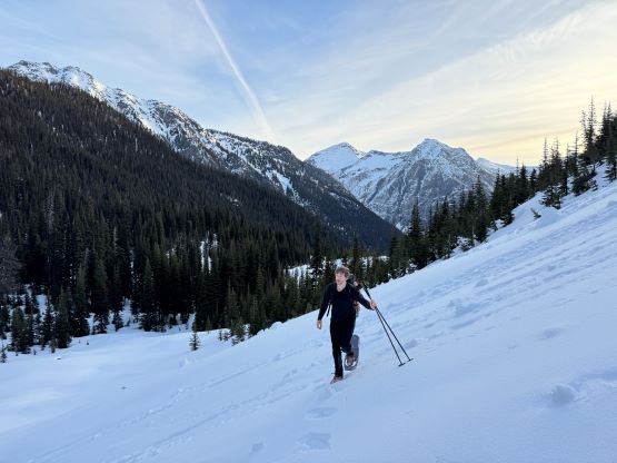
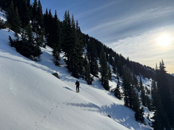
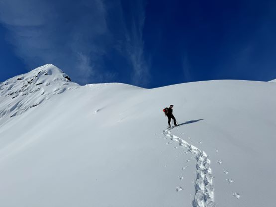
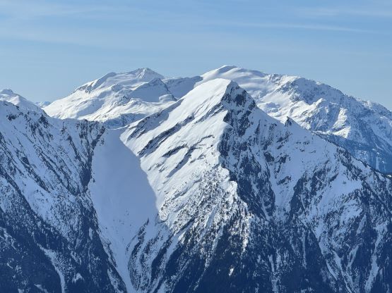
We had about 2 km of plodding to the end of the road and we were mostly walking on ice or firm snow. The snowshoes were not strapped on until leaving the main road. I knew the other group took a short-cut but the snow in the clear-cut was not supportive enough so we had to follow the spur road. We encountered some major deactivation ditches and fallen trees, and the road soon turned into a mess of alders. The bushwhacking for fortunately next to non-existent thank to the thick snow coverage at this elevation, but I’m sure the summer travel would be awful here. Kate and Finn started to fall behind as soon as the going was no longer no-brainer so Francis and I went ahead as planned to lay a set of tracks for them to follow. Despite the lack of bushwhacking the snowshoeing wasn’t that straightforward due to the slanted angle and some breakable crusts. We left this overgrown spur road at the obvious switchback at 1400 m elevation, and ascended and traversed some steep forest to an obvious basin with a frozen tarn. We deviated from Alan’s GPX track and stayed more in the middle of the valley beyond that frozen tarn, and slowly picked up the grade traversing into the steep bowl leading up to the 1900-m saddle on the east ridge of “Tolkien S1”. There were some big slopes and this section seemed to drag on forever. Minutes before reaching the saddle we got our first sunbeams of the day. We were doing great on time, and I started to consider bagging more peaks despite the time constraint.


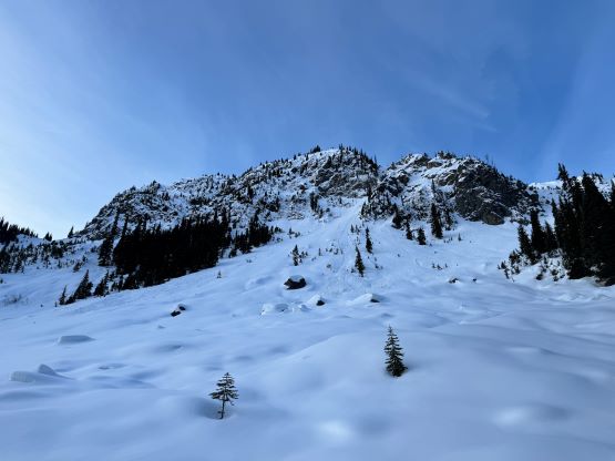
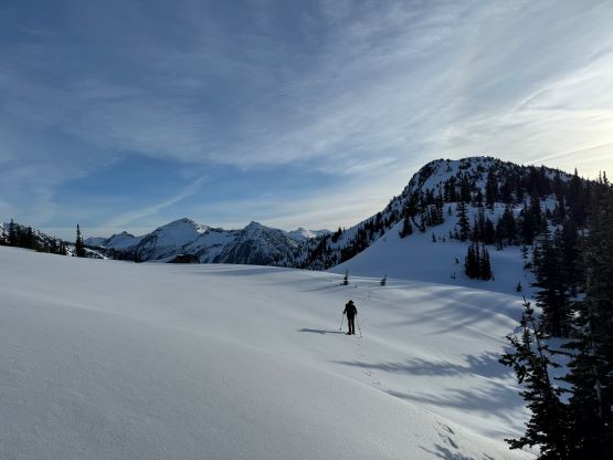
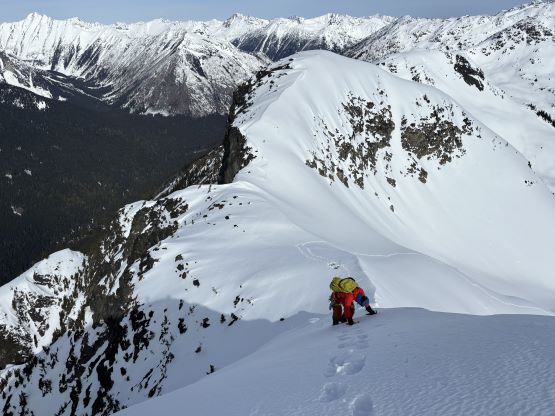
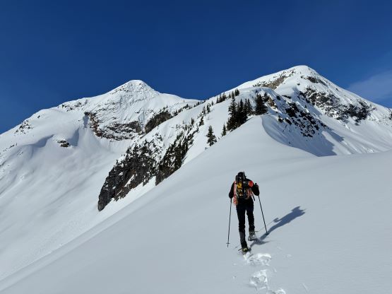
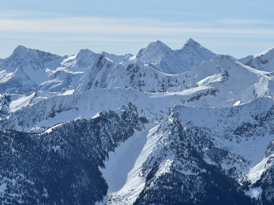
The next section was the “key” in Alan’s route and involves a steep downwards traverse across the southern slopes of “Tolkien S1” while dropping 100 m of the hard won elevation. The other group did not mention too much about it in the absence of snow, but the contour lines made this stretch seem rather steep on the maps. Indeed, Francis and I had to swap snowshoes for crampons in less than 5 minutes after stubbornly refusing to take the ‘shoes off. The price we paid for our stubbornness was an awkward transition in which we must be extremely careful to not drop anything down the slopes. I even took an ice axe out and appreciated the added security as some parts of the traverse was steep and icy with some bad runouts. The snow condition was good on the other hand, that we were able to avoid any notable post-holing until after finishing the traversing descent. After strapping the snowshoes back on we roughly took the same way that Alastair’s group did by wrapping around the obvious steep buttress on the far climber’s left side. We still had to ascend a steep slope to gain the NE Ridge that had been baked under the sun for at least 2 hours so the trail-breaking was rather tedious. The NE Ridge had some narrow sections but was not as scary as appeared from below, that we managed to keep the snowshoes on all the way to the col between the true summit and the northern sub-peak.


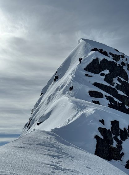
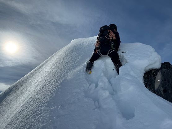
The climb appeared to be entirely on snow but we still donned harnesses mostly to use that time to take a needed break. I was slightly quicker on the transition so started out shortly afterwards, but upon hitting the first near-vertical step I got sucked into some extremely unconsolidated snow on the climber’s left side and sank chest deep. Francis took over the lead after watching me struggling to pad that step in, by directly attacking the arete. We had one more sugary near-vertical step that Francis managed to trench a way up, and the final traverse on climber’s right side of the arete was thankfully on some supportive crusts. We hauled a 60 m 6 mm tagline and a snow picket but those turned to become training weight. I did opt for the Irvis Hybrid crampons and the lightweight aluminum ice axes instead of the heavy ice climbing equipment and that was definitely the correct call.


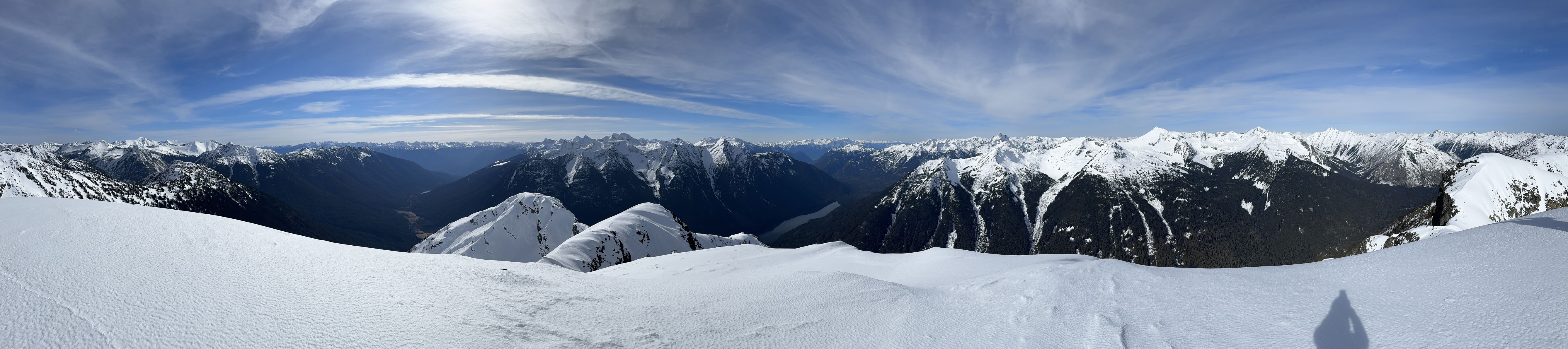

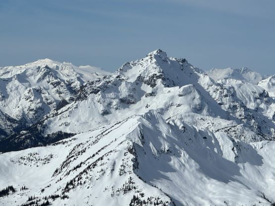


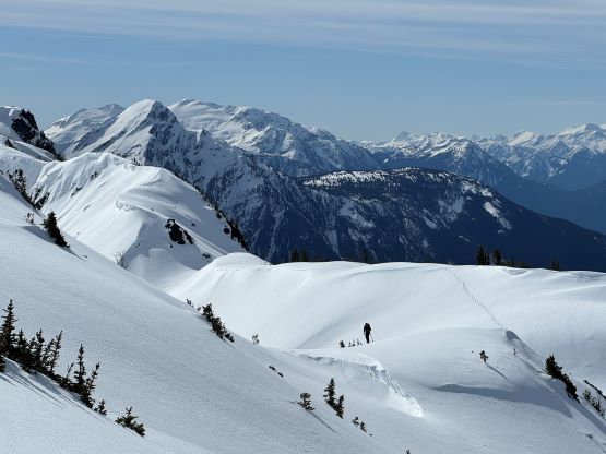
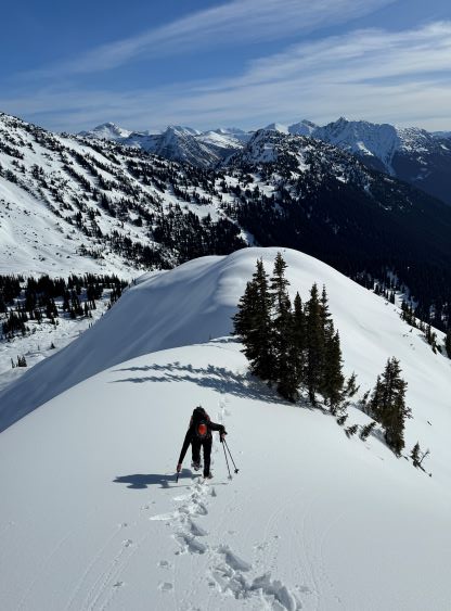
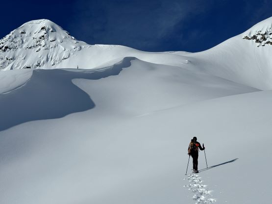
The down-climbing was uneventful as felt considerably easier as the tracks were already put in. We then decided to check out that northern sub-peak because from the previous trip report we knew the best view of the summit route was from there. Indeed, the route that we just climbed appeared very vertical and technical, but it was actually quite straightforward. At this point we had already decided to traverse towards Tolkien Peak and there are a few ways to do so. I opted to take Simon’s route by staying entirely on the ridge crest. There’s one steep roll to descend north of Mt. John Decker’s north sub-peak, and numerous narrow spots with cornices but generally speaking the traverse northwards to the west shoulder of “Tolkien S1” was without event.