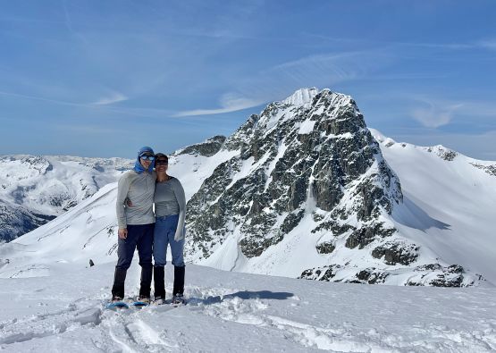
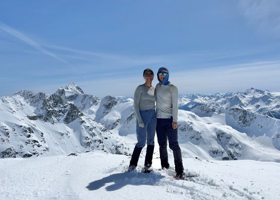
Mount James Turner
April 4-5, 2026
2703m
Whistler / Garibaldi Provincial Park, BC
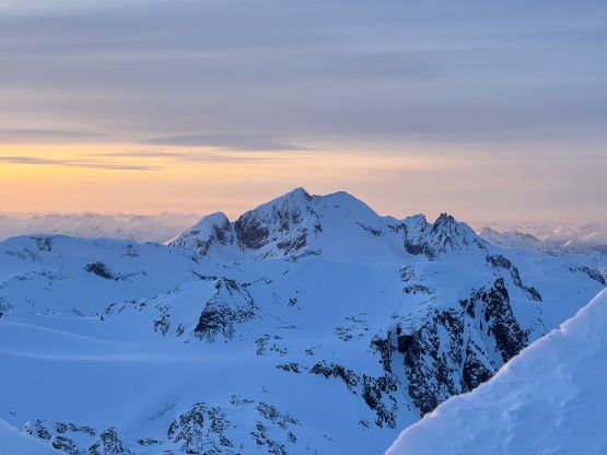
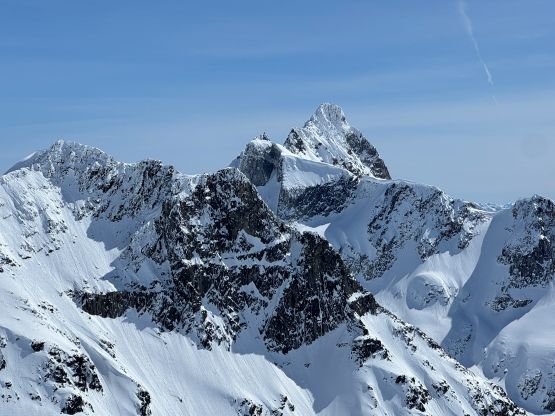
Mt. James Turner, the remote giant in the northern part of Garibaldi Provincial Park had caught my attention for more than a decade, dating back to my Canadian Rockies days in circa 2012. In the old time I was quite active on the ClubTread forum and the few trip reports of this objective seemed very cool. The standard route (SE Face) is only moderately technical and can be climbed as a class 4 scramble with some steep snow in the summer time, or mostly as a steep snow climb in winter/spring. The approach is harder than the climb itself as it requires traversing over 6 glaciers from Wedgemount Lake. There’s another way of accessing from Blackcomb backcountry but that is mostly only for skiers as the gondola refuses to load snowshoers nowadays, and the bushy valleys do not make sense in summer months. Most parties would plan at least 3 days no matter what approach one dares to take, but strong parties can easily get it done in 2 days. I ended up climbing it in the evening of Day 1 so in my strongest time I could possibly do it as a C2C push but that was only if there’s a known party ahead setting the tracks for me to follow at night. The SE Face has to be climbed early in the morning or late in the evening when the sun’s off the face, so doing it in one push means plodding the entire way in or out in the dark, which is far from being ideal.
Two trip reports popped out in the recent time – one from Alex, Trevor and Brayden in spring and the other from Sarah and Garrick in winter. Having their “beta” I finally made the decision to do it as a snow climb even though at least half of the older trip reports of Mt. James Turner involved getting caught in or triggering avalanches. A window seemed to have formed over the Easter long weekend and I managed to convince Mel to join for the 2-day push. The window turned out to be not as ideal as I was hoping for, but with 15 years of winter mountaineering experience I was able to thread the needle to get us up there and back safely. There was 30+ cm of dry powder in the high alpine making the trail breaking tedious even on the 30′ snowshoes, but we were still strong enough to make the entire push to the high camp on Berna Glacier, climb the peak at sunset and then tag a secondary objective (“West Peggy”) on the way out the next day. The “Day 1 summit” was not on the itinerary so we didn’t bother to leave home that early. Instead, I picked Mel up at 5 am from North Vancouver and we didn’t start hiking until 7:30 am. The weather forecast for the morning of the first day was not ideal so that’s another reason to not leave home too early. Indeed, we had to drive through periods of drizzle in Squamish but the rain had thankfully stopped by the time we got to Whistler.
This was only Mel’s second time camping in the backcountry and her first time camping on snow, so I had to lend or share with her almost all the gears including but not limited to the 70L backpack, -18C sleeping bag, air mattress, tent, stove, winter parka, MSR Lightning Ascents snowshoes and a Petzl Gully ice tool. Mel’s mountaineering boots were also too old to be trusted on trips like this so she paid a last minute visit to MEC Vancouver and got a brand new pair of Scarpa Mont Blancs. I suggested her to wear hiking shoes while carrying these boots but she insisted on donning the mountaineering boots from the start. I thought it was absurd to test out a brand new pair of boots on a mission this grand but she proved she could do it. I think Scarpa should give her sponsorship just because of this. The road to the trail-head was free of snow but had one minor rutted section that made me glad to have driven the Subaru. There’s however, one Evo parked at the trail-head from climbers in VOC so a 2WD car could still do it if one’s determined enough. We then spent at least half an hour at the trail-head packing and sorting out the gears.
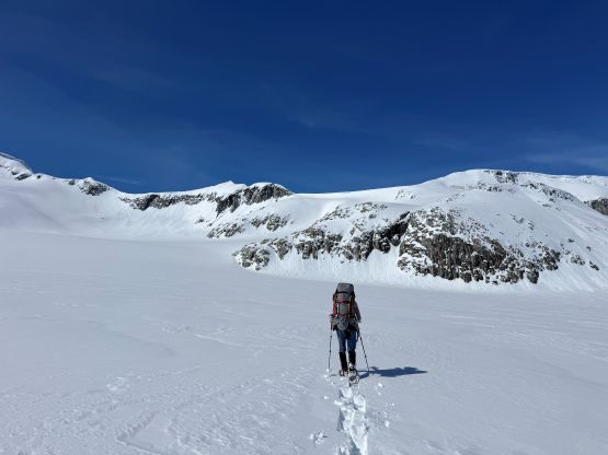
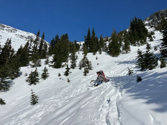
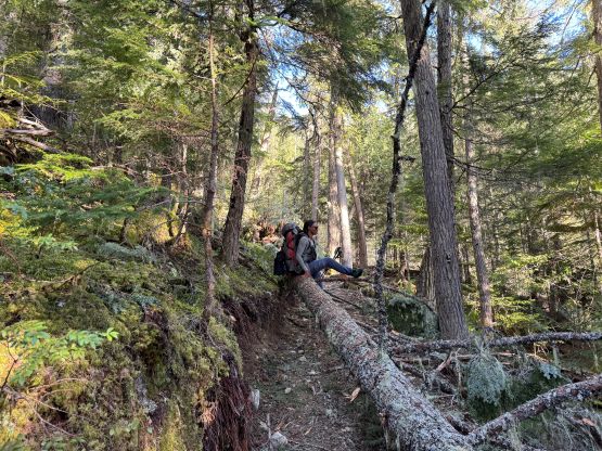
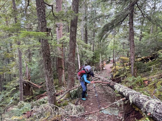
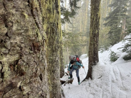
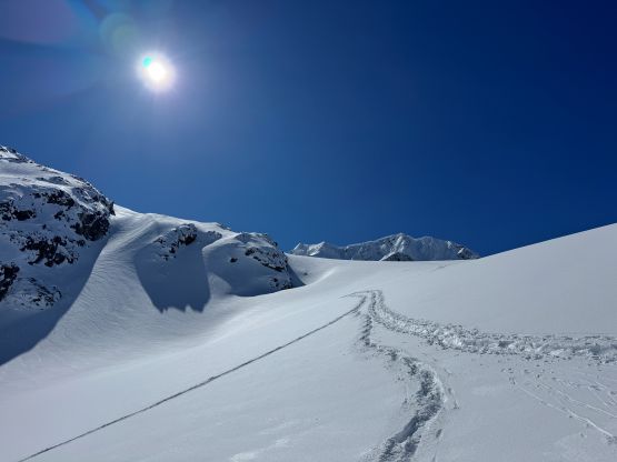
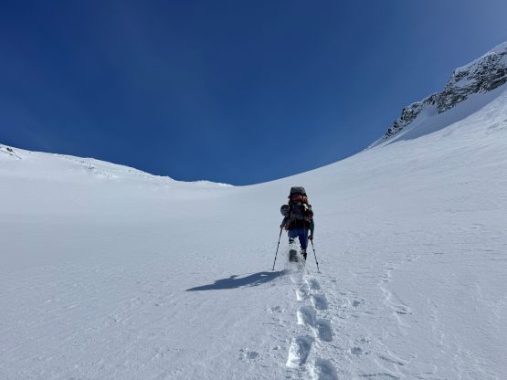
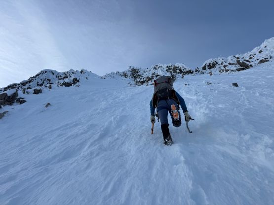
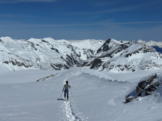
We finally shouldered the backpacks that weighted over 40 lb each, and started up the plod to Wedgemount Lake. They had rerouted the lower part of this trail such that it was longer but more gradual with more switchbacks. I thought there was more switchbacks than what I could remember and sure enough, I checked the phone and we had deviated from Alex’s GPX track. The rerouting was quite recent. Mel started to develop some neck and hip flexor problems so we did some adjustments to her pack. This was overall her first time wearing a pack this heavy and the pack itself wasn’t even hers. I also on purposely led at a slower-than-usual pace such that it took us 3 hours to get to the lake. In my previous visits I was always able to get there in 2-2.5 hours but with lighter packs. The trail was icy and slippery but we managed to tip toe ourselves up the entire way without donning crampons, and the snowshoes weren’t strapped on until the basin underneath the final headwall. We somehow got ourselves disoriented by picking up a set of skin tracks veering far climber’s left, and did a more roundabout route to get to Wedgemount Lake. Personally I always prefer the shortest and more direct route even though it could be steeper, so I was not happy about myself not paying closer attention to the route-finding. That route sure made more sense for skiers but we weren’t on skis.
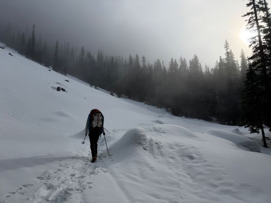
Thankfully the earlier issues that Mel had encountered did not persist and the only problem she was now struggling with was the shear exhaustion as this was her first ever winter overnight trip. As a result I would be doing most of the leading for the entire trip. Plodding across the lake we noticed there were more tracks made by snowshoeers than skiers and most of the “ants” above us were doing the NE Arete of Wedge Mountain. Sure enough we encountered two fast snowshoers descending, and judging by their movements I told Mel instantly that they had to be from SWBC Peak Baggers. Very few people could manage snowshoeing on dry powder with such style. Unfortunately we didn’t quite cross path with each other as Mel and I were following a traversing skin tracks around the secondary lake to avoid the minor elevation loss, whereas they were following their own tracks down to the second lake. They turned out to be Paul Ramu and Harrison Crerar and I was not surprised at all. Mel and I did our first long break of the day about halfway up Wedgemount Glacier as it was already lunch time. Our strategy was to carry no more than 1L of water on any given time, and more dehydrated meals than the ready-to-eat food, as the plan was to melt snow along the way. I also bought a brand new Reactor set-up (which costed over 400 dollars) and the new stove was doing the job really well. We then left the highway of tracks and broke our own trail up to Wedge/Weart col, which was quite foreshortened.
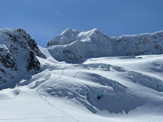
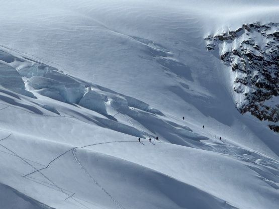
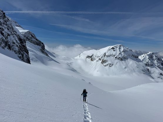
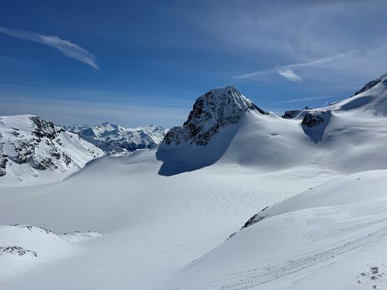
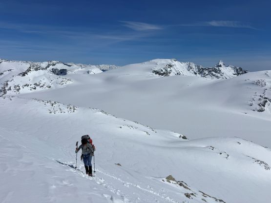
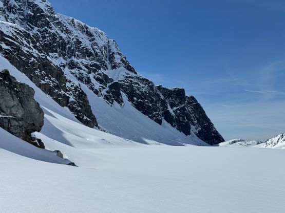
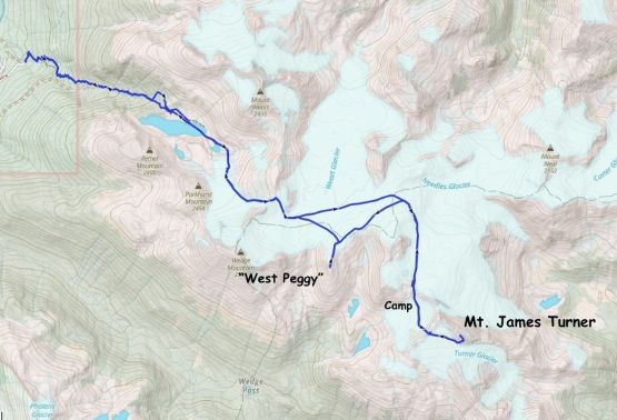
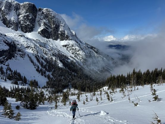
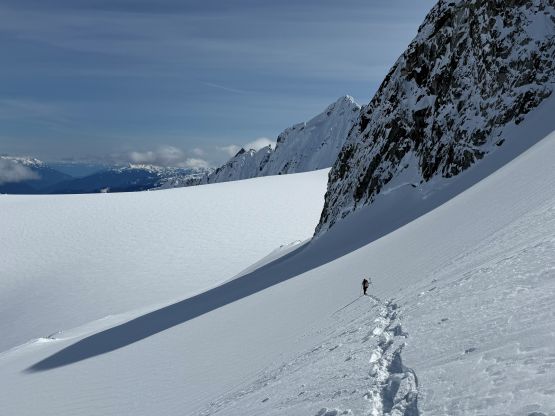
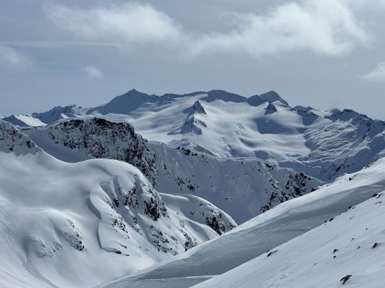
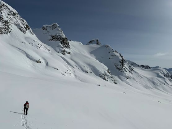
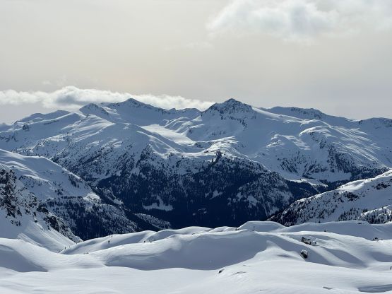
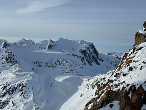
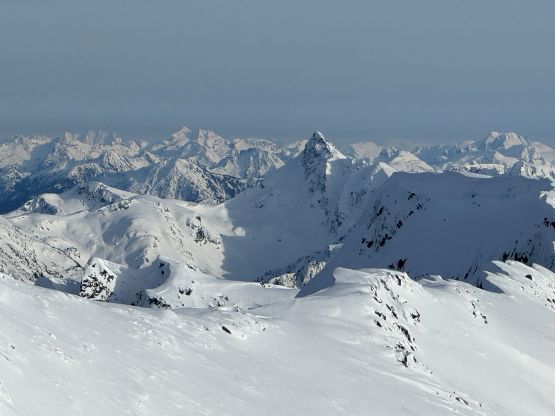
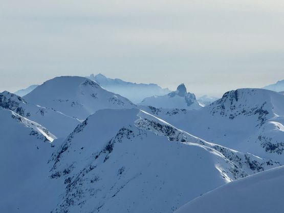
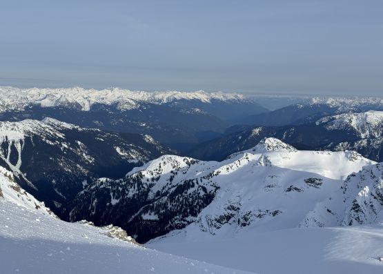
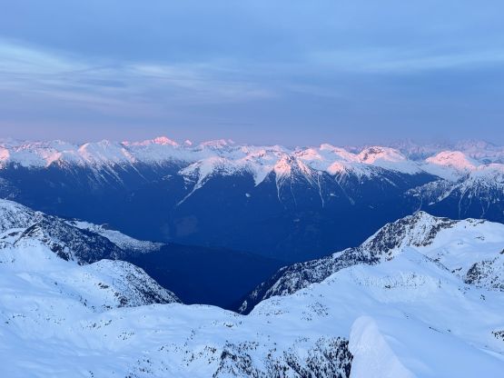
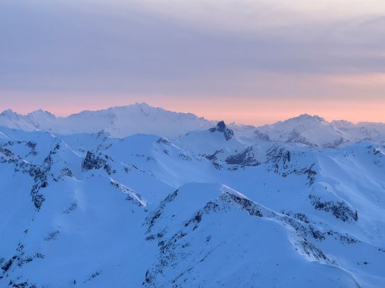
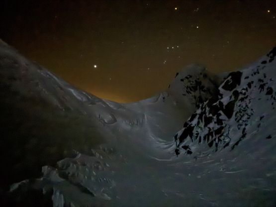
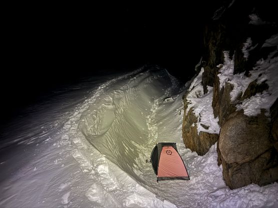
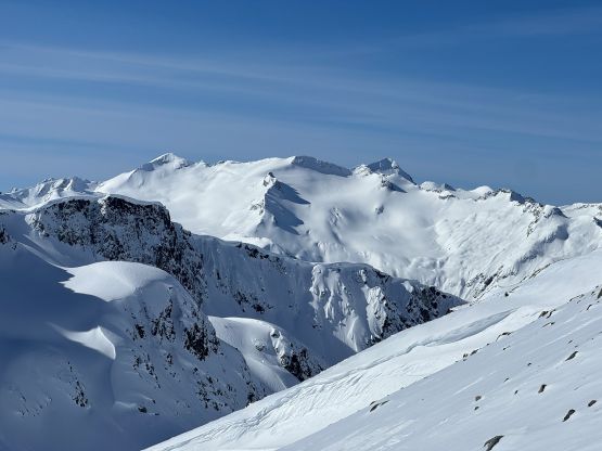
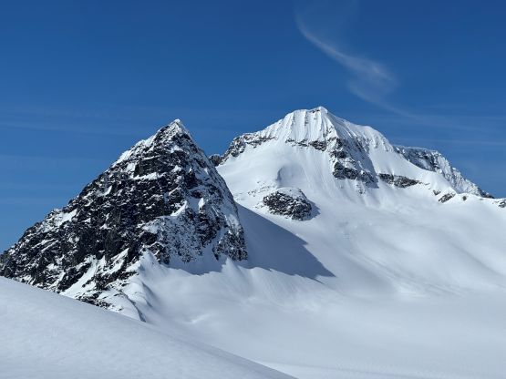
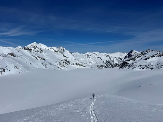
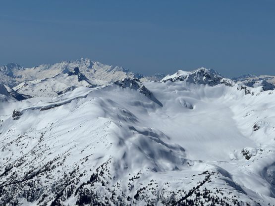
Descending the east side of Wedge/Weart col was trickier than I thought with a cornice blocking the most direct entry. We ended up having to traverse a ways left (north) before finding a suitable spot to drop in, and the descent involved a long stretch of 35+ degrees snow that had been baked for hours. Thankfully the temperature wasn’t that crazy warm this high up so the only avalanches we were able to observe were sluffing on extreme and unsupported terrain. About 200 m elevation loss later we were on the immense Weart Glacier. I thought about making a high traverse over the two “Peggy Peaks” but opted to follow Alex Barker’s route around the north and east aspects of “Peggy Peak”. This added a few kilometers of distance but shaved off at least 200 m elevation gain and loss. The terrain was not new to me as I had been here 6 years earlier completely illegally (during the Covid lock-down) for ascents of Mt. Neal etc. so I knew how foreshortened the plodding was. A while later we had wrapped around the north side of “Peggy Peak” and then opted for staying as high as possible traversing the Needles Glacier. This resulted in more steep traverses on somewhat crusted snow surfaces. The crusts weren’t supportive so we were still breaking trail fairly heavily on the snowshoes. We then plodded a few more kilometers due south across Chaos Glacier. The original plan was to camp at the saddle but the wind pushed us further. We descended another 50 m down to an obvious wind scoop to set up camp on Berna Glacier. It had taken us just over 8 hours from the trail-head (including the lunch cooking). Mel was exhausted but then I told her that she was only 15 minutes slower than Alex/Trevor/Brayden and she should not feel bad about that.
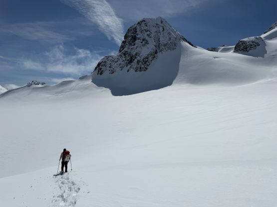
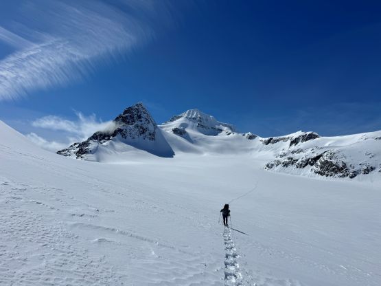
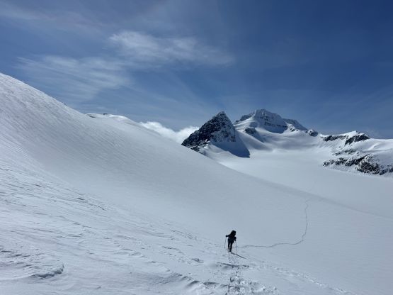
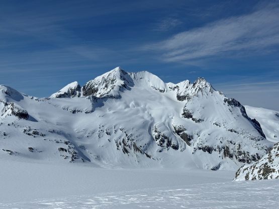
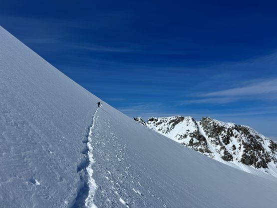
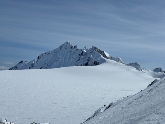
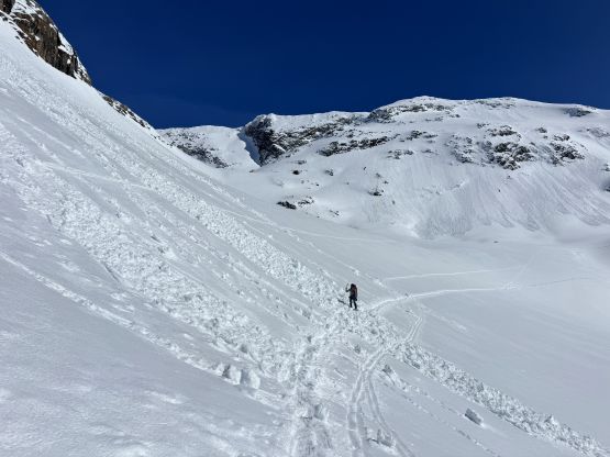
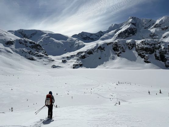
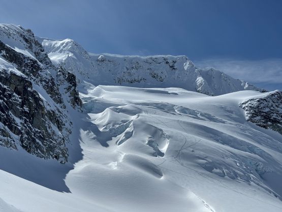
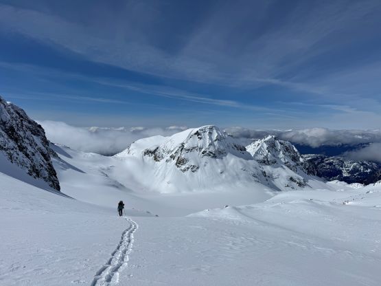
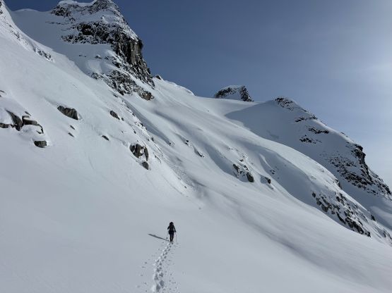
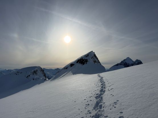
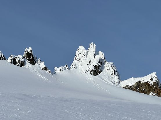
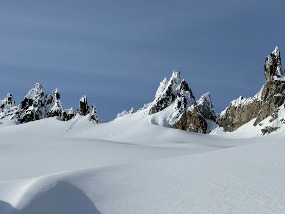
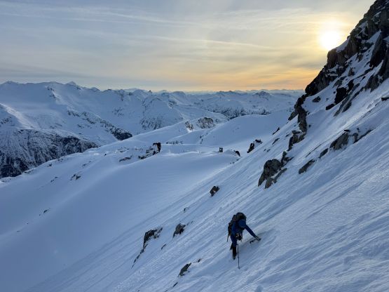
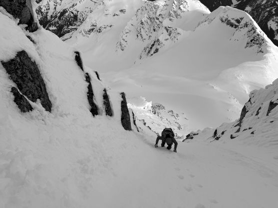
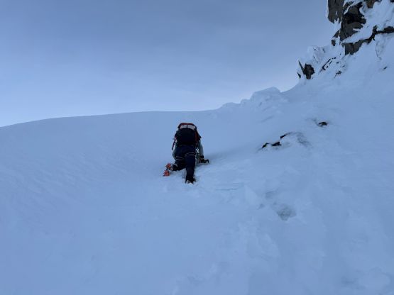
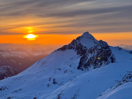
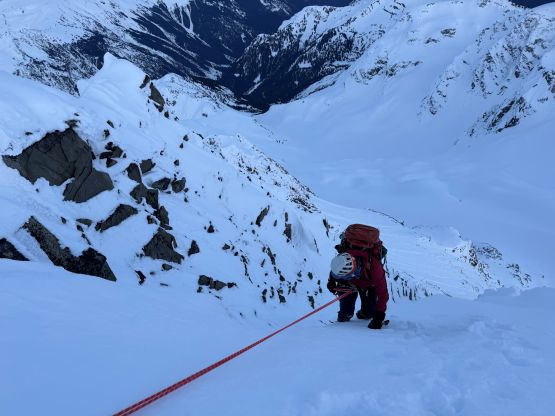
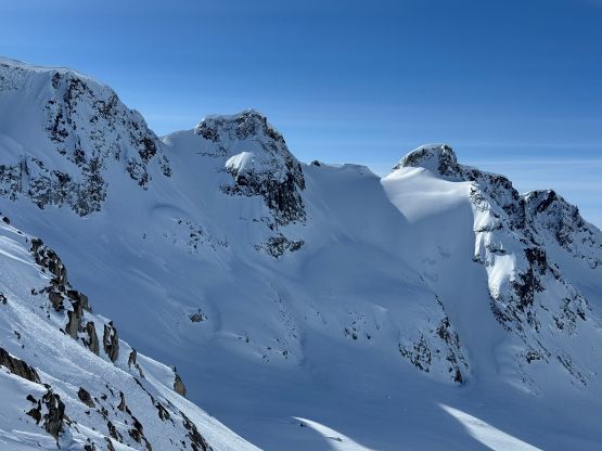
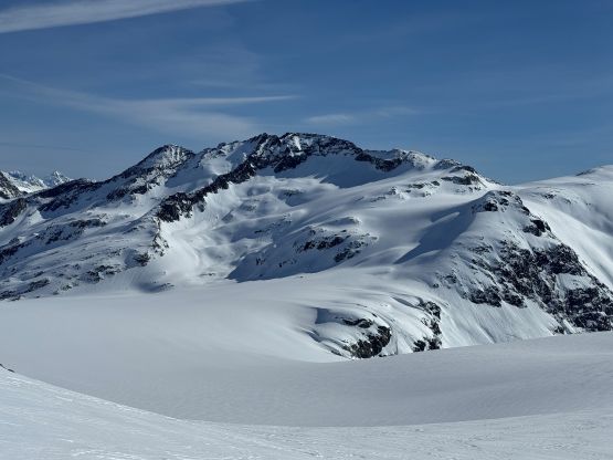
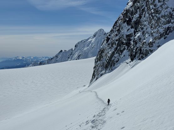
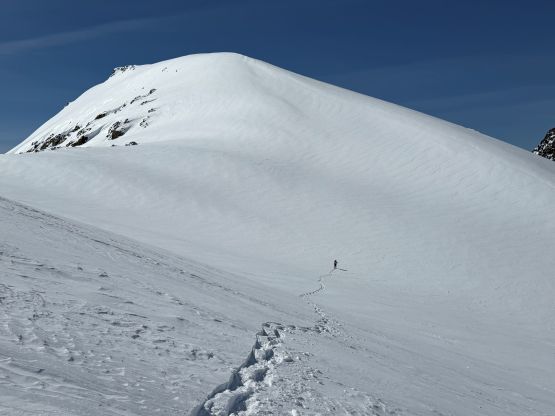
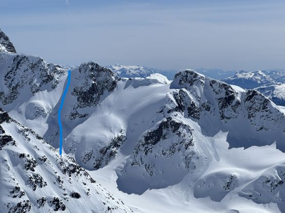
The plan was finally made to go for the summit at sunset as in my theory, as long as we were climbing the SE Face when the sun’s not on the face we should be fine. The temperatures weren’t that warm and it was only the sun that had softened the snowpacks. I was correct as from our high camp upwards the condition was definitely more “winter” than “spring”, with over 30 cm of dry powder collecting on the NW-facing slopes between Turner and Berna Glaciers. Gaining Turner Glacier was the crux of the trip in my opinion, as there’s no safe passage that is not exposed to overhead hazards. This part is the reason why some parties would not want to do the standard Wedgemount Lake approach on skis/snowshoes. There are three options – the Barkers route down and around far the climber’s right (south), and Sarah/Garrick’s short-cut from what one of the higher cols on Berna Glacier. I ruled out Sarah’s route first as the upper part appeared very loaded and had been baked in the afternoon sun, but then the Barkers’ route was also exposed to the same hazards. The only difference was to traverse underneath instead of plodding straight up. This route was also too roundabout to be practical given our time constraint and the heavy duty trail-breaking, so I went back to the maps and proposed a 3rd option, that was to aim far climber’s left, straight the hell up the first gully all the way to what I would call, the “Berna High Col”. I had not thought about this option prior to the trip but the in-situ observation combined with the satellite images downloaded to the phone helped confirming the decision. This route was also exposed to overhead hazards but I didn’t see it being much worse than any of the other two options, and the shorter distance meant we should probably be underneath those cornices for the shortest amount of time. The trail-breaking was however, heinous to say the least. It took me almost an hour pounding the way up, cutting infinitely many tight switchbacks on knee-to-thigh deep snow. At some point I wasn’t even sure if we could make it but I made it work with determination. The top-out had a gigantic wind scoop that necessitated a short boot-pack to go over the lip.
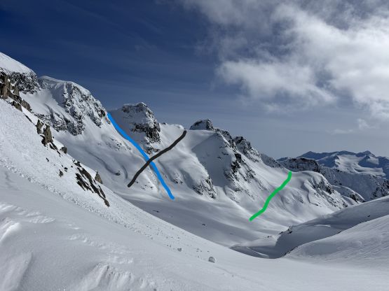
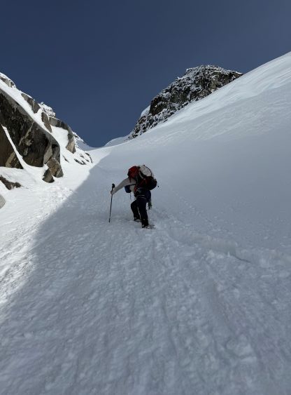
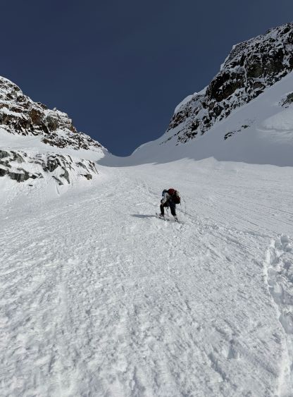
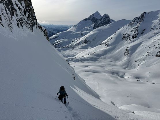
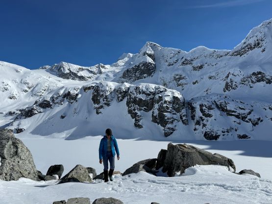
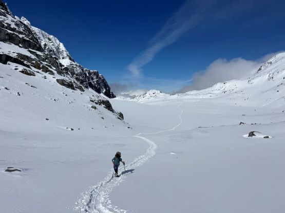
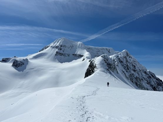
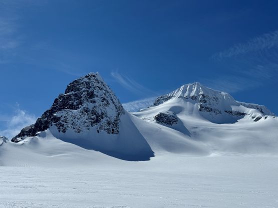
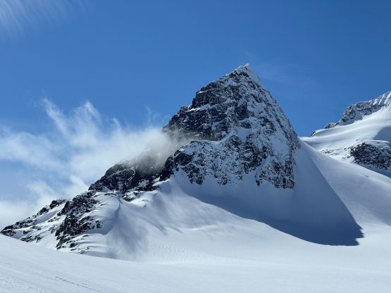
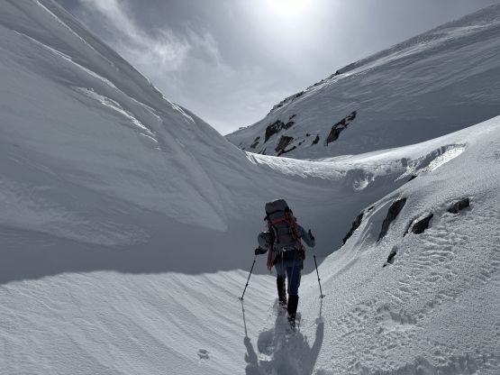
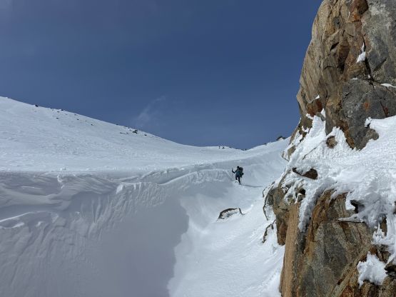
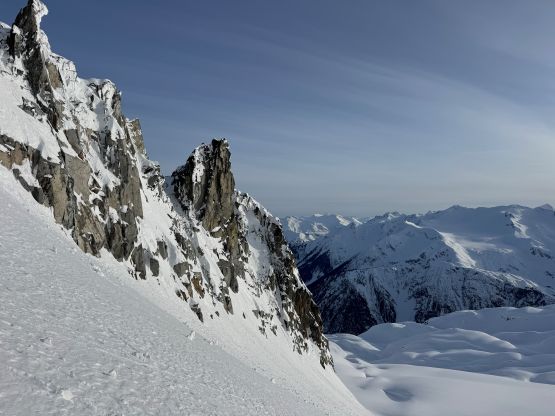
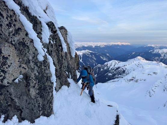
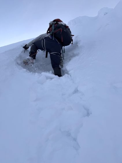
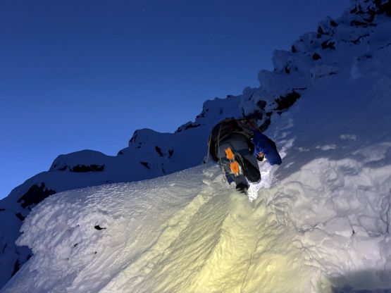
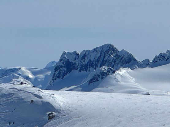
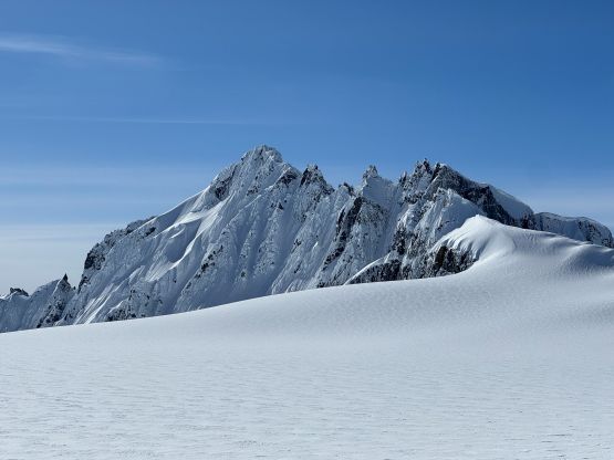
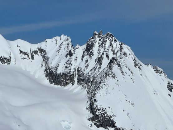
The traversing across Turner Glacier was now rather “tame” as the angle was either flat or slightly downhill as we aimed the bearing towards the “choss notch” that separated the SW and SE Faces of Mt. James Turner. The climbing route was still not visible but we were slowly getting there. The “choss notch” was quite tricky. I managed to cut a side-hilling line into the bottom of the notch on snowshoes but had to remove the snowshoes for a few interesting moves on rocks. The icy condition made the climbing particularly sketchy and unfortunately I was carrying both of our crampons. When Mel announced that her crampons were actually in my pack I told her then she’d better climb it without the ‘pons like I did. I also hauled my snowshoes but at this point, they weren’t needed. I led us post-holing across the lower part of the SE Face and I kept watching the GPS and the satellite images to make sure we could aim for the easiest “snow ramp option” to bypass the 4th class step that the Barkers had encountered. The first 100 m was some heavy duty post-holing on breakable crust but the trail-breaking quickly gave way to step-kicking in firm snow. The poles were quickly swapped for the axes and the crampons were also strapped on. I led the lower face climbing diagonally to the right. There’s one steep section to gain the snow ramp and the ramp itself was rather easy.
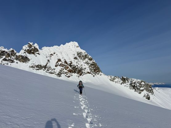
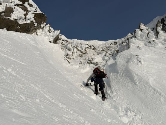
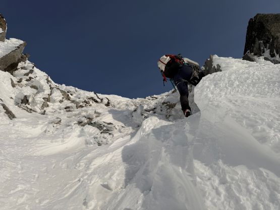
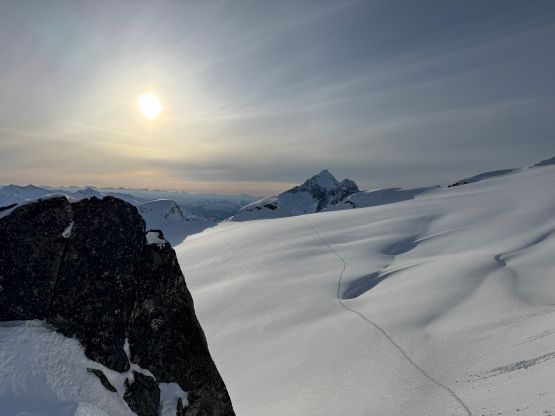
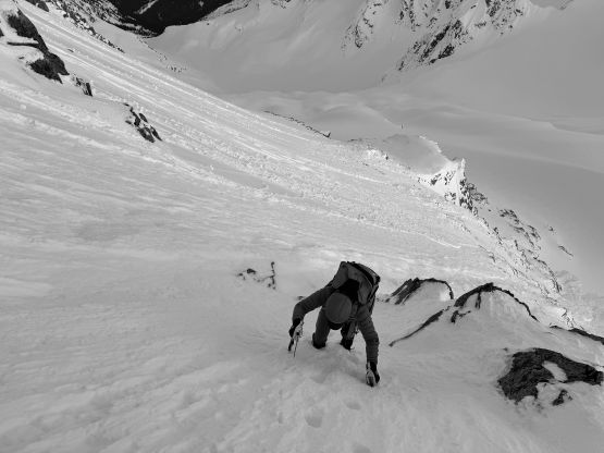
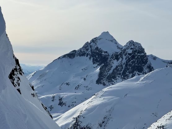
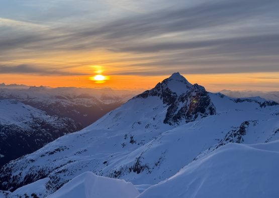
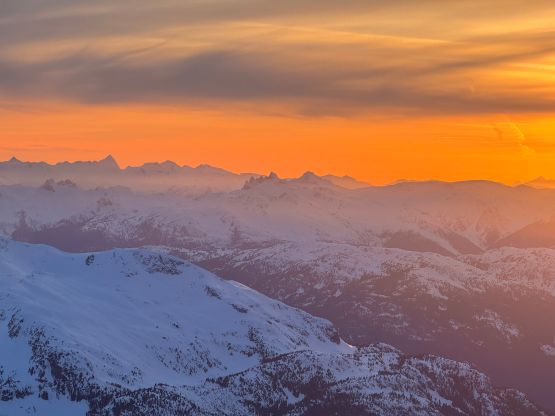
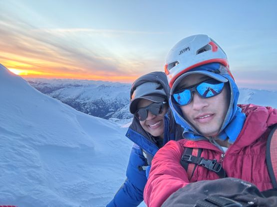
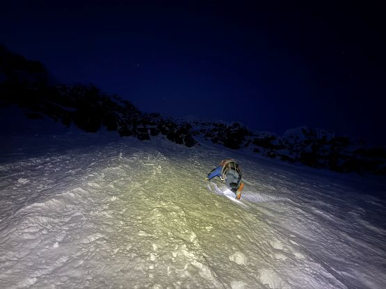
About halfway up the face the going finally became more “interesting” as the step-kicking had given way to wallowing in the facetted snow. The condition up on this face was definitely still winter and the snow condition was very variable. It was also impossible to not knock down chucks of ice on each other so we had to stay reasonably close. Traversing the top part of this snow ramp onto the infamous “3rd class ledge” I had to say that the ledge was quite narrow and exposed. The moves weren’t particularly tricky but the position was awkward with the rock wall trying to push us down the mountain. Thankfully it was quickly over. I then led us the “summit gully” in mostly firm snow until 30 m beneath the summit, where step-kicking on firm snow again gave way to wallowing on facets. The wallowing became really bad as I constantly sank down to the rocks and needed to use my knees and elbows to break the crust and “trench” a way up. The going felt like 55-degrees near the summit as I worked my way leftwards aiming at a more direct topping-out. The worst was to dig a horizontal trench so I could get onto the proper summit pitch, and after soloing my way up I spent 5 minutes building a snow anchor to belay Mel up. Meanwhile it was the gorgeous sunset from one of the remote giants in the park, but we had little mood in soaking in the views.
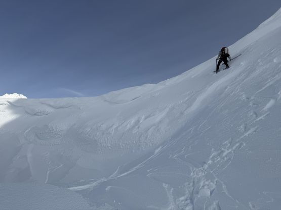
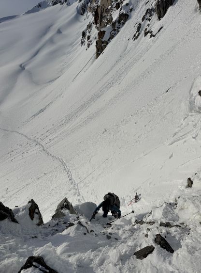
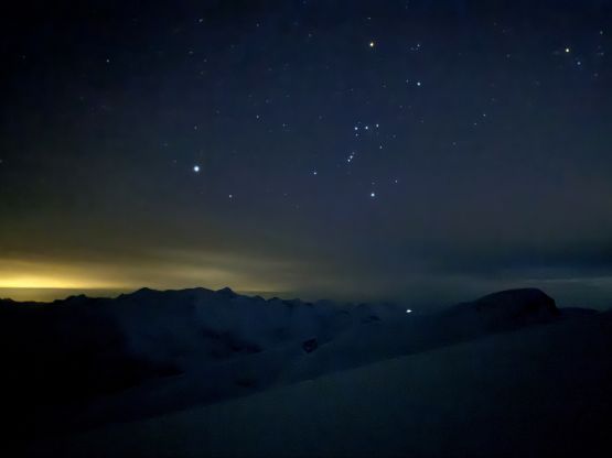
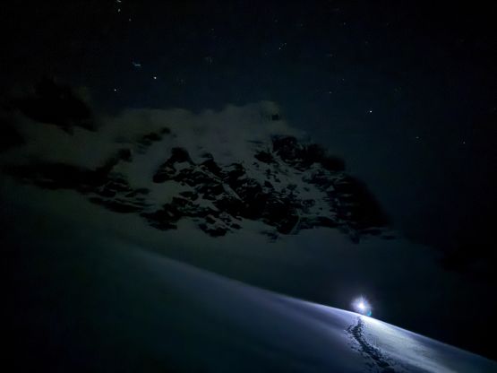
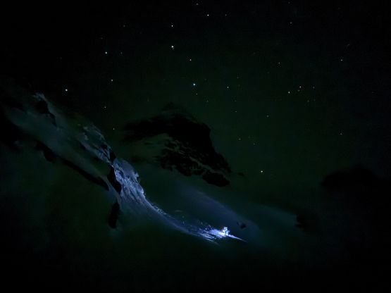
I thought about to let Mel rappelling on the single strand 30 m rope and I would down-climb afterwards (so we wouldn’t be leaving the 100-dollar picket behind), but the ice chucks falling on each other would be really terrible if we were 30 m apart. I eventually made the decision for us to both rappel the pitch, trading the money in for less weight carrying on the way back. We then gingerly down-climbed the summit gully and then back across that ledge. I actually gave Mel a belay using a buried ice tool but I didn’t think she really needed it. We then turned on the head-lamps and followed our own tracks down the lower SE Face, again staying close to each other to avoid dropping shits on each other. Down-climbing the choss notch didn’t feel much easier even with the crampons on so that notch was indeed not very straightforward. Plodding back across Turner Glacier was tiring but at least very scenic in the fading daylight. Mel was behind so I took my time playing with the night photography. Down from “Berna High Col” I had some of the best “telemark turns on snowshoes” in my entire career. We absolutely pounded our way down the 300-m couloir. There’s no evidence of slabs forming and the cornices would no longer be a concern in the night time so it was pure joy enjoying the run. The elevation regain back to camp was another story though. We eventually got back to camp at 10 pm and settled for the night. It was too late to cook another meal and we decided to simply eat some sandwiches and save the packages for the following day. With the summit already climbed we opted to sleep in to 8 am in the morning.


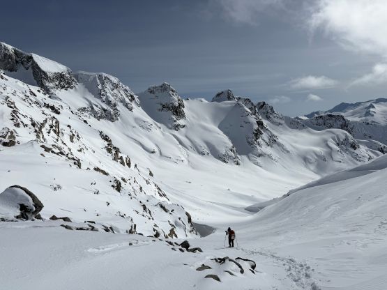
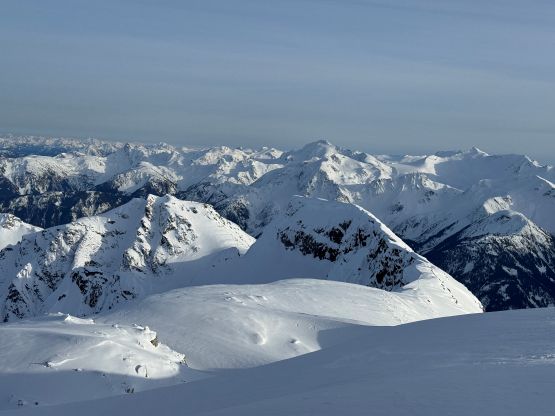
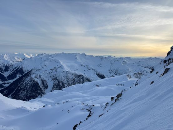
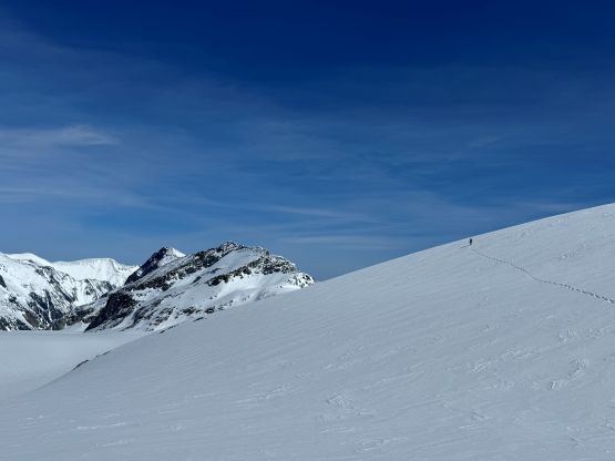
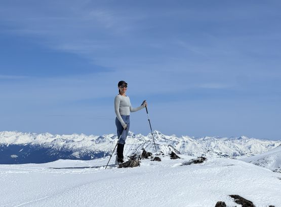
The morning routine was somehow very difficult so we didn’t manage to leave camp until 10 am, which was fine. The sun finally got us minutes before departure so we donned sunscreen and sunglasses right away. The temperatures weren’t as hot as forecasted and there wasn’t a significant avalanche cycle, at least not at this higher elevation. It sure was warm, but as soon as we stopped for a break we would have to put a jacket on, and there’s a constant cool breeze from the west. We saw no cornice fail the entire day. I had already done “Peggy Peak” so we opted to follow our own tracks traversing 270 degrees around “Peggy Peak”. I led us staying as high as we could traversing the NW flanks of “Peggy Peak” towards Peggy/West Peggy saddle and the plodding was longer than I thought. “West Peggy” was a mere bump on the glacier but boasts over 100 m prominence so I might as well tag it in this trip. Eventually after traversing across two more subsidiary bumps we finally dragged our elephant asses to the base of the north ridge and ditched the packs. We carried absolutely nothing while plodding up the north ridge which got quite narrow near the summit. The view was excellent and there’s even some cell reception to do some catch ups.
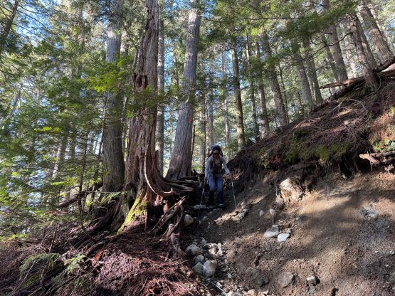
We took a lunch break (with cooking) once back at the packs, and then went directly for our tracks coming down from W/W col. The decision was made to minimize distance so we did more trail-breaking. I was aware of a less-aggressive route up to W/W col by venturing further climber’s right but despite the warm temperatures the snowpack was far from being isothermal. I saw no point in doing more trail-breaking so led us following our own tracks back to Wedge-Weart col. The upper 100 m was quite steep and surely tested the limit of our Lightning Ascents snowshoes. My legs were finally done by this point, but I still had enough energy to make a single dash down to Wedgemount Lake followed by plodding another 50 m up to the hut. We then took another long break at the hut cooking another pack of the backcountry food. Once we gathered enough physical and mental strength we shouldered the packs and dashed for the vehicle. Again we opted to slip and slide our asses down the forest instead of donning crampons. We concluded the round trip in only 14.5 hours “moving time”, which was an hour slower than the Barkers/Brayden’s pace but our distance was also longer with the detour to check out “West Peggy”. Wasting no time I quickly turned on the engine and drove us back to Whistler for a much-needed dinner, and eventually got back home at 10 pm.